Hail Map in Wisconsin on September 2, 2011
Get this storm
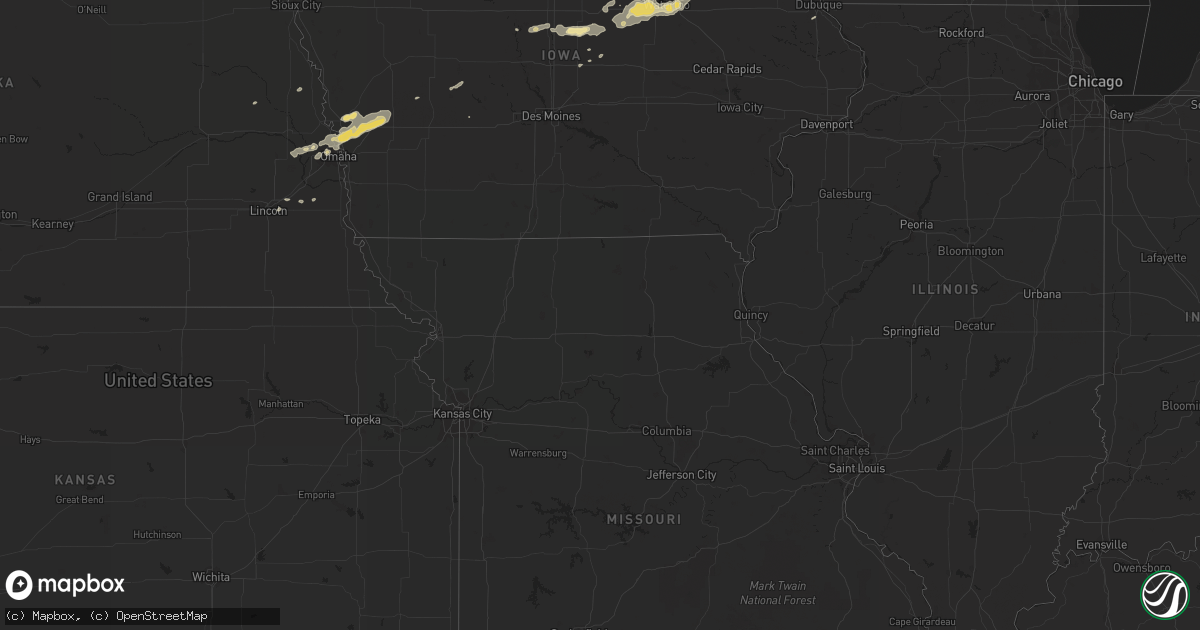
September 2 map
$229
one time, instant access
Download today. No call, no setup
Keep the $229
Bought the map and want the full workflow? Apply the entire $229 to a subscription within 7 days. None of it is wasted.
Every map, not just this one
This buys you this map. Subscription and you get every map we run, in the markets you choose from a few cities to whole states to nationwide. Plus real-time alerts the moment a storm fires.
Contact data
Name, contact info, occupancy, even credit band for addresses in the footprint. You go from where it hit to who to call.
Become the source they trust
Unlimited branding weather history reports on demand. You already have the documented answer ready for the property owner, and you are the one who showed up with it.
Property data and RoofTrace estimates
Pull up any address you have got, its value and the exact code rules for that jurisdiction, straight from One Click Code. Then RoofTrace estimates the squares, pitch, and roof value, priced the way you price.
Storm reports in Wisconsin
Wisconsin
| Date | Description |
|---|---|
| 09/02/201110:52 AM CDT | Power outages in city. |
| 09/02/201110:52 AM CDT | Trees and power lines down. |
| 09/02/201110:40 AM CDT | At the state park. |
| 09/02/201110:22 AM CDT | Few trees and large branches down at the new zoo. Delayed report. |
| 09/02/201110:15 AM CDT | Near pittsfield. Trees snapped. 1 to 2 ft in diameter. Roads block. |
| 09/02/201110:15 AM CDT | Large tree on house near the intersection of packerland and indian hill drive. |
| 09/02/201110:15 AM CDT | At the airport. |
| 09/02/201110:14 AM CDT | 4 trees and several highway signs down at various locations throughout sheboygan county. |
| 09/02/201110:13 AM CDT | Trees down. Light pole snapped. Power out in city. |
| 09/02/201110:03 AM CDT | Many trees and power lines down in the city. |
| 09/02/201110:00 AM CDT | 6 inch diameter limb snapped. |
| 09/02/201110:00 AM CDT | Near interstate 43 on exit 144. Semi overturned into median. |
| 09/02/201110:00 AM CDT | Many trees and power lines down in city. |
| 09/02/20119:55 AM CDT | Near hwy 55 and 41. Tree branches down and heavy rain. |
| 09/02/20119:55 AM CDT | North side of lake winnebago. 2 sections of dock gone. Trees snapped and powerlines down. |
| 09/02/20119:50 AM CDT | At the high school. Power is out at the high school. |
| 09/02/20119:49 AM CDT | Large trees uprooted at the fair grounds. Several damaged vehicles and campers. Scattered power outages. |
| 09/02/20119:45 AM CDT | A local report indicates 78 MPH wind near WRIGHTSTOWN |
| 09/02/20119:45 AM CDT | Semi truck blown over on county road u and hwy 41. Delayed report. |
| 09/02/20119:44 AM CDT | Intersection of jj and ballard. Several large tree branches snapped. |
| 09/02/20119:40 AM CDT | Observation taken at 40 ft elevation. |
| 09/02/20119:39 AM CDT | Delayed report |
| 09/02/20119:38 AM CDT | At the school. |
| 09/02/20119:37 AM CDT | A local report indicates 63 MPH wind near 1 N DARBOY |
| 09/02/20119:36 AM CDT | At the eaa fair grounds. |
| 09/02/20119:35 AM CDT | Near us 41 and us 10. Semi truck blown over. Delayed report. |
| 09/02/20119:35 AM CDT | Roof damage at the stock lumber yard on college ave. Delayed report. |
| 09/02/20119:35 AM CDT | At the university. |
| 09/02/20119:33 AM CDT | At the airport. |
| 09/02/20119:26 AM CDT | In the city. |
| 09/02/20119:16 AM CDT | Numerous power lines and trees down in city of berlin |
| 09/02/20119:05 AM CDT | Many 6 inch diameter tree limbs snapped |
| 09/02/20118:45 AM CDT | Trees and power lines down |
| 09/02/20118:45 AM CDT | Power lines down in city. |
| 09/02/20118:39 AM CDT | Numerious trees down across north western marquette county reported by sheriff department. |
| 09/02/20118:39 AM CDT | A local report indicates 67 MPH wind near 1 N WESTFIELD |
| 09/02/20118:27 AM CDT | Trees down about a mile south of highways 13 and 21 intersection. |
| 09/02/20118:25 AM CDT | Trees and power lines down across adams county. Reports of roads blocked...trees down on homes and cars. No injuries reported. Time estimated from radar between 825 and |
| 09/02/20118:25 AM CDT | Six inch trees blowing down from winds estimated at 60 mph in western adams county near castle rock park. |
| 09/02/20118:21 AM CDT | Trees down near sandstone estates. One fell on trailer in trailer park. |
| 09/02/20118:20 AM CDT | Numerous trees down |
| 09/02/20118:20 AM CDT | Jack pines snapping from wind gusts estimated at 50 mph. |
| 09/02/20118:16 AM CDT | Numerous trees down. Some snapped. |
| 09/02/20118:02 AM CDT | A local report indicates 60 MPH wind near TOMAH |
| 09/02/20118:00 AM CDT | Very large tree branches down. Some fell on roof and hit siding causing roof and siding damage. |
| 09/02/20117:59 AM CDT | Tree down on mobile home |
| 09/02/20117:56 AM CDT | A local report indicates 60 MPH wind near 4 E CATARACT |
| 09/02/20117:52 AM CDT | Trees down on power lines. Power out. |
| 09/02/20117:52 AM CDT | Several large trees down along county road ii |
| 09/02/20117:50 AM CDT | Lots of downed trees and power lines and also in chaseburg and stoddard. |
| 09/02/20117:50 AM CDT | 14 inch diameter tree down. Jack pine trees snapped off. Large oak tree split. |
| 09/02/20117:47 AM CDT | Tree down on home. 3 trees down on powerline on newport rd. |
| 09/02/20117:40 AM CDT | Numerous reports of trees down and power outages. Damage also reported between stoddard and genoa. |
| 09/02/20117:40 AM CDT | Multiple trees down on 16th and south ave and areas northward. Most are 1 to 2 foot diameter |
| 09/02/20117:38 AM CDT | Measured at la crosse airport. |
| 09/02/20117:34 AM CDT | Large pine tree down on house. Damage to house. |
| 09/02/20117:33 AM CDT | A local report indicates 60 MPH wind near WEST SALEM |
| 09/02/20117:31 AM CDT | A local report indicates 60 MPH wind near GALESVILLE |
| 09/02/20117:30 AM CDT | A local report indicates 62 MPH wind near ONALASKA |
| 09/02/20117:28 AM CDT | A local report indicates 65 MPH wind near ONALASKA |
| 09/02/20117:28 AM CDT | Trees and power lines down on losey blvd/main |
| 09/02/20117:27 AM CDT | Roof blown off house in chaseburg. Report relayed by wxow |
| 09/02/20117:26 AM CDT | A local report indicates 63 MPH wind near 4 N LA CROSSE |
| 09/02/20117:26 AM CDT | A local report indicates 62 MPH wind near ONALASKA |
| 09/02/20117:25 AM CDT | Two trees down on boma road and highway 33. Shelby ball fields. |
| 09/02/20117:25 AM CDT | Tree down on apartment bulding on 33rd street south just south of state road. Also trees took power lines down one block east on drive-in road. |
| 09/02/20117:22 AM CDT | Several trees down along hwy 35 between centerville and trempealeau. |
| 09/02/20117:18 AM CDT | Large trees down across roadways and on power lines |
| 09/02/20115:18 AM CDT | Power lines down in bayside. Time estimated. |
| 09/02/20115:15 AM CDT | Tree down at 76th street and overlook drive. Time estimated. |
| 09/02/20115:10 AM CDT | Tree branches down on w county line road between n 76th st and n 91st st. Time estimated. |
| 09/02/20115:03 AM CDT | Numerous trees and powerlines down in the richfield and erin areas. |
| 09/02/20114:39 AM CDT | Numerous reports of trees and power lines blown down across the far southern part of the county. |
| 09/02/20114:39 AM CDT | Two trees and two power poles down in the town of oconomowoc. Numerous branches down in the northwest part of waukesha county. |
| 09/02/20114:33 AM CDT | A local report indicates 59 MPH wind near WATERTOWN |
| 09/02/20114:26 AM CDT | Tree branches down. |
| 09/02/20114:11 AM CDT | Numerous reports of trees and power lines down in the northern half of the county north of i-94. |
| 09/02/20114:11 AM CDT | Large tree blown down onto county highway tt between sun prairie road and marshall. Time estimated from radar. |
| 09/02/20114:10 AM CDT | Medium sized branches down. Above ground pool blown into neighbor/s yard and outdoor furniture tossed around. Time estimated. |
| 09/02/20113:56 AM CDT | Small to medium sized branches down. |
| 09/02/20113:53 AM CDT | Power lines blown down on the south side of stoughton. Time estimated from radar. |
| 09/02/20113:48 AM CDT | Trees blown down on the east side of mcfarland. Time estimated from radar. |
| 09/02/20113:38 AM CDT | Small one to two inch branches down. Some siding torn off a house. |
| 09/02/20113:25 AM CDT | Large tree blocking state highway 92 in mount horeb. Time estimated from radar. |
| 09/02/20113:00 AM CDT | Numerous reports of trees and power lines down across the southeast part of the county between 3 am and 311 am. |
| 09/02/20112:40 AM CDT | Roof of building torn off south of dodgeville. Tree and corn crop damage across southern iowa county. Power lines down. Time estimated. |
| 09/02/20112:30 AM CDT | Large tree down on county road d south of platteville. |
| 09/02/20111:53 AM CDT | Small tree limbs blown into the road. |
| 09/02/20111:35 AM CDT | A local report indicates 60 MPH wind near MOUNT HOPE |
All States Impacted by Hail Map on September 2, 2011
Cities Impacted by Hail Map on September 2, 2011
- Omaha, NE
- Roanoke, VA
- Salem, VA
- Missouri Valley, IA
- Logan, IA
- Ararat, NC
- Pilot Mountain, NC
- Pine River, WI
- La Farge, WI
- Viola, WI
- Wytheville, VA
- Stratford, IA
- Ellsworth, IA
- Stanhope, IA
- Jewell, IA
- Mesick, MI
- Rapid City, SD
- Caputa, SD
- Independence, VA
- Elk Creek, VA
- Easton, MN
- Mouth Of Wilson, VA
- Troutdale, VA
- Hillsboro, WI
- Mooresboro, NC
- Ellenboro, NC
- White River, SD
- Kadoka, SD
- Belvidere, SD
- Long Valley, SD
- Saint Francis, SD
- Troutman, NC
- Sherrills Ford, NC
- Denver, NC
- Mount Ulla, NC
- Mooresville, NC
- Cleveland, NC
- Cornelius, NC
- Terrell, NC
- Commerce City, CO
- Fancy Gap, VA
- Grundy Center, IA
- Holland, IA
- Verona, WI
- Belleville, WI
- Mount Horeb, WI
- Mcfarland, WI
- Oregon, WI
- Hollandale, WI
- Barneveld, WI
- Madison, WI
- Blue Mounds, WI
- Wilton, WI
- Necedah, WI
- Wanblee, SD
- Lake Mills, WI
- Waterloo, WI
- Fort Calhoun, NE
- Persia, IA
- Harlan, IA
- Underwood, IA
- Honey Creek, IA
- Avoca, IA
- Shelby, IA
- Neola, IA
- Crescent, IA
- Portsmouth, IA
- Bennington, NE
- Minden, IA
- Floyd, VA
- Callaway, VA
- Bayard, IA
- Coon Rapids, IA
- Caledonia, MN
- Westfield, WI
- Grand Marsh, WI
- Adams, WI
- Friendship, WI
- Coloma, WI
- Lilesville, NC
- Wall, SD
- Quinn, SD
- Mauston, WI
- Taylorsville, NC
- Mission, SD
- Boys Town, NE
- Concord, NC
- Harrisburg, NC
- Charlotte, NC
- New Underwood, SD
- Cashton, WI
- Westby, WI
- Coon Valley, WI
- Interior, SD
- Cottage Grove, WI
- Trinidad, CO
- Aguilar, CO
- Radcliffe, IA
- Hubbard, IA
- New Providence, IA
- Owanka, SD
- Scenic, SD
- Wasta, SD
- Philip, SD
- Brownsville, MN
- Johnson, KS
- Midland, SD
- New Lisbon, WI
- Sun Prairie, WI
- Tekamah, NE
- Craig, NE
- Cassville, WI
- Valley, NE
- Elkhorn, NE
- Troutville, VA
- Fincastle, VA
- New Castle, VA
- Mequon, WI
- Milwaukee, WI
- Platteville, WI
- North Buena Vista, IA
- Sherrill, IA
- Guttenberg, IA
- New Vienna, IA
- Potosi, WI
- Holy Cross, IA
- Colesburg, IA
- Mount Gilead, NC
- Wild Rose, WI
- Redgranite, WI
- Wautoma, WI
- Fremont, WI
- Berlin, WI
- Hancock, WI
- Reinbeck, IA
- Jesup, IA
- Cedar Falls, IA
- Evansdale, IA
- Raymond, IA
- Hudson, IA
- Dike, IA
- Waterloo, IA
- Elmwood, NE
- Murdock, NE
- Alvo, NE
- Casey, IA
- Tuthill, SD
- Marshall, WI
- Steamboat Rock, IA
- Ackley, IA
- Aplington, IA
- Wellsburg, IA
- Onida, SD
- Bostic, NC
- Union Mills, NC
- Rutherfordton, NC
- Austinville, VA
- Ivanhoe, VA
- Max Meadows, VA
- Fries, VA
- Denver, IA
- Mineral Point, WI
- Darlington, WI
- Hortonville, WI
- Wisconsin Rapids, WI
- Bancroft, WI
- Larsen, WI
- Poy Sippi, WI
- Plainfield, WI
- Neenah, WI
- Neshkoro, WI
- Nekoosa, WI
- Arkdale, WI
- Winneconne, WI
- Cambridge, WI
- Plover, WI
- Amherst, WI
- Aurora, CO
- Denver, CO
- Hokah, MN
- Stoddard, WI
- Del Norte, CO
- Center, CO
- Onekama, MI
- Manistee, MI
- Harrietta, MI
- Brethren, MI
- Copemish, MI
- Kaleva, MI
- Bear Lake, MI
- Manawa, WI
- Bear Creek, WI
- Decorah, IA
- Dorchester, IA
- Spring Grove, MN
- Troy, NC
- Dunkerton, IA
- Parkersburg, IA
- Fairbank, IA
- Hazleton, IA
- Dewar, IA
- Morrison, IA
- Dodgeville, WI
- Ridgeway, WI
- Deerfield, WI
- Forest City, NC
- Martin, SD
- Sparta, WI
- Black River Falls, WI
- Albemarle, NC
- Stuart, VA
- Colorado Springs, CO
- Lincoln, NE
- Waverly, NE
- Keenesburg, CO
- Roggen, CO
- Lindstrom, MN
- Walsenburg, CO
- Melrose, WI
- Chaseburg, WI
- Ogdensburg, WI
- Salisbury, NC
- Gold Hill, NC
- Richfield, NC
- Hot Springs, VA
- Covington, VA
- Oelwein, IA
- Maynard, IA
- Bangor, WI
- Houston, MN
- Rushford, MN
- Genoa, WI
- Tobaccoville, NC
- King, NC
- Pinnacle, NC
- Siloam, NC
- Harrold, SD
- Blunt, SD
- Greenville, WI
- Oshkosh, WI
- Elroy, WI
- Appleton, WI
- Camp Douglas, WI
- Almond, WI
- Hillsville, VA
- Laurel Fork, VA
- Wonewoc, WI
- Good Thunder, MN
- Vernon Center, MN
- Amboy, MN
- Scandinavia, WI
- Ixonia, WI
- Neosho, WI
- Oconomowoc, WI
- Watertown, WI
- Damascus, VA
- Whitetop, VA
- Laurel Bloomery, TN
- Creston, NC
- Lansing, NC
- Delavan, MN
- Tomah, WI
- Norwalk, WI
- Harmony, NC
- Claudville, VA
- Ararat, VA
- Fredericksburg, IA
- Mount Airy, NC
- Lawsonville, NC
- Westfield, NC
- Kannapolis, NC
- Bassett, VA
- Saint Anthony, IA
- Clemons, IA
- Marshalltown, IA
- Sandy Ridge, NC
- State Center, IA
- Dayton, IA
- Dubuque, IA
- Zwingle, IA
- Rewey, WI
- Middleton, WI
- Stoughton, WI
- Montfort, WI
- Linden, WI
- Winston Salem, NC
- Castle Rock, CO
- Wadesboro, NC
- Rye, CO
- Memphis, TN
- Grafton, WI
- Danbury, NC
- Warrens, WI
- Elkhart, KS
- Norwood, NC
- Amherst Junction, WI
- Waterloo, NE
- Yutan, NE
- Dodge, NE
- Pierre, SD
- Weeping Water, NE
- Society Hill, SC
- Cheraw, SC
- Garden City, IA
- Eldora, IA
- Union, IA
- Story City, IA
- Patrick, SC
- Stanley, NC
- La Crescent, MN
- Eitzen, MN
- Peterson, MN
- La Crosse, WI
- Check, VA
- Shawsville, VA
- Copper Hill, VA
- Bent Mountain, VA
- Colo, IA
- Sedalia, CO
- Mapleton, MN
- Audubon, IA
- Readlyn, IA


