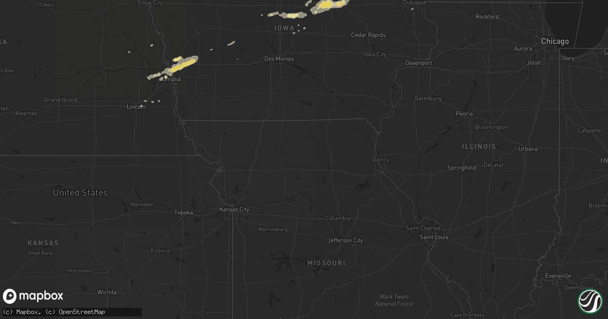
Hail Map in Iowa on September 2, 2011
Get this storm
September 2 map
$229
one time, instant access
Download today. No call, no setup
Keep the $229
Bought the map and want the full workflow? Apply the entire $229 to a subscription within 7 days. None of it is wasted.
Every map, not just this one
This buys you this map. Subscription and you get every map we run, in the markets you choose from a few cities to whole states to nationwide. Plus real-time alerts the moment a storm fires.
Contact data
Name, contact info, occupancy, even credit band for addresses in the footprint. You go from where it hit to who to call.
Become the source they trust
Unlimited branding weather history reports on demand. You already have the documented answer ready for the property owner, and you are the one who showed up with it.
Property data and RoofTrace estimates
Pull up any address you have got, its value and the exact code rules for that jurisdiction, straight from One Click Code. Then RoofTrace estimates the squares, pitch, and roof value, priced the way you price.
Storm reports in Iowa
Iowa
| Date | Description |
|---|---|
| 09/02/20117:30 AM CDT | Numerous branches and small trees down in and near decorah. Several large trees down across highway 139 near kendallville |
| 09/02/201112:52 AM CDT | Also pea sized hail |
| 09/02/201112:28 AM CDT | Numerous tree branches 2-3 inches in diameter and a few up to 6 inches in diamter down. |
| 09/02/201112:22 AM CDT | High wind gust estimated between 60 and 70 mph. |
| 09/02/201112:20 AM CDT | Tree limbs on power lines and several trees down blocking some city streets. |
| 09/02/201112:16 AM CDT | Numerous trees and limbs down in excess of 12 inches. Roof removed from grain elevator. |
| 09/01/201111:49 PM CDT | A local report indicates 60 MPH wind near WATERLOO AIRPORT |
| 09/01/201111:47 PM CDT | Small tree limbs down |
| 09/01/201111:45 PM CDT | A local report indicates 59 MPH wind near 3 SE WATERLOO |
| 09/01/201111:43 PM CDT | A local report indicates 59 MPH wind near WATERLOO AIRPORT |
| 09/01/201111:40 PM CDT | Spotter estimated 60 mph gust. |
| 09/01/201110:55 PM CDT | Spotter estimates gusts to 60 mph. |
| 09/01/201110:45 PM CDT | Tree damage throughout town. From dallas center fd while traveling. |
| 09/01/201110:45 PM CDT | Grain bin destroyed. Large trees down with crop damage. From dallas center fd while traveling through area. |
| 09/01/201110:40 PM CDT | Several branches downed...some 10 inches in diameter. |
| 09/01/201110:30 PM CDT | Numerous tree branches down. |
| 09/01/201110:20 PM CDT | Update to previous report. Ten large trees snapped in half...with a couple of these trees hitting and destroying two grain bins. Many large branches down...some 10 inch |
| 09/01/20119:47 PM CDT | A local report indicates 83 MPH wind near HARLAN |
| 09/01/20119:45 PM CDT | Large tree blocking a road off of highway 69. Time estimated from radar. |
| 09/01/20119:45 PM CDT | Large tree limb down in town. Time estimated from radar. |
| 09/01/20119:32 PM CDT | A local report indicates 60 MPH wind near SHELBY |
All States Impacted by Hail Map on September 2, 2011
Cities Impacted by Hail Map on September 2, 2011
- Omaha, NE
- Roanoke, VA
- Salem, VA
- Missouri Valley, IA
- Logan, IA
- Ararat, NC
- Pilot Mountain, NC
- Pine River, WI
- La Farge, WI
- Viola, WI
- Wytheville, VA
- Stratford, IA
- Ellsworth, IA
- Stanhope, IA
- Jewell, IA
- Mesick, MI
- Rapid City, SD
- Caputa, SD
- Independence, VA
- Elk Creek, VA
- Easton, MN
- Mouth Of Wilson, VA
- Troutdale, VA
- Hillsboro, WI
- Mooresboro, NC
- Ellenboro, NC
- White River, SD
- Kadoka, SD
- Belvidere, SD
- Long Valley, SD
- Saint Francis, SD
- Troutman, NC
- Sherrills Ford, NC
- Denver, NC
- Mount Ulla, NC
- Mooresville, NC
- Cleveland, NC
- Cornelius, NC
- Terrell, NC
- Commerce City, CO
- Fancy Gap, VA
- Grundy Center, IA
- Holland, IA
- Verona, WI
- Belleville, WI
- Mount Horeb, WI
- Mcfarland, WI
- Oregon, WI
- Hollandale, WI
- Barneveld, WI
- Madison, WI
- Blue Mounds, WI
- Wilton, WI
- Necedah, WI
- Wanblee, SD
- Lake Mills, WI
- Waterloo, WI
- Fort Calhoun, NE
- Persia, IA
- Harlan, IA
- Underwood, IA
- Honey Creek, IA
- Avoca, IA
- Shelby, IA
- Neola, IA
- Crescent, IA
- Portsmouth, IA
- Bennington, NE
- Minden, IA
- Floyd, VA
- Callaway, VA
- Bayard, IA
- Coon Rapids, IA
- Caledonia, MN
- Westfield, WI
- Grand Marsh, WI
- Adams, WI
- Friendship, WI
- Coloma, WI
- Lilesville, NC
- Wall, SD
- Quinn, SD
- Mauston, WI
- Taylorsville, NC
- Mission, SD
- Boys Town, NE
- Concord, NC
- Harrisburg, NC
- Charlotte, NC
- New Underwood, SD
- Cashton, WI
- Westby, WI
- Coon Valley, WI
- Interior, SD
- Cottage Grove, WI
- Trinidad, CO
- Aguilar, CO
- Radcliffe, IA
- Hubbard, IA
- New Providence, IA
- Owanka, SD
- Scenic, SD
- Wasta, SD
- Philip, SD
- Brownsville, MN
- Johnson, KS
- Midland, SD
- New Lisbon, WI
- Sun Prairie, WI
- Tekamah, NE
- Craig, NE
- Cassville, WI
- Valley, NE
- Elkhorn, NE
- Troutville, VA
- Fincastle, VA
- New Castle, VA
- Mequon, WI
- Milwaukee, WI
- Platteville, WI
- North Buena Vista, IA
- Sherrill, IA
- Guttenberg, IA
- New Vienna, IA
- Potosi, WI
- Holy Cross, IA
- Colesburg, IA
- Mount Gilead, NC
- Wild Rose, WI
- Redgranite, WI
- Wautoma, WI
- Fremont, WI
- Berlin, WI
- Hancock, WI
- Reinbeck, IA
- Jesup, IA
- Cedar Falls, IA
- Evansdale, IA
- Raymond, IA
- Hudson, IA
- Dike, IA
- Waterloo, IA
- Elmwood, NE
- Murdock, NE
- Alvo, NE
- Casey, IA
- Tuthill, SD
- Marshall, WI
- Steamboat Rock, IA
- Ackley, IA
- Aplington, IA
- Wellsburg, IA
- Onida, SD
- Bostic, NC
- Union Mills, NC
- Rutherfordton, NC
- Austinville, VA
- Ivanhoe, VA
- Max Meadows, VA
- Fries, VA
- Denver, IA
- Mineral Point, WI
- Darlington, WI
- Hortonville, WI
- Wisconsin Rapids, WI
- Bancroft, WI
- Larsen, WI
- Poy Sippi, WI
- Plainfield, WI
- Neenah, WI
- Neshkoro, WI
- Nekoosa, WI
- Arkdale, WI
- Winneconne, WI
- Cambridge, WI
- Plover, WI
- Amherst, WI
- Aurora, CO
- Denver, CO
- Hokah, MN
- Stoddard, WI
- Del Norte, CO
- Center, CO
- Onekama, MI
- Manistee, MI
- Harrietta, MI
- Brethren, MI
- Copemish, MI
- Kaleva, MI
- Bear Lake, MI
- Manawa, WI
- Bear Creek, WI
- Decorah, IA
- Dorchester, IA
- Spring Grove, MN
- Troy, NC
- Dunkerton, IA
- Parkersburg, IA
- Fairbank, IA
- Hazleton, IA
- Dewar, IA
- Morrison, IA
- Dodgeville, WI
- Ridgeway, WI
- Deerfield, WI
- Forest City, NC
- Martin, SD
- Sparta, WI
- Black River Falls, WI
- Albemarle, NC
- Stuart, VA
- Colorado Springs, CO
- Lincoln, NE
- Waverly, NE
- Keenesburg, CO
- Roggen, CO
- Lindstrom, MN
- Walsenburg, CO
- Melrose, WI
- Chaseburg, WI
- Ogdensburg, WI
- Salisbury, NC
- Gold Hill, NC
- Richfield, NC
- Hot Springs, VA
- Covington, VA
- Oelwein, IA
- Maynard, IA
- Bangor, WI
- Houston, MN
- Rushford, MN
- Genoa, WI
- Tobaccoville, NC
- King, NC
- Pinnacle, NC
- Siloam, NC
- Harrold, SD
- Blunt, SD
- Greenville, WI
- Oshkosh, WI
- Elroy, WI
- Appleton, WI
- Camp Douglas, WI
- Almond, WI
- Hillsville, VA
- Laurel Fork, VA
- Wonewoc, WI
- Good Thunder, MN
- Vernon Center, MN
- Amboy, MN
- Scandinavia, WI
- Ixonia, WI
- Neosho, WI
- Oconomowoc, WI
- Watertown, WI
- Damascus, VA
- Whitetop, VA
- Laurel Bloomery, TN
- Creston, NC
- Lansing, NC
- Delavan, MN
- Tomah, WI
- Norwalk, WI
- Harmony, NC
- Claudville, VA
- Ararat, VA
- Fredericksburg, IA
- Mount Airy, NC
- Lawsonville, NC
- Westfield, NC
- Kannapolis, NC
- Bassett, VA
- Saint Anthony, IA
- Clemons, IA
- Marshalltown, IA
- Sandy Ridge, NC
- State Center, IA
- Dayton, IA
- Dubuque, IA
- Zwingle, IA
- Rewey, WI
- Middleton, WI
- Stoughton, WI
- Montfort, WI
- Linden, WI
- Winston Salem, NC
- Castle Rock, CO
- Wadesboro, NC
- Rye, CO
- Memphis, TN
- Grafton, WI
- Danbury, NC
- Warrens, WI
- Elkhart, KS
- Norwood, NC
- Amherst Junction, WI
- Waterloo, NE
- Yutan, NE
- Dodge, NE
- Pierre, SD
- Weeping Water, NE
- Society Hill, SC
- Cheraw, SC
- Garden City, IA
- Eldora, IA
- Union, IA
- Story City, IA
- Patrick, SC
- Stanley, NC
- La Crescent, MN
- Eitzen, MN
- Peterson, MN
- La Crosse, WI
- Check, VA
- Shawsville, VA
- Copper Hill, VA
- Bent Mountain, VA
- Colo, IA
- Sedalia, CO
- Mapleton, MN
- Audubon, IA
- Readlyn, IA


