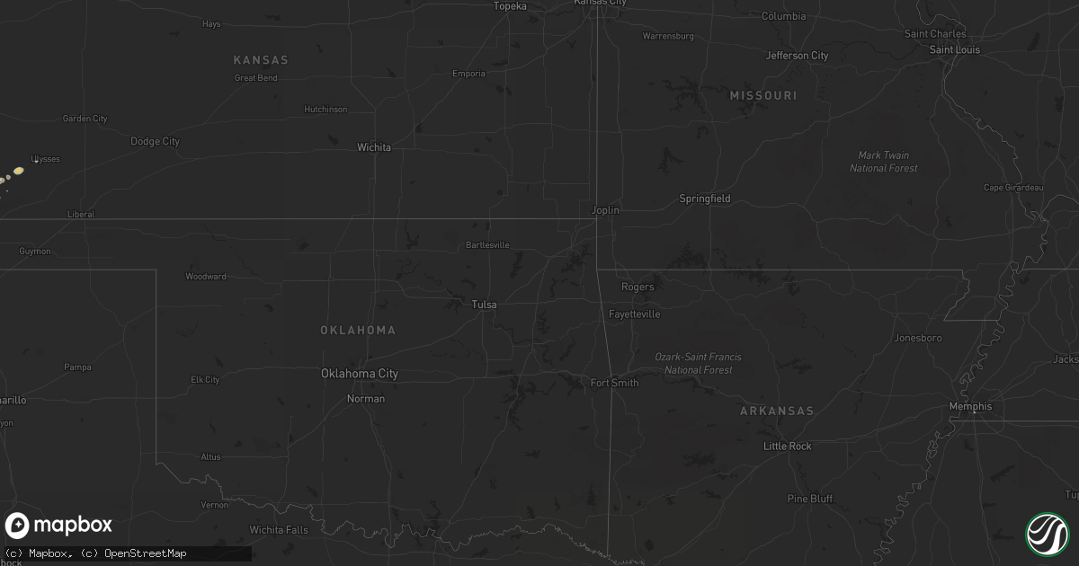
Hail Map on September 2, 2011
Get this storm
September 2 map
$229
one time, instant access
Download today. No call, no setup
Keep the $229
Bought the map and want the full workflow? Apply the entire $229 to a subscription within 7 days. None of it is wasted.
Every map, not just this one
This buys you this map. Subscription and you get every map we run, in the markets you choose from a few cities to whole states to nationwide. Plus real-time alerts the moment a storm fires.
Contact data
Name, contact info, occupancy, even credit band for addresses in the footprint. You go from where it hit to who to call.
Become the source they trust
Unlimited branding weather history reports on demand. You already have the documented answer ready for the property owner, and you are the one who showed up with it.
Property data and RoofTrace estimates
Pull up any address you have got, its value and the exact code rules for that jurisdiction, straight from One Click Code. Then RoofTrace estimates the squares, pitch, and roof value, priced the way you price.
States Impacted by Hail Map on September 2, 2011
Storm reports
Indiana
| Date | Description |
|---|---|
| 09/02/20114:50 PM CDT | Downed trees blocking hwy 160 at the scott-clark county line |
North Carolina
| Date | Description |
|---|---|
| 09/02/20116:53 PM CDT | One tree down |
| 09/02/20116:49 PM CDT | Multiple trees down |
| 09/02/20116:43 PM CDT | Large limbs down...winds estimated at 60 mph. |
| 09/02/20116:41 PM CDT | Multiple trees down |
| 09/02/20116:27 PM CDT | Large limbs down 6-8 inches in diameter |
| 09/02/20116:20 PM CDT | Mountain island raws |
| 09/02/20116:20 PM CDT | A local report indicates 60 MPH wind near 3 W CONCORD |
| 09/02/20116:06 PM CDT | Powerlines down along leland st |
| 09/02/20116:00 PM CDT | Power poles cut in half on us hwy 29. Roof blown off building on lyle lane and speedway blvd. Funnel cloud reported by concord airport officials. |
| 09/02/20115:50 PM CDT | Tree down at 900 george mcmilan road blocking the road. |
| 09/02/20115:48 PM CDT | Trees down on new hope church road. |
| 09/02/20115:46 PM CDT | Multiple trees down |
| 09/02/20115:46 PM CDT | Many trees down. |
| 09/02/20115:43 PM CDT | Large limbs down...winds estimated at 60 mph. |
| 09/02/20115:36 PM CDT | Tree down blocking highway 113 in piney creek. |
| 09/02/20115:36 PM CDT | Trees down. |
| 09/02/20115:32 PM CDT | Tree down blocking highway 93. |
| 09/02/20115:22 PM CDT | Lines down across road near blades trail |
| 09/02/20115:20 PM CDT | Tree down on snuggs park road |
| 09/02/20115:15 PM CDT | 2 trees down in the road. |
| 09/02/20115:15 PM CDT | Tree down on red white and blue road. |
| 09/02/20115:10 PM CDT | Tree down |
| 09/02/20115:10 PM CDT | Tree down at the 7000 block of traphill road. |
| 09/02/20115:05 PM CDT | Tree down on cemetary road. |
| 09/02/20114:50 PM CDT | Tree down at the 10000 block of austin traphill road. |
| 09/02/20114:50 PM CDT | Tree down on white plains road. |
| 09/02/20114:45 PM CDT | Tree down on chestnut grove road and ymca camp road. |
| 09/02/20114:37 PM CDT | A local report indicates 1.00 inch wind near ELLENBORO |
| 09/02/20114:32 PM CDT | Tree down on pond valley road. |
| 09/02/20114:28 PM CDT | Tree down on pilot power dam road. |
| 09/02/20114:24 PM CDT | Tree down on chilton road. |
| 09/02/20114:24 PM CDT | Tree down on neal road. |
| 09/02/20114:24 PM CDT | Tree down on toms creek road. |
| 09/02/20114:24 PM CDT | Tree down on key road. |
| 09/02/20114:24 PM CDT | Many trees down. |
| 09/02/20114:15 PM CDT | Tree down on cook school road. |
| 09/02/20114:11 PM CDT | Power lines down. |
| 09/02/20114:08 PM CDT | Tree blown down onto power line. |
| 09/02/20114:05 PM CDT | Several trees down in the courtney area |
| 09/02/20114:03 PM CDT | Trees down all over...south toward forest city. |
| 09/02/20114:02 PM CDT | Tree down on tom shelton road. |
| 09/02/20114:00 PM CDT | Roof blown off barn |
| 09/02/20114:00 PM CDT | Trees down on a power line on hoots road...which then fell on a house and has trapped people inside. |
| 09/02/20113:37 PM CDT | Tree down along u.s. 601. |
| 09/02/20113:24 PM CDT | Multiple trees and power lines down along doral road |
| 09/02/20113:24 PM CDT | Tree down on bowens road |
| 09/02/20113:24 PM CDT | Tree down near the intersection of highway 268 and u.s. 601. |
| 09/02/20113:24 PM CDT | Tree down on quaker church road. |
| 09/02/20113:20 PM CDT | Tree down along highway 268. |
| 09/02/20113:11 PM CDT | Tree down on jay max lane. |
| 09/02/20113:09 PM CDT | Tree down on homeplace park road. |
| 09/02/20113:05 PM CDT | Several trees down in the bryant mill road area. |
| 09/02/20113:03 PM CDT | Tree down on eldora road. |
| 09/02/20113:01 PM CDT | Power line down along greene road. |
| 09/02/20112:59 PM CDT | Tree down along pratt road. |
| 09/02/20112:59 PM CDT | Tree down on stanford church road. |
| 09/02/20112:50 PM CDT | Tree down near the intersection of dodson mill road and whitaker chapel road. |
| 09/02/20112:46 PM CDT | Numerous trees down. |
| 09/02/20112:24 PM CDT | Tree down on e. Pine street. |
| 09/02/20112:20 PM CDT | Quarter hail at family dollar store at 608 south key street. |
| 09/02/20112:20 PM CDT | A local report indicates 1.00 inch wind near 1 WSW PILOT MOUNTAIN |
| 09/02/20112:20 PM CDT | Large billborad and road signs blown down at and near the family dollar store at 608 south key street. |
| 09/02/20112:20 PM CDT | Large store sign blown down as well as outdoor store racks blown away. Tree also down in the area. |
| 09/02/20112:16 PM CDT | Several power lines down near the pilot mountain fire department. |
| 09/02/20112:02 PM CDT | Trees down on hard road and on vanderbilt road. Hail size of quarters. Reported biltmore forest pd. |
| 09/02/20112:02 PM CDT | Report by biltmore forest pd. |
| 09/02/20111:35 PM CDT | Tree down on lakewood road. Dime size hail at radio station. |
| 09/01/20117:20 PM CDT | Tree on powerline along windy hill dr. |
| 09/01/20117:20 PM CDT | Mature hardwoods snapped. Public report relayed from media. |
| 09/01/20117:06 PM CDT | A few trees blown down. |
| 09/01/20117:00 PM CDT | Scattered trees blown down in the county. Time estimated. |
Minnesota
| Date | Description |
|---|---|
| 09/02/20117:22 AM CDT | 18 inch diameter cottonwood tree down. Received about 0.70 inches of rain in 10 minutes. |
| 09/02/20117:21 AM CDT | Numerous trees and power lines down |
| 09/02/20117:19 AM CDT | A local report indicates 60 MPH wind near PICKWICK |
| 09/02/20117:15 AM CDT | Trees reported down along state highway 16. |
| 09/02/20117:10 AM CDT | A local report indicates 60 MPH wind near 4 SW WINONA |
| 09/02/20117:00 AM CDT | Several branches down. Outside furniture blown around. |
South Carolina
| Date | Description |
|---|---|
| 09/02/20116:49 PM CDT | One tree down |
| 09/02/20116:35 PM CDT | One tree down |
| 09/02/20116:30 PM CDT | 2 trees down on griffin road |
| 09/02/20116:12 PM CDT | Schp reports tree in road near hw-56 and millertown rd. |
Iowa
| Date | Description |
|---|---|
| 09/02/20117:30 AM CDT | Numerous branches and small trees down in and near decorah. Several large trees down across highway 139 near kendallville |
| 09/02/201112:52 AM CDT | Also pea sized hail |
| 09/02/201112:28 AM CDT | Numerous tree branches 2-3 inches in diameter and a few up to 6 inches in diamter down. |
| 09/02/201112:22 AM CDT | High wind gust estimated between 60 and 70 mph. |
| 09/02/201112:20 AM CDT | Tree limbs on power lines and several trees down blocking some city streets. |
| 09/02/201112:16 AM CDT | Numerous trees and limbs down in excess of 12 inches. Roof removed from grain elevator. |
| 09/01/201111:49 PM CDT | A local report indicates 60 MPH wind near WATERLOO AIRPORT |
| 09/01/201111:47 PM CDT | Small tree limbs down |
| 09/01/201111:45 PM CDT | A local report indicates 59 MPH wind near 3 SE WATERLOO |
| 09/01/201111:43 PM CDT | A local report indicates 59 MPH wind near WATERLOO AIRPORT |
| 09/01/201111:40 PM CDT | Spotter estimated 60 mph gust. |
| 09/01/201110:55 PM CDT | Spotter estimates gusts to 60 mph. |
| 09/01/201110:45 PM CDT | Tree damage throughout town. From dallas center fd while traveling. |
| 09/01/201110:45 PM CDT | Grain bin destroyed. Large trees down with crop damage. From dallas center fd while traveling through area. |
| 09/01/201110:40 PM CDT | Several branches downed...some 10 inches in diameter. |
| 09/01/201110:30 PM CDT | Numerous tree branches down. |
| 09/01/201110:20 PM CDT | Update to previous report. Ten large trees snapped in half...with a couple of these trees hitting and destroying two grain bins. Many large branches down...some 10 inch |
| 09/01/20119:47 PM CDT | A local report indicates 83 MPH wind near HARLAN |
| 09/01/20119:45 PM CDT | Large tree limb down in town. Time estimated from radar. |
| 09/01/20119:45 PM CDT | Large tree blocking a road off of highway 69. Time estimated from radar. |
| 09/01/20119:32 PM CDT | A local report indicates 60 MPH wind near SHELBY |
Michigan
| Date | Description |
|---|---|
| 09/02/201112:01 PM CDT | Trees down |
| 09/02/201111:43 AM CDT | Trees and power lines down in manistee |
| 09/02/20111:20 AM CDT | 2 trees down in grand haven. |
South Dakota
| Date | Description |
|---|---|
| 09/02/20114:00 AM CDT | A local report indicates 1.00 inch wind near 19 ESE SAINT FRANCIS |
| 09/02/20111:00 AM CDT | Broken windows from hail |
| 09/02/201112:18 AM CDT | Hail broke window of motorist at mm117. At least quarter size hail. |
| 09/01/201111:35 PM CDT | A local report indicates 1.00 inch wind near WNW WASTA |
Mississippi
| Date | Description |
|---|---|
| 09/02/201112:35 AM CDT | Tree down on corner of 24th ave and 23rd st. Time estimated. |
| 09/02/201112:30 AM CDT | Tree down. Time estimated. |
| 09/02/201112:30 AM CDT | Tree down on st paul ave and north st. |
Kansas
| Date | Description |
|---|---|
| 09/02/20116:11 PM CDT | A local report indicates 1.00 inch wind near 6 SE JOHNSON CITY |
| 09/02/20115:15 PM CDT | Spotter reported a snapped power pole 3 miles east of ulysses on road m just off of highway 160. |
| 09/02/20114:40 PM CDT | A local report indicates 60 MPH wind near 2 NW ULYSSES |
| 09/01/20117:00 PM CDT | A local report indicates 1.00 inch wind near 9 S MANTER |
Virginia
| Date | Description |
|---|---|
| 09/02/20115:15 PM CDT | Tree down on route 606. |
| 09/02/20114:40 PM CDT | Numerous trees down near the intersection of glendale road and country club lane and the intersection of west stuart and mountain view roads. A few homes had damage fro |
| 09/02/20114:30 PM CDT | Several trees and power lines down on pipers gap road between route 89 and tower road. Two power poles also snapped. |
| 09/02/20113:45 PM CDT | Tree down on golf course road. |
| 09/02/20113:38 PM CDT | Quarter size hail and a large limb down on windsor avenue. |
| 09/02/20113:37 PM CDT | Tree down on keno rd in laurel fork area |
| 09/02/20113:25 PM CDT | A local report indicates 1.00 inch wind near 2 NNW ROANOKE |
| 09/02/20113:24 PM CDT | A local report indicates 1.00 inch wind near HOLLINS |
| 09/02/20113:08 PM CDT | At salem civic center. |
| 09/02/20113:05 PM CDT | Damaging thunderstorm winds blew two trees down and brought down many limbs...some up to eight inches in diameter...in the 400 block of high street. |
| 09/02/20113:00 PM CDT | Marble size hail and several large limbs down on west 4th street. |
| 09/02/20112:55 PM CDT | Quarter size hail fell in the 400 block of high street. |
| 09/02/20112:41 PM CDT | Several trees down in the claudville highway and hatchers chapel road area. |
| 09/02/20112:39 PM CDT | Quarter size hail covering the ground. |
| 09/02/20112:35 PM CDT | Part of large sign blown out by the wind. Also had dime sized hail. |
| 09/02/20111:49 PM CDT | Tree blown down onto power lines along north fork road. |
| 09/02/20111:36 PM CDT | Power lines down along bradshaw road. |
Tennessee
| Date | Description |
|---|---|
| 09/01/20117:55 PM CDT | Few trees down |
Wisconsin
| Date | Description |
|---|---|
| 09/02/201110:52 AM CDT | Power outages in city. |
| 09/02/201110:52 AM CDT | Trees and power lines down. |
| 09/02/201110:40 AM CDT | At the state park. |
| 09/02/201110:22 AM CDT | Few trees and large branches down at the new zoo. Delayed report. |
| 09/02/201110:15 AM CDT | Large tree on house near the intersection of packerland and indian hill drive. |
| 09/02/201110:15 AM CDT | At the airport. |
| 09/02/201110:15 AM CDT | Near pittsfield. Trees snapped. 1 to 2 ft in diameter. Roads block. |
| 09/02/201110:14 AM CDT | 4 trees and several highway signs down at various locations throughout sheboygan county. |
| 09/02/201110:13 AM CDT | Trees down. Light pole snapped. Power out in city. |
| 09/02/201110:03 AM CDT | Many trees and power lines down in the city. |
| 09/02/201110:00 AM CDT | Many trees and power lines down in city. |
| 09/02/201110:00 AM CDT | Near interstate 43 on exit 144. Semi overturned into median. |
| 09/02/201110:00 AM CDT | 6 inch diameter limb snapped. |
| 09/02/20119:55 AM CDT | Near hwy 55 and 41. Tree branches down and heavy rain. |
| 09/02/20119:55 AM CDT | North side of lake winnebago. 2 sections of dock gone. Trees snapped and powerlines down. |
| 09/02/20119:50 AM CDT | At the high school. Power is out at the high school. |
| 09/02/20119:49 AM CDT | Large trees uprooted at the fair grounds. Several damaged vehicles and campers. Scattered power outages. |
| 09/02/20119:45 AM CDT | Semi truck blown over on county road u and hwy 41. Delayed report. |
| 09/02/20119:45 AM CDT | A local report indicates 78 MPH wind near WRIGHTSTOWN |
| 09/02/20119:44 AM CDT | Intersection of jj and ballard. Several large tree branches snapped. |
| 09/02/20119:40 AM CDT | Observation taken at 40 ft elevation. |
| 09/02/20119:39 AM CDT | Delayed report |
| 09/02/20119:38 AM CDT | At the school. |
| 09/02/20119:37 AM CDT | A local report indicates 63 MPH wind near 1 N DARBOY |
| 09/02/20119:36 AM CDT | At the eaa fair grounds. |
| 09/02/20119:35 AM CDT | At the university. |
| 09/02/20119:35 AM CDT | Near us 41 and us 10. Semi truck blown over. Delayed report. |
| 09/02/20119:35 AM CDT | Roof damage at the stock lumber yard on college ave. Delayed report. |
| 09/02/20119:33 AM CDT | At the airport. |
| 09/02/20119:26 AM CDT | In the city. |
| 09/02/20119:16 AM CDT | Numerous power lines and trees down in city of berlin |
| 09/02/20119:05 AM CDT | Many 6 inch diameter tree limbs snapped |
| 09/02/20118:45 AM CDT | Power lines down in city. |
| 09/02/20118:45 AM CDT | Trees and power lines down |
| 09/02/20118:39 AM CDT | Numerious trees down across north western marquette county reported by sheriff department. |
| 09/02/20118:39 AM CDT | A local report indicates 67 MPH wind near 1 N WESTFIELD |
| 09/02/20118:27 AM CDT | Trees down about a mile south of highways 13 and 21 intersection. |
| 09/02/20118:25 AM CDT | Six inch trees blowing down from winds estimated at 60 mph in western adams county near castle rock park. |
| 09/02/20118:25 AM CDT | Trees and power lines down across adams county. Reports of roads blocked...trees down on homes and cars. No injuries reported. Time estimated from radar between 825 and |
| 09/02/20118:21 AM CDT | Trees down near sandstone estates. One fell on trailer in trailer park. |
| 09/02/20118:20 AM CDT | Numerous trees down |
| 09/02/20118:20 AM CDT | Jack pines snapping from wind gusts estimated at 50 mph. |
| 09/02/20118:16 AM CDT | Numerous trees down. Some snapped. |
| 09/02/20118:02 AM CDT | A local report indicates 60 MPH wind near TOMAH |
| 09/02/20118:00 AM CDT | Very large tree branches down. Some fell on roof and hit siding causing roof and siding damage. |
| 09/02/20117:59 AM CDT | Tree down on mobile home |
| 09/02/20117:56 AM CDT | A local report indicates 60 MPH wind near 4 E CATARACT |
| 09/02/20117:52 AM CDT | Several large trees down along county road ii |
| 09/02/20117:52 AM CDT | Trees down on power lines. Power out. |
| 09/02/20117:50 AM CDT | 14 inch diameter tree down. Jack pine trees snapped off. Large oak tree split. |
| 09/02/20117:50 AM CDT | Lots of downed trees and power lines and also in chaseburg and stoddard. |
| 09/02/20117:47 AM CDT | Tree down on home. 3 trees down on powerline on newport rd. |
| 09/02/20117:40 AM CDT | Numerous reports of trees down and power outages. Damage also reported between stoddard and genoa. |
| 09/02/20117:40 AM CDT | Multiple trees down on 16th and south ave and areas northward. Most are 1 to 2 foot diameter |
| 09/02/20117:38 AM CDT | Measured at la crosse airport. |
| 09/02/20117:34 AM CDT | Large pine tree down on house. Damage to house. |
| 09/02/20117:33 AM CDT | A local report indicates 60 MPH wind near WEST SALEM |
| 09/02/20117:31 AM CDT | A local report indicates 60 MPH wind near GALESVILLE |
| 09/02/20117:30 AM CDT | A local report indicates 62 MPH wind near ONALASKA |
| 09/02/20117:28 AM CDT | A local report indicates 65 MPH wind near ONALASKA |
| 09/02/20117:28 AM CDT | Trees and power lines down on losey blvd/main |
| 09/02/20117:27 AM CDT | Roof blown off house in chaseburg. Report relayed by wxow |
| 09/02/20117:26 AM CDT | A local report indicates 62 MPH wind near ONALASKA |
| 09/02/20117:26 AM CDT | A local report indicates 63 MPH wind near 4 N LA CROSSE |
| 09/02/20117:25 AM CDT | Tree down on apartment bulding on 33rd street south just south of state road. Also trees took power lines down one block east on drive-in road. |
| 09/02/20117:25 AM CDT | Two trees down on boma road and highway 33. Shelby ball fields. |
| 09/02/20117:22 AM CDT | Several trees down along hwy 35 between centerville and trempealeau. |
| 09/02/20117:18 AM CDT | Large trees down across roadways and on power lines |
| 09/02/20115:18 AM CDT | Power lines down in bayside. Time estimated. |
| 09/02/20115:15 AM CDT | Tree down at 76th street and overlook drive. Time estimated. |
| 09/02/20115:10 AM CDT | Tree branches down on w county line road between n 76th st and n 91st st. Time estimated. |
| 09/02/20115:03 AM CDT | Numerous trees and powerlines down in the richfield and erin areas. |
| 09/02/20114:39 AM CDT | Numerous reports of trees and power lines blown down across the far southern part of the county. |
| 09/02/20114:39 AM CDT | Two trees and two power poles down in the town of oconomowoc. Numerous branches down in the northwest part of waukesha county. |
| 09/02/20114:33 AM CDT | A local report indicates 59 MPH wind near WATERTOWN |
| 09/02/20114:26 AM CDT | Tree branches down. |
| 09/02/20114:11 AM CDT | Numerous reports of trees and power lines down in the northern half of the county north of i-94. |
| 09/02/20114:11 AM CDT | Large tree blown down onto county highway tt between sun prairie road and marshall. Time estimated from radar. |
| 09/02/20114:10 AM CDT | Medium sized branches down. Above ground pool blown into neighbor/s yard and outdoor furniture tossed around. Time estimated. |
| 09/02/20113:56 AM CDT | Small to medium sized branches down. |
| 09/02/20113:53 AM CDT | Power lines blown down on the south side of stoughton. Time estimated from radar. |
| 09/02/20113:48 AM CDT | Trees blown down on the east side of mcfarland. Time estimated from radar. |
| 09/02/20113:38 AM CDT | Small one to two inch branches down. Some siding torn off a house. |
| 09/02/20113:25 AM CDT | Large tree blocking state highway 92 in mount horeb. Time estimated from radar. |
| 09/02/20113:00 AM CDT | Numerous reports of trees and power lines down across the southeast part of the county between 3 am and 311 am. |
| 09/02/20112:40 AM CDT | Roof of building torn off south of dodgeville. Tree and corn crop damage across southern iowa county. Power lines down. Time estimated. |
| 09/02/20112:30 AM CDT | Large tree down on county road d south of platteville. |
| 09/02/20111:53 AM CDT | Small tree limbs blown into the road. |
| 09/02/20111:35 AM CDT | A local report indicates 60 MPH wind near MOUNT HOPE |
Louisiana
| Date | Description |
|---|---|
| 09/02/20113:48 AM CDT | Entergy is reporting scattered minor outages throughout the greater baton rouge area. |
| 09/02/20113:31 AM CDT | Cleco electric reports 723 customers without power throughout their service area. Most outages are in st tammany near slidell with 663 residents reported without power. |
| 09/02/20113:26 AM CDT | Washington-st tammany electric coop reporting 1319 homes without power through their service area in washington and st tammany parishes. Most outages are in the mandevi |
| 09/02/20112:48 AM CDT | Entergy reporting 576 customers without power along highway 1. |
| 09/02/20112:42 AM CDT | Entergy electric reporting 1498 customers without power between causeway blvd and 17th st canal in the vicinity of veterans and i-10. |
| 09/02/20112:30 AM CDT | Entergy electric reporting 597 residents without power mostly in the bedico and lee landing areas. |
| 09/02/20112:11 AM CDT | Entergy reports 625 customers without power near oak alley. |
| 09/02/20112:11 AM CDT | Entergy reporting 357 customers without power. |
| 09/02/20112:07 AM CDT | Entergy electric reporting 708 customers without power between crowder and read blvd from chef menteur road north to dwyer road. |
| 09/02/20111:00 AM CDT | Entergy reported a power line down below warsaw landing with 111 customers without power. |
Kentucky
| Date | Description |
|---|---|
| 09/02/20114:28 PM CDT | Minor roof damage to a house |
Cities Impacted by Hail Map on September 2, 2011
- Omaha, NE
- Roanoke, VA
- Salem, VA
- Missouri Valley, IA
- Logan, IA
- Ararat, NC
- Pilot Mountain, NC
- Pine River, WI
- La Farge, WI
- Viola, WI
- Wytheville, VA
- Stratford, IA
- Ellsworth, IA
- Stanhope, IA
- Jewell, IA
- Mesick, MI
- Rapid City, SD
- Caputa, SD
- Independence, VA
- Elk Creek, VA
- Easton, MN
- Mouth Of Wilson, VA
- Troutdale, VA
- Hillsboro, WI
- Mooresboro, NC
- Ellenboro, NC
- White River, SD
- Kadoka, SD
- Belvidere, SD
- Long Valley, SD
- Saint Francis, SD
- Troutman, NC
- Sherrills Ford, NC
- Denver, NC
- Mount Ulla, NC
- Mooresville, NC
- Cleveland, NC
- Cornelius, NC
- Terrell, NC
- Commerce City, CO
- Fancy Gap, VA
- Grundy Center, IA
- Holland, IA
- Verona, WI
- Belleville, WI
- Mount Horeb, WI
- Mcfarland, WI
- Oregon, WI
- Hollandale, WI
- Barneveld, WI
- Madison, WI
- Blue Mounds, WI
- Wilton, WI
- Necedah, WI
- Wanblee, SD
- Lake Mills, WI
- Waterloo, WI
- Fort Calhoun, NE
- Persia, IA
- Harlan, IA
- Underwood, IA
- Honey Creek, IA
- Avoca, IA
- Shelby, IA
- Neola, IA
- Crescent, IA
- Portsmouth, IA
- Bennington, NE
- Minden, IA
- Floyd, VA
- Callaway, VA
- Bayard, IA
- Coon Rapids, IA
- Caledonia, MN
- Westfield, WI
- Grand Marsh, WI
- Adams, WI
- Friendship, WI
- Coloma, WI
- Lilesville, NC
- Wall, SD
- Quinn, SD
- Mauston, WI
- Taylorsville, NC
- Mission, SD
- Boys Town, NE
- Concord, NC
- Harrisburg, NC
- Charlotte, NC
- New Underwood, SD
- Cashton, WI
- Westby, WI
- Coon Valley, WI
- Interior, SD
- Cottage Grove, WI
- Trinidad, CO
- Aguilar, CO
- Radcliffe, IA
- Hubbard, IA
- New Providence, IA
- Owanka, SD
- Scenic, SD
- Wasta, SD
- Philip, SD
- Brownsville, MN
- Johnson, KS
- Midland, SD
- New Lisbon, WI
- Sun Prairie, WI
- Tekamah, NE
- Craig, NE
- Cassville, WI
- Valley, NE
- Elkhorn, NE
- Troutville, VA
- Fincastle, VA
- New Castle, VA
- Mequon, WI
- Milwaukee, WI
- Platteville, WI
- North Buena Vista, IA
- Sherrill, IA
- Guttenberg, IA
- New Vienna, IA
- Potosi, WI
- Holy Cross, IA
- Colesburg, IA
- Mount Gilead, NC
- Wild Rose, WI
- Redgranite, WI
- Wautoma, WI
- Fremont, WI
- Berlin, WI
- Hancock, WI
- Reinbeck, IA
- Jesup, IA
- Cedar Falls, IA
- Evansdale, IA
- Raymond, IA
- Hudson, IA
- Dike, IA
- Waterloo, IA
- Elmwood, NE
- Murdock, NE
- Alvo, NE
- Casey, IA
- Tuthill, SD
- Marshall, WI
- Steamboat Rock, IA
- Ackley, IA
- Aplington, IA
- Wellsburg, IA
- Onida, SD
- Bostic, NC
- Union Mills, NC
- Rutherfordton, NC
- Austinville, VA
- Ivanhoe, VA
- Max Meadows, VA
- Fries, VA
- Denver, IA
- Mineral Point, WI
- Darlington, WI
- Hortonville, WI
- Wisconsin Rapids, WI
- Bancroft, WI
- Larsen, WI
- Poy Sippi, WI
- Plainfield, WI
- Neenah, WI
- Neshkoro, WI
- Nekoosa, WI
- Arkdale, WI
- Winneconne, WI
- Cambridge, WI
- Plover, WI
- Amherst, WI
- Aurora, CO
- Denver, CO
- Hokah, MN
- Stoddard, WI
- Del Norte, CO
- Center, CO
- Onekama, MI
- Manistee, MI
- Harrietta, MI
- Brethren, MI
- Copemish, MI
- Kaleva, MI
- Bear Lake, MI
- Manawa, WI
- Bear Creek, WI
- Decorah, IA
- Dorchester, IA
- Spring Grove, MN
- Troy, NC
- Dunkerton, IA
- Parkersburg, IA
- Fairbank, IA
- Hazleton, IA
- Dewar, IA
- Morrison, IA
- Dodgeville, WI
- Ridgeway, WI
- Deerfield, WI
- Forest City, NC
- Martin, SD
- Sparta, WI
- Black River Falls, WI
- Albemarle, NC
- Stuart, VA
- Colorado Springs, CO
- Lincoln, NE
- Waverly, NE
- Keenesburg, CO
- Roggen, CO
- Lindstrom, MN
- Walsenburg, CO
- Melrose, WI
- Chaseburg, WI
- Ogdensburg, WI
- Salisbury, NC
- Gold Hill, NC
- Richfield, NC
- Hot Springs, VA
- Covington, VA
- Oelwein, IA
- Maynard, IA
- Bangor, WI
- Houston, MN
- Rushford, MN
- Genoa, WI
- Tobaccoville, NC
- King, NC
- Pinnacle, NC
- Siloam, NC
- Harrold, SD
- Blunt, SD
- Greenville, WI
- Oshkosh, WI
- Elroy, WI
- Appleton, WI
- Camp Douglas, WI
- Almond, WI
- Hillsville, VA
- Laurel Fork, VA
- Wonewoc, WI
- Good Thunder, MN
- Vernon Center, MN
- Amboy, MN
- Scandinavia, WI
- Ixonia, WI
- Neosho, WI
- Oconomowoc, WI
- Watertown, WI
- Damascus, VA
- Whitetop, VA
- Laurel Bloomery, TN
- Creston, NC
- Lansing, NC
- Delavan, MN
- Tomah, WI
- Norwalk, WI
- Harmony, NC
- Claudville, VA
- Ararat, VA
- Fredericksburg, IA
- Mount Airy, NC
- Lawsonville, NC
- Westfield, NC
- Kannapolis, NC
- Bassett, VA
- Saint Anthony, IA
- Clemons, IA
- Marshalltown, IA
- Sandy Ridge, NC
- State Center, IA
- Dayton, IA
- Dubuque, IA
- Zwingle, IA
- Rewey, WI
- Middleton, WI
- Stoughton, WI
- Montfort, WI
- Linden, WI
- Winston Salem, NC
- Castle Rock, CO
- Wadesboro, NC
- Rye, CO
- Memphis, TN
- Grafton, WI
- Danbury, NC
- Warrens, WI
- Elkhart, KS
- Norwood, NC
- Amherst Junction, WI
- Waterloo, NE
- Yutan, NE
- Dodge, NE
- Pierre, SD
- Weeping Water, NE
- Society Hill, SC
- Cheraw, SC
- Garden City, IA
- Eldora, IA
- Union, IA
- Story City, IA
- Patrick, SC
- Stanley, NC
- La Crescent, MN
- Eitzen, MN
- Peterson, MN
- La Crosse, WI
- Check, VA
- Shawsville, VA
- Copper Hill, VA
- Bent Mountain, VA
- Colo, IA
- Sedalia, CO
- Mapleton, MN
- Audubon, IA
- Readlyn, IA