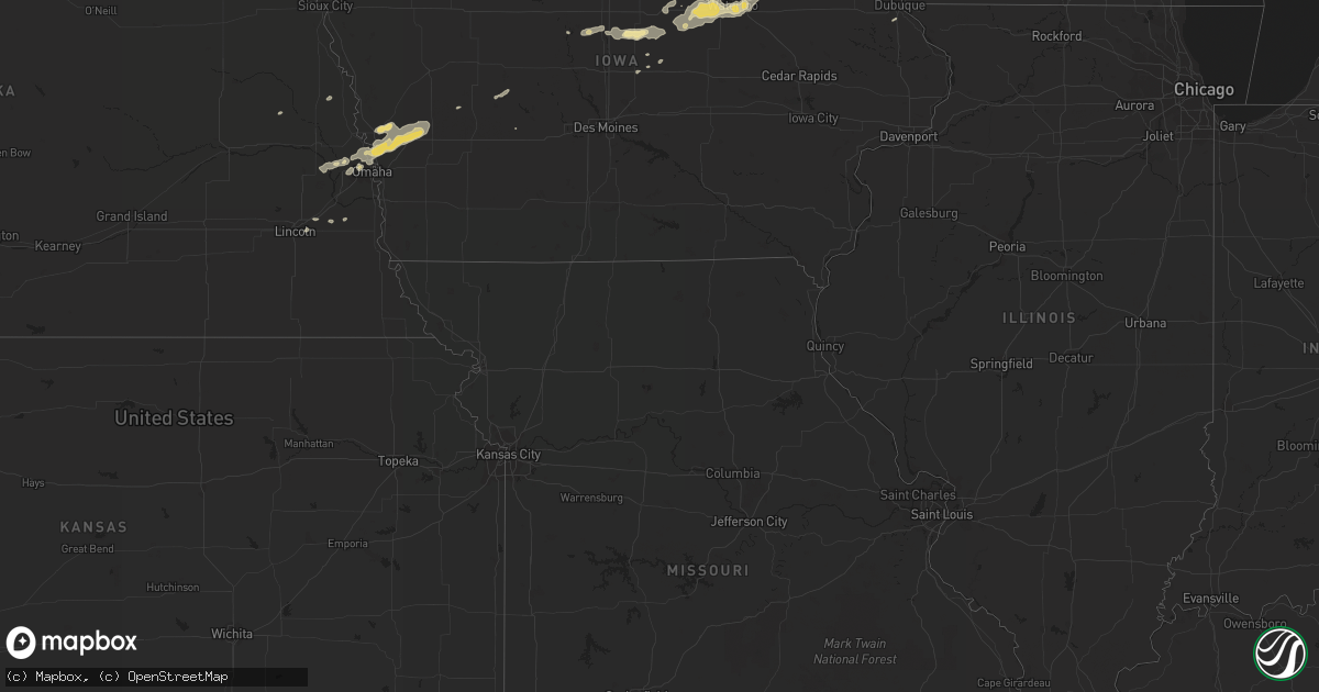
Hail Map in Virginia on September 2, 2011
Get this storm
September 2 map
$229
one time, instant access
Download today. No call, no setup
Keep the $229
Bought the map and want the full workflow? Apply the entire $229 to a subscription within 7 days. None of it is wasted.
Every map, not just this one
This buys you this map. Subscription and you get every map we run, in the markets you choose from a few cities to whole states to nationwide. Plus real-time alerts the moment a storm fires.
Contact data
Name, contact info, occupancy, even credit band for addresses in the footprint. You go from where it hit to who to call.
Become the source they trust
Unlimited branding weather history reports on demand. You already have the documented answer ready for the property owner, and you are the one who showed up with it.
Property data and RoofTrace estimates
Pull up any address you have got, its value and the exact code rules for that jurisdiction, straight from One Click Code. Then RoofTrace estimates the squares, pitch, and roof value, priced the way you price.
Storm reports in Virginia
Virginia
| Date | Description |
|---|---|
| 09/02/20115:15 PM CDT | Tree down on route 606. |
| 09/02/20114:40 PM CDT | Numerous trees down near the intersection of glendale road and country club lane and the intersection of west stuart and mountain view roads. A few homes had damage fro |
| 09/02/20114:30 PM CDT | Several trees and power lines down on pipers gap road between route 89 and tower road. Two power poles also snapped. |
| 09/02/20113:45 PM CDT | Tree down on golf course road. |
| 09/02/20113:38 PM CDT | Quarter size hail and a large limb down on windsor avenue. |
| 09/02/20113:37 PM CDT | Tree down on keno rd in laurel fork area |
| 09/02/20113:25 PM CDT | A local report indicates 1.00 inch wind near 2 NNW ROANOKE |
| 09/02/20113:24 PM CDT | A local report indicates 1.00 inch wind near HOLLINS |
| 09/02/20113:08 PM CDT | At salem civic center. |
| 09/02/20113:05 PM CDT | Damaging thunderstorm winds blew two trees down and brought down many limbs...some up to eight inches in diameter...in the 400 block of high street. |
| 09/02/20113:00 PM CDT | Marble size hail and several large limbs down on west 4th street. |
| 09/02/20112:55 PM CDT | Quarter size hail fell in the 400 block of high street. |
| 09/02/20112:41 PM CDT | Several trees down in the claudville highway and hatchers chapel road area. |
| 09/02/20112:39 PM CDT | Quarter size hail covering the ground. |
| 09/02/20112:35 PM CDT | Part of large sign blown out by the wind. Also had dime sized hail. |
| 09/02/20111:49 PM CDT | Tree blown down onto power lines along north fork road. |
| 09/02/20111:36 PM CDT | Power lines down along bradshaw road. |
All States Impacted by Hail Map on September 2, 2011
Cities Impacted by Hail Map on September 2, 2011
- Omaha, NE
- Roanoke, VA
- Salem, VA
- Missouri Valley, IA
- Logan, IA
- Ararat, NC
- Pilot Mountain, NC
- Pine River, WI
- La Farge, WI
- Viola, WI
- Wytheville, VA
- Stratford, IA
- Ellsworth, IA
- Stanhope, IA
- Jewell, IA
- Mesick, MI
- Rapid City, SD
- Caputa, SD
- Independence, VA
- Elk Creek, VA
- Easton, MN
- Mouth Of Wilson, VA
- Troutdale, VA
- Hillsboro, WI
- Mooresboro, NC
- Ellenboro, NC
- White River, SD
- Kadoka, SD
- Belvidere, SD
- Long Valley, SD
- Saint Francis, SD
- Troutman, NC
- Sherrills Ford, NC
- Denver, NC
- Mount Ulla, NC
- Mooresville, NC
- Cleveland, NC
- Cornelius, NC
- Terrell, NC
- Commerce City, CO
- Fancy Gap, VA
- Grundy Center, IA
- Holland, IA
- Verona, WI
- Belleville, WI
- Mount Horeb, WI
- Mcfarland, WI
- Oregon, WI
- Hollandale, WI
- Barneveld, WI
- Madison, WI
- Blue Mounds, WI
- Wilton, WI
- Necedah, WI
- Wanblee, SD
- Lake Mills, WI
- Waterloo, WI
- Fort Calhoun, NE
- Persia, IA
- Harlan, IA
- Underwood, IA
- Honey Creek, IA
- Avoca, IA
- Shelby, IA
- Neola, IA
- Crescent, IA
- Portsmouth, IA
- Bennington, NE
- Minden, IA
- Floyd, VA
- Callaway, VA
- Bayard, IA
- Coon Rapids, IA
- Caledonia, MN
- Westfield, WI
- Grand Marsh, WI
- Adams, WI
- Friendship, WI
- Coloma, WI
- Lilesville, NC
- Wall, SD
- Quinn, SD
- Mauston, WI
- Taylorsville, NC
- Mission, SD
- Boys Town, NE
- Concord, NC
- Harrisburg, NC
- Charlotte, NC
- New Underwood, SD
- Cashton, WI
- Westby, WI
- Coon Valley, WI
- Interior, SD
- Cottage Grove, WI
- Trinidad, CO
- Aguilar, CO
- Radcliffe, IA
- Hubbard, IA
- New Providence, IA
- Owanka, SD
- Scenic, SD
- Wasta, SD
- Philip, SD
- Brownsville, MN
- Johnson, KS
- Midland, SD
- New Lisbon, WI
- Sun Prairie, WI
- Tekamah, NE
- Craig, NE
- Cassville, WI
- Valley, NE
- Elkhorn, NE
- Troutville, VA
- Fincastle, VA
- New Castle, VA
- Mequon, WI
- Milwaukee, WI
- Platteville, WI
- North Buena Vista, IA
- Sherrill, IA
- Guttenberg, IA
- New Vienna, IA
- Potosi, WI
- Holy Cross, IA
- Colesburg, IA
- Mount Gilead, NC
- Wild Rose, WI
- Redgranite, WI
- Wautoma, WI
- Fremont, WI
- Berlin, WI
- Hancock, WI
- Reinbeck, IA
- Jesup, IA
- Cedar Falls, IA
- Evansdale, IA
- Raymond, IA
- Hudson, IA
- Dike, IA
- Waterloo, IA
- Elmwood, NE
- Murdock, NE
- Alvo, NE
- Casey, IA
- Tuthill, SD
- Marshall, WI
- Steamboat Rock, IA
- Ackley, IA
- Aplington, IA
- Wellsburg, IA
- Onida, SD
- Bostic, NC
- Union Mills, NC
- Rutherfordton, NC
- Austinville, VA
- Ivanhoe, VA
- Max Meadows, VA
- Fries, VA
- Denver, IA
- Mineral Point, WI
- Darlington, WI
- Hortonville, WI
- Wisconsin Rapids, WI
- Bancroft, WI
- Larsen, WI
- Poy Sippi, WI
- Plainfield, WI
- Neenah, WI
- Neshkoro, WI
- Nekoosa, WI
- Arkdale, WI
- Winneconne, WI
- Cambridge, WI
- Plover, WI
- Amherst, WI
- Aurora, CO
- Denver, CO
- Hokah, MN
- Stoddard, WI
- Del Norte, CO
- Center, CO
- Onekama, MI
- Manistee, MI
- Harrietta, MI
- Brethren, MI
- Copemish, MI
- Kaleva, MI
- Bear Lake, MI
- Manawa, WI
- Bear Creek, WI
- Decorah, IA
- Dorchester, IA
- Spring Grove, MN
- Troy, NC
- Dunkerton, IA
- Parkersburg, IA
- Fairbank, IA
- Hazleton, IA
- Dewar, IA
- Morrison, IA
- Dodgeville, WI
- Ridgeway, WI
- Deerfield, WI
- Forest City, NC
- Martin, SD
- Sparta, WI
- Black River Falls, WI
- Albemarle, NC
- Stuart, VA
- Colorado Springs, CO
- Lincoln, NE
- Waverly, NE
- Keenesburg, CO
- Roggen, CO
- Lindstrom, MN
- Walsenburg, CO
- Melrose, WI
- Chaseburg, WI
- Ogdensburg, WI
- Salisbury, NC
- Gold Hill, NC
- Richfield, NC
- Hot Springs, VA
- Covington, VA
- Oelwein, IA
- Maynard, IA
- Bangor, WI
- Houston, MN
- Rushford, MN
- Genoa, WI
- Tobaccoville, NC
- King, NC
- Pinnacle, NC
- Siloam, NC
- Harrold, SD
- Blunt, SD
- Greenville, WI
- Oshkosh, WI
- Elroy, WI
- Appleton, WI
- Camp Douglas, WI
- Almond, WI
- Hillsville, VA
- Laurel Fork, VA
- Wonewoc, WI
- Good Thunder, MN
- Vernon Center, MN
- Amboy, MN
- Scandinavia, WI
- Ixonia, WI
- Neosho, WI
- Oconomowoc, WI
- Watertown, WI
- Damascus, VA
- Whitetop, VA
- Laurel Bloomery, TN
- Creston, NC
- Lansing, NC
- Delavan, MN
- Tomah, WI
- Norwalk, WI
- Harmony, NC
- Claudville, VA
- Ararat, VA
- Fredericksburg, IA
- Mount Airy, NC
- Lawsonville, NC
- Westfield, NC
- Kannapolis, NC
- Bassett, VA
- Saint Anthony, IA
- Clemons, IA
- Marshalltown, IA
- Sandy Ridge, NC
- State Center, IA
- Dayton, IA
- Dubuque, IA
- Zwingle, IA
- Rewey, WI
- Middleton, WI
- Stoughton, WI
- Montfort, WI
- Linden, WI
- Winston Salem, NC
- Castle Rock, CO
- Wadesboro, NC
- Rye, CO
- Memphis, TN
- Grafton, WI
- Danbury, NC
- Warrens, WI
- Elkhart, KS
- Norwood, NC
- Amherst Junction, WI
- Waterloo, NE
- Yutan, NE
- Dodge, NE
- Pierre, SD
- Weeping Water, NE
- Society Hill, SC
- Cheraw, SC
- Garden City, IA
- Eldora, IA
- Union, IA
- Story City, IA
- Patrick, SC
- Stanley, NC
- La Crescent, MN
- Eitzen, MN
- Peterson, MN
- La Crosse, WI
- Check, VA
- Shawsville, VA
- Copper Hill, VA
- Bent Mountain, VA
- Colo, IA
- Sedalia, CO
- Mapleton, MN
- Audubon, IA
- Readlyn, IA


