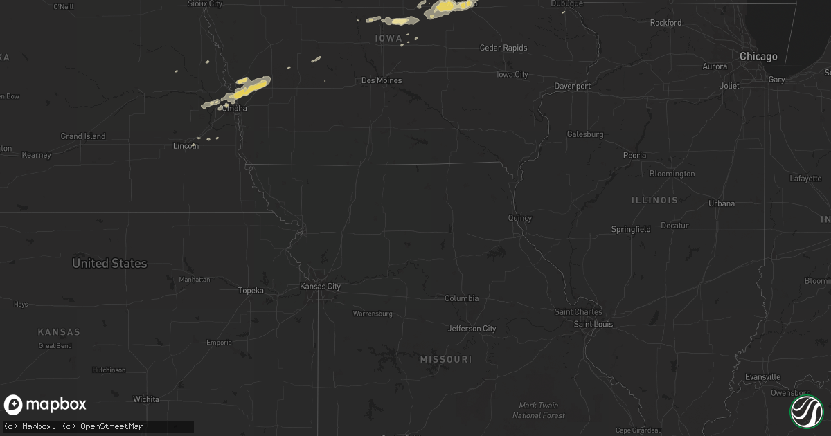
Hail Map in North Carolina on September 2, 2011
Get this storm
September 2 map
$229
one time, instant access
Download today. No call, no setup
Keep the $229
Bought the map and want the full workflow? Apply the entire $229 to a subscription within 7 days. None of it is wasted.
Every map, not just this one
This buys you this map. Subscription and you get every map we run, in the markets you choose from a few cities to whole states to nationwide. Plus real-time alerts the moment a storm fires.
Contact data
Name, contact info, occupancy, even credit band for addresses in the footprint. You go from where it hit to who to call.
Become the source they trust
Unlimited branding weather history reports on demand. You already have the documented answer ready for the property owner, and you are the one who showed up with it.
Property data and RoofTrace estimates
Pull up any address you have got, its value and the exact code rules for that jurisdiction, straight from One Click Code. Then RoofTrace estimates the squares, pitch, and roof value, priced the way you price.
Storm reports in North Carolina
North Carolina
| Date | Description |
|---|---|
| 09/02/20116:53 PM CDT | One tree down |
| 09/02/20116:49 PM CDT | Multiple trees down |
| 09/02/20116:43 PM CDT | Large limbs down...winds estimated at 60 mph. |
| 09/02/20116:41 PM CDT | Multiple trees down |
| 09/02/20116:27 PM CDT | Large limbs down 6-8 inches in diameter |
| 09/02/20116:20 PM CDT | Mountain island raws |
| 09/02/20116:20 PM CDT | A local report indicates 60 MPH wind near 3 W CONCORD |
| 09/02/20116:06 PM CDT | Powerlines down along leland st |
| 09/02/20116:00 PM CDT | Power poles cut in half on us hwy 29. Roof blown off building on lyle lane and speedway blvd. Funnel cloud reported by concord airport officials. |
| 09/02/20115:50 PM CDT | Tree down at 900 george mcmilan road blocking the road. |
| 09/02/20115:48 PM CDT | Trees down on new hope church road. |
| 09/02/20115:46 PM CDT | Multiple trees down |
| 09/02/20115:46 PM CDT | Many trees down. |
| 09/02/20115:43 PM CDT | Large limbs down...winds estimated at 60 mph. |
| 09/02/20115:36 PM CDT | Trees down. |
| 09/02/20115:36 PM CDT | Tree down blocking highway 113 in piney creek. |
| 09/02/20115:32 PM CDT | Tree down blocking highway 93. |
| 09/02/20115:22 PM CDT | Lines down across road near blades trail |
| 09/02/20115:20 PM CDT | Tree down on snuggs park road |
| 09/02/20115:15 PM CDT | Tree down on red white and blue road. |
| 09/02/20115:15 PM CDT | 2 trees down in the road. |
| 09/02/20115:10 PM CDT | Tree down at the 7000 block of traphill road. |
| 09/02/20115:10 PM CDT | Tree down |
| 09/02/20115:05 PM CDT | Tree down on cemetary road. |
| 09/02/20114:50 PM CDT | Tree down on white plains road. |
| 09/02/20114:50 PM CDT | Tree down at the 10000 block of austin traphill road. |
| 09/02/20114:45 PM CDT | Tree down on chestnut grove road and ymca camp road. |
| 09/02/20114:37 PM CDT | A local report indicates 1.00 inch wind near ELLENBORO |
| 09/02/20114:32 PM CDT | Tree down on pond valley road. |
| 09/02/20114:28 PM CDT | Tree down on pilot power dam road. |
| 09/02/20114:24 PM CDT | Many trees down. |
| 09/02/20114:24 PM CDT | Tree down on chilton road. |
| 09/02/20114:24 PM CDT | Tree down on key road. |
| 09/02/20114:24 PM CDT | Tree down on toms creek road. |
| 09/02/20114:24 PM CDT | Tree down on neal road. |
| 09/02/20114:15 PM CDT | Tree down on cook school road. |
| 09/02/20114:11 PM CDT | Power lines down. |
| 09/02/20114:08 PM CDT | Tree blown down onto power line. |
| 09/02/20114:05 PM CDT | Several trees down in the courtney area |
| 09/02/20114:03 PM CDT | Trees down all over...south toward forest city. |
| 09/02/20114:02 PM CDT | Tree down on tom shelton road. |
| 09/02/20114:00 PM CDT | Roof blown off barn |
| 09/02/20114:00 PM CDT | Trees down on a power line on hoots road...which then fell on a house and has trapped people inside. |
| 09/02/20113:37 PM CDT | Tree down along u.s. 601. |
| 09/02/20113:24 PM CDT | Tree down on bowens road |
| 09/02/20113:24 PM CDT | Tree down on quaker church road. |
| 09/02/20113:24 PM CDT | Multiple trees and power lines down along doral road |
| 09/02/20113:24 PM CDT | Tree down near the intersection of highway 268 and u.s. 601. |
| 09/02/20113:20 PM CDT | Tree down along highway 268. |
| 09/02/20113:11 PM CDT | Tree down on jay max lane. |
| 09/02/20113:09 PM CDT | Tree down on homeplace park road. |
| 09/02/20113:05 PM CDT | Several trees down in the bryant mill road area. |
| 09/02/20113:03 PM CDT | Tree down on eldora road. |
| 09/02/20113:01 PM CDT | Power line down along greene road. |
| 09/02/20112:59 PM CDT | Tree down along pratt road. |
| 09/02/20112:59 PM CDT | Tree down on stanford church road. |
| 09/02/20112:50 PM CDT | Tree down near the intersection of dodson mill road and whitaker chapel road. |
| 09/02/20112:46 PM CDT | Numerous trees down. |
| 09/02/20112:24 PM CDT | Tree down on e. Pine street. |
| 09/02/20112:20 PM CDT | Quarter hail at family dollar store at 608 south key street. |
| 09/02/20112:20 PM CDT | Large billborad and road signs blown down at and near the family dollar store at 608 south key street. |
| 09/02/20112:20 PM CDT | A local report indicates 1.00 inch wind near 1 WSW PILOT MOUNTAIN |
| 09/02/20112:20 PM CDT | Large store sign blown down as well as outdoor store racks blown away. Tree also down in the area. |
| 09/02/20112:16 PM CDT | Several power lines down near the pilot mountain fire department. |
| 09/02/20112:02 PM CDT | Trees down on hard road and on vanderbilt road. Hail size of quarters. Reported biltmore forest pd. |
| 09/02/20112:02 PM CDT | Report by biltmore forest pd. |
| 09/02/20111:35 PM CDT | Tree down on lakewood road. Dime size hail at radio station. |
| 09/01/20117:20 PM CDT | Mature hardwoods snapped. Public report relayed from media. |
| 09/01/20117:20 PM CDT | Tree on powerline along windy hill dr. |
| 09/01/20117:06 PM CDT | A few trees blown down. |
| 09/01/20117:00 PM CDT | Scattered trees blown down in the county. Time estimated. |
All States Impacted by Hail Map on September 2, 2011
Cities Impacted by Hail Map on September 2, 2011
- Omaha, NE
- Roanoke, VA
- Salem, VA
- Missouri Valley, IA
- Logan, IA
- Ararat, NC
- Pilot Mountain, NC
- Pine River, WI
- La Farge, WI
- Viola, WI
- Wytheville, VA
- Stratford, IA
- Ellsworth, IA
- Stanhope, IA
- Jewell, IA
- Mesick, MI
- Rapid City, SD
- Caputa, SD
- Independence, VA
- Elk Creek, VA
- Easton, MN
- Mouth Of Wilson, VA
- Troutdale, VA
- Hillsboro, WI
- Mooresboro, NC
- Ellenboro, NC
- White River, SD
- Kadoka, SD
- Belvidere, SD
- Long Valley, SD
- Saint Francis, SD
- Troutman, NC
- Sherrills Ford, NC
- Denver, NC
- Mount Ulla, NC
- Mooresville, NC
- Cleveland, NC
- Cornelius, NC
- Terrell, NC
- Commerce City, CO
- Fancy Gap, VA
- Grundy Center, IA
- Holland, IA
- Verona, WI
- Belleville, WI
- Mount Horeb, WI
- Mcfarland, WI
- Oregon, WI
- Hollandale, WI
- Barneveld, WI
- Madison, WI
- Blue Mounds, WI
- Wilton, WI
- Necedah, WI
- Wanblee, SD
- Lake Mills, WI
- Waterloo, WI
- Fort Calhoun, NE
- Persia, IA
- Harlan, IA
- Underwood, IA
- Honey Creek, IA
- Avoca, IA
- Shelby, IA
- Neola, IA
- Crescent, IA
- Portsmouth, IA
- Bennington, NE
- Minden, IA
- Floyd, VA
- Callaway, VA
- Bayard, IA
- Coon Rapids, IA
- Caledonia, MN
- Westfield, WI
- Grand Marsh, WI
- Adams, WI
- Friendship, WI
- Coloma, WI
- Lilesville, NC
- Wall, SD
- Quinn, SD
- Mauston, WI
- Taylorsville, NC
- Mission, SD
- Boys Town, NE
- Concord, NC
- Harrisburg, NC
- Charlotte, NC
- New Underwood, SD
- Cashton, WI
- Westby, WI
- Coon Valley, WI
- Interior, SD
- Cottage Grove, WI
- Trinidad, CO
- Aguilar, CO
- Radcliffe, IA
- Hubbard, IA
- New Providence, IA
- Owanka, SD
- Scenic, SD
- Wasta, SD
- Philip, SD
- Brownsville, MN
- Johnson, KS
- Midland, SD
- New Lisbon, WI
- Sun Prairie, WI
- Tekamah, NE
- Craig, NE
- Cassville, WI
- Valley, NE
- Elkhorn, NE
- Troutville, VA
- Fincastle, VA
- New Castle, VA
- Mequon, WI
- Milwaukee, WI
- Platteville, WI
- North Buena Vista, IA
- Sherrill, IA
- Guttenberg, IA
- New Vienna, IA
- Potosi, WI
- Holy Cross, IA
- Colesburg, IA
- Mount Gilead, NC
- Wild Rose, WI
- Redgranite, WI
- Wautoma, WI
- Fremont, WI
- Berlin, WI
- Hancock, WI
- Reinbeck, IA
- Jesup, IA
- Cedar Falls, IA
- Evansdale, IA
- Raymond, IA
- Hudson, IA
- Dike, IA
- Waterloo, IA
- Elmwood, NE
- Murdock, NE
- Alvo, NE
- Casey, IA
- Tuthill, SD
- Marshall, WI
- Steamboat Rock, IA
- Ackley, IA
- Aplington, IA
- Wellsburg, IA
- Onida, SD
- Bostic, NC
- Union Mills, NC
- Rutherfordton, NC
- Austinville, VA
- Ivanhoe, VA
- Max Meadows, VA
- Fries, VA
- Denver, IA
- Mineral Point, WI
- Darlington, WI
- Hortonville, WI
- Wisconsin Rapids, WI
- Bancroft, WI
- Larsen, WI
- Poy Sippi, WI
- Plainfield, WI
- Neenah, WI
- Neshkoro, WI
- Nekoosa, WI
- Arkdale, WI
- Winneconne, WI
- Cambridge, WI
- Plover, WI
- Amherst, WI
- Aurora, CO
- Denver, CO
- Hokah, MN
- Stoddard, WI
- Del Norte, CO
- Center, CO
- Onekama, MI
- Manistee, MI
- Harrietta, MI
- Brethren, MI
- Copemish, MI
- Kaleva, MI
- Bear Lake, MI
- Manawa, WI
- Bear Creek, WI
- Decorah, IA
- Dorchester, IA
- Spring Grove, MN
- Troy, NC
- Dunkerton, IA
- Parkersburg, IA
- Fairbank, IA
- Hazleton, IA
- Dewar, IA
- Morrison, IA
- Dodgeville, WI
- Ridgeway, WI
- Deerfield, WI
- Forest City, NC
- Martin, SD
- Sparta, WI
- Black River Falls, WI
- Albemarle, NC
- Stuart, VA
- Colorado Springs, CO
- Lincoln, NE
- Waverly, NE
- Keenesburg, CO
- Roggen, CO
- Lindstrom, MN
- Walsenburg, CO
- Melrose, WI
- Chaseburg, WI
- Ogdensburg, WI
- Salisbury, NC
- Gold Hill, NC
- Richfield, NC
- Hot Springs, VA
- Covington, VA
- Oelwein, IA
- Maynard, IA
- Bangor, WI
- Houston, MN
- Rushford, MN
- Genoa, WI
- Tobaccoville, NC
- King, NC
- Pinnacle, NC
- Siloam, NC
- Harrold, SD
- Blunt, SD
- Greenville, WI
- Oshkosh, WI
- Elroy, WI
- Appleton, WI
- Camp Douglas, WI
- Almond, WI
- Hillsville, VA
- Laurel Fork, VA
- Wonewoc, WI
- Good Thunder, MN
- Vernon Center, MN
- Amboy, MN
- Scandinavia, WI
- Ixonia, WI
- Neosho, WI
- Oconomowoc, WI
- Watertown, WI
- Damascus, VA
- Whitetop, VA
- Laurel Bloomery, TN
- Creston, NC
- Lansing, NC
- Delavan, MN
- Tomah, WI
- Norwalk, WI
- Harmony, NC
- Claudville, VA
- Ararat, VA
- Fredericksburg, IA
- Mount Airy, NC
- Lawsonville, NC
- Westfield, NC
- Kannapolis, NC
- Bassett, VA
- Saint Anthony, IA
- Clemons, IA
- Marshalltown, IA
- Sandy Ridge, NC
- State Center, IA
- Dayton, IA
- Dubuque, IA
- Zwingle, IA
- Rewey, WI
- Middleton, WI
- Stoughton, WI
- Montfort, WI
- Linden, WI
- Winston Salem, NC
- Castle Rock, CO
- Wadesboro, NC
- Rye, CO
- Memphis, TN
- Grafton, WI
- Danbury, NC
- Warrens, WI
- Elkhart, KS
- Norwood, NC
- Amherst Junction, WI
- Waterloo, NE
- Yutan, NE
- Dodge, NE
- Pierre, SD
- Weeping Water, NE
- Society Hill, SC
- Cheraw, SC
- Garden City, IA
- Eldora, IA
- Union, IA
- Story City, IA
- Patrick, SC
- Stanley, NC
- La Crescent, MN
- Eitzen, MN
- Peterson, MN
- La Crosse, WI
- Check, VA
- Shawsville, VA
- Copper Hill, VA
- Bent Mountain, VA
- Colo, IA
- Sedalia, CO
- Mapleton, MN
- Audubon, IA
- Readlyn, IA


