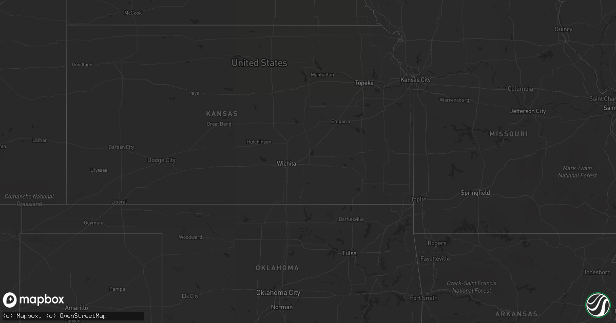
Hail Map in Arizona on August 26, 2013
Get this storm
August 26 map
$229
one time, instant access
Download today. No call, no setup
Keep the $229
Bought the map and want the full workflow? Apply the entire $229 to a subscription within 7 days. None of it is wasted.
Every map, not just this one
This buys you this map. Subscription and you get every map we run, in the markets you choose from a few cities to whole states to nationwide. Plus real-time alerts the moment a storm fires.
Contact data
Name, contact info, occupancy, even credit band for addresses in the footprint. You go from where it hit to who to call.
Become the source they trust
Unlimited branding weather history reports on demand. You already have the documented answer ready for the property owner, and you are the one who showed up with it.
Property data and RoofTrace estimates
Pull up any address you have got, its value and the exact code rules for that jurisdiction, straight from One Click Code. Then RoofTrace estimates the squares, pitch, and roof value, priced the way you price.
Storm reports in Arizona
Arizona
| Date | Description |
|---|---|
| 08/26/20136:05 PM CDT | Dock and 2 boats damaged at canyon lake marina. Wind gusts estimated to 60 mph. Delayed report. |
| 08/25/20139:35 PM CDT | Buckeye airport mesonet wind. Sustained 43 gust to 68 mph at 735 pm mst. |
| 08/25/20139:20 PM CDT | Additional report of a large down tree that heavily damaged a home in litchfield park. Delayed report via boradcast media. Time estimated around 720p. |
| 08/25/20139:15 PM CDT | Trees uprooted |
| 08/25/20139:15 PM CDT | Several trees uprooted. Delayed report. Time estimated from radar. |
| 08/25/20138:40 PM CDT | Large branches broken in far south gilbert near chandler heights and higley area. |
| 08/25/20138:27 PM CDT | A local report indicates 62 MPH wind near 4 SSE TUMBLEWEED PARK |
| 08/25/20138:15 PM CDT | Tree downed in far south gilbert near chandler heights and higley area. |
| 08/25/20138:03 PM CDT | 6 in. Tree branch blown off |
| 08/25/20137:50 PM CDT | Delayed report from monday...debris including a basketball hoop...flying down the street. Very strong winds. |
| 08/25/20137:38 PM CDT | Delayed report...winds estimated at over 60 mph. Cars in home depot parking lot dmaged by heavy debris. |
| 08/25/20137:35 PM CDT | Large tree downed on top of 3 adjacent parked cars. Car roofs caved in. Damaged occured at an apartment complex located at kyrene and elloit roads in tempe. |
| 08/25/20137:29 PM CDT | Several trees downed. |
All States Impacted by Hail Map on August 26, 2013
Cities Impacted by Hail Map on August 26, 2013
- Ladysmith, WI
- Brainerd, MN
- Garrison, MN
- Hillman, MN
- Cable, WI
- Mason, WI
- Grand View, WI
- Westby, MT
- Plentywood, MT
- Outlook, MT
- Antelope, MT
- Motley, MN
- Watford City, ND
- Aitkin, MN
- Palisade, MN
- Emily, MN
- Wadena, MN
- Perham, MN
- New York Mills, MN
- Bluffton, MN
- Verndale, MN
- Staples, MN
- Alamo, ND
- Detroit Lakes, MN
- Frazee, MN
- Vergas, MN
- Pelican Rapids, MN
- Moose Lake, MN
- Sturgeon Lake, MN
- Pinon, AZ
- Kettle River, MN
- Sabin, MN
- Pillager, MN
- Baxter, MN
- Fort Ripley, MN
- Nisswa, MN
- Crosby, MN
- Pequot Lakes, MN
- Merrifield, MN
- Plaza, ND
- Berthold, ND
- Kenmare, ND
- Hawley, MN
- Lake Park, MN
- Wakpala, SD
- Fort Yates, ND
- Wildrose, ND
- Phillips, WI
- Wright, MN
- Grand Canyon, AZ
- Barnesville, MN
- Eloy, AZ
- Fort Mcdowell, AZ
- Crosby, ND
- Killdeer, ND
- Flaxville, MT
- Sebeka, MN
- Audubon, MN
- Dent, MN
- Radisson, WI
- Coolidge, AZ
- Queen Creek, AZ
- Chandler, AZ
- Casa Grande, AZ
- Drummond, WI
- Crivitz, WI
- Porterfield, WI
- Barnum, MN
- Bruce, WI
- Weyerhaeuser, WI
- Marinette, WI
- Peshtigo, WI
- Mcgregor, MN
- Onamia, MN
- Sturgeon Bay, WI
- Marana, AZ
- Kerrick, MN
- Pickerel, WI
- Crandon, WI
- Tucson, AZ
- Arivaca, AZ
- Tony, WI
- Park Falls, WI
- Free Soil, MI
- Lac Du Flambeau, WI
- Exeland, WI
- Birchwood, WI
- Stetsonville, WI
- Custer, MI
- Scottville, MI
- Prescott, AZ
- Floodwood, MN
- Cromwell, MN
- Saint James City, FL
- Butternut, WI
- Cape Coral, FL
- Meadowlands, MN
- McGrath, MN
- Sandstone, MN
- Ambrose, ND
- Wabeno, WI
- Conrath, WI
- Holcombe, WI
- Sheldon, WI
- Gilman, WI
- Reed City, MI
- Holyoke, MN
- Sells, AZ
- Grand Rapids, MN
- Seligman, AZ
- Red Rock, AZ
- Akeley, MN
- Nevis, MN
- Grenora, ND
- Deerwood, MN
- Paris, MI
- Bruno, MN
- Ironton, MN
- Pine River, MN
- Ludington, MI
- Crosslake, MN


