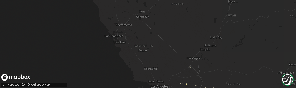
Hail Map in California on August 24, 2022
The weather event in California on August 24, 2022 includes Hail map. 14 states and 81 cities were impacted and suffered possible damage. The total estimated number of properties impacted is 0.
Want more than just the map?
Turn this storm into a full workflow.
- Owner + property data so you know who to knock
- OnDemand branded weather history reports to win the "did we even have hail?" argument
- RoofTrace estimate so reps stop guessing numbers at the door
Bought this map? Upgrade within 7 days and we'll credit the $230. (10-15 min setup call)
Hail
0
Estimated number of impacted properties by a 1.00" hail or larger0
Estimated number of impacted properties by a 1.75" hail or larger0
Estimated number of impacted properties by a 2.50" hail or largerStorm reports in California
California
| Date | Description |
|---|---|
| 08/24/20226:37 PM CDT | Power poles knocked down and hanging by wires. |
| 08/24/20225:45 PM CDT | Site at newberry springs elementary school gusted to 58 mph at 345pm. Data courtesy of earth networks. Chp also reported telephone pole leaning with two transformers bl |
| 08/24/20222:47 AM CDT | At 744 PM PDT, a severe thunderstorm was located 18 miles north of Midland, or 25 miles southwest of Highway 95 At Mile Marker 29, moving north at 5 mph. HAZARD...60 mph wind gusts. SOURCE...Radar indicated. IMPACT...Expect damage to roofs and trees. Locations impacted include... SR-62 west of Vidal Junction. |
| 08/24/20221:02 AM CDT | At 601 PM PDT, a severe thunderstorm was located over Twentynine Palms Base, or near Twentynine Palms, moving northeast at 15 mph Blowing dust reducing visibilities to less than a mile is also possible with this storm. HAZARD...60 mph wind gusts. SOURCE...Radar indicated. IMPACT...Expect damage to roofs and trees. Locations impacted include... Twentynine Palms and Twentynine Palms Base. |
| 08/24/202212:59 AM CDT | At 559 PM PDT, a severe thunderstorm was located 16 miles east of Desert Center, moving north at 15 mph. HAZARD...60 mph wind gusts. SOURCE...Radar indicated. IMPACT...Expect damage to roofs, siding, and trees. This severe thunderstorm will remain over mainly rural areas of Riverside County.This includes the following highways...CA Interstate 10 between mile markers 111 and 137.CA Route 177 between mile markers 6 and 7. |
| 08/23/202211:42 PM CDT | At 441 PM PDT, a severe thunderstorm was located 13 miles northeast of Twentynine Palms Airport, or 21 miles east of Twentynine Palms, moving northeast at 30 mph. HAZARD...60 mph wind gusts. SOURCE...Radar indicated. IMPACT...Expect damage to roofs and trees. This severe thunderstorm will remain over mainly rural areas of south central San Bernardino County including Amboy Rd. |
| 08/23/202211:09 PM CDT | At 408 PM PDT, a severe thunderstorm was located over I-8 Between Boulevard And Imperial County Line, and is nearly stationary. An additional severe thunderstorm over southwest Imperial County could bring severe winds into the lower deserts of San Diego County. HAZARD...70 mph wind gusts and quarter size hail. SOURCE...Radar indicated. IMPACT...Hail damage to vehicles is expected. Expect considerable tree damage. Wind damage is also likely to mobile homes, roofs, and outbuildings. Locations impacted include... I-8 Between Boulevard And Imperial County Line, Hwy 78 Between S2 And Borrego Springs Rd, I-8 Between Pine Valley And Boulevard, Hwy S2 Vallecito Creek Rd, Hwy S2 Between Canebrake And Imperial County Line, Boulevard, Hwy S2 Between Agua Caliente And Canebrake, Fish Creek Wash, Hwy S2 Between Shelter Valley And Agua Caliente and Campo. |
| 08/23/202210:55 PM CDT | At 355 PM PDT, a severe thunderstorm was located 7 miles northwest of Plaster City, moving north at 15 mph. HAZARD...60 mph wind gusts and penny size hail. SOURCE...Radar indicated. IMPACT...Expect damage to roofs, siding, and trees. This severe thunderstorm will remain over mainly rural areas of west central Imperial County. |
| 08/23/20229:38 PM CDT | At 238 PM PDT, a severe thunderstorm was located 12 miles west of Sandy Valley, or 24 miles south of Pahrump, and is nearly stationary. HAZARD...60 mph wind gusts and quarter size hail. SOURCE...Radar indicated. IMPACT...Hail damage to vehicles is expected. Expect wind damage to roofs and trees. Locations impacted include... Sandy Valley. |
| 08/23/20229:03 PM CDT | 69 mph gust measured at blythe airport. |
| 08/23/20229:01 PM CDT | Overturned big rig in blythe. |
| 08/23/20228:52 PM CDT | Awos station kblh 7 nnw ripley. |
| 08/23/20228:27 PM CDT | At 127 PM PDT, a severe thunderstorm was located near I-8 Between Pine Valley And Boulevard, and is nearly stationary. HAZARD...60 mph wind gusts and quarter size hail. SOURCE...Radar indicated. IMPACT...Hail damage to vehicles is expected. Expect wind damage to roofs, siding, and trees. Locations impacted include... I-8 Between Pine Valley And Boulevard, I-8 Between Boulevard And Imperial County Line, Campo, Boulevard, Lake Morena, Tierra Del Sol, Campo Indian Reservation, La Posta Indian Reservation, Live Oak Springs and Manzanita Indian Reservation. |
| 08/23/20228:25 PM CDT | Overturned big rig truck on i-10. Sinkhole size of domestic truck nearby in fastlane @6:39pm. |
| 08/23/20227:24 PM CDT | Big rig tipped over on i-10. Weather caused. |
All States Impacted by Hail Map on August 24, 2022
Cities Impacted by Hail Map on August 24, 2022
- Pavillion, WY
- Thermopolis, WY
- Colbert, WA
- Saint Regis, MT
- Pukwana, SD
- Allen, SD
- Wanblee, SD
- Enterprise, OR
- Imnaha, OR
- Edgemont, SD
- Hot Springs, SD
- Custer, SD
- Twentynine Palms, CA
- Vidal, CA
- Havelock, IA
- Laurens, IA
- Pocahontas, IA
- Deadwood, SD
- Saint Helen, MI
- Roscommon, MI
- Pilger, NE
- Chadron, NE
- Oelrichs, SD
- Nipton, CA
- Elk City, ID
- Porcupine, SD
- Wounded Knee, SD
- Cody, WY
- Meeteetse, WY
- Pine Valley, CA
- Campo, CA
- Kaycee, WY
- Mission, SD
- Cibola, AZ
- Wellton, AZ
- Winterhaven, CA
- Bison, SD
- Meadow, SD
- Prairie City, SD
- Hunters, WA
- Fruitland, WA
- Harrison, NE
- Burke, SD
- Porterfield, WI
- Wallace, MI
- Darby, MT
- Reliance, SD
- Lower Brule, SD
- Marinette, WI
- Menominee, MI
- Wisdom, MT
- Wood, SD
- Joshua Tree, CA
- Landers, CA
- Marathon, IA
- Algona, IA
- Thermal, CA
- Decker, MT
- Pine Ridge, SD
- Oacoma, SD
- Wisner, NE
- Hoskins, NE
- Stanton, NE
- Lostine, OR
- Quartzsite, AZ
- Bouse, AZ
- Desert Center, CA
- Gregory, SD
- Chewelah, WA
- White River, SD
- Long Valley, SD
- Wickenburg, AZ
- Norris, SD
- Spring Grove, MN
- Manderson, SD
- Newberry Springs, CA
- Malta, ID
- North Port, FL
- Buffalo, SD
- Congress, AZ
- Happy Jack, AZ


