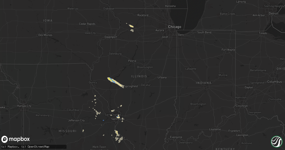
Hail Map in Illinois on August 23, 2021
Get this storm
August 23 map
$229
one time, instant access
Download today. No call, no setup
Keep the $229
Bought the map and want the full workflow? Apply the entire $229 to a subscription within 7 days. None of it is wasted.
Every map, not just this one
This buys you this map. Subscription and you get every map we run, in the markets you choose from a few cities to whole states to nationwide. Plus real-time alerts the moment a storm fires.
Contact data
Name, contact info, occupancy, even credit band for addresses in the footprint. You go from where it hit to who to call.
Become the source they trust
Unlimited branding weather history reports on demand. You already have the documented answer ready for the property owner, and you are the one who showed up with it.
Property data and RoofTrace estimates
Pull up any address you have got, its value and the exact code rules for that jurisdiction, straight from One Click Code. Then RoofTrace estimates the squares, pitch, and roof value, priced the way you price.
Storm reports in Illinois
Illinois
| Date | Description |
|---|---|
| 08/23/20214:15 PM CDT | Small tree limbs down. Time estimated from radar. |
| 08/23/20213:53 PM CDT | Large tree on a car. |
| 08/23/20213:00 PM CDT | Delayed report. Damage to outbuilding... Crop damage... Leaning power poles and damage to trailer. Relayed by sterling and dixon telegraph photographer and reporter. Ti |
| 08/23/20212:59 PM CDT | Damage to several large trees. About 100 yards east of intersection of penrose ad weldon roads. Time estimated from radar. |
| 08/23/20211:30 PM CDT | 20 power poles broken along us-67 south of beardstown. Us-67 is currently closed. Report relayed by broadcast media. Time estimated by radar. |
| 08/22/202111:23 PM CDT | At 423 PM CDT, a severe thunderstorm was located over Belleville, moving east at 10 mph. HAZARD...60 mph wind gusts. SOURCE...Radar indicated. IMPACT...Expect damage to roofs, siding, and trees. Locations impacted include... Belleville, O'Fallon, Fairview Heights, Swansea, Shiloh, Mascoutah, Lebanon, Freeburg, Caseyville, Millstadt, Scott AFB, Smithton and Fayetteville.This includes Interstate 64 in Illinois between exits 12 and 23. |
| 08/22/202110:33 PM CDT | At 332 PM CDT, a severe thunderstorm was located over Pine Lawn, and is nearly stationary. HAZARD...60 mph wind gusts. SOURCE...Radar indicated. IMPACT...Expect damage to roofs, siding, and trees. This severe thunderstorm will be near... St. Louis around 340 PM CDT.This also includes Scott Joplin Historic Site. |
| 08/22/202110:06 PM CDT | At 306 PM CDT, a severe thunderstorm was located over Dixon, moving southeast at 15 mph. HAZARD...60 mph wind gusts and nickel size hail. SOURCE...Radar indicated. IMPACT...Expect damage to roofs, siding, and trees. Locations impacted include... Dixon, Grand Detour, Woodland Shores and Woosung. Including the following interstate... I-88 between mile markers 50 and 54. |
| 08/22/20218:47 PM CDT | At 147 PM CDT, a severe thunderstorm was located near Bluff Springs, or near Virginia, moving southeast at 25 mph. HAZARD...60 mph wind gusts and penny size hail. SOURCE...Radar indicated. IMPACT...Expect damage to roofs, siding, and trees. This severe thunderstorm will be near... Virginia around 200 PM CDT.Other locations in the path of this severe thunderstorm includeLiterberry, Ashland and Alexander.This includes Interstate 72 between mile markers 71 and 79. |
| 08/22/20218:26 PM CDT | At 126 PM CDT, a severe thunderstorm was located near Beardstown, moving southeast at 25 mph. HAZARD...60 mph wind gusts and quarter size hail. SOURCE...Radar indicated. IMPACT...Hail damage to vehicles is expected. Expect wind damage to roofs, siding, and trees. This severe thunderstorm will be near... Beardstown around 135 PM CDT. Bluff Springs around 145 PM CDT.Other locations in the path of this severe thunderstorm includeArenzville and Virginia. |
| 08/22/20218:08 PM CDT | At 108 PM CDT, a severe thunderstorm was located near Rushville, moving southeast at 15 mph. HAZARD...60 mph wind gusts and quarter size hail. SOURCE...Radar indicated. IMPACT...Hail damage to vehicles is expected. Expect wind damage to roofs, siding, and trees. Locations impacted include... Beardstown. |
All States Impacted by Hail Map on August 23, 2021
Cities Impacted by Hail Map on August 23, 2021
- Northfield, MN
- Farwell, MN
- Kensington, MN
- Forbes, ND
- Leola, SD
- Ellsworth, WI
- Bay City, WI
- Saint Francis, SD
- Wellsville, MO
- Bayard, NM
- Hanover, NM
- Frankford, MO
- Max, ND
- Sawyer, ND
- Valley City, ND
- Benson, MN
- Milan, MN
- Montevideo, MN
- Clara City, MN
- Appleton, MN
- Danvers, MN
- Clarkfield, MN
- Maynard, MN
- Boyd, MN
- Glenwood, MN
- Lowry, MN
- Starbuck, MN
- Sauk Centre, MN
- Villard, MN
- Brooten, MN
- Revere, MN
- Walnut Grove, MN
- Alton, MO
- Couch, MO
- Douglas, AZ
- Lamberton, MN
- Westbrook, MN
- Thedford, NE
- White River, SD
- Dupree, SD
- Saint Charles, MO
- Golden Eagle, IL
- Brussels, IL
- Cosmos, MN
- Litchfield, MN
- Festus, MO
- Fults, IL
- Bloomsdale, MO
- Valmeyer, IL
- Saint Cloud, MN
- Kimball, MN
- Renville, MN
- Sacred Heart, MN
- Lakeside, NE
- Valentine, NE
- Johnstown, NE
- Gaylord, MN
- Capitan, NM
- Hondo, NM
- Turton, SD
- Conde, SD
- Alexandria, MN
- Parshall, ND
- Granite Falls, MN
- Elfrida, AZ
- Harrisonville, PA
- Breezewood, PA
- Crystal Spring, PA
- Eau Claire, WI
- Goodhue, MN
- Murdock, MN
- Eagle Butte, SD
- Hoven, SD
- Gettysburg, SD
- Lebanon, SD
- Olivia, MN
- Danube, MN
- Tombstone, AZ
- Timber Lake, SD
- Ellsworth, NE
- Belgrade, MN
- Sterling, IL
- Dixon, IL
- Polo, IL
- Elko New Market, MN
- Montgomery, MN
- Lonsdale, MN
- Webster, MN
- Dundas, MN
- Faribault, MN
- McIntosh, SD
- Garretson, SD
- Henderson, MN
- Green Isle, MN
- Lordsburg, NM
- Drake, ND
- Eden Prairie, MN
- Minnetonka, MN
- Hanley Falls, MN
- Magdalena, NM
- Holloway, MN
- Hancock, MN
- Shipman, IL
- Brighton, IL
- Le Sueur, MN
- Saint Louis, MO
- Meadow, SD
- Morris, MN
- Chokio, MN
- Dumont, MN
- Saint Paul, MN
- Madison, MN
- Canby, MN
- Burnsville, MN
- Middletown, MO
- Rushville, IL
- Virginia, IL
- Arenzville, IL
- Frederick, IL
- Beardstown, IL
- Ashland, IL
- Alexander, IL
- Jacksonville, IL
- Mount Sterling, IL
- Centerville, MO
- Potosi, MO
- Flasher, ND
- Solen, ND
- Cold Spring, MN
- Sainte Genevieve, MO
- Farmington, MO
- Saint Mary, MO
- Lake City, MN
- Frontenac, MN
- Red Wing, MN
- Tolstoy, SD
- Becker, MN
- Monticello, MN
- Clear Lake, MN
- Alma, WI
- Mondovi, WI
- Nelson, WI
- Durand, WI
- Eleva, WI
- McNeal, AZ
- Glencross, SD
- McLaughlin, SD
- Isabel, SD
- Bingham, NE
- Saint Peters, MO
- Fullerton, ND
- Ellendale, ND
- Watauga, SD
- Wakpala, SD
- Vienna, MO
- Belle, MO
- Karlsruhe, ND
- Grove City, MN
- Atwater, MN
- Chadwick, IL
- Covington, LA
- Ponchatoula, LA
- New Salem, ND
- Sisseton, SD
- Melrose, MN
- Paynesville, MN
- New London, MN
- Belleville, IL
- Shakopee, MN
- Belle Plaine, MN
- South Haven, MN
- Clearwater, MN
- Maple Lake, MN
- Annandale, MN
- Prior Lake, MN
- New Prague, MN
- Jordan, MN
- Minneota, MN
- Taunton, MN
- Porter, MN
- Ivanhoe, MN
- Pepin, WI
- Ellington, MO
- Seneca, SD
- Delano, MN
- Alberta, MN
- Graceville, MN
- Deming, NM
- Whitehorse, SD
- Elmwood, WI
- Odessa, MN
- Bellingham, MN
- Hopkins, MN
- Minneapolis, MN
- Cyrus, MN
- Selfridge, ND
- Watson, MN
- Lehr, ND
- Tyler, MN
- Ghent, MN
- Arco, MN
- Marshall, MN
- Russell, MN
- Lynd, MN
- Rugby, ND
- Clark, SD
- Raymond, SD
- Milbank, SD
- Towner, ND
- Savage, MN
- Florence, SD
- Henry, SD
- Harmon, IL
- Rock Falls, IL
- Raleigh, ND
- Eden, SD
- Willernie, MN
- Java, SD
- Selby, SD
- Lucan, MN
- Riverton, NE
- Bonne Terre, MO
- French Village, MO
- Bowling Green, MO
- Curryville, MO
- Cokato, MN
- Roscoe, MN
- Buffalo, MN
- Darwin, MN
- Watkins, MN
- Dassel, MN
- Richmond, MN
- Rockville, MN
- Eden Valley, MN
- Randolph, MN
- Cannon Falls, MN
- Birch Tree, MO
- Crystal City, MO
- Tracy, MN
- Currie, MN
- Higden, AR
- Lake Lillian, MN
- Carson, ND
- Ipswich, SD
- Aberdeen, SD
- Groton, SD
- Independence, WI
- Berlin, ND
- Balaton, MN
- Melbourne, AR
- Mount Pleasant, AR
- Killdeer, ND
- Roseglen, ND
- Webster, SD
- Madisonville, LA
- Wabasso, MN
- Vesta, MN
- Beardsley, MN
- Andover, MN
- Cedar, MN
- Wyoming, MN
- Mountain View, AR
- Plaza, ND
- Ryder, ND
- Correll, MN
- Millville, MN
- Storden, MN
- De Soto, MO
- Montrose, MN
- Waverly, MN
- Hamburg, MN
- Milroy, MN
- Garvin, MN
- Norwood Young America, MN
- Bellflower, MO
- Jonesburg, MO
- High Hill, MO
- Shields, ND
- East Saint Louis, IL
- Fairview Heights, IL
- Collinsville, IL
- Caseyville, IL
- Vandalia, MO
- Balfour, ND
- Hector, MN
- Okaton, SD
- Montgomery City, MO
- Warrenton, MO
- Herman, MN
- Hoffman, MN
- Donnelly, MN
- Sunburg, MN
- Mandaree, ND
- Linton, ND
- Hazelton, ND
- Menomonie, WI
- Eau Galle, WI
- Milledgeville, IL
- Faulkton, SD
- Baton Rouge, LA
- Prairieville, LA
- Saint Gabriel, LA
- Oriska, ND
- Lakeville, MN
- Union, MO
- Strum, WI
- Whitehall, WI
- Big Stone City, SD
- Hager City, WI
- Las Cruces, NM
- Portage Des Sioux, MO
- Piasa, IL
- Minot, ND
- Welch, MN
- Madison, IL
- Venice, IL
- Granite City, IL
- Rincon, NM
- Litchville, ND
- Chaska, MN
- Dawson, MN
- Raymond, MN
- Bald Knob, AR
- Maple Plain, MN
- Wright City, MO
- Truesdale, MO
- Cave City, AR
- Cologne, MN
- Hastings, MN
- Carver, MN
- Saint Peter, MN
- Farmington, MN
- Dennison, MN
- Hampton, MN
- Le Center, MN
- Spring Valley, WI
- Murdo, SD
- Evening Shade, AR
- Anoka, MN
- Mandan, ND
- Trail City, SD
- Bunker, MO
- Loretto, MN
- Rockford, MN
- Howard Lake, MN
- Pleasant Plains, IL
- New Berlin, IL
- Redwood Falls, MN
- Wishek, ND
- Judsonia, AR
- Winsted, MN
- Bowdle, SD
- Roscoe, SD
- Onaka, SD
- Arlington, MN
- Blomkest, MN
- Prinsburg, MN
- Echo, MN
- Andover, SD
- Bradley, SD
- Stockholm, WI
- Maiden Rock, WI
- Bird Island, MN
- Robert, LA
- Makoti, ND
- Mountainair, NM
- Berger, MO
- Ridgeview, SD
- Saint Michael, MN
- Clontarf, MN
- Elrosa, MN
- Hutchinson, MN
- Lester Prairie, MN
- Saint Martin, MN
- Mayer, MN
- Spicer, MN
- Willmar, MN
- Elk River, MN
- New Germany, MN
- Watertown, MN
- Freeport, MN
- Evansville, MN
- Silver Lake, MN
- Barrett, MN
- Big Lake, MN
- Avon, MN
- Albany, MN
- Stewart, MN
- Kerkhoven, MN
- Saint Joseph, MN
- Kandiyohi, MN
- Albertville, MN
- Buffalo Lake, MN
- Osakis, MN
- Brandon, MN
- Glencoe, MN
- Pennock, MN
- Lantry, SD
- Little Eagle, SD
- Glenham, SD
- Mound City, SD
- Mobridge, SD
- Akaska, SD
- Hankinson, ND
- Fairmount, ND
- Stirum, ND
- Claire City, SD
- Westport, SD
- Columbia, SD
- Oakes, ND
- Rosholt, SD
- Wheaton, MN
- Britton, SD
- Gwinner, ND
- Tintah, MN
- Houghton, SD
- Cogswell, ND
- Lake City, SD
- Barney, ND
- Havana, ND
- Amherst, SD
- Veblen, SD
- New Effington, SD
- Mantador, ND
- Forman, ND
- Wyndmere, ND
- Milnor, ND
- Barnard, SD
- Cayuga, ND
- Mooreton, ND
- Frederick, SD
- Campbell, MN
- Claremont, SD
- Wahpeton, ND
- Hecla, SD
- Lidgerwood, ND
- Rutland, ND
- Augusta, MO
- Marlborough, MA
- Bolton, MA


