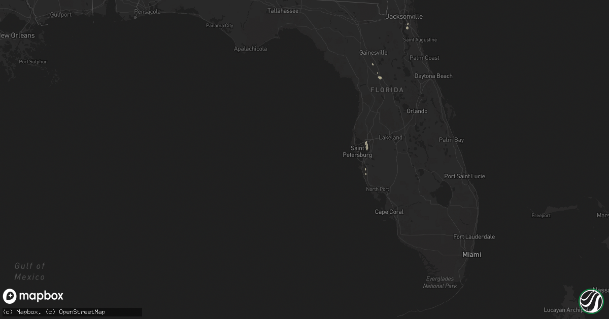
Hail Map in Florida on August 21, 2022
Get this storm
August 21 map
$229
one time, instant access
Download today. No call, no setup
Keep the $229
Bought the map and want the full workflow? Apply the entire $229 to a subscription within 7 days. None of it is wasted.
Every map, not just this one
This buys you this map. Subscription and you get every map we run, in the markets you choose from a few cities to whole states to nationwide. Plus real-time alerts the moment a storm fires.
Contact data
Name, contact info, occupancy, even credit band for addresses in the footprint. You go from where it hit to who to call.
Become the source they trust
Unlimited branding weather history reports on demand. You already have the documented answer ready for the property owner, and you are the one who showed up with it.
Property data and RoofTrace estimates
Pull up any address you have got, its value and the exact code rules for that jurisdiction, straight from One Click Code. Then RoofTrace estimates the squares, pitch, and roof value, priced the way you price.
Storm reports in Florida
Florida
| Date | Description |
|---|---|
| 08/21/20224:50 PM CDT | Report of tree down due to thunderstorm winds. |
| 08/21/20224:35 PM CDT | Fdem relayed reports of damage to around a dozen manufactured homes consisting mostly of metal pieces being peeled away from roofs and sides of structures. Downburst si |
| 08/21/20224:32 PM CDT | Broadcast media relayed photos on social media of multiple trees down along walnut bend rd. Time estimate based on radar. |
| 08/21/202212:29 AM CDT | At 529 PM EDT, a severe thunderstorm was located over Fruit Cove, moving southwest at 10 mph. HAZARD...60 mph wind gusts and quarter size hail. SOURCE...Radar indicated. IMPACT...Hail damage to vehicles is expected. Expect wind damage to roofs, siding, and trees. Locations impacted include... Fruit Cove, Mandarin and Switzerland. |
| 08/20/202210:27 PM CDT | At 327 PM EDT, a severe thunderstorm was located over Ocala, moving south at 5 mph. HAZARD...60 mph wind gusts and quarter size hail. SOURCE...Radar indicated. IMPACT...Hail damage to vehicles is expected. Expect wind damage to roofs, siding, and trees. Locations impacted include... Ocala, Santos, Ocala Airport, Lake Weir, Silver Springs Shores, Belleview and Summerfield. |
All States Impacted by Hail Map on August 21, 2022
Cities Impacted by Hail Map on August 21, 2022
- Blackfoot, ID
- Soda Springs, ID
- Overton, NV
- Elyria, OH
- Kalispell, MT
- Batavia, OH
- Arnoldsburg, WV
- Spencer, WV
- Oregonia, OH
- Lebanon, OH
- Franklin, OH
- Middletown, OH
- Springboro, OH
- Centertown, KY
- Alton, UT
- Glendale, UT
- Orderville, UT
- Memphis, TN
- Millington, TN
- Kanab, UT
- Cromwell, KY
- Horse Branch, KY
- Caneyville, KY
- Waynesville, OH
- New Lexington, OH
- Pataskala, OH
- Granville, OH
- Miamisburg, OH
- Dolan Springs, AZ
- Carey, OH
- Caliente, NV
- Peach Springs, AZ
- Kingman, AZ
- Hackberry, AZ
- Elizabethtown, NC
- Garland, NC
- Willow Beach, AZ
- Meadview, AZ
- Chloride, AZ
- Golden Valley, AZ
- Bullhead City, AZ
- Tropic, UT
- Henrieville, UT
- Escalante, UT
- Hurricane, UT
- Clarendon, NC
- Tabor City, NC
- Masontown, WV
- Bluffton, SC
- Osceola, AR
- Henning, TN
- Burlison, TN
- Wilson, AR
- Drummonds, TN
- Williams, AZ
- Maple Hill, NC
- Madison, OH
- Geneva, OH
- Vandergrift, PA
- Leechburg, PA
- Saint George, UT
- Memphis, NY
- Beryl, UT
- Enterprise, UT
- New Concord, OH
- Zanesville, OH
- Chandlersville, OH
- Norwich, OH
- Powell, OH
- Plain City, OH
- Delaware, OH
- Littlefield, AZ
- Ocala, FL
- Summer Shade, KY
- Tompkinsville, KY
- Vevay, IN
- Kamas, UT
- American Falls, ID
- Deep Run, NC
- Supai, AZ
- Congress, AZ
- Wickenburg, AZ
- Sedona, AZ
- Micanopy, FL
- Reddick, FL
- Williston, FL
- Jacksonville, FL
- Saint Johns, FL
- Morgantown, KY
- Lane, SC
- Andrews, SC
- Lake Havasu City, AZ
- Humboldt, AZ
- Dewey, AZ
- Young, AZ
- Rockland, ID
- Louisville, KY
- Penn Run, PA
- Lorain, OH
- Cumberland, OH
- Colorado City, AZ
- Okatie, SC
- Mayer, AZ
- Glasgow, KY
- Pocatello, ID
- Arbon, ID
- South Bloomingville, OH
- Creola, OH
- McArthur, OH
- Payson, AZ
- Arlington, TN
- Atoka, TN
- Prescott, AZ
- Ash Fork, AZ
- Seligman, AZ
- Parker, AZ
- Circleville, OH
- Kingston, OH
- Laurelville, OH
- Tampa, FL
- Chillicothe, OH
- Yemassee, SC
- Cottonwood, AZ
- Cornville, AZ
- Salome, AZ
- Hardeeville, SC
- Savannah, GA
- Bradenton, FL
- Sarasota, FL
- Wolfe City, TX
- East Syracuse, NY
- Syracuse, NY
- Cicero, NY
- Bridgeport, NY


