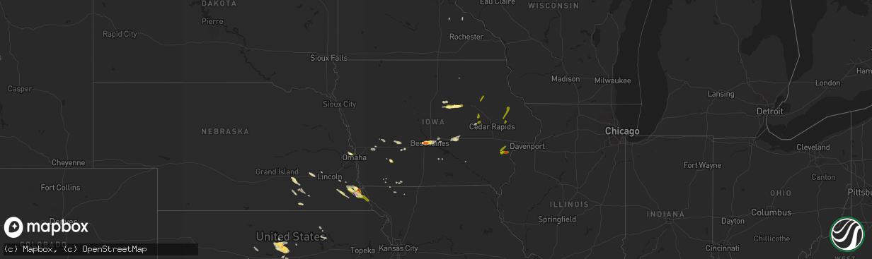
Hail Map in Iowa on August 19, 2022
The weather event in Iowa on August 19, 2022 includes Hail and Wind maps. 15 states and 186 cities were impacted and suffered possible damage. The total estimated number of properties impacted is 32,856.
Want more than just the map?
Turn this storm into a full workflow.
- Owner + property data so you know who to knock
- OnDemand branded weather history reports to win the "did we even have hail?" argument
- RoofTrace estimate so reps stop guessing numbers at the door
Bought this map? Upgrade within 7 days and we'll credit the $230. (10-15 min setup call)
Hail
Wind
32,856
Estimated number of impacted properties by a 1.00" hail or larger18,883
Estimated number of impacted properties by a 1.75" hail or larger9,704
Estimated number of impacted properties by a 2.50" hail or largerStorm reports in Iowa
Iowa
| Date | Description |
|---|---|
| 08/19/20226:21 PM CDT | A local report indicates 1.00 inch wind near OELWEIN |
| 08/19/20225:03 PM CDT | Corrects previous hail report from urbana. Delayed report. |
| 08/19/20225:03 PM CDT | Delayed report. |
| 08/19/20223:56 PM CDT | Pea and quarter sized hail falling north of holland. |
| 08/19/20223:50 PM CDT | Ping pong ball sized hail north of grundy center. Time estimated from radar. Report from social media. |
| 08/19/20223:10 PM CDT | Report relayed by b |
| 08/19/20223:10 PM CDT | Report relayed by broadcast media. Time estimated from radar. |
| 08/19/20223:10 PM CDT | Quarter size hail reported. Time estimated from radar. |
| 08/19/20222:56 PM CDT | Report from mping: quarter |
| 08/19/20222:50 PM CDT | Report from mping: half dollar |
| 08/19/20222:50 PM CDT | Hail at least 1.5 to 2 inches with plenty of cars damaged at valley west mall. Time estimated from radar. |
| 08/19/20222:47 PM CDT | Report from mping: quarter |
| 08/19/20222:46 PM CDT | Two inch diameter hail reported near valley high school. Time estimated from radar. Report from social media. |
| 08/19/20222:45 PM CDT | Egg sized hail reported in west des moines. Time estimated by radar. |
| 08/19/20222:45 PM CDT | 3 inch hail stone measured at woi in west des moines. |
| 08/19/20222:45 PM CDT | Ping pong ball hail in west des moines. Time estimated from radar. Report from social media. |
| 08/19/20222:43 PM CDT | Dime up to golf-ball sized hail. |
| 08/19/20222:40 PM CDT | Woi5 storm team reports ping pong ball hail at studio. |
| 08/19/20222:40 PM CDT | Breaking car windshields. |
| 08/19/20222:40 PM CDT | 1.5 to 2 inch hail in clive. |
| 08/19/20222:33 PM CDT | Report from mping: quarter |
| 08/19/20224:19 AM CDT | At 919 PM CDT, a severe thunderstorm was located over Bald Bluff, or near Oquawka, moving northeast at 30 mph. HAZARD...60 mph wind gusts and quarter size hail. SOURCE...Radar indicated. IMPACT...Hail damage to vehicles is expected. Expect wind damage to roofs, siding, and trees. Locations impacted include... Monmouth, Oquawka, Burgess, Little York, Rozetta, Seaton, Lake Warren, Alexis, Coldbrook, Bald Bluff, Gerlaw, Monmouth Municipal Airport, Big River State Forest, Sunbeam, Delabar State Park and Eleanor. |
| 08/19/20223:46 AM CDT | At 845 PM CDT, severe thunderstorms were located along a line extending from near Langworthy to near Central Park to near Morley, moving northeast at 25 mph. HAZARD...60 mph wind gusts and quarter size hail. SOURCE...Fire Department. IMPACT...Hail damage to vehicles is expected. Expect wind damage to roofs, siding, and trees. Severe thunderstorms will be near... Langworthy and Central Park around 850 PM CDT. Monticello, Center Junction, Jones County Fairgrounds and Monticello Municipal Airport around 855 PM CDT. Scotch Grove, Pictured Rocks Wildlife Area and Camp Courageous around 900 PM CDT. Onslow and Hale around 905 PM CDT.Other locations in the path of these severe thunderstorms includeCascade, Wyoming, Oxford Junction and Temple Hill. |
| 08/19/20223:31 AM CDT | At 831 PM CDT, severe thunderstorms were located along a line extending from near Cranston to Fruitland to near Snively Access Campground, moving east at 40 mph. HAZARD...60 mph wind gusts. SOURCE...Radar indicated. IMPACT...Expect damage to roofs, siding, and trees. Locations impacted include... Muscatine, Wapello, Fruitland, Millersburg, New Boston, Grandview, Eliza, Joy, Letts, Illinois City, Fairport, Mannon, Edgington, Sand Springs, Cranston, New Era, Petersville, Ardon, Muscatine Municipal Airport and Loud Thunder Scout Camp. |
| 08/19/20222:38 AM CDT | At 738 PM CDT, a severe thunderstorm was located over Gladwin, or 7 miles northwest of Columbus Junction, moving east at 15 mph. HAZARD...Quarter size hail. SOURCE...Radar indicated. IMPACT...Damage to vehicles is expected. Locations impacted include... Columbus Junction, Conesville, Columbus City, Letts, Cotter, Fredonia, Cranston, Louisa County Fairgrounds and Gladwin. |
| 08/19/20222:31 AM CDT | At 731 PM CDT, a severe thunderstorm was located over Washington Airport, or over Washington, moving east at 20 mph. HAZARD...60 mph wind gusts and quarter size hail. SOURCE...Radar indicated. IMPACT...Hail damage to vehicles is expected. Expect wind damage to roofs, siding, and trees. Locations impacted include... Washington, Ainsworth, Haskins, Marr Park and Washington Airport. |
| 08/19/20221:28 AM CDT | At 627 PM CDT, a severe thunderstorm was located 8 miles northwest of Albia, moving east at 30 mph. HAZARD...60 mph wind gusts and quarter size hail. SOURCE...Radar indicated. IMPACT...Hail damage to vehicles is expected. Expect wind damage to roofs, siding, and trees. This severe thunderstorm will be near... Albia around 640 PM CDT.Other locations in the path of this severe thunderstorm includeEddyville. |
| 08/19/20221:05 AM CDT | At 605 PM CDT, a severe thunderstorm was located near Littleton, or 7 miles southwest of Oelwein, moving northeast at 25 mph. HAZARD...60 mph wind gusts and quarter size hail. SOURCE...Radar indicated. IMPACT...Hail damage to vehicles is expected. Expect wind damage to roofs, siding, and trees. Locations impacted include... Fairbank, Hazleton, Stanley, Fontana County Park, Fontana Park and Littleton. |
| 08/19/202212:44 AM CDT | At 544 PM CDT, a severe thunderstorm was located over Conesville, or 8 miles north of Columbus Junction, moving northeast at 25 mph. HAZARD...60 mph wind gusts and quarter size hail. SOURCE...Radar indicated. IMPACT...Hail damage to vehicles is expected. Expect wind damage to roofs, siding, and trees. This severe thunderstorm will be near... Cranston around 555 PM CDT.Other locations in the path of this severe thunderstorm includeNichols, Ardon, West Liberty, Saulsbury Bridge Campground, MuscatineCounty Fairgrounds and Atalissa. |
| 08/19/202212:36 AM CDT | At 536 PM CDT, a severe thunderstorm was located 11 miles southeast of Knoxville, moving northeast at 30 mph. HAZARD...60 mph wind gusts and quarter size hail. SOURCE...Radar indicated. IMPACT...Hail damage to vehicles is expected. Expect wind damage to roofs, siding, and trees. This severe thunderstorm will be near... Harvey around 545 PM CDT. Leighton around 555 PM CDT.Other locations in the path of this severe thunderstorm includeBeacon, Oskaloosa and University Park. |
| 08/18/202211:57 PM CDT | At 457 PM CDT, a severe thunderstorm was located over Rodgers Park, or near Vinton, moving northeast at 25 mph. HAZARD...60 mph wind gusts and half dollar size hail. SOURCE...Radar indicated. IMPACT...Hail damage to vehicles is expected. Expect wind damage to roofs, siding, and trees. This severe thunderstorm will be near... Rodgers Park and Benton County Fairgrounds around 500 PM CDT. Vinton and Vinton Memorial Airport around 505 PM CDT. Mount Auburn around 510 PM CDT. Minne Estema Park around 515 PM CDT.Other locations in the path of this severe thunderstorm includeUrbana, Cheney, Brandon, Lime Creek County Park and Spencers Grove. |
| 08/18/202211:40 PM CDT | At 440 PM CDT, a severe thunderstorm was located near Lake Icaria, or 9 miles north of Corning, moving southeast at 35 mph. HAZARD...60 mph wind gusts and quarter size hail. SOURCE...Radar indicated. IMPACT...Hail damage to vehicles is expected. Expect wind damage to roofs, siding, and trees. This severe thunderstorm will be near... Prescott around 455 PM CDT.Other locations in the path of this severe thunderstorm include GreenValley Lake, Cromwell, Green Valley Lake State Park, Creston, Kentand Creston Municipal Airport. |
| 08/18/202211:36 PM CDT | At 436 PM CDT, a severe thunderstorm was located near Brooklyn, or 15 miles southeast of Toledo, moving east at 35 mph. HAZARD...60 mph wind gusts and nickel size hail. SOURCE...Radar indicated. IMPACT...Expect damage to roofs, siding, and trees. This severe thunderstorm will be near... Victor, Victor and Hartwick around 445 PM CDT.This includes Interstate 80 between mile markers 195 and 204. |
| 08/18/202211:34 PM CDT | At 434 PM CDT, a severe thunderstorm was located near Melcher-Dallas, or 12 miles southwest of Knoxville, moving east at 15 mph. HAZARD...60 mph wind gusts and quarter size hail. SOURCE...Radar indicated. IMPACT...Hail damage to vehicles is expected. Expect wind damage to roofs, siding, and trees. This severe thunderstorm will be near... Melcher-Dallas around 445 PM CDT.Other locations in the path of this severe thunderstorm includeKnoxville Raceway, Knoxville Municipal Airport and Knoxville. |
| 08/18/202211:29 PM CDT | At 429 PM CDT, a severe thunderstorm was located over Keystone, or 11 miles southwest of Vinton, moving east at 10 mph. HAZARD...60 mph wind gusts and quarter size hail. SOURCE...Radar indicated. IMPACT...Hail damage to vehicles is expected. Expect wind damage to roofs, siding, and trees. Locations impacted include... Van Horne, Newhall and Benton County Fairgrounds. |
| 08/18/202211:26 PM CDT | At 426 PM CDT, a severe thunderstorm was located near the Iowa State Fairgrounds, or near Pleasant Hill, moving east at 20 mph. HAZARD...60 mph wind gusts and quarter size hail. SOURCE...Radar indicated. IMPACT...Hail damage to vehicles is expected. Expect wind damage to roofs, siding, and trees. This severe thunderstorm will be near... Pleasant Hill around 430 PM CDT. Altoona, Bondurant, Adventureland Amusement Park and Prairie Meadows around 435 PM CDT.Other locations in the path of this severe thunderstorm includeMitchellville and Valeria.This includes the following highways... Interstate 35 between mile markers 87 and 89. Interstate 80 between mile markers 135 and 153. Interstate 235 between mile markers 9 and 14. |
| 08/18/202211:03 PM CDT | At 403 PM CDT, a severe thunderstorm was located near Rock Creek Lake, or near Grinnell, moving east at 25 mph. HAZARD...60 mph wind gusts and quarter size hail. SOURCE...Radar indicated. IMPACT...Hail damage to vehicles is expected. Expect wind damage to roofs, siding, and trees. This severe thunderstorm will be near... Grinnell and Grinnell Regional Airport around 415 PM CDT.Other locations in the path of this severe thunderstorm includeMalcom.This includes Interstate 80 between mile markers 175 and 197. |
| 08/18/202210:55 PM CDT | At 354 PM CDT, a severe thunderstorm was located near Holland or 5 miles north of Grundy Center, moving east at 20 mph. HAZARD...Half dollar size hail. SOURCE...Radar indicated. IMPACT...Damage to vehicles is expected. Locations impacted include... Dike, Uni-Dome And McLeod Center, Hudson, Waterloo, Waterloo Municipal Airport and George Wyth State Park.This replaces the previous Severe Thunderstorm Warning issued for this thunderstorm. |
| 08/18/202210:17 PM CDT | At 317 PM CDT, a severe thunderstorm was located over Julian, or 8 miles north of Auburn, moving southeast at 35 mph. HAZARD...60 mph wind gusts and quarter size hail. SOURCE...Radar indicated. IMPACT...Hail damage to vehicles is expected. Expect wind damage to roofs, siding, and trees. This severe thunderstorm will be near... Auburn and Peru around 330 PM CDT.Other locations in the path of this severe thunderstorm includeNemaha and Brownville.People attending Johnson County Fair Grounds should seek safeshelter immediately! |
| 08/18/202210:09 PM CDT | At 308 PM CDT, a severe thunderstorm was located near Steamboat Rock, moving east at 20 mph. HAZARD...Half dollar size hail. SOURCE...Radar indicated. IMPACT...Damage to vehicles is expected. This severe thunderstorm will be near... Wellsburg around 325 PM CDT. Holland around 345 PM CDT. Grundy Center around 350 PM CDT.Other locations impacted by this severe thunderstorm includeSteamboat Rock, Wellsburg and Holland. |
| 08/18/202210:03 PM CDT | At 303 PM CDT, a severe thunderstorm was located 4 miles southeast of Avoca, or 13 miles west of Atlantic, moving east at 25 mph. HAZARD...60 mph wind gusts and quarter size hail. SOURCE...Radar indicated. IMPACT...Hail damage to vehicles is expected. Expect wind damage to roofs, siding, and trees. This severe thunderstorm will remain over mainly rural areas of northeastern Pottawattamie and south central Shelby Counties, including the following locations... Botna Bend Park.This includes Interstate 80 in Iowa between mile markers 40 and 48. |
| 08/18/202210:03 PM CDT | At 303 PM CDT, a severe thunderstorm was located over Colfax, or 11 miles west of Newton, moving east at 20 mph. HAZARD...60 mph wind gusts and half dollar size hail. SOURCE...Radar indicated. IMPACT...Hail damage to vehicles is expected. Expect wind damage to roofs, siding, and trees. This severe thunderstorm will be near... Prairie City Krohn Airport around 310 PM CDT.Other locations in the path of this severe thunderstorm includeNewton, Lambs Grove, Newton Municipal Airport, Iowa Speedway andKellogg.This includes Interstate 80 between mile markers 151 and 177. |
| 08/18/20229:36 PM CDT | At 236 PM CDT, a severe thunderstorm was located 3 miles west of Unadilla, or 20 miles east of Lincoln, moving east at 20 mph. HAZARD...60 mph wind gusts and quarter size hail. SOURCE...Radar indicated. IMPACT...Hail damage to vehicles is expected. Expect wind damage to roofs, siding, and trees. This severe thunderstorm will be near... Unadilla around 245 PM CDT.Other locations in the path of this severe thunderstorm includeSyracuse, Dunbar, Talmage and Lorton.This includes Interstate 29 between mile markers 10 and 15. |
| 08/18/20229:23 PM CDT | At 223 PM CDT, a severe thunderstorm was located over Windsor Heights, or near Urbandale, moving east at 35 mph. HAZARD...60 mph wind gusts and quarter size hail. SOURCE...Radar indicated. IMPACT...Hail damage to vehicles is expected. Expect wind damage to roofs, siding, and trees. This severe thunderstorm will be near... Saylorville, Iowa Events Center, Principal Park and Southridge Mall around 230 PM CDT. Des Moines, Ankeny and Margo Frankel Woods State Park around 235 PM CDT. Pleasant Hill, Carlisle, Iowa State Fairgrounds, Weh-Weh-Neh-Kee State Park and Ankeny Regional Airport around 240 PM CDT.Other locations in the path of this severe thunderstorm includeAltoona, Bondurant, Adventureland Amusement Park, Prairie Meadows,Mitchellville, Valeria, Colfax, Prairie City and Mingo.This includes the following highways... Interstate 35 between mile markers 66 and 72, and between milemarkers 87 and 93. Interstate 80 between mile markers 116 and 154. Interstate 235 between mile markers 1 and 14. |
| 08/18/20228:46 PM CDT | Tree down on fletcher. Time estimated from radar. |
| 08/18/20228:45 PM CDT | Wind gust estimated by morley fire chief. |
| 08/18/20228:35 PM CDT | Time estimated by radar. Report on social media of trees down and large tree branches broken. |
| 08/18/20227:33 PM CDT | Hail falling the past 10 minutes with most stones pea to nickel size. |
| 08/18/20227:24 PM CDT | Via amatuer radio. Occurring right now. |
| 08/18/20227:07 PM CDT | Report from mping: quarter |
| 08/18/20227:00 PM CDT | Delayed report via amateur radio. Trees down blocking the road on the north side of conesville. |
All States Impacted by Hail Map on August 19, 2022
Cities Impacted by Hail Map on August 19, 2022
- Henderson, NE
- Portland, TN
- Hays, KS
- Victoria, KS
- Clarinda, IA
- Lometa, TX
- Blockton, IA
- Parnell, MO
- Massena, IA
- Cumberland, IA
- Geneva, NE
- Hohenwald, TN
- Centerville, TN
- Syracuse, NE
- Utica, NE
- Beaver Crossing, NE
- Goehner, NE
- Seward, NE
- Keystone, IA
- Grafton, NE
- Sutton, NE
- Lynnville, IA
- Grinnell, IA
- Kellogg, IA
- McCracken, KS
- Pavillion, WY
- War, WV
- Berwind, WV
- Raysal, WV
- Paynesville, WV
- Pierson, FL
- Portal, GA
- Statesboro, GA
- Stuart, IA
- Menlo, IA
- West Des Moines, IA
- Clive, IA
- Windsor Heights, IA
- Urbandale, IA
- Des Moines, IA
- Ackley, IA
- Iowa Falls, IA
- Ashton, ID
- Newdale, ID
- Dighton, KS
- Naples, FL
- Palmyra, NE
- Nemaha, NE
- Auburn, NE
- Brownville, NE
- Deland, FL
- De Leon Springs, FL
- La Fayette, GA
- Armuchee, GA
- Summerville, GA
- Barnard, KS
- Lincoln, KS
- Holland, IA
- Grundy Center, IA
- Dike, IA
- Wellsburg, IA
- Cook, NE
- Talmage, NE
- Brock, NE
- Guthrie Center, IA
- Casey, IA
- Adair, IA
- Shickley, NE
- Davenport, NE
- Kissimmee, FL
- Sylvan Grove, KS
- Fontanelle, IA
- Aurora, NE
- Fairmont, NE
- Ottumwa, IA
- Hopkins, MO
- Palatka, FL
- Satsuma, FL
- Minneapolis, KS
- Garfield, GA
- Twin City, GA
- Dennison, MN
- Julian, NE
- Nebraska City, NE
- Marana, AZ
- Avoca, IA
- Pikeville, TN
- Green, KS
- Harlan, IA
- Steamboat Rock, IA
- Huntsville, UT
- Beloit, KS
- Hunter, KS
- La Crosse, KS
- Bison, KS
- Crescent City, FL
- Bunnell, FL
- Swainsboro, GA
- Riley, KS
- Corning, IA
- Reinbeck, IA
- Omaha, NE
- Bethpage, TN
- Bedford, IA
- Adel, IA
- Pleasant Dale, NE
- Garland, NE
- Charles City, IA
- Shelby, IA
- Hancock, IA
- Mitchellville, IA
- Colfax, IA
- Falun, KS
- Brookville, KS
- Lindsborg, KS
- Ellsworth, KS
- Seville, FL
- Beverly, KS
- Prairie City, IA
- Sterling, NE
- Goodhue, MN
- Johnson, NE
- Peru, NE
- Gentry, MO
- Murfreesboro, TN
- Lebanon, TN
- Waukee, IA
- Pleasant Hill, IA
- Altoona, IA
- Hebron, NE
- Metter, GA
- Deshler, NE
- Kimballton, IA
- Audubon, IA
- Elk Horn, IA
- Pfeifer, KS
- Strang, NE
- Ohiowa, NE
- Osceola, WI
- Jetmore, KS
- Riceboro, GA
- Alexandria, NE
- Tobias, NE
- Daykin, NE
- Grace, ID
- Paradise, KS
- Newton, IA
- Lacona, IA
- Leonardville, KS
- Windermere, FL
- Orlando, FL
- Greenleaf, KS
- Melcher Dallas, IA
- Knoxville, IA
- Tecumseh, NE
- Adams, NE
- Elk Creek, NE
- Sugar Valley, GA
- Adrian, GA
- Kite, GA
- Quinter, KS
- Beryl, UT
- Clay Center, KS
- Guyton, GA
- Fairfax, MO
- Falls City, NE
- Rock Port, MO
- Shubert, NE
- Vinton, IA
- Van Horne, IA
- Mount Auburn, IA
- Garrison, IA
- West Liberty, IA
- Conesville, IA
- Nichols, IA
- Lone Tree, IA
- Muscatine, IA
- Columbus Junction, IA
- Letts, IA
- Hazleton, IA
- Fairbank, IA
- Oelwein, IA
- Anamosa, IA
- Monticello, IA
- Worthington, IA
- Hopkinton, IA


