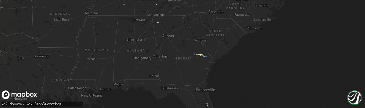
Hail Map in Georgia on August 19, 2022
The weather event in Georgia on August 19, 2022 includes Hail and Wind maps. 15 states and 186 cities were impacted and suffered possible damage. The total estimated number of properties impacted is 2,135.
Want more than just the map?
Turn this storm into a full workflow.
- Owner + property data so you know who to knock
- OnDemand branded weather history reports to win the "did we even have hail?" argument
- RoofTrace estimate so reps stop guessing numbers at the door
Bought this map? Upgrade within 7 days and we'll credit the $230. (10-15 min setup call)
Hail
Wind
2,135
Estimated number of impacted properties by a 1.00" hail or larger0
Estimated number of impacted properties by a 1.75" hail or larger0
Estimated number of impacted properties by a 2.50" hail or largerStorm reports in Georgia
Georgia
| Date | Description |
|---|---|
| 08/19/20225:20 PM CDT | Tree down across the road.20 |
| 08/19/20225:20 PM CDT | Tree down across the road at the intersection of hwy 21 and old tusculum road. |
| 08/19/20225:00 PM CDT | Funnel cloud reported and trees down at plantation point drive and zettwell road. Penny to nickel size hail reported. |
| 08/19/20224:50 PM CDT | Trained spotter reported power poles snapped off at the intersection of georgia highway 24 and clito road. Time of event was estimated from radar data. |
| 08/19/20224:50 PM CDT | Trained spotter reported multiple trees snapped off and uprooted at the intersection of rough rider and clito roads. Some trees blocked this intersection. Time of event |
| 08/19/20224:45 PM CDT | Large tree down in the road near eagle road and hwy 73. |
| 08/19/20224:40 PM CDT | Quarter size hail reported at red fern plantation lodge... Ga. |
| 08/19/20223:27 PM CDT | Multiple trees down between 1200 and 1300 blocks of hill city road. |
| 08/19/20223:03 PM CDT | Tree down on outbuilding near the 1000 block of mountain loop road. |
| 08/19/20221:18 AM CDT | At 618 PM EDT, severe thunderstorms were located along a line extending from Kildare to near Springfield to near Blitchton, moving east at 45 mph. HAZARD...60 mph wind gusts and quarter size hail. SOURCE...Radar indicated. IMPACT...Minor hail damage to vehicles is possible. Expect wind damage to trees and powerlines. Locations impacted include: Hilton Head Island, Pooler, Bluffton, Beaufort, Port Royal, Ridgeland, Springfield, Bellinger Hill Area, Godley Station, Savannah International Airport, Clarendon, Jasper, Rincon, Port Wentworth and Hardeeville.This warning includes the following interstates: I-95 in South Carolina between mile markers 2 and 34. I-95 in Georgia between mile markers 107 and 112. |
| 08/18/202211:45 PM CDT | At 444 PM EDT, severe thunderstorms were located along a line extending from near Swainsboro to near Garfield, moving east at 30 mph. HAZARD...60 mph wind gusts and penny size hail. SOURCE...Radar indicated. IMPACT...Expect damage to trees and powerlines. Locations impacted include: Statesboro, Sylvania, Butts, Portal, Rocky Ford, Woodcliff, Altman, Hopeulikit, Captolo, Dover and Scarboro. |
| 08/18/202211:42 PM CDT | At 442 PM EDT, a severe thunderstorm was located near Swainsboro, moving east at 30 mph. HAZARD...60 mph wind gusts. SOURCE...Radar indicated. IMPACT...Expect damage to roofs, siding, and trees. Locations impacted include... Swainsboro, Twin City, Garfield, Nunez, Modoc, Canoochee and George L Smith State Park. |
| 08/18/202211:05 PM CDT | At 405 PM EDT, severe thunderstorms were located along a line extending from Meeks to near Minter, moving east at 25 mph. HAZARD...60 mph wind gusts. SOURCE...Radar indicated. IMPACT...Expect damage to roofs, siding, and trees. Locations impacted include... Swainsboro, Soperton, Adrian, Nunez, Tarrytown, Lothair, Covena, Orland, Rockledge, Orianna, Norristown, Minter, Norristown Junction, Meeks, Blackville, Zaidee, Gillis Springs, Scott and Barnhill. |
| 08/18/202210:50 PM CDT | At 350 PM EDT, a severe thunderstorm was located over Lake Marvin, or 12 miles northwest of Calhoun, moving east at 15 mph. HAZARD...60 mph wind gusts. SOURCE...Radar indicated. IMPACT...Expect damage to roofs, siding, and trees. Locations impacted include... Dalton, Calhoun, Resaca, Subligna, Suttles Mill, Villanow, Sugar Valley, Everett Springs, Lake Marvin and Oostanaula. |
All States Impacted by Hail Map on August 19, 2022
Cities Impacted by Hail Map on August 19, 2022
- Henderson, NE
- Portland, TN
- Hays, KS
- Victoria, KS
- Clarinda, IA
- Lometa, TX
- Blockton, IA
- Parnell, MO
- Massena, IA
- Cumberland, IA
- Geneva, NE
- Hohenwald, TN
- Centerville, TN
- Syracuse, NE
- Utica, NE
- Beaver Crossing, NE
- Goehner, NE
- Seward, NE
- Keystone, IA
- Grafton, NE
- Sutton, NE
- Lynnville, IA
- Grinnell, IA
- Kellogg, IA
- McCracken, KS
- Pavillion, WY
- War, WV
- Berwind, WV
- Raysal, WV
- Paynesville, WV
- Pierson, FL
- Portal, GA
- Statesboro, GA
- Stuart, IA
- Menlo, IA
- West Des Moines, IA
- Clive, IA
- Windsor Heights, IA
- Urbandale, IA
- Des Moines, IA
- Ackley, IA
- Iowa Falls, IA
- Ashton, ID
- Newdale, ID
- Dighton, KS
- Naples, FL
- Palmyra, NE
- Nemaha, NE
- Auburn, NE
- Brownville, NE
- Deland, FL
- De Leon Springs, FL
- La Fayette, GA
- Armuchee, GA
- Summerville, GA
- Barnard, KS
- Lincoln, KS
- Holland, IA
- Grundy Center, IA
- Dike, IA
- Wellsburg, IA
- Cook, NE
- Talmage, NE
- Brock, NE
- Guthrie Center, IA
- Casey, IA
- Adair, IA
- Shickley, NE
- Davenport, NE
- Kissimmee, FL
- Sylvan Grove, KS
- Fontanelle, IA
- Aurora, NE
- Fairmont, NE
- Ottumwa, IA
- Hopkins, MO
- Palatka, FL
- Satsuma, FL
- Minneapolis, KS
- Garfield, GA
- Twin City, GA
- Dennison, MN
- Julian, NE
- Nebraska City, NE
- Marana, AZ
- Avoca, IA
- Pikeville, TN
- Green, KS
- Harlan, IA
- Steamboat Rock, IA
- Huntsville, UT
- Beloit, KS
- Hunter, KS
- La Crosse, KS
- Bison, KS
- Crescent City, FL
- Bunnell, FL
- Swainsboro, GA
- Riley, KS
- Corning, IA
- Reinbeck, IA
- Omaha, NE
- Bethpage, TN
- Bedford, IA
- Adel, IA
- Pleasant Dale, NE
- Garland, NE
- Charles City, IA
- Shelby, IA
- Hancock, IA
- Mitchellville, IA
- Colfax, IA
- Falun, KS
- Brookville, KS
- Lindsborg, KS
- Ellsworth, KS
- Seville, FL
- Beverly, KS
- Prairie City, IA
- Sterling, NE
- Goodhue, MN
- Johnson, NE
- Peru, NE
- Gentry, MO
- Murfreesboro, TN
- Lebanon, TN
- Waukee, IA
- Pleasant Hill, IA
- Altoona, IA
- Hebron, NE
- Metter, GA
- Deshler, NE
- Kimballton, IA
- Audubon, IA
- Elk Horn, IA
- Pfeifer, KS
- Strang, NE
- Ohiowa, NE
- Osceola, WI
- Jetmore, KS
- Riceboro, GA
- Alexandria, NE
- Tobias, NE
- Daykin, NE
- Grace, ID
- Paradise, KS
- Newton, IA
- Lacona, IA
- Leonardville, KS
- Windermere, FL
- Orlando, FL
- Greenleaf, KS
- Melcher Dallas, IA
- Knoxville, IA
- Tecumseh, NE
- Adams, NE
- Elk Creek, NE
- Sugar Valley, GA
- Adrian, GA
- Kite, GA
- Quinter, KS
- Beryl, UT
- Clay Center, KS
- Guyton, GA
- Fairfax, MO
- Falls City, NE
- Rock Port, MO
- Shubert, NE
- Vinton, IA
- Van Horne, IA
- Mount Auburn, IA
- Garrison, IA
- West Liberty, IA
- Conesville, IA
- Nichols, IA
- Lone Tree, IA
- Muscatine, IA
- Columbus Junction, IA
- Letts, IA
- Hazleton, IA
- Fairbank, IA
- Oelwein, IA
- Anamosa, IA
- Monticello, IA
- Worthington, IA
- Hopkinton, IA


