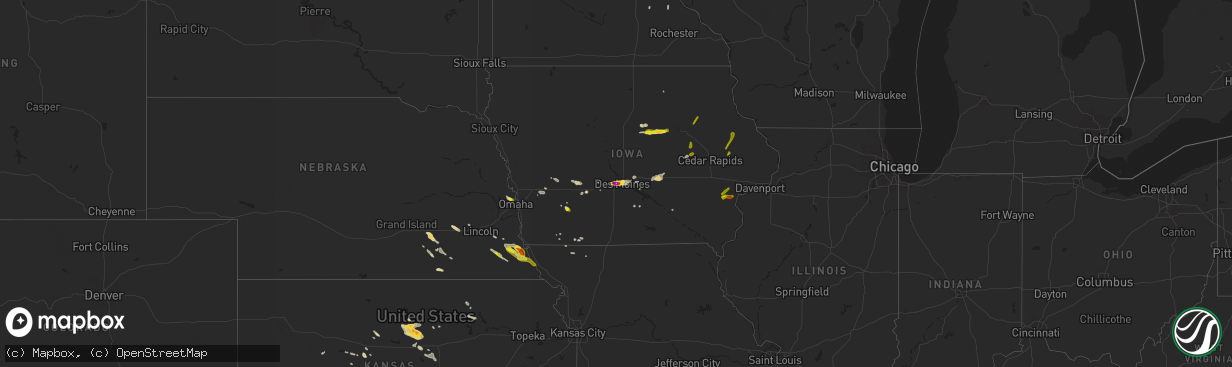
Hail Map on August 19, 2022
The weather event on August 19, 2022 includes Hail and Wind maps. 15 states and 186 cities were impacted and suffered possible damage. The total estimated number of properties impacted is 47,550.
Want more than just the map?
Turn this storm into a full workflow.
- Owner + property data so you know who to knock
- OnDemand branded weather history reports to win the "did we even have hail?" argument
- RoofTrace estimate so reps stop guessing numbers at the door
Bought this map? Upgrade within 7 days and we'll credit the $230. (10-15 min setup call)
Hail
Wind
47,550
Estimated number of impacted properties by a 1.00" hail or larger19,489
Estimated number of impacted properties by a 1.75" hail or larger9,704
Estimated number of impacted properties by a 2.50" hail or largerStates Impacted by Hail Map on August 19, 2022
Storm reports
Kentucky
| Date | Description |
|---|---|
| 08/18/20229:00 PM CDT | Trees were down all along highway 119 in and around tanyard hill. The road was blocked in places. |
Nebraska
| Date | Description |
|---|---|
| 08/19/20225:55 PM CDT | Quarter to half dollar size hail. Time estimated. |
| 08/19/20223:45 PM CDT | Several large branches down and nickel size hail. |
| 08/19/20223:38 PM CDT | Several trees down and one uprooted. |
| 08/19/20223:20 PM CDT | A local report indicates 1.25 inch wind near 5 NNW OMAHA |
| 08/19/20221:04 AM CDT | At 604 PM CDT, a severe thunderstorm was located 5 miles west of Tecumseh, moving southeast at 35 mph. HAZARD...Half dollar size hail. SOURCE...Radar indicated. IMPACT...Damage to vehicles is expected. This severe thunderstorm will be near... Tecumseh around 620 PM CDT.Other locations in the path of this severe thunderstorm include ElkCreek.People attending Johnson County Fair Grounds should seek safeshelter immediately! |
| 08/18/202210:12 PM CDT | At 312 PM CDT, a severe thunderstorm was located near Malcolm, or 9 miles east of Seward, moving southeast at 25 mph. HAZARD...60 mph wind gusts and quarter size hail. SOURCE...Radar indicated. IMPACT...Hail damage to vehicles is expected. Expect wind damage to roofs, siding, and trees. This severe thunderstorm will be near... Malcolm around 315 PM CDT. Raymond around 320 PM CDT. Emerald around 325 PM CDT. Lincoln Airport around 330 PM CDT.Other locations in the path of this severe thunderstorm includePioneers Park, Lincoln, Holmes Lake Park and Walton.People attending Lancaster Event Center should seek safe shelterimmediately!This includes Interstate 80 in Nebraska between mile markers 388 and409. |
| 08/18/202210:00 PM CDT | At 300 PM CDT, a severe thunderstorm was located over Lushton, or 14 miles southwest of York, moving southeast at 20 mph. HAZARD...60 mph wind gusts and quarter size hail. SOURCE...Radar indicated. IMPACT...Hail damage to vehicles is expected. Expect wind damage to roofs, siding, and trees. This severe thunderstorm will be near... Grafton around 315 PM CDT.Other locations in the path of this severe thunderstorm includeFairmont and Geneva. |
| 08/18/20229:31 PM CDT | At 231 PM CDT, a severe thunderstorm was located 3 miles southeast of Utica, or 10 miles west of Seward, moving southeast at 10 mph. HAZARD...Quarter size hail. SOURCE...Emergency management. IMPACT...Damage to vehicles is expected. Locations impacted include... Beaver Crossing, Goehner and Milford.This includes Interstate 80 in Nebraska between mile markers 366 and385. |
Idaho
| Date | Description |
|---|---|
| 08/19/20226:42 PM CDT | Wind gusts estimated 40mph. Lots of lightning. Caused loss of power to the entire community. |
| 08/19/202212:59 AM CDT | At 559 PM MDT, a severe thunderstorm was located over Chester, or 9 miles southwest of Ashton, moving northwest at 15 mph. HAZARD...Quarter size hail. SOURCE...Radar indicated. IMPACT...Damage to vehicles is expected. Locations impacted include... Teton, Chester, St Anthony, Newdale and northern Saint Anthony Sand Dunes. |
| 08/19/202212:39 AM CDT | At 539 PM MDT, a severe thunderstorm was located near Grace, or 8 miles west of Soda Springs, moving northwest at 20 mph. HAZARD...Quarter size hail. SOURCE...Radar indicated. IMPACT...Damage to vehicles is expected. Locations impacted include... Chesterfield Reservoir, Grace and Bancroft. |
| 08/19/202212:25 AM CDT | At 525 PM MDT, a severe thunderstorm was located 7 miles east of Teton, or 13 miles south of Ashton, moving northwest at 5 mph. HAZARD...Quarter size hail. SOURCE...Radar indicated. IMPACT...Damage to vehicles is expected. Locations impacted include... Teton, Chester and Newdale. |
| 08/19/202212:14 AM CDT | At 513 PM MDT, a severe thunderstorm was located near Ririe Reservoir, moving west at 10 mph. HAZARD...Quarter size hail. SOURCE...Radar indicated. IMPACT...Damage to vehicles is expected. Locations impacted include... Ririe Reservoir, Ririe and Heise. |
| 08/18/202210:46 PM CDT | At 346 PM MDT, a severe thunderstorm was located 11 miles east of Bone, or 13 miles west of Swan Valley, moving southwest at 10 mph. HAZARD...Quarter size hail. SOURCE...Radar indicated. IMPACT...Damage to vehicles is expected. Locations impacted include... Bone. |
| 08/18/20228:50 PM CDT | There were reports on social media about thunderstorm outflow winds that knocked down several large trees and power lines. Mccall airport recorded a peak wind gust of 4 |
| 08/18/20228:50 PM CDT | Mesonet station nrf inl naval reactors facility. |
| 08/18/20228:45 PM CDT | Mesonet station rov 9 ssw mud lake. |
Kansas
| Date | Description |
|---|---|
| 08/19/20223:54 PM CDT | Backyard mesonet weather station. |
| 08/19/20221:45 AM CDT | At 645 PM CDT, a severe thunderstorm was located over Walton, or 6 miles west of Peabody, moving southeast at 30 mph. HAZARD...60 mph wind gusts and quarter size hail. SOURCE...Radar indicated. IMPACT...Hail damage to vehicles is expected. Expect wind damage to roofs, siding, and trees. Locations impacted include... Newton, North Newton, Peabody, Whitewater, Potwin, Walton, Elbing, Burns and Newton Airport.This includes Interstate 135 between Mile Markers 23 and 35. |
| 08/19/202212:18 AM CDT | At 518 PM CDT, a severe thunderstorm was located near Lindsborg, moving southeast at 25 mph. HAZARD...60 mph wind gusts and penny size hail. SOURCE...Radar indicated. IMPACT...Expect damage to roofs, siding, and trees. Locations impacted include... Mcpherson, Lindsborg, Galva, Canton, Lehigh, Bridgeport and Roxbury.This includes Interstate 135 between Mile Markers 59 and 80. |
| 08/18/202211:44 PM CDT | At 443 PM CDT, a severe thunderstorm was located 5 miles west of Brookville, or 12 miles east of Kanopolis, moving southeast at 25 mph. HAZARD...60 mph wind gusts and quarter size hail. SOURCE...Radar indicated. IMPACT...Hail damage to vehicles is expected. Expect wind damage to roofs, siding, and trees. Locations impacted include... Lindsborg, Marquette, Brookville, Smolan, Falun, Kanopolis Lake and Kanopolis State Park. |
| 08/18/202210:54 PM CDT | At 354 PM CDT, a severe thunderstorm was located near Beverly, or 6 miles east of Lincoln, moving southeast at 20 mph. HAZARD...60 mph wind gusts and half dollar size hail. SOURCE...Radar indicated. IMPACT...Hail damage to vehicles is expected. Expect wind damage to roofs, siding, and trees. Locations impacted include... Lincoln, Beverly, Glendale and Westfall. This includes Interstate 70 between Mile Markers 229 and 249. |
| 08/18/202210:49 PM CDT | At 349 PM CDT, a severe thunderstorm was located 4 miles northwest of Beverly, moving southeast at 25 mph. HAZARD...Ping pong ball size hail and 60 mph wind gusts. SOURCE...Radar indicated. IMPACT...People and animals outdoors will be injured. Expect hail damage to roofs, siding, windows, and vehicles. Expect wind damage to roofs, siding, and trees. Locations impacted include... Tescott and Culver. |
| 08/18/202210:43 PM CDT | At 342 PM CDT, a severe thunderstorm was located 9 miles south of Alamota, moving south at 20 mph. HAZARD...60 mph wind gusts and quarter size hail. SOURCE...Radar indicated. IMPACT...Hail damage to vehicles is expected. Expect wind damage to roofs, siding, and trees. This severe thunderstorm will remain over mainly rural areas of northeastern Finney, southwestern Ness, northwestern Hodgeman and southeastern Lane Counties. |
| 08/18/202210:07 PM CDT | At 307 PM CDT, a severe thunderstorm was located near Victor, or 10 miles north of Lincoln, moving southeast at 25 mph. HAZARD...Quarter size hail. SOURCE...Radar indicated. IMPACT...Damage to vehicles is expected. Locations impacted include... Lincoln, Beverly, Barnard, Westfall and Ash Grove. This includes Interstate 70 between Mile Markers 229 and 230. |
| 08/18/20228:15 PM CDT | El dorado airport. |
Alabama
| Date | Description |
|---|---|
| 08/19/20226:05 PM CDT | At least one tall tree and several large tree limbs were knocked down at the monte sano campground. Time given by nearby measured wind gust. |
| 08/19/20226:05 PM CDT | *** 1 fatal *** a 22 year old male was killed after being struck by a large falling tree limb along bluff line trail at monte sano nature preserve near bankhead parkway |
| 08/19/202212:59 AM CDT | At 559 PM CDT, a severe thunderstorm was located near Gurley, or 7 miles east of Huntsville, moving northeast at 15 mph. HAZARD...60 mph wind gusts. SOURCE...Radar indicated. IMPACT...Expect damage to roofs, siding, and trees. Locations impacted include... Huntsville, Moores Mill, Gurley, Alabama A And M University, New Market, Maysville, Princeton, Plevna, Hampton Cove and Brownsboro. |
Iowa
| Date | Description |
|---|---|
| 08/19/20226:21 PM CDT | A local report indicates 1.00 inch wind near OELWEIN |
| 08/19/20225:03 PM CDT | Delayed report. |
| 08/19/20225:03 PM CDT | Corrects previous hail report from urbana. Delayed report. |
| 08/19/20223:56 PM CDT | Pea and quarter sized hail falling north of holland. |
| 08/19/20223:50 PM CDT | Ping pong ball sized hail north of grundy center. Time estimated from radar. Report from social media. |
| 08/19/20223:10 PM CDT | Quarter size hail reported. Time estimated from radar. |
| 08/19/20223:10 PM CDT | Report relayed by b |
| 08/19/20223:10 PM CDT | Report relayed by broadcast media. Time estimated from radar. |
| 08/19/20222:56 PM CDT | Report from mping: quarter |
| 08/19/20222:50 PM CDT | Report from mping: half dollar |
| 08/19/20222:50 PM CDT | Hail at least 1.5 to 2 inches with plenty of cars damaged at valley west mall. Time estimated from radar. |
| 08/19/20222:47 PM CDT | Report from mping: quarter |
| 08/19/20222:46 PM CDT | Two inch diameter hail reported near valley high school. Time estimated from radar. Report from social media. |
| 08/19/20222:45 PM CDT | Ping pong ball hail in west des moines. Time estimated from radar. Report from social media. |
| 08/19/20222:45 PM CDT | 3 inch hail stone measured at woi in west des moines. |
| 08/19/20222:45 PM CDT | Egg sized hail reported in west des moines. Time estimated by radar. |
| 08/19/20222:43 PM CDT | Dime up to golf-ball sized hail. |
| 08/19/20222:40 PM CDT | Woi5 storm team reports ping pong ball hail at studio. |
| 08/19/20222:40 PM CDT | Breaking car windshields. |
| 08/19/20222:40 PM CDT | 1.5 to 2 inch hail in clive. |
| 08/19/20222:33 PM CDT | Report from mping: quarter |
| 08/19/20224:19 AM CDT | At 919 PM CDT, a severe thunderstorm was located over Bald Bluff, or near Oquawka, moving northeast at 30 mph. HAZARD...60 mph wind gusts and quarter size hail. SOURCE...Radar indicated. IMPACT...Hail damage to vehicles is expected. Expect wind damage to roofs, siding, and trees. Locations impacted include... Monmouth, Oquawka, Burgess, Little York, Rozetta, Seaton, Lake Warren, Alexis, Coldbrook, Bald Bluff, Gerlaw, Monmouth Municipal Airport, Big River State Forest, Sunbeam, Delabar State Park and Eleanor. |
| 08/19/20223:46 AM CDT | At 845 PM CDT, severe thunderstorms were located along a line extending from near Langworthy to near Central Park to near Morley, moving northeast at 25 mph. HAZARD...60 mph wind gusts and quarter size hail. SOURCE...Fire Department. IMPACT...Hail damage to vehicles is expected. Expect wind damage to roofs, siding, and trees. Severe thunderstorms will be near... Langworthy and Central Park around 850 PM CDT. Monticello, Center Junction, Jones County Fairgrounds and Monticello Municipal Airport around 855 PM CDT. Scotch Grove, Pictured Rocks Wildlife Area and Camp Courageous around 900 PM CDT. Onslow and Hale around 905 PM CDT.Other locations in the path of these severe thunderstorms includeCascade, Wyoming, Oxford Junction and Temple Hill. |
| 08/19/20223:31 AM CDT | At 831 PM CDT, severe thunderstorms were located along a line extending from near Cranston to Fruitland to near Snively Access Campground, moving east at 40 mph. HAZARD...60 mph wind gusts. SOURCE...Radar indicated. IMPACT...Expect damage to roofs, siding, and trees. Locations impacted include... Muscatine, Wapello, Fruitland, Millersburg, New Boston, Grandview, Eliza, Joy, Letts, Illinois City, Fairport, Mannon, Edgington, Sand Springs, Cranston, New Era, Petersville, Ardon, Muscatine Municipal Airport and Loud Thunder Scout Camp. |
| 08/19/20222:38 AM CDT | At 738 PM CDT, a severe thunderstorm was located over Gladwin, or 7 miles northwest of Columbus Junction, moving east at 15 mph. HAZARD...Quarter size hail. SOURCE...Radar indicated. IMPACT...Damage to vehicles is expected. Locations impacted include... Columbus Junction, Conesville, Columbus City, Letts, Cotter, Fredonia, Cranston, Louisa County Fairgrounds and Gladwin. |
| 08/19/20222:31 AM CDT | At 731 PM CDT, a severe thunderstorm was located over Washington Airport, or over Washington, moving east at 20 mph. HAZARD...60 mph wind gusts and quarter size hail. SOURCE...Radar indicated. IMPACT...Hail damage to vehicles is expected. Expect wind damage to roofs, siding, and trees. Locations impacted include... Washington, Ainsworth, Haskins, Marr Park and Washington Airport. |
| 08/19/20221:28 AM CDT | At 627 PM CDT, a severe thunderstorm was located 8 miles northwest of Albia, moving east at 30 mph. HAZARD...60 mph wind gusts and quarter size hail. SOURCE...Radar indicated. IMPACT...Hail damage to vehicles is expected. Expect wind damage to roofs, siding, and trees. This severe thunderstorm will be near... Albia around 640 PM CDT.Other locations in the path of this severe thunderstorm includeEddyville. |
| 08/19/20221:05 AM CDT | At 605 PM CDT, a severe thunderstorm was located near Littleton, or 7 miles southwest of Oelwein, moving northeast at 25 mph. HAZARD...60 mph wind gusts and quarter size hail. SOURCE...Radar indicated. IMPACT...Hail damage to vehicles is expected. Expect wind damage to roofs, siding, and trees. Locations impacted include... Fairbank, Hazleton, Stanley, Fontana County Park, Fontana Park and Littleton. |
| 08/19/202212:44 AM CDT | At 544 PM CDT, a severe thunderstorm was located over Conesville, or 8 miles north of Columbus Junction, moving northeast at 25 mph. HAZARD...60 mph wind gusts and quarter size hail. SOURCE...Radar indicated. IMPACT...Hail damage to vehicles is expected. Expect wind damage to roofs, siding, and trees. This severe thunderstorm will be near... Cranston around 555 PM CDT.Other locations in the path of this severe thunderstorm includeNichols, Ardon, West Liberty, Saulsbury Bridge Campground, MuscatineCounty Fairgrounds and Atalissa. |
| 08/19/202212:36 AM CDT | At 536 PM CDT, a severe thunderstorm was located 11 miles southeast of Knoxville, moving northeast at 30 mph. HAZARD...60 mph wind gusts and quarter size hail. SOURCE...Radar indicated. IMPACT...Hail damage to vehicles is expected. Expect wind damage to roofs, siding, and trees. This severe thunderstorm will be near... Harvey around 545 PM CDT. Leighton around 555 PM CDT.Other locations in the path of this severe thunderstorm includeBeacon, Oskaloosa and University Park. |
| 08/18/202211:57 PM CDT | At 457 PM CDT, a severe thunderstorm was located over Rodgers Park, or near Vinton, moving northeast at 25 mph. HAZARD...60 mph wind gusts and half dollar size hail. SOURCE...Radar indicated. IMPACT...Hail damage to vehicles is expected. Expect wind damage to roofs, siding, and trees. This severe thunderstorm will be near... Rodgers Park and Benton County Fairgrounds around 500 PM CDT. Vinton and Vinton Memorial Airport around 505 PM CDT. Mount Auburn around 510 PM CDT. Minne Estema Park around 515 PM CDT.Other locations in the path of this severe thunderstorm includeUrbana, Cheney, Brandon, Lime Creek County Park and Spencers Grove. |
| 08/18/202211:40 PM CDT | At 440 PM CDT, a severe thunderstorm was located near Lake Icaria, or 9 miles north of Corning, moving southeast at 35 mph. HAZARD...60 mph wind gusts and quarter size hail. SOURCE...Radar indicated. IMPACT...Hail damage to vehicles is expected. Expect wind damage to roofs, siding, and trees. This severe thunderstorm will be near... Prescott around 455 PM CDT.Other locations in the path of this severe thunderstorm include GreenValley Lake, Cromwell, Green Valley Lake State Park, Creston, Kentand Creston Municipal Airport. |
| 08/18/202211:36 PM CDT | At 436 PM CDT, a severe thunderstorm was located near Brooklyn, or 15 miles southeast of Toledo, moving east at 35 mph. HAZARD...60 mph wind gusts and nickel size hail. SOURCE...Radar indicated. IMPACT...Expect damage to roofs, siding, and trees. This severe thunderstorm will be near... Victor, Victor and Hartwick around 445 PM CDT.This includes Interstate 80 between mile markers 195 and 204. |
| 08/18/202211:34 PM CDT | At 434 PM CDT, a severe thunderstorm was located near Melcher-Dallas, or 12 miles southwest of Knoxville, moving east at 15 mph. HAZARD...60 mph wind gusts and quarter size hail. SOURCE...Radar indicated. IMPACT...Hail damage to vehicles is expected. Expect wind damage to roofs, siding, and trees. This severe thunderstorm will be near... Melcher-Dallas around 445 PM CDT.Other locations in the path of this severe thunderstorm includeKnoxville Raceway, Knoxville Municipal Airport and Knoxville. |
| 08/18/202211:29 PM CDT | At 429 PM CDT, a severe thunderstorm was located over Keystone, or 11 miles southwest of Vinton, moving east at 10 mph. HAZARD...60 mph wind gusts and quarter size hail. SOURCE...Radar indicated. IMPACT...Hail damage to vehicles is expected. Expect wind damage to roofs, siding, and trees. Locations impacted include... Van Horne, Newhall and Benton County Fairgrounds. |
| 08/18/202211:26 PM CDT | At 426 PM CDT, a severe thunderstorm was located near the Iowa State Fairgrounds, or near Pleasant Hill, moving east at 20 mph. HAZARD...60 mph wind gusts and quarter size hail. SOURCE...Radar indicated. IMPACT...Hail damage to vehicles is expected. Expect wind damage to roofs, siding, and trees. This severe thunderstorm will be near... Pleasant Hill around 430 PM CDT. Altoona, Bondurant, Adventureland Amusement Park and Prairie Meadows around 435 PM CDT.Other locations in the path of this severe thunderstorm includeMitchellville and Valeria.This includes the following highways... Interstate 35 between mile markers 87 and 89. Interstate 80 between mile markers 135 and 153. Interstate 235 between mile markers 9 and 14. |
| 08/18/202211:03 PM CDT | At 403 PM CDT, a severe thunderstorm was located near Rock Creek Lake, or near Grinnell, moving east at 25 mph. HAZARD...60 mph wind gusts and quarter size hail. SOURCE...Radar indicated. IMPACT...Hail damage to vehicles is expected. Expect wind damage to roofs, siding, and trees. This severe thunderstorm will be near... Grinnell and Grinnell Regional Airport around 415 PM CDT.Other locations in the path of this severe thunderstorm includeMalcom.This includes Interstate 80 between mile markers 175 and 197. |
| 08/18/202210:55 PM CDT | At 354 PM CDT, a severe thunderstorm was located near Holland or 5 miles north of Grundy Center, moving east at 20 mph. HAZARD...Half dollar size hail. SOURCE...Radar indicated. IMPACT...Damage to vehicles is expected. Locations impacted include... Dike, Uni-Dome And McLeod Center, Hudson, Waterloo, Waterloo Municipal Airport and George Wyth State Park.This replaces the previous Severe Thunderstorm Warning issued for this thunderstorm. |
| 08/18/202210:17 PM CDT | At 317 PM CDT, a severe thunderstorm was located over Julian, or 8 miles north of Auburn, moving southeast at 35 mph. HAZARD...60 mph wind gusts and quarter size hail. SOURCE...Radar indicated. IMPACT...Hail damage to vehicles is expected. Expect wind damage to roofs, siding, and trees. This severe thunderstorm will be near... Auburn and Peru around 330 PM CDT.Other locations in the path of this severe thunderstorm includeNemaha and Brownville.People attending Johnson County Fair Grounds should seek safeshelter immediately! |
| 08/18/202210:09 PM CDT | At 308 PM CDT, a severe thunderstorm was located near Steamboat Rock, moving east at 20 mph. HAZARD...Half dollar size hail. SOURCE...Radar indicated. IMPACT...Damage to vehicles is expected. This severe thunderstorm will be near... Wellsburg around 325 PM CDT. Holland around 345 PM CDT. Grundy Center around 350 PM CDT.Other locations impacted by this severe thunderstorm includeSteamboat Rock, Wellsburg and Holland. |
| 08/18/202210:03 PM CDT | At 303 PM CDT, a severe thunderstorm was located 4 miles southeast of Avoca, or 13 miles west of Atlantic, moving east at 25 mph. HAZARD...60 mph wind gusts and quarter size hail. SOURCE...Radar indicated. IMPACT...Hail damage to vehicles is expected. Expect wind damage to roofs, siding, and trees. This severe thunderstorm will remain over mainly rural areas of northeastern Pottawattamie and south central Shelby Counties, including the following locations... Botna Bend Park.This includes Interstate 80 in Iowa between mile markers 40 and 48. |
| 08/18/202210:03 PM CDT | At 303 PM CDT, a severe thunderstorm was located over Colfax, or 11 miles west of Newton, moving east at 20 mph. HAZARD...60 mph wind gusts and half dollar size hail. SOURCE...Radar indicated. IMPACT...Hail damage to vehicles is expected. Expect wind damage to roofs, siding, and trees. This severe thunderstorm will be near... Prairie City Krohn Airport around 310 PM CDT.Other locations in the path of this severe thunderstorm includeNewton, Lambs Grove, Newton Municipal Airport, Iowa Speedway andKellogg.This includes Interstate 80 between mile markers 151 and 177. |
| 08/18/20229:36 PM CDT | At 236 PM CDT, a severe thunderstorm was located 3 miles west of Unadilla, or 20 miles east of Lincoln, moving east at 20 mph. HAZARD...60 mph wind gusts and quarter size hail. SOURCE...Radar indicated. IMPACT...Hail damage to vehicles is expected. Expect wind damage to roofs, siding, and trees. This severe thunderstorm will be near... Unadilla around 245 PM CDT.Other locations in the path of this severe thunderstorm includeSyracuse, Dunbar, Talmage and Lorton.This includes Interstate 29 between mile markers 10 and 15. |
| 08/18/20229:23 PM CDT | At 223 PM CDT, a severe thunderstorm was located over Windsor Heights, or near Urbandale, moving east at 35 mph. HAZARD...60 mph wind gusts and quarter size hail. SOURCE...Radar indicated. IMPACT...Hail damage to vehicles is expected. Expect wind damage to roofs, siding, and trees. This severe thunderstorm will be near... Saylorville, Iowa Events Center, Principal Park and Southridge Mall around 230 PM CDT. Des Moines, Ankeny and Margo Frankel Woods State Park around 235 PM CDT. Pleasant Hill, Carlisle, Iowa State Fairgrounds, Weh-Weh-Neh-Kee State Park and Ankeny Regional Airport around 240 PM CDT.Other locations in the path of this severe thunderstorm includeAltoona, Bondurant, Adventureland Amusement Park, Prairie Meadows,Mitchellville, Valeria, Colfax, Prairie City and Mingo.This includes the following highways... Interstate 35 between mile markers 66 and 72, and between milemarkers 87 and 93. Interstate 80 between mile markers 116 and 154. Interstate 235 between mile markers 1 and 14. |
| 08/18/20228:46 PM CDT | Tree down on fletcher. Time estimated from radar. |
| 08/18/20228:45 PM CDT | Wind gust estimated by morley fire chief. |
| 08/18/20228:35 PM CDT | Time estimated by radar. Report on social media of trees down and large tree branches broken. |
| 08/18/20227:33 PM CDT | Hail falling the past 10 minutes with most stones pea to nickel size. |
| 08/18/20227:24 PM CDT | Via amatuer radio. Occurring right now. |
| 08/18/20227:07 PM CDT | Report from mping: quarter |
| 08/18/20227:00 PM CDT | Delayed report via amateur radio. Trees down blocking the road on the north side of conesville. |
South Carolina
| Date | Description |
|---|---|
| 08/19/20226:58 PM CDT | Sc highway patrol reports a tree down at seaside rd and club bridge rd. Time estimated by radar. |
| 08/19/20226:55 PM CDT | Tree down on seaside rd. Time estimated by radar. |
| 08/19/20226:43 PM CDT | Tree down at pope ave and cordillo pkwy. Time estimated by radar. |
| 08/19/20226:14 PM CDT | Tree down on pinckney colony rd. Time estimated by radar. |
| 08/19/20226:14 PM CDT | Tree down on new riverside rd and myrtle ford rd. Time estimated by radar. |
| 08/19/20222:15 AM CDT | At 715 PM EDT, severe thunderstorms were located along a line extending from near Old House to Lemon Island to Bluffton, moving east at 30 mph. HAZARD...60 mph wind gusts and penny size hail. SOURCE...Radar indicated. IMPACT...Expect damage to trees and powerlines. Locations impacted include: Hilton Head Island, Bluffton, Beaufort, Port Royal, Bellinger Hill Area, Clarendon, Bennetts Point, Coosawhatchie, Gardens Corner, Rose Hill, Burton, Pritchardville, Ladys Island, Parris Island and Folly Field.This warning includes I-95 in South Carolina between mile markers 29and 30. |
| 08/19/202212:38 AM CDT | At 538 PM EDT, severe thunderstorms were located along a line extending from near Rocky Ford to near Register, moving east at 35 mph. HAZARD...60 mph wind gusts and quarter size hail. SOURCE...Radar indicated. IMPACT...Minor hail damage to vehicles is possible. Expect wind damage to trees and powerlines. Locations impacted include: Statesboro, Guyton, Brooklet, Newington, Oliver, Register, Rocky Ford, Egypt, Marlow, Shawnee, Dover, Pineora, Georgia Southern, Hopeulikit and Captolo. |
Georgia
| Date | Description |
|---|---|
| 08/19/20225:20 PM CDT | Tree down across the road.20 |
| 08/19/20225:20 PM CDT | Tree down across the road at the intersection of hwy 21 and old tusculum road. |
| 08/19/20225:00 PM CDT | Funnel cloud reported and trees down at plantation point drive and zettwell road. Penny to nickel size hail reported. |
| 08/19/20224:50 PM CDT | Trained spotter reported power poles snapped off at the intersection of georgia highway 24 and clito road. Time of event was estimated from radar data. |
| 08/19/20224:50 PM CDT | Trained spotter reported multiple trees snapped off and uprooted at the intersection of rough rider and clito roads. Some trees blocked this intersection. Time of event |
| 08/19/20224:45 PM CDT | Large tree down in the road near eagle road and hwy 73. |
| 08/19/20224:40 PM CDT | Quarter size hail reported at red fern plantation lodge... Ga. |
| 08/19/20223:27 PM CDT | Multiple trees down between 1200 and 1300 blocks of hill city road. |
| 08/19/20223:03 PM CDT | Tree down on outbuilding near the 1000 block of mountain loop road. |
| 08/19/20221:18 AM CDT | At 618 PM EDT, severe thunderstorms were located along a line extending from Kildare to near Springfield to near Blitchton, moving east at 45 mph. HAZARD...60 mph wind gusts and quarter size hail. SOURCE...Radar indicated. IMPACT...Minor hail damage to vehicles is possible. Expect wind damage to trees and powerlines. Locations impacted include: Hilton Head Island, Pooler, Bluffton, Beaufort, Port Royal, Ridgeland, Springfield, Bellinger Hill Area, Godley Station, Savannah International Airport, Clarendon, Jasper, Rincon, Port Wentworth and Hardeeville.This warning includes the following interstates: I-95 in South Carolina between mile markers 2 and 34. I-95 in Georgia between mile markers 107 and 112. |
| 08/18/202211:45 PM CDT | At 444 PM EDT, severe thunderstorms were located along a line extending from near Swainsboro to near Garfield, moving east at 30 mph. HAZARD...60 mph wind gusts and penny size hail. SOURCE...Radar indicated. IMPACT...Expect damage to trees and powerlines. Locations impacted include: Statesboro, Sylvania, Butts, Portal, Rocky Ford, Woodcliff, Altman, Hopeulikit, Captolo, Dover and Scarboro. |
| 08/18/202211:42 PM CDT | At 442 PM EDT, a severe thunderstorm was located near Swainsboro, moving east at 30 mph. HAZARD...60 mph wind gusts. SOURCE...Radar indicated. IMPACT...Expect damage to roofs, siding, and trees. Locations impacted include... Swainsboro, Twin City, Garfield, Nunez, Modoc, Canoochee and George L Smith State Park. |
| 08/18/202211:05 PM CDT | At 405 PM EDT, severe thunderstorms were located along a line extending from Meeks to near Minter, moving east at 25 mph. HAZARD...60 mph wind gusts. SOURCE...Radar indicated. IMPACT...Expect damage to roofs, siding, and trees. Locations impacted include... Swainsboro, Soperton, Adrian, Nunez, Tarrytown, Lothair, Covena, Orland, Rockledge, Orianna, Norristown, Minter, Norristown Junction, Meeks, Blackville, Zaidee, Gillis Springs, Scott and Barnhill. |
| 08/18/202210:50 PM CDT | At 350 PM EDT, a severe thunderstorm was located over Lake Marvin, or 12 miles northwest of Calhoun, moving east at 15 mph. HAZARD...60 mph wind gusts. SOURCE...Radar indicated. IMPACT...Expect damage to roofs, siding, and trees. Locations impacted include... Dalton, Calhoun, Resaca, Subligna, Suttles Mill, Villanow, Sugar Valley, Everett Springs, Lake Marvin and Oostanaula. |
Arizona
| Date | Description |
|---|---|
| 08/19/20227:28 AM CDT | At 1228 PM MST, a severe thunderstorm was located over Marana, and is nearly stationary. HAZARD...60 mph wind gusts and quarter size hail. SOURCE...Radar indicated. IMPACT...Hail damage to vehicles is expected. Expect wind damage to roofs, siding, and trees. Locations impacted include... Marana and Picture Rocks. |
| 08/19/20225:19 AM CDT | At 1019 PM MST, a severe thunderstorm was located 12 miles north of Wellton, or 22 miles east of Martinez Lake, moving southwest at 30 mph. HAZARD...60 mph wind gusts. SOURCE...Radar indicated. IMPACT...Expect damage to roofs, siding, and trees. Locations impacted include... Fortuna Foothills, Wellton, Blaisdell, Ligurta, Kinter and Roll. This includes the following highways...AZ Interstate 8 between mile markers 11 and 36.AZ Route 95 between mile markers 33 and 50. |
| 08/19/20222:25 AM CDT | At 725 PM MST, a severe thunderstorm was located near Wenden, or 28 miles south of Alamo Lake, moving south at 10 mph. HAZARD...60 mph wind gusts and penny size hail. SOURCE...Radar indicated. IMPACT...Expect damage to roofs, siding, and trees. Locations impacted include... Wenden, Salome and Harcuvar. This includes US Highway 60 between mile markers 54 and 73. |
| 08/19/20221:58 AM CDT | At 658 PM MST, a severe thunderstorm was located 35 miles west of Ajo, moving west at 10 mph. HAZARD...60 mph wind gusts. SOURCE...Radar indicated. IMPACT...Expect damage to roofs, siding, and trees. This severe thunderstorm will remain over mainly rural areas of southeastern Yuma County. |
| 08/19/202212:44 AM CDT | At 542 PM MST, a severe thunderstorm was located 10 miles southeast of Burro Creek Campground, or 18 miles northeast of Alamo Lake, moving south at 15 mph near Highway 93 south of Wikieup. HAZARD...Quarter size hail, winds up to 45 mph, and heavy rainfall. SOURCE...Radar indicated. IMPACT...Damage to vehicles is expected. This severe thunderstorm will remain over mainly rural areas of Yavapai County. |
| 08/19/202212:13 AM CDT | At 513 PM MST, a severe thunderstorm was located near Sonoran National Monument, or 10 miles east of Gila Bend, moving west at 10 mph. HAZARD...60 mph wind gusts and penny size hail. SOURCE...Radar indicated. IMPACT...Expect damage to roofs, siding, and trees. Locations impacted include... Gila Bend, Estrella, Bosque, Cotton Center and Sonoran National Monument.This includes the following highways...AZ Interstate 8 between mile markers 114 and 134.AZ Route 238 between mile markers 1 and 18.AZ Route 85 between mile markers 1 and 10, and between mile markers119 and 131. |
| 08/18/202210:48 PM CDT | At 347 PM MST, a severe thunderstorm was located 9 miles northwest of Kaka, or 27 miles southeast of Gila Bend, moving northwest at 10 mph. HAZARD...60 mph wind gusts. SOURCE...Radar indicated. IMPACT...Expect damage to roofs, siding, and trees. This severe thunderstorm will remain over mainly rural areas of Maricopa County. |
| 08/18/202210:02 PM CDT | At 301 PM MST, a severe thunderstorm was located over Seville, or near Gilbert, and is nearly stationary. HAZARD...60 mph wind gusts. SOURCE...Radar indicated. IMPACT...Expect damage to roofs, siding, and trees. Locations impacted include... Chandler, Gilbert, Sun Lakes, Queen Creek, Chandler Heights, Phoenix Mesa Gateway Airport, Seville, Sacaton, Santan and Higley.This includes the following highways...AZ Interstate 10 between mile markers 166 and 174.AZ Route 87 between mile markers 150 and 164.AZ Route 202 between mile markers 41 and 46. |
| 08/18/20229:35 PM CDT | At 235 PM MST, a severe thunderstorm was located near Florence Junction, or 7 miles south of Gold Canyon, moving west at 10 mph. HAZARD...60 mph wind gusts. SOURCE...Radar indicated. IMPACT...Expect damage to roofs, siding, and trees. Locations impacted include... Apache Junction, Queen Creek and Gold Camp. This includes US Highway 60 between mile markers 206 and 209. |
Wisconsin
| Date | Description |
|---|---|
| 08/19/20224:04 AM CDT | At 904 PM CDT, severe thunderstorms were located along a line extending from near Dyersville to near Cascade, moving northeast at 35 mph. HAZARD...60 mph wind gusts and quarter size hail. SOURCE...Radar indicated. IMPACT...Hail damage to vehicles is expected. Expect wind damage to roofs, siding, and trees. Severe thunderstorms will be near... Dyersville and New Wine Park around 910 PM CDT. New Vienna around 915 PM CDT. Farley, Luxemburg, Fillmore Recreation Area and Fillmore around 920 PM CDT.Other locations in the path of these severe thunderstorms includeHoly Cross, Bernard, Bankston, Bankston Park, Epworth, Cottage Hill,Five Points, Peosta, Rickardsville, Graf, Lattnerville, Camp LittleCloud, East Rickardsville, Dubuque, Sherrill, Centralia, Balltown,Waupeton, Dubuque County Fairgrounds, Swiss Valley Park, DubuqueRegional Airport, Asbury, Durango, Center Grove, Rockdale, Finley'sLanding Park, Key West and Mines of Spain. |
| 08/19/20222:17 AM CDT | At 716 PM CDT, a severe thunderstorm was located over Scales Mound, or 10 miles northeast of Galena, moving northeast at 15 mph. HAZARD...60 mph wind gusts and quarter size hail. SOURCE...Radar indicated. IMPACT...Hail damage to vehicles is expected. Expect wind damage to roofs, siding, and trees. Locations impacted include... Darlington, Shullsburg, New Diggings, Gratiot and Lead Mine. |
West Virginia
| Date | Description |
|---|---|
| 08/19/20223:01 PM CDT | Mcdowell county 911 advised there is a tree down in the town of welch. Time estimated by radar. |
| 08/19/20222:55 PM CDT | Mcdowell county 911 advised there is a tree down in the town of war. Time estimated by radar. |
| 08/18/202210:43 PM CDT | At 343 PM EDT, a severe thunderstorm was located over War, or 8 miles southwest of Welch, moving northeast at 15 mph. HAZARD...60 mph wind gusts and quarter size hail. SOURCE...Radar indicated. IMPACT...Hail damage to vehicles is expected. Expect wind damage to roofs, siding, and trees. Locations impacted include... Welch, Gary, War, Elbert, Cucumber and Coalwood. |
Utah
| Date | Description |
|---|---|
| 08/18/202211:27 PM CDT | At 427 PM MDT, a severe thunderstorm was located 14 miles southeast of Mantua, or 18 miles east of Brigham City, moving west at 20 mph. HAZARD...60 mph wind gusts and quarter size hail. SOURCE...Radar indicated. IMPACT...Hail damage to vehicles is expected. Expect wind damage to roofs, siding, and trees. Locations impacted include... Paradise, Nordic Valley, Powder Mountain, Avon, Liberty and Eden. |
| 08/18/202210:41 PM CDT | At 340 PM MDT, a severe thunderstorm was located near Holbrook Summit, or 13 miles west of Malad, moving north at 10 mph. HAZARD...Quarter size hail. SOURCE...Radar indicated. IMPACT...Damage to vehicles is expected. Locations impacted include... Pleasantview, Holbrook Summit, Holbrook and Daniels Reservoir. |
Illinois
| Date | Description |
|---|---|
| 08/19/20222:27 AM CDT | At 727 PM CDT, a severe thunderstorm was located over Hitt, or 9 miles west of Polo, moving northeast at 20 mph. HAZARD...60 mph wind gusts and quarter size hail. SOURCE...Radar indicated. IMPACT...Hail damage to vehicles is expected. Expect wind damage to roofs, siding, and trees. Locations impacted include... Lanark, Milledgeville, Shannon, Chadwick, Hitt and Carroll County Fairgrounds. |
| 08/19/20222:18 AM CDT | At 718 PM CDT, a severe thunderstorm was located over Scales Mound, or 10 miles northeast of Galena, moving northeast at 10 mph. HAZARD...60 mph wind gusts and quarter size hail. SOURCE...Radar indicated. IMPACT...Hail damage to vehicles is expected. Expect wind damage to roofs, siding, and trees. This severe thunderstorm will be near... Apple River around 730 PM CDT. |
| 08/19/20222:12 AM CDT | At 712 PM CDT, a severe thunderstorm was located over Muscatine Municipal Airport, or near Muscatine, moving east at 20 mph. HAZARD...60 mph wind gusts and quarter size hail. SOURCE...Law enforcement. IMPACT...Hail damage to vehicles is expected. Expect wind damage to roofs, siding, and trees. This severe thunderstorm will be near... Fruitland around 715 PM CDT.Other locations in the path of this severe thunderstorm includeMuscatine, Eliza and Illinois City. |
| 08/19/20221:25 AM CDT | At 625 PM CDT, a severe thunderstorm was located over Conesville, or near Columbus Junction, moving east at 15 mph. HAZARD...60 mph wind gusts and quarter size hail. SOURCE...Radar indicated. IMPACT...Hail damage to vehicles is expected. Expect wind damage to roofs, siding, and trees. This severe thunderstorm will be near... Cranston around 645 PM CDT.Other locations in the path of this severe thunderstorm includeLetts, Grandview, Sand Springs, Ardon, Muscatine Municipal Airport,Fruitland and Flaming Prairie Park. |
Florida
| Date | Description |
|---|---|
| 08/19/20224:50 PM CDT | Florida power and light reported fallen trees damage utility equipment on the south side of daytona north. The time of damage was based on radar. |
| 08/19/20221:47 AM CDT | At 646 PM EDT, a severe thunderstorm was located over Casselberry, and is nearly stationary. HAZARD...60 mph wind gusts. SOURCE...Radar indicated. IMPACT...Expect damage to roofs, siding, and trees. Locations impacted include... Orlando, Sanford, Apopka, Altamonte Springs and Oviedo. |
| 08/19/202212:40 AM CDT | At 540 PM EDT, a severe thunderstorm was located near Andalusia, moving east at 10 mph. HAZARD...60 mph wind gusts and quarter size hail. SOURCE...Radar indicated. IMPACT...Hail damage to vehicles is expected. Expect wind damage to roofs, siding, and trees. Locations impacted include... Crescent City, Andalusia and Espanola. |
Cities Impacted by Hail Map on August 19, 2022
- Henderson, NE
- Portland, TN
- Hays, KS
- Victoria, KS
- Clarinda, IA
- Lometa, TX
- Blockton, IA
- Parnell, MO
- Massena, IA
- Cumberland, IA
- Geneva, NE
- Hohenwald, TN
- Centerville, TN
- Syracuse, NE
- Utica, NE
- Beaver Crossing, NE
- Goehner, NE
- Seward, NE
- Keystone, IA
- Grafton, NE
- Sutton, NE
- Lynnville, IA
- Grinnell, IA
- Kellogg, IA
- McCracken, KS
- Pavillion, WY
- War, WV
- Berwind, WV
- Raysal, WV
- Paynesville, WV
- Pierson, FL
- Portal, GA
- Statesboro, GA
- Stuart, IA
- Menlo, IA
- West Des Moines, IA
- Clive, IA
- Windsor Heights, IA
- Urbandale, IA
- Des Moines, IA
- Ackley, IA
- Iowa Falls, IA
- Ashton, ID
- Newdale, ID
- Dighton, KS
- Naples, FL
- Palmyra, NE
- Nemaha, NE
- Auburn, NE
- Brownville, NE
- Deland, FL
- De Leon Springs, FL
- La Fayette, GA
- Armuchee, GA
- Summerville, GA
- Barnard, KS
- Lincoln, KS
- Holland, IA
- Grundy Center, IA
- Dike, IA
- Wellsburg, IA
- Cook, NE
- Talmage, NE
- Brock, NE
- Guthrie Center, IA
- Casey, IA
- Adair, IA
- Shickley, NE
- Davenport, NE
- Kissimmee, FL
- Sylvan Grove, KS
- Fontanelle, IA
- Aurora, NE
- Fairmont, NE
- Ottumwa, IA
- Hopkins, MO
- Palatka, FL
- Satsuma, FL
- Minneapolis, KS
- Garfield, GA
- Twin City, GA
- Dennison, MN
- Julian, NE
- Nebraska City, NE
- Marana, AZ
- Avoca, IA
- Pikeville, TN
- Green, KS
- Harlan, IA
- Steamboat Rock, IA
- Huntsville, UT
- Beloit, KS
- Hunter, KS
- La Crosse, KS
- Bison, KS
- Crescent City, FL
- Bunnell, FL
- Swainsboro, GA
- Riley, KS
- Corning, IA
- Reinbeck, IA
- Omaha, NE
- Bethpage, TN
- Bedford, IA
- Adel, IA
- Pleasant Dale, NE
- Garland, NE
- Charles City, IA
- Shelby, IA
- Hancock, IA
- Mitchellville, IA
- Colfax, IA
- Falun, KS
- Brookville, KS
- Lindsborg, KS
- Ellsworth, KS
- Seville, FL
- Beverly, KS
- Prairie City, IA
- Sterling, NE
- Goodhue, MN
- Johnson, NE
- Peru, NE
- Gentry, MO
- Murfreesboro, TN
- Lebanon, TN
- Waukee, IA
- Pleasant Hill, IA
- Altoona, IA
- Hebron, NE
- Metter, GA
- Deshler, NE
- Kimballton, IA
- Audubon, IA
- Elk Horn, IA
- Pfeifer, KS
- Strang, NE
- Ohiowa, NE
- Osceola, WI
- Jetmore, KS
- Riceboro, GA
- Alexandria, NE
- Tobias, NE
- Daykin, NE
- Grace, ID
- Paradise, KS
- Newton, IA
- Lacona, IA
- Leonardville, KS
- Windermere, FL
- Orlando, FL
- Greenleaf, KS
- Melcher Dallas, IA
- Knoxville, IA
- Tecumseh, NE
- Adams, NE
- Elk Creek, NE
- Sugar Valley, GA
- Adrian, GA
- Kite, GA
- Quinter, KS
- Beryl, UT
- Clay Center, KS
- Guyton, GA
- Fairfax, MO
- Falls City, NE
- Rock Port, MO
- Shubert, NE
- Vinton, IA
- Van Horne, IA
- Mount Auburn, IA
- Garrison, IA
- West Liberty, IA
- Conesville, IA
- Nichols, IA
- Lone Tree, IA
- Muscatine, IA
- Columbus Junction, IA
- Letts, IA
- Hazleton, IA
- Fairbank, IA
- Oelwein, IA
- Anamosa, IA
- Monticello, IA
- Worthington, IA
- Hopkinton, IA