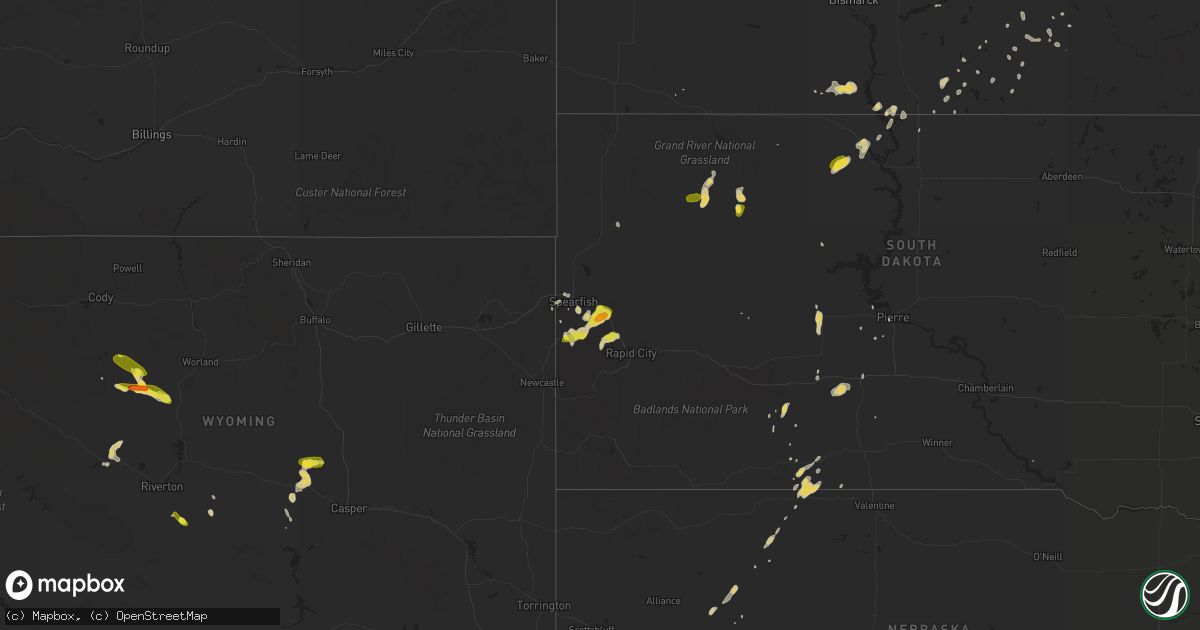
Hail Map on August 18, 2018
Get this storm
August 18 map
$229
one time, instant access
Download today. No call, no setup
Keep the $229
Bought the map and want the full workflow? Apply the entire $229 to a subscription within 7 days. None of it is wasted.
Every map, not just this one
This buys you this map. Subscription and you get every map we run, in the markets you choose from a few cities to whole states to nationwide. Plus real-time alerts the moment a storm fires.
Contact data
Name, contact info, occupancy, even credit band for addresses in the footprint. You go from where it hit to who to call.
Become the source they trust
Unlimited branding weather history reports on demand. You already have the documented answer ready for the property owner, and you are the one who showed up with it.
Property data and RoofTrace estimates
Pull up any address you have got, its value and the exact code rules for that jurisdiction, straight from One Click Code. Then RoofTrace estimates the squares, pitch, and roof value, priced the way you price.
States Impacted by Hail Map on August 18, 2018
Storm reports
North Dakota
| Date | Description |
|---|---|
| 08/18/20184:35 AM CDT | Very heavy rains and very strong winds impacted central melrose township... Flattening crops over several sections of farmland. Time estimated based on radar. |
| 08/18/20182:52 AM CDT | A few 3 to 5 inch diameter tree branches broken down at a number of homesites... Along with brief heavy rain and a few dime sized hail. |
| 08/18/20182:39 AM CDT | Deputy reported golf ball size hail. Relayed by dispatch. |
| 08/18/20182:36 AM CDT | Deputy reported golf ball size hail. Relayed by dispatch. |
Arizona
| Date | Description |
|---|---|
| 08/18/20186:58 PM CDT | A local report indicates 60 MPH wind near 2 SSE MIDDLE VERDE |
| 08/18/20184:22 PM CDT | Time lapse video shows narrow tornado at approximately 30 degree angle to the ground persisting for several minutes. |
| 08/17/201811:52 PM CDT | At 452 PM MST, a severe thunderstorm was located 7 miles west of Sunflower, moving south at 15 mph. HAZARD...60 mph wind gusts. SOURCE...Radar indicated. IMPACT...Expect damage to roofs, siding, and trees. Locations impacted include... Round Valley, Sugarloaf Mountain, Ballantine Trailhead and Rio Verde. |
| 08/17/201811:51 PM CDT | At 449 PM MST, a severe thunderstorm was located over Middle Verde and Camp Verde, moving south at 25 mph. HAZARD...60 mph wind gusts and penny size hail. SOURCE...Radar indicated. IMPACT...Expect damage to roofs, siding, and trees. Locations impacted include... Camp Verde, Montezuma Castle National Monument, Middle Verde, Mcguireville, Lake Montezuma and Clear Creek Campgrounds.This includes the following highways... Interstate 17 between mile markers 281 and 296. State Route 260 between mile markers 214 and 234. |
| 08/17/201811:08 PM CDT | At 408 PM MST, a severe thunderstorm was located near Clarkdale, or 12 miles west of Sedona, moving southeast at 20 mph. HAZARD...60 mph wind gusts and penny size hail. SOURCE...Radar indicated. IMPACT...Expect damage to roofs, siding, and trees. Locations impacted include... Clarkdale, Verde Village, Bridgeport, Cottonwood, Page Springs, Cornville, Dead Horse Ranch State Park and Tuzigoot National Monument.This includes the following highways... State Route 260 between mile markers 207 and 212. State Route 89A between mile markers 347 and 366. |
| 08/17/201810:51 PM CDT | At 350 PM MST, a severe thunderstorm was located 9 miles northeast of Cordes Lakes, or 14 miles southwest of Camp Verde, moving south at 15 mph. HAZARD...60 mph wind gusts and half dollar size hail. SOURCE...Radar indicated. IMPACT...Hail damage to vehicles is expected. Expect wind damage to roofs, siding, and trees. This severe thunderstorm will remain over mainly rural areas of Yavapai County, just east and northeast of Cordes Junction. |
| 08/17/201810:27 PM CDT | At 327 PM MST, a severe thunderstorm was located near Dairy Springs Campground, or 15 miles east of Sedona, moving southwest at 10 mph. HAZARD...60 mph wind gusts and quarter size hail. SOURCE...Radar indicated. IMPACT...Hail damage to vehicles is expected. Expect wind damage to roofs, siding, and trees. Locations impacted include... Mormon Lake, Munds Park, Dairy Springs Campground and Double Springs Campground.This includes Interstate 17 between mile markers 314 and 325. |
| 08/17/20189:46 PM CDT | At 245 PM MST, a severe thunderstorm was located near Dairy Springs Campground, or 14 miles southeast of Flagstaff, moving south at 10 mph. HAZARD...Quarter size hail. SOURCE...Radar indicated. IMPACT...Damage to vehicles is expected. Locations impacted include... Dairy Springs Campground, Mormon Lake, Upper Lake Mary, Double Springs Campground, Pinegrove Campground, Lake View Campground and Ashurst Lake Campgrounds. |
Kansas
| Date | Description |
|---|---|
| 08/18/20186:50 PM CDT | A local report indicates 58 MPH wind near 5 S TRIBUNE |
| 08/18/20186:50 PM CDT | House windows damaged. |
| 08/18/20186:30 PM CDT | Corrects previous tstm wnd gst report from tribune. Report of tree blown down. |
| 08/18/20186:30 PM CDT | A local report indicates 1.00 inch wind near TRIBUNE |
| 08/18/20186:20 PM CDT | A local report indicates 68 MPH wind near 1 WNW HORACE |
| 08/18/20186:03 PM CDT | A local report indicates 1.00 inch wind near LAKIN |
| 08/18/20186:00 PM CDT | A local report indicates 1.00 inch wind near 2 NW LAKIN |
| 08/18/20185:40 PM CDT | Report of a tornado touching down briefly. |
| 08/18/20185:17 PM CDT | Nickel to quarter size hail fell. |
| 08/18/20183:28 AM CDT | At 827 PM CDT, a severe thunderstorm was located 7 miles north of Hickok, moving east at 5 mph. HAZARD...Up to Two inch hail and 60 mph wind gusts. SOURCE...Radar indicated. IMPACT...People and animals outdoors will be injured. Expect hail damage to roofs, siding, windows, and vehicles. Expect wind damage to roofs, siding, and trees. Locations impacted include... Hickok. |
| 08/18/20182:38 AM CDT | At 738 PM CDT, a severe thunderstorm was located 11 miles north of Ulysses, and is nearly stationary. HAZARD...Up to Two inch hail and 60 mph wind gusts. SOURCE...Radar indicated. IMPACT...People and animals outdoors will be injured. Expect hail damage to roofs, siding, windows, and vehicles. Expect wind damage to roofs, siding, and trees. This severe thunderstorm will remain over mainly rural areas of southeastern Kearny and northeastern Grant Counties. |
| 08/18/20182:08 AM CDT | At 708 PM CDT, a severe thunderstorm was located 12 miles north of Ulysses, and is nearly stationary. HAZARD...Up to Golf ball size hail and 60 mph wind gusts. SOURCE...Radar indicated. IMPACT...People and animals outdoors will be injured. Expect hail damage to roofs, siding, windows, and vehicles. Expect wind damage to roofs, siding, and trees. This severe thunderstorm will remain over mainly rural areas of southwestern Kearny and northern Grant Counties. |
| 08/18/20181:58 AM CDT | At 658 PM CDT/558 PM MDT/, a severe thunderstorm was located 10 miles southeast of Tribune, moving southeast at 15 mph. HAZARD...Up to Golf ball size hail and 60 mph wind gusts. SOURCE...Radar indicated. IMPACT...People and animals outdoors will be injured. Expect hail damage to roofs, siding, windows, and vehicles. Expect wind damage to roofs, siding, and trees. Locations impacted include... Coolidge. |
| 08/18/201812:55 AM CDT | At 555 PM CDT, a severe thunderstorm was located near Lakin, and is nearly stationary. HAZARD...60 mph wind gusts and half dollar size hail. SOURCE...Radar indicated. IMPACT...Hail damage to vehicles is expected. Expect wind damage to roofs, siding, and trees. Locations impacted include... Lakin and Deerfield. |
| 08/18/201812:24 AM CDT | At 524 PM MDT, a severe thunderstorm was located 4 miles east of Towner, or 13 miles west of Tribune, moving southeast at 20 mph. HAZARD...Ping pong ball size hail and 60 mph wind gusts. SOURCE...Radar indicated. IMPACT...People and animals outdoors will be injured. Expect hail damage to roofs, siding, windows, and vehicles. Expect wind damage to roofs, siding, and trees. This severe thunderstorm will remain over mainly rural areas of southwestern Greeley County. |
| 08/17/201811:43 PM CDT | At 443 PM MDT, a severe thunderstorm was located 8 miles north of Horace, or 9 miles north of Tribune, moving south at 30 mph. HAZARD...60 mph wind gusts and half dollar size hail. SOURCE...Radar indicated. IMPACT...Hail damage to vehicles is expected. Expect wind damage to roofs, siding, and trees. Locations impacted include... Tribune and Horace. |
| 08/17/20189:42 PM CDT | At 242 PM MDT, a severe thunderstorm was located 6 miles northwest of Sharon Springs, and is nearly stationary. HAZARD...60 mph wind gusts and quarter size hail. SOURCE...Radar indicated. IMPACT...Hail damage to vehicles is expected. Expect wind damage to roofs, siding, and trees. Locations impacted include... Sharon Springs. |
| 08/17/20188:49 PM CDT | Hen egg sized hail reported from earlier storm by a phone call 10 miles northeast of ulysses. |
| 08/17/20188:18 PM CDT | Quarter sized hail reported by em. |
| 08/17/20187:55 PM CDT | Quarter sized hail reported by em. |
| 08/17/20187:54 PM CDT | Multi-vortex briefly touched down northwest of ulysses spotted by storm chaser. |
| 08/17/20187:42 PM CDT | Quarter sized hail reported. |
| 08/17/20187:15 PM CDT | Quarter size hail reported by public. |
New Jersey
| Date | Description |
|---|---|
| 08/18/20181:44 AM CDT | At 643 PM EDT, a severe thunderstorm was located over Pleasant Plains, or over Toms River, moving east at 25 mph. HAZARD...60 mph wind gusts. SOURCE...Radar indicated. IMPACT...Damage to roofs, siding, trees, and power lines is possible. This severe thunderstorm will be near... Brick Township around 655 PM EDT. Seaside Heights, Mantoloking, Dover Beaches South and Dover Beaches North around 700 PM EDT. Point Pleasant Beach around 705 PM EDT.Other locations impacted by this severe thunderstorm include SilverRidge, Island Heights, Point Pleasant, Holiday Heights, Gilford Park,South Toms River, Bay Head, Holiday City and Leisure Knoll. |
| 08/18/20181:17 AM CDT | At 617 PM EDT, a severe thunderstorm was located near Browns Mills, or 18 miles west of Toms River, moving east at 25 mph. HAZARD...60 mph wind gusts. SOURCE...Radar indicated. IMPACT...Damage to roofs, siding, trees, and power lines is possible. This severe thunderstorm will be near... Woodruff around 625 PM EDT. Cedar Glen Lakes and Whiting around 640 PM EDT. Lakehurst around 650 PM EDT. Jackson, Cedar Glen West and Pine Ridge At Crestwood around 655 PM EDT. Toms River, Lakewood, Beachwood, Leisure Village West-Pine Lake Park, Holiday City-Berkeley, Pleasant Plains, Holiday City South, Leisure Village and Leisure Village East around 700 PM EDT.Other locations impacted by this severe thunderstorm include SilverRidge, Leisure Knoll, Holiday Heights, Crestwood Village, South TomsRiver, Holiday City, Island Heights, New Egypt and Fort Dix. |
| 08/17/20189:46 PM CDT | At 246 AM EDT, a severe thunderstorm was located near Beachwood, or near Toms River, moving east at 45 mph. HAZARD...60 mph wind gusts and penny size hail. SOURCE...Radar indicated. IMPACT...Damage to roofs, siding, trees, and power lines is possible. Locations impacted include... Toms River, Barnegat, Beachwood, Seaside Heights, Dover Beaches North, Dover Beaches South, Holiday City South, South Toms River, Island Heights, Gilford Park, Waretown, Holiday Heights and Ocean Acres. |
South Dakota
| Date | Description |
|---|---|
| 08/18/20184:02 PM CDT | A local report indicates 1.00 inch wind near 1 NNW PIEDMONT |
| 08/18/20183:41 PM CDT | A local report indicates 1.00 inch wind near 4 NNW TILFORD |
| 08/18/20183:32 PM CDT | A local report indicates 1.00 inch wind near 5 SSE WHITEWOOD |
| 08/18/20183:20 PM CDT | A local report indicates 1.00 inch wind near 3 ESE GALENA |
| 08/18/20182:30 PM CDT | Delayed report. Social media image shows hail of at least quarter size. |
| 08/18/20182:49 AM CDT | At 749 PM MDT, a severe thunderstorm was located near Spring Lake, or 18 miles south of Mclaughlin, moving northeast at 25 mph. HAZARD...60 mph wind gusts and quarter size hail. SOURCE...Radar indicated. IMPACT...Hail damage to vehicles is expected. Expect wind damage to roofs, siding, and trees. Locations impacted include... Spring Lake and Little Eagle. |
| 08/17/20189:59 PM CDT | At 259 PM MDT, a severe thunderstorm was located over Piedmont, or 11 miles northwest of Rapid City, moving northeast at 20 mph. HAZARD...Quarter size hail. SOURCE...Radar indicated. IMPACT...Damage to vehicles is expected. Locations impacted include... Summerset, Black Hawk, Piedmont and Dalton Lake. This Includes Interstate 90 in South Dakota between Mile Markers 42and 52. |
| 08/17/20189:12 PM CDT | At 212 PM MDT, a severe thunderstorm was located 3 miles southwest of Fort Meade, or 4 miles south of Sturgis, moving northeast at 20 mph. HAZARD...60 mph wind gusts and half dollar size hail. SOURCE...Radar indicated. IMPACT...Hail damage to vehicles is expected. Expect wind damage to roofs, siding, and trees. Locations impacted include... Sturgis, Tilford, Apple Springs, Bear Butte State Park and Fort Meade.This Includes Interstate 90 in South Dakota between Mile Markers 28and 41. |
Florida
| Date | Description |
|---|---|
| 08/18/20186:50 PM CDT | Nws volunteer reported a tree down at terrell road and lem turner road. Multiple limbs on the roadway. Pea size hail was also observed during the storm. |
| 08/18/20182:39 AM CDT | At 738 PM EDT, a severe thunderstorm was located near Jacksonville International Arpt, moving southeast at 5 mph. HAZARD...Quarter size hail. SOURCE...Radar indicated. IMPACT...Damage to vehicles is expected. Locations impacted include... Jacksonville, Jacksonville International Arpt, Cisco Gardens, Oceanway, San Marco, Riverside and Tallyrand. |
| 08/18/20182:35 AM CDT | At 735 PM EDT, a severe thunderstorm was located over Middleburg, and is nearly stationary. HAZARD...Quarter size hail. SOURCE...Radar indicated. IMPACT...Damage to vehicles is expected. Locations impacted include... Middleburg, Doctors Inlet, Lakeside, Oakleaf Plantation, Bellair-Meadowbrook Terrace, Penney Farms and Asbury Lake. |
Colorado
| Date | Description |
|---|---|
| 08/18/20181:38 PM CDT | A local report indicates 1.00 inch wind near 5 SSW ELLICOTT |
| 08/18/20181:38 PM CDT | A local report indicates 1.00 inch wind near 4 N PEYTON |
| 08/18/20187:35 AM CDT | At 1235 PM MDT, a severe thunderstorm was located near Peyton, or 26 miles northeast of Colorado Springs, moving southeast at 25 mph. HAZARD...60 mph wind gusts and half dollar size hail. SOURCE...Radar indicated. IMPACT...Hail damage to vehicles is expected. Expect wind damage to roofs, siding, and trees. Locations impacted include... Calhan, Ramah and Peyton. |
| 08/18/20185:10 AM CDT | At 1009 PM MDT, a severe thunderstorm was located near Erie, or 24 miles north of Denver, moving southeast at 30 mph. HAZARD...60 mph wind gusts and quarter size hail. SOURCE...Radar indicated. IMPACT...Expect damage to roofs, siding, and trees. Hail damage to vehicles is expected. Locations impacted include... Thornton, northeastern Westminster, eastern Longmont, northeastern Broomfield, Commerce City, Northglenn, Brighton, Lafayette, Erie, Firestone, Frederick, Fort Lupton, Lochbuie, Dacono, Barr Lake and Niwot. |
| 08/18/201812:53 AM CDT | At 553 PM MDT, a severe thunderstorm was located near Bristol, or 10 miles east of Lamar, moving northeast at 10 mph. HAZARD...60 mph wind gusts and half dollar size hail. SOURCE...Radar indicated. IMPACT...Hail damage to vehicles is expected. Expect wind damage to roofs, siding, and trees. Locations impacted include... Holly, Granada, Hartman and Bristol. |
| 08/18/201812:16 AM CDT | At 515 PM MDT, a severe thunderstorm was located 9 miles northwest of Two Buttes Reservoir, or 23 miles south of Lamar, moving northeast at 30 mph. HAZARD...Ping pong ball size hail and 60 mph wind gusts. SOURCE...Radar indicated. IMPACT...People and animals outdoors will be injured. Expect hail damage to roofs, siding, windows, and vehicles. Expect wind damage to roofs, siding, and trees. Locations impacted include... Two Buttes Reservoir. |
| 08/17/201811:01 PM CDT | At 400 PM MDT, a severe thunderstorm was located 11 miles southeast of Weskan, or 13 miles south of Sharon Springs, moving south at 20 mph. HAZARD...60 mph wind gusts and half dollar size hail. SOURCE...Radar indicated. IMPACT...Hail damage to vehicles is expected. Expect wind damage to roofs, siding, and trees. This severe thunderstorm will remain over mainly rural areas of northern Greeley County. |
| 08/17/201810:44 PM CDT | At 344 PM MDT, a severe thunderstorm was located 7 miles southwest of Sharon Springs, moving south at 10 mph. HAZARD...60 mph wind gusts and half dollar size hail. SOURCE...Radar indicated. IMPACT...Hail damage to vehicles is expected. Expect wind damage to roofs, siding, and trees. Locations impacted include... Sharon Springs, Weskan and Wallace. |
| 08/17/201810:23 PM CDT | At 322 PM MDT, a severe thunderstorm was located 16 miles north of Bethune, or 17 miles north of Stratton, moving northeast at 10 mph. HAZARD...60 mph wind gusts and half dollar size hail. SOURCE...Radar indicated. IMPACT...Hail damage to vehicles is expected. Expect wind damage to roofs, siding, and trees. This severe thunderstorm will remain over mainly rural areas of south central Yuma and north central Kit Carson Counties.This includes Highway 385 between mile markers 203 and 209, and nearmile marker 211. |
| 08/17/201810:21 PM CDT | At 320 PM MDT, a severe thunderstorm was located 10 miles west of Trinchera, or 17 miles east of Trinidad, moving east at 30 mph. HAZARD...60 mph wind gusts and half dollar size hail. SOURCE...Radar indicated. IMPACT...Hail damage to vehicles is expected. Expect wind damage to roofs, siding, and trees. Locations impacted include... Branson and Trinchera. |
| 08/17/201810:04 PM CDT | At 304 PM MDT, a severe thunderstorm was located 5 miles east of Weskan, or 6 miles west of Sharon Springs, moving south at 15 mph. HAZARD...Ping pong ball size hail and 60 mph wind gusts. SOURCE...Radar indicated. IMPACT...People and animals outdoors will be injured. Expect hail damage to roofs, siding, windows, and vehicles. Expect wind damage to roofs, siding, and trees. Locations impacted include... Sharon Springs and Weskan. |
| 08/17/20189:12 PM CDT | At 212 PM MDT, a severe thunderstorm was located near Aguilar, or 13 miles northwest of Trinidad, moving southeast at 15 mph. HAZARD...70 mph wind gusts and ping pong ball size hail. SOURCE...Radar indicated. IMPACT...People and animals outdoors will be injured. Expect hail damage to roofs, siding, windows, and vehicles. Expect considerable tree damage. Wind damage is also likely to mobile homes, roofs, and outbuildings. Locations impacted include... Trinidad, Starkville, Model and Hoehne. |
| 08/17/20188:49 PM CDT | At 148 PM MDT, a severe thunderstorm was located near Aguilar, or 23 miles north of Trinidad, moving southeast at 15 mph. HAZARD...60 mph wind gusts and half dollar size hail. SOURCE...Radar indicated. IMPACT...Hail damage to vehicles is expected. Expect wind damage to roofs, siding, and trees. This severe thunderstorm will remain over mainly rural areas of east central Huerfano and central Las Animas Counties. |
Oklahoma
| Date | Description |
|---|---|
| 08/18/20185:33 PM CDT | Damage reported at winstar |
| 08/18/20182:15 PM CDT | A local report indicates 58 MPH wind near 4 NW WALTERS |
| 08/18/201812:08 AM CDT | At 507 PM CDT, a severe thunderstorm was located 4 miles northwest of Dickson, moving east at 15 mph. HAZARD...60 mph wind gusts and quarter size hail. SOURCE...Radar indicated. IMPACT...Hail damage to vehicles is expected. Expect wind damage to roofs, siding, and trees. Locations impacted include... Ardmore, Dickson, Mannsville, Springer, Gene Autry and northern Lake Murray. |
| 08/17/201811:51 PM CDT | At 451 PM CDT, a severe thunderstorm was located 4 miles north of Ardmore, moving east at 20 mph. HAZARD...60 mph wind gusts and quarter size hail. SOURCE...Radar indicated. IMPACT...Hail damage to vehicles is expected. Expect wind damage to roofs, siding, and trees. Locations impacted include... Ardmore, Lone Grove, Dickson, Springer, Gene Autry and northern Lake Murray. |
| 08/17/201811:19 PM CDT | At 419 PM MDT, a severe thunderstorm was located 11 miles west of Kenton, or 29 miles north of Clayton, moving southeast at 25 mph. HAZARD...60 mph wind gusts and quarter size hail. SOURCE...Radar indicated. IMPACT...Hail damage to vehicles is expected. Expect wind damage to roofs, siding, and trees. Locations impacted include... Seneca and Moses. |
| 08/17/201810:44 PM CDT | At 344 PM CDT, severe thunderstorms were located along a line extending from 3 miles east of Bray to near Velma to 7 miles north of Oscar, moving northeast at 15 mph. HAZARD...60 mph wind gusts and quarter size hail. SOURCE...Radar indicated. IMPACT...Hail damage to vehicles is expected. Expect wind damage to roofs, siding, and trees. Locations impacted include... Duncan, Marlow, Bray, Ringling, Velma, Loco and Cornish. |
| 08/17/201810:00 PM CDT | At 259 PM CDT, severe thunderstorms were located along a line extending from near Duncan to near Addington, moving east at 20 mph. HAZARD...Ping pong ball size hail and 60 mph wind gusts. SOURCE...Radar indicated. IMPACT...People and animals outdoors will be injured. Expect hail damage to roofs, siding, windows, and vehicles. Expect wind damage to roofs, siding, and trees. Locations impacted include... Duncan, Marlow, Comanche, Bray, Velma, Loco, Addington and Empire City. |
| 08/17/20189:24 PM CDT | At 223 PM CDT, a severe thunderstorm was located near Walters, moving east at 20 mph. Winds of 58 mph have been reported just northwest of Walters. HAZARD...60 mph wind gusts and quarter size hail. SOURCE...Radar indicated. IMPACT...Hail damage to vehicles is expected. Expect wind damage to roofs, siding, and trees. Locations impacted include... Duncan, Walters, Comanche, Temple, Addington, Waurika Lake, Corum and Empire City. |
Massachusetts
| Date | Description |
|---|---|
| 08/18/20184:43 PM CDT | Tree down across road on back river road. |
| 08/18/20184:30 PM CDT | 8 ft inflatable with outboard captized on a mooring in marion harbor. |
| 08/18/20182:20 PM CDT | Tree down near berry corner road blocking half the street and tree down on caroll hill road. |
| 08/18/201812:59 PM CDT | Wires down due to large limb |
| 08/18/201812:31 PM CDT | Tree down with wires. |
| 08/17/201810:19 PM CDT | At 318 PM EDT, a severe thunderstorm was located over Charlton, or 12 miles southwest of Worcester, moving east at 25 mph. HAZARD...60 mph wind gusts and quarter size hail. SOURCE...Radar indicated. IMPACT...Hail damage to vehicles is possible. Expect damage to trees and power lines. Locations impacted include... Grafton, Webster, Auburn, Oxford, Millbury, Charlton, Dudley, Sutton and Douglas. |
| 08/17/20189:07 PM CDT | At 207 PM EDT, severe thunderstorms were located along a line extending from near Sandisfield to near Millerton, moving east at 20 mph. HAZARD...60 mph wind gusts. SOURCE...Radar indicated. IMPACT...Expect damage to roofs, siding, and trees. Severe thunderstorms will be near... Sandisfield around 220 PM EDT. Norfolk around 245 PM EDT. Torrington around 250 PM EDT. Winsted around 310 PM EDT. |
| 08/17/20188:49 PM CDT | At 148 PM EDT, a severe thunderstorm was located over Hadley, or near Amherst, moving east at 30 mph. HAZARD...60 mph wind gusts and quarter size hail. SOURCE...Radar indicated. IMPACT...Hail damage to vehicles is possible. Expect damage to trees and power lines and localized flooding. Locations impacted include... Amherst, Belchertown, Ware, Barre, Hadley, West Brookfield, Sunderland, Hatfield, Hardwick, Leverett, Shutesbury, Pelham, Petersham, New Braintree and New Salem. |
| 08/17/20188:37 PM CDT | At 137 PM EDT, a severe thunderstorm was located over Red Hook, or near Saugerties, moving east at 25 mph. HAZARD...60 mph wind gusts and quarter size hail. SOURCE...Radar indicated. IMPACT...Hail damage to vehicles is expected. Expect wind damage to roofs, siding, and trees. This severe thunderstorm will be near... Red Hook around 140 PM EDT. Clermont around 145 PM EDT. Pine Plains and Ancram around 210 PM EDT. Copake around 220 PM EDT. Millerton around 225 PM EDT. |
New York
| Date | Description |
|---|---|
| 08/18/20181:10 PM CDT | Tree and powerlines down. |
| 08/18/20189:25 AM CDT | House damage to one house including damage to porch... Some siding ripped off... Blown in window fans and air conditioner |
Texas
| Date | Description |
|---|---|
| 08/18/20186:49 PM CDT | Large tree down in irving |
| 08/18/20186:41 PM CDT | Tree limbs down near intersection of park and custer. |
| 08/18/20186:27 PM CDT | Corrected for wind gust speed. Wind gust to 60 mph observed at denton enterprise airport |
| 08/18/20185:11 PM CDT | A least one trailer flipped upside down with damage to 3 others. Trees down. |
| 08/18/20183:51 PM CDT | Apparent microburst at dell city west texas mesonet site. |
| 08/18/20182:50 AM CDT | At 750 PM CDT, a severe thunderstorm was located near Frisco, moving northeast at 15 mph. HAZARD...60 mph wind gusts and nickel size hail. SOURCE...Radar indicated. IMPACT...Expect damage to roofs, siding, and trees. Locations impacted include... Plano, McKinney, Frisco, Allen, Prosper, Anna, Fairview, Princeton, Celina, Lucas, Parker, Van Alstyne, Lowry Crossing, Melissa, New Hope, Weston and Westminster. |
| 08/18/20181:25 AM CDT | At 624 PM CDT, a severe thunderstorm was located near Coppell, and is nearly stationary. Another severe storm was located near Grand Prairie and was also stationary. HAZARD...60 mph wind gusts and quarter size hail. SOURCE...Radar indicated. IMPACT...Hail damage to vehicles is expected. Expect wind damage to roofs, siding, and trees. Locations impacted include... Dallas, Irving, Grand Prairie, Carrollton, Euless, Grapevine, Coppell, Farmers Branch, University Park, Addison, Highland Park and Cockrell Hill.This includes the following interstates... Interstate 35E between mile markers 430 and 445. Interstate 30 between mile markers 32 and 44. |
| 08/18/201812:53 AM CDT | At 552 PM CDT, a severe thunderstorm was located 7 miles southeast of Windthorst, and is nearly stationary. HAZARD...60 mph wind gusts and quarter size hail. SOURCE...Radar indicated. IMPACT...Hail damage to vehicles is expected. Expect wind damage to roofs, siding, and trees. Locations impacted include... Shannon. |
| 08/18/201812:53 AM CDT | At 552 PM CDT, a severe thunderstorm was located near Sanger, moving southeast at 5 mph. HAZARD...60 mph wind gusts and quarter size hail. SOURCE...Radar indicated. IMPACT...Hail damage to vehicles is expected. Expect wind damage to roofs, siding, and trees. Locations impacted include... Denton, Sanger, Krum and Ponder. This includes the following interstates... Interstate 35 between mile markers 468 and 481. |
| 08/18/201812:41 AM CDT | At 541 PM CDT, a severe thunderstorm was located over Bowie, moving north at 5 mph. HAZARD...60 mph wind gusts and nickel size hail. SOURCE...Radar indicated. IMPACT...Expect damage to roofs, siding, and trees. Locations impacted include... Bowie, Stoneburg and Sunset. |
| 08/18/201812:40 AM CDT | At 540 PM CDT/440 PM MDT/, a severe thunderstorm was located near Carlsbad Caverns National Park, or 19 miles northeast of Pine Springs, and is nearly stationary. HAZARD...60 mph wind gusts and quarter size hail. SOURCE...Radar indicated. IMPACT...Hail damage to vehicles is expected. Expect wind damage to roofs, siding, and trees. Locations impacted include... Carlsbad Caverns National Park and Whites City. |
| 08/18/201812:38 AM CDT | At 538 PM CDT, a severe thunderstorm was located near Thackerville, and is nearly stationary. HAZARD...60 mph wind gusts and quarter size hail. SOURCE...Radar indicated. IMPACT...Hail damage to vehicles is expected. Expect wind damage to roofs, siding, and trees. Locations impacted include... Thackerville. |
| 08/17/201811:41 PM CDT | At 441 PM CDT, a severe thunderstorm was located 7 miles southwest of Sunset, or 10 miles south of Bowie, and is nearly stationary. HAZARD...60 mph wind gusts and penny size hail. SOURCE...Radar indicated. IMPACT...Expect damage to roofs, siding, and trees. Locations impacted include... Sunset. |
| 08/17/201811:00 PM CDT | A local report indicates 63 MPH wind near 2 SSW MULESHOE |
| 08/17/20188:17 PM CDT | Metal barn damaged |
| 08/17/20188:05 PM CDT | 3 to 6-inch diameter tree branches down along highway 455 between celina and weston. |
Missouri
| Date | Description |
|---|---|
| 08/18/20186:05 AM CDT | A nws survey determined that an ef-0 tornado struck a barn resulting in damage to the roof. Time estimated by radar. |
Arkansas
| Date | Description |
|---|---|
| 08/18/20181:40 AM CDT | At 640 PM CDT, a severe thunderstorm was located near Jones, or 7 miles south of Wilmot, moving east at 15 mph. HAZARD...60 mph wind gusts and half dollar size hail. SOURCE...Radar indicated. IMPACT...Hail damage to vehicles is expected. Expect wind damage to roofs, siding, and trees. Locations impacted include... Lake Providence, Oak Grove, Shelburn, Gassoway, Millikin and Kilbourne. |
| 08/18/20181:05 AM CDT | At 605 PM CDT, a severe thunderstorm was located near Galion, or 12 miles east of Bastrop, moving southeast at 15 mph. A second severe thunderstorm was located just east of Bonita. HAZARD...60 mph wind gusts and quarter size hail. SOURCE...Radar indicated. IMPACT...Hail damage to vehicles is expected. Expect wind damage to roofs, siding, and trees. This severe thunderstorm will be near... Goodwill around 635 PM CDT.Other locations impacted by this severe thunderstorm include MerRouge. |
Georgia
| Date | Description |
|---|---|
| 08/18/20181:17 AM CDT | At 617 PM EDT, a severe thunderstorm was located 5 miles northwest of Elberton, moving east at 35 mph. HAZARD...60 mph wind gusts. SOURCE...Radar indicated. IMPACT...Expect damage to trees and power lines. Locations impacted include... Elberton, Calhoun Falls, Iva, Bowman, Lake Secession, Lowndesville, Russell State Park, Middleton, Lake Russell and Antreville. |
| 08/18/20181:05 AM CDT | At 605 PM EDT, a severe thunderstorm was located near Covington, moving east at 35 mph. HAZARD...60 mph wind gusts. SOURCE...Radar indicated. IMPACT...Expect damage to roofs, siding, and trees. Locations impacted include... Covington, Madison, Social Circle, Oxford, Rutledge, Newborn, Mansfield, Bostwick, Buckhead, Ebenezer, Starrsville, Hard Labor Creek State Park, Brick Store, Herndonville, Farrar and Apalachee. |
Mississippi
| Date | Description |
|---|---|
| 08/18/20184:30 PM CDT | Tree downed across main street. Estimated 40-50 mph wind. |
| 08/18/20181:20 PM CDT | Tree downed on cr 373. Estimated 40-50 mph gust. |
| 08/18/20182:17 AM CDT | At 716 PM CDT, a severe thunderstorm was located over Mcnair, or 20 miles east of Natchez, moving west at 10 mph. HAZARD...60 mph wind gusts and quarter size hail. SOURCE...Radar indicated. IMPACT...Hail damage to vehicles is possible. Expect wind damage to roofs, siding, and trees. Locations impacted include... Fayette, Hamburg, Mcnair and Stampley. |
| 08/18/20181:18 AM CDT | At 618 PM CDT, a severe thunderstorm was located over Mccall Creek, or 15 miles west of Brookhaven, moving southwest at 5 mph. HAZARD...60 mph wind gusts and quarter size hail. SOURCE...Radar indicated. IMPACT...Hail damage to vehicles is possible. Expect wind damage to roofs, siding, and trees. Locations impacted include... Mccall Creek, Little Springs and New Hope. |
Wyoming
| Date | Description |
|---|---|
| 08/17/201811:12 PM CDT | At 412 PM MDT, a severe thunderstorm was located 8 miles northwest of Thermopolis, moving southeast at 30 mph. HAZARD...Quarter size hail. SOURCE...Radar indicated. IMPACT...Damage to vehicles is expected. This severe thunderstorm will be near... Lucerne around 425 PM MDT. Thermopolis and Hot Springs State Park around 430 PM MDT.Other locations impacted by this severe thunderstorm include HotSprings County Fairgrounds, Hot Sprgs County Thermopolis Airport andLegion Town And Country Golf Course. |
| 08/17/201810:52 PM CDT | At 352 PM MDT, a severe thunderstorm was located over Sand Draw, or 21 miles southeast of Riverton, moving east at 25 mph. HAZARD...60 mph wind gusts and half dollar size hail. SOURCE...Radar indicated. IMPACT...Hail damage to vehicles is expected. Expect wind damage to roofs, siding, and trees. This severe thunderstorm will remain over mainly rural areas of southeastern Fremont County. |
| 08/17/201810:51 PM CDT | At 350 PM MDT, a severe thunderstorm was located over Legend Rock State Petroglyph Site, or 20 miles northwest of Thermopolis, moving southeast at 25 mph. HAZARD...Two inch hail. SOURCE...Radar indicated. IMPACT...People and animals outdoors will be injured. Expect damage to roofs, siding, windows, and vehicles. This severe thunderstorm will remain over mainly rural areas of central Hot Springs County, including the following locations... Hot Sprgs County Thermopolis Airport and Legion Town And Country Golf Course. |
| 08/17/201810:32 PM CDT | At 331 PM MDT, a severe thunderstorm was located 9 miles west of Legend Rock State Petroglyph Site, or 24 miles south of Meeteetse, moving southeast at 25 mph. HAZARD...Ping pong ball size hail. SOURCE...Radar indicated. IMPACT...People and animals outdoors will be injured. Expect damage to roofs, siding, windows, and vehicles. This severe thunderstorm will be near... Legend Rock State Petroglyph Site and Anchor Dam around 345 PM MDT. Hamilton Dome around 350 PM MDT. |
| 08/17/20189:10 PM CDT | At 209 PM MDT, severe thunderstorms were located along a line extending from 14 miles southeast of Anchor Dam to 8 miles northwest of Fort Washakie, moving southeast at 20 mph. HAZARD...60 mph wind gusts and quarter size hail. SOURCE...Radar indicated. IMPACT...Hail damage to vehicles is expected. Expect wind damage to roofs, siding, and trees. Severe thunderstorms will be near... Fort Washakie around 240 PM MDT. Lander and Milford around 300 PM MDT.Other locations impacted by these severe thunderstorms includeWyoming Indian Elementary School, Midvale, Sinks Canyon Campground,Riverton Regional Airport, Pavillion Natural Gas Processing Plant andLander Hunt Field. |
New Mexico
| Date | Description |
|---|---|
| 08/18/20186:55 PM CDT | A local report indicates 1.00 inch wind near 2 E GLORIETA |
| 08/18/20184:12 PM CDT | A local report indicates 70 MPH wind near 11 WNW MAXWELL |
| 08/18/20187:57 AM CDT | At 1257 PM MDT, a severe thunderstorm was located over Frijoles, or near Los Alamos, moving southeast at 20 mph. HAZARD...60 mph wind gusts and quarter size hail. SOURCE...Radar indicated. IMPACT...Hail damage to vehicles is expected. Expect wind damage to roofs, siding, and trees. Locations impacted include... Southwestern Santa Fe, Los Alamos, White Rock, La Cienega, Frijoles, La Bajada, Bandelier National Monument and Cochiti Lake.This includes Interstate 25 between Mile Markers 265 and 282. |
| 08/18/20182:48 AM CDT | At 748 PM MDT, a severe thunderstorm was located 4 miles southeast of Cuchillo, moving southeast at 20 mph. HAZARD...60 mph wind gusts and quarter size hail. SOURCE...Radar indicated. IMPACT...Hail damage to vehicles is expected. Expect wind damage to roofs, siding, and trees. Locations impacted include... Upper Palomas Canyon... San Miguel... Cuchillo... and Lower Palomas Canyon. |
| 08/18/20182:04 AM CDT | At 703 PM MDT, severe thunderstorms were located along a line extending from 5 miles north of Monticello to 19 miles north of City of Elephant Butte to 20 miles south of Bosque Del Apache Refuge, moving south at 20 mph. HAZARD...60 mph wind gusts. SOURCE...Radar indicated. IMPACT...Expect damage to roofs, siding, and trees. Locations impacted include... City of Elephant Butte... Elephant Butte Lake... Rock House... North Monticello Point... Ash Canyon... Rock Canyon... South Monticello Campground... Hot Springs Landing... Lost Canyon... Lakeshore Highlands... and Truth or Consequences. |
| 08/18/201812:31 AM CDT | At 531 PM MDT, severe thunderstorms were located along a line extending from 6 miles southwest of Bueyeros to near Solano to 14 miles southwest of Roy, moving south to southeast at 35 mph. HAZARD...60 mph wind gusts and penny size hail. SOURCE...Radar indicated. IMPACT...Expect damage to roofs, siding, and trees. Locations impacted include... Mosquero, Solano and Bell Ranch. |
| 08/17/201811:43 PM CDT | At 443 PM MDT, a severe thunderstorm was located near Chicosa Lake State Park, or 27 miles northwest of Mosquero, moving southeast at 30 mph. HAZARD...60 mph wind gusts and quarter size hail. SOURCE...Radar indicated. IMPACT...Hail damage to vehicles is expected. Expect wind damage to roofs, siding, and trees. Locations impacted include... Roy, Mills, Chicosa Lake State Park, Solano and Yates. |
| 08/17/201810:12 PM CDT | At 311 PM MDT, a severe thunderstorm was located 9 miles northwest of Maxwell, or 17 miles north of Springer, moving southeast at 25 mph. HAZARD...60 mph wind gusts and quarter size hail. SOURCE...Radar indicated. IMPACT...Hail damage to vehicles is expected. Expect wind damage to roofs, siding, and trees. Locations impacted include... Maxwell.This includes Interstate 25 between Mile Markers 422 and 426. |
| 08/17/201810:05 PM CDT | At 305 PM MDT, a severe thunderstorm was located over Philmont Scout Ranch, or 23 miles northwest of Springer, moving southeast at 15 mph. HAZARD...60 mph wind gusts and quarter size hail. SOURCE...Radar indicated. IMPACT...Hail damage to vehicles is expected. Expect wind damage to roofs, siding, and trees. Locations impacted include... Cimarron, Philmont Scout Ranch, Rayado and Miami. |
| 08/17/20189:58 PM CDT | At 258 PM MDT, a severe thunderstorm was located near Raton Crews Airport, or 16 miles south of Raton, moving southeast at 15 mph. HAZARD...60 mph wind gusts and quarter size hail. SOURCE...Radar indicated. IMPACT...Hail damage to vehicles is expected. Expect wind damage to roofs, siding, and trees. Locations impacted include... Maxwell and Raton Crews Airport. This includes Interstate 25 between Mile Markers 425 and 440. |
| 08/17/20189:18 PM CDT | At 218 PM MDT, a severe thunderstorm was located 19 miles northeast of Ute Park, or 26 miles west of Raton, moving south at 10 mph. HAZARD...60 mph wind gusts and quarter size hail. SOURCE...Radar indicated. IMPACT...Hail damage to vehicles is expected. Expect wind damage to roofs, siding, and trees. This severe thunderstorm will remain over mainly rural areas of northwestern Colfax County. |
| 08/17/20188:59 PM CDT | At 159 PM MDT, a severe thunderstorm was located near Questa, moving southeast at 20 mph. HAZARD...60 mph wind gusts and quarter size hail. SOURCE...Radar indicated. IMPACT...Hail damage to vehicles is expected. Expect wind damage to roofs, siding, and trees. Locations impacted include... Questa, Angel Fire, Eagle Nest, Taos Ski Valley, Cimarron Canyon State Park, Eagle Nest Lake State Park, Vietnam Veterans Memorial State Park, Arroyo Seco, Valdez and San Cristobal. |
District of Columbia
| Date | Description |
|---|---|
| 08/17/20189:22 PM CDT | At 221 AM EDT, a severe thunderstorm was located over Great Falls, or near American Legion Bridge, moving east at 40 mph. HAZARD...60 mph wind gusts. SOURCE...Radar indicated. IMPACT...Damaging winds will cause some trees and large branches to fall. This could injure those outdoors, as well as damage homes and vehicles. Roadways may become blocked by downed trees. Localized power outages are possible. Unsecured light objects may become projectiles. Locations impacted include... Germantown, Rockville, Bethesda, Gaithersburg, Reston, Olney, Langley Park, Vienna, Lowes Island, Pimmit Hills, Poolesville, Mclean, American Legion Bridge, Aspen Hill, Potomac, North Bethesda, Oakton, Montgomery Village, North Potomac and Tysons Corner. |
South Carolina
| Date | Description |
|---|---|
| 08/18/20186:52 PM CDT | The south carolina highway patrol reports a tree down on wire road near the showa denko plant. |
| 08/18/20186:50 PM CDT | The south carolina highway patrol reports a tree down near the i-26 and us-15 interchange. |
| 08/18/20186:33 PM CDT | Tree down on powerlines near the intersection of heaton and independent school roads. |
| 08/18/20186:18 PM CDT | The south carolina highway patrol reports a tree down near the intersection of lodge highway and us-21. |
| 08/18/20186:15 PM CDT | The south carolina highway patrol reports a tree down on lodge highway. |
| 08/18/20182:24 AM CDT | At 724 PM EDT, severe thunderstorms were located along a line extending from 13 miles southwest of Saint George to 6 miles southeast of Walterboro, moving northeast at 20 mph. HAZARD...60 mph wind gusts. SOURCE...Radar indicated. IMPACT...Minor hail damage to vehicles is possible. Expect wind damage to trees and powerlines. Locations impacted include... North Charleston, Summerville, Walterboro, Middleton Place, Indian Field, Archdale, Slands Bridge and Givhans Ferry State Park.This warning includes... I-26 between mile markers 171 and 189. I-95 in South Carolina between mile markers 55 and 84. |
| 08/17/20187:07 PM CDT | Tree limb fell on a car on west creswell ave. |
Louisiana
| Date | Description |
|---|---|
| 08/18/20181:59 AM CDT | At 659 PM CDT, a severe thunderstorm was located 9 miles west of Clarks, or 13 miles west of Columbia, and is nearly stationary. HAZARD...60 mph wind gusts and penny size hail. SOURCE...Radar indicated. IMPACT...Expect damage to roofs, siding, and trees. Locations impacted include... Clarks, Grayson, Spaulding, Kelly and Burlington. |
| 08/18/20181:42 AM CDT | At 642 PM CDT, a severe thunderstorm was located near Rayville, moving east at 15 mph. HAZARD...60 mph wind gusts and quarter size hail. SOURCE...Radar indicated. IMPACT...Hail damage to vehicles is possible. Expect wind damage to roofs, siding, and trees. This severe thunderstorm will be near... Holly Ridge around 715 PM CDT. Warden around 745 PM CDT.Other locations impacted by this severe thunderstorm include OakRidge. |
| 08/18/201812:06 AM CDT | At 505 PM CDT, a severe thunderstorm was located over Omega, or 7 miles northeast of Tallulah, moving northeast at 15 mph. HAZARD...60 mph wind gusts and quarter size hail. SOURCE...Radar indicated. IMPACT...Hail damage to vehicles is expected. Expect wind damage to roofs, siding, and trees. This severe thunderstorm will be near... Alsatia around 515 PM CDT. Eagle Bend around 530 PM CDT. |
North Carolina
| Date | Description |
|---|---|
| 08/18/20183:13 PM CDT | 2 trees down near the intersection of county line road and st luke church road. |
| 08/18/20185:53 AM CDT | At 1053 PM EDT, severe thunderstorms were located along a line extending from near North Carolina Zoo to 12 miles southeast of Seagrove to 7 miles south of Biscoe, moving east at 35 mph. HAZARD...60 mph wind gusts. SOURCE...Radar indicated. IMPACT...Expect damage to roofs, siding, and trees. Locations impacted include... Sanford, Southern Pines, Carthage, North Carolina Zoo, Pinehurst, Biscoe, Goldston, Seagrove, Whispering Pines and Broadway. |
| 08/18/20185:17 AM CDT | At 1016 PM EDT, severe thunderstorms were located along a line extending from 10 miles west of North Carolina Zoo to 7 miles southwest of Seagrove to 6 miles southeast of Albemarle, moving east at 40 mph. HAZARD...60 mph wind gusts. SOURCE...Radar indicated. IMPACT...Expect damage to roofs, siding, and trees. Locations impacted include... Asheboro, Albemarle, Southern Pines, Troy, Carthage, Badin Lake, North Carolina Zoo, Siler City, Pinehurst and Biscoe. |
| 08/18/20184:13 AM CDT | At 913 PM EDT, a severe thunderstorm was located over Sanford, moving east at 30 mph. HAZARD...60 mph wind gusts. SOURCE...Radar indicated. IMPACT...Expect damage to roofs, siding, and trees. Locations impacted include... Sanford, Lillington, Fuquay-Varina, Angier, Holly Springs, Broadway, Lemon Springs, Gum Springs, Raven Rock State Park and Olivia. |
| 08/17/201811:03 PM CDT | At 403 PM EDT, a severe thunderstorm was located 7 miles northeast of Shelby, or near Waco, moving east at 25 mph. HAZARD...60 mph wind gusts and penny size hail. SOURCE...Radar indicated. IMPACT...Expect damage to trees and power lines. Locations impacted include... Gastonia, Cherryville, Bessemer City, Dallas, Stanley, Lowell, Ranlo, High Shoals, Fallston and Waco. |
| 08/17/201810:28 PM CDT | Tree down on carthage rd at seven lakes dr. |
| 08/17/201810:00 PM CDT | Very large tree down on bethlehem church rd... Blocking the road... Near scotch burying rd. |
| 08/17/201810:00 PM CDT | Tree down on bethlehem church rd and mount carmel rd. |
| 08/17/20188:40 PM CDT | Lee co 911 reports that several trees were downed across the county... Particularly across the eastern and western portions of the county. |
Connecticut
| Date | Description |
|---|---|
| 08/18/20182:05 PM CDT | Tree down at torringford east street and rock creek lane |
| 08/18/20181:18 PM CDT | Tree down at millerton road and mudge pond road |
Cities Impacted by Hail Map on August 18, 2018
- Waverly, GA
- Elbert, CO
- Calhan, CO
- Peyton, CO
- Nemo, SD
- Deadwood, SD
- Reynolds, ND
- Strasburg, ND
- Pollock, SD
- Fort Pierre, SD
- Pecos, NM
- Ribera, NM
- Santa Fe, NM
- Glorieta, NM
- Littlefork, MN
- Oak Grove, LA
- Comanche, OK
- Erie, CO
- Longmont, CO
- Lafayette, CO
- Sterling, CO
- Otis, CO
- Tuthill, SD
- Tribune, KS
- Flagstaff, AZ
- Hatton, ND
- Sedona, AZ
- Fort Worth, TX
- Trinidad, CO
- Thermopolis, WY
- San Jon, NM
- Logan, NM
- Mosquero, NM
- Ulysses, KS
- Emerado, ND
- Mayer, AZ
- Jeffrey City, WY
- Ramah, CO
- Weed, NM
- McLaughlin, SD
- Trail City, SD
- Bard, NM
- Cotopaxi, CO
- Albany, TX
- Crook, CO
- Cody, NE
- Dickey, ND
- Selfridge, ND
- Fort Yates, ND
- Olla, LA
- Meadow, SD
- Gackle, ND
- Montpelier, ND
- Wishek, ND
- Stroud, OK
- Davenport, OK
- Chandler, OK
- Duncan, OK
- Raton, NM
- Boulder, CO
- Walsenburg, CO
- Valdez, NM
- San Cristobal, NM
- Spearman, TX
- Lakin, KS
- Big Falls, MN
- Bowie, TX
- Punta Gorda, FL
- Trementina, NM
- Lead, SD
- Manvel, ND
- Lehr, ND
- Lamar, CO
- Las Animas, CO
- Akron, CO
- White River, SD
- Okaton, SD
- Hayes, SD
- Midland, SD
- Arapahoe, CO
- Natchez, MS
- Fort Morgan, CO
- Conchas Dam, NM
- Colorado Springs, CO
- Celeste, TX
- Mer Rouge, LA
- Rayville, LA
- Oak Ridge, LA
- Oakley, KS
- International Falls, MN
- Loman, MN
- Sharon Springs, KS
- Weskan, KS
- Leoti, KS
- Syracuse, KS
- Jermyn, TX
- Loving, TX
- Bryson, TX
- Graham, TX
- Plano, TX
- Gurley, NE
- Mekinock, ND
- Larimore, ND
- Grand Forks, ND
- Arvilla, ND
- Grand Forks Afb, ND
- Northwood, ND
- Mormon Lake, AZ
- Brookhaven, MS
- McCall Creek, MS
- Meadville, MS
- Gainesville, TX
- Sanger, TX
- Pavillion, WY
- Kinnear, WY
- Hermitage, AR
- Bison, SD
- Kulm, ND
- Dupree, SD
- Anna, TX
- Celina, TX
- Mckinney, TX
- Van Alstyne, TX
- Woodbine, GA
- Monument, CO
- Larkspur, CO
- Wing, ND
- Sturgis, SD
- Fort Meade, SD
- Agate, CO
- Cimarron, NM
- Ashley, ND
- Ville Platte, LA
- Washington, LA
- Brunswick, GA
- Cheyenne, WY
- Granite Canon, WY
- Gilby, ND
- Black Canyon City, AZ
- Wanblee, SD
- Kirk, CO
- Joes, CO
- Bingham, NE
- North Richland Hills, TX
- Prescott, AZ
- Jacksboro, TX
- Windthorst, TX
- Henrietta, TX
- Wellington, CO
- Stratton, CO
- Scott City, KS
- Kit Carson, CO
- Spearfish, SD
- Whitewood, SD
- Holly, CO
- Capitan, NM
- Tinnie, NM
- Vona, CO
- Grand Prairie, TX
- Arlington, TX
- Casper, WY
- Trinchera, CO
- Fort Myers, FL
- Lovington, NM
- Ellsworth, NE
- Jacksonville, FL
- Grassy Butte, ND
- Kim, CO
- Pritchett, CO
- Driscoll, ND
- Kingsland, GA
- Hilliard, FL
- Yulee, FL
- Oshkosh, NE
- Kendall, KS
- Deer Trail, CO
- Byers, CO
- Belvidere, SD
- North Fort Myers, FL
- Turkey, TX
- Walters, OK
- Cape Coral, FL
- Grafton, ND
- Killdeer, ND
- Mandaree, ND
- Ardmore, OK
- Haxtun, CO
- Lodgepole, NE
- Fayette, MS
- Roxie, MS
- Breckenridge, TX
- Zeeland, ND
- Wakpala, SD
- Vega, TX
- Idabel, OK
- Glenwood, GA
- Grenville, NM
- Lewisville, TX
- Carrollton, TX
- Ponder, TX
- Krum, TX
- Sunset, TX
- Chico, TX
- Crescent, OK
- Guthrie, OK
- Roy, NM
- Cooperstown, ND
- Chidester, AR
- Piedmont, SD
- Rapid City, SD
- Black Hawk, SD
- Camden, AR
- Garita, NM
- Solano, NM
- Cypress, TX
- Houston, TX
- Springer, NM
- Mills, NM
- Iowa, LA
- Fleming, CO
- Yuma, CO
- Tallulah, LA
- Kabetogama, MN
- Wolfe City, TX
- Greenville, TX
- Aneta, ND
- Binford, ND
- Port Charlotte, FL
- Spiritwood, ND
- Marlow, OK
- Mcville, ND
- Tomball, TX
- Marion Junction, AL
- Bixby, OK
- Glenpool, OK
- Bismarck, ND
- East Grand Forks, MN
- Melissa, TX
- Buxton, ND
- Climax, MN
- Bonita, LA
- Warren, AR
- Cooper, TX
- Jones, LA
- Truth Or Consequences, NM
- Grayson, LA
- Jud, ND
- Edgeley, ND
- Dallas, TX
- The Colony, TX
- Frisco, TX
- Cornville, AZ
- Wimbledon, ND
- Bethune, CO
- Bastrop, LA
- Hamburg, AR
- Lake Charles, LA
- Era, TX
- Saint Francis, SD
- Rosston, TX
- Decatur, TX
- Burlington, CO
- Douglass, TX
- Charlton, MA
- Murdo, SD
- Sedgwick, CO
- Lake Creek, TX
- Wilmot, AR
- Hope, ND
- Goodridge, MN
- Thief River Falls, MN
- Hannaford, ND
- Luverne, ND
- Clarksville, TX
- Sidney, NE
- Monroe, LA
- Grady, NM
- Prosper, TX
- Regan, ND
- Baldwin, ND
- Fredonia, ND
- Irving, TX
- Coppell, TX
- Dorchester, SC
- Saint George, SC
- Tarrytown, GA
- Soperton, GA
- Herreid, SD
- Middleburg, FL
- Hague, ND
- Merriman, NE
- Meeteetse, WY
- Bellevue, TX
- Moscow, KS
- Temple, OK
- Finley, ND
- Wagon Mound, NM
- Broadview, NM
- Lake Providence, LA
- Aguilar, CO
- Worland, WY