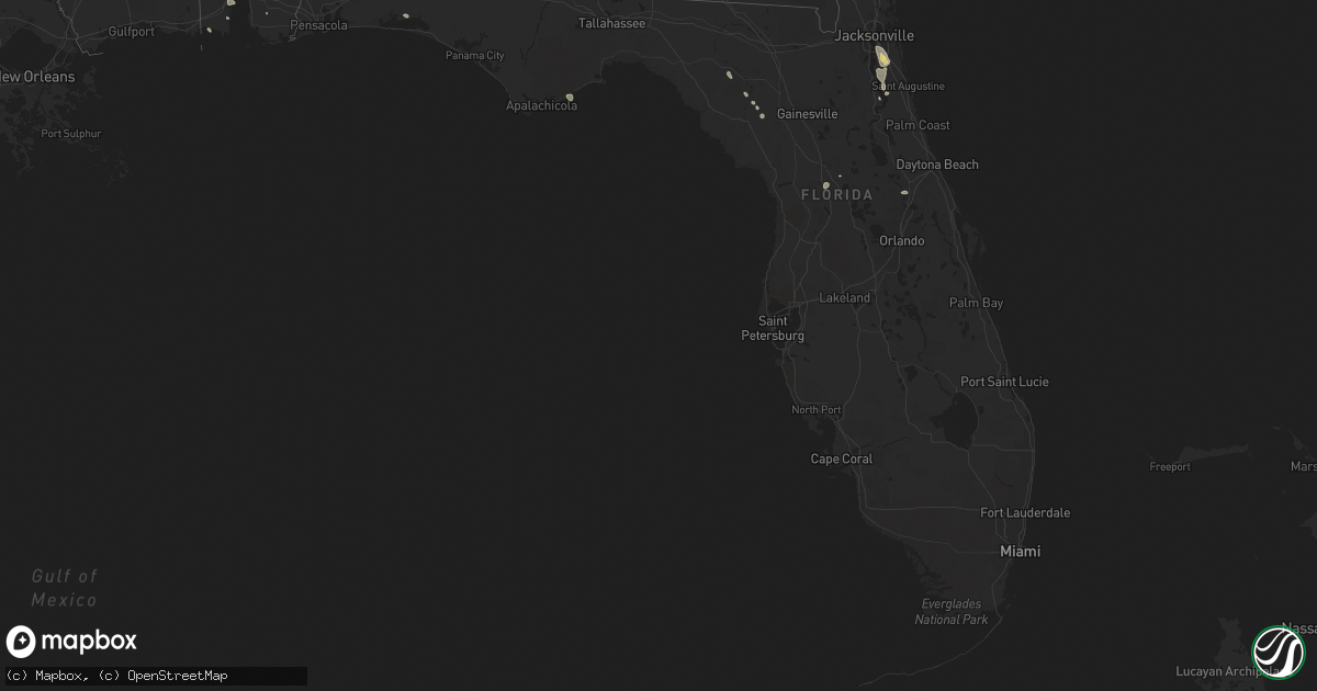
Hail Map in Florida on August 17, 2022
Get this storm
August 17 map
$229
one time, instant access
Download today. No call, no setup
Keep the $229
Bought the map and want the full workflow? Apply the entire $229 to a subscription within 7 days. None of it is wasted.
Every map, not just this one
This buys you this map. Subscription and you get every map we run, in the markets you choose from a few cities to whole states to nationwide. Plus real-time alerts the moment a storm fires.
Contact data
Name, contact info, occupancy, even credit band for addresses in the footprint. You go from where it hit to who to call.
Become the source they trust
Unlimited branding weather history reports on demand. You already have the documented answer ready for the property owner, and you are the one who showed up with it.
Property data and RoofTrace estimates
Pull up any address you have got, its value and the exact code rules for that jurisdiction, straight from One Click Code. Then RoofTrace estimates the squares, pitch, and roof value, priced the way you price.
Storm reports in Florida
Florida
| Date | Description |
|---|---|
| 08/17/20226:05 PM CDT | County dispatch reported trees and limbs were blown down into power lines near the county jail along old lewis speedway. The time of damage was based on radar. |
| 08/17/20226:00 PM CDT | Spotter reported estimated wind gust of 60 mph. |
| 08/17/20226:00 PM CDT | Trees were blown down into power lines by thunderstorm winds. The time of damage was based on radar. |
| 08/17/20226:00 PM CDT | Fallen trees or limbs resulted in a power outage along frank mckamey way. |
| 08/17/20225:05 PM CDT | The jacksonville electric authority reported severe thunderstorm damage along michaela street just east of veterans parkway. The time of damage was based on radar. |
| 08/17/20224:55 PM CDT | The jacksonville electric authority reported severe thunderstorm damage to utility equipment along harp street... Just north of julington creek road. The time of damage |
| 08/17/20224:43 PM CDT | Jacksonville electric authority reported severe thunderstorm damage to utility equipment along n village grove drive off of scott mill road. The time of damage was base |
| 08/17/20224:35 PM CDT | Duke energy reported damage to utility equipment due to fallen trees and/or large limbs along se 11th terrace... Just east of trenton. The time of damage was based on r |
| 08/17/20224:18 PM CDT | Report of trees and power lines down due to thunderstorm winds. |
| 08/17/20221:45 PM CDT | Thunderstorm winds downed trees near se 80th and se 42nd sse of ocala and n of belleview. The time of damage was based on radar. |
| 08/17/202212:07 PM CDT | Strong winds blew down trees and power lines along benham ave. From 20th street to 17th street. Reports and pictures/video from twitter and wftv. |
| 08/17/20222:14 AM CDT | At 713 PM EDT, severe thunderstorms were located along a line extending from Saint Augustine Beach to near Orange Mills, moving southeast at 15 mph. HAZARD...60 mph wind gusts and penny size hail. SOURCE...Radar indicated. IMPACT...Expect damage to roofs, siding, and trees. Locations impacted include... Saint Augustine, Hastings, East Palatka, Saint Augustine Beach, Marineland, Bostwick, Federal Point, Crescent Beach, Saint Augustine Shores and Orange Mills. |
| 08/17/20221:56 AM CDT | At 656 PM CDT, a severe thunderstorm was located 7 miles north of Niceville, moving east at 30 mph. HAZARD...60 mph wind gusts. SOURCE...Radar indicated. IMPACT...Expect damage to roofs, siding, and trees. Locations impacted include... De Funiak Springs, Eglin Air Force Base, Freeport, Oakwood Hills, Portland, Pleasant Ridge, Alpine Heights, New Home, De Funiak Spring Airport and Mossy Head. |
| 08/17/20221:55 AM CDT | At 654 PM EDT, a severe thunderstorm was located near Carrabelle, and is nearly stationary. HAZARD...60 mph wind gusts and nickel size hail. SOURCE...Radar indicated. IMPACT...Expect damage to roofs, siding, and trees. Locations impacted include... Carrabelle, Yent Place, Carrabelle Beach, St George Island St Pk, Royal Bluff and Green Point. |
| 08/17/20221:52 AM CDT | At 652 PM CDT, a severe thunderstorm was located 7 miles north of Niceville, moving east at 20 mph. HAZARD...60 mph wind gusts. SOURCE...Radar indicated. IMPACT...Expect damage to roofs, siding, and trees. Locations impacted include... Niceville and Valparaiso. |
| 08/17/20221:47 AM CDT | At 646 PM EDT, severe thunderstorms were located along a line extending from South Ponte Vedra to 8 miles south of World Golf Village to near Bostwick, moving east at 15 mph. HAZARD...60 mph wind gusts and penny size hail. SOURCE...Radar indicated. IMPACT...Expect damage to roofs, siding, and trees. Locations impacted include... Saint Augustine, Hastings, Saint Augustine Beach, Vilano Beach, Bostwick, Federal Point, South Ponte Vedra, Crescent Beach, Saint Augustine Shores and Butler Beach. |
| 08/17/20221:23 AM CDT | At 622 PM EDT, severe thunderstorms were located along a line extending from Nocatee to World Golf Village to near Green Cove Springs, moving southeast at 15 mph. HAZARD...60 mph wind gusts and penny size hail. SOURCE...Radar indicated. IMPACT...Expect damage to roofs, siding, and trees. Locations impacted include... Green Cove Springs, World Golf Village, South Ponte Vedra, Nocatee, Durbin, Vilano Beach, Picolata, Guana River State Park and Bakersville. |
| 08/17/20221:00 AM CDT | At 600 PM EDT, severe thunderstorms were located along a line extending from near Baymeadows to Switzerland, moving east at 10 mph. HAZARD...60 mph wind gusts and quarter size hail. SOURCE...Radar indicated. IMPACT...Hail damage to vehicles is expected. Expect wind damage to roofs, siding, and trees. Locations impacted include... Unf, Mandarin, Fruit Cove, Ponte Vedra Beach, World Golf Village, Sawgrass, Nocatee, Durbin, Switzerland and Palm Valley. |
| 08/17/202212:37 AM CDT | At 537 PM EDT, a severe thunderstorm was located over Baymeadows, or near Unf, moving southeast at 20 mph. HAZARD...60 mph wind gusts. SOURCE...Radar indicated. IMPACT...Expect damage to roofs, siding, and trees. Locations impacted include... Unf, Palm Valley, Baymeadows, Bayard, Durbin and Sawgrass. |
| 08/17/202212:28 AM CDT | At 528 PM EDT, severe thunderstorms were located along a line extending from near Bell to 6 miles east of Trenton, and are nearly stationary. HAZARD...60 mph wind gusts. SOURCE...Radar indicated. IMPACT...Expect damage to roofs, siding, and trees. Locations impacted include... Trenton and Bell. |
| 08/16/202211:53 PM CDT | At 453 PM EDT, severe thunderstorms were located along a line extending from near Bell to near Trenton, moving southeast at 15 mph. HAZARD...60 mph wind gusts. SOURCE...Radar indicated. IMPACT...Expect damage to roofs, siding, and trees. Locations impacted include... Trenton and Bell. |
| 08/16/202210:56 PM CDT | At 355 PM CDT, a severe thunderstorm was located 7 miles east of Callaway, moving south at 5 mph. HAZARD...60 mph wind gusts and penny size hail. SOURCE...Radar indicated. IMPACT...Expect damage to roofs, siding, and trees. Locations impacted include... Callaway, Tyndall Air Force Base and Wetappo. |
| 08/16/202210:17 PM CDT | At 317 PM EDT, a severe thunderstorm was located 7 miles northwest of Wildwood, moving south at 15 mph. HAZARD...60 mph wind gusts and quarter size hail. SOURCE...Radar indicated. IMPACT...Hail damage to vehicles is expected. Expect wind damage to roofs, siding, and trees. Locations impacted include... Wildwood, Lake Panasoffkee, Bushnell, Coleman, Rutland, Wahoo, Adamsville and Sumterville. |
| 08/16/202210:06 PM CDT | At 305 PM EDT, a severe thunderstorm was located 7 miles west of Lake Weir, or 10 miles west of The Villages, moving southeast at 20 mph. HAZARD...60 mph wind gusts and quarter size hail. SOURCE...Radar indicated. IMPACT...Hail damage to vehicles is expected. Expect wind damage to roofs, siding, and trees. Locations impacted include... Wildwood and Oxford. |
| 08/16/20229:59 PM CDT | At 259 PM EDT, a severe thunderstorm was located near Santos, or 10 miles south of Ocala, moving southeast at 30 mph. HAZARD...60 mph wind gusts and quarter size hail. SOURCE...Radar indicated. IMPACT...Hail damage to vehicles is expected. Expect wind damage to roofs, siding, and trees. Locations impacted include... Weirsdale, Lake Weir, Santos, Belleview and Summerfield. |
| 08/16/20229:33 PM CDT | At 233 PM EDT, a severe thunderstorm was located near Ocala Airport, or near Ocala, moving east at 30 mph. HAZARD...60 mph wind gusts. SOURCE...Radar indicated. IMPACT...Expect damage to roofs, siding, and trees. Locations impacted include... Ocala, Santos, Ocklawaha, Ocala Airport, Silver Springs Shores, Lake Weir, Belleview and Summerfield. |
| 08/16/20228:05 PM CDT | At 105 PM EDT, a severe thunderstorm was located near Orange City, moving east at 15 mph. HAZARD...60 mph wind gusts and penny size hail. SOURCE...Radar indicated. IMPACT...Expect damage to roofs, siding, and trees. Locations impacted include... Deltona, DeLand, Orange City, Lake Helen and DeBary. |
All States Impacted by Hail Map on August 17, 2022
Cities Impacted by Hail Map on August 17, 2022
- Williston, ND
- Grenora, ND
- Edgemont, SD
- Akron, NY
- Corfu, NY
- Towner, ND
- Isanti, MN
- Northome, MN
- Voltaire, ND
- Livonia, NY
- Fullerton, ND
- Squaw Lake, MN
- Penn Yan, NY
- Dundee, NY
- Dateland, AZ
- Buckeye, AZ
- Gila Bend, AZ
- Bradford, PA
- Waxahachie, TX
- Wright, MN
- Cromwell, MN
- Minot, ND
- Orange City, FL
- Meridian, TX
- Clifton, TX
- Moscow, TX
- Oral, SD
- Hot Springs, SD
- Buffalo Gap, SD
- Oelrichs, SD
- Fort Worth, TX
- Ajo, AZ
- Cleburne, TX
- Alvarado, TX
- Bell, FL
- Streeter, ND
- Ferris, TX
- Tyler, TX
- Andalusia, AL
- Wing, AL
- Daphne, AL
- Mobile, AL
- Ocala, FL
- Larue, TX
- Randolph, NY
- Stanley, NY
- Huntington, TX
- Grygla, MN
- Waterloo, NY
- Kettle River, MN
- Rush, CO
- Cambridge, MN
- Calvin, ND
- Rocklake, ND
- Munich, ND
- Egeland, ND
- Rugby, ND
- Wellsville, NY
- Rosemount, MN
- Inver Grove Heights, MN
- Newport, MN
- South Saint Paul, MN
- Farmington, MN
- Saint Paul, MN
- Whitesville, NY
- Rexville, NY
- Andover, NY
- Millsap, TX
- Weatherford, TX
- Santo, TX
- Vancleave, MS
- Esmond, ND
- Sturgeon Lake, MN
- Summerfield, FL
- Belleview, FL
- Barnum, MN
- Dagmar, MT
- Froid, MT
- Bainville, MT
- Crockett, TX
- Kennard, TX
- Belle Fourche, SD
- Conchas Dam, NM
- Avoca, NY
- Bath, NY
- Ennis, TX
- Palmer, TX
- Jena, LA
- Heidelberg, MS
- Vossburg, MS
- Branford, FL
- Alden, NY
- Lancaster, NY
- Batavia, NY
- Alexander, NY
- Mount Joy, PA
- Manheim, PA
- Kaycee, WY
- Cave Creek, AZ
- Dry Prong, LA
- Colfax, LA
- Bentley, LA
- Rusk, TX
- Godley, TX
- Joshua, TX
- Westby, MT
- Lead, SD
- Harleton, TX
- Mineola, TX
- Winnsboro, TX
- Quitman, TX
- Lufkin, TX
- Jacksonville, TX
- Crawford, NE
- Whitney, NE
- Grandy, MN
- Stanchfield, MN
- Union Church, MS
- McCall Creek, MS
- Douglass, TX
- Cushing, TX
- Grand Cane, LA
- Trenton, FL
- Saint Johns, FL
- Saint Augustine, FL
- Steele, ND
- Kintyre, ND
- Napoleon, ND
- Alzada, MT
- Culbertson, MT
- Dunseith, ND
- Mcgregor, MN
- Tamarack, MN
- Carrabelle, FL
- Jacksonville, FL
- Moose Lake, MN
- Spearfish, SD
- Saint Onge, SD
- Hill City, SD
- Custer, SD
- Grand Prairie, TX
- Cedar Hill, TX
- Dallas, TX
- Braddock, ND
- Bisbee, ND
- Austin, PA
- Frisco City, AL
- Atmore, AL
- Fairview, MT
- Wibaux, MT
- Pringle, SD
- Desoto, TX
- Red Oak, TX
- Hawkins, TX
- Tappen, ND
- Midlothian, TX
- Scroggins, TX
- Venus, TX
- Sells, AZ
- Livingston, TX
- Uriah, AL
- Winona, TX
- Clarence, NY
- Sacramento, PA
- Lykens, PA
- Klingerstown, PA
- Watford City, ND
- Medina, ND
- Mexia, TX
- Moss Point, MS
- Clayton, LA
- Oil City, LA
- Mooringsport, LA
- Lancaster, TX
- Mayo, FL
- Braham, MN
- Grasston, MN
- Belcourt, ND
- Geneva, NY
- Zavalla, TX
- Prattsburgh, NY
- Cloquet, MN
- Jasper, TX
- Theodore, AL
- Grand Bay, AL
- Marsland, NE
- Mylo, ND
- Rolette, ND
- Wolf Creek, OR
- Palatka, FL
- Kulm, ND
- Wirt, MN
- Sawyer, MN
- Eight Mile, AL
- Killdeer, ND
- Antelope, MT
- Plentywood, MT
- Reserve, MT
- Medicine Lake, MT
- Grandview, TX
- Sturgis, SD
- Piedmont, SD
- Hemingford, NE
- Silverhill, AL
- Natchez, MS
- Fayette, MS
- Niceville, FL
- Freeport, FL


