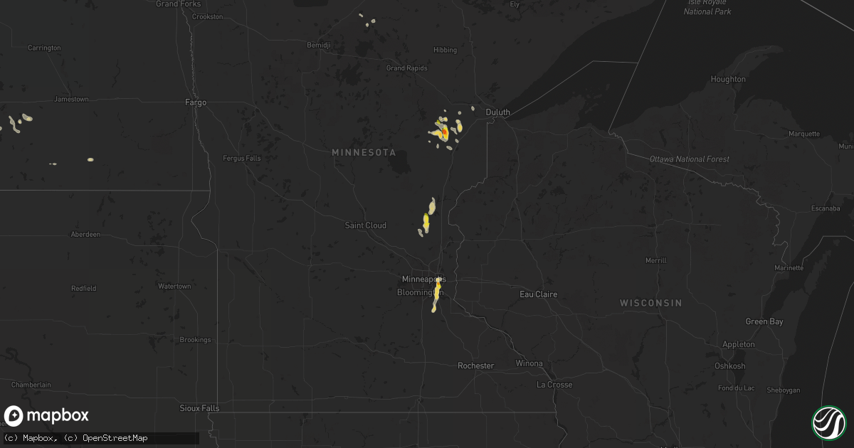
Hail Map on August 17, 2022
Get this storm
August 17 map
$229
one time, instant access
Download today. No call, no setup
Keep the $229
Bought the map and want the full workflow? Apply the entire $229 to a subscription within 7 days. None of it is wasted.
Every map, not just this one
This buys you this map. Subscription and you get every map we run, in the markets you choose from a few cities to whole states to nationwide. Plus real-time alerts the moment a storm fires.
Contact data
Name, contact info, occupancy, even credit band for addresses in the footprint. You go from where it hit to who to call.
Become the source they trust
Unlimited branding weather history reports on demand. You already have the documented answer ready for the property owner, and you are the one who showed up with it.
Property data and RoofTrace estimates
Pull up any address you have got, its value and the exact code rules for that jurisdiction, straight from One Click Code. Then RoofTrace estimates the squares, pitch, and roof value, priced the way you price.
States Impacted by Hail Map on August 17, 2022
Storm reports
California
| Date | Description |
|---|---|
| 08/17/20226:56 PM CDT | The needles asos recorded gusts in excess of 58 mph between 456 pm and 508 pm. The peak gust during this time was 63 mph and occurred at 456 pm. |
| 08/17/20221:57 AM CDT | At 657 PM PDT, a severe thunderstorm was located near Midland, or 31 miles west of Parker, and is nearly stationary. HAZARD...60 mph wind gusts and penny size hail. SOURCE...Radar indicated. IMPACT...Expect damage to roofs, siding, and trees. This severe thunderstorm will remain over mainly rural areas of Riverside County.This includes CA Route 95 between mile markers 25 and 28, and betweenmile markers 32 and 36. |
Arkansas
| Date | Description |
|---|---|
| 08/17/20227:55 AM CDT | At 1255 AM CDT, a severe thunderstorm was located 3 miles south of Mountainburg, moving east at 25 mph. HAZARD...60 mph wind gusts and quarter size hail. SOURCE...Radar indicated. IMPACT...Hail damage to vehicles is expected. Expect wind damage to roofs, siding, and trees. Locations in or near the path include... Ozark... Mulberry... Dyer... Altus... Denning... Wiederkehr Village... Fern... Jethro... Etna... Alix... Watalula... Meg... Piney... Toney... Cecil... Lonelm... Cravens... This includes the following highways, Interstate 40 in Arkansas between mile markers 18 and 42. Interstate 49 between mile markers 25 and 26. |
North Dakota
| Date | Description |
|---|---|
| 08/17/20224:41 AM CDT | At 941 PM CDT, a severe thunderstorm was located 9 miles northeast of Braddock, or 10 miles northwest of Napoleon, moving southeast at 30 mph. HAZARD...60 mph wind gusts and quarter size hail. SOURCE...Radar indicated. IMPACT...Hail damage to vehicles is expected. Expect wind damage to roofs, siding, and trees. This severe thunderstorm will be near... Napoleon around 1000 PM CDT.Other locations impacted by this severe thunderstorm includeBurnstad, Kintyre and Beaver Lake State Park. |
| 08/17/20223:05 AM CDT | Nd dot rwis sensor. |
| 08/17/20222:57 AM CDT | At 757 PM CDT/657 PM MDT/, a severe thunderstorm was located 7 miles west of Williston, moving southeast at 25 mph. HAZARD...60 mph wind gusts and quarter size hail. SOURCE...Radar indicated. IMPACT...Hail damage to vehicles is expected. Expect wind damage to roofs, siding, and trees. This severe thunderstorm will be near... Williston around 805 PM CDT.Other locations impacted by this severe thunderstorm includeCharbonneau and Trenton. |
| 08/17/20222:21 AM CDT | Niles 3 se ndawn 10 meter wind sensor. |
| 08/17/20221:57 AM CDT | At 656 PM MDT, a severe thunderstorm was located 8 miles northwest of Sidney, moving southeast at 30 mph. HAZARD...60 mph wind gusts and half dollar size hail. SOURCE...Radar indicated. IMPACT...Hail damage to vehicles is expected. Expect wind damage to roofs, siding, and trees. Locations impacted include... Sidney, Fairview and Wooley. |
| 08/17/20221:30 AM CDT | A local report indicates 60 MPH wind near 5 NW GEORGE LAKE |
| 08/16/20229:46 PM CDT | A local report indicates 60 MPH wind near 10 SE LAKE ISABEL |
| 08/16/20228:59 PM CDT | 2 e watford city ndawn. |
Arizona
| Date | Description |
|---|---|
| 08/17/20226:05 PM CDT | Mesonet in litchfield park measured thunderstorm wind gust of 61 mph. |
| 08/17/20224:29 PM CDT | A local report indicates 58 MPH wind near 4 W WICKENBURG |
| 08/17/20222:44 AM CDT | At 744 PM MST, a severe thunderstorm was located 15 miles north of Yuma Proving Ground, or 24 miles north of Martinez Lake, moving southeast at 10 mph. HAZARD...60 mph wind gusts. SOURCE...Radar indicated. IMPACT...Expect damage to roofs, siding, and trees. This severe thunderstorm will remain over mainly rural areas of southwestern La Paz and north central Yuma Counties.This includes AZ Route 95 between mile markers 68 and 86. |
| 08/17/20222:17 AM CDT | At 717 PM MST, a severe thunderstorm was located over Three Points, or 20 miles northwest of Sahuarita, moving southwest at 15 mph. HAZARD...60 mph wind gusts and quarter size hail. SOURCE...Radar indicated. IMPACT...Hail damage to vehicles is expected. Expect wind damage to roofs, siding, and trees. Locations impacted include... Three Points, Valencia West, Tucson Estates and Ryan AirField. |
| 08/17/20222:13 AM CDT | At 712 PM MST, a severe thunderstorm was located over Tucson, moving south at 15 mph. HAZARD...60 mph wind gusts and quarter size hail. SOURCE...Radar indicated. IMPACT...Hail damage to vehicles is expected. Expect wind damage to roofs, siding, and trees. Locations impacted include... Tucson, Davis-Monthan Air Force Base, Tanque Verde, South Tucson, Sabino Canyon Recreation Area, Catalina Foothills, Rita Ranch and Seven Falls. |
| 08/17/20222:04 AM CDT | At 704 PM MST, a severe thunderstorm was located 15 miles east of Cibola, or 30 miles north of Martinez Lake, moving south at 15 mph. HAZARD...60 mph wind gusts. SOURCE...Radar indicated. IMPACT...Expect damage to roofs, siding, and trees. This severe thunderstorm will remain over mainly rural areas of southwestern La Paz and northwestern Yuma Counties.This includes AZ Route 95 between mile markers 71 and 98. |
| 08/17/20221:58 AM CDT | At 658 PM MST, a severe thunderstorm was located near Sentinel, or 32 miles west of Gila Bend, moving south at 10 mph. HAZARD...60 mph wind gusts. SOURCE...Radar indicated. IMPACT...Expect damage to roofs, siding, and trees. Locations impacted include... Sentinel, Paloma, Dateland and Hyder. This includes AZ Interstate 8 between mile markers 69 and 97. |
| 08/17/20221:15 AM CDT | At 615 PM MST, severe thunderstorms were located along a line extending from 10 miles south of Sundad to 9 miles north of Paloma to 25 miles southeast of Kofa Wildlife Refuge, moving southwest at 15 mph. HAZARD...60 mph wind gusts. SOURCE...Radar indicated. IMPACT...Expect damage to roofs, siding, and trees. Locations impacted include... Dateland, Sentinel, Paloma and Hyder. This includes AZ Interstate 8 between mile markers 68 and 89. |
| 08/17/20221:12 AM CDT | At 612 PM MST, severe thunderstorms were located along a line extending from near Gold Canyon to 6 miles south of Gold Camp to near Florence Junction, moving southwest at 30 mph. HAZARD...60 mph wind gusts. SOURCE...Radar indicated. IMPACT...Expect damage to roofs, siding, and trees. Locations impacted include... Apache Junction, Gold Canyon, Queen Creek, Florence Junction, Blackwater, Chandler Heights, Gold Camp, Kings Ranch, San Tan Mountain Park, Magma, San Tan Valley and Queen Valley.This includes the following highways...US Highway 60 between mile markers 200 and 212.AZ Route 87 between mile markers 143 and 145.AZ Route 79 near mile marker 150. |
| 08/17/20221:06 AM CDT | At 606 PM MST, a severe thunderstorm was located over Quartzsite, or 31 miles south of Parker, moving south at 10 mph. HAZARD...60 mph wind gusts and penny size hail. SOURCE...Radar indicated. IMPACT...Expect damage to roofs, siding, and trees. Locations impacted include... Quartzsite.This includes the following highways...AZ Interstate 10 between mile markers 10 and 29.AZ Route 95 between mile markers 87 and 116. |
| 08/17/20221:02 AM CDT | At 602 PM MST, a severe thunderstorm was located 7 miles east of Sentinel, or 24 miles west of Gila Bend, moving south at 10 mph. HAZARD...60 mph wind gusts. SOURCE...Radar indicated. IMPACT...Expect damage to roofs, siding, and trees. This severe thunderstorm will remain over mainly rural areas of Maricopa County.This includes AZ Interstate 8 between mile markers 87 and 102. |
| 08/17/20221:01 AM CDT | At 601 PM MST, a severe thunderstorm was located 8 miles east of Freeman, or 23 miles west of Casa Grande, moving south at 15 mph. HAZARD...60 mph wind gusts. SOURCE...Radar indicated. IMPACT...Expect damage to roofs, siding, and trees. This severe thunderstorm will remain over mainly rural areas of Maricopa and Pinal Counties.This includes the following highways...AZ Interstate 8 between mile markers 145 and 161.AZ Route 347 between mile markers 161 and 163. |
| 08/17/202212:52 AM CDT | At 552 PM MST, a severe thunderstorm was located 21 miles west of Sundad, or 43 miles southwest of Tonopah, and is nearly stationary. HAZARD...60 mph wind gusts. SOURCE...Radar indicated. IMPACT...Expect damage to roofs, siding, and trees. This severe thunderstorm will remain over mainly rural areas of northeastern Yuma County. |
| 08/17/202212:16 AM CDT | At 516 PM MST, a severe thunderstorm was located 11 miles southeast of Kofa Wildlife Refuge, or 48 miles northeast of Martinez Lake, moving south at 20 mph. HAZARD...60 mph wind gusts. SOURCE...Radar indicated. IMPACT...Expect damage to roofs, siding, and trees. Locations impacted include... Palm Canyon. |
| 08/17/202212:15 AM CDT | At 515 PM MST, a severe thunderstorm was located 13 miles southwest of Gila Bend Auxiliary Field, or 18 miles southwest of Gila Bend, moving south at 10 mph. HAZARD...60 mph wind gusts and penny size hail. SOURCE...Radar indicated. IMPACT...Expect damage to roofs, siding, and trees. This severe thunderstorm will remain over mainly rural areas of Maricopa County.This includes AZ Route 85 between mile markers 10 and 20. |
| 08/17/202212:05 AM CDT | At 505 PM MST, a severe thunderstorm was located over Four Peaks, or 9 miles east of Sugarloaf Mountain, moving southwest at 10 mph. HAZARD...60 mph wind gusts. SOURCE...Radar indicated. IMPACT...Expect damage to roofs, siding, and trees. Locations impacted include... Sugarloaf Mountain, Saguaro Lake, Canyon Lake, Goldfield Ranch, Four Peaks, Apache Lake, Salt River Tubing Recreation Area, Fort McDowell and Tortilla Flat.This includes AZ Route 87 between mile markers 193 and 208. |
| 08/16/202211:38 PM CDT | At 438 PM MST, a severe thunderstorm was located near Glendale, moving southwest at 10 mph. HAZARD...60 mph wind gusts. SOURCE...Radar indicated. IMPACT...Expect damage to roofs, siding, and trees. Locations impacted include... Phoenix, Glendale, Tolleson, Laveen, Glendale Sports Complex, Downtown Glendale, Metro Center, Camelback Ranch and Arizona State Fairgrounds.This includes the following highways...AZ Interstate 10 between mile markers 134 and 145.AZ Interstate 17 between mile markers 199 and 210.AZ Route 51 between mile markers 4 and 6. |
| 08/16/202211:10 PM CDT | At 409 PM MST, a severe thunderstorm was located 9 miles northeast of Ajo, moving southwest at 20 mph. HAZARD...60 mph wind gusts and quarter size hail. Strong winds will also result in areas of blowing dust, reducing visibility to less than a half mile. SOURCE...Radar indicated. IMPACT...Hail damage to vehicles is expected. Expect wind damage to roofs, siding, and trees. Locations impacted include... Ajo. |
| 08/16/202210:58 PM CDT | At 358 PM MST, a severe thunderstorm was located near Wenden, or 26 miles south of Alamo Lake, moving south at 10 mph. HAZARD...60 mph wind gusts and penny size hail. SOURCE...Radar indicated. IMPACT...Expect damage to roofs, siding, and trees. Locations impacted include... Salome, Vicksburg, Vicksburg Junction, Wenden and Harcuvar. This includes the following highways...US Highway 60 between mile markers 51 and 64.AZ Route 72 between mile markers 42 and 49. |
| 08/16/202210:53 PM CDT | At 353 PM MST, a severe thunderstorm was located over Camp Creek, or 15 miles north of Scottsdale, moving south at 10 mph. HAZARD...60 mph wind gusts and penny size hail. SOURCE...Radar indicated. IMPACT...Expect damage to roofs, siding, and trees. Locations impacted include... Scottsdale, Cave Creek, Carefree, Desert Mountain, Camp Creek and Seven Springs. |
| 08/16/202210:36 PM CDT | At 335 PM MST, a severe thunderstorm was located 9 miles southeast of Wenden, or 32 miles northwest of Tonopah, moving southwest at 15 mph. HAZARD...60 mph wind gusts. SOURCE...Radar indicated. IMPACT...Expect damage to roofs, siding, and trees. Locations impacted include... Wenden, Salome and Harcuvar. This includes the following highways...AZ Interstate 10 between mile markers 60 and 73.US Highway 60 between mile markers 51 and 70. |
| 08/16/202210:31 PM CDT | At 331 PM MST, a severe thunderstorm was located over Luke AFB, or over Waddell, moving south at 10 mph. HAZARD...60 mph wind gusts. SOURCE...Radar indicated. IMPACT...Expect damage to roofs, siding, and trees. Locations impacted include... Phoenix, Glendale, Surprise, Avondale, Goodyear, Buckeye, El Mirage, Tolleson, Youngtown, Sun City West, Sun City, Waddell, Cashion, Litchfield Park and Glendale Sports Complex.This includes the following highways...AZ Interstate 10 between mile markers 112 and 136.US Highway 60 between mile markers 140 and 148.AZ Route 101 between mile markers 2 and 9. |
| 08/16/202210:19 PM CDT | At 319 PM MST, a severe thunderstorm was located 8 miles north of Kaka, or 31 miles southeast of Gila Bend, moving southwest at 10 mph. HAZARD...60 mph wind gusts and penny size hail. SOURCE...Radar indicated. IMPACT...Expect damage to roofs, siding, and trees. Locations impacted include... Kaka. |
| 08/16/20229:11 PM CDT | Yuma proving ground station 48 mesonet station reports 69 mph gust. |
| 08/16/20228:46 PM CDT | A local report indicates 64 MPH wind near 8 SE QUEEN CREEK |
| 08/16/20228:45 PM CDT | A local report indicates 69 MPH wind near 10 ESE QUEEN CREEK |
| 08/16/20228:16 PM CDT | Road sign blown over. Supports snapped in half. |
| 08/16/20227:04 PM CDT | Aps power lines down due to storms. |
Alabama
| Date | Description |
|---|---|
| 08/17/20223:32 PM CDT | Pine tree snapped and damaged a vehicle. |
| 08/16/202211:05 PM CDT | At 405 PM CDT, a severe thunderstorm was located 4 miles northeast of Downtown Mobile, moving east at 20 mph. HAZARD...60 mph wind gusts and quarter size hail. SOURCE...Radar indicated. IMPACT...Hail damage to vehicles is expected. Expect wind damage to roofs, siding, and trees. Locations impacted include... Spanish Fort, Robertsdale, Loxley and Stapleton. |
Montana
| Date | Description |
|---|---|
| 08/17/20226:15 PM CDT | Measured on home weather station. |
| 08/17/20222:15 AM CDT | At 714 PM CDT/614 PM MDT/, a severe thunderstorm was located 11 miles west of Bonetrail, or 26 miles northwest of Williston, moving southeast at 30 mph. HAZARD...60 mph wind gusts and quarter size hail. SOURCE...Radar indicated. IMPACT...Hail damage to vehicles is expected. Expect wind damage to roofs, siding, and trees. This severe thunderstorm will remain over mainly rural areas of northwestern McKenzie and western Williams Counties, including the following locations... Blacktail Lake, Fort Buford State Historical Site and Trenton. |
| 08/17/20221:24 AM CDT | At 624 PM CDT, a severe thunderstorm was located 13 miles southwest of Westby, or 14 miles east of Plentywood, moving southeast at 20 mph. HAZARD...60 mph wind gusts and quarter size hail. SOURCE...Radar indicated. IMPACT...Hail damage to vehicles is expected. Expect wind damage to roofs, siding, and trees. This severe thunderstorm will be near... Grenora around 710 PM CDT.Other locations impacted by this severe thunderstorm include Zahl andHanks. |
| 08/17/20221:12 AM CDT | At 611 PM MDT, a severe thunderstorm was located 13 miles west of Bonetrail, or 23 miles northeast of Culbertson, moving south at 30 mph. HAZARD...60 mph wind gusts and quarter size hail. SOURCE...Radar indicated. IMPACT...Hail damage to vehicles is expected. Expect wind damage to roofs, siding, and trees. This severe thunderstorm will remain over mainly rural areas of east central Roosevelt and southeastern Sheridan Counties. |
| 08/17/202212:21 AM CDT | At 520 PM MDT, a severe thunderstorm was located 13 miles west of Grenora, or 16 miles east of Plentywood, moving southeast at 20 mph. HAZARD...60 mph wind gusts and quarter size hail. SOURCE...Radar indicated. IMPACT...Hail damage to vehicles is expected. Expect wind damage to roofs, siding, and trees. Locations impacted include... Westby, Comertown, Dagmar and Coalridge. |
| 08/16/20229:21 PM CDT | At 220 PM MDT, a severe thunderstorm was located 10 miles north of Colony, or 26 miles northwest of Belle Fourche, moving southeast at 25 mph. HAZARD...60 mph wind gusts and quarter size hail. SOURCE...Radar indicated. IMPACT...Hail damage to vehicles is expected. Expect wind damage to roofs, siding, and trees. This severe thunderstorm will remain over mainly rural areas of southeastern Carter County. |
| 08/16/20229:18 PM CDT | At 217 PM MDT, a severe thunderstorm was located 11 miles northeast of Colony, or 26 miles northwest of Belle Fourche, moving southeast at 25 mph. HAZARD...60 mph wind gusts and half dollar size hail. SOURCE...Radar indicated. IMPACT...Hail damage to vehicles is expected. Expect wind damage to roofs, siding, and trees. Locations impacted include... Antelope Butte and areas northwest of Belle Fourche. |
Florida
| Date | Description |
|---|---|
| 08/17/20226:05 PM CDT | County dispatch reported trees and limbs were blown down into power lines near the county jail along old lewis speedway. The time of damage was based on radar. |
| 08/17/20226:00 PM CDT | Trees were blown down into power lines by thunderstorm winds. The time of damage was based on radar. |
| 08/17/20226:00 PM CDT | Fallen trees or limbs resulted in a power outage along frank mckamey way. |
| 08/17/20226:00 PM CDT | Spotter reported estimated wind gust of 60 mph. |
| 08/17/20225:05 PM CDT | The jacksonville electric authority reported severe thunderstorm damage along michaela street just east of veterans parkway. The time of damage was based on radar. |
| 08/17/20224:55 PM CDT | The jacksonville electric authority reported severe thunderstorm damage to utility equipment along harp street... Just north of julington creek road. The time of damage |
| 08/17/20224:43 PM CDT | Jacksonville electric authority reported severe thunderstorm damage to utility equipment along n village grove drive off of scott mill road. The time of damage was base |
| 08/17/20224:35 PM CDT | Duke energy reported damage to utility equipment due to fallen trees and/or large limbs along se 11th terrace... Just east of trenton. The time of damage was based on r |
| 08/17/20224:18 PM CDT | Report of trees and power lines down due to thunderstorm winds. |
| 08/17/20221:45 PM CDT | Thunderstorm winds downed trees near se 80th and se 42nd sse of ocala and n of belleview. The time of damage was based on radar. |
| 08/17/202212:07 PM CDT | Strong winds blew down trees and power lines along benham ave. From 20th street to 17th street. Reports and pictures/video from twitter and wftv. |
| 08/17/20222:14 AM CDT | At 713 PM EDT, severe thunderstorms were located along a line extending from Saint Augustine Beach to near Orange Mills, moving southeast at 15 mph. HAZARD...60 mph wind gusts and penny size hail. SOURCE...Radar indicated. IMPACT...Expect damage to roofs, siding, and trees. Locations impacted include... Saint Augustine, Hastings, East Palatka, Saint Augustine Beach, Marineland, Bostwick, Federal Point, Crescent Beach, Saint Augustine Shores and Orange Mills. |
| 08/17/20221:56 AM CDT | At 656 PM CDT, a severe thunderstorm was located 7 miles north of Niceville, moving east at 30 mph. HAZARD...60 mph wind gusts. SOURCE...Radar indicated. IMPACT...Expect damage to roofs, siding, and trees. Locations impacted include... De Funiak Springs, Eglin Air Force Base, Freeport, Oakwood Hills, Portland, Pleasant Ridge, Alpine Heights, New Home, De Funiak Spring Airport and Mossy Head. |
| 08/17/20221:55 AM CDT | At 654 PM EDT, a severe thunderstorm was located near Carrabelle, and is nearly stationary. HAZARD...60 mph wind gusts and nickel size hail. SOURCE...Radar indicated. IMPACT...Expect damage to roofs, siding, and trees. Locations impacted include... Carrabelle, Yent Place, Carrabelle Beach, St George Island St Pk, Royal Bluff and Green Point. |
| 08/17/20221:52 AM CDT | At 652 PM CDT, a severe thunderstorm was located 7 miles north of Niceville, moving east at 20 mph. HAZARD...60 mph wind gusts. SOURCE...Radar indicated. IMPACT...Expect damage to roofs, siding, and trees. Locations impacted include... Niceville and Valparaiso. |
| 08/17/20221:47 AM CDT | At 646 PM EDT, severe thunderstorms were located along a line extending from South Ponte Vedra to 8 miles south of World Golf Village to near Bostwick, moving east at 15 mph. HAZARD...60 mph wind gusts and penny size hail. SOURCE...Radar indicated. IMPACT...Expect damage to roofs, siding, and trees. Locations impacted include... Saint Augustine, Hastings, Saint Augustine Beach, Vilano Beach, Bostwick, Federal Point, South Ponte Vedra, Crescent Beach, Saint Augustine Shores and Butler Beach. |
| 08/17/20221:23 AM CDT | At 622 PM EDT, severe thunderstorms were located along a line extending from Nocatee to World Golf Village to near Green Cove Springs, moving southeast at 15 mph. HAZARD...60 mph wind gusts and penny size hail. SOURCE...Radar indicated. IMPACT...Expect damage to roofs, siding, and trees. Locations impacted include... Green Cove Springs, World Golf Village, South Ponte Vedra, Nocatee, Durbin, Vilano Beach, Picolata, Guana River State Park and Bakersville. |
| 08/17/20221:00 AM CDT | At 600 PM EDT, severe thunderstorms were located along a line extending from near Baymeadows to Switzerland, moving east at 10 mph. HAZARD...60 mph wind gusts and quarter size hail. SOURCE...Radar indicated. IMPACT...Hail damage to vehicles is expected. Expect wind damage to roofs, siding, and trees. Locations impacted include... Unf, Mandarin, Fruit Cove, Ponte Vedra Beach, World Golf Village, Sawgrass, Nocatee, Durbin, Switzerland and Palm Valley. |
| 08/17/202212:37 AM CDT | At 537 PM EDT, a severe thunderstorm was located over Baymeadows, or near Unf, moving southeast at 20 mph. HAZARD...60 mph wind gusts. SOURCE...Radar indicated. IMPACT...Expect damage to roofs, siding, and trees. Locations impacted include... Unf, Palm Valley, Baymeadows, Bayard, Durbin and Sawgrass. |
| 08/17/202212:28 AM CDT | At 528 PM EDT, severe thunderstorms were located along a line extending from near Bell to 6 miles east of Trenton, and are nearly stationary. HAZARD...60 mph wind gusts. SOURCE...Radar indicated. IMPACT...Expect damage to roofs, siding, and trees. Locations impacted include... Trenton and Bell. |
| 08/16/202211:53 PM CDT | At 453 PM EDT, severe thunderstorms were located along a line extending from near Bell to near Trenton, moving southeast at 15 mph. HAZARD...60 mph wind gusts. SOURCE...Radar indicated. IMPACT...Expect damage to roofs, siding, and trees. Locations impacted include... Trenton and Bell. |
| 08/16/202210:56 PM CDT | At 355 PM CDT, a severe thunderstorm was located 7 miles east of Callaway, moving south at 5 mph. HAZARD...60 mph wind gusts and penny size hail. SOURCE...Radar indicated. IMPACT...Expect damage to roofs, siding, and trees. Locations impacted include... Callaway, Tyndall Air Force Base and Wetappo. |
| 08/16/202210:17 PM CDT | At 317 PM EDT, a severe thunderstorm was located 7 miles northwest of Wildwood, moving south at 15 mph. HAZARD...60 mph wind gusts and quarter size hail. SOURCE...Radar indicated. IMPACT...Hail damage to vehicles is expected. Expect wind damage to roofs, siding, and trees. Locations impacted include... Wildwood, Lake Panasoffkee, Bushnell, Coleman, Rutland, Wahoo, Adamsville and Sumterville. |
| 08/16/202210:06 PM CDT | At 305 PM EDT, a severe thunderstorm was located 7 miles west of Lake Weir, or 10 miles west of The Villages, moving southeast at 20 mph. HAZARD...60 mph wind gusts and quarter size hail. SOURCE...Radar indicated. IMPACT...Hail damage to vehicles is expected. Expect wind damage to roofs, siding, and trees. Locations impacted include... Wildwood and Oxford. |
| 08/16/20229:59 PM CDT | At 259 PM EDT, a severe thunderstorm was located near Santos, or 10 miles south of Ocala, moving southeast at 30 mph. HAZARD...60 mph wind gusts and quarter size hail. SOURCE...Radar indicated. IMPACT...Hail damage to vehicles is expected. Expect wind damage to roofs, siding, and trees. Locations impacted include... Weirsdale, Lake Weir, Santos, Belleview and Summerfield. |
| 08/16/20229:33 PM CDT | At 233 PM EDT, a severe thunderstorm was located near Ocala Airport, or near Ocala, moving east at 30 mph. HAZARD...60 mph wind gusts. SOURCE...Radar indicated. IMPACT...Expect damage to roofs, siding, and trees. Locations impacted include... Ocala, Santos, Ocklawaha, Ocala Airport, Silver Springs Shores, Lake Weir, Belleview and Summerfield. |
| 08/16/20228:05 PM CDT | At 105 PM EDT, a severe thunderstorm was located near Orange City, moving east at 15 mph. HAZARD...60 mph wind gusts and penny size hail. SOURCE...Radar indicated. IMPACT...Expect damage to roofs, siding, and trees. Locations impacted include... Deltona, DeLand, Orange City, Lake Helen and DeBary. |
South Dakota
| Date | Description |
|---|---|
| 08/17/20226:19 PM CDT | A local report indicates 60 MPH wind near 3 NW WASTA |
| 08/17/20225:28 PM CDT | A local report indicates 60 MPH wind near 1 NNE FAITH |
| 08/17/20223:55 PM CDT | A local report indicates 62 MPH wind near 7 WSW HOOVER |
| 08/17/20223:49 PM CDT | A local report indicates 68 MPH wind near 13 NW BELLE FOURCHE |
| 08/17/20223:44 PM CDT | A local report indicates 62 MPH wind near 13 NW BELLE FOURCHE |
| 08/17/20223:30 PM CDT | A local report indicates 60 MPH wind near 13 NW BELLE FOURCHE RES |
| 08/16/20229:44 PM CDT | At 244 PM MDT, a severe thunderstorm was located 10 miles east of Colony, or 12 miles northwest of Belle Fourche, moving southeast at 30 mph. HAZARD...70 mph wind gusts and half dollar size hail. SOURCE...Radar indicated. IMPACT...Hail damage to vehicles is expected. Expect considerable tree damage. Wind damage is also likely to mobile homes, roofs, and outbuildings. Locations impacted include... Spearfish, Belle Fourche, Whitewood, Saint Onge, Fruitdale, Belle Fourche Reservoir, Bridal Veil Falls and northern Spearfish Canyon.This includes Interstate 90 in South Dakota between Mile Markers 6and 24. |
Texas
| Date | Description |
|---|---|
| 08/17/20226:42 PM CDT | Hail dimes to quarter size. |
| 08/17/20226:42 PM CDT | Gust estimated up to 40 mph blew over greenhouse and large limbs down. |
| 08/17/20226:24 PM CDT | 1nw castolon bbnp. |
| 08/17/20226:12 PM CDT | Corrects previous tstm wnd dmg report from tolar. Large tree limbs and trunks were snapped... And several large trees were uprooted in tolar. Damage to structures... In |
| 08/17/20226:12 PM CDT | Large tree down in tolar. |
| 08/17/20226:08 PM CDT | Mesonet station 123 1nw castolon... Bbnp big bend np/brewster. |
| 08/17/20226:00 PM CDT | Delayed report. A large tree was uprooted and a small shed was overturned in west. Most damage was reported along reagan street. |
| 08/17/20225:44 PM CDT | A local report indicates 60 MPH wind near QUITMAN |
| 08/17/20225:44 PM CDT | 1 inch hail reported quitman. |
| 08/17/20225:35 PM CDT | Corrects previous hail report from 7 ssw winnsboro. Fm 14 and hwy 37 sw of winnsboro. |
| 08/17/20225:30 PM CDT | Fm 14 and hwy 37 sw of winnsboro. |
| 08/17/20225:12 PM CDT | 18 wheeler box trailer flipped on hwy 14 and cr 983. Large tree branches down. |
| 08/17/20223:50 AM CDT | At 849 PM CDT, a severe thunderstorm was located over Cedar Hill State Park, or near Grand Prairie, and is nearly stationary. HAZARD...60 mph wind gusts and quarter size hail. SOURCE...Radar indicated. IMPACT...Hail damage to vehicles is expected. Expect wind damage to roofs, siding, and trees. Locations impacted include... Dallas, Arlington, Grand Prairie, Mansfield, Desoto, Cedar Hill, Duncanville, Lancaster, Glenn Heights, Cockrell Hill, Ovilla and Cedar Hill State Park.This includes the following highways... Interstate 35E between mile markers 412 and 425. Interstate 20 between mile markers 450 and 469. |
| 08/17/20223:44 AM CDT | At 844 PM CDT, a severe thunderstorm was located 8 miles northwest of Lipan, or 15 miles south of Mineral Wells, moving southwest at 10 mph. HAZARD...60 mph wind gusts and quarter size hail. SOURCE...Radar indicated. IMPACT...Hail damage to vehicles is expected. Expect wind damage to roofs, siding, and trees. Locations impacted include... Gordon.This includes Interstate 20 between mile markers 368 and 389. |
| 08/17/20222:45 AM CDT | At 745 PM CDT, severe thunderstorms were located along a line extending from 11 miles southeast of Etoile to 8 miles north of Chester, moving southeast at 15 mph. HAZARD...60 mph wind gusts and quarter size hail. SOURCE...Radar indicated. IMPACT...Hail damage to vehicles is expected. Expect wind damage to roofs, siding, and trees. Locations impacted include... Zavalla, Broaddus and Dolan. |
| 08/17/20222:18 AM CDT | At 718 PM CDT, a severe thunderstorm was located near Cool, or 9 miles southeast of Mineral Wells, moving south at 10 mph. HAZARD...60 mph wind gusts and quarter size hail. SOURCE...Radar indicated. IMPACT...Hail damage to vehicles is expected. Expect wind damage to roofs, siding, and trees. Locations impacted include... Weatherford, Cool and Millsap. This includes Interstate 20 between mile markers 390 and 405. |
| 08/17/20222:07 AM CDT | At 706 PM CDT, a severe thunderstorm was located near Lajitas, moving northwest at 10 mph. HAZARD...60 mph wind gusts and quarter size hail. SOURCE...Radar indicated. IMPACT...Hail damage to vehicles is expected. Expect wind damage to roofs, siding, and trees. Locations impacted include... Lajitas and Barton Warnock Environmental Educational Center. |
| 08/17/20221:39 AM CDT | At 638 PM CDT, a severe thunderstorm was located over Hawkins, or 14 miles west of Gladewater, moving southeast at 20 mph. HAZARD...60 mph wind gusts and quarter size hail. SOURCE...Radar indicated. IMPACT...Hail damage to vehicles is expected. Expect wind damage to roofs, siding, and trees. Locations impacted include... Big Sandy, Hawkins, Winona and Red Springs. |
| 08/17/20221:25 AM CDT | At 625 PM CDT, a severe thunderstorm was located over Castolon, or 18 miles east of Lajitas, and is nearly stationary. HAZARD...60 mph wind gusts and quarter size hail. SOURCE...Radar indicated. IMPACT...Hail damage to vehicles is expected. Expect wind damage to roofs, siding, and trees. Locations impacted include... Castolon and Study Butte. |
| 08/17/202212:26 AM CDT | At 525 PM CDT, a severe thunderstorm was located near Pleasant Grove, or 7 miles south of Winnsboro, moving southwest at 20 mph. HAZARD...60 mph wind gusts and quarter size hail. SOURCE...Radar indicated. IMPACT...Hail damage to vehicles is expected. Expect wind damage to roofs, siding, and trees. Locations impacted include... Mineola, Lindale, Quitman, Pleasant Grove, Hainesville and Hoard. |
| 08/16/202211:40 PM CDT | At 439 PM CDT, severe thunderstorms were located along a line extending from near Trawick to near Maydelle, moving southeast at 15 mph. HAZARD...60 mph wind gusts and quarter size hail. SOURCE...Radar indicated. IMPACT...Hail damage to vehicles is expected. Expect wind damage to roofs, siding, and trees. Locations impacted include... Nacogdoches, Rusk, Alto, Morrill, Sacul, Forest, Douglass, Trawick, Cushing, Appleby, Linwood, Lilbert and Looneyville. |
| 08/16/20229:15 PM CDT | Delayed report. An 18 wheeler was rolled over at a truck stop... And a fireworks stand nearby was blown over. Report was received via social media. |
| 08/16/20228:55 PM CDT | At 154 PM CDT, a severe thunderstorm was located 10 miles north of Logansport, or 14 miles west of Mansfield, moving southeast at 15 mph. HAZARD...60 mph wind gusts. SOURCE...Radar indicated. IMPACT...Expect damage to roofs, siding, and trees. Locations impacted include... Mansfield, Logansport, South Mansfield, Keachi, Grand Cane, Longstreet, Stanley and Keat Chie. |
| 08/16/20228:34 PM CDT | At 134 PM CDT, a severe thunderstorm was located near Marshall, moving southeast at 15 mph. HAZARD...60 mph wind gusts. SOURCE...Radar indicated. IMPACT...Expect damage to roofs, siding, and trees. Locations impacted include... Marshall, Scottsville and Nesbitt. |
| 08/16/20228:00 PM CDT | Delayed report. Downed trees and miscellaneous damage to trailer homes were reported on curtis ray drive in midlothian. Time estimated via radar. |
| 08/16/20227:55 PM CDT | Delayed report. Sheet metal and portions of the wooden patio structure were ripped off the side and roof of a house in palmer. The retractable door of the metal outbuil |
Mississippi
| Date | Description |
|---|---|
| 08/17/20224:45 PM CDT | Pictures of trees down in moss point. Time and exact location estimated by radar. |
| 08/17/20223:55 PM CDT | Em reports downed trees and powerlines near highway 613 and donniebrook lane. |
| 08/17/20223:30 PM CDT | Media relayed pictures of tree and metal roofing damage on big point rd. |
| 08/17/20222:09 PM CDT | Corrects previous tstm wnd dmg report from 1 nnw escatawpa. Trees down on highway 613 and donniebrook ln. Additional trees down reported at riverbend campground. |
| 08/16/202210:40 PM CDT | At 340 PM CDT, a severe thunderstorm was located over Vancleave, or near Escatawpa, moving southeast at 10 mph. HAZARD...60 mph wind gusts and quarter size hail. SOURCE...Radar indicated. IMPACT...Hail damage to vehicles is expected. Expect wind damage to roofs, siding, and trees. Locations impacted include... Escatawpa, Vancleave, Hickory Hills and Helena. This includes Interstate 10 in Mississippi between mile markers 64and 66. |
Minnesota
| Date | Description |
|---|---|
| 08/17/20226:12 PM CDT | Photos on social media of uprooted trees and large limbs down in cambridge. Time estimated by radar. |
| 08/17/20225:10 PM CDT | A local report indicates 1.00 inch wind near 3 E TAMARACK |
| 08/17/20225:10 PM CDT | Report relayed by the media. |
Michigan
| Date | Description |
|---|---|
| 08/17/20222:51 PM CDT | Small hail was also present. Reported at willow run airport. |
Nevada
| Date | Description |
|---|---|
| 08/17/202212:11 AM CDT | At 510 PM PDT/510 PM MST/, a severe thunderstorm was located 7 miles north of Oatman, or 11 miles east of Bullhead City, moving east at 25 mph. HAZARD...60 mph wind gusts. SOURCE...Radar indicated. IMPACT...Expect damage to roofs and trees. Locations impacted include... Bullhead City, Kingman, Laughlin, Topock, Yucca, Katherine Landing, Needles, Wild Cow Campground, Oatman, Mojave Ranch Estates, Mohave Valley, Big Bend Rec Area, Golden Valley, Highway 95 And I-40, Mesquite Creek, Dw Ranch Road, New Kingman-Butler, Arizona Village, Hualapai Mountain Park and Willow Valley.This includes the following highways... Interstate 40 in Arizona between mile markers 0 and 8, and betweenmile markers 18 and 63. Interstate 40 in California between mile markers 131 and 155. |
Louisiana
| Date | Description |
|---|---|
| 08/17/20224:23 PM CDT | Corrects previous tstm wnd dmg report from 4 sse dry prong. Tree down north of bentley. |
| 08/17/20224:07 PM CDT | Tree down north of bentley. |
| 08/17/20224:00 PM CDT | Tree down 492 and alford rd. |
| 08/17/202212:47 AM CDT | At 546 PM CDT, a severe thunderstorm was located over Oil City, or 20 miles northwest of Shreveport, moving south at 10 mph. HAZARD...60 mph wind gusts and quarter size hail. SOURCE...Radar indicated. IMPACT...Hail damage to vehicles is expected. Expect wind damage to roofs, siding, and trees. Locations impacted include... Blanchard, Oil City, Mooringsport, Belcher, Caddo Lake, Bethany, Cavett and Dixie. |
| 08/16/202211:15 PM CDT | At 414 PM CDT, severe thunderstorms were located along a line extending from near Walters to 7 miles east of Colfax, moving southeast at 20 mph. HAZARD...60 mph wind gusts and quarter size hail. SOURCE...Radar indicated. IMPACT...Hail damage to vehicles is expected. Expect wind damage to roofs, siding, and trees. Locations impacted include... Pollock, Dry Prong, Fishville, Rogers, Bentley and Catahoula Lake. |
| 08/16/202211:15 PM CDT | At 415 PM CDT, severe thunderstorms were located along a line extending from 7 miles southwest of Walters to 6 miles northwest of Timber Trails, moving southeast at 25 mph. HAZARD...60 mph wind gusts and penny size hail. SOURCE...Radar indicated. IMPACT...Expect damage to roofs, siding, and trees. Locations impacted include... Alexandria, Pineville, Boyce, Alexandria International Airport, Effie, Ball, Deville, Libuse, Tioga, Timber Trails, Brouillette, Esler Regional Airport, Lake Ophelia National Wildlife Refuge, Kingsville, Poland, Kolin, Centerpoint, Ruby, Holloway and Paradise.This includes Interstate 49 between mile markers 73 and 102. |
| 08/16/202210:37 PM CDT | At 337 PM CDT, severe thunderstorms were located along a line extending from Walters to 10 miles northwest of Flatwoods, moving southeast at 40 mph. HAZARD...60 mph wind gusts and penny size hail. SOURCE...Radar indicated. IMPACT...Expect damage to roofs, siding, and trees. Locations impacted include... Jena, Colfax, Midway, Pollock, Dry Prong, Nebo, Cloutierville, Rogers, Catahoula Lake, Bellwood, Chopin, Bentley, Lake Iatt, Aloha, Fishville, Williana and Gorum. |
Colorado
| Date | Description |
|---|---|
| 08/16/202211:02 PM CDT | At 401 PM MDT, a severe thunderstorm was located 6 miles west of Forder, or 39 miles south of Limon, moving southwest at 10 mph. HAZARD...Ping pong ball size hail and 60 mph wind gusts. SOURCE...Radar indicated. IMPACT...Expect damage to roofs, siding, and trees. People and animals outdoors will be injured. Expect hail damage to roofs, siding, windows, and vehicles. This severe thunderstorm will remain over mainly rural areas of southwestern Lincoln County. |
District of Columbia
| Date | Description |
|---|---|
| 08/17/20224:38 PM CDT | Tree down at 1401 maryland ave ne |
| 08/17/20224:36 PM CDT | Tree down at 1500 raum st. Ne |
New York
| Date | Description |
|---|---|
| 08/17/20224:15 PM CDT | Large tree snapped on green st between ferry and rensselaer ave. Radar time estimated. |
| 08/17/20224:12 PM CDT | Several trees and power lines down on columbia street on the lower end of the city. |
| 08/17/20224:00 PM CDT | Trees and wires down. |
| 08/17/202212:23 AM CDT | At 523 PM EDT, a severe thunderstorm was located over Waterloo, and is nearly stationary. HAZARD...60 mph wind gusts and quarter size hail. SOURCE...Radar indicated. IMPACT...Hail damage to vehicles is expected. Expect wind damage to roofs, siding, and trees. Locations impacted include... Seneca Falls, Waterloo, Packwood Corners and Rose Hill. |
| 08/17/202212:11 AM CDT | At 511 PM EDT, a severe thunderstorm was located over Caywood, or 9 miles east of Dundee, moving west at 10 mph. HAZARD...60 mph wind gusts and quarter size hail. SOURCE...Radar indicated. IMPACT...Hail damage to vehicles is expected. Expect wind damage to roofs, siding, and trees. Locations impacted include... Lodi, Caywood, Townsendville, Lodi Station, Lodi Point State Park and East Steamburg. |
| 08/17/202212:10 AM CDT | At 509 PM EDT, a severe thunderstorm was located over Menands, or over Watervliet, moving south at 20 mph. HAZARD...60 mph wind gusts and quarter size hail. SOURCE...Radar indicated. IMPACT...Hail damage to vehicles is expected. Expect wind damage to roofs, siding, and trees. Locations impacted include... Albany, Troy, East Greenbush, Cohoes, Watervliet, Rensselaer, Colonie, Nassau, Latham, Delmar, Menands, Ravena, Green Island, Castleton-On-Hudson, Loudonville, West Sand Lake, Center Brunswick, Wyantskill, Selkirk and Wynantskill. |
| 08/17/202212:00 AM CDT | At 500 PM EDT, a severe thunderstorm was located over Pembroke, or near Darien Lakes State Park, moving southwest at 10 mph. HAZARD...60 mph wind gusts and quarter size hail. SOURCE...Radar indicated. IMPACT...Minor damage to vehicles is possible. Expect wind damage to trees and power lines. Locations impacted include... Darien Lakes State Park, Pembroke, Akron, Alden, Corfu and East Pembroke.This includes Interstate 90 near exit 48A. |
| 08/16/202211:17 PM CDT | At 417 PM EDT, a severe thunderstorm was located near Batavia, moving southwest at 10 mph. HAZARD...60 mph wind gusts and quarter size hail. SOURCE...Radar indicated. IMPACT...Minor damage to vehicles is possible. Expect wind damage to trees and power lines. Locations impacted include... Darien Lakes State Park, Attica, Corfu, Alexander and East Pembroke. |
Cities Impacted by Hail Map on August 17, 2022
- Williston, ND
- Grenora, ND
- Edgemont, SD
- Akron, NY
- Corfu, NY
- Towner, ND
- Isanti, MN
- Northome, MN
- Voltaire, ND
- Livonia, NY
- Fullerton, ND
- Squaw Lake, MN
- Penn Yan, NY
- Dundee, NY
- Dateland, AZ
- Buckeye, AZ
- Gila Bend, AZ
- Bradford, PA
- Waxahachie, TX
- Wright, MN
- Cromwell, MN
- Minot, ND
- Orange City, FL
- Meridian, TX
- Clifton, TX
- Moscow, TX
- Oral, SD
- Hot Springs, SD
- Buffalo Gap, SD
- Oelrichs, SD
- Fort Worth, TX
- Ajo, AZ
- Cleburne, TX
- Alvarado, TX
- Bell, FL
- Streeter, ND
- Ferris, TX
- Tyler, TX
- Andalusia, AL
- Wing, AL
- Daphne, AL
- Mobile, AL
- Ocala, FL
- Larue, TX
- Randolph, NY
- Stanley, NY
- Huntington, TX
- Grygla, MN
- Waterloo, NY
- Kettle River, MN
- Rush, CO
- Cambridge, MN
- Calvin, ND
- Rocklake, ND
- Munich, ND
- Egeland, ND
- Rugby, ND
- Wellsville, NY
- Rosemount, MN
- Inver Grove Heights, MN
- Newport, MN
- South Saint Paul, MN
- Farmington, MN
- Saint Paul, MN
- Whitesville, NY
- Rexville, NY
- Andover, NY
- Millsap, TX
- Weatherford, TX
- Santo, TX
- Vancleave, MS
- Esmond, ND
- Sturgeon Lake, MN
- Summerfield, FL
- Belleview, FL
- Barnum, MN
- Dagmar, MT
- Froid, MT
- Bainville, MT
- Crockett, TX
- Kennard, TX
- Belle Fourche, SD
- Conchas Dam, NM
- Avoca, NY
- Bath, NY
- Ennis, TX
- Palmer, TX
- Jena, LA
- Heidelberg, MS
- Vossburg, MS
- Branford, FL
- Alden, NY
- Lancaster, NY
- Batavia, NY
- Alexander, NY
- Mount Joy, PA
- Manheim, PA
- Kaycee, WY
- Cave Creek, AZ
- Dry Prong, LA
- Colfax, LA
- Bentley, LA
- Rusk, TX
- Godley, TX
- Joshua, TX
- Westby, MT
- Lead, SD
- Harleton, TX
- Mineola, TX
- Winnsboro, TX
- Quitman, TX
- Lufkin, TX
- Jacksonville, TX
- Crawford, NE
- Whitney, NE
- Grandy, MN
- Stanchfield, MN
- Union Church, MS
- McCall Creek, MS
- Douglass, TX
- Cushing, TX
- Grand Cane, LA
- Trenton, FL
- Saint Johns, FL
- Saint Augustine, FL
- Steele, ND
- Kintyre, ND
- Napoleon, ND
- Alzada, MT
- Culbertson, MT
- Dunseith, ND
- Mcgregor, MN
- Tamarack, MN
- Carrabelle, FL
- Jacksonville, FL
- Moose Lake, MN
- Spearfish, SD
- Saint Onge, SD
- Hill City, SD
- Custer, SD
- Grand Prairie, TX
- Cedar Hill, TX
- Dallas, TX
- Braddock, ND
- Bisbee, ND
- Austin, PA
- Frisco City, AL
- Atmore, AL
- Fairview, MT
- Wibaux, MT
- Pringle, SD
- Desoto, TX
- Red Oak, TX
- Hawkins, TX
- Tappen, ND
- Midlothian, TX
- Scroggins, TX
- Venus, TX
- Sells, AZ
- Livingston, TX
- Uriah, AL
- Winona, TX
- Clarence, NY
- Sacramento, PA
- Lykens, PA
- Klingerstown, PA
- Watford City, ND
- Medina, ND
- Mexia, TX
- Moss Point, MS
- Clayton, LA
- Oil City, LA
- Mooringsport, LA
- Lancaster, TX
- Mayo, FL
- Braham, MN
- Grasston, MN
- Belcourt, ND
- Geneva, NY
- Zavalla, TX
- Prattsburgh, NY
- Cloquet, MN
- Jasper, TX
- Theodore, AL
- Grand Bay, AL
- Marsland, NE
- Mylo, ND
- Rolette, ND
- Wolf Creek, OR
- Palatka, FL
- Kulm, ND
- Wirt, MN
- Sawyer, MN
- Eight Mile, AL
- Killdeer, ND
- Antelope, MT
- Plentywood, MT
- Reserve, MT
- Medicine Lake, MT
- Grandview, TX
- Sturgis, SD
- Piedmont, SD
- Hemingford, NE
- Silverhill, AL
- Natchez, MS
- Fayette, MS
- Niceville, FL
- Freeport, FL