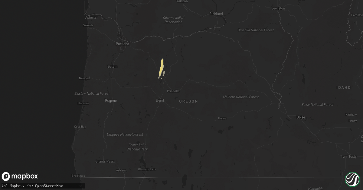
Hail Map in Oregon on August 17, 2020
Get this storm
August 17 map
$229
one time, instant access
Download today. No call, no setup
Keep the $229
Bought the map and want the full workflow? Apply the entire $229 to a subscription within 7 days. None of it is wasted.
Every map, not just this one
This buys you this map. Subscription and you get every map we run, in the markets you choose from a few cities to whole states to nationwide. Plus real-time alerts the moment a storm fires.
Contact data
Name, contact info, occupancy, even credit band for addresses in the footprint. You go from where it hit to who to call.
Become the source they trust
Unlimited branding weather history reports on demand. You already have the documented answer ready for the property owner, and you are the one who showed up with it.
Property data and RoofTrace estimates
Pull up any address you have got, its value and the exact code rules for that jurisdiction, straight from One Click Code. Then RoofTrace estimates the squares, pitch, and roof value, priced the way you price.
Storm reports in Oregon
Oregon
| Date | Description |
|---|---|
| 08/17/20206:52 PM CDT | Mesonet station mgfo3 morgan mountain. |
| 08/17/20206:30 PM CDT | Report relayed via nwschat by local storm spotter of downed power lines on us highway 26 between madras and warm springs. Time estimated off radar. |
| 08/17/20204:43 PM CDT | Mesonet station rlfo3 riddle mountain. |
| 08/17/20203:20 PM CDT | A local report indicates 70 MPH wind near 1 NNE ANDREWS |
| 08/17/20203:00 PM CDT | Spotter in fields or measured sustained 44mph with gust to 58 mph. |
| 08/17/20202:10 PM CDT | Mesonet station od111 10.9 n catnip mountain |
| 08/17/20202:01 AM CDT | At 700 PM PDT, a severe thunderstorm was located 9 miles northeast of Condon, moving northeast at 30 mph. HAZARD...60 mph wind gusts are possible, along with brief heavy rain, small hail and frequent lightning. SOURCE...Radar indicated. IMPACT...Expect damage to roofs, siding, and trees. Locations impacted include... Heppner, Ione and Lexington. |
| 08/17/20201:51 AM CDT | At 649 PM MDT/549 PM PDT/, severe thunderstorms were located along a line extending from Lake Fork Campground to Indian Valley, moving northeast at 25 mph. HAZARD...65 mph wind gusts. SOURCE...Mesonet observations. IMPACT...Expect damage to roofs, siding, and trees. Severe thunderstorms will be near... Goodrich, Indian Valley, and Mesa around 650 PM MDT. Council, and Bear around 710 PM MDT. Cuprum, and Glendale around 720 PM MDT. McCall, New Meadows, Tamarack Ski Area and Cascade Reservoir around 730 PM MDT. |
| 08/17/20201:07 AM CDT | At 607 PM PDT, severe thunderstorms were located along a line extending from 10 miles south of Flora to near Council, moving northeast at 40 mph. HAZARD...70 mph wind gusts. SOURCE...Radar indicated. IMPACT...Expect considerable tree damage. Damage is likely to mobile homes, roofs, and outbuildings. Locations impacted include... Riggins, White Bird, Canfield, Riggins Hot Spring, Lucile, Pollock, Keuterville, Slate Creek, Copperville and Burgdorf. |
| 08/17/202012:38 AM CDT | At 537 PM PDT, a severe thunderstorm was located over Wapinitia, or 30 miles southeast of Government Camp, moving north at 25 mph. HAZARD...60 mph wind gusts, quarter or bigger size hail and brief heavy rain is possible. SOURCE...Radar indicated. IMPACT...Hail damage to vehicles is expected. Expect wind damage to roofs, siding, and trees. Locations impacted include... Maupin, Wamic, Wapinitia and Tygh Valley. |
| 08/17/202012:03 AM CDT | At 502 PM PDT, a severe thunderstorm was located over eastern Warm Springs Reservation, or 16 miles north of Madras, moving north at 25 mph. HAZARD...60 mph wind gusts, quarter size hail and brief heavy rain is possible. SOURCE...Spotters report marble size hail an gusty winds around 5 mph. IMPACT...Hail damage to vehicles is expected. Expect wind damage to roofs, siding, and trees. Locations impacted include... South Junction, Simnasho, Gateway and eastern Warm Springs Reservation. |
| 08/16/202011:13 PM CDT | At 412 PM MDT, severe thunderstorms were located along a line extending from 7 miles northeast of Monument Peak to 7 miles northeast of Knottingham Butte, moving northeast at 40 mph. HAZARD...70 mph wind gusts. SOURCE...Radar indicated. IMPACT...Expect considerable tree damage. Damage is likely to mobile homes, roofs, and outbuildings. Severe thunderstorms will be near... Pelican Point around 420 PM MDT. Twin Springs Campground around 430 PM MDT. Owyhee Reservoir and Little Valley around 440 PM MDT. Vale, Adrian around 500 PM MDT. |
| 08/16/202010:52 PM CDT | At 352 PM PDT, a severe thunderstorm was located 11 miles east of Camp Sherman, or 16 miles northwest of Redmond, moving northeast at 25 mph. HAZARD...60 mph wind gusts and quarter size hail possible. SOURCE...Radar indicated. IMPACT...Hail damage to vehicles is expected. Expect wind damage to roofs, siding, and trees. Locations impacted include... Madras, Culver, Metolius, Gateway, Camp Sherman, Warm Springs and southern Warm Springs Reservation. |
| 08/16/202010:28 PM CDT | At 328 PM MDT/228 PM PDT/, a severe thunderstorm was located over Hat Butte, or 42 miles northwest of Rome, moving northeast at 35 mph. HAZARD...70 mph wind gusts. SOURCE...Radar indicated. IMPACT...Expect damage to roofs, siding, and trees. This severe thunderstorm will be near... Dowell Butte around 330 PM MDT. Swamp Creek Buttes, Dunnean, Coleman Mountain and Sacramento Butte around 340 PM MDT. Turnbull Mountain, Crowley and Cedar Mountain around 350 PM MDT. Monumental Rock, Riverside and Warm Springs Reservoir around 400 PM MDT. Juntura, Red Butte, Monument Peak and Mosquito Mountain around 410 PM MDT. |
| 08/16/20209:15 PM CDT | Spotter reported a tree down across route 74 at ella rd in ione. |
| 08/16/20209:01 PM CDT | At 159 PM MDT/1259 PM PDT/, severe thunderstorms were located along a line extending from Butler Hill to near Pueblo Mountain, moving east at 40 mph. HAZARD...65 mph wind gusts. SOURCE...Radar indicated. IMPACT...Expect damage to roofs, siding, and trees. Severe thunderstorms will be near... Fields around 100 PM PDT. Frenchglen, Page Springs Campground around 110 PM PDT. South Steens Campground around 120 PM PDT. Fish Lake Campground, Wildhorse Lake around 130 PM PDT. Willow Creek Hot Springs and Juniper Lake around 140 PM PDT. |
| 08/16/20207:05 PM CDT | Roof torn off of carport in the wolf creek subdivision north of warm springs. Time estimated from radar. |
| 08/16/20207:00 PM CDT | Trees downed and neighbor lost their porch. Neighbor relayed that power poles were downed approx 1 mile west of spotter. |
All States Impacted by Hail Map on August 17, 2020
Cities Impacted by Hail Map on August 17, 2020
- Commerce, GA
- Homer, GA
- Waurika, OK
- Hastings, OK
- Honesdale, PA
- Equinunk, PA
- Pleasant Mount, PA
- Stuart, FL
- Palm Coast, FL
- Bunnell, FL
- Valentine, NE
- Melbourne Beach, FL
- Agar, SD
- Pierre, SD
- Eagle Butte, SD
- Onida, SD
- Randlett, OK
- Angora, NE
- Bridgeport, NE
- Belle Glade, FL
- Alliance, NE
- Geneva, FL
- Wilmer, AL
- Mcdonough, GA
- Fort Pierre, SD
- Presho, SD
- Maupin, OR
- Warm Springs, OR
- Jefferson, GA
- Hay Springs, NE
- Chadron, NE
- Alamogordo, NM
- Tunkhannock, PA
- Broadwater, NE
- Crooksville, OH
- Roseville, OH
- Blue Rock, OH
- Mcconnelsville, OH
- Lucedale, MS
- Shelby, NC
- Kings Mountain, NC
- Cherryville, NC
- Calliham, TX
- Elkton, FL
- Thedford, NE
- Hemingford, NE
- Fort Yates, ND
- Washoe Valley, NV
- Meshoppen, PA
- Mehoopany, PA
- Dunnellon, FL
- Titusville, FL
- Clarks Summit, PA
- Dalton, PA
- Reno, NV
- Okeechobee, FL
- Mountain Top, PA
- Blunt, SD
- Loxahatchee, FL
- Lower Brule, SD
- Perry, FL
- Whitsett, TX
- Marietta, OK
- Prescott, AZ
- Three Rivers, TX
- Hialeah, FL
- Fort Pierce, FL
- Draper, SD
- Wind Gap, PA
- Bath, PA
- Laceyville, PA
- Eunice, NM
- Cloudcroft, NM
- Wichita Falls, TX
- Sells, AZ
- Oswego, NY
- Madras, OR
- Citronelle, AL
- Culver, OR
- Lake Harmony, PA
- Genoa, NV
- Prattville, AL
- Pollock, SD
- Rocksprings, TX
- Windermere, FL
- Winter Garden, FL
- Malta, OH


