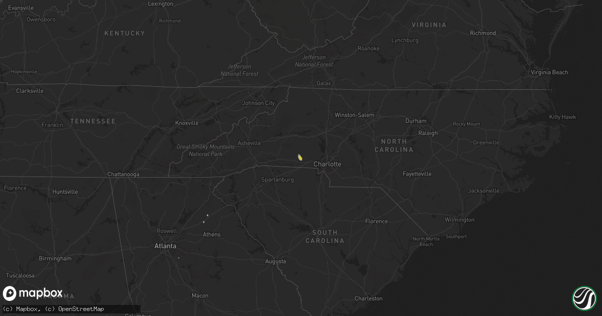
Hail Map on August 17, 2020
Get this storm
August 17 map
$229
one time, instant access
Download today. No call, no setup
Keep the $229
Bought the map and want the full workflow? Apply the entire $229 to a subscription within 7 days. None of it is wasted.
Every map, not just this one
This buys you this map. Subscription and you get every map we run, in the markets you choose from a few cities to whole states to nationwide. Plus real-time alerts the moment a storm fires.
Contact data
Name, contact info, occupancy, even credit band for addresses in the footprint. You go from where it hit to who to call.
Become the source they trust
Unlimited branding weather history reports on demand. You already have the documented answer ready for the property owner, and you are the one who showed up with it.
Property data and RoofTrace estimates
Pull up any address you have got, its value and the exact code rules for that jurisdiction, straight from One Click Code. Then RoofTrace estimates the squares, pitch, and roof value, priced the way you price.
States Impacted by Hail Map on August 17, 2020
Storm reports
Virginia
| Date | Description |
|---|---|
| 08/17/20203:50 PM CDT | Reports of trees blown down along plank road. |
| 08/17/20203:10 PM CDT | A tree blew down onto va-629 lahore road near the intersection with va-631 brick church road. |
| 08/17/20203:05 PM CDT | A tree blew down on va-2010 miller road near the intersection with gobler knob lane. |
| 08/17/20204:28 AM CDT | At 928 PM EDT, a severe thunderstorm was located near Carson, or 7 miles southwest of Disputanta, moving southeast at 20 mph. HAZARD...60 mph wind gusts and nickel size hail. SOURCE...Radar indicated. IMPACT...Expect damage to trees and powerlines. This severe thunderstorm will be near, Sussex around 955 PM EDT. Homeville around 1000 PM EDT.Other locations impacted by this severe thunderstorm includeLumberton, Newville, Templeton, Booker and Littleton. |
| 08/16/202011:50 PM CDT | At 450 PM EDT, a severe thunderstorm was located near Lake Monticello, or 9 miles south of Charlottesville, moving east at 15 mph. HAZARD...60 mph wind gusts. SOURCE...Radar indicated. IMPACT...Damaging winds will cause some trees and large branches to fall. This could injure those outdoors, as well as damage homes and vehicles. Roadways may become blocked by downed trees. Localized power outages are possible. Unsecured light objects may become projectiles. Locations impacted include... Scottsville, Esmont, Keene, Glendower, Overton, Boyd Tavern and Woodridge. |
| 08/16/202011:04 PM CDT | At 404 PM EDT, a severe thunderstorm was located over Orange, moving east at 15 mph. HAZARD...60 mph wind gusts. SOURCE...Radar indicated. IMPACT...Damaging winds will cause some trees and large branches to fall. This could injure those outdoors, as well as damage homes and vehicles. Roadways may become blocked by downed trees. Localized power outages are possible. Unsecured light objects may become projectiles. Locations impacted include... Orange, Mine Run, Rhoadesville, Everona, Verdiersville, Madison Run, Locust Grove, Gold Dale, Thornhill, Nasons, Lahore, Unionville and Madison Mills. |
Texas
| Date | Description |
|---|---|
| 08/17/20206:26 PM CDT | Ten powerline poles were snapped at their midpoint along hwy 90. |
| 08/17/20207:17 AM CDT | At 1216 AM CDT, a severe thunderstorm was located over Douglass, or 12 miles west of Nacogdoches, moving southeast at 20 mph. HAZARD...60 mph wind gusts and quarter size hail. SOURCE...Radar indicated. IMPACT...Hail damage to vehicles is expected. Expect wind damage to roofs, siding, and trees. Locations impacted include... Nacogdoches and Douglass. |
| 08/17/20207:09 AM CDT | At 1208 AM CDT, a cluster of severe thunderstorms was located near Corrigan, or 9 miles southwest of Diboll, moving south at 25 mph. HAZARD...60 mph wind gusts and quarter size hail. SOURCE...Radar indicated. IMPACT...Hail damage to vehicles is expected. Expect wind damage to roofs, siding, and trees. Locations impacted include... Apple Springs, Trinity, Corrigan, Groveton, Sebastopol, Pennington and Centralia. |
| 08/17/20207:04 AM CDT | At 1204 AM CDT, a severe thunderstorm was located over Mount Vernon, or 13 miles west of Mount Pleasant, moving south at 10 mph. HAZARD...60 mph wind gusts and quarter size hail. SOURCE...Radar indicated. IMPACT...Hail damage to vehicles is expected. Expect wind damage to roofs, siding, and trees. Locations impacted include... Mount Vernon, Purley, Cypress and Hopewell. |
| 08/16/202011:30 PM CDT | At 429 PM CDT, a severe thunderstorm was located 12 miles northeast of Alamo Village, or 18 miles northeast of Brackettville, moving southwest at 25 mph. HAZARD...60 mph wind gusts. SOURCE...Radar indicated. IMPACT...Expect damage to roofs, siding, and trees. Locations impacted include... Alamo Village and Turkey Mountain. |
Pennsylvania
| Date | Description |
|---|---|
| 08/17/20206:59 AM CDT | At 1159 PM EDT, a severe thunderstorm was located over Blakeslee, or 13 miles west of Mount Pocono, moving east at 25 mph. HAZARD...60 mph wind gusts and quarter size hail. SOURCE...Radar indicated. IMPACT...Minor damage to vehicles is possible. Wind damage to roofs, siding, trees, and power lines is possible. Locations impacted include... Mount Pocono, Tobyhanna, Brodheadsville, Pocono Pines, Gilbert, Pocono Raceway, Lake Harmony, Skytop, Tannersville, Mountainhome, Rossland, Long Pond, Albrightsville, Kresgeville, Sun Valley, Arrowhead Lake, Jonas, Meckesville, Reeders and McMichael.This includes the following highways... Northeast Extension between mile markers 83 and 97. Interstate 80 in Pennsylvania between mile markers 277 and 304. Interstate 380 in Pennsylvania between mile markers 0 and 13. |
| 08/17/20206:57 AM CDT | At 1157 PM EDT, a severe thunderstorm was located over Rutledgedale, or 10 miles northeast of Honesdale, moving southeast at 25 mph. HAZARD...60 mph wind gusts and quarter size hail. SOURCE...Radar indicated. IMPACT...Hail damage to vehicles is expected. Expect wind damage to roofs, siding, and trees. Locations impacted include... Bethel, Damascus, Callicoon, Tusten, Cochecton, Narrowsburg, Mongaup Valley, Smallwood, White Lake and Rutledgedale. |
| 08/17/20206:39 AM CDT | At 1139 PM EDT, a severe thunderstorm was located over Penobscot, or 7 miles south of Wilkes-Barre, moving southeast at 25 mph. HAZARD...60 mph wind gusts and quarter size hail. SOURCE...Radar indicated. IMPACT...Hail damage to vehicles is expected. Expect wind damage to roofs, siding, and trees. Locations impacted include... Wilkes-Barre, Ashley, Bear Creek, White Haven, Preston, Sugar Notch, Nuangola, Warrior Run, Laurel Run and Penn Lake Park. |
| 08/17/20206:37 AM CDT | At 1137 PM EDT, a severe thunderstorm was located near Rutledgedale, or 12 miles north of Honesdale, moving east at 35 mph. HAZARD...60 mph wind gusts and quarter size hail. SOURCE...Radar indicated. IMPACT...Hail damage to vehicles is expected. Expect wind damage to roofs, siding, and trees. Locations impacted include... Bethel, Damascus, Callicoon, Cochecton, Jeffersonville, Narrowsburg, Stalker, Equinunk, Rutledgedale and Hankins. |
| 08/17/20205:39 AM CDT | At 1039 PM EDT, a severe thunderstorm was located over Osterhout, or near Tunkhannock, moving southeast at 25 mph. HAZARD...60 mph wind gusts and nickel size hail. SOURCE...Radar indicated. IMPACT...Expect damage to roofs, siding, and trees. Locations impacted include... Scranton, Falls, Dunmore, Old Forge, Archbald, Blakely, Taylor, Dickson City, Moosic and Olyphant. |
| 08/17/202012:17 AM CDT | Downed trees and wires near hartzell ferry road. Time estimated from radar. |
| 08/17/202012:10 AM CDT | Trees and wires down in lower saucon twp. Time estimated by radar. |
| 08/17/202012:00 AM CDT | Trees and wires down in bethlehem twp. Time estimated by radar. |
| 08/16/202011:59 PM CDT | Downed trees and wires near twilight trail. Time estimated from radar. |
| 08/16/202011:48 PM CDT | Downed trees and power lines on paradise trail near wooddale road. Time estimated from radar. |
| 08/16/202011:44 PM CDT | Downed tree blocking reish road in stroud township. Time estimated from radar. |
| 08/16/202011:34 PM CDT | Downed tree on camelback road near resort drive in tannersville. Time estimated from radar. |
| 08/16/202011:33 PM CDT | Downed trees and wires near mountain spring lake. Time estimated from radar. |
| 08/16/202011:22 PM CDT | Downed tree and wires near steckel road in jonas. Time estimated from radar. |
| 08/16/202011:20 PM CDT | Downed tree on timber lane in tobyhanna twp. Time estimated from radar. |
| 08/16/202011:16 PM CDT | Tree down on roadway in pocono pines. Time estimated by radar. |
| 08/16/202011:13 PM CDT | Downed tree on stoney hollow road in tobyhanna twp. Time estimated from radar. |
| 08/16/202011:11 PM CDT | Downed tree on locust ridge road near spur road in tobyhanna twp. Time estimated from radar. |
| 08/16/20209:30 PM CDT | Large pine tree fell onto a garage causing significant damage. Time is estimated by radar. |
| 08/16/20209:30 PM CDT | Tree fell down in the yard of a house. Time estimated from radar. |
| 08/16/20208:35 PM CDT | Tree down across roadway near route 6 and route 409. Time estimated from radar. |
New York
| Date | Description |
|---|---|
| 08/17/20201:50 AM CDT | At 649 PM EDT, a severe thunderstorm was located near Russell, moving southeast at 25 mph. HAZARD...60 mph wind gusts and nickel size hail. SOURCE...Radar indicated. IMPACT...Expect damage to trees, roofs, and siding. Locations impacted include... Russell, Scandia and Kinzua Dam. This includes the following highways... Route 62 from North Warren to the New York border. State Road 59 from east of Warren to east of Kinzua Dam. |
Idaho
| Date | Description |
|---|---|
| 08/17/20206:52 PM CDT | Mesonet station deai1 catfish. |
| 08/17/20202:20 AM CDT | At 719 PM MDT, severe thunderstorms were located along a line extending from near Pollock Mountain to near Paddy Flat Work Center, moving northeast at 45 mph. HAZARD...70 mph wind gusts. SOURCE...Radar indicated. IMPACT...Expect considerable tree damage. Damage is likely to mobile homes, roofs, and outbuildings. Severe thunderstorms will be near... Paddy Flat Work Center, Lake Fork Guard Station, Little Payette Lake and Payette Lake around 720 PM MDT. Poverty Flat Campground, Upper Payette Lake and Lick Creek Summit around 730 PM MDT. Halfway Station, Krassel Work Center, Yellow Pine and Pistol Rock around 740 PM MDT. |
| 08/16/20208:46 PM CDT | Mesonet station srfi1 snake river. |
| 08/16/20207:30 PM CDT | Measured 68 mph with possible higher gusts. |
Florida
| Date | Description |
|---|---|
| 08/17/20204:36 PM CDT | An off duty nws employee reported several large tree branches down in the vicinity of sw 178th ave and 61st ct in southwest ranches. |
| 08/17/20201:30 PM CDT | Large tree blown down into 3 vehicles at albert park near the intersection of edgewater drive and vassar street. Report from wkmg-tv. |
| 08/17/202012:05 AM CDT | At 505 PM EDT, a severe thunderstorm was located near Bunnell, moving northeast at 10 mph. HAZARD...60 mph wind gusts and nickel size hail. SOURCE...Radar indicated. IMPACT...Expect damage to roofs, siding, and trees. Locations impacted include... Palm Coast, Flagler Beach, Bunnell and Beverly Beach. |
| 08/16/202011:51 PM CDT | At 451 PM EDT, severe thunderstorms were located along a line extending from 8 miles northwest of North County Airport to 11 miles southwest of Lion Country Safari Park, moving east at 5 mph. HAZARD...60 mph wind gusts and quarter size hail. SOURCE...Radar indicated. IMPACT...Hail damage to vehicles is expected. Expect wind damage to roofs, siding, and trees. Locations impacted include... Wellington, Palm Beach Gardens, Belle Glade, Royal Palm Beach and Okeelanta. |
| 08/16/202010:53 PM CDT | At 353 PM EDT, a severe thunderstorm was located near Palm City, and is nearly stationary. HAZARD...60 mph wind gusts and quarter size hail. SOURCE...Radar indicated. IMPACT...Hail damage to vehicles is expected. Expect wind damage to roofs, siding, and trees. Locations impacted include... Stuart, Jupiter Island, Palm City, Hobe Sound and Port Salerno. |
| 08/16/20209:06 PM CDT | At 206 PM EDT, a severe thunderstorm was located over Ocoee, moving east at 20 mph. HAZARD...60 mph wind gusts and penny size hail. SOURCE...Radar indicated. IMPACT...Expect damage to roofs, siding, and trees. Locations impacted include... Orlando, Apopka, Ocoee, Winter Garden and Winter Park. |
Maryland
| Date | Description |
|---|---|
| 08/17/20201:16 AM CDT | At 615 PM EDT, severe thunderstorms were located along a line extending from near Glenmoore to Kemblesville, moving east at 25 mph. HAZARD...60 mph wind gusts and nickel size hail. SOURCE...Radar indicated. IMPACT...Damage to roofs, siding, trees, and power lines is possible. Locations impacted include... Wilmington, West Chester, Phoenixville, Coatesville, Westtown, Downingtown, Elsmere, Kennett Square, Oxford, Parkesburg, West Grove, Cochranville, North Star, Marshallton, Pike Creek, Lionville-Marchwood, Ashland, Greenville, Glenmoore and Chester Springs.This includes Pennsylvania Turnpike between mile markers 306 and 320. |
| 08/17/202012:38 AM CDT | At 537 PM EDT, severe thunderstorms were located along a line extending from Honey Brook to near Richardsmere, moving east at 30 mph. HAZARD...60 mph wind gusts and nickel size hail. SOURCE...Radar indicated. IMPACT...Damage to roofs, siding, trees, and power lines is possible. Locations impacted include... West Chester, Coatesville, Downingtown, Kennett Square, Oxford, Parkesburg, West Grove, Honey Brook, Elverson, Homeville, Glen Roy, Cochranville, North Star, Pughtown, Mount Vernon, Marshallton, Pike Creek, Lionville-Marchwood, Glenmoore and Chester Springs.This includes Pennsylvania Turnpike between mile markers 300 and 316. |
| 08/17/202012:27 AM CDT | At 527 PM EDT, severe thunderstorms were located along a line extending from near New Holland to Quarryville to near Delta, moving east at 35 mph. HAZARD...60 mph wind gusts and nickel size hail. SOURCE...Radar indicated. IMPACT...Expect damage to trees, roofs, and siding. Locations impacted include... New Holland, Paradise, Strasburg, Quarryville, Gap, Wakefield, Churchtown, Smithville, Intercourse, Christiana, Blue Ball, Georgetown, Gordonville, Goodville, Kirkwood, Little Britain, Refton, Buck, White Horse and Peach Bottom. |
Colorado
| Date | Description |
|---|---|
| 08/16/20208:55 PM CDT | At 155 AM MDT, a severe thunderstorm was located near Milton Reservoir, or 15 miles southeast of Greeley, moving south at 15 mph. HAZARD...60 mph wind gusts and half dollar size hail. SOURCE...Radar indicated. IMPACT...Expect damage to roofs, siding, and trees. Hail damage to vehicles is expected. Locations impacted include... Hudson, Keenesburg and Milton Reservoir. |
Oregon
| Date | Description |
|---|---|
| 08/17/20206:52 PM CDT | Mesonet station mgfo3 morgan mountain. |
| 08/17/20206:30 PM CDT | Report relayed via nwschat by local storm spotter of downed power lines on us highway 26 between madras and warm springs. Time estimated off radar. |
| 08/17/20204:43 PM CDT | Mesonet station rlfo3 riddle mountain. |
| 08/17/20203:20 PM CDT | A local report indicates 70 MPH wind near 1 NNE ANDREWS |
| 08/17/20203:00 PM CDT | Spotter in fields or measured sustained 44mph with gust to 58 mph. |
| 08/17/20202:10 PM CDT | Mesonet station od111 10.9 n catnip mountain |
| 08/17/20202:01 AM CDT | At 700 PM PDT, a severe thunderstorm was located 9 miles northeast of Condon, moving northeast at 30 mph. HAZARD...60 mph wind gusts are possible, along with brief heavy rain, small hail and frequent lightning. SOURCE...Radar indicated. IMPACT...Expect damage to roofs, siding, and trees. Locations impacted include... Heppner, Ione and Lexington. |
| 08/17/20201:51 AM CDT | At 649 PM MDT/549 PM PDT/, severe thunderstorms were located along a line extending from Lake Fork Campground to Indian Valley, moving northeast at 25 mph. HAZARD...65 mph wind gusts. SOURCE...Mesonet observations. IMPACT...Expect damage to roofs, siding, and trees. Severe thunderstorms will be near... Goodrich, Indian Valley, and Mesa around 650 PM MDT. Council, and Bear around 710 PM MDT. Cuprum, and Glendale around 720 PM MDT. McCall, New Meadows, Tamarack Ski Area and Cascade Reservoir around 730 PM MDT. |
| 08/17/20201:07 AM CDT | At 607 PM PDT, severe thunderstorms were located along a line extending from 10 miles south of Flora to near Council, moving northeast at 40 mph. HAZARD...70 mph wind gusts. SOURCE...Radar indicated. IMPACT...Expect considerable tree damage. Damage is likely to mobile homes, roofs, and outbuildings. Locations impacted include... Riggins, White Bird, Canfield, Riggins Hot Spring, Lucile, Pollock, Keuterville, Slate Creek, Copperville and Burgdorf. |
| 08/17/202012:38 AM CDT | At 537 PM PDT, a severe thunderstorm was located over Wapinitia, or 30 miles southeast of Government Camp, moving north at 25 mph. HAZARD...60 mph wind gusts, quarter or bigger size hail and brief heavy rain is possible. SOURCE...Radar indicated. IMPACT...Hail damage to vehicles is expected. Expect wind damage to roofs, siding, and trees. Locations impacted include... Maupin, Wamic, Wapinitia and Tygh Valley. |
| 08/17/202012:03 AM CDT | At 502 PM PDT, a severe thunderstorm was located over eastern Warm Springs Reservation, or 16 miles north of Madras, moving north at 25 mph. HAZARD...60 mph wind gusts, quarter size hail and brief heavy rain is possible. SOURCE...Spotters report marble size hail an gusty winds around 5 mph. IMPACT...Hail damage to vehicles is expected. Expect wind damage to roofs, siding, and trees. Locations impacted include... South Junction, Simnasho, Gateway and eastern Warm Springs Reservation. |
| 08/16/202011:13 PM CDT | At 412 PM MDT, severe thunderstorms were located along a line extending from 7 miles northeast of Monument Peak to 7 miles northeast of Knottingham Butte, moving northeast at 40 mph. HAZARD...70 mph wind gusts. SOURCE...Radar indicated. IMPACT...Expect considerable tree damage. Damage is likely to mobile homes, roofs, and outbuildings. Severe thunderstorms will be near... Pelican Point around 420 PM MDT. Twin Springs Campground around 430 PM MDT. Owyhee Reservoir and Little Valley around 440 PM MDT. Vale, Adrian around 500 PM MDT. |
| 08/16/202010:52 PM CDT | At 352 PM PDT, a severe thunderstorm was located 11 miles east of Camp Sherman, or 16 miles northwest of Redmond, moving northeast at 25 mph. HAZARD...60 mph wind gusts and quarter size hail possible. SOURCE...Radar indicated. IMPACT...Hail damage to vehicles is expected. Expect wind damage to roofs, siding, and trees. Locations impacted include... Madras, Culver, Metolius, Gateway, Camp Sherman, Warm Springs and southern Warm Springs Reservation. |
| 08/16/202010:28 PM CDT | At 328 PM MDT/228 PM PDT/, a severe thunderstorm was located over Hat Butte, or 42 miles northwest of Rome, moving northeast at 35 mph. HAZARD...70 mph wind gusts. SOURCE...Radar indicated. IMPACT...Expect damage to roofs, siding, and trees. This severe thunderstorm will be near... Dowell Butte around 330 PM MDT. Swamp Creek Buttes, Dunnean, Coleman Mountain and Sacramento Butte around 340 PM MDT. Turnbull Mountain, Crowley and Cedar Mountain around 350 PM MDT. Monumental Rock, Riverside and Warm Springs Reservoir around 400 PM MDT. Juntura, Red Butte, Monument Peak and Mosquito Mountain around 410 PM MDT. |
| 08/16/20209:15 PM CDT | Spotter reported a tree down across route 74 at ella rd in ione. |
| 08/16/20209:01 PM CDT | At 159 PM MDT/1259 PM PDT/, severe thunderstorms were located along a line extending from Butler Hill to near Pueblo Mountain, moving east at 40 mph. HAZARD...65 mph wind gusts. SOURCE...Radar indicated. IMPACT...Expect damage to roofs, siding, and trees. Severe thunderstorms will be near... Fields around 100 PM PDT. Frenchglen, Page Springs Campground around 110 PM PDT. South Steens Campground around 120 PM PDT. Fish Lake Campground, Wildhorse Lake around 130 PM PDT. Willow Creek Hot Springs and Juniper Lake around 140 PM PDT. |
| 08/16/20207:05 PM CDT | Roof torn off of carport in the wolf creek subdivision north of warm springs. Time estimated from radar. |
| 08/16/20207:00 PM CDT | Trees downed and neighbor lost their porch. Neighbor relayed that power poles were downed approx 1 mile west of spotter. |
Ohio
| Date | Description |
|---|---|
| 08/17/20204:33 PM CDT | Trees down. |
| 08/17/20203:30 PM CDT | Time estimated from radar. |
| 08/16/202011:56 PM CDT | At 455 PM EDT, a severe thunderstorm was located 9 miles northwest of McConnelsville, moving southeast at 25 mph. HAZARD...60 mph wind gusts and quarter size hail. SOURCE...Radar indicated. IMPACT...Hail damage to vehicles is expected. Expect wind damage to roofs, siding, and trees. Locations impacted include... McConnelsville, Malta and Eagleport. |
California
| Date | Description |
|---|---|
| 08/17/20204:54 PM CDT | A local report indicates 58 MPH wind near OWENS VALLEY (RAWS) |
| 08/17/20201:11 AM CDT | At 610 PM PDT, a severe thunderstorm was located 10 miles northeast of Yosemite Valley, or 19 miles west of Lee Vining, moving north at 15 mph. HAZARD...60 mph wind gusts and quarter size hail. SOURCE...Radar indicated. IMPACT...Expect wind damage to roofs, siding, and trees. Locations impacted include... May Lake High Sierra Camp, Sunrise High Sierra Camp, Snow Flat, Glen Aulin High Sierra Camp and Tenaya Lake. |
| 08/17/202012:05 AM CDT | At 504 PM PDT, a severe thunderstorm was located 17 miles southwest of Mammouth Mountain, or 19 miles southwest of Mammoth Lakes, moving north at 15 mph. HAZARD...60 mph wind gusts and quarter size hail. SOURCE...Radar indicated. IMPACT...Expect wind damage to roofs, siding, and trees. Locations impacted include... Devils Postpile, Clover Meadow Wilderness Office, Mount Tom, Graveyard Meadow, Green Mtn, Agnew Pass and Red Meadow Ranger Station. |
Nebraska
| Date | Description |
|---|---|
| 08/17/20206:24 PM CDT | A local report indicates 1.00 inch wind near 5 SE CHADRON |
| 08/17/20205:40 PM CDT | Chadrad radio reporting power outages to 450 customers from nebraska public power district in southwest part of chadron. |
| 08/17/20205:35 PM CDT | Corrects previous hail report from 5 se chadron. |
| 08/17/20205:15 PM CDT | Public reports estimated winds of 60mph and hail up to the size of ping pongs. Damage to property crop also noted. |
| 08/17/20201:00 AM CDT | At 600 PM MDT, a severe thunderstorm was located 12 miles northeast of Northport, or 21 miles south of Alliance, moving southeast at 25 mph. HAZARD...60 mph wind gusts and quarter size hail. SOURCE...Radar indicated. IMPACT...Hail damage to vehicles is expected. Expect wind damage to roofs, siding, and trees. Locations impacted include... Broadwater. |
| 08/17/202012:35 AM CDT | At 535 PM MDT, a severe thunderstorm was located 13 miles north of Wild Horse Butte, or 17 miles south of Hay Springs, moving southeast at 20 mph. HAZARD...Ping pong ball size hail and 60 mph wind gusts. SOURCE...Radar indicated. IMPACT...People and animals outdoors will be injured. Expect hail damage to roofs, siding, windows, and vehicles. Expect wind damage to roofs, siding, and trees. Locations impacted include... Wild Horse Butte. |
| 08/17/202012:10 AM CDT | At 510 PM MDT, a severe thunderstorm was located 8 miles southwest of Hay Springs, moving southeast at 25 mph. HAZARD...Two inch hail and 60 mph wind gusts. SOURCE...Radar indicated. IMPACT...People and animals outdoors will be injured. Expect hail damage to roofs, siding, windows, and vehicles. Expect wind damage to roofs, siding, and trees. This severe thunderstorm will remain over mainly rural areas of southeastern Dawes County. |
| 08/16/202011:38 PM CDT | At 437 PM MDT, a severe thunderstorm was located near Red Cloud Campground, or 9 miles west of Hay Springs, moving southeast at 25 mph. HAZARD...Golf ball size hail and 60 mph wind gusts. SOURCE...Radar indicated. IMPACT...People and animals outdoors will be injured. Expect hail damage to roofs, siding, windows, and vehicles. Expect wind damage to roofs, siding, and trees. Locations impacted include... Chadron, Red Cloud Campground, Chadron Campground and Chadron St Park. |
| 08/16/202011:13 PM CDT | At 413 PM MDT, a severe thunderstorm was located 9 miles southeast of Chadron, moving southeast at 30 mph. HAZARD...Ping pong ball size hail and 60 mph wind gusts. SOURCE...Radar indicated. IMPACT...People and animals outdoors will be injured. Expect hail damage to roofs, siding, windows, and vehicles. Expect wind damage to roofs, siding, and trees. Locations impacted include... Chadron. |
Arizona
| Date | Description |
|---|---|
| 08/17/20204:28 AM CDT | At 927 PM MST, a severe thunderstorm was located just east of Why, or 12 miles southeast of Ajo, moving west at 25 mph. HAZARD...60 mph wind gusts and nickel size hail. SOURCE...Radar indicated. IMPACT...Expect damage to roofs, siding, and trees. Locations impacted include... Ajo, Why and Gunsight. This includes the following highways... Route 85 between mile markers 40 and 61. Route 86 between mile markers 53 and 61. |
| 08/17/20202:57 AM CDT | At 757 PM MST, a severe thunderstorm was located 7 miles west of Bapchule, or 8 miles southwest of Sun Lakes, moving west at 30 mph. HAZARD...60 mph wind gusts. SOURCE...Radar indicated. IMPACT...Expect damage to roofs, siding, and trees. Locations impacted include... Chandler, Sun Lakes, Maricopa, Bapchule, Estrella Sailport, Olberg and Ak-Chin Village. |
| 08/17/20202:40 AM CDT | At 739 PM MST, severe winds associated with a thunderstorm were located over Sky Harbor Airport, or near Laveen, moving west at 30 mph. HAZARD...60 mph wind gusts. SOURCE...Radar indicated. IMPACT...Expect damage to roofs, siding, and trees. Locations impacted include... Phoenix, Mesa, Chandler, Glendale, Scottsdale, Gilbert, Tempe, Paradise Valley, Laveen, Tempe Marketplace, Papago Park, Piestewa Peak Park, Salt River Indian Community, North Mountain Park and South Phoenix. |
| 08/17/20202:14 AM CDT | At 713 PM MST, a severe thunderstorm was located over Mesa, moving west at 40 mph. HAZARD...60 mph wind gusts. SOURCE...Radar indicated. IMPACT...Expect damage to roofs, siding, and trees. Locations impacted include... Mesa, Chandler, Gilbert, Tempe, East Mesa, Mesa Riverview Mall, Tempe Marketplace, Granite Reef Dam, Gilbert City Hall, Falcon Field Airport, Salt River Indian Community, Downtown Mesa, Superstition Springs Mall, Chandler City Hall and San Tan Village Mall. |
| 08/17/20201:45 AM CDT | At 644 PM MST, a severe thunderstorm was located over Lost Dutchman State Park, or over Apache Junction, moving southwest at 40 mph. HAZARD...60 mph wind gusts. SOURCE...Radar indicated. IMPACT...Expect damage to roofs, siding, and trees. Locations impacted include... Apache Junction, Gold Canyon, Gold Camp, Lost Dutchman State Park, Goldfield, Usery Mountain Park, Florence Junction, Saguaro Lake, Queen Valley, Canyon Lake, Superstition Mountains, Kings Ranch, Salt River Tubing Recreation Area and Tortilla Flat. |
| 08/17/20201:16 AM CDT | At 615 PM MST, a severe thunderstorm was located near Apache Lake, or 12 miles southwest of Roosevelt, moving southwest at 35 mph. HAZARD...60 mph wind gusts. SOURCE...Radar indicated. IMPACT...Expect damage to roofs, siding, and trees. Locations impacted include... Four Peaks, Canyon Lake, Apache Lake and Tortilla Flat. |
| 08/17/20201:00 AM CDT | At 559 PM MST, a severe thunderstorm was located 14 miles south of Young, or 21 miles northeast of Roosevelt, moving west at 25 mph. HAZARD...70 mph wind gusts and penny size hail. SOURCE...Radar indicated. IMPACT...Expect considerable tree damage. Damage is likely to mobile homes, roofs, and outbuildings. Locations impacted include... Reynolds Creek Group Campground and Rose Creek Campground. |
| 08/17/202012:45 AM CDT | At 545 PM MST, a severe thunderstorm was located near Tonto National Monument, or near Roosevelt, moving southwest at 15 mph. HAZARD...60 mph wind gusts. SOURCE...Radar indicated. IMPACT...Expect damage to roofs, siding, and trees. Locations impacted include... Roosevelt, Roosevelt Dam, Tonto National Monument, Tonto Basin and Roosevelt Estates. |
| 08/17/202012:29 AM CDT | At 529 PM MST, a severe thunderstorm was located 7 miles west of Morenci, or 9 miles west of Clifton, moving southwest at 25 mph. HAZARD...60 mph wind gusts and nickel size hail. SOURCE...Radar indicated. IMPACT...Expect damage to roofs, siding, and trees. Locations impacted include... Safford, Clifton, Thatcher, Solomon, Morenci, Safford Regional Airport, Pima and Central.This includes the following highways... Route 70 between mile markers 310 and 351. Route 191 between mile markers 119 and 134, and between mile markers170 and 174. |
| 08/17/202012:16 AM CDT | [delayed report] a local storm chaser tweeted a video of a semi truck tipped over on i-8. Adot also reported that the road closed about an hour later due to the crash a |
| 08/16/202011:38 PM CDT | At 438 PM MST, a severe thunderstorm was located near San Carlos, or 18 miles east of Globe, moving southwest at 35 mph. HAZARD...60 mph wind gusts. SOURCE...Radar indicated. IMPACT...Expect damage to roofs, siding, and trees. Locations impacted include... San Carlos and Cutter. |
| 08/16/202010:10 PM CDT | **delayed report**...power lines down along highway 238 between hartmann road and white and parker road as reported by member of maricopa police dispatch on their way i |
| 08/16/20209:55 PM CDT | Corrects previous tstm wnd dmg report from 4 nnw chandler. Near the 101 freeway and warner rd.... Three trees 15-20 ft tall were uprooted. Twenty to thirty other trees |
| 08/16/20209:42 PM CDT | Two mesquite trees had limbs of 5-10 inches in diameter snapped off. A small gazebo was lifted from a backyard and landed on a fence wall. Estimated winds of 50-55mph. |
| 08/16/20209:40 PM CDT | Sky harbor asos recorded wind gust of 59 mph. Visibility also reduced down to 2-3 mi from blowing dust. |
| 08/16/20209:30 PM CDT | Strong winds damaged 4 rv awnings and uprooted a tree with a 10 inch diameter. Winds estimated 60 mph. |
| 08/16/20209:25 PM CDT | Multiple large trees down in the shopping center area near market st. |
| 08/16/20209:24 PM CDT | **delayed report**...very large tree at least 30-40 feet tall and trunk diameter over a foot fell on a house near main st. And stapley dr; additional roof shingles torn |
New Jersey
| Date | Description |
|---|---|
| 08/17/202012:53 AM CDT | Downed power lines near route 24 in schooleys mountain. Time estimated from radar. |
| 08/17/202012:47 AM CDT | Downed trees and wires near winona trail in woodport. Time estimated from radar. |
| 08/17/202012:41 AM CDT | Trees and wires down in washington twp. Time estimated by radar. |
| 08/17/202012:27 AM CDT | Downed trees near state park road in the jenny jump state forest area. Time estimated from radar. |
| 08/17/202012:02 AM CDT | Downed trees and wires on fox hollow road near montague. Time estimated from radar. |
Alabama
| Date | Description |
|---|---|
| 08/17/202012:33 AM CDT | At 533 PM CDT, a severe thunderstorm was located 7 miles southeast of Leakesville, moving southwest at 15 mph. HAZARD...60 mph wind gusts and penny size hail. SOURCE...Radar indicated. IMPACT...Expect damage to roofs, siding, and trees. Locations impacted include... Lucedale. |
North Carolina
| Date | Description |
|---|---|
| 08/17/20203:52 PM CDT | At least 3 trees were blown down by the storm near stoney point road. |
| 08/17/20202:45 PM CDT | 911 call center reported trees down on pilch rd. |
| 08/16/202011:21 PM CDT | At 421 PM EDT, severe thunderstorms were located along a line extending from 6 miles west of Lincolnton to 18 miles northwest of Gastonia to 8 miles north of Shelby, moving southeast at 15 mph. HAZARD...60 mph wind gusts and nickel size hail. SOURCE...Radar indicated. IMPACT...Expect damage to trees and power lines. Locations impacted include... Lincolnton, Cherryville, Fallston, Waco, Boger City, Crouse, Vale and Lawndale. |
| 08/16/202010:28 PM CDT | At 328 PM EDT, a severe thunderstorm was located near Statesville, or near Troutman, moving southeast at 20 mph. HAZARD...60 mph wind gusts and quarter size hail. SOURCE...Radar indicated. IMPACT...Minor hail damage to vehicles is expected. Expect wind damage to trees and power lines. Locations impacted include... Statesville, Troutman, Cleveland, Mount Ulla and Mooresville. |
| 08/16/20209:53 PM CDT | At 252 PM EDT, a severe thunderstorm was located near Hickory, or over Hickory Regional Airport, moving southeast at 15 mph. HAZARD...60 mph wind gusts and quarter size hail. SOURCE...Radar indicated. IMPACT...Minor hail damage to vehicles is expected. Expect wind damage to trees and power lines. Locations impacted include... Hickory, Newton, St. Stephens, Conover, Longview, Maiden, Icard, Hildebran, Claremont and Rhodhiss. |
Washington
| Date | Description |
|---|---|
| 08/17/20201:25 AM CDT | At 622 PM PDT, a severe thunderstorm was located 19 miles northeast of Enterprise, moving northeast at 35 mph. The thunderstorms are looking to enter Nez Perce County by 6:45PM. Brief heavy downpours and wind gusts up to 50 mph are possible. HAZARD...50 mph wind gusts and penny size hail. SOURCE...Doppler radar indicated. IMPACT...Expect damage to roofs, siding, and trees. Locations impacted include... Kamiah, Lapwai, Craigmont, Nezperce, Culdesac, Winchester, Kendrick, Peck, Reubens, Mohler, Rogersburg, Waha, Gifford and Lenore. |
| 08/16/202011:00 PM CDT | Mesonet station hpasc 0.7 e pasco |
South Carolina
| Date | Description |
|---|---|
| 08/16/202011:43 PM CDT | At 442 PM EDT, severe thunderstorms were located along a line extending from 8 miles southwest of Lincolnton to 5 miles northeast of Shelby, moving southeast at 15 mph. HAZARD...60 mph wind gusts and quarter size hail. SOURCE...Radar indicated. IMPACT...Minor hail damage to vehicles is expected. Expect wind damage to trees and power lines. Locations impacted include... Gastonia, Kings Mountain, Cherryville, Bessemer City, South Gastonia, Dallas, Grover, Waco, Crowders Mountain State Park and Crowders. |
New Mexico
| Date | Description |
|---|---|
| 08/16/20209:41 PM CDT | At 240 PM MDT, a severe thunderstorm was located near Holloman Air Force Base, moving west at 10 mph. HAZARD...60 mph wind gusts and dime size hail. SOURCE...Radar indicated. IMPACT...Expect damage to roofs, siding, and trees. Locations impacted include... White Sands National Monument and Holloman Air Force Base. This includes Highway 70 in New Mexico between mile markers 194 and210. |
| 08/16/20209:09 PM CDT | At 208 PM MDT, a severe thunderstorm was located 4 miles southwest of High Rolls, moving west at 10 mph. HAZARD...60 mph wind gusts and penny size hail. SOURCE...Radar indicated. IMPACT...Expect damage to roofs, siding, and trees. Locations impacted include... Alamogordo, Burro Flats, High Rolls, La Luz, Mountain Park, Boles Acres and Karr Canyon.Very strong outflow winds downsloping off the Sacramento Mountains may precede any rainfall.This includes the following highways... Highway 70 in New Mexico between mile markers 210 and 212. Highway 54 in New Mexico between mile markers 60 and 74. |
Nevada
| Date | Description |
|---|---|
| 08/16/20209:41 PM CDT | At 238 PM MDT/138 PM PDT/, severe thunderstorms were located along a line extending from 6 miles west of Juniper Lake to 8 miles southeast of Willow Creek Hot Springs, moving northeast at 45 mph. HAZARD...70 mph wind gusts. SOURCE...Trained weather spotters. IMPACT...Expect considerable tree damage. Damage is likely to mobile homes, roofs, and outbuildings. Severe thunderstorms will be near... Coffin Butte and Mickey Butte around 140 PM PDT. Heath Lake, Tencent Lake, and Juniper Lake around 250 PM MDT. Ryegrass Butte and Three Man Butte around 300 PM MDT. Burns Junction and Basque Station around 310 PM MDT. Rome and Bowden Hills around 320 PM MDT. |
Mississippi
| Date | Description |
|---|---|
| 08/17/202012:29 AM CDT | At 529 PM CDT, a severe thunderstorm was located 6 miles west of Gulfcrest, or 10 miles southwest of Citronelle, moving southwest at 10 mph. HAZARD...60 mph wind gusts. SOURCE...Radar indicated. IMPACT...Expect damage to roofs, siding, and trees. Locations impacted include... Wilmer. |
Cities Impacted by Hail Map on August 17, 2020
- Commerce, GA
- Homer, GA
- Waurika, OK
- Hastings, OK
- Honesdale, PA
- Equinunk, PA
- Pleasant Mount, PA
- Stuart, FL
- Palm Coast, FL
- Bunnell, FL
- Valentine, NE
- Melbourne Beach, FL
- Agar, SD
- Pierre, SD
- Eagle Butte, SD
- Onida, SD
- Randlett, OK
- Angora, NE
- Bridgeport, NE
- Belle Glade, FL
- Alliance, NE
- Geneva, FL
- Wilmer, AL
- Mcdonough, GA
- Fort Pierre, SD
- Presho, SD
- Maupin, OR
- Warm Springs, OR
- Jefferson, GA
- Hay Springs, NE
- Chadron, NE
- Alamogordo, NM
- Tunkhannock, PA
- Broadwater, NE
- Crooksville, OH
- Roseville, OH
- Blue Rock, OH
- Mcconnelsville, OH
- Lucedale, MS
- Shelby, NC
- Kings Mountain, NC
- Cherryville, NC
- Calliham, TX
- Elkton, FL
- Thedford, NE
- Hemingford, NE
- Fort Yates, ND
- Washoe Valley, NV
- Meshoppen, PA
- Mehoopany, PA
- Dunnellon, FL
- Titusville, FL
- Clarks Summit, PA
- Dalton, PA
- Reno, NV
- Okeechobee, FL
- Mountain Top, PA
- Blunt, SD
- Loxahatchee, FL
- Lower Brule, SD
- Perry, FL
- Whitsett, TX
- Marietta, OK
- Prescott, AZ
- Three Rivers, TX
- Hialeah, FL
- Fort Pierce, FL
- Draper, SD
- Wind Gap, PA
- Bath, PA
- Laceyville, PA
- Eunice, NM
- Cloudcroft, NM
- Wichita Falls, TX
- Sells, AZ
- Oswego, NY
- Madras, OR
- Citronelle, AL
- Culver, OR
- Lake Harmony, PA
- Genoa, NV
- Prattville, AL
- Pollock, SD
- Rocksprings, TX
- Windermere, FL
- Winter Garden, FL
- Malta, OH