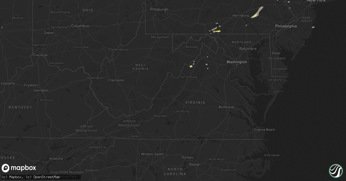
Hail Map in Virginia on August 17, 2018
Get this storm
August 17 map
$229
one time, instant access
Download today. No call, no setup
Keep the $229
Bought the map and want the full workflow? Apply the entire $229 to a subscription within 7 days. None of it is wasted.
Every map, not just this one
This buys you this map. Subscription and you get every map we run, in the markets you choose from a few cities to whole states to nationwide. Plus real-time alerts the moment a storm fires.
Contact data
Name, contact info, occupancy, even credit band for addresses in the footprint. You go from where it hit to who to call.
Become the source they trust
Unlimited branding weather history reports on demand. You already have the documented answer ready for the property owner, and you are the one who showed up with it.
Property data and RoofTrace estimates
Pull up any address you have got, its value and the exact code rules for that jurisdiction, straight from One Click Code. Then RoofTrace estimates the squares, pitch, and roof value, priced the way you price.
Storm reports in Virginia
Virginia
| Date | Description |
|---|---|
| 08/17/20185:10 PM CDT | Tree down on novum road at the culpeper county line. |
| 08/17/20185:05 PM CDT | Tree down near the intersection of west hoover road and novum church road. |
| 08/17/20184:15 PM CDT | Downed tree on airport road. |
| 08/17/20184:10 PM CDT | Tree down on hittles mill road. |
| 08/17/20184:01 PM CDT | Downed tree on airport road. |
| 08/17/20184:01 PM CDT | Downed tree on airport road. |
| 08/17/20184:01 PM CDT | Tree down on little long mountain road. |
| 08/17/20184:00 PM CDT | Tree down on hittles mill road. |
| 08/17/20183:48 PM CDT | Several reports of trees down near and just south of harrisonburg. |
| 08/17/20183:15 PM CDT | Downed tree on wires near the 200 block of smallwood lane. |
| 08/17/20183:15 PM CDT | Tree down in the 2100 block of west dry river road. |
| 08/17/20183:14 PM CDT | Tree down blocking roadway on orchard rd. Near mechanicsville |
| 08/17/20183:10 PM CDT | Large tree down near the intersection of spring creek road and george wine road. |
| 08/17/20182:57 PM CDT | Two trees down on bishop meade road near us-50 john mosby highway. |
| 08/17/20182:56 PM CDT | Downed wires near the intersection of route 50 and millwood road. |
| 08/17/20182:56 PM CDT | Downed tree on wires near the 1000 block of bishop meade rd. |
| 08/17/20182:55 PM CDT | Large pine tree down in the 15000 block of evergreen valley road. |
| 08/17/20182:55 PM CDT | Wires down and tree on a house near the intersection of orchard drive and andrick mill road. |
| 08/17/20182:47 PM CDT | Tree down near the intersection of berrys ferry road and white post road. |
| 08/17/20182:46 PM CDT | Tree down blocking road on sugar hill rd. Near white post |
| 08/17/20182:45 PM CDT | Tree down near the intersection of brocks gap road and north mountain road. |
| 08/17/20182:40 PM CDT | Two trees down |
| 08/17/20182:38 PM CDT | Trees down in stephens city. |
| 08/17/20182:34 PM CDT | Several large tree limbs down on i-81 south of mount jackson. |
| 08/17/20182:33 PM CDT | Tree down blocking roadway on orchard rd. Near mechanicsville |
| 08/17/20182:33 PM CDT | Trees down near intersection of crooked run road and state route 263. |
| 08/17/20182:33 PM CDT | Trees down near intersection of crooked run road and state route 263. |
| 08/17/20182:33 PM CDT | Tree down near intersection of stoney creek road and senedo road. |
| 08/17/20182:30 PM CDT | Reports of at least one tree and several limbs down near i-81 near mount jackson. |
| 08/17/20182:25 PM CDT | Tree down on power lines near the intersection of tussing lane and morning star road. |
| 08/17/20182:17 PM CDT | Tree down blocking roadway near intersection of artz road and old valley pike. |
| 08/17/20182:15 PM CDT | Tree down on power lines near the intersection of tussing lane and morning star road. |
| 08/17/20181:55 PM CDT | Tree down near intersection of stoney creek road and senedo road. |
| 08/17/20181:53 PM CDT | Branch down blocking road at 3400 block of north frederick pike. |
| 08/17/20181:42 PM CDT | Tree down near the intersection of stony hill road and farmer jebs lane. |
| 08/17/20181:35 PM CDT | Multiple trees down along back creek road. |
| 08/17/20182:45 AM CDT | At 745 PM EDT, a severe thunderstorm was located near Shenandoah, or 15 miles west of Madison, moving east at 20 mph. HAZARD...60 mph wind gusts. SOURCE...Radar indicated. IMPACT...Damaging winds will cause some trees and large branches to fall. This could injure those outdoors, as well as damage homes and vehicles. Roadways may become blocked by downed trees. Localized power outages are possible. Unsecured light objects may become projectiles. Locations impacted include... Elkton, Criglersville, Banco, Swift Run, Fletcher, Graves Mill, Jollett, Aylor and Syria. |
| 08/17/201812:53 AM CDT | At 553 PM EDT, a severe thunderstorm was located near Sperryville, or 11 miles northwest of Culpeper, moving east at 15 mph. HAZARD...60 mph wind gusts. SOURCE...Radar indicated. IMPACT...Damaging winds will cause some trees and large branches to fall. This could injure those outdoors, as well as damage homes and vehicles. Roadways may become blocked by downed trees. Localized power outages are possible. Unsecured light objects may become projectiles. Locations impacted include... Culpeper, Castleton, Five Forks, Catalpa, Rock Mills, Slate Mills, Viewtown, Cardova, Reva, Rixeyville, Woodville and Boston. |
| 08/17/201812:49 AM CDT | At 549 PM EDT, a severe thunderstorm was located near Big Meadows, or 10 miles northwest of Madison, moving east at 15 mph. HAZARD...60 mph wind gusts. SOURCE...Radar indicated. IMPACT...Damaging winds will cause some trees and large branches to fall. This could injure those outdoors, as well as damage homes and vehicles. Roadways may become blocked by downed trees. Localized power outages are possible. Unsecured light objects may become projectiles. Locations impacted include... Madison, Big Meadows, Brightwood, Criglersville, Etlan, Haywood, Syria, Banco, Fordsville, Graves Mill, Aylor, Leon and Fletcher. |
| 08/17/201812:06 AM CDT | At 505 PM EDT, a severe thunderstorm was located near Sperryville, or 15 miles south of Front Royal, moving northeast at 30 mph. HAZARD...60 to 70 mph wind gusts and quarter size hail. SOURCE...Radar indicated. IMPACT...Damaging winds will cause some trees and large branches to fall. This could injure those outdoors, as well as damage homes and vehicles. Roadways may become blocked by downed trees. Localized power outages are possible. Unsecured light objects may become projectiles. Locations impacted include... Warrenton, The Plains, Hume, New Baltimore, Marshall, Flint Hill, Washington, Broken Hill, Hackleys Crossroads, Cresthill, Rectortown, Orlean, Five Forks, Meadowville, Rock Mills, Airlie, Ashville, Ada and Halfway. |
| 08/16/201811:58 PM CDT | At 458 PM EDT, a severe thunderstorm was located near Stanley, or 16 miles south of Woodstock, moving east at 15 mph. HAZARD...60 mph wind gusts. SOURCE...Radar indicated. IMPACT...Damaging winds will cause some trees and large branches to fall. This could injure those outdoors, as well as damage homes and vehicles. Roadways may become blocked by downed trees. Localized power outages are possible. Unsecured light objects may become projectiles. Locations impacted include... Luray, Shenandoah, Stanley, Alma, Kimball, Newport, Honeyville, Ingham, Leaksville, Ida, Hamburg, Fairview and Pine Grove. |
| 08/16/201811:48 PM CDT | At 448 PM EDT, a severe thunderstorm was located near Harrisonburg, moving east at 15 mph. HAZARD...60 mph wind gusts. SOURCE...Radar indicated. IMPACT...Damaging winds will cause some trees and large branches to fall. This could injure those outdoors, as well as damage homes and vehicles. Roadways may become blocked by downed trees. Localized power outages are possible. Unsecured light objects may become projectiles. Locations impacted include... Harrisonburg, Shenandoah, Massanutten, Elkton, Weyers Cave, Dayton, Mount Crawford, Rocky Bar, Penn Laird, Pleasant Valley, Keezletown, Mcgaheysville and Montevideo. |
| 08/16/201810:32 PM CDT | At 332 PM EDT, a severe thunderstorm was located near Stephens City, or near Strasburg, moving northeast at 25 mph. HAZARD...60 mph wind gusts. SOURCE...Radar indicated. IMPACT...Damaging winds will cause some trees and large branches to fall. This could injure those outdoors, as well as damage homes and vehicles. Roadways may become blocked by downed trees. Localized power outages are possible. Unsecured light objects may become projectiles. Locations impacted include... Millwood Pike, Berryville, Stephens City, Middletown, Boyce, White Post, Greenwood, Reliance, Armel, Briggs, Millwood, Nineveh and Bethel. |
| 08/16/201810:15 PM CDT | At 315 PM EDT, a severe thunderstorm was located over Basye-Bryce Mountain, or 15 miles southwest of Woodstock, moving northeast at 25 mph. HAZARD...60 mph wind gusts and quarter size hail. SOURCE...Radar indicated. IMPACT...Damaging winds will cause some trees and large branches to fall. This could injure those outdoors, as well as damage homes and vehicles. Roadways may become blocked by downed trees. Localized power outages are possible. Unsecured light objects may become projectiles. Locations impacted include... Woodstock, Mount Jackson, Basye-Bryce Mountain, Basye, Edinburg, Orkney Springs, Kings Crossing, Shenandoah Caverns, Harmony, Quicksburg, Saint Davids Church, Hawkinstown, Forestville and Mount Clifton. |
| 08/16/20189:06 PM CDT | At 206 PM EDT, a severe thunderstorm was located near Wardensville, or 16 miles northwest of Strasburg, moving east at 25 mph. HAZARD...60 mph wind gusts. SOURCE...Radar indicated. IMPACT...Damaging winds will cause some trees and large branches to fall. This could injure those outdoors, as well as damage homes and vehicles. Roadways may become blocked by downed trees. Localized power outages are possible. Unsecured light objects may become projectiles. Locations impacted include... Winchester, Millwood Pike, Stephens City, Wardensville, Star Tannery, Gravel Springs, Yellow Spring, High View, High View Manor, Gainesboro, Wilde Acres, Cedar Grove, Delray, Cross Junction, Rock Enon Springs, Rio, Albin, Gore, Capon Springs and Lehew. |
All States Impacted by Hail Map on August 17, 2018
Cities Impacted by Hail Map on August 17, 2018
- Woodrow, CO
- Dalhart, TX
- Mountain Park, OK
- Snyder, OK
- Frederick, OK
- Loveland, OK
- Hollister, OK
- Micanopy, FL
- Williston, FL
- Lockney, TX
- Parker, CO
- Newmanstown, PA
- Lebanon, PA
- Cove, AR
- Hatfield, AR
- Stoneham, CO
- Matador, TX
- Lititz, PA
- Manheim, PA
- Stinnett, TX
- Wiggins, CO
- Westcliffe, CO
- Louann, AR
- Smackover, AR
- Bear Lake, MI
- Saddle Brook, NJ
- Paramus, NJ
- Fair Lawn, NJ
- Elmwood Park, NJ
- Nowata, OK
- Vinita, OK
- Foster, OK
- Elmore City, OK
- Gould, OK
- Colorado Springs, CO
- Fountain, CO
- Rogers, NM
- Breaux Bridge, LA
- Chugwater, WY
- Rye, CO
- Colorado City, CO
- Pueblo, CO
- Pearl, MS
- Strasburg, CO
- Roggen, CO
- Bennett, CO
- Wheatland, WY
- Grenville, NM
- Kenton, OK
- Duke, OK
- Fort White, FL
- Branford, FL
- Weldona, CO
- Talala, OK
- Plainview, TX
- Petersburg, TX
- Gainesville, FL
- Rocky Ford, CO
- Nazareth, TX
- Ludowici, GA
- Greencastle, PA
- Texico, NM
- Friona, TX
- Bovina, TX
- Floydada, TX
- Sunray, TX
- Stratford, TX
- Yoder, WY
- Quanah, TX
- Chattanooga, OK
- Orchard, CO
- Kersey, CO
- Crosbyton, TX
- Roaring Springs, TX
- Manitou Springs, CO
- Cascade, CO
- Usaf Academy, CO
- Muleshoe, TX
- Crowell, TX
- Alex, OK
- Blanchard, OK
- Pauls Valley, OK
- Mercersburg, PA
- Chambersburg, PA
- Childress, TX
- Elk City, ID
- McGehee, AR
- Lewisville, AR
- Yoder, CO
- Lake City, FL
- Randlett, OK
- Wichita Falls, TX
- Elizabeth, CO
- Mount Jackson, VA
- Ashuelot, NH
- Winchester, NH
- Headrick, OK
- Morse, TX
- Cache, OK
- Upperstrasburg, PA
- Fort Loudon, PA
- Broken Bow, OK
- Chiefland, FL
- Agate, CO
- La Junta, CO
- Las Animas, CO
- Schaefferstown, PA
- Shartlesville, PA
- Richland, PA
- Stevens, PA
- Mohrsville, PA
- Denver, PA
- Bernville, PA
- Robesonia, PA
- Hamburg, PA
- Myerstown, PA
- Womelsdorf, PA
- La Veta, CO
- Fort Morgan, CO
- Buford, WY
- Granite Canon, WY
- Lodge, SC
- Chickasha, OK
- Amber, OK
- Pocasset, OK
- Dickens, TX
- Borger, TX
- Limon, CO
- Ralls, TX
- Westford, MA
- Acton, MA
- Littleton, MA
- Boxborough, MA
- Boise City, OK
- Arlington, CO
- Haswell, CO
- Eads, CO
- Cheyenne, WY
- Lindon, CO
- Dunnellon, FL
- Ramah, CO
- Thompsonville, MI
- Albin, WY
- Lagrange, WY
- Tulia, TX
- Mena, AR
- High Springs, FL
- Bard, NM
- Huntington, OR
- Lawton, OK
- Saint Thomas, PA
- Valhalla, NY
- Armonk, NY
- Thornwood, NY
- Stratford, OK
- Fargo, GA
- White Springs, FL
- Grahamsville, NY
- Bell, FL
- Frenchtown, NJ
- Stockton, NJ
- Model, CO
- Palatka, FL
- White Post, VA
- Front Royal, VA
- Wynnewood, OK
- Joseph, OR
- Guyton, GA
- Springfield, GA
- Washington, VA
- Throckmorton, TX
- Estill, SC
- Garnett, SC
- Walsenburg, CO
- Littlefield, AZ
- Stonewall, OK
- Tishomingo, OK
- Mccurtain, OK
- Roosevelt, OK
- Hobart, OK
- Goodman, MS
- Sallis, MS
- Tulsa, OK
- Indiahoma, OK
- Edinburg, VA
- Mill River, MA
- Great Barrington, MA
- Camden, AR
- Mathias, WV
- Paoli, OK
- Florissant, CO
- Palisades, NY
- Tarrytown, NY
- Northvale, NJ
- Piermont, NY
- Sparkill, NY
- Kiowa, CO
- Brooklet, GA
- Kaleva, MI
- Lost City, WV
- Eldorado, OK
- Olney, TX
- Fayette, MS
- Roxie, MS
- Byers, TX
- Paducah, TX
- Imnaha, OR
- Canon City, CO
- New Raymer, CO
- Flomot, TX
- Saint Augustine, FL
- Monument, CO
- Middleburg, FL
- Green Cove Springs, FL
- Shamrock, TX
- Roff, OK
- Brandon, MS
- Northampton, PA
- York, PA
- Timberville, VA
- Quicksburg, VA
- Hilliard, FL
- Folkston, GA
- Jemez Springs, NM
- Bentonville, VA
- Boone, CO
- Lafayette, LA
- Copemish, MI
- Arkadelphia, AR
- Sparkman, AR
- Charles Town, WV
- Shenandoah Junction, WV
- Kearneysville, WV
- Woodland Park, CO
- Ocean Gate, NJ
- Seaside Park, NJ
- Bayville, NJ
- Faxon, OK
- Walters, OK
- Keota, OK
- Asbury, NJ
- Bloomsbury, NJ
- Stigler, OK
- Effingham, SC
- Eupora, MS
- Peyton, CO
- Spiro, OK
- Bedford, NY
- Marion, NC
- Reevesville, SC
- Saint George, SC
- Altus, OK
- Tipton, OK
- Hudson, NY
- Ghent, NY
- Hollandale, MS
- Pittstown, NJ
- Florence, SC
- Palmer Lake, CO
- Deming, NM
- Ellisville, MS
- Wind Gap, PA
- Pen Argyl, PA
- Mosquero, NM
- Cameron, OK
- Pocola, OK
- Big Cove Tannery, PA
- Keenesburg, CO
- Divide, CO
- Pampa, TX
- Twin Falls, ID
- Castle Rock, CO
- Bowman, SC
- Canton, MS
- Jacksonville, FL
- Blackshear, GA
- Waycross, GA
- Vernon, VT
- Hinsdale, NH
- Swanzey, NH
- Dermott, AR
- Shady Point, OK
- Valatie, NY
- Kinderhook, NY
- Chatham, NY
- Stamford, CT
- Pound Ridge, NY
- Pineland, SC
- Islandton, SC
- Williams, SC
- Ruffin, SC
- Smoaks, SC
- Bokoshe, OK
- Glen Rock, NJ
- Township Of Washington, NJ
- Emerson, NJ
- Westwood, NJ
- Ridgewood, NJ
- Paterson, NJ


