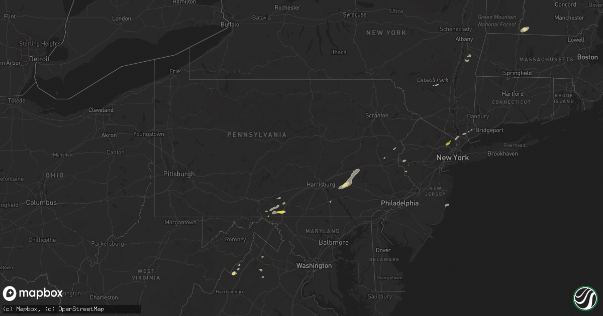
Hail Map in Pennsylvania on August 17, 2018
Get this storm
August 17 map
$229
one time, instant access
Download today. No call, no setup
Keep the $229
Bought the map and want the full workflow? Apply the entire $229 to a subscription within 7 days. None of it is wasted.
Every map, not just this one
This buys you this map. Subscription and you get every map we run, in the markets you choose from a few cities to whole states to nationwide. Plus real-time alerts the moment a storm fires.
Contact data
Name, contact info, occupancy, even credit band for addresses in the footprint. You go from where it hit to who to call.
Become the source they trust
Unlimited branding weather history reports on demand. You already have the documented answer ready for the property owner, and you are the one who showed up with it.
Property data and RoofTrace estimates
Pull up any address you have got, its value and the exact code rules for that jurisdiction, straight from One Click Code. Then RoofTrace estimates the squares, pitch, and roof value, priced the way you price.
Storm reports in Pennsylvania
Pennsylvania
| Date | Description |
|---|---|
| 08/17/20186:50 PM CDT | Tree and wires down in easton. Time estimated from radar. |
| 08/17/20186:42 PM CDT | Tree down at sawmill road and hauseman road in colebrookdale twp. Time estimated from radar. |
| 08/17/20186:37 PM CDT | Report of trees down in lower saucon twp. Time estimated from radar. |
| 08/17/20186:22 PM CDT | Tree down at seisholtzville road and chickadee lane. |
| 08/17/20186:12 PM CDT | Tree down on east grant street in washington twp... Forcing the temporary closure of the road. Time estimated from radar. |
| 08/17/20186:10 PM CDT | Tree down at intersection of girl scout road and furnace hill road |
| 08/17/20186:02 PM CDT | Tree down oley rd. |
| 08/17/20185:59 PM CDT | Downed tree at intersection of arnold road and leisczs bridge road. |
| 08/17/20185:57 PM CDT | Several reports of trees down in perry twp...including near schappell road and merkel lane and on grandview road. |
| 08/17/20185:52 PM CDT | Tree fell onto house - jefferson st. |
| 08/17/20185:52 PM CDT | Tree down 500 block south muddy creek road |
| 08/17/20185:50 PM CDT | Tree down blocking traffic. Time estimated from radar. |
| 08/17/20185:49 PM CDT | Several reports of downed trees and malfunctioning traffic lights in tilden twp. Time estimated from radar. |
| 08/17/20185:49 PM CDT | Tree down on christmas village road near fairway drive. Time estimated from radar. |
| 08/17/20185:45 PM CDT | Tree down - snyder dr. And quarry rd. |
| 08/17/20185:45 PM CDT | Tree down - snyder dr. And quarry rd. |
| 08/17/20185:40 PM CDT | Report of trees fallen on wires |
| 08/17/20185:30 PM CDT | Several trees down in upper mount bethel twp and east bangor. Time estimated from radar. |
| 08/17/20185:25 PM CDT | Trees down in the 3200 block of harrisburg pike. Trees also down along lancaster road. Phone and cable lines down in the area also. |
| 08/17/20185:12 PM CDT | Trees down in the town of elizabethtown |
| 08/17/20185:11 PM CDT | Downed utility on broadway street between the monroe county line and route 33 north. All lanes closed. Time estimated from radar. |
| 08/17/20185:03 PM CDT | Multiple reports of trees and wires down in bushkill township |
| 08/17/20185:03 PM CDT | Trees downed in wires. Time estimated from radar. |
| 08/17/20185:02 PM CDT | Tree down oley rd. |
| 08/17/20185:00 PM CDT | Two trees downed. |
| 08/17/20185:00 PM CDT | Several reports of downed trees and power lines in moore twp...allen twp...and chapman. Time estimated from radar. |
| 08/17/20185:00 PM CDT | A local report indicates 62 MPH wind near BATH |
| 08/17/20184:57 PM CDT | Tree down - bellevue ave. |
| 08/17/20184:45 PM CDT | Tree down - snyder dr. And quarry rd. |
| 08/17/20184:22 PM CDT | Trees down in paradise twp |
| 08/17/20183:52 PM CDT | County 911 reports several downed trees... And power lines and poles in the town of bonneauville |
| 08/17/20183:36 PM CDT | A local report indicates 1.25 inch wind near GREENCASTLE |
| 08/17/20183:47 AM CDT | At 846 PM EDT, severe thunderstorms were located along a line extending from Ogdensburg to near Mendham to New Hope, moving east at 30 mph. HAZARD...70 mph wind gusts. SOURCE...Emergency management. Hunterdon County reported tree damage with this storm in Hampton earlier. IMPACT...Expect considerable tree damage. Damage is likely to mobile homes, roofs, and outbuildings. Locations impacted include... New Brunswick, Perth Amboy, Morristown, Somerville, Somerset, Edison, Old Bridge, East Brunswick, Bridgewater, South Brunswick, Sayreville, North Brunswick, Carteret, Madison, Middlesex, Princeton, Florham Park, East Hanover, Lincoln Park and Bound Brook. |
| 08/17/20183:17 AM CDT | At 816 PM EDT, severe thunderstorms were located along a line extending from Blairstown to Beatyestown to Milford, moving northeast at 40 mph. HAZARD...60 mph wind gusts. SOURCE...Radar indicated. IMPACT...Damage to roofs, siding, trees, and power lines is possible. Locations impacted include... Morristown, Somerville, Newton, Bridgewater, Dover, Hopatcong, Manville, Hackettstown, Wharton, Washington, Rockaway, Blairstown, Morris Plains, Mount Arlington, Franklin, Mendham, Flemington, Mountain Lakes, Tinicum and High Bridge. |
| 08/17/20182:09 AM CDT | At 708 PM EDT, severe thunderstorms were located along a line extending from Lehighton to Jordan Valley to near Fleetwood to Terre Hill, moving northeast at 35 mph. HAZARD...70 mph wind gusts. SOURCE...Radar indicated. IMPACT...Expect considerable tree damage. Damage is likely to mobile homes, roofs, and outbuildings. Locations impacted include... Allentown, Reading, Lehighton, Bethlehem, Pottstown, Phoenixville, Emmaus, Wyomissing, Northampton, Quakertown, Hellertown, Nazareth, Palmerton, Birdsboro, Kutztown, Jim Thorpe, Royersford, Slatington, Fleetwood and Sinking Spring.People attending Philadelphia Folk Festival should seek safe shelterimmediately! |
| 08/17/20181:23 AM CDT | At 622 PM EDT, severe thunderstorms were located along a line extending from Strausstown to near Wernersville, moving northeast at 35 mph. HAZARD...60 mph wind gusts. SOURCE...Radar indicated. IMPACT...Damage to roofs, siding, trees, and power lines is possible. Locations impacted include... Allentown, Reading, Wyomissing, Birdsboro, Kutztown, Hamburg, Fleetwood, Sinking Spring, Laureldale, Womelsdorf, Wernersville, Newmanstown, Topton, Leesport, Shoemakersville, Bernville, Lyons, Strausstown, Lenhartsville and New Morgan. |
| 08/17/20181:22 AM CDT | At 621 PM EDT, severe thunderstorms were located along a line extending from near Dehart Dam to Lebanon South to near East Petersburg, moving northeast at 40 mph. HAZARD...60 mph wind gusts and nickel size hail. SOURCE...Radar indicated. IMPACT...Expect damage to roofs, siding, and trees. Severe thunderstorms will be near... Myerstown, Richland, Leacock, Schaefferstown, Rothsville and Kleinfeltersville around 630 PM EDT. Akron, Ephrata, Leola, Newmanstown, Bareville and Fredericksburg around 640 PM EDT. New Holland, Terre Hill, Pine Grove, Adamstown, Tremont, Donaldson, Reamstown, Denver and Churchtown around 650 PM EDT. Minersville, Friedensburg, Marlin, Seltzer, Forrestville and Branchdale around 700 PM EDT.This includes the following Interstates... The Pennsylvania Turnpike from mile markers 264 to 295.Interstate 78 from mile markers 0 to 8.Interstate 81 from mile markers 79 to 111. |
| 08/17/20181:22 AM CDT | At 621 PM EDT, a severe thunderstorm was located over East Bangor, or 14 miles north of Easton, moving northeast at 40 mph. HAZARD...70 mph wind gusts and nickel size hail. SOURCE...Public. Several reports of wind damage have been received from Northampton County during the past 20 minutes. IMPACT...Expect considerable tree damage. Damage is likely to mobile homes, roofs, and outbuildings. Locations impacted include... Newton, East Stroudsburg, Blairstown, Bangor, Belvidere, Hope, East Bangor, Branchville, Andover, Stormville, Lake Mohawk, Werry Lake, Greendell, Millbrook, Delaware Water Gap, Crandon Lakes, Flatbrookville, Five Points, Columbia and Echo Lake. |
| 08/17/20181:19 AM CDT | At 619 PM EDT, a severe thunderstorm was located near Christmans, or 11 miles north of Lehighton, moving northeast at 40 mph. HAZARD...60 mph wind gusts. SOURCE...Radar indicated. IMPACT...Damage to roofs, siding, trees, and power lines is possible. Locations impacted include... Mount Pocono, Tobyhanna, Jim Thorpe, Nesquehoning, Weatherly, Henryville, Pocono Pines, Pocono Raceway, Lake Harmony, Tannersville, Mountainhome, Alpine Mountain, Long Pond, Albrightsville, Sun Valley, Arrowhead Lake, Jonas, Meckesville, Reeders and Analomink. |
| 08/16/201811:24 PM CDT | At 424 PM EDT, a severe thunderstorm was located near Claylick, moving northeast at 35 mph. HAZARD...Ping pong ball size hail and 60 mph wind gusts. SOURCE...Radar indicated. IMPACT...People and animals outdoors will be injured. Expect hail damage to roofs, siding, windows, and vehicles. Expect wind damage to roofs, siding, and trees. This severe thunderstorm will be near... Greencastle around 430 PM EDT. Marion around 440 PM EDT. Chambersburg, Fayetteville, Guilford, Scotland and Mont Alto around 450 PM EDT.Other locations impacted by this severe thunderstorm includeWilliamson, Upton, Quincy and Penn State Mont Alto.This includes Interstate 81 from mile markers 4 to 25. |
| 08/16/201810:46 PM CDT | At 346 PM EDT, a severe thunderstorm was located near Fannettsburg, moving east at 20 mph. HAZARD...60 mph wind gusts and quarter size hail. SOURCE...Radar indicated. IMPACT...Hail damage to vehicles is expected. Expect wind damage to roofs, siding, and trees. Locations impacted include... Chambersburg, Shippensburg, Scotland, Upper Strasburg, Roxbury, Willow Hill, Fannettsburg, Orrstown and Shippensburg University.This includes The Pennsylvania Turnpike between mile markers 192 and194...and from mile markers 197 to 205. |
| 08/16/201810:40 PM CDT | At 340 PM EDT, a severe thunderstorm was located near Shepherdstown, moving northeast at 25 mph. HAZARD...70 mph wind gusts and half dollar size hail. SOURCE...Radar indicated. This storm has a history of producing 60 to 70 mph wind gusts. IMPACT...Damaging winds will cause some trees and large branches to fall. This could injure those outdoors, as well as damage homes and vehicles. Roadways may become blocked by downed trees. Localized power outages are possible. Unsecured light objects may become projectiles. Locations impacted include... Frederick, Hagerstown, Thurmont, Emmitsburg, Harry Grove Stadium, Ballenger Creek, Robinwood, Taneytown, Brunswick, Walkersville, Boonsboro, Smithsburg, Braddock Heights, Mount Aetna, Mount Lena, San Mar, Clover Hill, Discovery-Spring Garden, Wolfsville and Saint James. |
All States Impacted by Hail Map on August 17, 2018
Cities Impacted by Hail Map on August 17, 2018
- Woodrow, CO
- Dalhart, TX
- Mountain Park, OK
- Snyder, OK
- Frederick, OK
- Loveland, OK
- Hollister, OK
- Micanopy, FL
- Williston, FL
- Lockney, TX
- Parker, CO
- Newmanstown, PA
- Lebanon, PA
- Cove, AR
- Hatfield, AR
- Stoneham, CO
- Matador, TX
- Lititz, PA
- Manheim, PA
- Stinnett, TX
- Wiggins, CO
- Westcliffe, CO
- Louann, AR
- Smackover, AR
- Bear Lake, MI
- Saddle Brook, NJ
- Paramus, NJ
- Fair Lawn, NJ
- Elmwood Park, NJ
- Nowata, OK
- Vinita, OK
- Foster, OK
- Elmore City, OK
- Gould, OK
- Colorado Springs, CO
- Fountain, CO
- Rogers, NM
- Breaux Bridge, LA
- Chugwater, WY
- Rye, CO
- Colorado City, CO
- Pueblo, CO
- Pearl, MS
- Strasburg, CO
- Roggen, CO
- Bennett, CO
- Wheatland, WY
- Grenville, NM
- Kenton, OK
- Duke, OK
- Fort White, FL
- Branford, FL
- Weldona, CO
- Talala, OK
- Plainview, TX
- Petersburg, TX
- Gainesville, FL
- Rocky Ford, CO
- Nazareth, TX
- Ludowici, GA
- Greencastle, PA
- Texico, NM
- Friona, TX
- Bovina, TX
- Floydada, TX
- Sunray, TX
- Stratford, TX
- Yoder, WY
- Quanah, TX
- Chattanooga, OK
- Orchard, CO
- Kersey, CO
- Crosbyton, TX
- Roaring Springs, TX
- Manitou Springs, CO
- Cascade, CO
- Usaf Academy, CO
- Muleshoe, TX
- Crowell, TX
- Alex, OK
- Blanchard, OK
- Pauls Valley, OK
- Mercersburg, PA
- Chambersburg, PA
- Childress, TX
- Elk City, ID
- McGehee, AR
- Lewisville, AR
- Yoder, CO
- Lake City, FL
- Randlett, OK
- Wichita Falls, TX
- Elizabeth, CO
- Mount Jackson, VA
- Ashuelot, NH
- Winchester, NH
- Headrick, OK
- Morse, TX
- Cache, OK
- Upperstrasburg, PA
- Fort Loudon, PA
- Broken Bow, OK
- Chiefland, FL
- Agate, CO
- La Junta, CO
- Las Animas, CO
- Schaefferstown, PA
- Shartlesville, PA
- Richland, PA
- Stevens, PA
- Mohrsville, PA
- Denver, PA
- Bernville, PA
- Robesonia, PA
- Hamburg, PA
- Myerstown, PA
- Womelsdorf, PA
- La Veta, CO
- Fort Morgan, CO
- Buford, WY
- Granite Canon, WY
- Lodge, SC
- Chickasha, OK
- Amber, OK
- Pocasset, OK
- Dickens, TX
- Borger, TX
- Limon, CO
- Ralls, TX
- Westford, MA
- Acton, MA
- Littleton, MA
- Boxborough, MA
- Boise City, OK
- Arlington, CO
- Haswell, CO
- Eads, CO
- Cheyenne, WY
- Lindon, CO
- Dunnellon, FL
- Ramah, CO
- Thompsonville, MI
- Albin, WY
- Lagrange, WY
- Tulia, TX
- Mena, AR
- High Springs, FL
- Bard, NM
- Huntington, OR
- Lawton, OK
- Saint Thomas, PA
- Valhalla, NY
- Armonk, NY
- Thornwood, NY
- Stratford, OK
- Fargo, GA
- White Springs, FL
- Grahamsville, NY
- Bell, FL
- Frenchtown, NJ
- Stockton, NJ
- Model, CO
- Palatka, FL
- White Post, VA
- Front Royal, VA
- Wynnewood, OK
- Joseph, OR
- Guyton, GA
- Springfield, GA
- Washington, VA
- Throckmorton, TX
- Estill, SC
- Garnett, SC
- Walsenburg, CO
- Littlefield, AZ
- Stonewall, OK
- Tishomingo, OK
- Mccurtain, OK
- Roosevelt, OK
- Hobart, OK
- Goodman, MS
- Sallis, MS
- Tulsa, OK
- Indiahoma, OK
- Edinburg, VA
- Mill River, MA
- Great Barrington, MA
- Camden, AR
- Mathias, WV
- Paoli, OK
- Florissant, CO
- Palisades, NY
- Tarrytown, NY
- Northvale, NJ
- Piermont, NY
- Sparkill, NY
- Kiowa, CO
- Brooklet, GA
- Kaleva, MI
- Lost City, WV
- Eldorado, OK
- Olney, TX
- Fayette, MS
- Roxie, MS
- Byers, TX
- Paducah, TX
- Imnaha, OR
- Canon City, CO
- New Raymer, CO
- Flomot, TX
- Saint Augustine, FL
- Monument, CO
- Middleburg, FL
- Green Cove Springs, FL
- Shamrock, TX
- Roff, OK
- Brandon, MS
- Northampton, PA
- York, PA
- Timberville, VA
- Quicksburg, VA
- Hilliard, FL
- Folkston, GA
- Jemez Springs, NM
- Bentonville, VA
- Boone, CO
- Lafayette, LA
- Copemish, MI
- Arkadelphia, AR
- Sparkman, AR
- Charles Town, WV
- Shenandoah Junction, WV
- Kearneysville, WV
- Woodland Park, CO
- Ocean Gate, NJ
- Seaside Park, NJ
- Bayville, NJ
- Faxon, OK
- Walters, OK
- Keota, OK
- Asbury, NJ
- Bloomsbury, NJ
- Stigler, OK
- Effingham, SC
- Eupora, MS
- Peyton, CO
- Spiro, OK
- Bedford, NY
- Marion, NC
- Reevesville, SC
- Saint George, SC
- Altus, OK
- Tipton, OK
- Hudson, NY
- Ghent, NY
- Hollandale, MS
- Pittstown, NJ
- Florence, SC
- Palmer Lake, CO
- Deming, NM
- Ellisville, MS
- Wind Gap, PA
- Pen Argyl, PA
- Mosquero, NM
- Cameron, OK
- Pocola, OK
- Big Cove Tannery, PA
- Keenesburg, CO
- Divide, CO
- Pampa, TX
- Twin Falls, ID
- Castle Rock, CO
- Bowman, SC
- Canton, MS
- Jacksonville, FL
- Blackshear, GA
- Waycross, GA
- Vernon, VT
- Hinsdale, NH
- Swanzey, NH
- Dermott, AR
- Shady Point, OK
- Valatie, NY
- Kinderhook, NY
- Chatham, NY
- Stamford, CT
- Pound Ridge, NY
- Pineland, SC
- Islandton, SC
- Williams, SC
- Ruffin, SC
- Smoaks, SC
- Bokoshe, OK
- Glen Rock, NJ
- Township Of Washington, NJ
- Emerson, NJ
- Westwood, NJ
- Ridgewood, NJ
- Paterson, NJ


