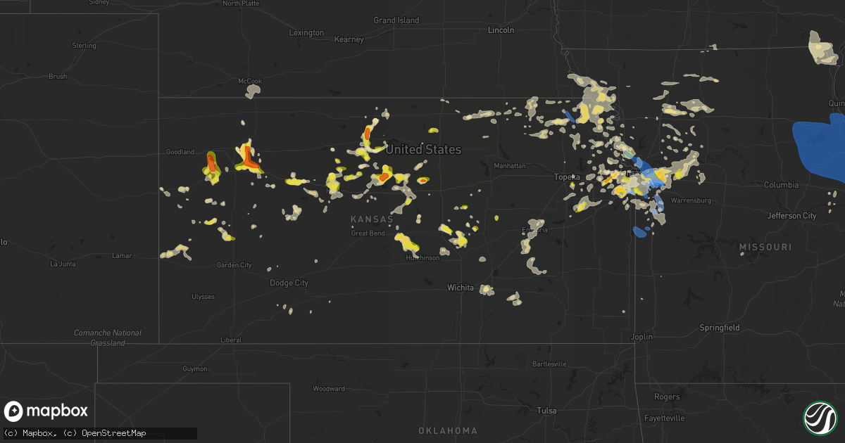
Hail Map in Kansas on August 12, 2021
Get this storm
August 12 map
$229
one time, instant access
Download today. No call, no setup
Keep the $229
Bought the map and want the full workflow? Apply the entire $229 to a subscription within 7 days. None of it is wasted.
Every map, not just this one
This buys you this map. Subscription and you get every map we run, in the markets you choose from a few cities to whole states to nationwide. Plus real-time alerts the moment a storm fires.
Contact data
Name, contact info, occupancy, even credit band for addresses in the footprint. You go from where it hit to who to call.
Become the source they trust
Unlimited branding weather history reports on demand. You already have the documented answer ready for the property owner, and you are the one who showed up with it.
Property data and RoofTrace estimates
Pull up any address you have got, its value and the exact code rules for that jurisdiction, straight from One Click Code. Then RoofTrace estimates the squares, pitch, and roof value, priced the way you price.
Storm reports in Kansas
Kansas
| Date | Description |
|---|---|
| 08/12/20216:55 PM CDT | A local report indicates 1.00 inch wind near 2 N Hays |
| 08/12/20216:55 PM CDT | Estimated 50-60 mph wind gusts. |
| 08/12/20216:45 PM CDT | Measured by mesonet station. |
| 08/12/20216:45 PM CDT | Quarter size hail reported in winona... Has been ongoing for 5-10 mins |
| 08/12/20216:37 PM CDT | Sustained hail for 5-10mins ranging from pea to quarters |
| 08/12/20216:28 PM CDT | Scattered hail up to quarter size. |
| 08/12/20216:21 PM CDT | Public report of quarter to golfball hail |
| 08/12/20216:20 PM CDT | Facebook photo sent to wfo gld. Time estimated from radar. |
| 08/12/20216:18 PM CDT | Delayed report. Golf ball sized hail relayed via social media. |
| 08/12/20216:12 PM CDT | Power pole reorted down. |
| 08/12/20215:59 PM CDT | Report came in via facebook. |
| 08/12/20215:41 PM CDT | A local report indicates 65 MPH wind near 15 WNW LINCOLN |
| 08/12/20215:41 PM CDT | A local report indicates 1.00 inch wind near 15 WNW LINCOLN |
| 08/12/20215:40 PM CDT | Tree blown down 3 miles west of sylvan grove. |
| 08/12/20215:38 PM CDT | A local report indicates 1.00 inch wind near JOHNSON CO ARPT |
| 08/12/20215:38 PM CDT | A local report indicates 58 MPH wind near JOHNSON CO ARPT |
| 08/12/20215:20 PM CDT | Quarter to golf ball sized hail |
| 08/12/20215:15 PM CDT | A local report indicates 1.00 inch wind near 7 WNW ASH GROVE |
| 08/12/20215:15 PM CDT | Delayed report... |
| 08/12/20215:11 PM CDT | A local report indicates 1.00 inch wind near OLATHE |
| 08/12/20215:10 PM CDT | A few stones up to ping pong ball size. |
| 08/12/20215:10 PM CDT | A few stones up to ping pong ball size. |
| 08/12/20215:09 PM CDT | Delayed report... |
| 08/12/20215:00 PM CDT | A local report indicates 1.00 inch wind near SYLVAN GROVE |
| 08/12/20214:57 PM CDT | A local report indicates 75 MPH wind near SYLVAN GROVE |
| 08/12/20214:56 PM CDT | Ups truck blown over near highway 14 just east of lincoln. |
| 08/12/20214:56 PM CDT | Ups truck blown over near hwy 14 east of lincoln. Driver extracted. Reported injured taken in ambulance. |
| 08/12/20214:51 PM CDT | Power pole snapped. |
| 08/12/20214:45 PM CDT | Estimated 50-60mph winds between cr 15 and cr 17 east of leoti along with half mile visibility due to heavy rain |
| 08/12/20214:36 PM CDT | Corrects previous hail report from tescott. |
| 08/12/20216:57 AM CDT | At 1156 PM CDT, a severe thunderstorm was located near Archie, or near Adrian, moving southeast at 20 mph. HAZARD...60 mph wind gusts and penny size hail. SOURCE...Radar indicated. IMPACT...Expect damage to roofs, siding, and trees. Locations impacted include... Butler, Adrian, Pleasanton, La Cygne, Drexel, Linn Valley, Fontana, Amsterdam, Amoret, Merwin, Passaic, Worland and New Lancaster. |
| 08/12/20216:06 AM CDT | At 1106 PM CDT, a severe thunderstorm was located near Centropolis, moving northeast at 25 mph. HAZARD...60 mph wind gusts and quarter size hail. SOURCE...Radar indicated. IMPACT...Hail damage to vehicles is expected. Expect wind damage to roofs, siding, and trees. Locations impacted include... Ottawa, Centropolis and Globe. |
| 08/12/20215:38 AM CDT | At 1038 PM CDT, a severe thunderstorm was located near Centropolis, moving east at 15 mph. HAZARD...60 mph wind gusts and quarter size hail. SOURCE...Radar indicated. IMPACT...Hail damage to vehicles is expected. Expect wind damage to roofs, siding, and trees. Locations impacted include... Baldwin City, Wellsville, Centropolis, Vinland and Globe. This includes Interstate 35 between mile markers 196 and 198. |
| 08/12/20214:55 AM CDT | At 954 PM CDT, a severe thunderstorm was located over Shawnee, moving east at 20 mph. HAZARD...60 mph wind gusts and quarter size hail. SOURCE...Radar indicated. IMPACT...Hail damage to vehicles is expected. Expect wind damage to roofs, siding, and trees. Locations impacted include... Overland Park, Olathe, Shawnee, Lenexa, Leawood, Prairie Village, Merriam, Mission, Bonner Springs, De Soto, Basehor, Edwardsville, Fairway, Mission Hills, Westwood, Lake Quivira, Kansas City Kansas, Kansas City, Westwood Hills and Mission Woods.This includes the following highways... Interstate 70 in Missouri near mile marker 0. Interstate 70 in Kansas between mile markers 410 and 423. Interstate 35 in Kansas between mile markers 218 and 234. Interstate 635 between mile markers 0 and 7. Interstate 435 between mile markers 0 and 14, and between milemarkers 76 and 83. Kansas Turnpike between mile markers 220 and 226. |
| 08/12/20214:46 AM CDT | At 945 PM CDT, a severe thunderstorm was located near Pomona, moving east at 20 mph. HAZARD...60 mph wind gusts and half dollar size hail. SOURCE...Radar indicated. IMPACT...Hail damage to vehicles is expected. Expect wind damage to roofs, siding, and trees. Locations impacted include... Ottawa, Wellsville, Centropolis, Pomona and Rantoul. This includes Interstate 35 between mile markers 180 and 198. |
| 08/12/20214:36 AM CDT | At 935 PM CDT, a severe thunderstorm was located over De Soto, moving east at 20 mph. HAZARD...60 mph wind gusts and quarter size hail. SOURCE...Radar indicated. IMPACT...Hail damage to vehicles is expected. Expect wind damage to roofs, siding, and trees. Locations impacted include... Olathe, Shawnee, Lenexa, Bonner Springs, De Soto, Tonganoxie, Basehor, Edwardsville, Kansas City, Linwood, Holliday, Clearview City and Maywood.This includes the following highways... Interstate 70 in Kansas between mile markers 410 and 413. Interstate 435 between mile markers 10 and 14. Kansas Turnpike between mile markers 211 and 226. |
| 08/12/20214:06 AM CDT | At 906 PM CDT, a severe thunderstorm was located near Burdick, moving north at 5 mph. HAZARD...60 mph wind gusts and quarter size hail. SOURCE...Radar indicated. IMPACT...Hail damage to vehicles is expected. Expect wind damage to roofs, siding, and trees. Locations impacted include... Burdick. |
| 08/12/20212:35 AM CDT | At 734 PM CDT, a severe thunderstorm was located near Gaylord, or 29 miles east of Phillipsburg, moving north at 10 mph. HAZARD...60 mph wind gusts and quarter size hail. SOURCE...Radar indicated. IMPACT...Hail damage to vehicles is expected. Expect wind damage to roofs, siding, and trees. Locations impacted include... Smith Center and Athol. |
| 08/12/20212:19 AM CDT | At 719 PM CDT, a severe thunderstorm was located 4 miles northwest of Concordia, moving northeast at 10 mph. HAZARD...60 mph wind gusts and half dollar size hail. SOURCE...Radar indicated. IMPACT...Hail damage to vehicles is expected. Expect wind damage to roofs, siding, and trees. Locations impacted include... Concordia, Jamestown and Norway. |
| 08/12/20212:15 AM CDT | 12 to 24 inch limbs down and power outages. |
| 08/12/20212:12 AM CDT | At 712 PM CDT, a severe thunderstorm was located near Portis, or 33 miles southeast of Phillipsburg, moving north at 5 mph. HAZARD...60 mph wind gusts and quarter size hail. SOURCE...Radar indicated. IMPACT...Hail damage to vehicles is expected. Expect wind damage to roofs, siding, and trees. Locations impacted include... Portis. |
| 08/12/20212:11 AM CDT | At 711 PM CDT, a severe thunderstorm was located near Menlo, or 13 miles west of Hoxie, moving north at 15 mph. HAZARD...60 mph wind gusts and quarter size hail. SOURCE...Radar indicated. IMPACT...Hail damage to vehicles is expected. Expect wind damage to roofs, siding, and trees. This severe thunderstorm will be near... Menlo around 725 PM CDT.Other locations in the path of this severe thunderstorm includeRexford. |
| 08/12/20212:05 AM CDT | At 705 PM CDT, a severe thunderstorm was located near Stockton, or 23 miles south of Phillipsburg, moving north at 5 mph. HAZARD...60 mph wind gusts and quarter size hail. SOURCE...Radar indicated. IMPACT...Hail damage to vehicles is expected. Expect wind damage to roofs, siding, and trees. Locations impacted include... Stockton. |
| 08/12/20212:00 AM CDT | Several reports in north lawrence of trees and power poles down. |
| 08/12/20211:59 AM CDT | At 658 PM CDT, a severe thunderstorm was located 4 miles north of Richland, moving east at 15 mph. HAZARD...60 mph wind gusts and quarter size hail. SOURCE...Radar indicated. IMPACT...Hail damage to vehicles is expected. Expect wind damage to roofs, siding, and trees. Locations impacted include... Southwestern Lawrence, Lecompton, Clinton and Clinton Lake. This includes Kansas Turnpike between mile markers 188 and 198. |
| 08/12/20211:58 AM CDT | 62 mph gust reported at kemp. |
| 08/12/20211:44 AM CDT | At 644 PM CDT, a severe thunderstorm was located near Hays, moving southeast at 15 mph. HAZARD...60 mph wind gusts and quarter size hail. SOURCE...Radar indicated. IMPACT...Hail damage to vehicles is expected. Expect wind damage to roofs, siding, and trees. This severe thunderstorm will be near... Toulon around 700 PM CDT.Other locations in the path of this severe thunderstorm includeVictoria and Munjor. |
| 08/12/20211:42 AM CDT | At 642 PM CDT, a severe thunderstorm was located 7 miles west of Osborne, or 34 miles northeast of Emmeram, moving north at 10 mph. HAZARD...60 mph wind gusts and quarter size hail. SOURCE...Radar indicated. IMPACT...Hail damage to vehicles is expected. Expect wind damage to roofs, siding, and trees. Locations impacted include... Osborne and Alton. |
| 08/12/20211:40 AM CDT | 10 inch diameter tree blown down onto a vehicle. |
| 08/12/20211:33 AM CDT | At 633 PM CDT, a severe thunderstorm was located near Woodston, or 27 miles southeast of Phillipsburg, moving north at 5 mph. HAZARD...60 mph wind gusts and quarter size hail. SOURCE...Radar indicated. IMPACT...Hail damage to vehicles is expected. Expect wind damage to roofs, siding, and trees. Locations impacted include... Woodston. |
| 08/12/20211:14 AM CDT | At 614 PM CDT, a severe thunderstorm was located 4 miles north of Grinnell, moving northwest at 25 mph. HAZARD...60 mph wind gusts and quarter size hail. SOURCE...Radar indicated. IMPACT...Hail damage to vehicles is expected. Expect wind damage to roofs, siding, and trees. Locations impacted include... Menlo.This includes Interstate 70 in Kansas between mile markers 81 and 92. |
| 08/12/20211:12 AM CDT | At 612 PM CDT, a severe thunderstorm was located near Alton, or 33 miles southeast of Phillipsburg, moving north at 20 mph. HAZARD...60 mph wind gusts and quarter size hail. SOURCE...Radar indicated. IMPACT...Hail damage to vehicles is expected. Expect wind damage to roofs, siding, and trees. This severe thunderstorm will be near... Alton around 625 PM CDT. |
| 08/12/20211:10 AM CDT | At 610 PM MDT/710 PM CDT/, a severe thunderstorm was located 9 miles southeast of Brewster, moving northwest at 30 mph. HAZARD...60 mph wind gusts and quarter size hail. SOURCE...Radar indicated. IMPACT...Hail damage to vehicles is expected. Expect wind damage to roofs, siding, and trees. This severe thunderstorm will be near... Brewster around 730 PM CDT.This includes Interstate 70 in Kansas between mile markers 28 and 51. |
| 08/12/202112:59 AM CDT | At 559 PM CDT, a severe thunderstorm was located near Lucas, or 12 miles north of Wilson, moving south at 10 mph. HAZARD...70 mph wind gusts and quarter size hail. SOURCE...Emergency management. IMPACT...Hail damage to vehicles is expected. Expect considerable tree damage. Wind damage is also likely to mobile homes, roofs, and outbuildings. Locations impacted include... Russell, Lucas, Sylvan Grove, Luray, Dorrance, Bunker Hill, Waldo, Wilson State Park, Wilson Lake and Russell Airport.This includes Interstate 70 between Mile Markers 187 and 202. |
| 08/12/202112:44 AM CDT | At 544 PM CDT, a severe thunderstorm was located 9 miles southwest of Osborne, or 30 miles north of Russell, moving north at 10 mph. HAZARD...60 mph wind gusts and half dollar size hail. SOURCE...Radar indicated. IMPACT...Hail damage to vehicles is expected. Expect wind damage to roofs, siding, and trees. Locations impacted include... Osborne. |
| 08/12/202112:28 AM CDT | At 527 PM CDT, a severe thunderstorm was located near Lucas, or 19 miles west of Lincoln, moving north at 5 mph. HAZARD...60 mph wind gusts and quarter size hail. SOURCE...Radar indicated. IMPACT...Hail damage to vehicles is expected. Expect wind damage to roofs, siding, and trees. Locations impacted include... Hunter. |
| 08/12/202112:18 AM CDT | At 517 PM CDT, a severe thunderstorm was located 7 miles northeast of Emmeram, moving west at 5 mph. HAZARD...60 mph wind gusts and quarter size hail. SOURCE...Radar indicated. IMPACT...Hail damage to vehicles is expected. Expect wind damage to roofs, siding, and trees. Locations impacted include... Paradise. |
| 08/12/202112:07 AM CDT | At 507 PM CDT, a severe thunderstorm was located over Codell, or 14 miles north of Emmeram, and is nearly stationary. HAZARD...60 mph wind gusts and quarter size hail. SOURCE...Radar indicated. IMPACT...Hail damage to vehicles is expected. Expect wind damage to roofs, siding, and trees. Locations impacted include... Plainville and Codell. |
| 08/12/202112:05 AM CDT | At 505 PM CDT, severe thunderstorms were located along a line extending from near Lincoln to 7 miles northeast of Russell, moving east at 5 mph. HAZARD...70 mph wind gusts and quarter size hail. SOURCE...Radar indicated. IMPACT...Hail damage to vehicles is expected. Expect considerable tree damage. Wind damage is also likely to mobile homes, roofs, and outbuildings. Locations impacted include... Lincoln, Lucas, Sylvan Grove, Luray, Bunker Hill, Waldo, Ash Grove, Wilson State Park and Wilson Lake.This includes Interstate 70 between Mile Markers 189 and 193. |
| 08/12/202112:00 AM CDT | At 500 PM CDT, a severe thunderstorm was located 7 miles west of Hunter, or 23 miles northwest of Lincoln, moving north at 10 mph. HAZARD...60 mph wind gusts and quarter size hail. SOURCE...Radar indicated. IMPACT...Hail damage to vehicles is expected. Expect wind damage to roofs, siding, and trees. This severe thunderstorm will be near... Hunter around 515 PM CDT. |
| 08/11/202111:57 PM CDT | At 457 PM CDT, severe thunderstorms were located along a line extending from near Barnard to near Beverly, moving east at 5 mph. HAZARD...60 mph wind gusts and quarter size hail. SOURCE...Radar indicated. IMPACT...Hail damage to vehicles is expected. Expect wind damage to roofs, siding, and trees. Locations impacted include... Beverly and Barnard. |
| 08/11/202111:53 PM CDT | At 453 PM CDT, a severe thunderstorm was located 7 miles west of Modoc, moving northwest at 10 mph. HAZARD...60 mph wind gusts and penny size hail. SOURCE...Public. IMPACT...Expect damage to roofs, siding, and trees. Locations impacted include... Leoti. |
| 08/11/202111:51 PM CDT | At 451 PM CDT, a severe thunderstorm was located 8 miles east of Natoma, or 21 miles north of Russell, moving north at 10 mph. HAZARD...60 mph wind gusts and quarter size hail. SOURCE...Radar indicated. IMPACT...Hail damage to vehicles is expected. Expect wind damage to roofs, siding, and trees. This severe thunderstorm will remain over mainly rural areas of southwestern Osborne County. |
| 08/11/202111:41 PM CDT | At 440 PM CDT, a severe thunderstorm was located over Tescott, and is nearly stationary. HAZARD...60 mph wind gusts and quarter size hail. SOURCE...Trained weather spotters. At 439 PM CDT trained spotters reported quarter size hail in Tescott. IMPACT...Hail damage to vehicles is expected. Expect wind damage to roofs, siding, and trees. Locations impacted include... Tescott. |
| 08/11/202110:56 PM CDT | At 356 PM CDT, a severe thunderstorm was located near Lake Waukomis, or near Gladstone, moving southeast at 35 mph. HAZARD...60 mph wind gusts and quarter size hail. SOURCE...Radar indicated. IMPACT...Hail damage to vehicles is expected. Expect wind damage to roofs, siding, and trees. Locations impacted include... Kansas City, Independence, Liberty, Gladstone, Smithville, Parkville, North Kansas City, Sugar Creek, Riverside, Weatherby Lake, Claycomo, Courtney, Pleasant Valley, Lake Waukomis, Glenaire, Ferrelview, Avondale, Platte Woods, Oakview and Northmoor.This includes the following highways... Interstate 70 in Missouri between mile markers 0 and 13. Interstate 35 in Missouri between mile markers 3 and 23. Interstate 29 between mile markers 0 and 16. Interstate 635 between mile markers 8 and 12. Interstate 435 between mile markers 20 and 29, and between milemarkers 32 and 62. |
| 08/11/202110:55 PM CDT | At 355 PM CDT, a severe thunderstorm was located 6 miles west of Lincoln, moving west at 5 mph. HAZARD...60 mph wind gusts and quarter size hail. SOURCE...Radar indicated. IMPACT...Hail damage to vehicles is expected. Expect wind damage to roofs, siding, and trees. Locations impacted include... Lincoln and Sylvan Grove. |
| 08/11/202110:28 PM CDT | At 328 PM CDT, a severe thunderstorm was located over Weston, moving east at 35 mph. HAZARD...60 mph wind gusts and quarter size hail. SOURCE...Radar indicated. IMPACT...Hail damage to vehicles is expected. Expect wind damage to roofs, siding, and trees. Locations impacted include... Kansas City, Leavenworth, Smithville, Platte City, Weston, Lake Waukomis, Camden Point, Ferrelview, Platte Woods, Tracy, Ridgely, Fort Leavenworth, Beverly, Kansas City Intl Arpt and Hoover.This includes the following highways... Interstate 29 between mile markers 8 and 28. Interstate 435 between mile markers 27 and 41. |
| 08/11/20219:54 PM CDT | A local report indicates 1.25 inch wind near EDWARDSVILLE |
| 08/11/20219:45 PM CDT | A local report indicates 1.50 inch wind near 7 W BONNER SPRINGS |
| 08/11/20219:14 PM CDT | At 214 PM CDT, a severe thunderstorm was located near Circleville, moving east at 25 mph. HAZARD...60 mph wind gusts and half dollar size hail. SOURCE...Radar indicated. IMPACT...Hail damage to vehicles is expected. Expect wind damage to roofs, siding, and trees. Locations impacted include... Holton, Denison, Circleville and Soldier. |
| 08/11/20218:25 PM CDT | Delayed report from mping... |
| 08/11/20218:17 PM CDT | Nickel to quarter size hail reported at 68th and lackman. |
| 08/11/20218:13 PM CDT | Delayed report from mping... |
| 08/11/20217:30 PM CDT | Delayed report... |
| 08/11/20217:26 PM CDT | Spotter reported golf ball size hail |
| 08/11/20217:14 PM CDT | A local report indicates 1.00 inch wind near 5 ENE BERRYTON |
| 08/11/20217:02 PM CDT | Picture of quarter size hail posted on social media. |
All States Impacted by Hail Map on August 12, 2021
Cities Impacted by Hail Map on August 12, 2021
- Orient, OH
- Mount Sterling, OH
- Grove City, OH
- London, OH
- Galloway, OH
- South Solon, OH
- Cedarville, OH
- Yellow Springs, OH
- West Jefferson, OH
- South Charleston, OH
- South Vienna, OH
- Springfield, OH
- Munden, KS
- Sullivan, IN
- Merom, IN
- Edinburg, PA
- New Castle, PA
- Hillsville, PA
- Morrisonville, IL
- Overland Park, KS
- Pittsburgh, PA
- Shawnee, KS
- Oakdale, IL
- Coulterville, IL
- Syracuse, KS
- Leavenworth, KS
- Norfolk, CT
- Holdrege, NE
- Kansas City, MO
- Hoyt, KS
- Topeka, KS
- Oblong, IL
- Annapolis, IL
- Martinsville, IL
- Limon, CO
- Sterling, KS
- Hutchinson, KS
- Nickerson, KS
- Raymond, KS
- Chase, KS
- Lyons, KS
- Sabetha, KS
- Bern, KS
- Oskaloosa, KS
- East Lynne, MO
- Garden City, MO
- Harrisonville, MO
- Ayr, NE
- Lawrence, NE
- Blue Hill, NE
- Linwood, KS
- De Soto, KS
- Harvel, IL
- Liverpool, IL
- Canton, IL
- Polo, MO
- Lawson, MO
- Shoals, IN
- Tampa, KS
- Springfield, IL
- Nashport, OH
- Zanesville, OH
- Feeding Hills, MA
- West Suffield, CT
- Suffield, CT
- Southwick, MA
- Clarion, PA
- Sligo, PA
- Saint Louis, MO
- Mittie, LA
- Jermyn, PA
- Carbondale, PA
- Factoryville, PA
- Nicholson, PA
- Fleetville, PA
- Dalton, PA
- Tunkhannock, PA
- Ness City, KS
- West Jefferson, NC
- Millers Creek, NC
- Purlear, NC
- Portersville, PA
- Slippery Rock, PA
- Pulaski, PA
- Moweaqua, IL
- Assumption, IL
- Bethany, IL
- Wallace, KS
- Sharon Springs, KS
- Weskan, KS
- Lucas, KS
- Sylvan Grove, KS
- Selden, KS
- Browning, IL
- Hamilton, MO
- Winston, MO
- Gallatin, MO
- Kidder, MO
- Elsberry, MO
- Silex, MO
- Clarksville, MO
- Eolia, MO
- Bowling Green, MO
- Colby, KS
- Levant, KS
- Winona, KS
- Monument, KS
- Arapahoe, NE
- Oxford, NE
- Edison, NE
- Swanton, NE
- Western, NE
- Hillsboro, KS
- Lehigh, KS
- Newton, KS
- Goessel, KS
- Hoxie, KS
- Rexford, KS
- Union City, OH
- Union City, IN
- Montgomery City, MO
- New Florence, MO
- Dighton, KS
- Wilcox, NE
- Stockton, KS
- Emporia, KS
- Morris, PA
- Concordia, KS
- Jamestown, KS
- Hydetown, PA
- Centerville, PA
- Guys Mills, PA
- Cooperstown, PA
- Titusville, PA
- Grand Valley, PA
- Indianola, NE
- Bartley, NE
- Cambridge, NE
- Vona, CO
- McDonald, PA
- Burgettstown, PA
- Bulger, PA
- Morrowville, KS
- Linn, KS
- Norborne, MO
- Lexington, MO
- Axtell, KS
- Baileyville, KS
- Amsterdam, OH
- Powhattan, KS
- Netawaka, KS
- Wetmore, KS
- Tallmadge, OH
- Akron, OH
- Peyton, CO
- Ansonia, OH
- Scott City, KS
- Marienthal, KS
- Corning, KS
- Centralia, KS
- Seneca, KS
- Montverde, FL
- Clermont, FL
- Clemmons, NC
- Wathena, KS
- Mayview, MO
- Wellington, MO
- Odessa, MO
- Overton, NV
- Home, KS
- Grainfield, KS
- Grinnell, KS
- Oakley, KS
- Dolan Springs, AZ
- Bonner Springs, KS
- Basehor, KS
- Sturgeon, PA
- Steinauer, NE
- Burchard, NE
- Pawnee City, NE
- Lawrence, KS
- Moundridge, KS
- Hesston, KS
- Meadows Of Dan, VA
- Stuart, VA
- Floyd, VA
- Willis, VA
- Lebanon, TN
- Hartsville, TN
- Riddleton, TN
- Hurtsboro, AL
- Auburn, NE
- Dawson, NE
- Verdon, NE
- Stella, NE
- Shubert, NE
- Texline, TX
- Cameron, MO
- Pawnee, IL
- Poseyville, IN
- Tulia, TX
- Barnesville, OH
- Sherrodsville, OH
- Bowerston, OH
- Dennison, OH
- Adams, NE
- Pickrell, NE
- Cortland, NE
- Firth, NE
- Bedford, IN
- Heltonville, IN
- Norman, IN
- Minneola, KS
- Greenville, MO
- Hildebran, NC
- Connelly Springs, NC
- Hickory, NC
- Sibley, MO
- Oak Grove, MO
- Napoleon, MO
- Grain Valley, MO
- Blue Springs, MO
- Jefferson, NC
- Milton, PA
- Northumberland, PA
- Craig, MO
- Ellsworth, KS
- Kanopolis, KS
- Peculiar, MO
- Waldo, KS
- Paradise, KS
- Stanford, IL
- Minier, IL
- Cheyenne Wells, CO
- Lincoln, KS
- Forest City, PA
- Union Dale, PA
- Waymart, PA
- Waterville, KS
- Barnes, KS
- Natoma, KS
- Victoria, KS
- Gorham, KS
- Walnut, MS
- Worthville, KY
- Owenton, KY
- Berryton, KS
- Hays, KS
- Lorraine, KS
- Goff, KS
- Horton, KS
- Montrose, IA
- Keokuk, IA
- Adamsville, OH
- Hopewell, OH
- Frazeysburg, OH
- Dresden, OH
- Marquette, KS
- Little River, KS
- Cochranton, PA
- West Mifflin, PA
- Homestead, PA
- Braddock, PA
- Lecompton, KS
- Quinter, KS
- Holly, CO
- Albany, NY
- Guilderland, NY
- Schenectady, NY
- Abilene, KS
- Argyle, IA
- Kahoka, MO
- Wayland, MO
- Silverton, TX
- Soldier, KS
- Havensville, KS
- Plainville, KS
- Mooresville, MO
- Breckenridge, MO
- Russell, KS
- Bunker Hill, KS
- Lansing, NC
- Warrensville, NC
- Jamesport, MO
- Augusta, KS
- Summerville, PA
- Strattanville, PA
- Marysville, OH
- Palmer, IL
- Owaneco, IL
- Taylorville, IL
- Kampsville, IL
- Hamburg, IL
- Winfield, MO
- Foley, MO
- Nebo, IL
- Troy, MO
- Moscow Mills, MO
- Annada, MO
- Hutsonville, IL
- Robinson, IL
- Ellis, KS
- Boulder City, NV
- Barnard, KS
- Lewisberry, PA
- Dover, PA
- York Haven, PA
- Abernathy, TX
- Anton, TX
- Littlefield, TX
- Pomona, KS
- Greenup, IL
- Casey, IL
- Concordia, MO
- Whitewater, KS
- Burns, KS
- Potwin, KS
- Karval, CO
- Hugo, CO
- Ferrum, VA
- Axtell, NE
- Hildreth, NE
- Cowgill, MO
- Richmond, MO
- Falls City, NE
- Woodston, KS
- Olathe, KS
- Sarasota, FL
- Trinidad, CO
- Matheson, CO
- Bucyrus, KS
- Freeport, OH
- Kimbolton, OH
- Du Bois, NE
- Excelsior Springs, MO
- Corder, MO
- Seligman, AZ
- Holton, KS
- Effingham, KS
- Muscotah, KS
- Valley Falls, KS
- Ransom, KS
- Sheridan Lake, CO
- Fairview, KS
- Cogan Station, PA
- Eudora, KS
- Quenemo, KS
- Ottawa, KS
- Vassar, KS
- Overbrook, KS
- Weston, MO
- Platte City, MO
- Portis, KS
- New Philadelphia, PA
- Brockton, PA
- Lakin, KS
- Kendall, KS
- Marquand, MO
- Bergholz, OH
- Gardner, KS
- Emlenton, PA
- Kennerdell, PA
- Stockport, IA
- Smith Center, KS
- Braymer, MO
- Dawn, MO
- Senoia, GA
- Plymouth, NE
- Collyer, KS
- Ogallah, KS
- Wakeeney, KS
- Arapahoe, CO
- Leoti, KS
- Iola, TX
- Tonganoxie, KS
- Franklin, PA
- Nortonville, KS
- Ferguson, NC
- Wilkesboro, NC
- Lawrenceville, IL
- Union Springs, AL
- Parrish, FL
- Manito, IL
- Topeka, IL
- Forest City, IL
- Havana, IL
- Luray, KS
- Evans City, PA
- Prospect, PA
- Harmony, PA
- Renfrew, PA
- Butler, PA
- West Sunbury, PA
- Highland, IL
- Oil City, PA
- Milford Center, OH
- Whiting, KS
- Durham, KS
- Andover, OH
- Mayport, PA
- Coolspring, PA
- Brookville, PA
- Sprankle Mills, PA
- Punxsutawney, PA
- Morrill, KS
- Hiawatha, KS
- Deer Trail, CO
- Canaan, CT
- East Canaan, CT
- Tecumseh, NE
- Johnson, NE
- Elk Creek, NE
- Alma, MO
- Blackburn, MO
- Healy, KS
- Ariton, AL
- De Witt, NE
- Clatonia, NE
- Oregon, MO
- Wilber, NE
- Daykin, NE
- Fenton, MO
- Osborne, KS
- Onaga, KS
- Pleasant Hill, MO
- Atchison, KS
- Cummings, KS
- Ohiowa, NE
- Strang, NE
- Bradford, IL
- Putnam, IL
- Kansas City, KS
- Hamilton, KS
- Marshall, IL
- Mcpherson, KS
- Galva, KS
- Lithonia, GA
- Natchitoches, LA
- Natchez, LA
- Robeline, LA
- McCook, NE
- Winchester, IN
- Flagler, CO
- Castleton On Hudson, NY
- Selkirk, NY
- Glenmont, NY
- Warren, OH
- Mineral Ridge, OH
- Niles, OH
- Gypsum, KS
- Ramer, AL
- Montgomery, AL
- De Kalb, MO
- Grenola, KS
- Howard, KS
- Altamont, MO
- Smithville, MO
- Lees Summit, MO
- Buckner, MO
- Independence, MO
- Genoa, CO
- Sherman, IL
- Trout Run, PA
- Kit Carson, CO
- Vincennes, IN
- Sunbury, OH
- Centerburg, OH
- Sullivan, IL
- Versailles, OH
- Lutz, FL
- Tampa, FL
- Odessa, FL
- Vermillion, KS
- Summerfield, KS
- Dearborn, MO
- Olney, IL
- Robinson, KS
- Everest, KS
- Hamel, IL
- Edwardsville, IL
- Worden, IL
- Table Rock, NE
- Troy, KS
- Medora, IL
- Hackberry, AZ
- Roseland, NE
- Glenvil, NE
- Bladen, NE
- Deerfield, OH
- Mercer, MO
- Sainte Genevieve, MO
- Conover, OH
- Fletcher, OH
- Saint Paris, OH
- Jonesburg, MO
- Eureka, KS
- Virgil, KS
- Saint Petersburg, FL
- Lewistown, IL
- Tescott, KS
- Beverly, KS
- Agate, CO
- Hays, NC
- McGrady, NC
- Carthage, TN
- Gaylord, KS
- Winsted, CT
- Pontiac, IL
- Flanagan, IL
- Virden, IL
- Piedmont, KS
- Latham, KS
- Belleville, KS
- Brookville, OH
- Salina, KS
- Williams, AZ
- Frankfort, KS
- Reading, KS
- Pinnacle, NC
- Westfield, NC
- Pilot Mountain, NC
- Cantrall, IL
- Stratton, CO
- Knox, PA
- Shippenville, PA
- Piper City, IL
- Humboldt, NE
- Girard, IL
- Pendleton, KY
- La Grange, KY
- Walton, KS
- Canton, KS
- Peabody, KS
- Dumas, TX
- Clifton Park, NY
- Rexford, NY
- Warrenton, MO
- Edinburg, IL
- Kincaid, IL
- Mound City, MO
- Bolckow, MO
- White Cloud, KS
- Rulo, NE
- Maitland, MO
- Savannah, MO
- Bendena, KS
- Lancaster, KS
- Amazonia, MO
- Nemaha, NE
- Highland, KS
- Denton, KS
- Fillmore, MO
- Forest City, MO
- Potosi, MO
- Belgrade, MO
- Lenexa, KS
- Linden, PA
- Saint Joseph, MO
- Faucett, MO
- Agency, MO
- Laurel, IN
- Greensburg, IN
- Moores Hill, IN
- Milan, IN
- Quitaque, TX
- North Benton, OH
- Beloit, OH
- Berlin Center, OH
- Coventry, CT
- Storrs Mansfield, CT
- Tolland, CT
- Willington, CT
- Meadville, PA
- Beloit, KS
- Columbia, IL
- Burrton, KS
- Halstead, KS
- Buhler, KS
- Lawsonville, NC
- Old Town, FL
- Esbon, KS
- Lebanon, KS
- Madison, KS
- Olpe, KS
- Chillicothe, MO
- Freeburg, IL
- Quaker City, OH
- Lagrange, GA
- Linesville, PA
- Muncy Valley, PA
- Hettick, IL
- Greenfield, IL
- Wauchula, FL
- Simla, CO
- Oberlin, KS
- Bruning, NE
- Lykens, PA
- Wiconisco, PA
- Liberty, NE
- Dillonvale, OH
- Adena, OH
- Cadiz, OH
- Heath, OH
- Madison, FL
- Palmetto, FL
- Ellenton, FL
- Herndon, PA
- Bath, IL
- Greenville, OH
- Medora, IN
- Rochester, IL
- Chatham, IL
- Bradenton, FL
- Rhineland, MO
- Oakmont, PA
- Cheswick, PA
- Leechburg, PA
- Apollo, PA
- Tarentum, PA
- Natrona Heights, PA
- Creighton, PA
- Verona, PA
- Brackenridge, PA
- Vandergrift, PA
- Glenshaw, PA
- Freeport, PA
- Indianola, PA
- Allison Park, PA
- Harwick, PA
- Springdale, PA
- New Kensington, PA
- Spring Glen, PA
- Gratz, PA
- Halifax, PA
- Elizabethville, PA
- Bushnell, IL
- Marietta, IL
- Torrington, CT
- Falls Village, CT
- Salem, NE
- Newton Falls, OH
- Garrettsville, OH
- Southington, OH
- Windham, OH
- Adrian, MO
- Archie, MO
- Weatherby, MO
- Wellsville, KS
- Baldwin City, KS
- Alexandria, NE
- Peninsula, OH
- Alhambra, IL
- Jersey Shore, PA
- Newcomerstown, OH
- Port Washington, OH
- Lansing, KS
- Marissa, IL
- Addieville, IL
- Mascoutah, IL
- Fenelton, PA
- Tobias, NE
- Athens, IL
- Riverton, IL
- Perry, KS
- Conroe, TX
- Brookville, IN
- Metamora, IN
- Connersville, IN
- Albert, KS
- Rushville, MO
- Marion, KS
- Rensselaer, NY
- Danvers, IL
- Bates City, MO
- Allerton, IA
- Hardin, MO
- Danbury, NE
- Paris, IL
- Houston, TX
- Stilwell, KS
- Grandview, MO
- Dover, MO
- Orrick, MO
- Lone Jack, MO
- Henrietta, MO
- Levasy, MO
- New Century, KS
- Higginsville, MO
- Waverly, MO
- Raymore, MO
- McLouth, KS
- Mission, KS
- Belton, MO
- Carrollton, MO
- Camden, MO
- Leawood, KS
- Cuba, IL
- Smithfield, IL
- Burdick, KS
- Dalmatia, PA
- Pillow, PA
- Batchtown, IL
- Donnellson, IA
- Farmington, IA
- Fredericktown, OH
- Mount Gilead, OH
- Carbon, IN
- Rosedale, IN
- Fredericktown, MO
- Falls Creek, PA
- Rockton, PA
- Reynoldsville, PA
- Du Bois, PA
- Geneva, NE
- Turners Station, KY
- Lexington, NC
- Norridgewock, ME
- Madison, ME
- Anson, ME
- French Lick, IN
- West Baden Springs, IN
- Spring Hill, KS
- Paola, KS
- Louisburg, KS
- Danville, PA
- Lenoxville, PA
- Falls, PA
- Olyphant, PA
- Edgerton, MO
- Bicknell, IN
- Hanover, KS
- Admire, KS
- West Middlesex, PA
- Hubbard, OH
- Pana, IL
- Shelbyville, IL
- Ironton, MO
- Annapolis, MO
- Callaway, VA
- Bristol, FL
- Fort Leavenworth, KS
- Hoxie, AR
- Walnut Ridge, AR
- Portia, AR
- Deweese, NE
- Fairfield, NE
- Lovington, IL
- Midway, AL
- Jonesville, KY
- Glencoe, KY
- Dry Ridge, KY
- Blountstown, FL
- Hope, KS
- Townville, PA
- Mantua, OH
- Chagrin Falls, OH
- Aurora, OH
- North Jackson, OH
- Blairsville, PA
- Youngstown, OH
- Lowellville, OH
- Gnadenhutten, OH
- Uhrichsville, OH
- Park, KS
- Kingston, MO
- Luray, MO
- Mount Sterling, IA
- Bonaparte, IA
- Liberal, MO
- Modesto, IL
- Waverly, IL
- New Liberty, KY
- Milligan, NE
- McCracken, KS
- Belleville, IL
- East Saint Louis, IL
- Granada, CO
- Henry, IL
- Denison, KS
- Landisburg, PA
- Shermans Dale, PA
- Bowling Green, IN
- Florissant, MO
- Mcconnelsville, OH
- Mascotte, FL
- Howey In The Hills, FL
- Groveland, FL
- Winfield, PA
- Lewisburg, PA
- Pella, IA
- Otley, IA
- Youngstown, FL
- Vernon, FL
- Panama City, FL
- Pattonsburg, MO
- Bethany, MO
- McFall, MO
- Leon, KS
- Holyrood, KS
- Carlisle, IN
- Gordonsville, TN
- Spickard, MO
- Washington, KS
- Haddam, KS
- Avonmore, PA
- Spring Church, PA
- Shelocta, PA
- Astoria, IL
- East Carondelet, IL
- Dupo, IL
- Thonotosassa, FL
- Duncannon, PA
- Volant, PA
- Joffre, PA
- Oakdale, PA
- Edgewood, IL
- Dalhart, TX
- Union City, PA
- Marysville, KS
- Leitchfield, KY
- Lock Haven, PA
- Cammal, PA
- Waterville, PA
- Chrisman, IL
- Lewis, IN
- Shelburn, IN
- Downs, KS
- Climax Springs, MO
- Roach, MO
- Claudville, VA
- Ringgold, VA
- Ipava, IL
- Table Grove, IL
- Carrollton, OH
- Alton, KS
- Alliance, OH
- Salem, OH
- Canfield, OH
- Sebring, OH
- Flushing, OH
- Saint Clairsville, OH
- Green, KS
- Randolph, KS
- Newton, IL
- Matfield Green, KS
- Americus, KS
- Vienna, OH
- Grove City, PA
- Brussels, IL
- Saint Charles, MO
- Portage Des Sioux, MO
- Campbell, NE
- Hermann, MO
- Wenona, IL
- Ancona, IL
- Long Point, IL
- Dana, IL
- Mechanicsburg, OH
- Catawba, OH
- Fowler, KS
- Lesterville, MO
- New Port Richey, FL
- Holiday, FL
- Keosauqua, IA
- Revere, MO
- Blue Rapids, KS
- Yadkinville, NC
- Wilmington, OH
- Xenia, OH
- Jamestown, OH
- Deep Gap, NC
- Statesville, NC
- Easton, IL
- Lewisburg, OH
- West Manchester, OH
- Monongahela, PA
- Charleroi, PA
- Woodrow, CO
- Riverside, MO
- Mitchell, IN
- Tunnelton, IN
- Winston Salem, NC
- Galt, MO
- Madisonville, TX
- Louisville, KY
- Spring Hill, FL
- Dawson, IL
- Clifton, KS
- Oakland, IL
- Hindsboro, IL
- Schodack Landing, NY
- Sunbury, PA
- Jewett, OH
- Woolwine, VA
- Salesville, OH
- Winchester, KS
- Danbury, NC
- Shallowater, TX
- Williamsport, PA
- Finleyville, PA
- Amelia, OH
- Mingo Junction, OH
- Follansbee, WV
- Steubenville, OH
- Colliers, WV
- Hidalgo, IL
- Arcanum, OH
- New Madison, OH
- Hilliards, PA
- Boyers, PA
- Harrisville, PA
- Cabot, PA
- Sarver, PA
- Brownstown, IN
- Parker, PA
- Pekin, IL
- Macomb, IL
- Industry, IL
- Bryant, IL
- Adair, IL
- Saint David, IL
- Glasford, IL
- Pinellas Park, FL
- Carrollton, IL
- New Wilmington, PA
- Rayville, MO
- New Philadelphia, OH
- Trenton, MO
- Humphreys, MO
- Lickingville, PA
- Tionesta, PA
- Fryburg, PA
- Dallas City, IL
- Jacksonville, IL
- Minneapolis, KS
- Glasco, KS
- Delphos, KS
- Presto, PA
- Bridgeville, PA
- Carnegie, PA
- Kilbourne, IL
- Goodview, VA
- Vinton, VA
- Chula, MO
- Neoga, IL
- Delmar, NY
- Springboro, PA
- Conneautville, PA
- Circleville, KS
- Dubois, IN
- Goodwell, OK
- Utica, PA
- Carlton, PA
- Murrayville, IL
- Franklin, IL
- Happy, TX
- Colorado Springs, CO
- Wright City, MO
- Chino Valley, AZ
- Stewartsville, MO
- Osborn, MO
- Findlay, IL
- Salem, VA
- Woodlawn, VA
- Seminole, PA
- New Bethlehem, PA
- Maysville, MO
- Kane, IL
- Nevada, MO
- Piedmont, OH
- Camden Point, MO
- Hudson, OH
- Streetsboro, OH
- Bucklin, KS
- Rocky Mount, VA
- Lyons, IN
- Sandborn, IN
- Coeymans, NY
- Slingerlands, NY
- Ravena, NY
- Bushton, KS
- Ellinwood, KS
- Nashville, IN
- Advance, NC
- Brundidge, AL
- Spring Mills, PA
- Prairie Village, KS
- Crittenden, KY
- Edgar, NE
- Ong, NE
- Thurmond, NC
- Dobson, NC
- Gove, KS
- Mullinville, KS
- Potts Camp, MS
- Melvern, KS
- Lyndon, KS
- Easton, KS
- Utica, KS
- Freeman, MO
- Lincolnville, KS
- Kinsley, KS
- Urbana, OH
- Hardy, VA
- Conyers, GA
- Chicora, PA
- East Brady, PA
- Worthington, PA
- Jamestown, TN
- Catharine, KS
- Mount Orab, OH
- Frankfort, KY
- Bruceville, IN
- Karns City, PA
- Perryopolis, PA
- Grindstone, PA
- Oketo, KS
- Tribune, KS
- Gay, GA
- Concord, GA
- Pierpont, OH
- Butler, MO
- Normangee, TX
- Holstein, NE
- Stamford, NE
- Tilden, IL
- Sparta, IL
- Floyd, NM
- Scranton, KS
- Carbondale, KS
- Troy, AL
- Corsica, PA
- Newman, IL
- Greenwood, MO
- Hallam, NE
- Ludlow, MO
- Myrtle, MS
- New Albany, MS
- Princeton, MO
- Gilman City, MO
- Glen Elder, KS
- Pittsburg, KS
- Cypress, TX
- Conchas Dam, NM
- Dauphin, PA
- Tecumseh, KS
- Grantville, KS
- Cherokee, AL
- Gower, MO
- Alma, NE
- Ellington, MO
- Paxinos, PA
- Farmersville, IL
- Lake Milton, OH
- Diamond, OH
- Brownstown, IL
- Edgerton, KS
- Toledo, IL
- Bostic, NC
- Lewisville, OH
- Mason City, IL
- San Jose, IL
- Port Saint Joe, FL
- Jetmore, KS
- Cimarron, KS
- Pleasantville, PA
- Cleveland, MO
- Creighton, MO
- Abbeville, MS
- Oxford, MS
- Pottsville, PA
- Saint Clair, PA
- Lock Springs, MO
- Wheeling, MO
- Silva, MO
- Hogansville, GA
- Wampum, PA
- Ellwood City, PA
- West Pittsburg, PA
- New Galilee, PA
- Enon Valley, PA
- New Middletown, OH
- Bessemer, PA
- Leesville, OH
- Salineville, OH
- Scio, OH
- Canyon, TX
- Ona, FL
- McKees Rocks, PA
- Enterprise, KS
- North Lewisburg, OH
- Woodstock, OH
- Cable, OH
- Normal, IL
- Bloomington, IL
- Camargo, IL
- Fombell, PA
- Fort Montgomery, NY
- Timblin, PA
- Guilford, MO
- Linton, IN
- Jasonville, IN
- Lamar, CO
- Hunter, KS
- Vandalia, MO
- Maryland Heights, MO
- Curryville, MO
- Clarence, MO
- Shelbina, MO
- Bartelso, IL
- Crystal City, MO
- Stoutsville, MO
- Frankford, MO
- New Canton, IL
- Wellsville, MO
- Bellflower, MO
- Santa Fe, MO
- House Springs, MO
- Percy, IL
- Trenton, IL
- Campbell Hill, IL
- Red Bud, IL
- Albers, IL
- Martinsburg, MO
- Ashley, IL
- Rockport, IL
- Lentner, MO
- Richview, IL
- Eureka, MO
- Centralia, IL
- High Hill, MO
- O'Fallon, IL
- Saint Libory, IL
- Ashburn, MO
- Valmeyer, IL
- Walsh, IL
- High Ridge, MO
- Rush Hill, MO
- Ballwin, MO
- Golden Eagle, IL
- Chester, IL
- Saint Peters, MO
- Truxton, MO
- Holliday, MO
- Baldwin, IL
- Lebanon, IL
- Paris, MO
- Rockwood, IL
- Cutler, IL
- Summerfield, IL
- Saint Mary, MO
- Prairie Du Rocher, IL
- Perryville, MO
- Monroe City, MO
- Wildwood, MO
- Old Monroe, MO
- Festus, MO
- Saint Ann, MO
- Benton City, MO
- Pacific, MO
- Pevely, MO
- New Baden, IL
- Aviston, IL
- Laddonia, MO
- Bridgeton, MO
- Hull, IL
- Palmyra, MO
- Lake Saint Louis, MO
- Barnhart, MO
- Modoc, IL
- Ellis Grove, IL
- O'Fallon, MO
- Centralia, MO
- Perry, MO
- Hawk Point, MO
- Kinderhook, IL
- Valley Park, MO
- Millstadt, IL
- Hannibal, MO
- Scott Air Force Base, IL
- Arnold, MO
- Evansville, IL
- Breese, IL
- Bloomsdale, MO
- New London, MO
- Carlyle, IL
- Fults, IL
- Thompson, MO
- Foristell, MO
- Hecker, IL
- Middletown, MO
- Defiance, MO
- Mexico, MO
- Pleasant Hill, IL
- Madison, MO
- Okawville, IL
- Hoyleton, IL
- Herculaneum, MO
- Center, MO
- Nashville, IL
- Chesterfield, MO
- Farber, MO
- Pinckneyville, IL
- Lenzburg, IL
- Steeleville, IL
- Louisiana, MO
- New Athens, IL
- Smithton, IL
- Germantown, IL
- Hunnewell, MO
- Imperial, MO
- Waterloo, IL
- Wentzville, MO
- Liberty, MO
- Amsterdam, MO
- Amoret, MO
- La Cygne, KS
- Drexel, MO
- North Bloomfield, OH
- Hiram, OH
- West Farmington, OH
- Burton, OH
- Middlefield, OH
- Cortland, OH
- Bristolville, OH
- Mineral City, OH
- Dellroy, OH
- Wellsville, OH
- Richmond, OH
- Mechanicstown, OH
- Irondale, OH
- Hammondsville, OH
- Muncy, PA
- Loganton, PA
- White Deer, PA
- Montgomery, PA
- Rebersburg, PA
- New Columbia, PA
- Mifflinburg, PA
- Allenwood, PA
- Watsontown, PA
- Hickory, PA
- Wellsburg, WV
- Claysville, PA
- Beech Bottom, WV
- Bethany, WV
- Brilliant, OH
- Avella, PA
- Atlasburg, PA
- Rayland, OH
- Wheeling, WV
- Selinsgrove, PA
- Shamokin Dam, PA
- New Berlin, PA
- Bloomsburg, PA
- Catawissa, PA
- Riverside, PA
- Willow Beach, AZ
- Wilbraham, MA
- Springfield, MA
- Bondsville, MA
- West Brookfield, MA
- Sturbridge, MA
- Ware, MA
- Blandford, MA
- Holyoke, MA
- Becket, MA
- Lenox Dale, MA
- East Longmeadow, MA
- West Springfield, MA
- Hinsdale, MA
- West Warren, MA
- Enfield, CT
- Hampden, MA
- Longmeadow, MA
- Palmer, MA
- Chicopee, MA
- Fiskdale, MA
- Easthampton, MA
- Granby, MA
- South Hadley, MA
- Wales, MA
- Russell, MA
- Holland, MA
- Huntington, MA
- Florence, MA
- Brimfield, MA
- Southampton, MA
- Somers, CT
- Chester, MA
- Lenox, MA
- Agawam, MA
- Monson, MA
- Three Rivers, MA
- Stafford Springs, CT
- Ludlow, MA
- Warren, MA
- Indian Orchard, MA
- Belchertown, MA
- Lee, MA
- Thorndike, MA
- Westfield, MA
- Saybrook, IL
- Versailles, IL
- Chambersburg, IL
- Waterford, NY
- Troy, NY
- Watervliet, NY
- Wynantskill, NY
- Cohoes, NY
- Latham, NY
- Nassau, NY
- East Greenbush, NY
- Mechanicsburg, IL
- Rosamond, IL
- Wheeler, IL
- Mattoon, IL
- Yale, IL
- Sainte Marie, IL
- Sumner, IL
- Willow Hill, IL
- Windsor, IL
- Pleasant Plains, IL
- Stoy, IL
- Strasburg, IL
- Nokomis, IL
- Sigel, IL
- Trilla, IL
- Blue Mound, IL
- Bulpitt, IL
- Stonington, IL
- Gays, IL
- Macon, IL
- Montrose, IL
- Jewett, IL
- West Liberty, IL
- Tower Hill, IL
- Petersburg, IL
- Dushore, PA
- Augusta, NJ
- Riverdale, NJ
- Andover, NJ
- Hawley, PA
- Montoursville, PA
- Oak Ridge, NJ
- Kingston, PA
- Taylor, PA
- Wellsboro, PA
- Plymouth, PA
- Tamiment, PA
- Stockholm, NJ
- Old Forge, PA
- Mehoopany, PA
- Wyoming, PA
- Lincoln Park, NJ
- Sterling, PA
- Branchville, NJ
- Mountain Lakes, NJ
- Hibernia, NJ
- Cresco, PA
- Layton, NJ
- Scranton, PA
- Sweet Valley, PA
- Liberty, PA
- Roaring Branch, PA
- Hillsgrove, PA
- Stanhope, NJ
- Duryea, PA
- Ogdensburg, NJ
- Lake Ariel, PA
- Sparta, NJ
- Hopatcong, NJ
- Harveys Lake, PA
- East Stroudsburg, PA
- Mount Arlington, NJ
- Shunk, PA
- Newfoundland, PA
- Blairstown, NJ
- South Sterling, PA
- Moosic, PA
- Noxen, PA
- Montville, NJ
- Newton, NJ
- Denville, NJ
- West Milford, NJ
- Gouldsboro, PA
- Bloomingdale, NJ
- Henryville, PA
- Franklin, NJ
- Canadensis, PA
- Butler, NJ
- Newfoundland, NJ
- Luzerne, PA
- Wharton, NJ
- Eagles Mere, PA
- Dover, NJ
- Towaco, NJ
- Ralston, PA
- Pittston, PA
- Tobyhanna, PA
- Laporte, PA
- Boonton, NJ
- Pompton Plains, NJ
- Dingmans Ferry, PA
- Blossburg, PA
- Mildred, PA
- Bushkill, PA
- Lafayette, NJ
- Lake Hopatcong, NJ
- Forksville, PA
- Canton, PA
- Lopez, PA
- Columbia, NJ
- Moscow, PA
- Greentown, PA
- Shavertown, PA
- Rockaway, NJ
- Clarks Summit, PA
- Dallas, PA
- Cedar Run, PA
- Hamburg, NJ
- Wilkes Barre, PA
- Kittanning, PA
- Ford City, PA
- Manorville, PA
- Walston, PA
- Glen Campbell, PA
- Rossiter, PA
- Clarence, PA
- Mineral Springs, PA
- Glen Richey, PA
- Kylertown, PA
- Allport, PA
- Hawk Run, PA
- Clearfield, PA
- Morrisdale, PA
- Winburne, PA
- Grassflat, PA
- Luthersburg, PA
- Munson, PA
- Bigler, PA
- Philipsburg, PA
- Curwensville, PA
- Karthaus, PA
- Grampian, PA
- Hyde, PA
- Frenchville, PA
- Osceola Mills, PA
- Lanse, PA
- Woodland, PA
- Drifting, PA
- Snow Shoe, PA
- Penfield, PA
- Wallaceton, PA
- Brockway, PA
- Moshannon, PA
- West Decatur, PA
- West Elizabeth, PA
- South Park, PA
- Turtle Creek, PA
- Indiana, PA
- Glassport, PA
- Elizabeth, PA
- Monroeville, PA
- Black Lick, PA
- Harrison City, PA
- Irwin, PA
- New Alexandria, PA
- Bairdford, PA
- New Florence, PA
- Russellton, PA
- Elrama, PA
- Murrysville, PA
- Ardara, PA
- East Pittsburgh, PA
- Gibsonia, PA
- Greenock, PA
- East McKeesport, PA
- Dravosburg, PA
- Brush Valley, PA
- Delmont, PA
- Slickville, PA
- Derry, PA
- Josephine, PA
- Lawrence, PA
- Wilmerding, PA
- Greensburg, PA
- Coral, PA
- Saltsburg, PA
- Bethel Park, PA
- Clarksburg, PA
- Jeannette, PA
- North Versailles, PA
- Homer City, PA
- Eighty Four, PA
- Pitcairn, PA
- Duquesne, PA
- Clairton, PA
- Canonsburg, PA
- Trafford, PA
- Armagh, PA
- Export, PA
- Mckeesport, PA
- Venetia, PA
- North Bend, PA
- Slate Run, PA
- Cross Fork, PA


