Hail Map on August 12, 2021
Get this storm
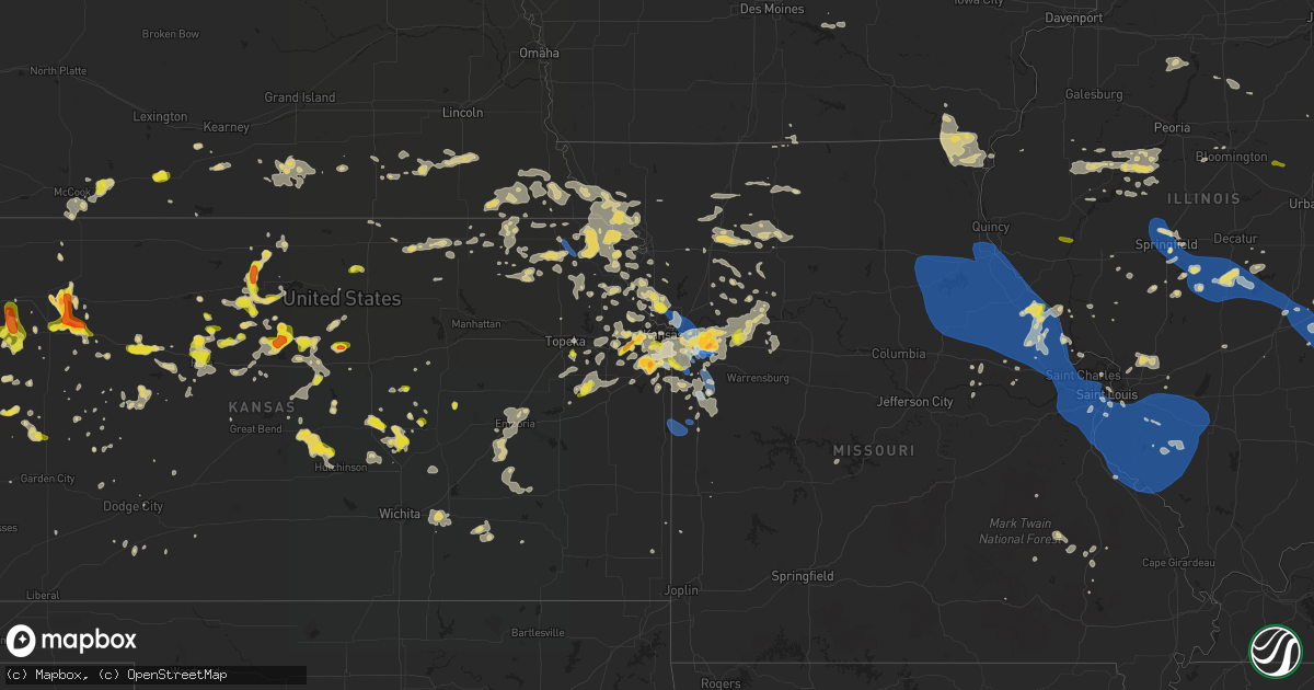
August 12 map
$229
one time, instant access
Download today. No call, no setup
Keep the $229
Bought the map and want the full workflow? Apply the entire $229 to a subscription within 7 days. None of it is wasted.
Every map, not just this one
This buys you this map. Subscription and you get every map we run, in the markets you choose from a few cities to whole states to nationwide. Plus real-time alerts the moment a storm fires.
Contact data
Name, contact info, occupancy, even credit band for addresses in the footprint. You go from where it hit to who to call.
Become the source they trust
Unlimited branding weather history reports on demand. You already have the documented answer ready for the property owner, and you are the one who showed up with it.
Property data and RoofTrace estimates
Pull up any address you have got, its value and the exact code rules for that jurisdiction, straight from One Click Code. Then RoofTrace estimates the squares, pitch, and roof value, priced the way you price.
States Impacted by Hail Map on August 12, 2021
Storm reports
Michigan
| Date | Description |
|---|---|
| 08/12/20215:20 PM CDT | Delayed report. A few trees down |
| 08/12/20212:09 AM CDT | At 708 AM EDT, a severe thunderstorm was located near Ypsilanti, moving northeast at 65 mph. HAZARD...60 mph wind gusts. SOURCE...Radar indicated. IMPACT...Expect damage to roofs, siding, and trees. This severe thunderstorm will be near... Romulus around 720 AM EDT. Livonia, Taylor and Greenfield Village around 725 AM EDT. Southfield, Detroit, Dearborn and Detroit Zoo around 730 AM EDT. Warren, Downtown Detroit and Belle Isle around 735 AM EDT. Grosse Pointe around 740 AM EDT. St. Clair Shores around 745 AM EDT.Other locations impacted by this severe thunderstorm includeMelvindale, Gibraltar, Roseville, New Boston, Rockwood, Harper Woods,Pleasant Ridge, Westland, Grosse Pointe Shores and Ecorse. |
| 08/12/20211:31 AM CDT | At 630 AM EDT, a severe thunderstorm was located near Cement City, or 8 miles south of Vandercook Lake, moving northeast at 65 mph. HAZARD...60 mph wind gusts and penny size hail. SOURCE...Radar indicated. IMPACT...Expect damage to roofs, siding, and trees. This severe thunderstorm will be near... Manchester around 650 AM EDT. Chelsea around 655 AM EDT. Ann Arbor and Dexter around 700 AM EDT. Hamburg around 705 AM EDT. Dixboro and Whitmore Lake around 710 AM EDT. South Lyon and Salem around 715 AM EDT.Other locations impacted by this severe thunderstorm include ManitouBeach-Devils Lake, Whittaker, Hudson Mills Metropark, Ridgeway, DelhiMills, Pleasant Lake, Pinckney State Recreation Area, Chilson,Cambridge Junction and Unadilla.People attending Manchester Community Fair should seek safe shelterimmediately! |
| 08/12/20211:15 AM CDT | At 610 AM EDT, a severe thunderstorm was located near Quincy, or 7 miles northeast of Coldwater, moving northeast at 65 mph. HAZARD...60 mph wind gusts. SOURCE...Radar indicated. IMPACT...Expect damage to roofs, siding, and trees. Locations impacted include... Jackson... Homer... Brooklyn... Grass Lake... Vandercook Lake... Leoni... Spring Arbor... Napoleon... Sandstone... Norvell... Pulaski... Concord... Horton... Hanover... Oak Point... Sunset Beach... Michigan Center... |
| 08/12/202112:52 AM CDT | At 552 AM EDT, severe thunderstorms were located along a line extending from Centreville to Bronson, moving northeast at 45 mph. HAZARD...60 mph wind gusts. SOURCE...Radar indicated. IMPACT...Expect damage to roofs, siding, and trees. Severe thunderstorms will be near... Bronson around 555 AM EDT. Coldwater around 605 AM EDT.Other locations in the path of these severe thunderstorms includeQuincy, Union City and Litchfield.This includes Interstate 69 in Michigan between mile markers 11 and21. |
Nevada
| Date | Description |
|---|---|
| 08/12/20212:40 AM CDT | At 740 PM PDT, a severe thunderstorm was located 14 miles southwest of Moapa Town, moving south at 25 mph. HAZARD...60 mph wind gusts and quarter size hail. SOURCE...Radar indicated. IMPACT...Hail damage to vehicles is expected. Expect wind damage to roofs and trees. Locations impacted include... Moapa Town and Valley Of Fire. This includes Interstate 15 in Nevada between mile markers 65 and 87. |
| 08/12/20212:06 AM CDT | At 705 PM PDT, a severe thunderstorm was located near Sr 168 Mile Marker 21, or 10 miles west of Moapa Town, moving southeast at 25 mph. HAZARD...60 mph wind gusts and quarter size hail. SOURCE...Radar indicated. IMPACT...Hail damage to vehicles is expected. Expect wind damage to roofs and trees. Locations impacted include... Moapa Town, Moapa Valley, Logandale and Sr 168 Mile Marker 21. This includes Interstate 15 in Nevada between mile markers 71 and 96. |
| 08/12/20211:15 AM CDT | Thunderstorm wind gust to 58 mph recorded at cottonwood cove hads site. Sustained winds of 33 mph were recorded at the same time. |
| 08/11/202111:15 PM CDT | Peak wind gust of 63 mph reported at 915 pm with thunderstorm at boulder island. Sustained wind with the ob was 30 mph out of the north. |
| 08/11/20219:54 PM CDT | A local report indicates 67 MPH wind near 15 WNW VALLEY OF FIRE S |
Oklahoma
| Date | Description |
|---|---|
| 08/12/202112:38 AM CDT | At 538 PM CDT, a severe thunderstorm was located 6 miles northeast of Eva, or 8 miles south of Elkhart, moving north at 20 mph. HAZARD...60 mph wind gusts and quarter size hail. SOURCE...Radar indicated. IMPACT...Minor damage to roofs, siding, and trees is possible. Hail damage to vehicles is expected. This severe thunderstorm will remain over mainly rural areas of northwestern Texas County. |
Arizona
| Date | Description |
|---|---|
| 08/12/20214:10 AM CDT | At 909 PM PDT/909 PM MST/, a severe thunderstorm was located near Callville Bay, or near Las Vegas Bay, moving south at 20 mph. HAZARD...60 mph wind gusts. SOURCE...Radar indicated. IMPACT...Expect damage to roofs and trees. Locations impacted include... Henderson, Boulder City, Las Vegas Bay, Lake Las Vegas, Boulder Beach, Railroad Pass, Boulder Beach Campground, Las Vegas Bay Campground, Callville Bay, Hoover Dam, Callville Bay Campground, Black Mtn and Willow Beach. |
| 08/12/20213:17 AM CDT | At 816 PM PDT/816 PM MST/, a severe thunderstorm was located 10 miles north of Callville Bay Campground, or 12 miles east of The Motor Speedway, moving south at 45 mph. HAZARD...60 mph wind gusts and quarter size hail. SOURCE...Radar indicated. IMPACT...Hail damage to vehicles is expected. Expect wind damage to roofs and trees. Locations impacted include... Henderson, North Las Vegas, Boulder City, Las Vegas Bay, Lake Las Vegas, Nellis AFB, East Las Vegas, Sam Boyd Stadium, The Motor Speedway, Boulder Beach, Railroad Pass, Boulder Beach Campground, Las Vegas Bay Campground, Callville Bay, Hoover Dam, Callville Bay Campground, Sunrise Mtn and Frenchman Mtn.This includes Interstate 15 in Nevada between mile markers 60 and 63. |
| 08/12/20212:25 AM CDT | At 725 PM MST, a severe thunderstorm was located near Brenda, or 32 miles southeast of Parker, moving southwest at 10 mph. HAZARD...60 mph wind gusts and penny size hail. SOURCE...Radar indicated. IMPACT...Expect damage to roofs, siding, and trees. Locations impacted include... Quartzsite, Vicksburg, Brenda and Vicksburg Junction. This includes the following highways...AZ Interstate 10 between mile markers 12 and 48.US Highway 60 between mile markers 31 and 52.AZ Route 72 between mile markers 39 and 49. |
| 08/12/20211:52 AM CDT | At 652 PM MST, a severe thunderstorm was located near Bouse, or 21 miles southeast of Parker, moving southwest at 15 mph. HAZARD...60 mph wind gusts and quarter size hail. SOURCE...Radar indicated. IMPACT...Hail damage to vehicles is expected. Expect wind damage to roofs, siding, and trees. Locations impacted include... Bouse.This includes AZ Route 72 between mile markers 19 and 41. |
| 08/12/20211:50 AM CDT | At 650 PM MST, a severe thunderstorm was located near Tacna, or 32 miles east of Fortuna Foothills, moving southeast at 20 mph. HAZARD...60 mph wind gusts and penny size hail. SOURCE...Radar indicated. IMPACT...Expect damage to roofs, siding, and trees. Locations impacted include... Tacna, Tyson, Mohawk and Roll. This includes AZ Interstate 8 between mile markers 35 and 55. |
| 08/11/20219:46 PM CDT | Multiple semi trucks reported blown over on westbound i-10 east of quartzsite... Resulting in closure of the interstate. |
| 08/11/20219:40 PM CDT | Trees down on highway 95 in north part of quartzsite. Bypassers assisted deputy to remove large tree blocking highway. Debris from properties blowing on to residential |
| 08/11/20219:00 PM CDT | Numerous power poles blown down along avenue 40 e between e county 6th st and 8th st. Time estimated from spotter between 700 and 745 pm. |
Pennsylvania
| Date | Description |
|---|---|
| 08/12/20216:50 PM CDT | Trees and wires down |
| 08/12/20216:50 PM CDT | Tree/wires down |
| 08/12/20216:45 PM CDT | Trees down |
| 08/12/20216:45 PM CDT | Several trees and power lines down in penn township |
| 08/12/20216:43 PM CDT | Trees and lines down at thomsville and parkwood in peters twp |
| 08/12/20216:42 PM CDT | County officials have reported several trees and lines down in peters township |
| 08/12/20216:41 PM CDT | Report and photos of snapped trees in delmont. |
| 08/12/20216:40 PM CDT | Trees and wires down |
| 08/12/20216:37 PM CDT | Several trees and power lines down around cecil township |
| 08/12/20216:32 PM CDT | Trees across road |
| 08/12/20216:31 PM CDT | Report of uprooted trees in the area. |
| 08/12/20216:23 PM CDT | Tree across road |
| 08/12/20216:20 PM CDT | Tree down on labelle vue rd. In vandergrift |
| 08/12/20216:18 PM CDT | Lines down on applewood dr and garvers ferry in lower burrell |
| 08/12/20216:17 PM CDT | Tree down on 7th st. Extension in trafford |
| 08/12/20216:14 PM CDT | Report of large tree branches down. |
| 08/12/20216:11 PM CDT | Tree down on sleepy hollow rd in mt lebanon |
| 08/12/20216:09 PM CDT | Trees and wires down |
| 08/12/20216:09 PM CDT | Report of trees down. Time estimated based on radar. |
| 08/12/20216:07 PM CDT | Tree down on trailer on werner camp road |
| 08/12/20216:05 PM CDT | Several trees and lines reported down in allegheny township |
| 08/12/20216:04 PM CDT | Tree down on mayview rd in bridgeville |
| 08/12/20216:00 PM CDT | Report of downed trees. Time estimated based on radar. |
| 08/12/20215:58 PM CDT | Tree down across dutch road |
| 08/12/20215:47 PM CDT | Several trees down in the area... Including on burgettstown rd in mt pleasant township |
| 08/12/20215:43 PM CDT | Lines and tree down on highway 322 near detrick road |
| 08/12/20215:40 PM CDT | Report of lots of trees down and power outages... With picture of downed tree along 5th avenue. |
| 08/12/20215:38 PM CDT | Report of power line and tree down. Time estimated based on radar. |
| 08/12/20215:38 PM CDT | Nws employee witnessed a downburst cross from moon township and coraopolis...across the ohio river...and proceed into osborne/haysville between 634 and 639 pm. This eve |
| 08/12/20215:38 PM CDT | Trees and wires down between haysville light and glen mitchell road. |
| 08/12/20215:37 PM CDT | Trees and power lines down at the intersection of beaver st and glen mitchell rd |
| 08/12/20215:35 PM CDT | Large tree limbs and branches down. |
| 08/12/20215:34 PM CDT | Rough estimate of around 20 trees down by rmus campus |
| 08/12/20215:10 PM CDT | Tree on a vehicle |
| 08/12/20215:06 PM CDT | Trees and wires down |
| 08/12/20215:05 PM CDT | Trees and wires down |
| 08/12/20215:04 PM CDT | Report of several trees and lines down in the area of cranberry township |
| 08/12/20215:01 PM CDT | Photo of large uprooted tree on settlers village circle. Time estimated based on radar. |
| 08/12/20215:00 PM CDT | Report of many downed or broken trees. Time estimated based on radar. |
| 08/12/20214:52 PM CDT | Spotter reported several trees down along or near route 168 in eastbrook |
| 08/12/20214:45 PM CDT | Tree down on power lines in brookville off church st |
| 08/12/20214:40 PM CDT | Tree fell onto a house severely damaging the home near summit township in western crawford county. A mobile home was severely damaged. Numerous trees were blown down. T |
| 08/12/20214:38 PM CDT | Report of power line and tree down. Time estimated based on radar. |
| 08/12/20214:30 PM CDT | Multiple reports of trees and power lines down |
| 08/12/20214:30 PM CDT | Lawrence county public safety reports several trees down in the area... Including the city of new castle. |
| 08/12/20214:28 PM CDT | Delayed report tree down onto a house on brittany dr. |
| 08/12/20214:18 PM CDT | Delayed report. Approximately golf ball-size hail per photo. Time estimated via radar. |
| 08/12/20214:15 PM CDT | Lawrence county public safety reports several trees down in the area... Including the city of new wilmington. |
| 08/12/20214:14 PM CDT | Delayed report. Approximately golf ball-size hail per photo. Time estimated via radar. |
| 08/12/20213:49 PM CDT | Trees down in rockland twp |
| 08/12/20212:25 PM CDT | Trees blown down in scotrun. Time estimated from radar. |
| 08/12/20212:15 PM CDT | Multiple reports of trees and wires down in the pocono lake area. Time estimated from radar. |
| 08/12/20212:15 PM CDT | Tree down across route 435. |
| 08/12/20212:10 PM CDT | Mping report of a tree uprooted or snapped. Time estimated from radar. |
| 08/12/20212:10 PM CDT | Tree and wires blown down on ranger trail near tobyhanna. |
| 08/12/20211:48 PM CDT | Wires down on hillside road. Time estimated from radar. |
| 08/12/20211:26 PM CDT | Multiple reports of wires down. Time estimated from radar. |
| 08/12/20211:12 PM CDT | Trees down and garage door blown in. Images sent via facebook. |
| 08/12/20211:05 PM CDT | Multiple trees down. |
| 08/12/202112:55 PM CDT | Multiple wires down. |
| 08/12/202112:42 PM CDT | Several trees and power lines down in punxsutawney |
| 08/12/202112:40 PM CDT | Multiple trees reported down on power lines in the area of young township |
| 08/12/202112:38 PM CDT | Reported multiple trees down on hamilton porter rd and ewing rd in perry township |
| 08/12/202112:35 PM CDT | Multiple wires down on roadway. |
| 08/12/202112:25 PM CDT | Trees and wires down. |
| 08/12/202112:25 PM CDT | Report of trees down in and around west kittanning. |
| 08/12/202112:15 PM CDT | Tree down. |
| 08/12/202112:15 PM CDT | Multiple trees and wires down. |
| 08/12/202111:00 AM CDT | Trees down |
| 08/12/202110:55 AM CDT | Trees down |
| 08/12/202110:45 AM CDT | Trees down |
| 08/12/20217:56 AM CDT | At 1256 PM EDT, a severe thunderstorm was located near Sarver, or 8 miles southeast of Butler, moving southeast at 40 mph. HAZARD...60 mph wind gusts. SOURCE...Radar indicated. IMPACT...Expect damage to trees and power lines, resulting in some power outages. Locations impacted include... Vandergrift, Kittanning, Apollo, Harrison Township, Ford City, Leechburg, Sarver, Freeport, West Kittanning, Saxonburg, North Apollo, and West Leechburg. |
| 08/12/20217:51 AM CDT | At 1251 PM EDT, severe thunderstorms were located along a line extending from near Leetonia to near Ole Bull State Park to near Kettle Creek State Park, moving east at 40 mph. HAZARD...60 mph wind gusts. SOURCE...Radar indicated. IMPACT...Expect damage to roofs, siding, and trees. Locations impacted include... Morris, Blossburg, Renovo, South Renovo, Arnot, Cross Fork, Glen Union, Waterville, Leonard Harrison State Park, Tamarack, Kettle Creek State Park, Cedar Run, Cammal, Ole Bull State Park, Little Pine State Park, Westport, Leetonia, Cherry Springs State Park, Hyner and Ogdensburg. |
| 08/12/20217:34 AM CDT | At 1234 PM EDT, a severe thunderstorm was located over Leetsdale, or over Moon Township, moving southeast at 40 mph. HAZARD...60 mph wind gusts. SOURCE...Radar indicated. IMPACT...Expect damage to trees and power lines, resulting in some power outages. Locations impacted include... Pittsburgh, Penn Hills, Mount Lebanon, Ross Township, McCandless Township, Cranberry, Moon Township, Franklin Park, Aliquippa, Monaca, Shaler Township, and Plum. |
| 08/12/20217:21 AM CDT | At 1220 PM EDT, a severe thunderstorm was located near Slippery Rock, or 11 miles south of Grove City, moving east at 45 mph. HAZARD...60 mph wind gusts and quarter size hail. SOURCE...Radar indicated. IMPACT...Minor hail damage to vehicles is possible. Expect wind damage to trees and power lines, resulting in some power outages. Locations impacted include... Cranberry, Butler, Kittanning, Rimersburg, New Kensington, Lower Burrell, Harrison Township, Homeacre-Lyndora, Shanor-Northvue, Tarentum, Natrona Heights, and Meridian. |
| 08/12/20216:59 AM CDT | At 1159 AM EDT, a severe thunderstorm was located near New Castle, moving southeast at 40 mph. HAZARD...60 mph wind gusts. SOURCE...Radar indicated. IMPACT...Expect damage to trees and power lines, resulting in some power outages. Locations impacted include... New Castle, Ellwood City, Homeacre-Lyndora, Shanor-Northvue, Meridian, Zelienople, Oakwood, Evans City, New Castle Northwest, Big Beaver, New Beaver, and Ellport. |
| 08/12/20216:10 AM CDT | At 1109 PM EDT, severe thunderstorms were located along a line extending from Lawn to near Valley Green, moving east at 25 mph. HAZARD...60 mph wind gusts and penny size hail. SOURCE...Radar indicated. IMPACT...Expect damage to roofs, siding, and trees. Locations impacted include... Ephrata, Elizabethtown, Lititz, Middletown, Mount Joy, Manheim, East Petersburg, Cornwall, Salunga-Landisville, Denver, Maytown, Campbelltown, Valley Green, Reamstown, Rothsville, Adamstown, Rheems, Bainbridge, Brickerville and Schaefferstown.This includes the following Interstates... The Pennsylvania Turnpike from mile markers 252 to 285. Interstate 83 from mile markers 29 to 32. |
| 08/12/20216:01 AM CDT | At 1101 AM EDT, severe thunderstorms were located along a line extending from near North Bloomfield to near Bristolville to near Newton Falls, moving east at 50 mph. HAZARD...70 mph wind gusts. SOURCE...Radar indicated. IMPACT...Expect considerable tree damage. Damage is likely to mobile homes, roofs, and outbuildings. Locations impacted include... Warren, Niles, Hubbard, Cortland, Lordstown, Kinsman, North Bloomfield, West Farmington, Vienna Center, Adamsville, Pymatuning Central, Bristolville, Leavittsburg, Atlantic, Girard, Vienna, McDonald, Mecca, Johnston and Cochranton. |
| 08/12/20215:31 AM CDT | At 1031 PM EDT, severe thunderstorms were located along a line extending from near Aristes to near Fort Indiantown Gap, moving northeast at 55 mph. HAZARD...60 mph wind gusts. SOURCE...Radar indicated. IMPACT...Expect damage to roofs, siding, and trees. Locations impacted include... Pottsville, Colonial Park, Shamokin, Tamaqua, Linglestown, Mount Carmel, Schuylkill Haven, Shenandoah, Minersville, Mahanoy City, Frackville, St. Clair, Kulpmont, Ashland, Paxtonia, Skyline View, Orwigsburg, Valley View, Mcadoo and Pine Grove.This includes the following Interstates... Interstate 78 from mile markers 0 to 8. Interstate 81 between mile markers 71 and 72...and from mile markers75 to 139. |
| 08/12/20215:27 AM CDT | At 1026 PM EDT, severe thunderstorms were located along a line extending from near Numidia to near Palmyra, moving northeast at 45 mph. HAZARD...60 mph wind gusts. SOURCE...Radar indicated. IMPACT...Damage to roofs, siding, trees, and power lines is possible. Locations impacted include... Hamburg, Womelsdorf, Weatherly, Wernersville, Robesonia, Bernville, Strausstown, Lansford, Beaver Meadows, Centerport and Tresckow.This includes Interstate 78 in Pennsylvania near mile marker 8, andbetween mile markers 10 and 31. |
| 08/12/20214:59 AM CDT | At 958 PM EDT, severe thunderstorms were located along a line extending from Rebuck to Marysville, moving east at 40 mph. HAZARD...60 mph wind gusts. SOURCE...Radar indicated. IMPACT...Expect damage to roofs, siding, and trees. Locations impacted include... Shamokin, Linglestown, Mount Carmel, Kulpmont, Ashland, Skyline View, Valley View, Millersburg, Marysville, Elysburg, Fairview-Ferndale, Trevorton, Lykens, Tremont, Duncannon, Girardville, Elizabethville, Marshallton, Williamstown and Tower City.This includes the following Interstates... Interstate 78 from mile markers 0 to 3. Interstate 81 from mile markers 75 to 117. |
| 08/12/20214:56 AM CDT | At 956 PM EDT, a severe thunderstorm was located over Factoryville, or near Waverly, moving east at 40 mph. HAZARD...60 mph wind gusts and quarter size hail. SOURCE...Radar indicated. IMPACT...Hail damage to vehicles is expected. Expect wind damage to roofs, siding, and trees. Locations impacted include... Scranton, Carbondale, Archbald, Blakely, Dickson City, Olyphant, Clarks Summit, Jessup, Honesdale and Throop. |
| 08/12/20214:31 AM CDT | At 931 PM EDT, a severe thunderstorm was located over Central, or 16 miles northwest of Berwick, moving east at 40 mph. HAZARD...60 mph wind gusts and penny size hail. SOURCE...Radar indicated. IMPACT...Expect damage to roofs, siding, and trees. Locations impacted include... Wilkes-Barre, Muhlenberg, Kingston, Nanticoke, Plains, Pittston, Plymouth, Exeter, Swoyersville and West Pittston. |
| 08/12/20214:23 AM CDT | At 922 PM EDT, severe thunderstorms were located along a line extending from Allenwood to Kreamer, moving east at 45 mph. HAZARD...60 mph wind gusts. SOURCE...Radar indicated. IMPACT...Expect damage to roofs, siding, and trees. Locations impacted include... Bloomsburg, Berwick, Sunbury, Milton, Lewisburg, Selinsgrove, Danville, Northumberland, Winfield, Watsontown, Elysburg, Riverside, Shamokin Dam, Catawissa, Linntown, Hummels Wharf, Middleburg, Mifflinville, Lightstreet and Almedia.For those driving on Interstate 80, this includes areas between theMile Run and Nescopek exits, specifically from mile markers 208 to247.This includes Interstate 180 from mile markers 1 to 3. |
| 08/12/20214:14 AM CDT | At 914 PM EDT, a severe thunderstorm was located 7 miles southeast of Overton, or 15 miles southwest of Wyalusing, moving east at 40 mph. HAZARD...60 mph wind gusts and penny size hail. SOURCE...Radar indicated. IMPACT...Expect damage to roofs, siding, and trees. Locations impacted include... Falls, Vernon, Rush, Harveys Lake, Tunkhannock, Wilmot, Hollenback, Noxen, Mehoopany and Wyalusing. |
| 08/12/20214:01 AM CDT | At 901 PM EDT, a severe thunderstorm was located over Allenwood, moving northeast at 30 mph. HAZARD...60 mph wind gusts and penny size hail. SOURCE...Radar indicated. IMPACT...Expect damage to roofs, siding, and trees. Locations impacted include... Muncy, Watsontown, Hughesville, Montgomery, Allenwood, Biggertown, Lairdsville, Delaware Run and Picture Rocks.For those driving on Interstate 80, this includes areas between theMile Run and Lewisburg-Williamsport exits, specifically from milemarkers 204 to 207.This includes Interstate 180 from mile markers 4 to 17. |
| 08/12/20213:58 AM CDT | At 857 PM EDT, a severe thunderstorm was located over Donora, or 8 miles southeast of Gastonville, moving east at 25 mph. HAZARD...60 mph wind gusts. SOURCE...Radar indicated. IMPACT...Expect damage to trees and power lines, resulting in some power outages. Locations impacted include... Pittsburgh, Monroeville, Greensburg, McKeesport, Jeannette, Latrobe, West Mifflin, Murrysville, Munhall, Jefferson Hills, North Versailles, and Pleasant Hills. |
| 08/12/20213:42 AM CDT | At 842 PM EDT, severe thunderstorms were located along a line extending from Mill Hall to near Rebersburg to Coburn, moving northeast at 30 mph. HAZARD...60 mph wind gusts and penny size hail. SOURCE...Radar indicated. IMPACT...Expect damage to roofs, siding, and trees. Locations impacted include... Williamsport, Lock Haven, Jersey Shore, Mifflinburg, Carroll, Woodward, Lamar, Mill Hall, Avis, Dunnstown, Flemington, Duboistown, Castanea, Millheim, Aaronsburg, McElhattan, Rebersburg, Vicksburg, Coburn and Madisonburg.For those driving on Interstate 80, this includes areas between theLamar and Lewisburg-Williamsport exits, specifically from milemarkers 173 to 204.This includes Interstate 180 from mile markers 24 to 29. |
| 08/12/20213:28 AM CDT | At 827 PM EDT, a severe thunderstorm was located over Cogan Station, moving east at 45 mph. HAZARD...60 mph wind gusts and nickel size hail. SOURCE...Radar indicated. IMPACT...Expect damage to roofs, siding, and trees. Locations impacted include... Williamsport, Montoursville, Hughesville, Kettle Creek Gorge, Cogan Station, Ricketts Glen State Park, Biggertown, Muncy Valley, Barbours, Loyalsockville, Garden View, Picture Rocks, Laporte, Salladasburg, Forksville, Eagles Mere and Hillsgrove.This includes Interstate 180 from mile markers 17 to 23. |
| 08/12/20213:05 AM CDT | At 805 PM EDT, severe thunderstorms were located along a line extending from near Ralston to near Cammal, moving east at 45 mph. HAZARD...60 mph wind gusts and penny size hail. SOURCE...Radar indicated. IMPACT...Expect damage to roofs, siding, and trees. Locations impacted include... Glen Union, Waterville, Ralston, Ogdensburg, Cammal, Slate Run, English Center, Trout Run, Lincoln Falls, Shunk, Little Pine State Park, Buttonwood and Ski Sawmill Ski Area. |
| 08/12/20212:56 AM CDT | At 755 PM EDT, a severe thunderstorm was located over North Philipsburg, moving east at 40 mph. HAZARD...60 mph wind gusts. SOURCE...Law enforcement. IMPACT...Expect damage to roofs, siding, and trees. Locations impacted include... Bellefonte, Pleasant Gap, Philipsburg, Woodland, Lamar, Lemont, Zion, Houserville, Centre Hall, Milesburg, Chester Hill, Snow Shoe, North Philipsburg, Clarence, South Philipsburg, Moshannon, Spring Mills, Julian, Bald Eagle State Park and Potters Mills.For those driving on Interstate 80, this includes areas between theWoodland and Lamar exits, specifically from mile markers 123 to 170.This includes Interstate 99 from mile markers 73 to 85. |
| 08/12/20212:53 AM CDT | At 753 PM EDT, a severe thunderstorm was located near Imperial, or 7 miles southwest of Moon Township, moving east at 45 mph. HAZARD...60 mph wind gusts. SOURCE...Radar indicated. IMPACT...Expect damage to trees and power lines, resulting in some power outages. Locations impacted include... Pittsburgh, Penn Hills, Ross Township, McCandless Township, Moon Township, Franklin Park, Shaler Township, Plum, North Side Pittsburgh, Hampton Township, Scott Township, and Robinson Township. |
| 08/12/20212:43 AM CDT | At 743 PM EDT, a severe thunderstorm was located over Indiana, moving east at 50 mph. HAZARD...60 mph wind gusts. SOURCE...Radar indicated. IMPACT...Expect damage to trees and power lines, resulting in some power outages. Locations impacted include... Indiana, Homer City, Clymer, West Lebanon, Chevy Chase Heights, Ernest, Marion Center, Cherry Tree, Creekside, Plumville, Glen Campbell, and Shelocta. |
| 08/12/20212:09 AM CDT | At 709 PM EDT, severe thunderstorms were located along a line extending from New Kensington to Baldwin to near Wolfdale, moving east at 35 mph. HAZARD...60 mph wind gusts. SOURCE...Radar indicated. IMPACT...Expect damage to trees and power lines, resulting in some power outages. Locations impacted include... Pittsburgh, Penn Hills, Mount Lebanon, Bethel Park, Monroeville, McMurray, Greensburg, McKeesport, Washington, Jeannette, Canonsburg, and Latrobe. |
| 08/12/20212:07 AM CDT | At 707 PM EDT, severe thunderstorms were located along a line extending from 7 miles west of Portland Mills to Reynoldsville to Punxsutawney, moving east at 45 mph. HAZARD...60 mph wind gusts. SOURCE...Radar indicated. IMPACT...Expect damage to roofs, siding, and trees. Locations impacted include... St. Marys, DuBois, Clearfield, Ridgway, Sandy, Woodland, Curwensville, Penfield, Hyde, Plymptonville, Rockton, Houtzdale, Force, Benezette, Jeffries, Lecontes Mills, S.B. Elliot State Park, Medix Run, Portland Mills and Brandy Camp.For those driving on Interstate 80, this includes areas between theDubois and Kylertown exits, specifically from mile markers 97 to 128. |
| 08/12/20211:53 AM CDT | At 653 PM EDT, severe thunderstorms were located along a line extending from 8 miles northeast of Tionesta to 8 miles south of Marienville to Brookville, moving east at 25 mph. HAZARD...60 mph wind gusts. SOURCE...Radar indicated. IMPACT...Expect damage to trees and power lines, resulting in some power outages. Locations impacted include... Brookville, Marienville, Brockway, Falls Creek, Sigel, Kellettville, West Hickory, Clarington, Clear Creek State Park, East Hickory, and Starr. |
| 08/12/20211:40 AM CDT | At 640 PM EDT, a severe thunderstorm was located 7 miles west of Tiltonsville, or 8 miles northwest of Clearview, moving east at 45 mph. HAZARD...60 mph wind gusts. SOURCE...Radar indicated. IMPACT...Expect damage to trees and power lines, resulting in some power outages. Locations impacted include... Weirton, Steubenville, Martins Ferry, Wellsburg, West Liberty, Avella, Clearview, Wintersville, Mingo Junction, Follansbee, Hooverson Heights, and Tiltonsville. |
| 08/12/20211:38 AM CDT | At 637 PM EDT, severe thunderstorms were located along a line extending from near New Bethlehem to near Hampton Township, moving east at 40 mph. HAZARD...60 mph wind gusts. SOURCE...Radar indicated. IMPACT...Expect damage to trees and power lines, resulting in some power outages. Locations impacted include... Indiana, Punxsutawney, Vandergrift, Kittanning, Apollo, Hampton Township, New Kensington, Lower Burrell, Harrison Township, Tarentum, Natrona Heights, and Brackenridge. |
| 08/12/20211:25 AM CDT | At 625 PM EDT, a severe thunderstorm was located over S.B. Elliot State Park, moving east at 20 mph. HAZARD...60 mph wind gusts and penny size hail. SOURCE...Radar indicated. IMPACT...Expect damage to roofs, siding, and trees. Locations impacted include... Clearfield, Philipsburg, Woodland, Curwensville, Hyde, Osceola Mills, Plymptonville, Chester Hill, Karthaus, Jeffries, Lecontes Mills, S.B. Elliot State Park, Morrisdale, West Decatur, Grassflat, Kylertown, Wallaceton and Clearfield-Lawrence Airport.For those driving on Interstate 80, this includes areas between theDubois Route 255 and Snow Shoe exits, specifically from mile markers106 to 138. |
| 08/12/20211:10 AM CDT | At 608 PM EDT, a severe thunderstorm was located 8 miles west of Knox, moving east at 30 mph. HAZARD...60 mph wind gusts. SOURCE...Radar indicated. IMPACT...Expect damage to trees and power lines, resulting in some power outages. Locations impacted include... Clarion, Brookville, Knox, Parker, Sligo, Emlenton, Strattanville, Summerville, Limestone, Shippenville, St. Petersburg, and Corsica. |
| 08/12/20211:06 AM CDT | At 606 PM EDT, a severe thunderstorm was located over Wintersville, or over Steubenville, moving east at 25 mph. HAZARD...60 mph wind gusts. SOURCE...Radar indicated. IMPACT...Expect damage to trees and power lines, resulting in some power outages. Locations impacted include... Weirton, Steubenville, Wellsburg, Avella, Toronto, Wintersville, Mingo Junction, Follansbee, Hooverson Heights, Burgettstown, Franklin, and Hickory. |
| 08/12/202112:53 AM CDT | At 553 PM EDT, a severe thunderstorm was located over Zelienople, or near Cranberry, moving east at 30 mph. HAZARD...60 mph wind gusts. SOURCE...Radar indicated. IMPACT...Expect damage to trees and power lines, resulting in some power outages. Locations impacted include... Cranberry, Butler, Homeacre-Lyndora, Shanor-Northvue, Meridian, Zelienople, Seven Fields, Meadowood, Oak Hills, Sarver, Evans City, and Freeport. |
| 08/12/202112:46 AM CDT | At 544 PM EDT, severe thunderstorms were located along a line extending from near Reynoldsville to near Brockway, moving east at 20 mph. HAZARD...60 mph wind gusts and penny size hail. SOURCE...Radar indicated. IMPACT...Expect damage to roofs, siding, and trees. Locations impacted include... DuBois, Sandy, Penfield, Rockton, Force, Parker Dam State Park, S.B. Elliot State Park, Brockport, Treasure Lake and Penn State Dubois.For those driving on Interstate 80, this includes areas between theDubois and Clearfield exits, specifically from mile markers 97 to113. |
| 08/12/202112:43 AM CDT | At 543 PM EDT, a severe thunderstorm was located 7 miles west of Slippery Rock, or 8 miles east of New Castle, moving east at 35 mph. HAZARD...60 mph wind gusts. SOURCE...Radar indicated. IMPACT...Expect damage to trees and power lines, resulting in some power outages. Locations impacted include... Shanor-Northvue, Slippery Rock, Chicora, Harrisville, Parker, Plain Grove Township, Bruin, West Liberty, Eau Claire, Harlansburg, Portersville, and Petrolia. |
| 08/12/202112:36 AM CDT | At 536 PM EDT, severe thunderstorms were located along a line extending from near Cambridge Springs to near Kinsman, moving east at 35 mph. HAZARD...60 mph wind gusts and quarter size hail. SOURCE...Radar indicated. IMPACT...Minor damage to vehicles is possible. Expect damage to trees and power lines. Locations impacted include... Meadville, Titusville, Cambridge Springs, Linesville, Adamsville, Canadohta Lake, Pymatuning Central, Riceville, Harmonsburg, Lincolnville, Guys Mills, Atlantic, Pymatuning North, Cochranton, Saegertown, Conneaut Lake, Jamestown, Hydetown, Blooming Valley and Townville. |
| 08/12/202112:20 AM CDT | At 520 PM EDT, a severe thunderstorm was located near Brookville, moving east at 15 mph. HAZARD...60 mph wind gusts. SOURCE...Radar indicated. IMPACT...Expect damage to trees and power lines, resulting in some power outages. Locations impacted include... Brookville, Reynoldsville, Falls Creek, Summerville, Corsica, Sigel, Fisher, and Clear Creek State Park. |
| 08/12/202112:12 AM CDT | At 512 PM EDT, a severe thunderstorm was located near Titusville, moving northeast at 25 mph. HAZARD...60 mph wind gusts and nickel size hail. SOURCE...Radar indicated. IMPACT...Expect damage to roofs, siding, and trees. Locations impacted include... Enterprise, Garland, Grand Valley and Tidioute. |
| 08/12/202112:06 AM CDT | At 506 PM EDT, a severe thunderstorm was located near Harmonsburg, or 11 miles west of Meadville, moving east at 25 mph. HAZARD...60 mph wind gusts and quarter size hail. SOURCE...Radar indicated. IMPACT...Minor damage to vehicles is possible. Expect damage to trees and power lines. Locations impacted include... Meadville, Cambridge Springs, Linesville, Riceville, Harmonsburg, Lincolnville, Guys Mills, Pymatuning North, Canadohta Lake, Pymatuning Central, Saegertown, Conneautville, Conneaut Lake, Springboro, Blooming Valley, Venango, Woodcock and Conneaut Lakeshore. |
| 08/11/202111:58 PM CDT | At 458 PM EDT, a severe thunderstorm was located 7 miles east of Guys Mills, or 14 miles northwest of Oil City, moving northeast at 25 mph. HAZARD...60 mph wind gusts and quarter size hail. SOURCE...Radar indicated. IMPACT...Minor damage to vehicles is possible. Expect damage to trees and power lines. Locations impacted include... Titusville, Hydetown and Townville. |
| 08/11/202111:56 PM CDT | At 456 PM EDT, a severe thunderstorm was located near Sugarcreek, or 9 miles north of Franklin, moving east at 30 mph. HAZARD...60 mph wind gusts. SOURCE...Radar indicated. IMPACT...Expect damage to trees and power lines, resulting in some power outages. Locations impacted include... Oil City, Sugarcreek, Tionesta, Hasson Heights, Rouseville, Cooperstown, Pleasantville, West Hickory, Oil Creek State Park, Starr, and East Hickory. |
| 08/11/202111:46 PM CDT | At 441 PM EDT, a severe thunderstorm was located 9 miles west of Knox, moving east at 20 mph. HAZARD...60 mph wind gusts. SOURCE...Radar indicated. IMPACT...Expect damage to trees and power lines, resulting in some power outages. Locations impacted include... Clarion, Knox, Emlenton, Strattanville, Limestone, Shippenville, Fryburg, Leeper, and Cranberry Township. |
| 08/11/202111:07 PM CDT | At 406 PM EDT, severe thunderstorms were located along a line extending from Montague to near Branchville to Blairstown, moving east at 40 mph. HAZARD...60 mph wind gusts. SOURCE...Radar indicated. IMPACT...Expect damage to trees and power lines. Locations impacted include... New City, West Milford, Monsey, Nanuet, Ramsey, Ringwood, Haverstraw, Pompton Lakes, Suffern, Port Jervis, Monroe, West Point, Warwick, Goshen and Sloatsburg. |
| 08/11/202110:33 PM CDT | At 333 PM EDT, severe thunderstorms were located along a line extending from Ledgerdale to near Canadensis to McMichael, moving east at 50 mph. HAZARD...60 mph wind gusts. SOURCE...Law enforcement. At around 3:25 PM, downed trees were reported in Tobyhanna. These storms have a history of producing wind damage. IMPACT...Damage to roofs, siding, trees, and power lines is possible. Locations impacted include... Newton, Montague, Hopatcong, East Stroudsburg, Blairstown, Franklin, Stanhope, Hamburg, Ogdensburg, Sussex, Hope, Branchville, Andover, Stormville, High Point, Henryville, Lake Mohawk, Werry Lake, Greendell and Millbrook.People at the New Jersey State Fair should seek safe shelterimmediately!This includes the following highways... Interstate 80 in Pennsylvania between mile markers 306 and 314. Interstate 80 in New Jersey between mile markers 0 and 24. |
| 08/11/202110:10 PM CDT | Tree down. |
| 08/11/20219:59 PM CDT | At 258 PM EDT, severe thunderstorms were located along a line extending from La Plume to near Scranton to near Bear Creek Village to near Mountain Top, moving southeast at 60 mph. HAZARD...60 mph wind gusts and penny size hail. SOURCE...Radar indicated. IMPACT...Expect damage to roofs, siding, and trees. Locations impacted include... Scranton, Wilkes-Barre, Falls, Dunmore, Kingston, Nanticoke, Plains, Old Forge, Pittston and Archbald. |
| 08/11/20219:56 PM CDT | At 255 PM EDT, severe thunderstorms were located along a line extending from near Old Forge to near Glendale to near Penobscot, moving east at 30 mph. HAZARD...60 mph wind gusts. SOURCE...Law enforcement. These storms have a history of producing wind damage across north-central Pennsylvania. IMPACT...Damage to roofs, siding, trees, and power lines is possible. Locations impacted include... Mount Pocono, East Stroudsburg, Tobyhanna, Stormville, Henryville, Pocono Pines, Pocono Raceway, Lake Harmony, Skytop, Tannersville, Mountainhome, Alpine Mountain, Long Pond, Albrightsville, Sun Valley, Arrowhead Lake, Meckesville, Reeders, Analomink and McMichael.This includes the following highways... Northeast Extension between mile markers 88 and 97. Interstate 80 in Pennsylvania between mile markers 277 and 310. Interstate 380 in Pennsylvania between mile markers 0 and 13. |
| 08/11/20219:50 PM CDT | Tree down blocking wolf creek road. Time estimated from radar. |
| 08/11/20219:45 PM CDT | Tree down on perkins pond road. Via dispatch scanner. Radar-estimated time. |
| 08/11/20219:38 PM CDT | Tree across i-81 blocking roadway. |
| 08/11/20219:23 PM CDT | Tree down on road... Via dispatch scanner feed. Radar estimated time. |
| 08/11/20219:18 PM CDT | Tree down on stanton drive. Via dispatch scanner. Radar estimated time. |
| 08/11/20219:15 PM CDT | Trees across road. |
| 08/11/20219:15 PM CDT | Tree down on hickory ridge road of greenfield township. Via dispatch scanner. Radar-estimated time. |
| 08/11/20219:15 PM CDT | Tree and wires down on roadway... Via dispatch scanner. Radar estimated time. |
| 08/11/20219:14 PM CDT | At 212 PM EDT, severe thunderstorms were located along a line extending from near New Albany to 6 miles northwest of Ricketts Glen State Park to near Biggertown, moving east at 60 mph. HAZARD...70 mph wind gusts. SOURCE...Radar indicated. IMPACT...Expect considerable tree damage. Damage is likely to mobile homes, roofs, and outbuildings. Locations impacted include... Scranton, Wilkes-Barre, Falls, Muhlenberg, Dunmore, Kingston, Nanticoke, Plains, Old Forge and Pittston. |
| 08/11/20219:05 PM CDT | Tree down on seminary road. Via dispatch scanner. Radar-estimated time. |
| 08/11/20219:00 PM CDT | Trees on wires |
| 08/11/20219:00 PM CDT | Large tree down on highway 11. Radar estimated time. |
| 08/11/20219:00 PM CDT | Multiple branches and small trees down. Radar-estimated time. |
| 08/11/20218:47 PM CDT | At 146 PM EDT, a severe thunderstorm was located near Waterville, moving east at 30 mph. HAZARD...60 mph wind gusts and nickel size hail. SOURCE...Radar indicated. IMPACT...Expect damage to roofs, siding, and trees. Locations impacted include... Williamsport, Jersey Shore, Avis, Duboistown, Glen Union, Waterville, Cogan Station, Collomsville, Little Pine State Park, South Williamsport, Garden View, Oval and Salladasburg.This includes Interstate 180 from mile markers 27 to 29. |
| 08/11/20218:43 PM CDT | At 142 PM EDT, a severe thunderstorm was located near Punxsutawney, moving east at 35 mph. HAZARD...60 mph wind gusts. SOURCE...Radar indicated. IMPACT...Expect damage to roofs, siding, and trees. Locations impacted include... Clearfield, Philipsburg, Woodland, Curwensville, Hyde, Osceola Mills, Plymptonville, Chester Hill, Houtzdale, Jeffries, Morrisdale, Irvona, West Decatur, Coalport, Ramey, Brisbin, Westover, Mahaffey, Grampian and Kylertown.For those driving on Interstate 80, this includes areas between thePenfield and Snow Shoe exits, specifically from mile markers 113 to134. |
| 08/11/20218:33 PM CDT | Trees and power lines down upper raven creek rd. Benton twp. |
| 08/11/20218:30 PM CDT | Report of lots of tree damage and downed limbs. |
| 08/11/20218:30 PM CDT | Trees down across ligonier township. |
| 08/11/20218:27 PM CDT | At 127 PM EDT, severe thunderstorms were located along a line extending from near Ogdensburg to Ralston to near Trout Run, moving east at 45 mph. HAZARD...60 mph wind gusts. SOURCE...Radar indicated. IMPACT...Expect damage to roofs, siding, and trees. Locations impacted include... Hughesville, Kettle Creek Gorge, Lairdsville, Ricketts Glen State Park, Ralston, Biggertown, Muncy Valley, Trout Run, Lincoln Falls, Barbours, Shunk, Loyalsockville, Picture Rocks, Dushore, Laporte, Forksville, Eagles Mere and Hillsgrove. |
| 08/11/20218:26 PM CDT | At 126 PM EDT, a severe thunderstorm was located near Punxsutawney, moving east at 30 mph. HAZARD...60 mph wind gusts. SOURCE...Radar indicated. IMPACT...Expect damage to trees and power lines, resulting in some power outages. Locations impacted include... Punxsutawney, Big Run, Dayton, Rossiter, Marion Center, Cherry Tree, Plumville, Glen Campbell, Timblin, Commodore, Dixonville, and Worthville. |
| 08/11/20218:25 PM CDT | Trees and wires down |
| 08/11/20218:25 PM CDT | Power lines down on four mile run rd |
| 08/11/20218:15 PM CDT | Trees and wires down |
| 08/11/20218:05 PM CDT | At 105 PM EDT, a severe thunderstorm was located over New Bethlehem, or 11 miles southeast of Rimersburg, moving southeast at 35 mph. HAZARD...60 mph wind gusts and quarter size hail. SOURCE...Radar indicated. IMPACT...Minor hail damage to vehicles is possible. Expect wind damage to trees and power lines, resulting in some power outages. Locations impacted include... Punxsutawney, New Bethlehem, Dayton, Hawthorn, Plumville, Timblin, Worthville, Smicksburg, Rochester Mills, Mahoning Creek Lake, Anita, and Distant. |
| 08/11/20217:49 PM CDT | Several reports of trees and wires down in the williamsport area and surrounding townships. |
| 08/11/20217:45 PM CDT | Tree down on washington pike in independence township |
| 08/11/20217:40 PM CDT | Trees down |
| 08/11/20217:36 PM CDT | Trees down |
| 08/11/20217:34 PM CDT | Tree across road |
| 08/11/20217:30 PM CDT | *** 1 inj *** vehicle struck a fallen tree. |
| 08/11/20217:26 PM CDT | Trees and wires down |
| 08/11/20217:08 PM CDT | *** 1 inj *** several trees down and one individual severely injured by a fallen tree. |
Vermont
| Date | Description |
|---|---|
| 08/11/20219:42 PM CDT | At 241 PM EDT, a severe thunderstorm was located over Latham, moving east at 30 mph. HAZARD...60 mph wind gusts and penny size hail. SOURCE...Radar indicated. IMPACT...Expect damage to roofs, siding, and trees. Locations impacted include... Albany, Troy, Clifton Park, Cohoes, Watervliet, Rensselaer, Colonie, Mechanicville, Hoosick Falls, Delmar, Latham, Menands, Green Island, Grafton, Waterford, Berlin, Loudonville, West Sand Lake, Averill Park and Center Brunswick. |
Florida
| Date | Description |
|---|---|
| 08/12/20215:01 PM CDT | Delayed report... State emergency management reported that a tree fell onto a mobile home on 46th avenue drive east in ellenton. No injuries reported. Time estimated fr |
| 08/12/20214:59 PM CDT | Delayed report... State emergency management reported that a roof was blown off of a mobile home on imperial avenue near ellenton. No injuries reported. Time estimated |
| 08/12/20214:34 PM CDT | Corrects previous tstm wnd gst report from 3 ene saint petersburg. Delayed report... Asos station kspg st petersburg albert whitted airport reported a wind gust of 61 m |
| 08/12/202112:57 AM CDT | At 557 PM EDT, a severe thunderstorm was located over Ellenton, or near Palmetto, moving southwest at 20 mph. HAZARD...60 mph wind gusts and quarter size hail. SOURCE...Radar indicated. IMPACT...Hail damage to vehicles is expected. Expect wind damage to roofs, siding, and trees. Locations impacted include... Sarasota, Bradenton, Palmetto, Holmes Beach, Anna Maria, Bradenton Beach, Bayshore Gardens, Ellenton, Cortez and Whitney Beach. |
| 08/12/202112:41 AM CDT | At 541 PM EDT, a severe thunderstorm was located near Ona, or 8 miles west of Wauchula, moving west at 10 mph. HAZARD...60 mph wind gusts. SOURCE...Radar indicated. IMPACT...Expect damage to roofs, siding, and trees. Locations impacted include... Duette and Fort Green. |
| 08/12/202112:36 AM CDT | At 536 PM EDT, a severe thunderstorm was located over Saint Petersburg, moving southwest at 10 mph. HAZARD...60 mph wind gusts. SOURCE...Radar indicated. IMPACT...Expect damage to roofs, siding, and trees. Locations impacted include... St. Petersburg, Pinellas Park, Seminole, Gulfport, St. Pete Beach, Treasure Island, Kenneth City, South Pasadena, Madeira Beach and Redington Shores. |
| 08/11/202111:43 PM CDT | At 442 PM EDT, severe thunderstorms were located along a line extending from 12 miles east of Port Everglades to near Surfside, moving southwest at 25 mph. HAZARD...60 mph wind gusts. SOURCE...Radar indicated. IMPACT...Expect damage to roofs, siding, and trees. Locations impacted include... Miami, Hialeah, Pembroke Pines, Hollywood and Miramar. |
| 08/11/20219:39 PM CDT | At 239 PM CDT, a severe thunderstorm was located 13 miles south of Vernon, moving west at 20 mph. HAZARD...60 mph wind gusts. SOURCE...Radar indicated. IMPACT...Expect damage to roofs, siding, and trees. Locations impacted include... Vernon, Eglin Air Force Base, Live Oak, Freeport, Ebro, Hinsons Crossroads, Red Bay, Douglass Crossroad, Greenhead, Rock Hill, Bruce, Red Head, Eucheeanna, Holmes Valley, Millers Ferry, Knox Hill, Smyrna, Spring Hollow, Sylvania and Riverside. |
| 08/11/20219:08 PM CDT | At 208 PM CDT, a severe thunderstorm was located near Lynn Haven, moving west at 20 mph. HAZARD...60 mph wind gusts. SOURCE...Radar indicated. IMPACT...Expect damage to roofs, siding, and trees. Locations impacted include... Panama City, Lynn Haven, Panama City Beach, Ebro, Bayhead, West Bay, Southport, Seminole Hills, Singer Road, Recota Beach, College Station, Bayou George, Camp Flowers, Gainer Spring, Bennett, Pine Log, Sunnyside, Brannonville, Laird and Laguna Beach. |
| 08/11/20218:00 PM CDT | At 100 PM EDT, a severe thunderstorm was located 11 miles northwest of Carrabelle, moving west at 5 mph. HAZARD...60 mph wind gusts and penny size hail. SOURCE...Radar indicated. IMPACT...Expect damage to roofs, siding, and trees. Locations impacted include... Morgan Place. |
Ohio
| Date | Description |
|---|---|
| 08/12/20216:50 PM CDT | Report of trees down and power outages. Time estimated based on radar. |
| 08/12/20216:45 PM CDT | Multiple large trees down. |
| 08/12/20216:41 PM CDT | Report of multiple trees down and widespread power outages. |
| 08/12/20216:36 PM CDT | Report of large tree down in yard. |
| 08/12/20216:14 PM CDT | Report of multiple trees down. |
| 08/12/20216:05 PM CDT | Photos show numerous large tree branches snapped. Time estimated based on radar. |
| 08/12/20215:54 PM CDT | Numerous trees down throughout city. |
| 08/12/20215:52 PM CDT | Report and photo of multiple trees down blocking 4th avenue. Time estimated based on radar. |
| 08/12/20215:52 PM CDT | Numerous trees down along croft street. Time estimated based on radar. |
| 08/12/20215:19 PM CDT | Multiple large tree limbs down on us 62. |
| 08/12/20215:13 PM CDT | A local report indicates 1.00 inch wind near 5 N MOUNT STERLING |
| 08/12/20215:13 PM CDT | Large tree down in roadway. |
| 08/12/20215:11 PM CDT | Photo of snapped trees in steubenville. Time estimated based on radar. |
| 08/12/20215:09 PM CDT | Large tree down. Fell into power lines. |
| 08/12/20215:07 PM CDT | Multiple large tree limbs downed in roadway. |
| 08/12/20215:05 PM CDT | Large tree down blocking roadway. |
| 08/12/20215:05 PM CDT | Multiple large trees down blocking roads. |
| 08/12/20215:02 PM CDT | Large tree down blocking roadway. |
| 08/12/20214:36 PM CDT | Per scanner... Tree down on house on euclid blvd. In boardman. Time estimated via radar. |
| 08/12/20214:18 PM CDT | Multiple trees down on wilson road. Time estimated using radar data. |
| 08/12/20214:11 PM CDT | Photo of snapped trees in steubenville. Time estimated based on radar. |
| 08/12/20214:09 PM CDT | *** 1 inj *** tree fell on a vehicle near the intersection of springvalley road and state route 665 leading to one injury. Time estimated using radar data. |
| 08/12/20213:49 PM CDT | Tree down on wires. |
| 08/12/20213:44 PM CDT | Tree fell onto backyard pool. |
| 08/12/20213:20 PM CDT | Tree down at lewis ave. And lincoln ave. In maplewood park. Time estimated via radar. |
| 08/12/20213:19 PM CDT | Trees down at clark state. Time estimated from radar. |
| 08/12/20213:14 PM CDT | Large limb down. |
| 08/12/20213:13 PM CDT | A local report indicates 1.00 inch wind near 5 NW LONDON |
| 08/12/20213:11 PM CDT | Tree down on garage. |
| 08/12/20213:09 PM CDT | Trees down in holiday hills. Time estimated from radar. |
| 08/12/20212:57 PM CDT | Several large limbs down and 8 inch diameter trees snapped off. |
| 08/12/20212:51 PM CDT | Tree down. Time estimated from radar. |
| 08/12/202110:00 AM CDT | Several trees down. |
| 08/12/20219:38 AM CDT | Tree down on wires. |
| 08/12/20219:32 AM CDT | Large branch and utility wires down. |
| 08/12/20216:51 AM CDT | At 1151 PM EDT, a severe thunderstorm was located near Sunbury, moving northeast at 25 mph. HAZARD...Quarter size hail. SOURCE...Radar indicated. IMPACT...Minor damage to vehicles is possible. Locations impacted include... Sunbury and Olive Green. This includes I-71 in Ohio between mile markers 132 and 138. |
| 08/12/20216:51 AM CDT | At 1150 PM EDT, a severe thunderstorm was located near Centerburg, or 15 miles south of Mount Gilead, moving east at 30 mph. HAZARD...60 mph wind gusts and quarter size hail. SOURCE...Radar indicated. IMPACT...Minor damage to vehicles is possible. Expect damage to trees and power lines. Locations impacted include... Mount Vernon, Fredericktown, Gambier, Utica, Centerburg, Sparta, Marengo, Martinsburg, North Liberty and Bladensburg. |
| 08/12/20216:33 AM CDT | At 1133 AM EDT, a severe thunderstorm was located over Farrell, or over Sharon, moving east at 40 mph. HAZARD...60 mph wind gusts. SOURCE...Radar indicated. IMPACT...Expect damage to trees and power lines, resulting in some power outages. Locations impacted include... Hermitage, Sharon, Grove City, Sharpsville, Farrell, New Wilmington, Mercer, Pulaski, Stoneboro, New Bedford, West Middlesex, and Plain Grove Township. |
| 08/12/20215:28 AM CDT | At 1028 AM EDT, severe thunderstorms were located along a line extending from near Highland Hills to Solon to near Cuyahoga Falls, moving east at 45 mph. HAZARD...60 mph wind gusts. SOURCE...Radar indicated. IMPACT...Expect damage to trees and power lines. Locations impacted include... Chardon, Cleveland Heights, Solon, Hudson, Twinsburg, Streetsboro, Warrensville Heights, Macedonia, Cortland, South Russell, Middlefield, Garrettsville, North Bloomfield, Orwell, Burton, Highland Hills, Mantua, West Farmington, Chesterland and Bristolville. |
| 08/12/20214:00 AM CDT | At 900 PM EDT, a severe thunderstorm was located near Dennison, or near Uhrichsville, moving east at 20 mph. HAZARD...60 mph wind gusts. SOURCE...Radar indicated. IMPACT...Expect damage to trees and power lines, resulting in some power outages. Locations impacted include... Carrollton, Minerva, Dennison, Augusta, Salineville, Malvern, Mineral City, Bergholz, Amsterdam, Hanoverton, Bowerston, and Barnhill. |
| 08/12/20213:39 AM CDT | At 839 PM EDT, a severe thunderstorm was located near Wellsburg, moving northeast at 30 mph. HAZARD...60 mph wind gusts. SOURCE...Radar indicated. IMPACT...Expect damage to trees and power lines, resulting in some power outages. Locations impacted include... Weirton, Steubenville, Wellsburg, West Liberty, Avella, Robinson Township, Toronto, Wintersville, Mingo Junction, Follansbee, Midland, and Hooverson Heights. |
| 08/12/20212:46 AM CDT | At 745 PM EDT, a severe thunderstorm was located 8 miles south of Newcomerstown, or 9 miles north of Cambridge, moving east at 30 mph. HAZARD...60 mph wind gusts. SOURCE...Radar indicated. IMPACT...Expect damage to trees and power lines, resulting in some power outages. Locations impacted include... Cambridge, St. Clairsville, Cadiz, Freeport, Newcomerstown, Antrim, Flushing, Scio, Jewett, Holloway, New Athens, and Morristown. |
| 08/12/20212:44 AM CDT | At 744 PM EDT, a severe thunderstorm was located near West Milton, moving east at 30 mph. HAZARD...60 mph wind gusts and penny size hail. SOURCE...Radar indicated. IMPACT...Expect damage to trees and power lines. Locations impacted include... Troy, Tipp City, West Milton, Brown, Union, Casstown, Ludlow Falls, Ginghamsburg, Haven View and Grayson.This includes I-75 in Ohio between mile markers 66 and 74. |
| 08/12/20211:58 AM CDT | At 657 PM EDT, a severe thunderstorm was located near Dresden, or 7 miles north of Zanesville, moving northeast at 20 mph. HAZARD...60 mph wind gusts. SOURCE...Radar indicated. IMPACT...Expect damage to trees and power lines, resulting in some power outages. Locations impacted include... Zanesville, Coshocton, Cambridge, New Concord, Byesville, North Zanesville, Dresden, Frazeysburg, Pleasant Grove, Conesville, Plainfield, and Norwich. |
| 08/12/20211:33 AM CDT | At 633 PM EDT, severe thunderstorms were located along a line extending from Moon Township to near Wellsburg, moving east at 35 mph. HAZARD...60 mph wind gusts. SOURCE...Radar indicated. IMPACT...Expect damage to trees and power lines, resulting in some power outages. Locations impacted include... Pittsburgh, Penn Hills, Mount Lebanon, Bethel Park, Ross Township, McCandless Township, Monroeville, Moon Township, McMurray, McKeesport, Washington, and Franklin Park. |
| 08/12/202112:28 AM CDT | At 528 PM EDT, a severe thunderstorm was located near Jefferson, moving east at 20 mph. HAZARD...60 mph wind gusts and quarter size hail. SOURCE...Radar indicated. IMPACT...Minor hail damage to vehicles is possible. Expect wind damage to trees and power lines. Locations impacted include... Columbus, Grove City, Bexley, Jefferson, West Jefferson, Lake Darby, Grandview Heights, Obetz, Urbancrest, Valleyview, Marble Cliff, Harrisburg, Orient, Lockbourne, Lilly Chapel, Georgesville, Madison Lake, Darbydale and Big Plain.This includes the following Interstates... I-70 in Ohio between mile markers 79 and 103. I-71 in Ohio between mile markers 86 and 109. |
| 08/12/202112:03 AM CDT | At 503 PM EDT, a severe thunderstorm was located near New Wilmington, or 7 miles north of New Castle, moving east at 35 mph. HAZARD...60 mph wind gusts. SOURCE...Radar indicated. IMPACT...Expect damage to trees and power lines, resulting in some power outages. Locations impacted include... New Castle, Hermitage, Grove City, Slippery Rock, New Wilmington, Oakwood, New Castle Northwest, Pulaski, Bessemer, New Bedford, Harrisville, and West Middlesex. |
| 08/11/202111:52 PM CDT | At 452 PM EDT, a severe thunderstorm was located near Ravenna, moving east at 20 mph. HAZARD...60 mph wind gusts and quarter size hail. SOURCE...Radar indicated. IMPACT...Minor damage to vehicles is possible. Expect damage to trees and power lines. Locations impacted include... Youngstown, Ravenna, Boardman, Campbell, Canfield, Sebring, Austintown, Struthers, Brimfield, Randolph, Atwater, Edinburg, Poland, Ellsworth, New Middletown, Craig Beach, Lowellville, Deerfield, North Jackson and Berlin Center. |
| 08/11/202111:41 PM CDT | At 440 PM EDT, a severe thunderstorm was located 3 miles southeast of Springfield, moving east at 15 mph. HAZARD...60 mph wind gusts and quarter size hail. SOURCE...Radar indicated. IMPACT...Minor hail damage to vehicles is possible. Expect wind damage to trees and power lines. Locations impacted include... Springfield, South Charleston, Choctaw Lake, Harmony, Lisbon, Brighton, South Vienna, Clifton, Pitchin, Springfield Municipal Airport and Plattsburg.This includes I-70 in Ohio between mile markers 53 and 73. |
| 08/11/202111:27 PM CDT | At 427 PM EDT, a severe thunderstorm was located over Garrettsville, or 12 miles northeast of Ravenna, moving east at 40 mph. HAZARD...60 mph wind gusts and quarter size hail. SOURCE...Radar indicated. IMPACT...Minor damage to vehicles is possible. Expect damage to trees and power lines. Locations impacted include... Warren, Ravenna, Cuyahoga Falls, Kent, Hudson, Niles, Twinsburg, Streetsboro, Hubbard, Cortland, Newton Falls, Lordstown, Garrettsville, Mantua, West Farmington, Vienna Center, Hilltop, Maplewood Park, Bristolville and Leavittsburg. |
| 08/11/202111:09 PM CDT | At 409 PM EDT, a severe thunderstorm was located over Akron, moving east at 20 mph. HAZARD...60 mph wind gusts and quarter size hail. SOURCE...Radar indicated. IMPACT...Minor damage to vehicles is possible. Expect damage to trees and power lines. Locations impacted include... Akron, Ravenna, Cuyahoga Falls, Kent, Barberton, Tallmadge, Mogadore, Stow, Norton, Brimfield, Fairlawn, Randolph, Munroe Falls, Lakemore, Atwater, Edinburg, Silver Lake, Brady Lake, Portage Lakes and Montrose-Ghent. |
| 08/11/202111:03 PM CDT | At 403 PM EDT, a severe thunderstorm was located near Springfield, moving east at 25 mph. HAZARD...60 mph wind gusts and penny size hail. SOURCE...Radar indicated. IMPACT...Expect damage to trees and power lines. Locations impacted include... Springfield, London, Choctaw Lake, Harmony, Brighton, Lafayette, South Vienna, Catawba, Buck Creek State Park, State Route 29 at State Route 38, Interstate 70 at State Route 56, New Moorefield and Plattsburg.This includes I-70 in Ohio between mile markers 56 and 78. |
| 08/11/202110:58 PM CDT | Several trees down. Lightning struck a house. Time estimated from radar. |
| 08/11/202110:42 PM CDT | At 342 PM EDT, a severe thunderstorm was located near Macedonia, or 12 miles north of Akron, moving east at 20 mph. HAZARD...60 mph wind gusts and quarter size hail. SOURCE...Radar indicated. IMPACT...Minor damage to vehicles is possible. Expect damage to trees and power lines. Locations impacted include... Ravenna, Cuyahoga Falls, Kent, Hudson, Twinsburg, Streetsboro, Macedonia, Garrettsville, Mantua, Stow, Aurora, Brecksville, Richfield, Reminderville, Silver Lake, Windham, Hiram, Boston Heights, Peninsula and Brady Lake. |
| 08/11/20218:05 PM CDT | Multiple trees down between sherrodsville and leesville |
| 08/11/20217:39 PM CDT | County reported several trees and power lines down in the area |
Kentucky
| Date | Description |
|---|---|
| 08/12/20215:04 AM CDT | At 1003 PM EDT, a severe thunderstorm was located east of Mount Washington, moving east at 20 mph. HAZARD...60 mph wind gusts and penny size hail. SOURCE...Radar indicated. IMPACT...Expect damage to roofs, siding, and trees. Locations impacted include... Veech, Yoder, Rivals, Finchville, Normandy, Elk Creek, and Wilsonville. |
| 08/12/20214:24 AM CDT | At 924 PM EDT, a severe thunderstorm was located near Owenton, moving northeast at 25 mph. HAZARD...60 mph wind gusts and penny size hail. SOURCE...Radar indicated. IMPACT...Expect damage to trees and power lines. Locations impacted include... Williamstown, Crittenden, Dry Ridge, Owenton, Butler, Glencoe, Sparta, Gratz, Stewartsville, Northcutt, Wheatley, Bracht, Gardnersville, New Liberty, Fiskburg, Elmer Davis Lake, Sherman, Elliston, Goforth and Greenwood.This includes I-75 in Kentucky between mile markers 151 and 167. |
| 08/11/20219:07 PM CDT | Tree down. |
| 08/11/20219:03 PM CDT | Power pulls snapped along dixie highway near sherman. Time estimated from radar data. |
| 08/11/20218:53 PM CDT | Multiple trees down across town |
| 08/11/20218:46 PM CDT | Tree down on calendar road |
| 08/11/20218:40 PM CDT | Multiple trees and powerlines blown down. Demossville and butler areas hardest hit. |
| 08/11/20218:36 PM CDT | Multiple trees down in jonesville |
Indiana
| Date | Description |
|---|---|
| 08/12/20216:43 PM CDT | Roof damage to the gibson county correctional building. Time estimated by radar. |
| 08/12/20216:01 PM CDT | Tree limbs 4 to 6 inches in diameter downed near vincennes. |
| 08/12/20215:15 PM CDT | Large tree blown onto power lines. Time estimated from radar. |
| 08/12/20214:30 PM CDT | Delayed report of tree limb down on powerlines at rio grande avenue and adams street. Time estimated from radar. |
| 08/12/20214:30 PM CDT | Delayed report. Partially rotted tree snapped in half along cr 8 north of bristol... In. |
| 08/12/20213:15 AM CDT | At 815 PM EDT, a severe thunderstorm was located over Lake Santee, or 9 miles northwest of Batesville, moving northeast at 20 mph. HAZARD...60 mph wind gusts and quarter size hail. SOURCE...Radar indicated. IMPACT...Hail damage to vehicles is expected. Expect wind damage to roofs, siding, and trees. This severe thunderstorm will remain over mainly rural areas of northeastern Decatur County. |
| 08/12/20213:10 AM CDT | At 810 PM EDT, a severe thunderstorm was located over Brownstown, or 7 miles southwest of Seymour, moving east at 20 mph. HAZARD...60 mph wind gusts and quarter size hail. SOURCE...Radar indicated. IMPACT...Hail damage to vehicles is expected. Expect wind damage to roofs, siding, and trees. This severe thunderstorm will be near... Cortland around 825 PM EDT.Other locations in the path of this severe thunderstorm includeSeymour.This includes Interstate 65 between mile markers 42 and 54. |
| 08/12/20212:35 AM CDT | At 734 AM EDT, a severe thunderstorm was located 7 miles south of Otterbein, moving east at 40 mph. HAZARD...60 mph wind gusts and quarter size hail. SOURCE...Radar indicated. IMPACT...Hail damage to vehicles is expected. Expect wind damage to roofs, siding, and trees. This severe thunderstorm will be near... Shadeland and Purdue University around 750 AM EDT.Other locations in the path of this severe thunderstorm includeLafayette, West Lafayette, Dayton, Mulberry and Rossville.This includes Interstate 65 between mile markers 158 and 180. |
| 08/12/20212:02 AM CDT | At 702 AM EDT, severe thunderstorms were located along a line extending from near Bourbon to near North Webster to near Pierceton, moving northeast at 30 mph. HAZARD...60 mph wind gusts. SOURCE...Radar indicated. IMPACT...Expect damage to roofs, siding, and trees. Severe thunderstorms will be near... North Webster around 705 AM EDT.Other locations in the path of these severe thunderstorms includeMilford, New Paris, Syracuse, Albion and Ligonier. |
| 08/12/20211:21 AM CDT | At 620 AM EDT, a severe thunderstorm was located 7 miles southeast of Culver, or 9 miles northwest of Rochester, moving northeast at 65 mph. HAZARD...70 mph wind gusts. SOURCE...Radar indicated. IMPACT...Expect considerable tree damage. Damage is likely to mobile homes, roofs, and outbuildings. This severe thunderstorm will be near... Rochester around 625 AM EDT. Argos around 630 AM EDT. Mentone around 635 AM EDT.Other locations in the path of this severe thunderstorm includeWarsaw, Winona Lake, Pierceton and North Webster. |
| 08/12/20211:12 AM CDT | At 612 AM EDT, severe thunderstorms were located along a line extending from near Litchfield to near Fremont, moving northeast at 60 mph. HAZARD...60 mph wind gusts. SOURCE...Radar indicated. IMPACT...Expect damage to roofs, siding, and trees. Severe thunderstorms will be near... Litchfield around 615 AM EDT. Jonesville around 620 AM EDT. Hillsdale around 625 AM EDT. |
| 08/12/202112:49 AM CDT | At 549 AM EDT, a severe thunderstorm was located over Moody, moving east at 45 mph. HAZARD...60 mph wind gusts. SOURCE...Radar indicated. IMPACT...Expect damage to roofs, siding, and trees. This severe thunderstorm will be near... Francesville and Medaryville around 555 AM EDT.Other locations in the path of this severe thunderstorm includeWinamac. |
| 08/12/202112:15 AM CDT | At 515 PM EDT, a severe thunderstorm was located near Brazil, or 16 miles northeast of Terre Haute, moving east at 45 mph. HAZARD...60 mph wind gusts and quarter size hail. SOURCE...Radar indicated. IMPACT...Hail damage to vehicles is expected. Expect wind damage to roofs, siding, and trees. This severe thunderstorm will be near... Knightsville and Harmony around 520 PM EDT. Lena around 525 PM EDT. |
| 08/12/202112:09 AM CDT | At 509 PM CDT, a severe thunderstorm was located over Eaton, or near Robinson, moving east at 35 mph. HAZARD...60 mph wind gusts and penny size hail. SOURCE...Radar indicated. IMPACT...Expect damage to roofs, siding, and trees. This severe thunderstorm will be near... Robinson, Hutsonville and New Hebron around 520 PM CDT.Other locations in the path of this severe thunderstorm includePalestine. |
| 08/11/202111:30 PM CDT | At 430 AM CDT, a severe thunderstorm was located over Brook, or 8 miles southeast of Morocco, moving east at 50 mph. HAZARD...60 mph wind gusts. SOURCE...Radar indicated. IMPACT...Expect damage to roofs, siding, and trees. Locations impacted include... Rensselaer, Remington, Goodland, Brook, Hanging Grove, Collegeville, Mount Ayr and Foresman.Including the following interstate... Indiana I-65 between mile markers 200 and 217. |
| 08/11/20219:55 PM CDT | At 255 AM CDT, a severe thunderstorm was located over Harvey, moving east at 30 mph. HAZARD...60 mph wind gusts. SOURCE...Radar indicated. IMPACT...Expect damage to roofs, siding, and trees. Locations impacted include... Hammond, Gary, Calumet City, Portage, Roseland, East Chicago, Hobart, Lansing, Oak Forest, Harvey, Highland, Blue Island, Munster, Dolton, Homewood, Alsip, South Holland, Griffith, Country Club Hills and South Deering. |
| 08/11/20219:53 PM CDT | At 253 PM CDT, a severe thunderstorm was located near Oakwood, or near Danville, moving east at 35 mph. HAZARD...60 mph wind gusts and penny size hail. SOURCE...Radar indicated. IMPACT...Expect damage to roofs, siding, and trees. This severe thunderstorm will be near... Danville, Westville, Tilton and Belgium around 305 PM CDT.This includes Interstate 74 between mile markers 202 and 220. |
Georgia
| Date | Description |
|---|---|
| 08/12/20214:15 PM CDT | Corrects previous tstm wnd dmg report from evans. Broadcast media posted photo of tree down in front of business off belair rd. Time estimated from radar. |
| 08/11/202110:59 PM CDT | At 359 PM CDT, severe thunderstorms were located along a line extending from near Taylor to near Ashford, moving north at 15 mph. HAZARD...60 mph wind gusts. SOURCE...Radar indicated. IMPACT...Expect damage to roofs, siding, and trees. Locations impacted include... Cottonwood, Dothan, Taylor, Kinsey, Ashford, Cowarts, Webb, Columbia, Rehobeth, Avon, Gordon, Memphis, Pansey, Garretts Crossroads, Sigma, Enon, Wilson Mill, Barber, Merritts Crossroads and Keytons. |
New Hampshire
| Date | Description |
|---|---|
| 08/11/202111:01 PM CDT | At 400 PM EDT, a severe thunderstorm was located over Wilmington, or 12 miles south of Stratton, moving east at 30 mph. HAZARD...60 mph wind gusts and penny size hail. SOURCE...Radar indicated. IMPACT...Expect damage to roofs, siding, and trees. Locations impacted include... Brattleboro, Putney, Vernon, Wilmington, Stamford, Readsboro, Newfane, Guilford Center, Guilford, Whitingham, Dover, Marlboro, Halifax, Woodford, Jacksonville, Searsburg, Glastenbury, Somerset, Goose City and East Putney. |
North Carolina
| Date | Description |
|---|---|
| 08/12/20214:36 PM CDT | Tree down on donnaha rd. |
| 08/12/20214:32 PM CDT | Tree down on s stratford road. |
| 08/12/20214:24 PM CDT | Public reported large tree limbs/branches down in table rock. |
| 08/12/20214:22 PM CDT | Tree on house. No injuries reported. |
| 08/12/20214:20 PM CDT | Powerlines and powerpoles down. |
| 08/12/20214:17 PM CDT | Tree down on idols and foxpark dr. |
| 08/12/20214:10 PM CDT | 911 call center reported tree down on umberger rd. |
| 08/12/20213:45 PM CDT | Several trees down in courtney that they assisted in moving. |
| 08/12/20213:45 PM CDT | Several trees down. |
| 08/12/20213:36 PM CDT | Fire dept reported tree down on dobson farm rd blocking the road. |
| 08/12/20213:22 PM CDT | Numerous trees down outside the moores spring area. |
| 08/12/20212:32 PM CDT | Trees down near sheep farm road and old us 52. |
| 08/12/20212:32 PM CDT | Trees down near sheep farm road and highway 52. |
| 08/12/20212:20 PM CDT | Multiple trees down in the boomer area. |
| 08/12/20212:20 PM CDT | Multiple trees down in the boomer area. |
| 08/12/20212:17 PM CDT | Tree down at white pine country club road near highway 52. |
| 08/12/20212:15 PM CDT | A local report indicates 1.75 inch wind near JEFFERSON |
| 08/12/20212:09 PM CDT | A local report indicates 1.25 inch wind near JEFFERSON |
| 08/12/20212:01 PM CDT | Multiple trees down in the danbury area. |
| 08/12/20211:57 PM CDT | A local report indicates 1.50 inch wind near 1 WSW OTHELLO |
| 08/12/20211:45 PM CDT | Numerous trees down along 421... To the mt.pleasant area. |
| 08/12/20211:17 PM CDT | Multiple trees in lawsonville area. |
| 08/12/202112:21 AM CDT | At 520 PM EDT, a severe thunderstorm was located near Winston-Salem, moving northeast at 15 mph. HAZARD...60 mph wind gusts and nickel size hail. SOURCE...Radar indicated. IMPACT...Expect damage to roofs, siding, and trees. Locations impacted include... Winston-Salem, Kernersville, Clemmons, Bermuda Run, Lewisville, Walkertown, Rural Hall, Pfafftown, Belews Creek and Arcadia. |
| 08/12/202112:06 AM CDT | At 505 PM EDT, a severe thunderstorm was located 12 miles southeast of Statesville, or 5 miles southwest of Cleveland, and is nearly stationary. HAZARD...60 mph wind gusts and quarter size hail. SOURCE...Radar indicated. IMPACT...Minor hail damage to vehicles is expected. Expect wind damage to trees and power lines. Locations impacted include... Mooresville, China Grove, Landis, Cleveland, Mount Ulla, Piedmont Research Station and Enochville. |
| 08/11/202111:27 PM CDT | At 427 PM EDT, a severe thunderstorm was located over Shacktown, or near Yadkinville, and is nearly stationary. HAZARD...60 mph wind gusts and half dollar size hail. SOURCE...Radar indicated. IMPACT...Hail damage to vehicles is expected. Expect wind damage to roofs, siding, and trees. Locations impacted include... Enon... Courtney... Huntsville... and Shacktown. |
| 08/11/202111:10 PM CDT | At 409 PM EDT, a severe thunderstorm was located 4 miles west of Hickory, or near Hickory Regional Airport, moving northeast at 5 mph. HAZARD...60 mph wind gusts and quarter size hail. SOURCE...Radar indicated. IMPACT...Minor hail damage to vehicles is expected. Expect wind damage to trees and power lines. Locations impacted include... Hickory, St. Stephens, Longview, Sawmills, Granite Falls, Bethlehem, Icard, Hildebran, Connelly Springs and Rhodhiss. |
| 08/11/202110:58 PM CDT | At 358 PM EDT, a severe thunderstorm was located near Collinstown, or near Stuart, and is nearly stationary. HAZARD...60 mph wind gusts and quarter size hail. SOURCE...Radar indicated. IMPACT...Hail damage to vehicles is expected. Expect wind damage to roofs, siding, and trees. Locations impacted include... Stuart... Danbury... Francisco... Woodville... Collinstown... Hanging Rock State Park... and Westfield. |
| 08/11/202110:31 PM CDT | At 331 PM EDT, a severe thunderstorm was located over Ararat, or near Pilot Mountain, moving southeast at 25 mph. HAZARD...60 mph wind gusts and quarter size hail. SOURCE...Radar indicated. IMPACT...Hail damage to vehicles is expected. Expect wind damage to roofs, siding, and trees. Locations impacted include... Mount Airy... Dobson... Pilot Mountain... King... Pilot Mountain State Park... Level Cross... and Siloam. |
| 08/11/202110:11 PM CDT | At 311 PM EDT, a severe thunderstorm was located over Wilkesboro Reservoir, or near Boomer, moving east at 10 mph. HAZARD...60 mph wind gusts and half dollar size hail. SOURCE...Radar indicated. IMPACT...Hail damage to vehicles is expected. Expect wind damage to roofs, siding, and trees. Locations impacted include... North Wilkesboro... Wilkesboro... Jefferson... West Jefferson... Ronda... Lansing... and Traphill. |
| 08/11/20219:57 PM CDT | At 257 PM EDT, a severe thunderstorm was located over Danbury, moving northeast at 5 mph. HAZARD...60 mph wind gusts and quarter size hail. SOURCE...Radar indicated. IMPACT...Hail damage to vehicles is expected. Expect wind damage to roofs, siding, and trees. Locations impacted include... Danbury... Sandy Ridge... Price... Dillard... Prestonville... Ayersville... and Hanging Rock State Park. |
| 08/11/20218:35 PM CDT | At 135 PM EDT, a severe thunderstorm was located near Dockery, or near Mc Grady, moving southeast at 15 mph. HAZARD...60 mph wind gusts and pea size hail. SOURCE...Radar indicated. IMPACT...Expect damage to roofs, siding, and trees. Locations impacted include... North Wilkesboro... Elkin... Wilkesboro... Jonesville... Ronda... Traphill... and Mc Grady. |
Virginia
| Date | Description |
|---|---|
| 08/12/20214:00 PM CDT | Two trees down on shooting creek road se. |
| 08/12/20213:53 PM CDT | Tree down at endicott road and franklin street. |
| 08/12/20213:20 PM CDT | Tree and large limbs down across bent mountain road and clover hill road. Time estimated from radar. |
| 08/12/20213:16 PM CDT | Multiple trees were blown down by thunderstorm winds around the community of vesta. |
| 08/12/20212:55 PM CDT | Tree down at intersection of rock ridge road and ferrum mountain road. |
| 08/12/20212:52 PM CDT | Tree down on 6 mile post road and factory hill road. |
| 08/12/20212:40 PM CDT | Tree down on franklin street and stave mountain road. |
| 08/12/20212:35 PM CDT | Thunderstorm winds blew down multiple large tree limbs along ruritan road. |
| 08/12/20212:35 PM CDT | One tree was blown down by thunderstorm winds along byllesby road. |
| 08/12/20211:59 PM CDT | Multiple trees down north of the westlake corner area. |
| 08/11/202111:49 PM CDT | At 449 PM EDT, a severe thunderstorm was located near Endicott, or near Floyd, moving northeast at 10 mph. HAZARD...60 mph wind gusts and quarter size hail. SOURCE...Radar indicated. IMPACT...Hail damage to vehicles is expected. Expect wind damage to roofs, siding, and trees. Locations impacted include... Floyd... Charity... and Endicott. |
| 08/11/202111:20 PM CDT | At 420 PM EDT, a severe thunderstorm was located over Bent Mountain, and is nearly stationary. HAZARD...60 mph wind gusts and quarter size hail. SOURCE...Radar indicated. IMPACT...Hail damage to vehicles is expected. Expect wind damage to roofs, siding, and trees. Locations impacted include... Bent Mountain... and Poages Mill. |
| 08/11/202111:16 PM CDT | At 416 PM EDT, a severe thunderstorm was located over Mabry Mill, or near Woolwine, moving southeast at 10 mph. HAZARD...60 mph wind gusts and half dollar size hail. SOURCE...Radar indicated. IMPACT...Hail damage to vehicles is expected. Expect wind damage to roofs, siding, and trees. Locations impacted include... Woolwine... Rocky Knob Recreation Area... Meadows Of Dan... Rocky Knob Summit... Mabry Mill... and Buffalo Ridge. |
| 08/11/202110:43 PM CDT | At 343 PM EDT, a severe thunderstorm was located over Ferrum, and is nearly stationary. HAZARD...60 mph wind gusts and quarter size hail. SOURCE...Radar indicated. IMPACT...Hail damage to vehicles is expected. Expect wind damage to roofs, siding, and trees. Locations impacted include... Rocky Mount... and Ferrum. |
| 08/11/202110:37 PM CDT | At 337 PM EDT, a severe thunderstorm was located near Abbott, or near Sinking Creek, moving southeast at 10 mph. HAZARD...60 mph wind gusts and quarter size hail. SOURCE...Radar indicated. IMPACT...Hail damage to vehicles is expected. Expect wind damage to roofs, siding, and trees. Locations impacted include... Catawba... Glenvar... Mc Donalds Mill... and Bradshaw. |
| 08/11/202110:27 PM CDT | At 327 PM EDT, a severe thunderstorm was located over Byllesby, or near Fries, and is nearly stationary. HAZARD...60 mph wind gusts and quarter size hail. SOURCE...Radar indicated. IMPACT...Hail damage to vehicles is expected. Expect wind damage to roofs, siding, and trees. Locations impacted include... Hillsville... Byllesby... Ivanhoe... and Woodlawn. |
| 08/11/202110:18 PM CDT | At 317 PM EDT, a severe thunderstorm was located over Rocky Mount, moving east at 10 mph. HAZARD...60 mph wind gusts and quarter size hail. SOURCE...Radar indicated. IMPACT...Hail damage to vehicles is expected. Expect wind damage to roofs, siding, and trees. Locations impacted include... Rocky Mount... Penhook... Ferrum... Western Smith Mountain Lake... Union Hall... Sontag... and Southern Smith Mountain Lake. |
| 08/11/20219:18 PM CDT | At 217 PM EDT, a severe thunderstorm was located over Wilbar, moving east at 15 mph. HAZARD...60 mph wind gusts and quarter size hail. SOURCE...Radar indicated. IMPACT...Hail damage to vehicles is expected. Expect wind damage to roofs, siding, and trees. Locations impacted include... Boone... North Wilkesboro... Elkin... Wilkesboro... Fairview... Jonesville... and Sparta.This includes The following Location Appalachian State University. |
| 08/11/20219:12 PM CDT | At 212 PM EDT, a severe thunderstorm was located over Stewartsville, moving southeast at 20 mph. HAZARD...60 mph wind gusts and quarter size hail. SOURCE...Radar indicated. IMPACT...Hail damage to vehicles is expected. Expect wind damage to roofs, siding, and trees. Locations impacted include... Vinton... Stewartsville... Huddleston... Moneta... Penhook... Leesville... and Northwest Smith Mountain Lake. |
| 08/11/20218:17 PM CDT | At 117 PM EDT, a severe thunderstorm was located near Poages Mill, or near Salem, moving southeast at 15 mph. HAZARD...60 mph wind gusts. SOURCE...Radar indicated. IMPACT...Expect damage to roofs, siding, and trees. Locations impacted include... Roanoke... Salem... Vinton... Boones Mill... Stewartsville... Bent Mountain... and Glenvar.This includes The following Locations The Salem Fairgrounds andRoanoke Regional Airport. |
Massachusetts
| Date | Description |
|---|---|
| 08/12/20215:38 PM CDT | Trees and wires down on ferdinand street |
| 08/12/20215:25 PM CDT | Tree and wires down on old douglas road |
| 08/12/20214:50 PM CDT | Tree down on home on crescent drive |
| 08/12/20214:44 PM CDT | Tree and wires down on high street. Tree down on line street |
| 08/12/20214:37 PM CDT | A local report indicates 58 MPH wind near WESTOVER AFB |
| 08/12/20214:37 PM CDT | Multiple trees down on rte 202 |
| 08/12/20214:35 PM CDT | Tree and wires down on northhampton street |
| 08/12/20214:33 PM CDT | Tree and wires down on building and car on wilson ave |
| 08/12/20214:30 PM CDT | Tree down on rte 23 at rte 20 intersection |
| 08/12/20214:27 PM CDT | Tree and wires down on westhampton road |
| 08/12/20214:27 PM CDT | A local report indicates 68 MPH wind near WESTFIELD-BARNES AP |
| 08/12/20214:27 PM CDT | Multiple trees down blocking a portion of rte 202 |
| 08/12/20214:23 PM CDT | Utliity pole down and wires down on unoccupied car on upper russell road |
| 08/12/20213:59 PM CDT | Tree down on yokum pond road |
| 08/12/20213:54 PM CDT | Tree down on washington mountain road |
| 08/12/20213:51 PM CDT | Tree down on christian hill road |
| 08/12/20213:49 PM CDT | Tree and wires down on wilson hill road near purlington lane |
| 08/12/202112:51 AM CDT | At 550 PM EDT, a severe thunderstorm was located near Palmer, or 11 miles east of Chicopee, moving east at 45 mph. HAZARD...70 mph wind gusts. SOURCE...Radar indicated. IMPACT...Expect considerable damage to trees and power lines. Damage is likely to mobile homes and outbuildings. Locations impacted include... Worcester, Shrewsbury, Ludlow, Grafton, Holden, Webster, Southbridge, Auburn, Belchertown, Wilbraham, Northborough, Oxford, Millbury, Charlton, Palmer, Spencer, Dudley, Leicester, Ware and Sturbridge. |
| 08/12/202112:35 AM CDT | At 534 PM EDT, severe thunderstorms were located along a line extending from Holyoke to near Winsted, moving east at 35 mph. HAZARD...60 mph wind gusts. SOURCE...Radar indicated. IMPACT...Expect damage to trees and power lines. Locations impacted include... Springfield, Hartford, West Hartford, Manchester, Chicopee, East Hartford, Enfield, Westfield, Holyoke, Glastonbury, Vernon, Windsor, Agawam, West Springfield, South Windsor, Simsbury, Ludlow, Bloomfield, Avon and South Hadley. |
| 08/12/202112:28 AM CDT | At 528 PM EDT, a severe thunderstorm was located over Norfolk, or 10 miles north of Torrington, moving east at 45 mph. HAZARD...60 mph wind gusts and nickel size hail. SOURCE...Radar indicated. IMPACT...Expect damage to roofs, siding, and trees. Locations impacted include... Torrington, New Hartford, Norfolk, Cornwall Bridge, Winsted, New Hartford Center, Northwest Harwinton, Barkhamsted, Goshen, Colebrook, Cornwall, South Norfolk, West Torrington, Torringford, South Canaan, Mooreville, Kelly Corner, Mill Brook, West Goshen and Beech Rock. |
| 08/12/202112:02 AM CDT | At 502 PM EDT, a severe thunderstorm was located near Middlefield, or 16 miles southeast of Pittsfield, moving east at 30 mph. HAZARD...60 mph wind gusts. SOURCE...Radar indicated. IMPACT...Expect damage to trees and power lines. Locations impacted include... Springfield, Chicopee, Westfield, Holyoke, Amherst, Northampton, Agawam, West Springfield, Ludlow, South Hadley, Easthampton, East Longmeadow, Belchertown, Wilbraham, Palmer, Ware, Monson, Granby, Southampton and Hadley. |
| 08/11/202111:29 PM CDT | At 428 PM EDT, a severe thunderstorm was located over Austerlitz, or 8 miles east of Chatham, moving east at 35 mph. HAZARD...60 mph wind gusts and penny size hail. SOURCE...Radar indicated. IMPACT...Expect damage to roofs, siding, and trees. Locations impacted include... Pittsfield, Great Barrington, Hudson, Chatham, Claverack, Lee, Lenox, Valatie, Becket, Austerlitz, Otis, Philmont, Kinderhook, Lorenz Park, Claverack-Red Mills, Housatonic, Ghent, Stockport, Hinsdale and Stockbridge. |
| 08/11/202110:29 PM CDT | At 328 PM EDT, severe thunderstorms were located along a line extending from near Hoosick Falls to near Averill Park to near Castleton-On-Hudson, moving east at 30 mph. HAZARD...60 mph wind gusts and penny size hail. SOURCE...Law enforcement. IMPACT...Expect damage to roofs, siding, and trees. Locations impacted include... Pittsfield, Bennington, East Greenbush, North Adams, Hoosick Falls, Nassau, Adams, Williamstown, Pownal, Cheshire, Stephentown, New Lebanon, Grafton, Berlin, Stamford, Readsboro, Florida, Hancock, Savoy and New Ashford. |
Alabama
| Date | Description |
|---|---|
| 08/12/20214:45 PM CDT | Tree down in ozark |
| 08/12/20214:30 PM CDT | Tree down along county road 14 |
| 08/12/20214:00 PM CDT | A couple of trees and power lines were blown down in the southwest part of the county |
| 08/11/202111:12 PM CDT | At 412 PM CDT, a severe thunderstorm was located over Dothan, moving north at 15 mph. HAZARD...60 mph wind gusts. SOURCE...Radar indicated. IMPACT...Expect damage to roofs, siding, and trees. Locations impacted include... Headland, Ozark, Fort Rucker, Midland City, Newton, Pinckard, Kinsey, Grimes, Newville, Napier Field, Hunt Field, Waterford, Kirkland Crossroads, Mabson, Ewell, Dale County Lake, Headland Municipal A/P, Sylvan Grove, Echo and Blackwood. |
Connecticut
| Date | Description |
|---|---|
| 08/12/20216:04 PM CDT | Trees and wires down on pinch street |
| 08/12/20215:40 PM CDT | Trees down on eldridge mills road |
| 08/12/20215:20 PM CDT | Tree and wires down on south road |
| 08/12/20215:00 PM CDT | 6 power poles down on south street |
| 08/12/20214:46 PM CDT | Tree down on wires at wallens hill road and rams gate road |
| 08/12/20214:43 PM CDT | Multiple trees down along huntington road... One on a house... One on power lines... One on a driveway and a few in a yard at the top of the hill |
| 08/12/20214:13 PM CDT | Multiple trees down along huntington road... One on a house... One on power lines... One on a driveway and a few in a yard at the top of the hill |
| 08/12/20211:26 AM CDT | At 625 PM EDT, severe thunderstorms were located along a line extending from Stafford to Canton, moving east at 25 mph. HAZARD...60 mph wind gusts and quarter size hail. SOURCE...Radar indicated. IMPACT...Expect wind damage to trees and power lines. Minor hail damage to vehicles is possible. Locations impacted include... Hartford, New Britain, West Hartford, Manchester, East Hartford, Glastonbury, Newington, Vernon, Windsor, Wethersfield, Mansfield, South Windsor, Farmington, Windham, Simsbury, Bloomfield, Berlin, Rocky Hill, Avon and Willimantic. |
| 08/12/20211:13 AM CDT | At 612 PM EDT, severe thunderstorms were located along a line extending from Spencer to near Willington, moving east at 45 mph. HAZARD...60 mph wind gusts. SOURCE...Radar indicated. IMPACT...Expect damage to trees and power lines. Locations impacted include... Worcester, Providence, Newton, Pawtucket, Framingham, Woonsocket, Marlborough, Shrewsbury, Cumberland, Natick, North Providence, Franklin, Needham, Johnston, North Attleborough, Milford, Wellesley, Attleboro, Dedham and Walpole. |
New Mexico
| Date | Description |
|---|---|
| 08/12/20214:32 PM CDT | Kcao asos. |
New York
| Date | Description |
|---|---|
| 08/12/20214:14 PM CDT | Trees down across road in bear mountain state park. |
| 08/12/20214:14 PM CDT | Trees down across road in bear mountain state park. |
| 08/12/20213:03 PM CDT | Tree and wires down on route 9j south of ridge road |
| 08/12/20212:35 PM CDT | Large tree down along route 9 |
| 08/12/20212:35 PM CDT | Tree down across the road on south old post road |
| 08/12/20212:28 PM CDT | Tree and wires down on petersburg junction road |
| 08/12/20212:19 PM CDT | Numerous trees and wires down from ridge road to phillips road north of hays road |
| 08/12/20212:01 PM CDT | Tree down across the road on ridge road |
| 08/12/20212:00 PM CDT | Wires were downed across the road at north lake and valley view |
| 08/12/20211:59 PM CDT | Tree and wires down at irish road and route 40 |
| 08/12/20211:59 PM CDT | Large tree down across north lake avenue and kestner lane in troy. |
| 08/12/20211:53 PM CDT | Trees down along route 9 in cohoes. Time estimated by radar. |
| 08/12/20211:49 PM CDT | Roue 9 has all lanes closed between osborne road and spring street road due to downed wires |
| 08/12/20211:48 PM CDT | Tree limbs and power poles down at dunsback road. |
| 08/12/202112:53 PM CDT | A few reports of trees down on junction road |
| 08/12/20215:43 AM CDT | At 1042 PM EDT, a severe thunderstorm was located near Rutledgedale, or 11 miles north of Honesdale, moving northeast at 30 mph. HAZARD...60 mph wind gusts and quarter size hail. SOURCE...Radar indicated. IMPACT...Hail damage to vehicles is expected. Expect wind damage to roofs, siding, and trees. Locations impacted include... Rockland, Honesdale, Bethel, Damascus, Callicoon, Cochecton, Fremont, Jeffersonville, Bethany and Stalker. |
| 08/12/202112:04 AM CDT | At 504 PM EDT, a severe thunderstorm was located near Peekskill, moving east at 25 mph. HAZARD...60 mph wind gusts and penny size hail. SOURCE...Radar indicated. IMPACT...Expect damage to trees and power lines. This severe thunderstorm will be near... Peekskill and Haverstraw around 515 PM EDT. Ossining around 525 PM EDT. Yorktown Heights around 535 PM EDT. Mount Kisco around 540 PM EDT. |
| 08/11/202110:44 PM CDT | At 344 PM EDT, a severe thunderstorm was located over Ravena, or 10 miles southwest of East Greenbush, moving east at 20 mph. HAZARD...60 mph wind gusts and nickel size hail. SOURCE...Radar indicated. IMPACT...Expect damage to roofs, siding, and trees. Locations impacted include... Chatham, New Baltimore, Ravena, Coxsackie, Valatie, Athens, Kinderhook, Coeymans, Ghent, Stockport, Stuyvesant, Canaan, Coeymans Hollow, Rossman, Earlton, Otter Hook, Climax, Harlemville, Fitchs Wharf and West Ghent. |
| 08/11/202110:28 PM CDT | At 328 PM EDT, severe thunderstorms were located along a line extending from Carbondale to near Skytop to Pocono Raceway, moving east at 55 mph. HAZARD...60 mph wind gusts and penny size hail. SOURCE...Radar indicated. IMPACT...Expect damage to roofs, siding, and trees. Locations impacted include... Dunmore, Carbondale, Bushkill, Archbald, Blakely, Olyphant, Lackawaxen, Blooming Grove, Jessup and Honesdale. |
| 08/11/202110:12 PM CDT | At 312 PM EDT, a severe thunderstorm was located over East Greenbush, moving east at 55 mph. HAZARD...60 mph wind gusts and penny size hail. SOURCE...Radar indicated. IMPACT...Expect damage to roofs, siding, and trees. Locations impacted include... East Greenbush, Nassau, Delmar, Ravena, Stephentown, Castleton-On-Hudson, Selkirk, Averill Park, West Sand Lake, Coeymans, East Nassau, Brookview, Van Hoesen Station, West Stephentown, Jacks Corners, Beckers Corners, Millers Corners, Riders Mills, South Schodack and Denault Corners. |
| 08/11/20218:51 PM CDT | At 151 PM EDT, severe thunderstorms were located along a line extending from near Pattersonville-Rotterdam Junction to Cobleskill, moving east at 35 mph. HAZARD...60 mph wind gusts and quarter size hail. SOURCE...Radar indicated. IMPACT...Hail damage to vehicles is expected. Expect wind damage to roofs, siding, and trees. Severe thunderstorms will be near... Pattersonville-Rotterdam Junction around 155 PM EDT. Rotterdam Junction around 200 PM EDT. Scotia, Niskayuna, Alplaus and East Glenville around 210 PM EDT. Burnt Hills around 215 PM EDT. Clifton Park, Delanson and Country Knolls around 220 PM EDT. Round Lake around 225 PM EDT. Mechanicville and Duanesburg around 230 PM EDT. Altamont around 235 PM EDT.Other locations impacted by these severe thunderstorms includeShakers, Bleecker Stadium, Glenridge, Hoffmans, Rockwell Corners,Harding Crossing, Willow Glen, Garrison Manor, Quaker Street andPrincetown. |
Kansas
| Date | Description |
|---|---|
| 08/12/20216:55 PM CDT | Estimated 50-60 mph wind gusts. |
| 08/12/20216:55 PM CDT | A local report indicates 1.00 inch wind near 2 N Hays |
| 08/12/20216:45 PM CDT | Measured by mesonet station. |
| 08/12/20216:45 PM CDT | Quarter size hail reported in winona... Has been ongoing for 5-10 mins |
| 08/12/20216:37 PM CDT | Sustained hail for 5-10mins ranging from pea to quarters |
| 08/12/20216:28 PM CDT | Scattered hail up to quarter size. |
| 08/12/20216:21 PM CDT | Public report of quarter to golfball hail |
| 08/12/20216:20 PM CDT | Facebook photo sent to wfo gld. Time estimated from radar. |
| 08/12/20216:18 PM CDT | Delayed report. Golf ball sized hail relayed via social media. |
| 08/12/20216:12 PM CDT | Power pole reorted down. |
| 08/12/20215:59 PM CDT | Report came in via facebook. |
| 08/12/20215:41 PM CDT | A local report indicates 1.00 inch wind near 15 WNW LINCOLN |
| 08/12/20215:41 PM CDT | A local report indicates 65 MPH wind near 15 WNW LINCOLN |
| 08/12/20215:40 PM CDT | Tree blown down 3 miles west of sylvan grove. |
| 08/12/20215:38 PM CDT | A local report indicates 58 MPH wind near JOHNSON CO ARPT |
| 08/12/20215:38 PM CDT | A local report indicates 1.00 inch wind near JOHNSON CO ARPT |
| 08/12/20215:20 PM CDT | Quarter to golf ball sized hail |
| 08/12/20215:15 PM CDT | A local report indicates 1.00 inch wind near 7 WNW ASH GROVE |
| 08/12/20215:15 PM CDT | Delayed report... |
| 08/12/20215:11 PM CDT | A local report indicates 1.00 inch wind near OLATHE |
| 08/12/20215:10 PM CDT | A few stones up to ping pong ball size. |
| 08/12/20215:10 PM CDT | A few stones up to ping pong ball size. |
| 08/12/20215:09 PM CDT | Delayed report... |
| 08/12/20215:00 PM CDT | A local report indicates 1.00 inch wind near SYLVAN GROVE |
| 08/12/20214:57 PM CDT | A local report indicates 75 MPH wind near SYLVAN GROVE |
| 08/12/20214:56 PM CDT | Ups truck blown over near hwy 14 east of lincoln. Driver extracted. Reported injured taken in ambulance. |
| 08/12/20214:56 PM CDT | Ups truck blown over near highway 14 just east of lincoln. |
| 08/12/20214:51 PM CDT | Power pole snapped. |
| 08/12/20214:45 PM CDT | Estimated 50-60mph winds between cr 15 and cr 17 east of leoti along with half mile visibility due to heavy rain |
| 08/12/20214:36 PM CDT | Corrects previous hail report from tescott. |
| 08/12/20216:57 AM CDT | At 1156 PM CDT, a severe thunderstorm was located near Archie, or near Adrian, moving southeast at 20 mph. HAZARD...60 mph wind gusts and penny size hail. SOURCE...Radar indicated. IMPACT...Expect damage to roofs, siding, and trees. Locations impacted include... Butler, Adrian, Pleasanton, La Cygne, Drexel, Linn Valley, Fontana, Amsterdam, Amoret, Merwin, Passaic, Worland and New Lancaster. |
| 08/12/20216:06 AM CDT | At 1106 PM CDT, a severe thunderstorm was located near Centropolis, moving northeast at 25 mph. HAZARD...60 mph wind gusts and quarter size hail. SOURCE...Radar indicated. IMPACT...Hail damage to vehicles is expected. Expect wind damage to roofs, siding, and trees. Locations impacted include... Ottawa, Centropolis and Globe. |
| 08/12/20215:38 AM CDT | At 1038 PM CDT, a severe thunderstorm was located near Centropolis, moving east at 15 mph. HAZARD...60 mph wind gusts and quarter size hail. SOURCE...Radar indicated. IMPACT...Hail damage to vehicles is expected. Expect wind damage to roofs, siding, and trees. Locations impacted include... Baldwin City, Wellsville, Centropolis, Vinland and Globe. This includes Interstate 35 between mile markers 196 and 198. |
| 08/12/20214:55 AM CDT | At 954 PM CDT, a severe thunderstorm was located over Shawnee, moving east at 20 mph. HAZARD...60 mph wind gusts and quarter size hail. SOURCE...Radar indicated. IMPACT...Hail damage to vehicles is expected. Expect wind damage to roofs, siding, and trees. Locations impacted include... Overland Park, Olathe, Shawnee, Lenexa, Leawood, Prairie Village, Merriam, Mission, Bonner Springs, De Soto, Basehor, Edwardsville, Fairway, Mission Hills, Westwood, Lake Quivira, Kansas City Kansas, Kansas City, Westwood Hills and Mission Woods.This includes the following highways... Interstate 70 in Missouri near mile marker 0. Interstate 70 in Kansas between mile markers 410 and 423. Interstate 35 in Kansas between mile markers 218 and 234. Interstate 635 between mile markers 0 and 7. Interstate 435 between mile markers 0 and 14, and between milemarkers 76 and 83. Kansas Turnpike between mile markers 220 and 226. |
| 08/12/20214:46 AM CDT | At 945 PM CDT, a severe thunderstorm was located near Pomona, moving east at 20 mph. HAZARD...60 mph wind gusts and half dollar size hail. SOURCE...Radar indicated. IMPACT...Hail damage to vehicles is expected. Expect wind damage to roofs, siding, and trees. Locations impacted include... Ottawa, Wellsville, Centropolis, Pomona and Rantoul. This includes Interstate 35 between mile markers 180 and 198. |
| 08/12/20214:36 AM CDT | At 935 PM CDT, a severe thunderstorm was located over De Soto, moving east at 20 mph. HAZARD...60 mph wind gusts and quarter size hail. SOURCE...Radar indicated. IMPACT...Hail damage to vehicles is expected. Expect wind damage to roofs, siding, and trees. Locations impacted include... Olathe, Shawnee, Lenexa, Bonner Springs, De Soto, Tonganoxie, Basehor, Edwardsville, Kansas City, Linwood, Holliday, Clearview City and Maywood.This includes the following highways... Interstate 70 in Kansas between mile markers 410 and 413. Interstate 435 between mile markers 10 and 14. Kansas Turnpike between mile markers 211 and 226. |
| 08/12/20214:06 AM CDT | At 906 PM CDT, a severe thunderstorm was located near Burdick, moving north at 5 mph. HAZARD...60 mph wind gusts and quarter size hail. SOURCE...Radar indicated. IMPACT...Hail damage to vehicles is expected. Expect wind damage to roofs, siding, and trees. Locations impacted include... Burdick. |
| 08/12/20212:35 AM CDT | At 734 PM CDT, a severe thunderstorm was located near Gaylord, or 29 miles east of Phillipsburg, moving north at 10 mph. HAZARD...60 mph wind gusts and quarter size hail. SOURCE...Radar indicated. IMPACT...Hail damage to vehicles is expected. Expect wind damage to roofs, siding, and trees. Locations impacted include... Smith Center and Athol. |
| 08/12/20212:19 AM CDT | At 719 PM CDT, a severe thunderstorm was located 4 miles northwest of Concordia, moving northeast at 10 mph. HAZARD...60 mph wind gusts and half dollar size hail. SOURCE...Radar indicated. IMPACT...Hail damage to vehicles is expected. Expect wind damage to roofs, siding, and trees. Locations impacted include... Concordia, Jamestown and Norway. |
| 08/12/20212:15 AM CDT | 12 to 24 inch limbs down and power outages. |
| 08/12/20212:12 AM CDT | At 712 PM CDT, a severe thunderstorm was located near Portis, or 33 miles southeast of Phillipsburg, moving north at 5 mph. HAZARD...60 mph wind gusts and quarter size hail. SOURCE...Radar indicated. IMPACT...Hail damage to vehicles is expected. Expect wind damage to roofs, siding, and trees. Locations impacted include... Portis. |
| 08/12/20212:11 AM CDT | At 711 PM CDT, a severe thunderstorm was located near Menlo, or 13 miles west of Hoxie, moving north at 15 mph. HAZARD...60 mph wind gusts and quarter size hail. SOURCE...Radar indicated. IMPACT...Hail damage to vehicles is expected. Expect wind damage to roofs, siding, and trees. This severe thunderstorm will be near... Menlo around 725 PM CDT.Other locations in the path of this severe thunderstorm includeRexford. |
| 08/12/20212:05 AM CDT | At 705 PM CDT, a severe thunderstorm was located near Stockton, or 23 miles south of Phillipsburg, moving north at 5 mph. HAZARD...60 mph wind gusts and quarter size hail. SOURCE...Radar indicated. IMPACT...Hail damage to vehicles is expected. Expect wind damage to roofs, siding, and trees. Locations impacted include... Stockton. |
| 08/12/20212:00 AM CDT | Several reports in north lawrence of trees and power poles down. |
| 08/12/20211:59 AM CDT | At 658 PM CDT, a severe thunderstorm was located 4 miles north of Richland, moving east at 15 mph. HAZARD...60 mph wind gusts and quarter size hail. SOURCE...Radar indicated. IMPACT...Hail damage to vehicles is expected. Expect wind damage to roofs, siding, and trees. Locations impacted include... Southwestern Lawrence, Lecompton, Clinton and Clinton Lake. This includes Kansas Turnpike between mile markers 188 and 198. |
| 08/12/20211:58 AM CDT | 62 mph gust reported at kemp. |
| 08/12/20211:44 AM CDT | At 644 PM CDT, a severe thunderstorm was located near Hays, moving southeast at 15 mph. HAZARD...60 mph wind gusts and quarter size hail. SOURCE...Radar indicated. IMPACT...Hail damage to vehicles is expected. Expect wind damage to roofs, siding, and trees. This severe thunderstorm will be near... Toulon around 700 PM CDT.Other locations in the path of this severe thunderstorm includeVictoria and Munjor. |
| 08/12/20211:42 AM CDT | At 642 PM CDT, a severe thunderstorm was located 7 miles west of Osborne, or 34 miles northeast of Emmeram, moving north at 10 mph. HAZARD...60 mph wind gusts and quarter size hail. SOURCE...Radar indicated. IMPACT...Hail damage to vehicles is expected. Expect wind damage to roofs, siding, and trees. Locations impacted include... Osborne and Alton. |
| 08/12/20211:40 AM CDT | 10 inch diameter tree blown down onto a vehicle. |
| 08/12/20211:33 AM CDT | At 633 PM CDT, a severe thunderstorm was located near Woodston, or 27 miles southeast of Phillipsburg, moving north at 5 mph. HAZARD...60 mph wind gusts and quarter size hail. SOURCE...Radar indicated. IMPACT...Hail damage to vehicles is expected. Expect wind damage to roofs, siding, and trees. Locations impacted include... Woodston. |
| 08/12/20211:14 AM CDT | At 614 PM CDT, a severe thunderstorm was located 4 miles north of Grinnell, moving northwest at 25 mph. HAZARD...60 mph wind gusts and quarter size hail. SOURCE...Radar indicated. IMPACT...Hail damage to vehicles is expected. Expect wind damage to roofs, siding, and trees. Locations impacted include... Menlo.This includes Interstate 70 in Kansas between mile markers 81 and 92. |
| 08/12/20211:12 AM CDT | At 612 PM CDT, a severe thunderstorm was located near Alton, or 33 miles southeast of Phillipsburg, moving north at 20 mph. HAZARD...60 mph wind gusts and quarter size hail. SOURCE...Radar indicated. IMPACT...Hail damage to vehicles is expected. Expect wind damage to roofs, siding, and trees. This severe thunderstorm will be near... Alton around 625 PM CDT. |
| 08/12/20211:10 AM CDT | At 610 PM MDT/710 PM CDT/, a severe thunderstorm was located 9 miles southeast of Brewster, moving northwest at 30 mph. HAZARD...60 mph wind gusts and quarter size hail. SOURCE...Radar indicated. IMPACT...Hail damage to vehicles is expected. Expect wind damage to roofs, siding, and trees. This severe thunderstorm will be near... Brewster around 730 PM CDT.This includes Interstate 70 in Kansas between mile markers 28 and 51. |
| 08/12/202112:59 AM CDT | At 559 PM CDT, a severe thunderstorm was located near Lucas, or 12 miles north of Wilson, moving south at 10 mph. HAZARD...70 mph wind gusts and quarter size hail. SOURCE...Emergency management. IMPACT...Hail damage to vehicles is expected. Expect considerable tree damage. Wind damage is also likely to mobile homes, roofs, and outbuildings. Locations impacted include... Russell, Lucas, Sylvan Grove, Luray, Dorrance, Bunker Hill, Waldo, Wilson State Park, Wilson Lake and Russell Airport.This includes Interstate 70 between Mile Markers 187 and 202. |
| 08/12/202112:44 AM CDT | At 544 PM CDT, a severe thunderstorm was located 9 miles southwest of Osborne, or 30 miles north of Russell, moving north at 10 mph. HAZARD...60 mph wind gusts and half dollar size hail. SOURCE...Radar indicated. IMPACT...Hail damage to vehicles is expected. Expect wind damage to roofs, siding, and trees. Locations impacted include... Osborne. |
| 08/12/202112:28 AM CDT | At 527 PM CDT, a severe thunderstorm was located near Lucas, or 19 miles west of Lincoln, moving north at 5 mph. HAZARD...60 mph wind gusts and quarter size hail. SOURCE...Radar indicated. IMPACT...Hail damage to vehicles is expected. Expect wind damage to roofs, siding, and trees. Locations impacted include... Hunter. |
| 08/12/202112:18 AM CDT | At 517 PM CDT, a severe thunderstorm was located 7 miles northeast of Emmeram, moving west at 5 mph. HAZARD...60 mph wind gusts and quarter size hail. SOURCE...Radar indicated. IMPACT...Hail damage to vehicles is expected. Expect wind damage to roofs, siding, and trees. Locations impacted include... Paradise. |
| 08/12/202112:07 AM CDT | At 507 PM CDT, a severe thunderstorm was located over Codell, or 14 miles north of Emmeram, and is nearly stationary. HAZARD...60 mph wind gusts and quarter size hail. SOURCE...Radar indicated. IMPACT...Hail damage to vehicles is expected. Expect wind damage to roofs, siding, and trees. Locations impacted include... Plainville and Codell. |
| 08/12/202112:05 AM CDT | At 505 PM CDT, severe thunderstorms were located along a line extending from near Lincoln to 7 miles northeast of Russell, moving east at 5 mph. HAZARD...70 mph wind gusts and quarter size hail. SOURCE...Radar indicated. IMPACT...Hail damage to vehicles is expected. Expect considerable tree damage. Wind damage is also likely to mobile homes, roofs, and outbuildings. Locations impacted include... Lincoln, Lucas, Sylvan Grove, Luray, Bunker Hill, Waldo, Ash Grove, Wilson State Park and Wilson Lake.This includes Interstate 70 between Mile Markers 189 and 193. |
| 08/12/202112:00 AM CDT | At 500 PM CDT, a severe thunderstorm was located 7 miles west of Hunter, or 23 miles northwest of Lincoln, moving north at 10 mph. HAZARD...60 mph wind gusts and quarter size hail. SOURCE...Radar indicated. IMPACT...Hail damage to vehicles is expected. Expect wind damage to roofs, siding, and trees. This severe thunderstorm will be near... Hunter around 515 PM CDT. |
| 08/11/202111:57 PM CDT | At 457 PM CDT, severe thunderstorms were located along a line extending from near Barnard to near Beverly, moving east at 5 mph. HAZARD...60 mph wind gusts and quarter size hail. SOURCE...Radar indicated. IMPACT...Hail damage to vehicles is expected. Expect wind damage to roofs, siding, and trees. Locations impacted include... Beverly and Barnard. |
| 08/11/202111:53 PM CDT | At 453 PM CDT, a severe thunderstorm was located 7 miles west of Modoc, moving northwest at 10 mph. HAZARD...60 mph wind gusts and penny size hail. SOURCE...Public. IMPACT...Expect damage to roofs, siding, and trees. Locations impacted include... Leoti. |
| 08/11/202111:51 PM CDT | At 451 PM CDT, a severe thunderstorm was located 8 miles east of Natoma, or 21 miles north of Russell, moving north at 10 mph. HAZARD...60 mph wind gusts and quarter size hail. SOURCE...Radar indicated. IMPACT...Hail damage to vehicles is expected. Expect wind damage to roofs, siding, and trees. This severe thunderstorm will remain over mainly rural areas of southwestern Osborne County. |
| 08/11/202111:41 PM CDT | At 440 PM CDT, a severe thunderstorm was located over Tescott, and is nearly stationary. HAZARD...60 mph wind gusts and quarter size hail. SOURCE...Trained weather spotters. At 439 PM CDT trained spotters reported quarter size hail in Tescott. IMPACT...Hail damage to vehicles is expected. Expect wind damage to roofs, siding, and trees. Locations impacted include... Tescott. |
| 08/11/202110:56 PM CDT | At 356 PM CDT, a severe thunderstorm was located near Lake Waukomis, or near Gladstone, moving southeast at 35 mph. HAZARD...60 mph wind gusts and quarter size hail. SOURCE...Radar indicated. IMPACT...Hail damage to vehicles is expected. Expect wind damage to roofs, siding, and trees. Locations impacted include... Kansas City, Independence, Liberty, Gladstone, Smithville, Parkville, North Kansas City, Sugar Creek, Riverside, Weatherby Lake, Claycomo, Courtney, Pleasant Valley, Lake Waukomis, Glenaire, Ferrelview, Avondale, Platte Woods, Oakview and Northmoor.This includes the following highways... Interstate 70 in Missouri between mile markers 0 and 13. Interstate 35 in Missouri between mile markers 3 and 23. Interstate 29 between mile markers 0 and 16. Interstate 635 between mile markers 8 and 12. Interstate 435 between mile markers 20 and 29, and between milemarkers 32 and 62. |
| 08/11/202110:55 PM CDT | At 355 PM CDT, a severe thunderstorm was located 6 miles west of Lincoln, moving west at 5 mph. HAZARD...60 mph wind gusts and quarter size hail. SOURCE...Radar indicated. IMPACT...Hail damage to vehicles is expected. Expect wind damage to roofs, siding, and trees. Locations impacted include... Lincoln and Sylvan Grove. |
| 08/11/202110:28 PM CDT | At 328 PM CDT, a severe thunderstorm was located over Weston, moving east at 35 mph. HAZARD...60 mph wind gusts and quarter size hail. SOURCE...Radar indicated. IMPACT...Hail damage to vehicles is expected. Expect wind damage to roofs, siding, and trees. Locations impacted include... Kansas City, Leavenworth, Smithville, Platte City, Weston, Lake Waukomis, Camden Point, Ferrelview, Platte Woods, Tracy, Ridgely, Fort Leavenworth, Beverly, Kansas City Intl Arpt and Hoover.This includes the following highways... Interstate 29 between mile markers 8 and 28. Interstate 435 between mile markers 27 and 41. |
| 08/11/20219:54 PM CDT | A local report indicates 1.25 inch wind near EDWARDSVILLE |
| 08/11/20219:45 PM CDT | A local report indicates 1.50 inch wind near 7 W BONNER SPRINGS |
| 08/11/20219:14 PM CDT | At 214 PM CDT, a severe thunderstorm was located near Circleville, moving east at 25 mph. HAZARD...60 mph wind gusts and half dollar size hail. SOURCE...Radar indicated. IMPACT...Hail damage to vehicles is expected. Expect wind damage to roofs, siding, and trees. Locations impacted include... Holton, Denison, Circleville and Soldier. |
| 08/11/20218:25 PM CDT | Delayed report from mping... |
| 08/11/20218:17 PM CDT | Nickel to quarter size hail reported at 68th and lackman. |
| 08/11/20218:13 PM CDT | Delayed report from mping... |
| 08/11/20217:30 PM CDT | Delayed report... |
| 08/11/20217:26 PM CDT | Spotter reported golf ball size hail |
| 08/11/20217:14 PM CDT | A local report indicates 1.00 inch wind near 5 ENE BERRYTON |
| 08/11/20217:02 PM CDT | Picture of quarter size hail posted on social media. |
Illinois
| Date | Description |
|---|---|
| 08/12/20216:54 PM CDT | Large tree blown over onto illinois route 3. |
| 08/12/20215:30 PM CDT | Penny to quarter size hail |
| 08/12/20214:20 PM CDT | Tree limbs down |
| 08/12/20213:50 PM CDT | Power pole knocked down. Time estimated from radar. |
| 08/12/20213:48 PM CDT | Very large tree estimated 3 ft diameter reported broken at the base. Several 2 to 3 in tree limbs reported as well. |
| 08/12/20213:38 PM CDT | Fire department damaged... Metal roof blown off a church... And a tree down on a car. |
| 08/12/20213:30 PM CDT | Several trees damaged. |
| 08/12/20213:27 PM CDT | Several large tree branches down and power outage. Time estimated from radar. |
| 08/12/20213:20 PM CDT | Trained spotter estimated 70-75 mph winds. |
| 08/12/20213:20 PM CDT | Trained spotter reported 70-75 mph wind gusts. |
| 08/12/20213:16 PM CDT | A local report indicates 70 MPH wind near TAYLORVILLE AIRPORT |
| 08/12/20213:15 PM CDT | Branches down north silver st 800 block blocking road. |
| 08/12/20213:10 PM CDT | Large limbs up to 3 in down some of which that have fallen on houses and vehicles. Time estimated from radar. |
| 08/12/20213:10 PM CDT | Personal weather equipment read 58 mph before failing. |
| 08/12/20213:10 PM CDT | Personal weather station read 58 mph before equipment outage |
| 08/12/20213:10 PM CDT | A few trees broken in two... Several limbs down. Weather station recorded gusts of 50 to 75 mph. |
| 08/12/20213:06 PM CDT | Trees uprooted... Extensive tree damage. |
| 08/12/20213:01 PM CDT | Power outages reported. |
| 08/12/20212:48 PM CDT | Report from mping: 1-inch tree limbs broken; shingles blown off. |
| 08/12/20212:48 PM CDT | Power pole snapped and tents damaged at state fairgrounds |
| 08/12/20212:48 PM CDT | Large tree down in bridgeview park. |
| 08/12/20212:48 PM CDT | A local report indicates 60 MPH wind near 2 NW GRANDVIEW |
| 08/12/20212:48 PM CDT | Large tree split and blown down south of toronto rd on north cotton hill rd. |
| 08/12/20212:47 PM CDT | 16 in diameter healthy tree snapped. Several branches down in the same area as well. Time estimated from radar. |
| 08/12/20212:47 PM CDT | 16 in diameter healthy tree snapped. Several branches down in the same area as well. Time estimated from radar. |
| 08/12/20212:45 PM CDT | Report of trees down. |
| 08/12/20212:44 PM CDT | Tree limb down. Time estimated from radar. |
| 08/12/20212:44 PM CDT | Tree limb down on north side of interstate. |
| 08/12/20212:40 PM CDT | Trees down on isles and leonard rd as well as leonard and reed. |
| 08/12/20212:39 PM CDT | 2 to 3 inch tree limbs down - time estimated by radar. |
| 08/12/20219:55 AM CDT | Report of large trees blown down and a gast station sign blown over. Time estimated from radar. |
| 08/12/20215:52 AM CDT | At 1051 AM CDT, a severe thunderstorm was located over Fisher, or 9 miles west of Rantoul, moving east at 15 mph. HAZARD...60 mph wind gusts and quarter size hail. SOURCE...Radar indicated. IMPACT...Hail damage to vehicles is expected. Expect wind damage to roofs, siding, and trees. Locations impacted include... Thomasboro, Rantoul and Gifford.This includes the following highways... Interstate 57 between mile markers 241 and 257. Interstate 74 between mile markers 169 and 172. |
| 08/12/20214:13 AM CDT | At 912 AM CDT, a severe thunderstorm was located over Saybrook, or 7 miles west of Gibson City, moving east at 15 mph. HAZARD...60 mph wind gusts and quarter size hail. SOURCE...Radar indicated. IMPACT...Hail damage to vehicles is expected. Expect wind damage to roofs, siding, and trees. Locations impacted include... Fisher.This includes Interstate 57 between mile markers 249 and 254. |
| 08/12/20213:22 AM CDT | At 821 AM CDT, severe thunderstorms were located along a line extending from 6 miles south of Chatsworth to near Colfax to near Wapella, moving east at 30 mph. HAZARD...60 mph wind gusts and quarter size hail. SOURCE...Radar indicated. IMPACT...Hail damage to vehicles is expected. Expect wind damage to roofs, siding, and trees. Locations impacted include... Paxton, Gibson City, Cissna Park, Buckley, Melvin, Loda, Roberts, Elliott, Sibley, Thawville, Clarence and Claytonville.Including the following interstate... I-57 between mile markers 258 and 277. |
| 08/12/20213:11 AM CDT | At 811 PM CDT, severe thunderstorms were located along a line extending from near Willisville to near Perryville to Womac, moving southeast at 40 mph. HAZARD...60 mph wind gusts. SOURCE...Radar indicated. IMPACT...Expect damage to roofs, siding, and trees. Severe thunderstorms will be near... Perryville around 820 PM CDT. Ava around 825 PM CDT.Other locations in the path of these severe thunderstorms includeAlliance, Murphysboro, Altenburg, Patton and Grand Tower.This includes Interstate 55 between Mile Markers 111 and 131. |
| 08/12/20213:07 AM CDT | At 807 PM CDT, severe thunderstorms were located along a line extending from 7 miles southeast of Carlyle to 6 miles south of Nashville to Percy, moving east at 45 mph. HAZARD...60 mph wind gusts. SOURCE...Radar indicated. IMPACT...Expect damage to roofs, siding, and trees. Severe thunderstorms will be near... Tamaroa around 820 PM CDT.Other locations in the path of these severe thunderstorms includeWoodlawn, Du Quoin and Valier.This includes the following highways... Interstate 57 in Illinois between Mile Markers 81 and 105. Interstate 64 in Illinois between Mile Markers 63 and 85. |
| 08/12/20212:23 AM CDT | At 723 PM CDT, severe thunderstorms were located along a line extending from near Lebanon to Red Bud to near Bonne Terre, moving southeast at 45 mph. HAZARD...60 mph wind gusts. SOURCE...Radar indicated. IMPACT...Expect damage to roofs, siding, and trees. Locations impacted include... Chester, Perryville, Pinckneyville, Tamaroa, Willisville, Cutler, Campbell Hill and Lithium.This includes Interstate 55 between Mile Markers 132 and 139. |
| 08/12/20212:14 AM CDT | At 712 PM CDT, severe thunderstorms were located along a line extending from Shiloh to New Design to near De Soto, moving southeast at 50 mph. HAZARD...70 mph wind gusts. SOURCE...This line of storms has a history of damaging wind gusts. IMPACT...Expect considerable tree damage. Damage is likely to mobile homes, roofs, and outbuildings. Severe thunderstorms will be near... Mascoutah, Lebanon, Red Bud and Scott AFB around 720 PM CDT. New Baden around 725 PM CDT. Albers, Evansville, Baldwin and New Memphis around 730 PM CDT.Other locations in the path of these severe thunderstorms includeBloomsdale, Rocky Ridge, Sparta, Okawville, Weingarten, Ste.Genevieve, Nashville, Steeleville, Percy, Chester and St. Mary.This includes the following highways... Interstate 64 in Illinois between exits 14 and 61. Interstate 55 in Missouri between exits 141 and 174.This also includes Hawn State Park and Felix Valle House State Park. |
| 08/12/20211:30 AM CDT | At 629 PM EDT, severe thunderstorms were located along a line extending from 12 miles southeast of Terre Haute to 6 miles northeast of Lancaster, moving southeast at 25 mph. HAZARD...60 mph wind gusts and quarter size hail. SOURCE...Radar indicated. IMPACT...Hail damage to vehicles is expected. Expect wind damage to roofs, siding, and trees. Locations impacted include... Coalmont, Jasonville, Coal City, Vicksburg, Linton, Worthington and Switz City. |
| 08/12/20211:06 AM CDT | At 606 PM EDT, a severe thunderstorm was located over Sullivan, or 16 miles east of Robinson, moving southeast at 30 mph. HAZARD...60 mph wind gusts and quarter size hail. SOURCE...Radar indicated. IMPACT...Hail damage to vehicles is expected. Expect wind damage to roofs, siding, and trees. This severe thunderstorm will be near... Paxton around 615 PM EDT. Dugger and Carlisle around 620 PM EDT.Other locations in the path of this severe thunderstorm includePleasantville. |
| 08/12/202112:51 AM CDT | At 551 PM CDT, severe thunderstorms were located along a line extending from near Davis to near Treloar to near Mount Sterling, moving southeast at 40 mph. HAZARD...60 mph wind gusts and penny size hail. SOURCE...This line of storms has a history of wind damage. IMPACT...Expect damage to roofs, siding, and trees. Severe thunderstorms will be near... Marthasville and Fountain N' Lakes around 600 PM CDT. Washington, Winfield, Chain of Rocks and Dutzow around 605 PM CDT. Gerald around 610 PM CDT.Other locations in the path of these severe thunderstorms includeAugusta, Villa Ridge, Defiance, Beaufort, Gray Summit, St. Charles,Oak Grove, Sullivan, Pacific, Orchard Farms, Maryland Heights,Eureka, Portage Des Sioux and Miramiguoa Park.This includes the following highways... Interstate 44 in Missouri between exits 228 and 277. Interstate 70 in Missouri between exits 188 and 231.This also includes Babler Memorial State Park, Route 66 State Park,Deutschheim Historic Site, Castlewood State Park, First MissouriState Capitol Historic Site, and Robertsville State Park. |
| 08/12/202112:30 AM CDT | At 530 PM CDT, a severe thunderstorm was located over Meredosia, or 13 miles north of Winchester, moving east at 25 mph. HAZARD...60 mph wind gusts and quarter size hail. SOURCE...Radar indicated. IMPACT...Hail damage to vehicles is expected. Expect wind damage to roofs, siding, and trees. This severe thunderstorm will be near... Exeter around 540 PM CDT. Chapin and Arenzville around 550 PM CDT.Other locations in the path of this severe thunderstorm includeJacksonville.This includes Interstate 72 between mile markers 52 and 66. |
| 08/12/202112:27 AM CDT | At 526 PM CDT, severe thunderstorms were located along a line extending from near Louisiana to near New Hartford to near Wellsville, moving east at 35 mph. HAZARD...60 mph wind gusts and penny size hail. SOURCE...This line of storms has a history of wind damage. IMPACT...Expect damage to roofs, siding, and trees. Severe thunderstorms will be near... Bowling Green and New Hartford around 530 PM CDT. Louisiana around 535 PM CDT. Atlas and Pike around 540 PM CDT. Bellflower around 545 PM CDT.Other locations in the path of these severe thunderstorms includeClarksville, Pleasant Hill, Eolia, Hawk Point, Belleview and Davis.This also includes Cuivre River State Park. |
| 08/11/202111:50 PM CDT | At 450 PM CDT, severe thunderstorms were located along a line extending from 7 miles northwest of Perry to near Santa Fe to near Mexico, moving east at 45 mph. HAZARD...60 mph wind gusts and penny size hail. SOURCE...Radar indicated. IMPACT...Expect damage to roofs, siding, and trees. Severe thunderstorms will be near... Perry around 455 PM CDT. Laddonia around 500 PM CDT. Center and Farber around 505 PM CDT. Vandalia and Martinsburg around 510 PM CDT.Other locations in the path of these severe thunderstorms includeWellsville, Frankford, Curryville, Spencerburg, Montgomery City,Buell, New Hartford, Bowling Green, Bellflower and Tarrants.This also includes Mark Twain Lake Recreational Area. |
| 08/11/202111:45 PM CDT | At 444 PM CDT, severe thunderstorms were located along a line extending from near Quincy Regional Airport to near Hannibal to near Warren, moving southeast at 25 mph. HAZARD...60 mph wind gusts and penny size hail. SOURCE...Radar indicated. IMPACT...Expect damage to roofs, siding, and trees. Severe thunderstorms will be near... Hannibal and Quincy Regional Airport around 450 PM CDT. Payson and Fall Creek around 455 PM CDT.Other locations in the path of these severe thunderstorms includeRensselaer, Beverly, Spaulding, Barry, New London and Center.This includes the following highways... Interstate 172 between exits 2 and 14. Interstate 72 between exits 4 and 31.This also includes Siloam Springs State Park. |
| 08/11/202111:29 PM CDT | At 429 PM CDT, a severe thunderstorm was located over Jewett, or near Toledo, moving southeast at 50 mph. HAZARD...60 mph wind gusts and nickel size hail. SOURCE...Radar indicated. IMPACT...Expect damage to roofs, siding, and trees. This severe thunderstorm will be near... Greenup around 435 PM CDT. Hidalgo around 440 PM CDT. Hazel Dell around 445 PM CDT.Other locations in the path of this severe thunderstorm includeOblong, Eaton and Annapolis.This includes the following highways... Interstate 57 between mile markers 158 and 179. Interstate 70 between mile markers 92 and 131. |
| 08/11/202111:26 PM CDT | At 426 AM CDT, a severe thunderstorm was located near Emden, or 12 miles north of Lincoln, moving southeast at 45 mph. HAZARD...60 mph wind gusts. SOURCE...Radar indicated. IMPACT...Expect damage to roofs, siding, and trees. This severe thunderstorm will be near... Armington around 435 AM CDT. Lincoln and Atlanta around 440 AM CDT. McLean around 445 AM CDT.Other locations in the path of this severe thunderstorm includeBeason.This includes the following highways... Interstate 155 between mile markers 5 and 20. Interstate 55 between mile markers 129 and 145. |
| 08/11/202111:00 PM CDT | At 359 PM EDT, a severe thunderstorm was located over Danville, moving east at 40 mph. HAZARD...60 mph wind gusts. SOURCE...Radar indicated. IMPACT...Expect damage to roofs, siding, and trees. This severe thunderstorm will be near... State Line City and Gessie around 405 PM EDT. Foster around 410 PM EDT. Covington around 415 PM EDT.Other locations in the path of this severe thunderstorm include WestLebanon, Veedersburg and Williamsport.This includes Interstate 74 between mile markers 1 and 14. |
| 08/11/202110:43 PM CDT | At 343 PM CDT, a severe thunderstorm was located over Shelbyville, moving southeast at 50 mph. HAZARD...70 mph wind gusts and quarter size hail. SOURCE...Radar indicated. IMPACT...Hail damage to vehicles is expected. Expect considerable tree damage. Wind damage is also likely to mobile homes, roofs, and outbuildings. This severe thunderstorm will be near... Stewardson and Shumway around 400 PM CDT.Other locations in the path of this severe thunderstorm includeEffingham, Neoga, Teutopolis and Montrose.This includes the following highways... Interstate 57 between mile markers 146 and 190. Interstate 70 between mile markers 79 and 107. |
| 08/11/202110:14 PM CDT | At 314 AM CDT, a severe thunderstorm was located near Towanda, or 9 miles northeast of Bloomington, moving east at 30 mph. HAZARD...60 mph wind gusts and nickel size hail. SOURCE...Radar indicated. IMPACT...Expect damage to roofs, siding, and trees. This severe thunderstorm will be near... Lexington around 325 AM CDT. Cooksville around 330 AM CDT.Other locations in the path of this severe thunderstorm includeColfax.This includes Interstate 55 between mile markers 169 and 186. |
| 08/11/202110:08 PM CDT | At 307 PM CDT, a severe thunderstorm was located near Taylorville, moving southeast at 45 mph. HAZARD...60 mph wind gusts and penny size hail. SOURCE...Radar indicated. IMPACT...Expect damage to roofs, siding, and trees. Locations impacted include... Pana and Tower Hill. |
| 08/11/202110:02 PM CDT | At 302 AM CDT, severe thunderstorms were located along a line extending from Peru to Naplate to Seneca, moving north at 30 mph. HAZARD...60 mph wind gusts. SOURCE...Radar indicated. IMPACT...Expect damage to roofs, siding, and trees. Locations impacted include... Ottawa, Streator, Peru, La Salle, Mendota, Marseilles, Sheridan, Lake Holiday, Oglesby, Seneca, Somonauk, Earlville, North Utica, Serena, Leland, Tonica, Grand Ridge, Naplate, Millington and Dayton.Including the following interstates... I-39 between mile markers 44 and 77. I-80 between mile markers 74 and 102.This includes... Buffalo Rock State Park, Illini State Park,Illinois Valley Community College, Matthiessen State Park, StarvedRock State Park, and Tri-County Fairgrounds. |
| 08/11/20219:43 PM CDT | At 243 PM CDT, a severe thunderstorm was located over Rochester, or near Springfield, moving southeast at 30 mph. HAZARD...60 mph wind gusts and penny size hail. SOURCE...Radar indicated. IMPACT...Expect damage to roofs, siding, and trees. This severe thunderstorm will be near... Mechanicsburg around 250 PM CDT.Other locations in the path of this severe thunderstorm includeEdinburg, Kincaid, Bulpitt, Jeisyville, Taylorville and Stonington.This includes the following highways... Interstate 55 between mile markers 88 and 107. Interstate 72 between mile markers 93 and 120. |
| 08/11/20219:30 PM CDT | At 230 AM CDT, a severe thunderstorm was located near Lakewood Shores, or near Wilmington, moving east at 35 mph. HAZARD...60 mph wind gusts and penny size hail. SOURCE...Radar indicated. IMPACT...Expect damage to roofs, siding, and trees. Locations impacted include... Joliet, Park Forest, Bourbonnais, Channahon, Steger, Manteno, Braidwood, Wilmington, Peotone, Crete, University Park, Manhattan, Monee, Beecher, Diamond, Elwood, Lakewood Shores, Grant Park, Essex and Godley.Including the following interstates... I-55 between mile markers 235 and 246. I-57 between mile markers 318 and 338.This includes... Governors State University, Kankakee River StatePark, and Will County Fairgrounds. |
| 08/11/20219:13 PM CDT | At 212 AM CDT, severe thunderstorms were located along a line extending from Braidwood to near Herscher to near Pontiac, moving east at 40 mph. HAZARD...60 mph wind gusts and nickel size hail. SOURCE...Radar indicated. IMPACT...Expect damage to roofs, siding, and trees. Locations impacted include... Kankakee, Bourbonnais, Bradley, Momence, Herscher, Clifton, Limestone, St. Anne, Chebanse, Ashkum, Aroma Park, Hopkins Park, Cullom, Saunemin, Martinton, Essex, Sun River Terrace, Bonfield, Beaverville and Donovan.Including the following interstate... I-57 between mile markers 289 and 318. This includes... Kankakee Community College, Kankakee CountyFairgrounds and Speedway, Kankakee River State Park, and OlivetNazarine University. |
| 08/11/20218:25 PM CDT | Trees reported down. |
| 08/11/20218:10 PM CDT | 63 mph wind gust reported by a viewers weather station. |
| 08/11/20217:22 PM CDT | Numerous trees and tree limbs blown down around town. |
| 08/11/20217:20 PM CDT | Power lines blown down at the intersection of illinois route 15 and jefferson road. |
| 08/11/20217:10 PM CDT | Numerous tree limbs blown down. Via facebook. |
| 08/11/20217:10 PM CDT | Via twitter photo of small tree uprooted and medium sized tree limb snapped. |
| 08/11/20217:07 PM CDT | Several trees blown down around town. Also... Several power lines were blown down. |
| 08/11/20217:01 PM CDT | A local report indicates 67 MPH wind near 1 ESE SAUGET |
| 08/11/20217:01 PM CDT | A local report indicates 67 MPH wind near 1 NE CAHOKIA |
Iowa
| Date | Description |
|---|---|
| 08/12/20217:50 AM CDT | Delayed report. Time estimated from radar. |
New Jersey
| Date | Description |
|---|---|
| 08/12/20213:46 PM CDT | Large |
| 08/12/20213:45 PM CDT | Police report fallen tree and downed wires on terrace heights dr. |
| 08/12/20213:40 PM CDT | Tree down blocking a road. Time estimated from radar. |
| 08/12/20212:55 PM CDT | Multiple reports of trees and wires down in sussex county. Time estimated from radar. |
| 08/11/202111:11 PM CDT | At 411 PM EDT, severe thunderstorms were located along a line extending from near Pellettown to Lake Mohawk to Allamuchy-Panther Valley, moving east at 50 mph. HAZARD...60 mph wind gusts. SOURCE...Law enforcement. Theses storms have a history of producing downed trees and power lines. IMPACT...Damage to roofs, siding, trees, and power lines is possible. Locations impacted include... Morristown, Dover, Madison, Hopatcong, Florham Park, East Hanover, Lincoln Park, Kinnelon, Hackettstown, Chatham, Boonton, Butler, Wharton, Rockaway, Morris Plains, Mount Arlington, Mendham, Mountain Lakes, Stanhope and Riverdale.This includes the following highways... Interstate 80 in New Jersey between mile markers 23 and 48. Interstate 287 in New Jersey between mile markers 31 and 54. |
Utah
| Date | Description |
|---|---|
| 08/11/202111:02 PM CDT | At 402 PM PDT, a severe thunderstorm was located 9 miles southwest of Beaver Dam State Park, or 10 miles southwest of Beaver Dam, and is nearly stationary. HAZARD...60 mph wind gusts and quarter size hail. SOURCE...Radar indicated. IMPACT...Hail damage to vehicles is expected. Expect wind damage to roofs and trees. Locations impacted include... Beaver Dam State Park. |
Missouri
| Date | Description |
|---|---|
| 08/12/20216:58 PM CDT | 1 to 3 inch limbs down. |
| 08/12/20216:55 PM CDT | A local report indicates 58 MPH wind near 1 SSW HAZELWOOD |
| 08/12/20216:55 PM CDT | Numerous tree limbs blown down. Via facebook. |
| 08/12/20216:54 PM CDT | Limbs down. |
| 08/12/20216:51 PM CDT | Numerous tree limbs blown down. |
| 08/12/20216:44 PM CDT | Several trees down across mccausland ave. |
| 08/12/20216:42 PM CDT | Large tree limb blown down. |
| 08/12/20216:41 PM CDT | Tree down blocking watson road. |
| 08/12/20216:41 PM CDT | Power lines down and multiple trees snapped. |
| 08/12/20216:41 PM CDT | Large tree snapped in half causing damage to a house on pine avenue near the intersection with st. Clair in brentwood. |
| 08/12/20216:37 PM CDT | Several trees and numerous tree limbs blown down near the intersection of manchester road and geyer road. |
| 08/12/20216:37 PM CDT | Several trees and numerous tree limbs were blown down near the intersection of manchester road and geyer road. |
| 08/12/20216:34 PM CDT | Large limbs down on house. |
| 08/12/20216:29 PM CDT | Shingles blown off of a few houses. |
| 08/12/20216:24 PM CDT | 3 to 4 inch diameter tree limbs down. |
| 08/12/20216:21 PM CDT | Gust front winds blew down several trees and power lines down around labadie. |
| 08/12/20216:21 PM CDT | Tree and power line blown down over highway dd near intersection with highway 94. |
| 08/12/20216:15 PM CDT | Several trees blown down near intersection of highways n and k. |
| 08/12/20216:14 PM CDT | Several trees blown down near intersection of mexico road and belleau creek road. |
| 08/12/20216:05 PM CDT | Modot observation site on interstate 70. |
| 08/12/20216:04 PM CDT | Several large tree branches down. |
| 08/12/20216:04 PM CDT | Portion of flat roof peeled off of elementary school. |
| 08/12/20216:02 PM CDT | Large tree blown over onto w. Meyer road in wentzville. |
| 08/12/20216:01 PM CDT | Tree down. |
| 08/12/20216:01 PM CDT | 3-5 inch tree limb down. |
| 08/12/20215:58 PM CDT | Corrects previous tstm wnd dmg report from 1 w new melle... Location corrected to warrenton. Portion of flat roof peeled off of elementary school... Time estimated from |
| 08/12/20215:52 PM CDT | A local report indicates 60 MPH wind near 1 SW RAYMORE |
| 08/12/20215:50 PM CDT | Tree downed and blocking highway 58 at gray road |
| 08/12/20215:48 PM CDT | At least three power poles snapped along hwy 47. |
| 08/12/20215:48 PM CDT | Numerous trees... Tree limbs and power lines blown down across the northern half of the county. A large tree branch was blown onto a house. Also... A trampoline was blo |
| 08/12/20215:17 PM CDT | Lxt asos measures 78 mph wind gust |
| 08/12/20215:02 PM CDT | Delayed report... |
| 08/12/20215:00 PM CDT | Delayed report... |
| 08/12/20215:00 PM CDT | Delayed report... |
| 08/12/20214:55 PM CDT | Camper flipped over. |
| 08/12/20214:55 PM CDT | Measured kmyj awos. |
| 08/12/20214:55 PM CDT | Multiple 5 inch diameter tree limbs downed. |
| 08/12/20214:55 PM CDT | A local report indicates 61 MPH wind near 2 E VANDIVER |
| 08/12/20214:54 PM CDT | Delayed report... |
| 08/12/20214:50 PM CDT | Trees down. |
| 08/12/20214:47 PM CDT | A local report indicates 1.75 inch wind near 2 NNE BLUE SPRINGS |
| 08/12/20214:45 PM CDT | Wind damage to a hardware store. |
| 08/12/20214:45 PM CDT | Tree limbs downed |
| 08/12/20214:45 PM CDT | 6 to 8 in diameter limb broken off of tree. |
| 08/12/20214:45 PM CDT | Fence destroyed... Tree limbs downded... And bbq grill thrown several yards over due to strong winds. |
| 08/12/20214:45 PM CDT | Fence destroyed... Tree limbs downed... And bbq grill thrown a few yards down due to strong wind gusts. |
| 08/12/20214:45 PM CDT | Large portion of flat metal roof removed from hannibal-lagrange university building... Along with some trees blown over and broken tree limbs. |
| 08/12/20214:45 PM CDT | Tree down onto a camper. |
| 08/12/20214:40 PM CDT | A local report indicates 1.00 inch wind near 2 E BLUE SPRINGS |
| 08/12/20214:38 PM CDT | Delayed report... Entire tree branches down... Power lines disconnected/down. E college st; e t.c. Lea rd. |
| 08/12/20214:36 PM CDT | Tree limbs down across road. |
| 08/12/20214:00 PM CDT | A local report indicates 60 MPH wind near KANSAS CITY INTL AIRPOR |
| 08/12/20213:56 PM CDT | A local report indicates 1.00 inch wind near 4 NNW WEATHERBY LAKE |
| 08/12/20213:36 PM CDT | A local report indicates 1.00 inch wind near PLATTE CITY |
| 08/12/20213:20 PM CDT | Delayed report... Chariton county emergency management indicated some structure damage near hwy e and westville road. Time estimated from radar. |
| 08/12/20213:15 PM CDT | Delayed report.... Chariton county emergency management indicated outbuildings damaged near hwy jj and twichell road. |
| 08/12/20213:15 PM CDT | Tree limbs downed and power outages across marceline |
| 08/12/20212:40 PM CDT | A local report indicates 1.00 inch wind near 2 NNW AVALON |
| 08/12/20212:35 PM CDT | 4 to 6 inch diameter limbs down with reports of some power outages. |
| 08/12/20214:52 AM CDT | At 952 PM CDT, a severe thunderstorm was located over Olathe, moving east at 25 mph. HAZARD...60 mph wind gusts and quarter size hail. SOURCE...Radar indicated. IMPACT...Hail damage to vehicles is expected. Expect wind damage to roofs, siding, and trees. Locations impacted include... Overland Park, Olathe, Leawood, Grandview, Belton, Gardner, Spring Hill, Stanley, Clare and Stillwell.This includes Interstate 35 in Kansas between mile markers 210 and220. |
| 08/12/20214:29 AM CDT | At 929 PM CDT, a severe thunderstorm was located 7 miles northeast of Spring Hill, moving east at 20 mph. HAZARD...60 mph wind gusts and quarter size hail. SOURCE...Radar indicated. IMPACT...Hail damage to vehicles is expected. Expect wind damage to roofs, siding, and trees. Locations impacted include... Overland Park, Olathe, Lee's Summit, Leawood, Grandview, Belton, Raymore, Spring Hill, Peculiar, Cleveland, Bucyrus, Stillwell and Stanley.This includes Interstate 35 in Kansas between mile markers 212 and220. |
| 08/12/20214:06 AM CDT | At 905 PM CDT, a severe thunderstorm was located near Olathe, moving east at 30 mph. HAZARD...Quarter size hail. SOURCE...Radar indicated. IMPACT...Damage to vehicles is expected. Locations impacted include... Overland Park, Olathe, Lenexa, Leawood, Grandview, Belton, Gardner, Spring Hill, Stanley, Clare, Lackmans and Stillwell.This includes the following highways... Interstate 35 in Kansas between mile markers 209 and 222. Interstate 435 between mile markers 0 and 1, and between milemarkers 78 and 83. |
| 08/12/20213:53 AM CDT | At 852 PM CDT, a severe thunderstorm was located near Grain Valley, moving east at 40 mph. HAZARD...Quarter size hail. SOURCE...Radar indicated. IMPACT...Damage to vehicles is expected. Locations impacted include... Independence, Lee's Summit, Blue Springs, Grain Valley, Oak Grove, Odessa, Higginsville, Lexington, Buckner, Lake Lotawana, Wellington, Lake Tapawingo, Sibley, Mayview, Levasy, Lake Lafayette, Napoleon, Bates City, Dover and Aullville.This includes Interstate 70 in Missouri between mile markers 18 and52. |
| 08/12/20213:16 AM CDT | At 816 PM CDT, a severe thunderstorm was located over Lake Quivira, moving east at 15 mph. HAZARD...60 mph wind gusts and quarter size hail. SOURCE...Radar indicated. IMPACT...Hail damage to vehicles is expected. Expect wind damage to roofs, siding, and trees. Locations impacted include... Kansas City, Overland Park, Olathe, Shawnee, Lenexa, Leawood, Grandview, Prairie Village, Merriam, Mission, Bonner Springs, Edwardsville, Fairway, Mission Hills, Westwood, Lake Quivira, Westwood Hills, Mission Woods, Countryside and Roeland Park.This includes the following highways... Interstate 70 in Missouri between mile markers 5 and 6. Interstate 35 in Missouri between mile markers 0 and 1. Interstate 35 in Kansas between mile markers 221 and 235. Interstate 635 between mile markers 0 and 3. Interstate 470 near mile marker 0. Interstate 435 between mile markers 0 and 10, and between milemarkers 71 and 83. |
| 08/12/20212:26 AM CDT | At 726 AM CDT, a severe thunderstorm was located over Keosauqua, moving east at 25 mph. HAZARD...Quarter size hail. SOURCE...Radar indicated. IMPACT...Damage to vehicles is expected. This severe thunderstorm will be near... Keosauqua around 735 AM CDT.Other locations in the path of this severe thunderstorm includeStockport, Bentonsport/Vernon and Bonaparte. |
| 08/12/20211:37 AM CDT | At 636 PM CDT, severe thunderstorms were located along a line extending from East Alton to near Valley Park to near St. Clair, moving southeast at 40 mph. HAZARD...60 mph wind gusts and penny size hail. SOURCE...This line of storms has a history of damaging wind gusts. IMPACT...Expect damage to roofs, siding, and trees. Severe thunderstorms will be near... St. Louis, Kirkwood, Sunset Hills, Des Peres, Valley Park, Fenton, Byrnes Mill, Oakland, Murphy and High Ridge around 640 PM CDT. Granite City, Crestwood, Madison, Affton, South Roxana, Grantwood Village, Sappington and Concord around 645 PM CDT. Edwardsville, Arnold, Pontoon Beach, Lakeshire, Mehlville, Antonia, Green Park and St. George around 650 PM CDT. Collinsville, Maryville, Oakville, Barnhart, Imperial and Dittmer around 655 PM CDT.Other locations in the path of these severe thunderstorms includeGlen Carbon, Troy, Columbia, Caseyville, Cedar Hill Lakes, Fountain,O'Fallon, Valmeyer, Waterloo, Hillsboro, St. Jacob, De Soto, Lebanonand Scott AFB.This includes the following highways... Interstate 64 in Illinois between exits 9 and 41. Interstate 44 in Missouri between exits 239 and 247, and betweenexits 257 and 277. Interstate 55 in Missouri between exits 170 and 191.This also includes Scott Joplin Historic Site, Route 66 State Park,Castlewood State Park, Confluence State Park, Mastodon Historic Site,Sandy Creek Covered Bridge Historic Site, Gov. Dunklin's GraveHistoric Site, Robertsville State Park, and Horseshoe Lake StatePark. |
| 08/12/202112:43 AM CDT | At 542 PM CDT, a severe thunderstorm was located over Pleasant Hill, moving southeast at 25 mph. HAZARD...60 mph wind gusts and quarter size hail. SOURCE...Radar indicated. IMPACT...Hail damage to vehicles is expected. Expect wind damage to roofs, siding, and trees. Locations impacted include... Lee's Summit, Grandview, Belton, Raymore, Harrisonville, Pleasant Hill, Greenwood, Peculiar, Holden, Lake Winnebago, Lone Jack, East Lynne, Kingsville, Baldwin Park, Strasburg and Gunn City. |
| 08/12/202112:37 AM CDT | At 537 PM CDT, a severe thunderstorm was located over Greenwood, moving southeast at 25 mph. HAZARD...60 mph wind gusts and quarter size hail. SOURCE...Radar indicated. IMPACT...Hail damage to vehicles is expected. Expect wind damage to roofs, siding, and trees. Locations impacted include... Lee's Summit, Grandview, Belton, Raymore, Harrisonville, Pleasant Hill, Greenwood, Peculiar, Lake Lotawana, Lake Winnebago, Lone Jack, Baldwin Park and Strasburg. |
| 08/12/202112:31 AM CDT | At 531 AM CDT, a severe thunderstorm was located over Cainsville, or 17 miles northeast of Bethany, moving east at 25 mph. HAZARD...Quarter size hail. SOURCE...Radar indicated. IMPACT...Damage to vehicles is expected. Locations impacted include... Princeton and Cainsville. |
| 08/12/202112:22 AM CDT | At 521 PM CDT, a severe thunderstorm was located over Lee's Summit, moving east at 25 mph. HAZARD...60 mph wind gusts and quarter size hail. SOURCE...Radar indicated. IMPACT...Hail damage to vehicles is expected. Expect wind damage to roofs, siding, and trees. Locations impacted include... Kansas City, Lee's Summit, Raytown, Grandview, Greenwood, Lake Winnebago and Unity Village.This includes the following highways... Interstate 470 between mile markers 1 and 12. Interstate 435 between mile markers 67 and 69, and near mile marker71. |
| 08/12/202112:18 AM CDT | At 517 PM CDT, a severe thunderstorm was located near Olathe, moving east at 25 mph. HAZARD...60 mph wind gusts and quarter size hail. SOURCE...Radar indicated. IMPACT...Hail damage to vehicles is expected. Expect wind damage to roofs, siding, and trees. Locations impacted include... Overland Park, Olathe, Lenexa, Leawood, Grandview, Belton, Gardner, Stanley, Clare and Lackmans.This includes the following highways... Interstate 35 in Kansas between mile markers 211 and 223. Interstate 470 near mile marker 0. Interstate 435 between mile markers 0 and 2, and between milemarkers 72 and 83. |
| 08/12/202112:11 AM CDT | At 510 PM CDT, a severe thunderstorm was located over Lake Lotawana, moving southeast at 25 mph. HAZARD...60 mph wind gusts and quarter size hail. SOURCE...Radar indicated. IMPACT...Hail damage to vehicles is expected. Expect wind damage to roofs, siding, and trees. Locations impacted include... Lee's Summit, Blue Springs, Pleasant Hill, Greenwood, Lake Lotawana, Lone Jack, Baldwin Park, Unity Village and Tarsney Lakes.This includes Interstate 470 between mile markers 8 and 14. |
| 08/11/202111:42 PM CDT | At 442 PM CDT, a severe thunderstorm was located over Grain Valley, moving southeast at 20 mph. HAZARD...60 mph wind gusts and quarter size hail. SOURCE...Radar indicated. IMPACT...Hail damage to vehicles is expected. Expect wind damage to roofs, siding, and trees. Locations impacted include... Independence, Lee's Summit, Blue Springs, Grain Valley, Oak Grove, Odessa, Lake Lotawana, Lone Jack, Lake Tapawingo, Lake Lafayette, Bates City and Tarsney Lakes.This includes the following highways... Interstate 70 in Missouri between mile markers 18 and 40. Interstate 470 between mile markers 10 and 12. |
| 08/11/202111:09 PM CDT | At 409 PM CDT, a severe thunderstorm was located over Levasy, or near Buckner, moving east at 25 mph. HAZARD...60 mph wind gusts and quarter size hail. SOURCE...Radar indicated. IMPACT...Hail damage to vehicles is expected. Expect wind damage to roofs, siding, and trees. Locations impacted include... Kansas City, Independence, Lee's Summit, Blue Springs, Marshall, Grain Valley, Oak Grove, Odessa, Higginsville, Lexington, Buckner, Concordia, Slater, Waverly, Orrick, Wellington, Lake Tapawingo, Hardin, Corder and Alma.This includes the following highways... Interstate 70 in Missouri between mile markers 13 and 60. Interstate 470 between mile markers 14 and 16. |
| 08/11/202110:58 PM CDT | At 358 PM CDT, a severe thunderstorm was located near Cairo, moving east at 30 mph. HAZARD...60 mph wind gusts and penny size hail. SOURCE...Radar indicated. IMPACT...Expect damage to roofs, siding, and trees. This severe thunderstorm will be near... Woodlawn around 410 PM CDT. Madison around 415 PM CDT.Other locations in the path of this severe thunderstorm includeGranville, Paris and Santa Fe.This also includes Union Covered Bridge Historic Site and Mark TwainLake Recreational Area. |
| 08/11/202110:53 PM CDT | At 353 PM CDT, a severe thunderstorm was located over Cairo, or near Moberly, moving east at 45 mph. HAZARD...60 mph wind gusts and quarter size hail. SOURCE...Radar indicated. IMPACT...Hail damage to vehicles is expected. Expect wind damage to roofs, siding, and trees. Locations impacted include... Moberly, Huntsville, Cairo and Jacksonville. |
| 08/11/202110:44 PM CDT | At 343 PM CDT, a severe thunderstorm was located near Bevier, or near Macon, moving east at 35 mph. HAZARD...60 mph wind gusts and quarter size hail. SOURCE...Radar indicated. IMPACT...Hail damage to vehicles is expected. Expect wind damage to roofs, siding, and trees. Locations impacted include... Macon, Bevier, Callao, New Cambria, Jacksonville and Excello. |
| 08/11/202110:30 PM CDT | Tree down on v highway just outside ellsinore. A car wrecked into the downed tree. Time estimated from radar. |
| 08/11/202110:13 PM CDT | At 313 PM CDT, a severe thunderstorm was located near Hale, or 13 miles north of Carrollton, moving east at 35 mph. HAZARD...60 mph wind gusts and quarter size hail. SOURCE...Radar indicated. IMPACT...Hail damage to vehicles is expected. Expect wind damage to roofs, siding, and trees. Locations impacted include... Carrollton, Brunswick, Hale, Bosworth, Wakenda, Miami, Mendon, Bogard, Tina, De Witt and Triplett. |
| 08/11/202110:06 PM CDT | Tree down in piedmont. |
| 08/11/202110:00 PM CDT | Trees downed on d highway north of van buren. |
| 08/11/20219:49 PM CDT | At 249 PM CDT, a severe thunderstorm was located 11 miles west of Hale, or 13 miles north of Carrollton, moving east at 45 mph. HAZARD...60 mph wind gusts and quarter size hail. SOURCE...Radar indicated. IMPACT...Hail damage to vehicles is expected. Expect wind damage to roofs, siding, and trees. Locations impacted include... Carrollton, Hale, Bosworth, Wakenda, Mendon, Bogard, Tina, Ludlow, De Witt, Triplett, Dawn and Avalon. |
| 08/11/20219:31 PM CDT | At 231 PM CDT, a severe thunderstorm was located near Breckenridge, or 10 miles west of Chillicothe, moving east at 30 mph. HAZARD...60 mph wind gusts and quarter size hail. SOURCE...Radar indicated. IMPACT...Hail damage to vehicles is expected. Expect wind damage to roofs, siding, and trees. Locations impacted include... Chillicothe, Meadville, Breckenridge, Laclede, Wheeling, Utica, Ludlow, Mooresville, Dawn and Avalon. |
| 08/11/20219:18 PM CDT | At 218 PM CDT, a severe thunderstorm was located 8 miles north of Chillicothe, moving east at 45 mph. HAZARD...60 mph wind gusts and quarter size hail. SOURCE...Radar indicated. IMPACT...Hail damage to vehicles is expected. Expect wind damage to roofs, siding, and trees. Locations impacted include... Laclede, Linneus, Browning, Chula, Laredo, Purdin and Spring Hill. |
| 08/11/20218:39 PM CDT | Delayed report from mping... |
| 08/11/20218:20 PM CDT | Tree on a house in perryville. Minor damage to home. Power knocked out. |
| 08/11/20218:09 PM CDT | Measured at the perryville airport. |
| 08/11/20217:05 PM CDT | Numerous tree limbs blown down. Winds estimated between 60 and 70 mph. |
| 08/11/20217:00 PM CDT | Large tree limbs down. |
| 08/11/20217:00 PM CDT | Large tree down across road. |
Louisiana
| Date | Description |
|---|---|
| 08/12/20212:10 AM CDT | At 709 PM CDT, a severe thunderstorm was located just south of Natchitoches, moving northwest at 10 mph. HAZARD...60 mph wind gusts. SOURCE...Radar indicated. IMPACT...Expect damage to roofs, siding, and trees. Locations impacted include... Natchitoches, Provencal, Natchez and Hagewood. |
Maine
| Date | Description |
|---|---|
| 08/12/20215:06 PM CDT | Trees with some wires down in north madison... Time estimated by radar. |
| 08/12/20214:52 PM CDT | Tree down on hilltop rd... Time estimated by radar. |
| 08/11/20217:15 PM CDT | Tree on rt 162 and tree on power line. |
| 08/11/20217:13 PM CDT | Tree on power line. |
Colorado
| Date | Description |
|---|---|
| 08/12/20214:46 PM CDT | Dispatch relayed from on patrol deputy of 50-60 mph winds in town |
| 08/12/20212:56 AM CDT | At 756 PM MDT, a severe thunderstorm was located near Peyton, or 21 miles northeast of Colorado Springs, moving southwest at 10 mph. HAZARD...60 mph wind gusts and quarter size hail. SOURCE...Radar indicated. IMPACT...Hail damage to vehicles is expected. Expect wind damage to roofs, siding, and trees. Locations impacted include... Peyton. |
| 08/12/20212:52 AM CDT | At 752 PM MDT, a severe thunderstorm was located 7 miles south of Flagler, moving west at 15 mph. HAZARD...Ping pong ball size hail. SOURCE...Radar indicated. IMPACT...People and animals outdoors will be injured. Expect damage to roofs, siding, windows, and vehicles. This severe thunderstorm will remain over mainly rural areas of southwestern Kit Carson County.This includes Interstate 70 in Colorado between mile markers 391 and400. |
| 08/12/20212:49 AM CDT | At 748 PM MDT, a severe thunderstorm was located 8 miles southeast of Agate, or 10 miles northwest of Limon, moving southwest at 5 mph. HAZARD...60 mph wind gusts and quarter size hail. SOURCE...Radar indicated. IMPACT...Expect damage to roofs, siding, and trees. Hail damage to vehicles is expected. This severe thunderstorm will remain over mainly rural areas of east central Elbert County, including the following locations... Cedar Point. |
| 08/12/20212:45 AM CDT | At 745 PM MDT, a severe thunderstorm was located near Vona, or near Seibert, moving southwest at 10 mph. HAZARD...Quarter size hail. SOURCE...Radar indicated. IMPACT...Damage to vehicles is expected. Locations impacted include... Seibert.This includes Interstate 70 in Colorado between mile markers 401 and417. |
| 08/12/20212:16 AM CDT | At 716 PM MDT, a severe thunderstorm was located near Vona, or 5 miles west of Stratton, and is nearly stationary. HAZARD...Quarter size hail. SOURCE...Trained weather spotters. IMPACT...Damage to vehicles is expected. Locations impacted include... Stratton.This includes Interstate 70 in Colorado between mile markers 409 and428. |
| 08/11/20218:45 PM CDT | Cocorahs observer commented most 3/4 inch with largest 1 inch. |
| 08/11/20218:24 PM CDT | Report of at least golf ball hail ongoing in town. Also reported 1.75 inches of rain in rain gauge. |
| 08/11/20218:15 PM CDT | A local report indicates 1.00 inch wind near 3 E VONA |
Nebraska
| Date | Description |
|---|---|
| 08/12/20216:04 AM CDT | At 1104 PM CDT, a severe thunderstorm was located near Edison, or 21 miles southwest of Holdrege, moving east at 10 mph. HAZARD...60 mph wind gusts and quarter size hail. SOURCE...Radar indicated. IMPACT...Hail damage to vehicles is expected. Expect wind damage to roofs, siding, and trees. Locations impacted include... Oxford. |
| 08/12/20215:49 AM CDT | At 1049 PM CDT, a severe thunderstorm was located near Bartley, or 15 miles east of McCook, moving east at 20 mph. HAZARD...Quarter size hail. SOURCE...Public. IMPACT...Damage to vehicles is expected. This severe thunderstorm will remain over mainly rural areas of northeastern Red Willow County. |
| 08/11/202110:47 PM CDT | Report of pea to quarter size hail. |
Texas
| Date | Description |
|---|---|
| 08/12/20215:38 PM CDT | A local report indicates 62 MPH wind near 4 E PALO DURO (JA) |
| 08/12/20215:05 PM CDT | A local report indicates 67 MPH wind near 2 ENE TULIA |
| 08/12/20214:26 PM CDT | A local report indicates 61 MPH wind near 6 SSW WOLFFORTH |
| 08/12/20211:24 AM CDT | At 623 PM CDT, a severe thunderstorm was located 4 miles north of Lake Tanglewood, or 6 miles southeast of Amarillo, moving north at 25 mph. HAZARD...60 mph wind gusts. SOURCE...Radar indicated. IMPACT...Minor damage to roofs, siding, and trees is possible. Locations impacted include... Amarillo, Canyon, Lake Tanglewood, Mescalero Park and Timbercreek Canyon. |
| 08/12/202112:52 AM CDT | At 551 PM CDT, severe thunderstorms were located along a line extending from 12 miles southeast of Buffalo Lake to 3 miles northeast of Happy, moving north at 20 mph. HAZARD...60 mph wind gusts and nickel size hail. SOURCE...Radar indicated. IMPACT...Minor damage to roofs, siding, and trees is possible. Locations impacted include... Canyon, Umbarger, Buffalo Lake and Palo Duro Canyon. |
| 08/11/202111:14 PM CDT | At 413 PM CDT, a severe thunderstorm was located 5 miles west of Cactus, or 13 miles northwest of Dumas, and is nearly stationary. HAZARD...60 mph wind gusts and quarter size hail. SOURCE...Radar indicated. IMPACT...Minor damage to roofs, siding, and trees is possible. Hail damage to vehicles is expected. Locations impacted include... Dumas and Cactus. |
| 08/11/202111:03 PM CDT | At 403 PM CDT, a severe thunderstorm was located 8 miles northwest of Ware, or 22 miles northwest of Dalhart, moving north at 15 mph. HAZARD...60 mph wind gusts and quarter size hail. SOURCE...Radar indicated. IMPACT...Minor damage to roofs, siding, and trees is possible. Hail damage to vehicles is expected. Locations impacted include... Ware. |
Cities Impacted by Hail Map on August 12, 2021
- Orient, OH
- Mount Sterling, OH
- Grove City, OH
- London, OH
- Galloway, OH
- South Solon, OH
- Cedarville, OH
- Yellow Springs, OH
- West Jefferson, OH
- South Charleston, OH
- South Vienna, OH
- Springfield, OH
- Munden, KS
- Sullivan, IN
- Merom, IN
- Edinburg, PA
- New Castle, PA
- Hillsville, PA
- Morrisonville, IL
- Overland Park, KS
- Pittsburgh, PA
- Shawnee, KS
- Oakdale, IL
- Coulterville, IL
- Syracuse, KS
- Leavenworth, KS
- Norfolk, CT
- Holdrege, NE
- Kansas City, MO
- Hoyt, KS
- Topeka, KS
- Oblong, IL
- Annapolis, IL
- Martinsville, IL
- Limon, CO
- Sterling, KS
- Hutchinson, KS
- Nickerson, KS
- Raymond, KS
- Chase, KS
- Lyons, KS
- Sabetha, KS
- Bern, KS
- Oskaloosa, KS
- East Lynne, MO
- Garden City, MO
- Harrisonville, MO
- Ayr, NE
- Lawrence, NE
- Blue Hill, NE
- Linwood, KS
- De Soto, KS
- Harvel, IL
- Liverpool, IL
- Canton, IL
- Polo, MO
- Lawson, MO
- Shoals, IN
- Tampa, KS
- Springfield, IL
- Nashport, OH
- Zanesville, OH
- Feeding Hills, MA
- West Suffield, CT
- Suffield, CT
- Southwick, MA
- Clarion, PA
- Sligo, PA
- Saint Louis, MO
- Mittie, LA
- Jermyn, PA
- Carbondale, PA
- Factoryville, PA
- Nicholson, PA
- Fleetville, PA
- Dalton, PA
- Tunkhannock, PA
- Ness City, KS
- West Jefferson, NC
- Millers Creek, NC
- Purlear, NC
- Portersville, PA
- Slippery Rock, PA
- Pulaski, PA
- Moweaqua, IL
- Assumption, IL
- Bethany, IL
- Wallace, KS
- Sharon Springs, KS
- Weskan, KS
- Lucas, KS
- Sylvan Grove, KS
- Selden, KS
- Browning, IL
- Hamilton, MO
- Winston, MO
- Gallatin, MO
- Kidder, MO
- Elsberry, MO
- Silex, MO
- Clarksville, MO
- Eolia, MO
- Bowling Green, MO
- Colby, KS
- Levant, KS
- Winona, KS
- Monument, KS
- Arapahoe, NE
- Oxford, NE
- Edison, NE
- Swanton, NE
- Western, NE
- Hillsboro, KS
- Lehigh, KS
- Newton, KS
- Goessel, KS
- Hoxie, KS
- Rexford, KS
- Union City, OH
- Union City, IN
- Montgomery City, MO
- New Florence, MO
- Dighton, KS
- Wilcox, NE
- Stockton, KS
- Emporia, KS
- Morris, PA
- Concordia, KS
- Jamestown, KS
- Hydetown, PA
- Centerville, PA
- Guys Mills, PA
- Cooperstown, PA
- Titusville, PA
- Grand Valley, PA
- Indianola, NE
- Bartley, NE
- Cambridge, NE
- Vona, CO
- McDonald, PA
- Burgettstown, PA
- Bulger, PA
- Morrowville, KS
- Linn, KS
- Norborne, MO
- Lexington, MO
- Axtell, KS
- Baileyville, KS
- Amsterdam, OH
- Powhattan, KS
- Netawaka, KS
- Wetmore, KS
- Tallmadge, OH
- Akron, OH
- Peyton, CO
- Ansonia, OH
- Scott City, KS
- Marienthal, KS
- Corning, KS
- Centralia, KS
- Seneca, KS
- Montverde, FL
- Clermont, FL
- Clemmons, NC
- Wathena, KS
- Mayview, MO
- Wellington, MO
- Odessa, MO
- Overton, NV
- Home, KS
- Grainfield, KS
- Grinnell, KS
- Oakley, KS
- Dolan Springs, AZ
- Bonner Springs, KS
- Basehor, KS
- Sturgeon, PA
- Steinauer, NE
- Burchard, NE
- Pawnee City, NE
- Lawrence, KS
- Moundridge, KS
- Hesston, KS
- Meadows Of Dan, VA
- Stuart, VA
- Floyd, VA
- Willis, VA
- Lebanon, TN
- Hartsville, TN
- Riddleton, TN
- Hurtsboro, AL
- Auburn, NE
- Dawson, NE
- Verdon, NE
- Stella, NE
- Shubert, NE
- Texline, TX
- Cameron, MO
- Pawnee, IL
- Poseyville, IN
- Tulia, TX
- Barnesville, OH
- Sherrodsville, OH
- Bowerston, OH
- Dennison, OH
- Adams, NE
- Pickrell, NE
- Cortland, NE
- Firth, NE
- Bedford, IN
- Heltonville, IN
- Norman, IN
- Minneola, KS
- Greenville, MO
- Hildebran, NC
- Connelly Springs, NC
- Hickory, NC
- Sibley, MO
- Oak Grove, MO
- Napoleon, MO
- Grain Valley, MO
- Blue Springs, MO
- Jefferson, NC
- Milton, PA
- Northumberland, PA
- Craig, MO
- Ellsworth, KS
- Kanopolis, KS
- Peculiar, MO
- Waldo, KS
- Paradise, KS
- Stanford, IL
- Minier, IL
- Cheyenne Wells, CO
- Lincoln, KS
- Forest City, PA
- Union Dale, PA
- Waymart, PA
- Waterville, KS
- Barnes, KS
- Natoma, KS
- Victoria, KS
- Gorham, KS
- Walnut, MS
- Worthville, KY
- Owenton, KY
- Berryton, KS
- Hays, KS
- Lorraine, KS
- Goff, KS
- Horton, KS
- Montrose, IA
- Keokuk, IA
- Adamsville, OH
- Hopewell, OH
- Frazeysburg, OH
- Dresden, OH
- Marquette, KS
- Little River, KS
- Cochranton, PA
- West Mifflin, PA
- Homestead, PA
- Braddock, PA
- Lecompton, KS
- Quinter, KS
- Holly, CO
- Albany, NY
- Guilderland, NY
- Schenectady, NY
- Abilene, KS
- Argyle, IA
- Kahoka, MO
- Wayland, MO
- Silverton, TX
- Soldier, KS
- Havensville, KS
- Plainville, KS
- Mooresville, MO
- Breckenridge, MO
- Russell, KS
- Bunker Hill, KS
- Lansing, NC
- Warrensville, NC
- Jamesport, MO
- Augusta, KS
- Summerville, PA
- Strattanville, PA
- Marysville, OH
- Palmer, IL
- Owaneco, IL
- Taylorville, IL
- Kampsville, IL
- Hamburg, IL
- Winfield, MO
- Foley, MO
- Nebo, IL
- Troy, MO
- Moscow Mills, MO
- Annada, MO
- Hutsonville, IL
- Robinson, IL
- Ellis, KS
- Boulder City, NV
- Barnard, KS
- Lewisberry, PA
- Dover, PA
- York Haven, PA
- Abernathy, TX
- Anton, TX
- Littlefield, TX
- Pomona, KS
- Greenup, IL
- Casey, IL
- Concordia, MO
- Whitewater, KS
- Burns, KS
- Potwin, KS
- Karval, CO
- Hugo, CO
- Ferrum, VA
- Axtell, NE
- Hildreth, NE
- Cowgill, MO
- Richmond, MO
- Falls City, NE
- Woodston, KS
- Olathe, KS
- Sarasota, FL
- Trinidad, CO
- Matheson, CO
- Bucyrus, KS
- Freeport, OH
- Kimbolton, OH
- Du Bois, NE
- Excelsior Springs, MO
- Corder, MO
- Seligman, AZ
- Holton, KS
- Effingham, KS
- Muscotah, KS
- Valley Falls, KS
- Ransom, KS
- Sheridan Lake, CO
- Fairview, KS
- Cogan Station, PA
- Eudora, KS
- Quenemo, KS
- Ottawa, KS
- Vassar, KS
- Overbrook, KS
- Weston, MO
- Platte City, MO
- Portis, KS
- New Philadelphia, PA
- Brockton, PA
- Lakin, KS
- Kendall, KS
- Marquand, MO
- Bergholz, OH
- Gardner, KS
- Emlenton, PA
- Kennerdell, PA
- Stockport, IA
- Smith Center, KS
- Braymer, MO
- Dawn, MO
- Senoia, GA
- Plymouth, NE
- Collyer, KS
- Ogallah, KS
- Wakeeney, KS
- Arapahoe, CO
- Leoti, KS
- Iola, TX
- Tonganoxie, KS
- Franklin, PA
- Nortonville, KS
- Ferguson, NC
- Wilkesboro, NC
- Lawrenceville, IL
- Union Springs, AL
- Parrish, FL
- Manito, IL
- Topeka, IL
- Forest City, IL
- Havana, IL
- Luray, KS
- Evans City, PA
- Prospect, PA
- Harmony, PA
- Renfrew, PA
- Butler, PA
- West Sunbury, PA
- Highland, IL
- Oil City, PA
- Milford Center, OH
- Whiting, KS
- Durham, KS
- Andover, OH
- Mayport, PA
- Coolspring, PA
- Brookville, PA
- Sprankle Mills, PA
- Punxsutawney, PA
- Morrill, KS
- Hiawatha, KS
- Deer Trail, CO
- Canaan, CT
- East Canaan, CT
- Tecumseh, NE
- Johnson, NE
- Elk Creek, NE
- Alma, MO
- Blackburn, MO
- Healy, KS
- Ariton, AL
- De Witt, NE
- Clatonia, NE
- Oregon, MO
- Wilber, NE
- Daykin, NE
- Fenton, MO
- Osborne, KS
- Onaga, KS
- Pleasant Hill, MO
- Atchison, KS
- Cummings, KS
- Ohiowa, NE
- Strang, NE
- Bradford, IL
- Putnam, IL
- Kansas City, KS
- Hamilton, KS
- Marshall, IL
- Mcpherson, KS
- Galva, KS
- Lithonia, GA
- Natchitoches, LA
- Natchez, LA
- Robeline, LA
- McCook, NE
- Winchester, IN
- Flagler, CO
- Castleton On Hudson, NY
- Selkirk, NY
- Glenmont, NY
- Warren, OH
- Mineral Ridge, OH
- Niles, OH
- Gypsum, KS
- Ramer, AL
- Montgomery, AL
- De Kalb, MO
- Grenola, KS
- Howard, KS
- Altamont, MO
- Smithville, MO
- Lees Summit, MO
- Buckner, MO
- Independence, MO
- Genoa, CO
- Sherman, IL
- Trout Run, PA
- Kit Carson, CO
- Vincennes, IN
- Sunbury, OH
- Centerburg, OH
- Sullivan, IL
- Versailles, OH
- Lutz, FL
- Tampa, FL
- Odessa, FL
- Vermillion, KS
- Summerfield, KS
- Dearborn, MO
- Olney, IL
- Robinson, KS
- Everest, KS
- Hamel, IL
- Edwardsville, IL
- Worden, IL
- Table Rock, NE
- Troy, KS
- Medora, IL
- Hackberry, AZ
- Roseland, NE
- Glenvil, NE
- Bladen, NE
- Deerfield, OH
- Mercer, MO
- Sainte Genevieve, MO
- Conover, OH
- Fletcher, OH
- Saint Paris, OH
- Jonesburg, MO
- Eureka, KS
- Virgil, KS
- Saint Petersburg, FL
- Lewistown, IL
- Tescott, KS
- Beverly, KS
- Agate, CO
- Hays, NC
- McGrady, NC
- Carthage, TN
- Gaylord, KS
- Winsted, CT
- Pontiac, IL
- Flanagan, IL
- Virden, IL
- Piedmont, KS
- Latham, KS
- Belleville, KS
- Brookville, OH
- Salina, KS
- Williams, AZ
- Frankfort, KS
- Reading, KS
- Pinnacle, NC
- Westfield, NC
- Pilot Mountain, NC
- Cantrall, IL
- Stratton, CO
- Knox, PA
- Shippenville, PA
- Piper City, IL
- Humboldt, NE
- Girard, IL
- Pendleton, KY
- La Grange, KY
- Walton, KS
- Canton, KS
- Peabody, KS
- Dumas, TX
- Clifton Park, NY
- Rexford, NY
- Warrenton, MO
- Edinburg, IL
- Kincaid, IL
- Mound City, MO
- Bolckow, MO
- White Cloud, KS
- Rulo, NE
- Maitland, MO
- Savannah, MO
- Bendena, KS
- Lancaster, KS
- Amazonia, MO
- Nemaha, NE
- Highland, KS
- Denton, KS
- Fillmore, MO
- Forest City, MO
- Potosi, MO
- Belgrade, MO
- Lenexa, KS
- Linden, PA
- Saint Joseph, MO
- Faucett, MO
- Agency, MO
- Laurel, IN
- Greensburg, IN
- Moores Hill, IN
- Milan, IN
- Quitaque, TX
- North Benton, OH
- Beloit, OH
- Berlin Center, OH
- Coventry, CT
- Storrs Mansfield, CT
- Tolland, CT
- Willington, CT
- Meadville, PA
- Beloit, KS
- Columbia, IL
- Burrton, KS
- Halstead, KS
- Buhler, KS
- Lawsonville, NC
- Old Town, FL
- Esbon, KS
- Lebanon, KS
- Madison, KS
- Olpe, KS
- Chillicothe, MO
- Freeburg, IL
- Quaker City, OH
- Lagrange, GA
- Linesville, PA
- Muncy Valley, PA
- Hettick, IL
- Greenfield, IL
- Wauchula, FL
- Simla, CO
- Oberlin, KS
- Bruning, NE
- Lykens, PA
- Wiconisco, PA
- Liberty, NE
- Dillonvale, OH
- Adena, OH
- Cadiz, OH
- Heath, OH
- Madison, FL
- Palmetto, FL
- Ellenton, FL
- Herndon, PA
- Bath, IL
- Greenville, OH
- Medora, IN
- Rochester, IL
- Chatham, IL
- Bradenton, FL
- Rhineland, MO
- Oakmont, PA
- Cheswick, PA
- Leechburg, PA
- Apollo, PA
- Tarentum, PA
- Natrona Heights, PA
- Creighton, PA
- Verona, PA
- Brackenridge, PA
- Vandergrift, PA
- Glenshaw, PA
- Freeport, PA
- Indianola, PA
- Allison Park, PA
- Harwick, PA
- Springdale, PA
- New Kensington, PA
- Spring Glen, PA
- Gratz, PA
- Halifax, PA
- Elizabethville, PA
- Bushnell, IL
- Marietta, IL
- Torrington, CT
- Falls Village, CT
- Salem, NE
- Newton Falls, OH
- Garrettsville, OH
- Southington, OH
- Windham, OH
- Adrian, MO
- Archie, MO
- Weatherby, MO
- Wellsville, KS
- Baldwin City, KS
- Alexandria, NE
- Peninsula, OH
- Alhambra, IL
- Jersey Shore, PA
- Newcomerstown, OH
- Port Washington, OH
- Lansing, KS
- Marissa, IL
- Addieville, IL
- Mascoutah, IL
- Fenelton, PA
- Tobias, NE
- Athens, IL
- Riverton, IL
- Perry, KS
- Conroe, TX
- Brookville, IN
- Metamora, IN
- Connersville, IN
- Albert, KS
- Rushville, MO
- Marion, KS
- Rensselaer, NY
- Danvers, IL
- Bates City, MO
- Allerton, IA
- Hardin, MO
- Danbury, NE
- Paris, IL
- Houston, TX
- Stilwell, KS
- Grandview, MO
- Dover, MO
- Orrick, MO
- Lone Jack, MO
- Henrietta, MO
- Levasy, MO
- New Century, KS
- Higginsville, MO
- Waverly, MO
- Raymore, MO
- McLouth, KS
- Mission, KS
- Belton, MO
- Carrollton, MO
- Camden, MO
- Leawood, KS
- Cuba, IL
- Smithfield, IL
- Burdick, KS
- Dalmatia, PA
- Pillow, PA
- Batchtown, IL
- Donnellson, IA
- Farmington, IA
- Fredericktown, OH
- Mount Gilead, OH
- Carbon, IN
- Rosedale, IN
- Fredericktown, MO
- Falls Creek, PA
- Rockton, PA
- Reynoldsville, PA
- Du Bois, PA
- Geneva, NE
- Turners Station, KY
- Lexington, NC
- Norridgewock, ME
- Madison, ME
- Anson, ME
- French Lick, IN
- West Baden Springs, IN
- Spring Hill, KS
- Paola, KS
- Louisburg, KS
- Danville, PA
- Lenoxville, PA
- Falls, PA
- Olyphant, PA
- Edgerton, MO
- Bicknell, IN
- Hanover, KS
- Admire, KS
- West Middlesex, PA
- Hubbard, OH
- Pana, IL
- Shelbyville, IL
- Ironton, MO
- Annapolis, MO
- Callaway, VA
- Bristol, FL
- Fort Leavenworth, KS
- Hoxie, AR
- Walnut Ridge, AR
- Portia, AR
- Deweese, NE
- Fairfield, NE
- Lovington, IL
- Midway, AL
- Jonesville, KY
- Glencoe, KY
- Dry Ridge, KY
- Blountstown, FL
- Hope, KS
- Townville, PA
- Mantua, OH
- Chagrin Falls, OH
- Aurora, OH
- North Jackson, OH
- Blairsville, PA
- Youngstown, OH
- Lowellville, OH
- Gnadenhutten, OH
- Uhrichsville, OH
- Park, KS
- Kingston, MO
- Luray, MO
- Mount Sterling, IA
- Bonaparte, IA
- Liberal, MO
- Modesto, IL
- Waverly, IL
- New Liberty, KY
- Milligan, NE
- McCracken, KS
- Belleville, IL
- East Saint Louis, IL
- Granada, CO
- Henry, IL
- Denison, KS
- Landisburg, PA
- Shermans Dale, PA
- Bowling Green, IN
- Florissant, MO
- Mcconnelsville, OH
- Mascotte, FL
- Howey In The Hills, FL
- Groveland, FL
- Winfield, PA
- Lewisburg, PA
- Pella, IA
- Otley, IA
- Youngstown, FL
- Vernon, FL
- Panama City, FL
- Pattonsburg, MO
- Bethany, MO
- McFall, MO
- Leon, KS
- Holyrood, KS
- Carlisle, IN
- Gordonsville, TN
- Spickard, MO
- Washington, KS
- Haddam, KS
- Avonmore, PA
- Spring Church, PA
- Shelocta, PA
- Astoria, IL
- East Carondelet, IL
- Dupo, IL
- Thonotosassa, FL
- Duncannon, PA
- Volant, PA
- Joffre, PA
- Oakdale, PA
- Edgewood, IL
- Dalhart, TX
- Union City, PA
- Marysville, KS
- Leitchfield, KY
- Lock Haven, PA
- Cammal, PA
- Waterville, PA
- Chrisman, IL
- Lewis, IN
- Shelburn, IN
- Downs, KS
- Climax Springs, MO
- Roach, MO
- Claudville, VA
- Ringgold, VA
- Ipava, IL
- Table Grove, IL
- Carrollton, OH
- Alton, KS
- Alliance, OH
- Salem, OH
- Canfield, OH
- Sebring, OH
- Flushing, OH
- Saint Clairsville, OH
- Green, KS
- Randolph, KS
- Newton, IL
- Matfield Green, KS
- Americus, KS
- Vienna, OH
- Grove City, PA
- Brussels, IL
- Saint Charles, MO
- Portage Des Sioux, MO
- Campbell, NE
- Hermann, MO
- Wenona, IL
- Ancona, IL
- Long Point, IL
- Dana, IL
- Mechanicsburg, OH
- Catawba, OH
- Fowler, KS
- Lesterville, MO
- New Port Richey, FL
- Holiday, FL
- Keosauqua, IA
- Revere, MO
- Blue Rapids, KS
- Yadkinville, NC
- Wilmington, OH
- Xenia, OH
- Jamestown, OH
- Deep Gap, NC
- Statesville, NC
- Easton, IL
- Lewisburg, OH
- West Manchester, OH
- Monongahela, PA
- Charleroi, PA
- Woodrow, CO
- Riverside, MO
- Mitchell, IN
- Tunnelton, IN
- Winston Salem, NC
- Galt, MO
- Madisonville, TX
- Louisville, KY
- Spring Hill, FL
- Dawson, IL
- Clifton, KS
- Oakland, IL
- Hindsboro, IL
- Schodack Landing, NY
- Sunbury, PA
- Jewett, OH
- Woolwine, VA
- Salesville, OH
- Winchester, KS
- Danbury, NC
- Shallowater, TX
- Williamsport, PA
- Finleyville, PA
- Amelia, OH
- Mingo Junction, OH
- Follansbee, WV
- Steubenville, OH
- Colliers, WV
- Hidalgo, IL
- Arcanum, OH
- New Madison, OH
- Hilliards, PA
- Boyers, PA
- Harrisville, PA
- Cabot, PA
- Sarver, PA
- Brownstown, IN
- Parker, PA
- Pekin, IL
- Macomb, IL
- Industry, IL
- Bryant, IL
- Adair, IL
- Saint David, IL
- Glasford, IL
- Pinellas Park, FL
- Carrollton, IL
- New Wilmington, PA
- Rayville, MO
- New Philadelphia, OH
- Trenton, MO
- Humphreys, MO
- Lickingville, PA
- Tionesta, PA
- Fryburg, PA
- Dallas City, IL
- Jacksonville, IL
- Minneapolis, KS
- Glasco, KS
- Delphos, KS
- Presto, PA
- Bridgeville, PA
- Carnegie, PA
- Kilbourne, IL
- Goodview, VA
- Vinton, VA
- Chula, MO
- Neoga, IL
- Delmar, NY
- Springboro, PA
- Conneautville, PA
- Circleville, KS
- Dubois, IN
- Goodwell, OK
- Utica, PA
- Carlton, PA
- Murrayville, IL
- Franklin, IL
- Happy, TX
- Colorado Springs, CO
- Wright City, MO
- Chino Valley, AZ
- Stewartsville, MO
- Osborn, MO
- Findlay, IL
- Salem, VA
- Woodlawn, VA
- Seminole, PA
- New Bethlehem, PA
- Maysville, MO
- Kane, IL
- Nevada, MO
- Piedmont, OH
- Camden Point, MO
- Hudson, OH
- Streetsboro, OH
- Bucklin, KS
- Rocky Mount, VA
- Lyons, IN
- Sandborn, IN
- Coeymans, NY
- Slingerlands, NY
- Ravena, NY
- Bushton, KS
- Ellinwood, KS
- Nashville, IN
- Advance, NC
- Brundidge, AL
- Spring Mills, PA
- Prairie Village, KS
- Crittenden, KY
- Edgar, NE
- Ong, NE
- Thurmond, NC
- Dobson, NC
- Gove, KS
- Mullinville, KS
- Potts Camp, MS
- Melvern, KS
- Lyndon, KS
- Easton, KS
- Utica, KS
- Freeman, MO
- Lincolnville, KS
- Kinsley, KS
- Urbana, OH
- Hardy, VA
- Conyers, GA
- Chicora, PA
- East Brady, PA
- Worthington, PA
- Jamestown, TN
- Catharine, KS
- Mount Orab, OH
- Frankfort, KY
- Bruceville, IN
- Karns City, PA
- Perryopolis, PA
- Grindstone, PA
- Oketo, KS
- Tribune, KS
- Gay, GA
- Concord, GA
- Pierpont, OH
- Butler, MO
- Normangee, TX
- Holstein, NE
- Stamford, NE
- Tilden, IL
- Sparta, IL
- Floyd, NM
- Scranton, KS
- Carbondale, KS
- Troy, AL
- Corsica, PA
- Newman, IL
- Greenwood, MO
- Hallam, NE
- Ludlow, MO
- Myrtle, MS
- New Albany, MS
- Princeton, MO
- Gilman City, MO
- Glen Elder, KS
- Pittsburg, KS
- Cypress, TX
- Conchas Dam, NM
- Dauphin, PA
- Tecumseh, KS
- Grantville, KS
- Cherokee, AL
- Gower, MO
- Alma, NE
- Ellington, MO
- Paxinos, PA
- Farmersville, IL
- Lake Milton, OH
- Diamond, OH
- Brownstown, IL
- Edgerton, KS
- Toledo, IL
- Bostic, NC
- Lewisville, OH
- Mason City, IL
- San Jose, IL
- Port Saint Joe, FL
- Jetmore, KS
- Cimarron, KS
- Pleasantville, PA
- Cleveland, MO
- Creighton, MO
- Abbeville, MS
- Oxford, MS
- Pottsville, PA
- Saint Clair, PA
- Lock Springs, MO
- Wheeling, MO
- Silva, MO
- Hogansville, GA
- Wampum, PA
- Ellwood City, PA
- West Pittsburg, PA
- New Galilee, PA
- Enon Valley, PA
- New Middletown, OH
- Bessemer, PA
- Leesville, OH
- Salineville, OH
- Scio, OH
- Canyon, TX
- Ona, FL
- McKees Rocks, PA
- Enterprise, KS
- North Lewisburg, OH
- Woodstock, OH
- Cable, OH
- Normal, IL
- Bloomington, IL
- Camargo, IL
- Fombell, PA
- Fort Montgomery, NY
- Timblin, PA
- Guilford, MO
- Linton, IN
- Jasonville, IN
- Lamar, CO
- Hunter, KS
- Vandalia, MO
- Maryland Heights, MO
- Curryville, MO
- Clarence, MO
- Shelbina, MO
- Bartelso, IL
- Crystal City, MO
- Stoutsville, MO
- Frankford, MO
- New Canton, IL
- Wellsville, MO
- Bellflower, MO
- Santa Fe, MO
- House Springs, MO
- Percy, IL
- Trenton, IL
- Campbell Hill, IL
- Red Bud, IL
- Albers, IL
- Martinsburg, MO
- Ashley, IL
- Rockport, IL
- Lentner, MO
- Richview, IL
- Eureka, MO
- Centralia, IL
- High Hill, MO
- O'Fallon, IL
- Saint Libory, IL
- Ashburn, MO
- Valmeyer, IL
- Walsh, IL
- High Ridge, MO
- Rush Hill, MO
- Ballwin, MO
- Golden Eagle, IL
- Chester, IL
- Saint Peters, MO
- Truxton, MO
- Holliday, MO
- Baldwin, IL
- Lebanon, IL
- Paris, MO
- Rockwood, IL
- Cutler, IL
- Summerfield, IL
- Saint Mary, MO
- Prairie Du Rocher, IL
- Perryville, MO
- Monroe City, MO
- Wildwood, MO
- Old Monroe, MO
- Festus, MO
- Saint Ann, MO
- Benton City, MO
- Pacific, MO
- Pevely, MO
- New Baden, IL
- Aviston, IL
- Laddonia, MO
- Bridgeton, MO
- Hull, IL
- Palmyra, MO
- Lake Saint Louis, MO
- Barnhart, MO
- Modoc, IL
- Ellis Grove, IL
- O'Fallon, MO
- Centralia, MO
- Perry, MO
- Hawk Point, MO
- Kinderhook, IL
- Valley Park, MO
- Millstadt, IL
- Hannibal, MO
- Scott Air Force Base, IL
- Arnold, MO
- Evansville, IL
- Breese, IL
- Bloomsdale, MO
- New London, MO
- Carlyle, IL
- Fults, IL
- Thompson, MO
- Foristell, MO
- Hecker, IL
- Middletown, MO
- Defiance, MO
- Mexico, MO
- Pleasant Hill, IL
- Madison, MO
- Okawville, IL
- Hoyleton, IL
- Herculaneum, MO
- Center, MO
- Nashville, IL
- Chesterfield, MO
- Farber, MO
- Pinckneyville, IL
- Lenzburg, IL
- Steeleville, IL
- Louisiana, MO
- New Athens, IL
- Smithton, IL
- Germantown, IL
- Hunnewell, MO
- Imperial, MO
- Waterloo, IL
- Wentzville, MO
- Liberty, MO
- Amsterdam, MO
- Amoret, MO
- La Cygne, KS
- Drexel, MO
- North Bloomfield, OH
- Hiram, OH
- West Farmington, OH
- Burton, OH
- Middlefield, OH
- Cortland, OH
- Bristolville, OH
- Mineral City, OH
- Dellroy, OH
- Wellsville, OH
- Richmond, OH
- Mechanicstown, OH
- Irondale, OH
- Hammondsville, OH
- Muncy, PA
- Loganton, PA
- White Deer, PA
- Montgomery, PA
- Rebersburg, PA
- New Columbia, PA
- Mifflinburg, PA
- Allenwood, PA
- Watsontown, PA
- Hickory, PA
- Wellsburg, WV
- Claysville, PA
- Beech Bottom, WV
- Bethany, WV
- Brilliant, OH
- Avella, PA
- Atlasburg, PA
- Rayland, OH
- Wheeling, WV
- Selinsgrove, PA
- Shamokin Dam, PA
- New Berlin, PA
- Bloomsburg, PA
- Catawissa, PA
- Riverside, PA
- Willow Beach, AZ
- Wilbraham, MA
- Springfield, MA
- Bondsville, MA
- West Brookfield, MA
- Sturbridge, MA
- Ware, MA
- Blandford, MA
- Holyoke, MA
- Becket, MA
- Lenox Dale, MA
- East Longmeadow, MA
- West Springfield, MA
- Hinsdale, MA
- West Warren, MA
- Enfield, CT
- Hampden, MA
- Longmeadow, MA
- Palmer, MA
- Chicopee, MA
- Fiskdale, MA
- Easthampton, MA
- Granby, MA
- South Hadley, MA
- Wales, MA
- Russell, MA
- Holland, MA
- Huntington, MA
- Florence, MA
- Brimfield, MA
- Southampton, MA
- Somers, CT
- Chester, MA
- Lenox, MA
- Agawam, MA
- Monson, MA
- Three Rivers, MA
- Stafford Springs, CT
- Ludlow, MA
- Warren, MA
- Indian Orchard, MA
- Belchertown, MA
- Lee, MA
- Thorndike, MA
- Westfield, MA
- Saybrook, IL
- Versailles, IL
- Chambersburg, IL
- Waterford, NY
- Troy, NY
- Watervliet, NY
- Wynantskill, NY
- Cohoes, NY
- Latham, NY
- Nassau, NY
- East Greenbush, NY
- Mechanicsburg, IL
- Rosamond, IL
- Wheeler, IL
- Mattoon, IL
- Yale, IL
- Sainte Marie, IL
- Sumner, IL
- Willow Hill, IL
- Windsor, IL
- Pleasant Plains, IL
- Stoy, IL
- Strasburg, IL
- Nokomis, IL
- Sigel, IL
- Trilla, IL
- Blue Mound, IL
- Bulpitt, IL
- Stonington, IL
- Gays, IL
- Macon, IL
- Montrose, IL
- Jewett, IL
- West Liberty, IL
- Tower Hill, IL
- Petersburg, IL
- Dushore, PA
- Augusta, NJ
- Riverdale, NJ
- Andover, NJ
- Hawley, PA
- Montoursville, PA
- Oak Ridge, NJ
- Kingston, PA
- Taylor, PA
- Wellsboro, PA
- Plymouth, PA
- Tamiment, PA
- Stockholm, NJ
- Old Forge, PA
- Mehoopany, PA
- Wyoming, PA
- Lincoln Park, NJ
- Sterling, PA
- Branchville, NJ
- Mountain Lakes, NJ
- Hibernia, NJ
- Cresco, PA
- Layton, NJ
- Scranton, PA
- Sweet Valley, PA
- Liberty, PA
- Roaring Branch, PA
- Hillsgrove, PA
- Stanhope, NJ
- Duryea, PA
- Ogdensburg, NJ
- Lake Ariel, PA
- Sparta, NJ
- Hopatcong, NJ
- Harveys Lake, PA
- East Stroudsburg, PA
- Mount Arlington, NJ
- Shunk, PA
- Newfoundland, PA
- Blairstown, NJ
- South Sterling, PA
- Moosic, PA
- Noxen, PA
- Montville, NJ
- Newton, NJ
- Denville, NJ
- West Milford, NJ
- Gouldsboro, PA
- Bloomingdale, NJ
- Henryville, PA
- Franklin, NJ
- Canadensis, PA
- Butler, NJ
- Newfoundland, NJ
- Luzerne, PA
- Wharton, NJ
- Eagles Mere, PA
- Dover, NJ
- Towaco, NJ
- Ralston, PA
- Pittston, PA
- Tobyhanna, PA
- Laporte, PA
- Boonton, NJ
- Pompton Plains, NJ
- Dingmans Ferry, PA
- Blossburg, PA
- Mildred, PA
- Bushkill, PA
- Lafayette, NJ
- Lake Hopatcong, NJ
- Forksville, PA
- Canton, PA
- Lopez, PA
- Columbia, NJ
- Moscow, PA
- Greentown, PA
- Shavertown, PA
- Rockaway, NJ
- Clarks Summit, PA
- Dallas, PA
- Cedar Run, PA
- Hamburg, NJ
- Wilkes Barre, PA
- Kittanning, PA
- Ford City, PA
- Manorville, PA
- Walston, PA
- Glen Campbell, PA
- Rossiter, PA
- Clarence, PA
- Mineral Springs, PA
- Glen Richey, PA
- Kylertown, PA
- Allport, PA
- Hawk Run, PA
- Clearfield, PA
- Morrisdale, PA
- Winburne, PA
- Grassflat, PA
- Luthersburg, PA
- Munson, PA
- Bigler, PA
- Philipsburg, PA
- Curwensville, PA
- Karthaus, PA
- Grampian, PA
- Hyde, PA
- Frenchville, PA
- Osceola Mills, PA
- Lanse, PA
- Woodland, PA
- Drifting, PA
- Snow Shoe, PA
- Penfield, PA
- Wallaceton, PA
- Brockway, PA
- Moshannon, PA
- West Decatur, PA
- West Elizabeth, PA
- South Park, PA
- Turtle Creek, PA
- Indiana, PA
- Glassport, PA
- Elizabeth, PA
- Monroeville, PA
- Black Lick, PA
- Harrison City, PA
- Irwin, PA
- New Alexandria, PA
- Bairdford, PA
- New Florence, PA
- Russellton, PA
- Elrama, PA
- Murrysville, PA
- Ardara, PA
- East Pittsburgh, PA
- Gibsonia, PA
- Greenock, PA
- East McKeesport, PA
- Dravosburg, PA
- Brush Valley, PA
- Delmont, PA
- Slickville, PA
- Derry, PA
- Josephine, PA
- Lawrence, PA
- Wilmerding, PA
- Greensburg, PA
- Coral, PA
- Saltsburg, PA
- Bethel Park, PA
- Clarksburg, PA
- Jeannette, PA
- North Versailles, PA
- Homer City, PA
- Eighty Four, PA
- Pitcairn, PA
- Duquesne, PA
- Clairton, PA
- Canonsburg, PA
- Trafford, PA
- Armagh, PA
- Export, PA
- Mckeesport, PA
- Venetia, PA
- North Bend, PA
- Slate Run, PA
- Cross Fork, PA