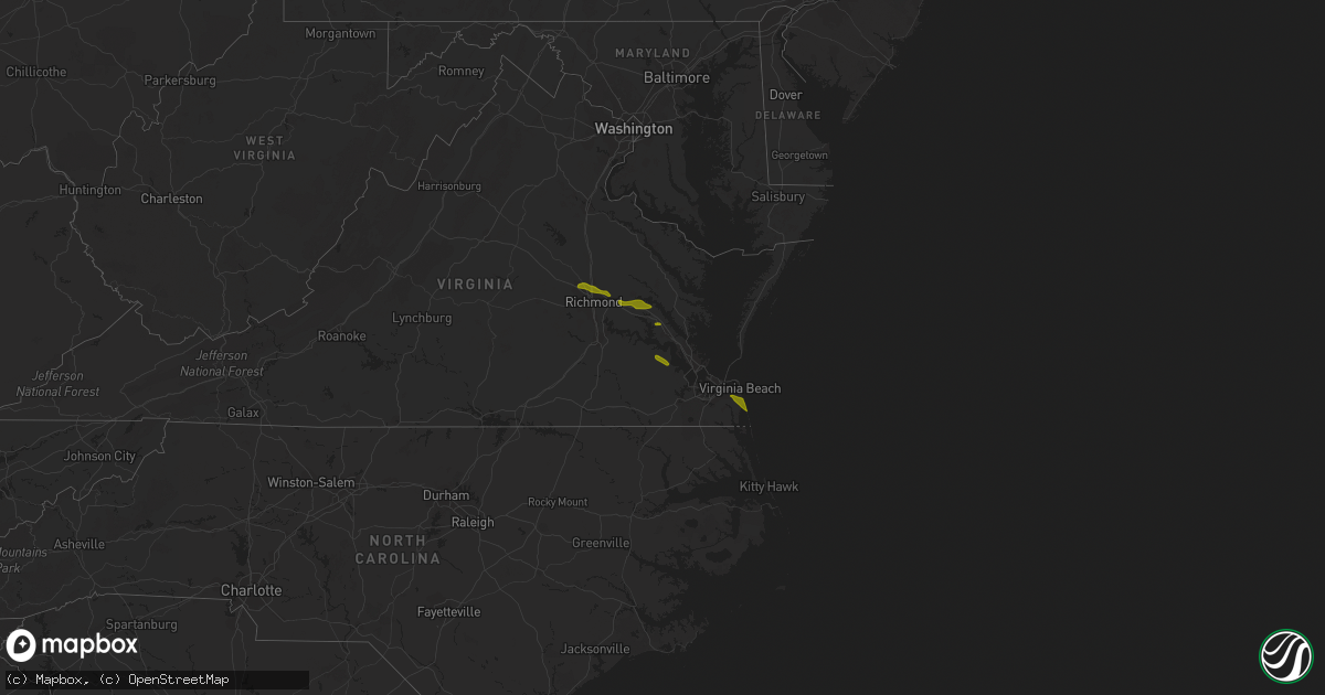
Hail Map in Virginia on August 10, 2013
Get this storm
August 10 map
$229
one time, instant access
Download today. No call, no setup
Keep the $229
Bought the map and want the full workflow? Apply the entire $229 to a subscription within 7 days. None of it is wasted.
Every map, not just this one
This buys you this map. Subscription and you get every map we run, in the markets you choose from a few cities to whole states to nationwide. Plus real-time alerts the moment a storm fires.
Contact data
Name, contact info, occupancy, even credit band for addresses in the footprint. You go from where it hit to who to call.
Become the source they trust
Unlimited branding weather history reports on demand. You already have the documented answer ready for the property owner, and you are the one who showed up with it.
Property data and RoofTrace estimates
Pull up any address you have got, its value and the exact code rules for that jurisdiction, straight from One Click Code. Then RoofTrace estimates the squares, pitch, and roof value, priced the way you price.
Storm reports in Virginia
Virginia
| Date | Description |
|---|---|
| 08/10/20135:49 PM CDT | One tree fell and took a power line down on cutlett lane near the intersection of rolling hill road...time estimated from radar |
| 08/10/20133:57 PM CDT | Hail varied between nickel and quarter size |
| 08/10/20133:25 PM CDT | Large tree limbs down and partially blocking traffic in kirby crescent section of norfolk |
| 08/10/20133:20 PM CDT | Several trees downed in northern virginia beach |
| 08/10/20133:20 PM CDT | 60 mph wind also measured. |
| 08/10/20133:19 PM CDT | One tree down along us route 360 north of the intersection of route 613...time estimated from radar |
| 08/10/20133:01 PM CDT | One tree limb fell and took down a power line near the schewel furniture company along halifax road...time estimated from radar |
| 08/10/20132:20 PM CDT | Several trees down near settlers lane |
| 08/10/20131:55 PM CDT | Trees downed near intersection of va-632 and va-10 |
| 08/10/20131:44 PM CDT | Large tree downed on i-64 eastbound side. Traffic partially blocked. |
| 08/10/20131:41 PM CDT | Large tree branches downed on i-64...near colonial downs |
| 08/10/20131:30 PM CDT | Large tree also downed |
| 08/10/20131:23 PM CDT | Tree down vicinity of pole green road |
| 08/10/20131:10 PM CDT | Vicinity of pole green and meadowbridge roads |
| 08/10/20131:10 PM CDT | Encountered tremendous downburst vicinity of pole green and meadowbridge roads... Wind gust estimated 75 mph or greater... Moved 3000 lb truck several feet. |
| 08/10/20131:05 PM CDT | Structural damage to several homes from downed trees on windsor drive in mechanicsville...also a tree downed onto a vehicle |
| 08/10/20131:05 PM CDT | Several large trees down |
| 08/10/20131:03 PM CDT | Quarter size hail vicinity rte 360 and lee davis rd |
| 08/10/20131:00 PM CDT | Tree down near atlee and meadowbridge roads |
| 08/10/20131:00 PM CDT | A local report indicates 1.00 inch wind near GLEN ALLEN |
| 08/10/20131:00 PM CDT | Several large tree limbs downed also. |
| 08/10/201310:57 AM CDT | Tree down blocking rolling rd |
| 08/10/201310:49 AM CDT | Tree knocked down onto power lines along rt 20 south of charlottesville |
All States Impacted by Hail Map on August 10, 2013
Cities Impacted by Hail Map on August 10, 2013
- Glen Allen, VA
- Henrico, VA
- Richmond, VA
- Mechanicsville, VA
- Quinton, VA
- New Kent, VA
- Providence Forge, VA
- Lanexa, VA
- Williamsburg, VA
- Toano, VA
- Virginia Beach, VA
- Elberon, VA
- Surry, VA
- Smithfield, VA
- Rock Island, WA
- Malaga, WA
- Belfield, ND
- Amidon, ND
- New England, ND
- Choteau, MT
- Lavina, MT
- Larchwood, IA
- Roberts, MT
- Red Lodge, MT
- Yoder, WY
- Lodge Grass, MT
- Yadkinville, NC
- Bayard, NE
- Harrisburg, NE
- Gallup, NM
- Oak Ridge, NC
- Summerfield, NC
- Cartwright, ND
- Quemado, NM
- Fence Lake, NM
- Kimball, NE
- Government Camp, OR
- Rhododendron, OR
- Bennett, CO
- New Underwood, SD
- Wasta, SD
- Howes, SD
- Enning, SD
- Smithfield, NC
- Lake Charles, LA
- Buffalo, SD
- Nashua, MT
- Glasgow, MT
- Naches, WA
- Union Center, SD
- Fort Morgan, CO
- Montrose, SD
- Randolph, NE
- Wausa, NE
- Cle Elum, WA
- Easton, WA
- Freeman, SD
- Union Grove, NC
- Hamptonville, NC
- Barhamsville, VA
- Bluewater, NM
- Grants, NM
- Alexander, ND
- Arnegard, ND
- Davis, SD
- Farmington, NM
- Lance Creek, WY
- Parkston, SD
- Dimock, SD
- Olivet, SD
- Ethan, SD
- La Grande, OR
- Creighton, NE
- Froid, MT
- Culbertson, MT
- Bainville, MT
- Sumpter, OR
- Baker City, OR
- Winfred, SD
- Ramona, SD
- Kernersville, NC
- Heart Butte, MT
- Valier, MT
- Blue River, OR
- Spring Grove, VA
- Dendron, VA
- Stumpy Point, NC
- Hurley, SD
- Lesterville, SD
- Yankton, SD
- Utica, SD
- Tabor, SD
- East Glacier Park, MT
- Rockport, WA
- Crofton, NE
- Saint Helena, NE
- Quincy, WA
- Mitchell, SD
- Cove, OR
- Shaniko, OR
- Union, OR
- Williston, ND
- Enumclaw, WA
- Leavenworth, WA
- Sultan, WA
- Alexandria, SD
- Ronald, WA
- Viborg, SD
- Irene, SD
- Sidney, MT
- Fairview, MT
- Cubero, NM
- Casa Blanca, NM
- Plainview, NE
- Bloomfield, NE
- Pep, NM
- Emery, SD
- Norfolk, VA
- Killdeer, ND
- Maupin, OR
- Medical Lake, WA
- Cheney, WA
- Monument, OR
- Heppner, OR
- Whitewood, SD
- Mount Vernon, SD
- Menno, SD
- Tripp, SD
- Scotland, SD
- Marion, SD
- Bridgewater, SD
- Wiggins, CO
- Tohatchi, NM
- Fremont, NC
- Lucama, NC
- Kenly, NC
- Mount Pleasant, NC
- Gold Hill, NC
- Livingston, TX
- Cleveland, TX
- Lettsworth, LA
- Batchelor, LA
- Saint Francisville, LA
- Bridger, MT
- Elgin, OR
- Wallowa, OR
- Aurora, CO
- Centerville, SD
- Wakonda, SD
- Dulce, NM
- Jewett, TX
- Woodville, MS
- Iowa, LA
- Plaquemine, LA
- North Powder, OR
- Guernsey, WY
- Condon, OR
- College Station, TX
- Navasota, TX
- Brenham, TX
- Skykomish, WA
- Crownpoint, NM
- Fossil, OR
- Camp Crook, SD
- Rhame, ND
- Verdigre, NE
- Lambert, MT
- Kimberly, OR
- Spray, OR
- Sugar City, CO
- Volin, SD
- Nashville, AR
- Browning, MT
- Larslan, MT
- Hood River, OR
- Letcher, SD
- Glendale, OR
- Azalea, OR
- Parker, CO
- Hickory, NC
- Portsmouth, VA
- Amity, AR
- McIntosh, SD
- Parker, SD
- Paullina, IA
- Springfield, SD
- Edenton, NC
- Santa Fe, NM
- Thorp, WA
- Niobrara, NE
- Watkins, CO
- Sandston, VA
- Carlton, WA
- Tyndall, SD
- Dix, NE
- Newport News, VA
- Belhaven, NC
- Bath, NC
- Pinetown, NC
- Manns Harbor, NC
- Catawba, SC
- Rock Hill, SC
- Tatum, TX
- Castroville, TX
- De Berry, TX
- Avon, MT
- Sioux Center, IA
- Hull, IA
- Potter, NE
- Osmond, NE
- Winnetoon, NE
- Hartington, NE
- Coleridge, NE
- Sims, NC
- Middlesex, NC
- Spring Hope, NC
- Connelly Springs, NC
- Wickes, AR
- Pantego, NC
- Plymouth, NC
- Buffalo, TX
- Marquez, TX
- Bismarck, AR
- Granite Falls, NC
- Bonnerdale, AR
- White Swan, WA
- Antelope, OR
- Worthing, SD
- Canton, SD
- Beresford, SD
- Lennox, SD
- Alvord, IA
- Idanha, OR
- Alcester, SD
- Hudson, SD
- Wall, SD
- Bridgeport, NE
- Rockville, VA
- Waverly, VA
- Kill Devil Hills, NC
- Tyner, NC
- Louisburg, NC
- Newton, NC
- Bastrop, LA
- Maiden, NC
- Granville, IA
- Prairie City, OR
- Lingle, WY
- Nebo, NC
- Salisbury, NC
- Rocky Face, GA
- Liberty, TX
- Wallisville, TX
- Benton, AR
- Lonsdale, AR
- Ellensburg, WA
- Roscoe, MT
- Gillette, WY
- Rozet, WY
- Lusk, WY
- Chesapeake, VA
- Suffolk, VA
- South Boston, VA
- Carthage, TX
- Raleigh, NC
- Wake Forest, NC
- Safford, AZ
- Nacogdoches, TX
- Grosse Tete, LA
- Dayton, TX
- Douglas, WY
- Fulton, SD
- Woonsocket, SD
- Torrington, WY
- Florissant, CO
- Brush, CO
- Meadow, SD
- Hayes, VA
- Yorktown, VA
- Ivor, VA
- Vale, NC
- Marion, NC
- Oden, AR
- Pencil Bluff, AR
- Tellico Plains, TN
- Rockwell, NC
- Concord, NC
- Plainview, AR
- Centreville, MS
- Hot Springs Village, AR
- Sabinal, TX
- Anderson, TX
- Manteo, NC
- Belews Creek, NC
- Greensboro, NC
- Clayton, NC
- Selma, NC
- Hot Springs National Park, AR
- Vandervoort, AR
- Cove, AR
- Somerville, TX
- Burton, TX
- Devers, TX
- Salem, SD
- Humboldt, SD
- Hartford, SD
- Bunn, NC
- Zebulon, NC
- Center, CO
- Wanchese, NC
- Columbia, NC
- Dallas, GA
- Apple Springs, TX
- Lufkin, TX
- Diboll, TX
- Brady, TX
- Utopia, TX
- Concan, TX
- Hallettsville, TX
- Othello, WA
- Summerville, OR
- Orange City, IA
- Sheldon, IA
- Benson, NC
- Four Oaks, NC
- Claremont, NC
- Conover, NC
- Stony Point, NC
- Waxhaw, NC
- Jessieville, AR
- Coats, NC
- Bremen, GA
- Temple, GA
- Buchanan, GA
- Delight, AR
- Royal, AR
- Haines, OR
- Canova, SD
- Howard, SD
- Bushnell, NE
- Charles City, VA
- Alton, IA
- Hospers, IA
- Canon City, CO
- Rison, AR
- Lockesburg, AR
- Mena, AR
- Pearcy, AR
- Sealy, TX
- San Antonio, TX
- Weimar, TX
- Schulenburg, TX


