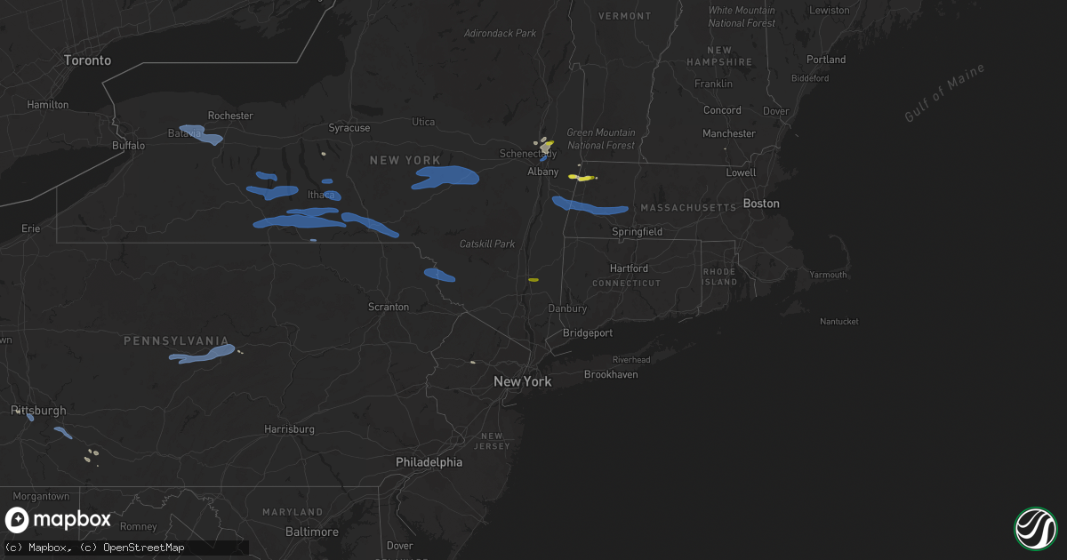
Hail Map on August 8, 2019
Get this storm
August 8 map
$229
one time, instant access
Download today. No call, no setup
Keep the $229
Bought the map and want the full workflow? Apply the entire $229 to a subscription within 7 days. None of it is wasted.
Every map, not just this one
This buys you this map. Subscription and you get every map we run, in the markets you choose from a few cities to whole states to nationwide. Plus real-time alerts the moment a storm fires.
Contact data
Name, contact info, occupancy, even credit band for addresses in the footprint. You go from where it hit to who to call.
Become the source they trust
Unlimited branding weather history reports on demand. You already have the documented answer ready for the property owner, and you are the one who showed up with it.
Property data and RoofTrace estimates
Pull up any address you have got, its value and the exact code rules for that jurisdiction, straight from One Click Code. Then RoofTrace estimates the squares, pitch, and roof value, priced the way you price.
States Impacted by Hail Map on August 8, 2019
Storm reports
New Mexico
| Date | Description |
|---|---|
| 08/08/20195:40 PM CDT | Largest stone half dollar size... Winds estimated at 60 mph |
| 08/08/20195:35 PM CDT | A few quarter size stones... Mostly nickels |
| 08/08/20192:34 AM CDT | At 734 PM MDT, a severe thunderstorm was located 9 miles west of Nara Visa, moving east at 30 mph. HAZARD...60 mph wind gusts and quarter size hail. SOURCE...Radar indicated. IMPACT...Hail damage to vehicles is expected. Expect wind damage to roofs, siding, and trees. Locations impacted include... Nara Visa. |
| 08/08/20191:02 AM CDT | At 602 PM MDT, a severe thunderstorm was located 10 miles east of Bueyeros, or 20 miles west of Amistad, moving southeast at 25 mph. HAZARD...60 mph wind gusts and half dollar size hail. SOURCE...Radar indicated. IMPACT...Hail damage to vehicles is expected. Expect wind damage to roofs, siding, and trees. Locations impacted include... Rosebud. |
| 08/08/201912:05 AM CDT | At 505 PM MDT, a severe thunderstorm was located 8 miles east of Gladstone, or 31 miles south of Des Moines, moving southeast at 10 mph. HAZARD...60 mph wind gusts and half dollar size hail. SOURCE...Radar indicated. IMPACT...Hail damage to vehicles is expected. Expect wind damage to roofs, siding, and trees. This severe thunderstorm will remain over mainly rural areas of northern Harding and west central Union Counties. |
| 08/07/201911:32 PM CDT | At 432 PM MDT, a severe thunderstorm was located over Capulin, or 7 miles west of Des Moines, moving east at 15 mph. HAZARD...60 mph wind gusts and half dollar size hail. SOURCE...Radar indicated. IMPACT...Hail damage to vehicles is expected. Expect wind damage to roofs, siding, and trees. Locations impacted include... Des Moines, Folsom and Capulin. |
South Carolina
| Date | Description |
|---|---|
| 08/08/20194:34 PM CDT | Local television station shared a picture on social media of hail as large as a ping pong ball. |
| 08/08/20194:32 PM CDT | The isle of palms police department reported a tree down on the corner of 25th avenue and cameron blvd. Time is estimated by radar. |
| 08/08/20194:30 PM CDT | Local television station relayed a report on social media of a tree down on red tide road. |
| 08/08/20194:30 PM CDT | Charleston county warning point reports a tree down at the intersection of 4th avenue and merritt boulevard. Time estimated based on radar. |
| 08/08/20193:50 PM CDT | Local television station relayed a report from a viewer of quarter sized hail on isle of palms. |
| 08/08/201912:30 AM CDT | At 529 PM EDT, a severe thunderstorm was located near Mount Pleasant, and is nearly stationary. HAZARD...60 mph wind gusts and quarter size hail. SOURCE...Radar indicated. IMPACT...Minor hail damage to vehicles is possible. Expect wind damage to trees and powerlines. Locations impacted include... Mount Pleasant, Isle Of Palms, Sullivan's Island, Boone Hall Plantation, Capers Inlet, Mount Pleasant Towne Centre and Sullivans Island.This warning includes I-526 between mile markers 28 and 31. |
Nevada
| Date | Description |
|---|---|
| 08/08/20195:57 PM CDT | Thunderstorm wind gust to 64 mph recorded by nv dot weather station. |
| 08/08/20194:37 PM CDT | Thunderstorm wind gust of 62 mph reported by nv dot weather station. |
| 08/08/20192:07 PM CDT | Multiple wind damage reports to trees. Largest tree limb was 1.5 inches in diameter. |
| 08/08/20196:40 AM CDT | At 1140 AM PDT, a severe thunderstorm was located 18 miles south of Pine Valley, moving northeast at 20 mph. HAZARD...60 mph wind gusts and quarter size hail. SOURCE...Radar indicated. IMPACT...Hail damage to vehicles is expected. Expect wind damage to roofs, siding, and trees. This severe thunderstorm will remain over mainly rural areas of south central Elko and northeastern Eureka Counties. |
| 08/08/20194:09 AM CDT | At 908 PM PDT, a severe thunderstorm was located 11 miles southwest of Cabin Pines Campground, or 18 miles south of Caliente, moving northeast at 20 mph. HAZARD...60 mph wind gusts. SOURCE...RAWS Station. IMPACT...Expect damage to roofs and trees. Locations impacted include... Caliente, Kershaw-Ryan Campground, Cabin Pines Campground and Elgin. |
| 08/07/201910:41 PM CDT | A local report indicates 61 MPH wind near 12 SW ELGIN |
| 08/07/20199:14 PM CDT | At 213 PM PDT, a severe thunderstorm continues to be located near Nixon, or 12 miles southeast of Pyramid Lake, moving southeast at 10 mph. HAZARD...60 mph wind gusts and quarter size hail. SOURCE...Radar indicated. IMPACT...Hail damage to vehicles is expected. Expect wind damage to roofs, siding, fencing and trees. Locations impacted include... Nixon. |
| 08/07/20198:50 PM CDT | At 148 PM PDT, a severe thunderstorm was located near Sutcliffe, or 9 miles south of Pyramid Lake, moving southeast at 10 mph. HAZARD...60 mph wind gusts and quarter size hail. SOURCE...Radar indicated. IMPACT...Hail damage to vehicles is expected. Expect wind damage to roofs, siding, fencing and trees. Locations impacted include... Nixon, Sutcliffe and Virginia Peak. |
| 08/07/20198:32 PM CDT | At 132 PM PDT, a severe thunderstorm was located 8 miles north of Lamoille, moving north at 20 mph. HAZARD...60 mph wind gusts and quarter size hail. SOURCE...Radar indicated. IMPACT...Hail damage to vehicles is expected. Expect wind damage to roofs, siding, and trees. Locations impacted include... Halleck. |
North Carolina
| Date | Description |
|---|---|
| 08/08/20192:01 PM CDT | Multiple large limbs down. Time estimated by radar. |
| 08/08/20197:52 AM CDT | At 1251 AM EDT, a severe thunderstorm was located 7 miles north of Clayton, or 11 miles east of Raleigh, moving east at 25 mph. HAZARD...60 mph wind gusts. SOURCE...Radar indicated. IMPACT...Expect damage to roofs, siding, and trees. Locations impacted include... Raleigh, Goldsboro, Smithfield, Garner, Clayton, Zebulon, Benson, Fremont, Bailey and Bunn. |
| 08/08/20197:18 AM CDT | At 1218 AM EDT, a severe thunderstorm was located 7 miles southwest of Cary, moving east at 40 mph. HAZARD...60 mph wind gusts. SOURCE...Radar indicated. IMPACT...Expect damage to roofs, siding, and trees. Locations impacted include... Raleigh, Cary, Smithfield, Lillington, Wake Forest, Garner, Fuquay-Varina, Clayton, Angier and RDU International. |
| 08/07/20199:46 PM CDT | At 245 PM EDT, a severe thunderstorm was located over Peletier, or 11 miles west of Newport, moving east at 25 mph. HAZARD...60 mph wind gusts and quarter size hail. SOURCE...Radar indicated. IMPACT...Hail damage to vehicles is expected. Expect wind damage to roofs, siding, and trees. Locations impacted include... Morehead City, Newport, Harkers Island, Stella, Swansboro, Cape Carteret, North River, Straits, Pine Knoll Shores, Otway, Broad Creek, Wildwood, Peletier, Kuhns, Bogue, Bettie, Michael J Smith Airport, Oceana Pier, Rachel Carson Estuarine Reserve and Fort Macon State Park. |
Colorado
| Date | Description |
|---|---|
| 08/08/20196:56 AM CDT | At 1156 PM MDT, a severe thunderstorm was located near Two Buttes, or 12 miles northeast of Springfield, moving southeast at 20 mph. HAZARD...70 mph wind gusts and ping pong ball size hail. SOURCE...Radar indicated. IMPACT...People and animals outdoors will be injured. Expect hail damage to roofs, siding, windows, and vehicles. Expect considerable tree damage. Wind damage is also likely to mobile homes, roofs, and outbuildings. Locations impacted include... Walsh, Vilas and Two Buttes. |
| 08/08/20196:40 AM CDT | At 1140 PM MDT, a severe thunderstorm was located near Two Buttes, or 13 miles northeast of Springfield, moving southeast at 20 mph. HAZARD...60 mph wind gusts and quarter size hail. SOURCE...Radar indicated. IMPACT...Hail damage to vehicles is expected. Expect wind damage to roofs, siding, and trees. Locations impacted include... Two Buttes. |
| 08/08/20196:28 AM CDT | At 1128 PM MDT, a severe thunderstorm was located 9 miles southwest of Two Buttes Reservoir, or 10 miles northwest of Springfield, moving southeast at 20 mph. HAZARD...60 mph wind gusts and quarter size hail. SOURCE...Radar indicated. IMPACT...Hail damage to vehicles is expected. Expect wind damage to roofs, siding, and trees. Locations impacted include... Springfield. |
| 08/08/20195:58 AM CDT | At 1058 PM MDT, a severe thunderstorm was located 11 miles west of Two Buttes Reservoir, or 19 miles northwest of Springfield, moving southeast at 40 mph. HAZARD...60 mph wind gusts and quarter size hail. SOURCE...Radar indicated. IMPACT...Hail damage to vehicles is expected. Expect wind damage to roofs, siding, and trees. Locations impacted include... Springfield, Two Buttes and Two Buttes Reservoir. |
| 08/08/20195:29 AM CDT | At 1029 PM MDT, a severe thunderstorm was located 23 miles south of John Martin Reservoir, or 30 miles southwest of Lamar, moving east at 25 mph. HAZARD...60 mph wind gusts and half dollar size hail. SOURCE...Radar indicated. IMPACT...Hail damage to vehicles is expected. Expect wind damage to roofs, siding, and trees. This severe thunderstorm will remain over mainly rural areas of southwestern Prowers, north central Baca and southeastern Bent Counties. |
| 08/08/20192:44 AM CDT | At 743 PM MDT, a severe thunderstorm was located 15 miles northeast of Boone, or 32 miles east of Pueblo, moving northeast at 25 mph. HAZARD...60 mph wind gusts and quarter size hail. SOURCE...Radar indicated. IMPACT...Hail damage to vehicles is expected. Expect wind damage to roofs, siding, and trees. This severe thunderstorm will remain over mainly rural areas of northwestern Crowley and northeastern Pueblo Counties. |
| 08/08/20192:20 AM CDT | At 720 PM MDT, a severe thunderstorm was located 8 miles northeast of Boone, or 26 miles east of Pueblo, moving northeast at 25 mph. HAZARD...60 mph wind gusts and quarter size hail. SOURCE...Radar indicated. IMPACT...Hail damage to vehicles is expected. Expect wind damage to roofs, siding, and trees. This severe thunderstorm will remain over mainly rural areas of west central Crowley and east central Pueblo Counties. |
| 08/08/20191:23 AM CDT | At 622 PM MDT, severe thunderstorms were located along a line extending from 5 miles north of Kutch to 7 miles east of Rush, or along a line extending from 23 miles southwest of Limon to 46 miles east of Colorado Springs, moving southeast at 25 mph. HAZARD...60 mph wind gusts and nickel size hail. SOURCE...Radar indicated. IMPACT...Expect damage to roofs, siding, and trees. Locations impacted include... Forder, Kutch and Punkin Center. |
| 08/08/20191:06 AM CDT | *delayed report* power poles snapped... Tree branches everywhere... And a bbq grill thrown. |
| 08/08/201912:52 AM CDT | At 551 PM MDT, a severe thunderstorm was located 18 miles south of Blende, or 20 miles south of Pueblo, moving northeast at 30 mph. HAZARD...60 mph wind gusts and quarter size hail. SOURCE...Radar indicated. IMPACT...Hail damage to vehicles is expected. Expect wind damage to roofs, siding, and trees. Locations impacted include... Blende and open country of southeast Pueblo County. |
| 08/08/201912:43 AM CDT | At 541 PM MDT, severe thunderstorms were located along a line extending from 7 miles southeast of Agate to 10 miles south of Simla, or along a line extending from 12 miles northwest of Limon to 44 miles east of Colorado Springs, moving east at 15 mph. HAZARD...60 mph wind gusts. SOURCE...Radar indicated. IMPACT...Expect damage to roofs, siding, and trees. Locations impacted include... Limon, Simla and Matheson. |
| 08/07/201911:42 PM CDT | At 442 PM MDT, a severe thunderstorm was located 9 miles south of Pueblo Reservoir, or 11 miles southwest of Pueblo, moving east at 10 mph. HAZARD...60 mph wind gusts and quarter size hail. SOURCE...Radar indicated. IMPACT...Hail damage to vehicles is expected. Expect wind damage to roofs, siding, and trees. Locations impacted include... Southern Pueblo, Salt Creek, Blende and Avondale. |
| 08/07/201911:17 PM CDT | At 417 PM MDT, severe thunderstorms were located along a line extending from Gleneagle to Air Force Academy to near Cascade, moving southeast at 20 mph. HAZARD...60 mph wind gusts and quarter size hail. SOURCE...Radar indicated. IMPACT...Hail damage to vehicles is expected. Expect wind damage to roofs, siding, and trees. Locations impacted include... Colorado Springs, Monument, Air Force Academy, Manitou Springs, Green Mountain Falls, Black Forest, Peyton, Security, Security-Widefield, Falcon, Gleneagle, Peterson AFB, Cimarron Hills, Chipita Park, Cascade and Stratmoor. |
| 08/07/20198:37 PM CDT | Measured 64 mph wind gust and had 0.70 inches of rainfall with this storm. |
| 08/07/20198:37 PM CDT | Measured 64 mph wind gust and had 0.70 inches of rainfall. |
California
| Date | Description |
|---|---|
| 08/07/20198:30 PM CDT | *** 1 inj *** chp reports a semi truck roll over south of five mile road on highway 95 near needles... Around mile marker 51. Law enforcement twitter confirms that truc |
Alabama
| Date | Description |
|---|---|
| 08/08/201912:50 PM CDT | Large oak tree snapped with 2 involved power poles also snapped in front of notasulga high school. Time estimated from radar. |
| 08/08/201912:32 PM CDT | Tree blown down along macedonia road... Near the church. Time estimated from radar. |
| 08/08/20197:30 AM CDT | At 1230 PM CDT, a severe thunderstorm was located near Tallapoosa City, or near Tallassee, moving southeast at 20 mph. HAZARD...60 mph wind gusts. SOURCE...Radar indicated. IMPACT...Expect damage to roofs, siding, and trees. Locations impacted include... Tuskegee, Tallassee, Notasulga, Franklin, Liberty City, Reeves Airport, Tallapoosa City, Yates Dam, I 85 Rest Area, Uphapee Creek, Reeltown, Moton Field Municipal Airport and Yates Reservoir. |
| 08/07/201910:06 PM CDT | At 306 PM CDT, a severe thunderstorm was located 7 miles east of Moundville, or 13 miles south of Tuscaloosa, moving southeast at 40 mph. HAZARD...60 mph wind gusts. SOURCE...Radar indicated. IMPACT...Expect damage to roofs, siding, and trees. Locations impacted include... Moundville, Low Gap, Mertz, Eoline, Englewood, Little Sandy, Maxwell, Phipps, Hull, Hagler, Duncanville, Pearson, Harmon, Wateroak, Ellards and Elliots Creek. |
Arizona
| Date | Description |
|---|---|
| 08/08/20193:52 AM CDT | At 851 PM MST, a severe thunderstorm was located near Oatman, or 14 miles southeast of Bullhead City, moving northeast at 30 mph. HAZARD...60 mph wind gusts. SOURCE...Radar indicated. IMPACT...Expect damage to roofs and trees. Locations impacted include... Kingman, Oatman, New Kingman-Butler and Golden Valley. |
| 08/07/20198:09 PM CDT | Trained spotters reported strong winds in topock... Az. Power outage reported in topock and utility company is responding to lines down. Also received a video via socia |
Kansas
| Date | Description |
|---|---|
| 08/08/20197:59 AM CDT | At 1259 AM CDT, a severe thunderstorm was located near Cherryvale, moving east at 20 mph. HAZARD...60 mph wind gusts and quarter size hail. SOURCE...Radar indicated. IMPACT...Hail damage to vehicles is expected. Expect wind damage to roofs, siding, and trees. Locations impacted include... Parsons, Oswego, Chetopa, Altamont, Edna, Mound Valley, Bartlett, Labette, Parsons Tri City Airport, Angola, Dennis and Big Hill Lake. |
| 08/07/20198:33 PM CDT | At 132 AM CDT, a severe thunderstorm was located near Neodesha, moving east at 20 mph. HAZARD...70 mph wind gusts and quarter size hail. SOURCE...Radar indicated. IMPACT...Hail damage to vehicles is expected. Expect considerable tree damage. Wind damage is also likely to mobile homes, roofs, and outbuildings. Locations impacted include... Neodesha and Altoona. |
Indiana
| Date | Description |
|---|---|
| 08/08/20196:38 PM CDT | Small tree branches were blown down. |
| 08/08/20193:42 PM CDT | Estimated wind gust around 65 mph. A healthy... 1 ft diameter tree is downed across sr 27 at high street. There are numerous 8 to 10 inch limbs down around that locatio |
| 08/08/20193:38 PM CDT | Measured with anemometer. |
| 08/08/20193:05 PM CDT | Delayed report. Spotter arrived home from work to find several 4-6 inch healthy limbs broken off his trees with a couple landing 50-60 ft. Away. His neighbor had two 8- |
| 08/08/20192:26 AM CDT | At 725 PM EDT, a severe thunderstorm was located 8 miles northeast of Franklin, or 9 miles west of Shelbyville, moving southeast at 40 mph. HAZARD...60 mph wind gusts and penny size hail. SOURCE...Radar indicated. IMPACT...Expect damage to roofs, siding, and trees. Locations impacted include... Shelbyville, Franklin, Flat Rock, Geneva, St. Paul, Fairland, Marietta, Waldron and Boggstown.This includes the following highways... Interstate 65 between mile markers 82 and 86, and between milemarkers 90 and 97. Interstate 74 between mile markers 101 and 123. |
| 08/08/20191:10 AM CDT | At 610 PM EDT, a severe thunderstorm was located 13 miles northwest of Danville, or 15 miles southeast of Crawfordsville, moving southeast at 40 mph. HAZARD...60 mph wind gusts and penny size hail. SOURCE...Radar indicated. IMPACT...Expect damage to roofs, siding, and trees. Locations impacted include... Plainfield, Brownsburg, Danville, Avon, Pittsboro, Ladoga, Clayton, Jamestown, Roachdale, North Salem, Lizton and New Ross.This includes the following highways... Interstate 70 between mile markers 62 and 68. Interstate 74 between mile markers 49 and 69. |
New Hampshire
| Date | Description |
|---|---|
| 08/08/20195:51 PM CDT | Multiple reports of trees on wires. Time estimated from radar. |
| 08/08/20191:14 AM CDT | At 613 PM EDT, severe thunderstorms were located along a line extending from near Greenwich to near Cheshire to Ashley Falls, moving east at 35 mph. HAZARD...60 mph wind gusts. SOURCE...Trained weather spotters reported trees and wires down in Stockbridge, MA, and Ghent, NY. IMPACT...Expect damage to roofs, siding, and trees. Severe thunderstorms will be near... Cheshire and Savoy around 620 PM EDT. Shaftsbury, Sandisfield and Hawley around 635 PM EDT. Arlington around 640 PM EDT. Manchester around 645 PM EDT. Tolland and Manchester Center around 650 PM EDT. Stratton around 700 PM EDT. West Wardsboro around 705 PM EDT. Townshend around 715 PM EDT.Other locations impacted by these severe thunderstorms include GooseCity, Chiselville, North Hancock, Readsboro Falls, Cheshire Harbor,South Shaftsbury, South Windham, Middle Falls, Dalton and AdamsJunction. |
Ohio
| Date | Description |
|---|---|
| 08/08/20196:38 PM CDT | Athens 911 reports trees and power lines down in the coolville area. Time estimated from radar. |
| 08/08/20196:30 PM CDT | Large... Healthy apple tree came down along with a section of fence. Via facebook with pictures. Time estimated via radar. |
| 08/08/20196:04 PM CDT | Small limb downed in circleville. Time estimated by radar. |
| 08/08/20196:01 PM CDT | *** 1 inj *** tree fell onto vehicle along northridge road near nicholas road. 1 serious injury reported. Time estimated by radar. |
| 08/08/20195:52 PM CDT | Athens 911 reports trees and power lines down... As well as a porch roof removed near the post office. Time estimated from radar. |
| 08/08/20195:49 PM CDT | Numerous trees... Tree limbs... And powerlines downed in the choctaw lake area. Time estimated by radar. |
| 08/08/20195:46 PM CDT | Athens 911 reports trees and power lines down in the glouster area. Time estimated from radar. |
| 08/08/20195:27 PM CDT | Trees and powerlines downed in the german township area. Time estimated by radar. |
| 08/08/20195:27 PM CDT | Trees and powerlines downed along a portion of mechanicsburg road. Time estimated by radar. |
| 08/08/20195:24 PM CDT | Trees downed along moorefield ct and throughout the neighborhood. Time of event estimated. |
| 08/08/20195:21 PM CDT | Tree downed along a portion of sr 55 near champaign and clark county line. Time estimated by radar. |
| 08/08/20195:21 PM CDT | Tree downed along a portion of sr 560 near champaign and clark county line. Time estimated by radar. |
| 08/08/20195:21 PM CDT | Tree downed along a portion of sr 55 near champaign and clark county line. Time estimated by radar. Lsr corrected for location. |
| 08/08/20195:15 PM CDT | Tree down and blocking sr 339 in both directions at mile marker 10.2 near sr 550. |
| 08/08/20195:05 PM CDT | Numerous trees down blocking county road 80 outside of chesterhill. |
| 08/08/20194:46 PM CDT | Some lights and signs were damaged on a few buildings along us 127 n. Time estimated from radar. |
| 08/08/20194:44 PM CDT | Time estimated by radar. |
| 08/08/20194:44 PM CDT | Healthy tree of unknown size downed on a vehicle along s. Miami ave. Time estimated by radar. |
| 08/08/20194:43 PM CDT | Trees downed. |
| 08/08/20194:25 PM CDT | A few trees downed in the minster area. Time estimated from radar. |
| 08/08/20194:16 PM CDT | Part of a tree was downed along with several limbs from other trees. Time estimated from radar. |
| 08/08/20194:15 PM CDT | Pictures from a farm showing multiple trees down and stripped. Roof damage to barn. Time estimated from radar. |
| 08/08/20194:07 PM CDT | Trees and power lines down reported in the vanfossen ln. Area west of chester hill. Time estimated from radar. |
| 08/08/20194:06 PM CDT | Trees and power lines down along wood rd. Near chester hill. Time estimated from radar. |
| 08/08/20194:01 PM CDT | Trees downed. |
| 08/08/20193:57 PM CDT | Perry 911 reports a camper flipped and carport flipped in the pen road area of junction. Time estimated from radar. |
| 08/08/20193:44 PM CDT | Numerous trees and powerlines downed in the buckeye lake area. Time estimated by radar. |
| 08/08/20193:42 PM CDT | Large tree downed along a portion of high st. South of us 40. Time estimated by radar. |
| 08/08/20193:42 PM CDT | Large tree downed near intersection of 9th ave and north st. Time estimated by radar. |
| 08/08/20193:35 PM CDT | Branches approximately four inches at the base were broken off the top of a silver maple... And were strewn across a ten foot wide driveway. |
| 08/08/20193:35 PM CDT | A local report indicates 1.00 inch wind near 2 S DUNGANNON |
| 08/08/20193:35 PM CDT | Several trees down in the area |
| 08/08/20193:33 PM CDT | Numerous trees and powerlines downed in pataskala. Time estimated by radar. |
| 08/08/20193:30 PM CDT | Several medium sized trees snapped to the ground. |
| 08/08/20193:20 PM CDT | A thirty foot tall tree was snapped off at its base. |
| 08/08/20193:18 PM CDT | Limbs down in residential yard |
| 08/08/20193:15 PM CDT | Washington co. 911 reports multiple trees and power lines down in the lowell area. Time estimated from radar. |
| 08/08/20193:11 PM CDT | Trees and power lines down in the old somerset rd. Area. Time estimated from radar. |
| 08/08/20193:02 PM CDT | Hail size estimated with coin. Also tree limbs and power lines down. |
| 08/08/20192:48 PM CDT | A tree fell onto a road. Time esimated from radar. |
| 08/08/20197:09 AM CDT | At 1209 PM EDT, a severe thunderstorm was located near Centerburg, or 11 miles southwest of Mount Vernon, moving southeast at 40 mph. HAZARD...60 mph wind gusts and quarter size hail. SOURCE...Radar indicated. IMPACT...Minor damage to vehicles is possible. Expect damage to trees and power lines. Locations impacted include... Utica and Centerburg. |
| 08/08/20196:26 AM CDT | At 1125 PM EDT, a severe thunderstorm was located near Huber Heights, moving east at 45 mph. HAZARD...60 mph wind gusts and nickel size hail. SOURCE...Radar indicated. IMPACT...Expect damage to trees and power lines. Locations impacted include... Dayton, Huber Heights, Fairborn, Yellow Springs, Wright-Patterson Afb, Cedarville, Enon, Wilberforce, Riverside, Clifton, Green Meadows, Medway, Springfield Municipal Airport, Hustead, Holiday Valley, John Bryan State Park, Snyderville, Selma, Crystal Lakes and Pitchin.This includes I-70 in Ohio between mile markers 37 and 51. |
| 08/08/20195:50 AM CDT | At 1050 PM EDT, a severe thunderstorm was located over Pleasant Hill, moving east at 45 mph. HAZARD...60 mph wind gusts and quarter size hail. SOURCE...Radar indicated. IMPACT...Minor hail damage to vehicles is possible. Expect wind damage to trees and power lines. Locations impacted include... Huber Heights, Troy, Piqua, Vandalia, Tipp City, New Carlisle, West Milton, Covington, Enon, Pleasant Hill, Brown, Christiansburg, North Hampton, Laura, Donnelsville, Casstown, Ludlow Falls, Green Meadows, Ginghamsburg and Thackery.This includes the following Interstates... I-70 in Ohio between mile markers 43 and 48. I-75 in Ohio between mile markers 66 and 80. |
| 08/08/20193:58 AM CDT | At 858 PM EDT, a severe thunderstorm was located near De Graff, moving east at 40 mph. HAZARD...60 mph wind gusts and quarter size hail. SOURCE...Radar indicated. IMPACT...Minor hail damage to vehicles is possible. Expect wind damage to trees and power lines. Locations impacted include... Bellefontaine, West Liberty, De Graff, Quincy, Port Jefferson, Mcmorran, Maplewood, Logansville and Pemberton. |
| 08/08/20193:27 AM CDT | At 827 PM EDT, a severe thunderstorm was located near Piqua, moving southeast at 30 mph. HAZARD...60 mph wind gusts and quarter size hail. SOURCE...Radar indicated. IMPACT...Minor hail damage to vehicles is possible. Expect wind damage to trees and power lines. Locations impacted include... Troy, Sidney, Piqua, New Carlisle, St. Paris, Brown, Hardin, Christiansburg, North Hampton, Fletcher, Casstown, Lockington, Thackery, Westville, Newbern, Haven View, Ballou, Farrington, Terre Haute and State Route 41 at State Route 235.This includes I-75 in Ohio between mile markers 78 and 90. |
| 08/08/20193:13 AM CDT | At 812 PM EDT, a severe thunderstorm was located near Coldwater, moving east at 40 mph. HAZARD...60 mph wind gusts and quarter size hail. SOURCE...Radar indicated. IMPACT...Minor hail damage to vehicles is possible. Expect wind damage to trees and power lines. Locations impacted include... Celina, St. Marys, New Knoxville, Moulton, Wabash, Buckland, Neptune, State Route 116 at State Route 197, Bulkhead and Tama. |
| 08/08/20192:50 AM CDT | At 749 PM EDT, a severe thunderstorm was located near St. Henry, moving southeast at 30 mph. HAZARD...60 mph wind gusts and quarter size hail. SOURCE...Radar indicated. IMPACT...Minor hail damage to vehicles is possible. Expect wind damage to trees and power lines. Locations impacted include... Piqua, Versailles, Covington, Newport, Bradford, Pleasant Hill, Webster, Russia, Osgood, North Star, Rossburg, Lockington, New Weston, Yorkshire, Polo, Newbern, Darke County Airport, State Route 47 at US Route 127, Eldora Speedway and Willowdell.This includes I-75 in Ohio between mile markers 78 and 88. |
| 08/08/20191:18 AM CDT | At 617 PM EDT, a severe thunderstorm was located near Urbana, moving southeast at 35 mph. HAZARD...60 mph wind gusts and nickel size hail. SOURCE...Radar indicated. IMPACT...Expect damage to trees and power lines. Locations impacted include... Springfield, Urbana, London, South Charleston, Choctaw Lake, Harmony, Lisbon, Brighton, Lafayette, South Vienna, Tremont City, Midway, Catawba, Newport, Thackery, Westville, Powhattan, Catawba Station, Terre Haute and Madison Lake.Those attending Champaign County Fair are in the path of this storm and should prepare for IMMINENT DANGEROUS WEATHER CONDITIONS. SEEK SHELTER NOW!This includes the following Interstates... I-70 in Ohio between mile markers 59 and 78. I-71 in Ohio near mile marker 76. |
| 08/08/201912:55 AM CDT | At 555 PM EDT, a severe thunderstorm was located near Trotwood, moving east at 40 mph. HAZARD...60 mph wind gusts and penny size hail. SOURCE...Radar indicated. IMPACT...Expect damage to trees and power lines. Locations impacted include... Dayton, Kettering, Beavercreek, Huber Heights, Fairborn, Xenia, Trotwood, Vandalia, Moraine, Oakwood, Yellow Springs, Wright-Patterson Afb, Cedarville, Enon, Wilberforce, Riverside, Clayton, New Lebanon, Shiloh and Clifton.This includes the following Interstates... I-70 in Ohio between mile markers 43 and 44. I-75 in Ohio between mile markers 50 and 59. |
| 08/08/201912:49 AM CDT | At 549 PM EDT, a severe thunderstorm was located over Pleasant Hill, moving east at 35 mph. HAZARD...60 mph wind gusts and penny size hail. SOURCE...Radar indicated. IMPACT...Expect damage to trees and power lines. Locations impacted include... Troy, Piqua, Tipp City, New Carlisle, Covington, Pleasant Hill, Brown, Christiansburg, North Hampton, Donnelsville, Casstown, Ludlow Falls, Thackery, Haven View, Circle Hill, Farrington, State Route 41 at State Route 235, Grayson and Dialton.This includes the following Interstates... I-70 in Ohio near mile marker 47. I-75 in Ohio between mile markers 68 and 79. |
| 08/08/201912:15 AM CDT | At 515 PM EDT, a severe thunderstorm was located near Minster, moving southeast at 40 mph. HAZARD...60 mph wind gusts. SOURCE...Radar indicated. IMPACT...Expect damage to trees and power lines. Locations impacted include... Sidney, New Bremen, Minster, Newport, Anna, Fort Loramie, Hardin, Port Jefferson, Osgood, Lockington, Newbern, Egypt, Lake Loramie State Park, Ballou, Plattsville, Mccartyville, Swanders, Pemberton and Houston.This includes I-75 in Ohio between mile markers 86 and 99. |
| 08/08/201912:03 AM CDT | At 503 PM EDT, a severe thunderstorm was located near South Zanesville, or near Zanesville, moving southeast at 30 mph. HAZARD...Wind gusts to 60 mph. SOURCE...Radar. IMPACT...Expect damage to trees and power lines, resulting in some power outages. Locations impacted include... Zanesville... South Zanesville... Philo... Fultonham... Ruraldale... Cannelville... High Hill... Duncan Falls... East Fultonham... Blue Rock State Park...This includes Interstate 70 in Ohio between mile markers 152 and153. |
| 08/07/201911:45 PM CDT | At 445 PM EDT, a severe thunderstorm was located over Geneva, moving southeast at 35 mph. HAZARD...60 mph wind gusts. SOURCE...Radar indicated. IMPACT...Expect damage to trees and power lines. Locations impacted include... Celina, Coldwater, St. Henry, Fort Recovery, Wabash, Chickasaw, Burkettsville, Montezuma, Carthagena and Maria Stein. |
| 08/07/201911:36 PM CDT | At 436 PM EDT, a severe thunderstorm was located over Thornport, or 7 miles south of Heath, moving southeast at 45 mph. HAZARD...60 mph wind gusts and quarter size hail. SOURCE...Radar indicated. IMPACT...Hail damage to vehicles is expected. Expect wind damage to roofs, siding, and trees. Locations impacted include... New Lexington, Somerset, Shawnee, Perry State Forest, Crooksville, Thornville, Junction City, New Straitsville, Glenford, Hemlock, Rendville and Eagleport. |
| 08/07/201911:33 PM CDT | At 433 PM EDT, a severe thunderstorm was located over Shawnee, moving southeast at 30 mph. HAZARD...60 mph wind gusts and quarter size hail. SOURCE...Radar indicated. IMPACT...Hail damage to vehicles is expected. Expect wind damage to roofs, siding, and trees. Locations impacted include... Glouster, Shawnee, Chesterhill, New Straitsville, Corning, Jacksonville, Trimble, Hemlock, Amesville, Rendville, Stroud Run State Park and Burr Oak State Park. |
| 08/07/201911:33 PM CDT | At 433 PM EDT, a severe thunderstorm was located near Geneva, or near Berne, moving southeast at 35 mph. HAZARD...60 mph wind gusts and penny size hail. SOURCE...Radar indicated. IMPACT...Expect damage to roofs, siding, and trees. Locations impacted include... Berne, Geneva, Westchester, Nottingham, Bryant, Trinity, Linn Grove, Domestic, New Corydon, Ceylon, Petroleum and Bellfountain. |
| 08/07/201911:29 PM CDT | At 429 PM EDT, a severe thunderstorm was located near Beverly, moving southeast at 35 mph. HAZARD...Wind gusts to 60 mph and quarter-size hail. SOURCE...Radar. IMPACT...Minor hail damage to vehicles is possible. Expect wind damage to trees and power lines, resulting in some power outages. Locations impacted include... Dudley... Dexter City... Harriettsville... This includes Interstate 77 in Ohio between mile markers 18 and 21. |
| 08/07/201910:54 PM CDT | At 353 PM EDT, a severe thunderstorm was located near St. Marys, moving southeast at 25 mph. HAZARD...60 mph wind gusts and quarter size hail. SOURCE...Radar indicated. IMPACT...Hail damage to vehicles is expected. Expect wind damage to roofs, siding, and trees. Locations impacted include... Harrisville, St. Marys, Pennsboro, Belmont, Newport, Ellenboro, Maxwell, Arvilla, Point Lookout, Wick, Mountain, Hebron, Pike and Highland.This includes Route 50 in West Virginia between mile markers 32 and41. |
| 08/07/201910:48 PM CDT | At 347 PM EDT, a severe thunderstorm was located near Bremen, or near Somerset, moving southeast at 30 mph. HAZARD...60 mph wind gusts and quarter size hail. SOURCE...Radar indicated. IMPACT...Hail damage to vehicles is expected. Expect wind damage to roofs, siding, and trees. Locations impacted include... New Lexington, Somerset, Shawnee, Perry State Forest, Crooksville, Junction City, New Straitsville, Corning, Hemlock and Rendville. |
| 08/07/201910:46 PM CDT | At 345 PM EDT, a severe thunderstorm was located 8 miles south of New Concord, or 13 miles southwest of Cambridge, moving east at 45 mph. HAZARD...Wind gusts to 60 mph. SOURCE...Radar. IMPACT...Expect damage to trees and power lines, resulting in some power outages. Locations impacted include... Caldwell... New Concord... Dudley... Senecaville... Pleasant City... Cumberland... Summerfield... Belle Valley... Lewisville... Sarahsville... Norwich... High Hill...This includes the following highways... Interstate 70 in Ohio between mile markers 166 and 170. Interstate 77 in Ohio between mile markers 21 and 40. |
| 08/07/201910:07 PM CDT | Tree reported down at the intersection of oh-571 and worley rd. Time estimated from radar. |
| 08/07/20199:26 PM CDT | Trees and power lines reported down. Barn destroyed. Damage to grain silos. Time estimated from radar. |
| 08/07/20197:25 PM CDT | Time estimated by radar. |
| 08/07/20197:25 PM CDT | Several limbs downed on the north side of celina. Also... Some field tile removed from an unknown type structure. Time estimated by radar. |
Utah
| Date | Description |
|---|---|
| 08/08/20196:54 PM CDT | Vernon hills raws |
| 08/08/20196:30 PM CDT | Udot i-15 at sevier river - delayed report |
| 08/08/20191:00 AM CDT | At 600 PM MDT, a severe thunderstorm was located near Tooele Army Depot South, or 21 miles east of Dugway English Village, moving northeast at 35 mph. HAZARD...60 mph wind gusts. SOURCE...Radar indicated. IMPACT...Expect damage to roofs, siding, and trees. Locations impacted include... Tooele, Lehi, Eagle Mountain, Cedar Fort, Vernon, Ophir, Camp Williams, Tooele Army Depot South, Utah Lake, Tooele Army Depot, Saratoga Springs, Stockton, Rush Valley, Fairfield, Faust, Lofgreen and Erda. |
| 08/08/201912:28 AM CDT | At 527 PM MDT, a severe thunderstorm was located 13 miles north of Scipio, moving northeast at 35 mph. HAZARD...60 mph wind gusts. SOURCE...Radar indicated. IMPACT...Expect damage to roofs, siding, and trees. Locations impacted include... Nephi, Moroni, Ephraim, Mount Pleasant, Wales, Fayette, Mona, Fairview, Fountain Green, Spring City, Levan, Yuba Lake State Park and Mills. |
| 08/08/201912:17 AM CDT | At 516 PM MDT, a severe thunderstorm was located 15 miles southwest of Vernon, or 18 miles south of Dugway English Village, moving northeast at 35 mph. HAZARD...60 mph wind gusts. SOURCE...Radar indicated. IMPACT...Expect damage to roofs, siding, and trees. Locations impacted include... Dugway English Village, Vernon, Tooele Army Depot South, Rush Valley, Faust and Lofgreen. |
| 08/07/20197:00 PM CDT | Vernon hills raws |
| 08/07/20197:00 PM CDT | Udot i-70 at salina - delayed report |
Georgia
| Date | Description |
|---|---|
| 08/08/20195:10 PM CDT | Photos relayed through social media show trees down and large branches snapped off from trees on dolphus lane near the intersection of bay st. Time estimated by radar. |
| 08/08/20191:58 AM CDT | At 658 PM EDT, a severe thunderstorm was located near Douglas, moving east at 15 mph. HAZARD...60 mph wind gusts and quarter size hail. SOURCE...Radar indicated. IMPACT...Hail damage to vehicles is expected. Expect wind damage to roofs, siding, and trees. Locations impacted include... Douglas, Pearson, Nicholls, Bickley, Millwood and Axson. |
New York
| Date | Description |
|---|---|
| 08/08/20196:55 PM CDT | Outlflow winds from a thunderstorm resulted in a downed tree at hoffman drive and woodhaven boulevard |
| 08/08/20195:34 PM CDT | Trees down on bruzgul road and clove valley road in the town of beekman. Time estimated by radar. |
| 08/08/20195:24 PM CDT | Tree down on maywood road. |
| 08/08/20195:13 PM CDT | A local report indicates 1.00 inch wind near 1 ENE RED OAKS MILL |
| 08/08/20195:06 PM CDT | State route 115 closed at cream street due to a downed tree and wires |
| 08/08/20194:55 PM CDT | A local report indicates 63 MPH wind near 3 ENE AUSTERLITZ |
| 08/08/20194:55 PM CDT | Tree and wires down in clintondale. |
| 08/08/20194:50 PM CDT | Tree on wires in shawungunk valley. |
| 08/08/20194:48 PM CDT | Tree down on a car |
| 08/08/20194:45 PM CDT | Trees down in stillwater. |
| 08/08/20194:45 PM CDT | Large tree branches down. Estimated wind of 60 mph. |
| 08/08/20194:45 PM CDT | Trees down in several locations throughout columbia county. |
| 08/08/20194:42 PM CDT | Power pole downed near intersection of routes 9 and 236 in halfmoon |
| 08/08/20194:40 PM CDT | Route 236 north and southbound is closed at route 9 in the town of halfmoon due to downed poles and wires. |
| 08/08/20194:40 PM CDT | Trees down in halfmoon township. |
| 08/08/20194:37 PM CDT | A local report indicates 59 MPH wind near LATHAM |
| 08/08/20194:33 PM CDT | Route 385 north and southbound closed due to downed wires. |
| 08/08/20194:30 PM CDT | Gazebo destroyed and trees down at hampton manor park |
| 08/08/20194:20 PM CDT | Tree down on fares road in coeymans |
| 08/08/20194:20 PM CDT | Trees and wires down at several locations in greene county. |
| 08/08/20194:20 PM CDT | Tree down at winnie avenue and dempster street |
| 08/08/20194:10 PM CDT | Tree down on wires along maple ave in the town of tribes hill. |
| 08/08/20194:08 PM CDT | Tree down on oak street in the town of fort johnson. |
| 08/08/20194:05 PM CDT | Tree down with wires. |
| 08/08/20194:02 PM CDT | Multiple reports of trees and wires down along county route 1... Route 143 and state route 32 in the town of westerlo. |
| 08/08/20194:00 PM CDT | Tree down in knox. |
| 08/08/20193:55 PM CDT | Tree down across burtonsville road. |
| 08/08/20193:55 PM CDT | Tree down across burtonsville road in the town of burtonsville. |
| 08/08/20193:52 PM CDT | Trees and wires down at the intersection of knox-gallupville road and berne-altamont road |
| 08/08/20193:50 PM CDT | Trees down in several places in schoharie county. |
| 08/08/20193:46 PM CDT | Dime to quarter size hail |
| 08/08/20193:29 PM CDT | Trees down blocking roads. |
| 08/08/20193:06 PM CDT | Trees and wires down. |
| 08/08/20193:00 PM CDT | Tree down in german flatts south of mohawk. |
| 08/08/20192:57 PM CDT | Trees and wires down. |
| 08/08/20192:51 PM CDT | Trees and wires down. |
| 08/08/20192:43 PM CDT | Trees and wires down. |
| 08/08/20192:42 PM CDT | Trees down blocking road. |
| 08/08/20192:40 PM CDT | Trees down in schaghticoke. |
| 08/08/20192:38 PM CDT | Trees and wires down. |
| 08/08/20192:38 PM CDT | Trees and wires down. |
| 08/08/20192:35 PM CDT | Trees and wires down. |
| 08/08/20192:35 PM CDT | Trees and wires down. |
| 08/08/20192:33 PM CDT | A local report indicates 1.00 inch wind near MECHANICVILLE |
| 08/08/20192:30 PM CDT | Trees down. |
| 08/08/20192:30 PM CDT | Tree down blocking road. |
| 08/08/20192:29 PM CDT | Several areas with trees and wires down... Including deyo hill road and oakdale road. |
| 08/08/20192:27 PM CDT | Trees and wires down on oak hill rd.... Near intersection with route 12. |
| 08/08/20192:15 PM CDT | Large tree across both lanes of route 26. |
| 08/08/20192:12 PM CDT | Power line down on house. |
| 08/08/20192:04 PM CDT | Trees down. |
| 08/08/20192:00 PM CDT | Trees down blocking roads. |
| 08/08/20191:50 PM CDT | Large tree down blocking road. |
| 08/08/20191:47 PM CDT | Powerlines down in the area. |
| 08/08/20191:40 PM CDT | Several trees down in multiple locations. Some involving wires. |
| 08/08/20191:35 PM CDT | Tree and wires down across road. |
| 08/08/20191:32 PM CDT | Wires down and tents blown away near wisner park downtown. Corner of gray and main st. |
| 08/08/20191:31 PM CDT | Trees and wires down. |
| 08/08/20191:30 PM CDT | Shingles blown off house. |
| 08/08/20191:25 PM CDT | Trees down. |
| 08/08/20191:20 PM CDT | A local report indicates 60 MPH wind near GROTON |
| 08/08/20191:14 PM CDT | Trees and wires down. |
| 08/08/20191:07 PM CDT | Trees and wires down. |
| 08/08/20191:05 PM CDT | Poles down. |
| 08/08/20191:00 PM CDT | Trees and wires down blocking road. |
| 08/08/201912:57 PM CDT | Numerous trees and wires down. |
| 08/08/201912:47 PM CDT | Trees and wires down. |
| 08/08/201912:39 PM CDT | Multiple trees down on county road 39. |
| 08/08/201912:36 PM CDT | Trees and wires down on route 54 south of penn yan village. |
| 08/08/201912:30 PM CDT | Trees and wires down on main street |
| 08/08/201912:25 PM CDT | Trees and wires down |
| 08/08/201912:21 PM CDT | Trees down blocking road. |
| 08/08/201912:11 PM CDT | Tree down on taylor road. Time estimated. |
| 08/08/201912:10 PM CDT | Multiple trees down on county road 39. |
| 08/08/201912:03 PM CDT | Trees and wires down. |
| 08/08/201912:00 PM CDT | Trees and wires down. |
| 08/08/201912:00 PM CDT | Trees and wires down in bolivar. Time estimated. |
| 08/08/201911:52 AM CDT | Tree on wires on county road 36. Time estimated. |
| 08/08/201911:49 AM CDT | Tree down near cox road and county road 14. Time estimated. |
| 08/08/201911:48 AM CDT | Tree down near 5/20 and county road 37. Time estimated. |
| 08/08/201911:48 AM CDT | Trees and powerlines down. Time estimated. |
| 08/08/201911:46 AM CDT | Trees and wires down. Time estimated. |
| 08/08/201911:45 AM CDT | Trees and wires down. Time estimated. |
| 08/08/201911:45 AM CDT | Trees and wires down in portville...time estimated. Report from cattaraugus county sheriff |
| 08/08/201911:45 AM CDT | Tree down on wires on curtis rd. Time estimated. |
| 08/08/201911:42 AM CDT | Trees and wires down. Time estimated. |
| 08/08/201911:39 AM CDT | Tree down on the 1300 block of macedon center rd. Time estimated. |
| 08/08/201911:36 AM CDT | Trees and powerlines down in olean. Time estimated |
| 08/08/201911:36 AM CDT | Trees and wires down. Time estimated. |
| 08/08/201911:36 AM CDT | Trees and wires down. Time estimated. |
| 08/08/201911:34 AM CDT | Trees and wires down. Time estimated. |
| 08/08/201911:34 AM CDT | Tree down blocking kennedy road in the town of penfield. Time estimated |
| 08/08/201911:32 AM CDT | Trees and powerlined down. Time estimated. |
| 08/08/201911:25 AM CDT | Tree down on wires on the 900 block of south washington. Time estimated. |
| 08/08/201911:24 AM CDT | Tree down on powerlines near jefferson and eastview terrace. Time estimated. |
| 08/08/201911:03 AM CDT | Powerlines down on robin crescent. Time estimated |
| 08/08/201910:59 AM CDT | Tree down on miller road in the town of gainesville. Time estimated. |
| 08/08/201910:50 AM CDT | Tree down blocking the road at brockport middle school. |
| 08/08/201910:23 AM CDT | Multiple reports of trees and wires down |
| 08/08/201910:00 AM CDT | Trees and branches reported down on washburn st between oliver st and spalding st. |
| 08/08/201910:00 AM CDT | Trees and lines down on route 60 at route 83 |
| 08/08/20197:53 AM CDT | At 1253 PM EDT, a severe thunderstorm was located near Weston Mills, or near Olean, moving east at 30 mph. HAZARD...60 mph wind gusts. SOURCE...Radar indicated. IMPACT...Expect damage to roofs, siding, and trees. Locations impacted include... Wellsville, Whitesville, Weston Mills, Scio, Bolivar, Andover, Portville, Alma, Richburg and Stannards. |
| 08/08/20197:39 AM CDT | At 1239 PM EDT, severe thunderstorms were located along a line extending from near Webster to near Conesus to 7 miles east of Belfast, moving southeast at 50 mph. HAZARD...60 mph wind gusts and penny size hail. SOURCE...Radar indicated. IMPACT...Expect damage to roofs, siding, and trees. Locations impacted include... Hornell, Bath, Penn Yan, Benton, Urbana, Canisteo, Potter, Wayland, Middlesex and Howard. |
| 08/08/20197:38 AM CDT | At 1238 PM EDT, severe thunderstorms were located along a line extending from Avon to 8 miles west of Dansville, moving east at 25 mph. HAZARD...60 mph wind gusts and penny size hail. SOURCE...Radar indicated. IMPACT...Expect damage to roofs, siding, and trees. Locations impacted include... Geneva, Canandaigua, Geneseo, Dansville, Avon, Conesus, Bristol, Lima, Bloomfield and Naples. This includes Interstate 390 between exits 4 and 6, and betweenexits 8 and 10. |
| 08/08/20197:20 AM CDT | At 1219 PM EDT, severe thunderstorms were located along a line extending from near Greece to near Scottsville to 6 miles east of Pavilion, moving east at 35 mph. HAZARD...60 mph wind gusts. SOURCE...Radar indicated. IMPACT...Expect damage to roofs, siding, and trees. Locations impacted include... Canandaigua, East Rochester, Webster, Fairport, Brighton, Ontario, Penfield, Newark, Williamson and Marion. This includes Interstate 90 between exits 45 and 42. |
| 08/08/20196:50 AM CDT | At 1149 AM EDT, severe thunderstorms were located along a line extending from near Hamlin Beach State Park to Byron to near Attica, moving east at 35 mph. HAZARD...60 mph wind gusts. SOURCE...Radar indicated. IMPACT...Expect damage to roofs, siding, and trees. Locations impacted include... Rochester, Greece, Irondequoit, Chili, Brockport, East Rochester, Hilton, Webster, Fairport and Brighton. This includes the following highways... Interstate 390 between exits 10 and 12. Interstate 90 between exits 47 and 46. |
| 08/08/20196:45 AM CDT | At 1145 AM EDT, severe thunderstorms were located along a line extending from Bennington to 8 miles west of Salamanca, moving east at 10 mph. HAZARD...60 mph wind gusts. SOURCE...Radar indicated. IMPACT...Expect damage to roofs, siding, and trees. Locations impacted include... Salamanca, Allegany State Park, Springville, Warsaw, Bennington, Attica, Ashford, Arcade, Franklinville and Ashford Hollow. This includes Interstate 86 between exits 20 and 21. |
| 08/08/20196:15 AM CDT | At 1115 AM EDT, severe thunderstorms were located along a line extending from 7 miles northeast of Newfane to near Alden, moving northeast at 35 mph. HAZARD...60 mph wind gusts. SOURCE...Radar indicated. IMPACT...Expect damage to roofs, siding, and trees. Locations impacted include... Batavia, Medina, Albion, Darien Lakes State Park, Hamlin Beach State Park, Le Roy, Pembroke, Akron, Alden and Attica. This includes Interstate 90 between exits 48A and 47. |
| 08/08/20195:48 AM CDT | At 1048 AM EDT, a severe thunderstorm was located over Kenmore, moving east at 35 mph. HAZARD...60 mph wind gusts. SOURCE...Radar indicated. IMPACT...Expect damage to roofs, siding, and trees. Locations impacted include... Buffalo, Cheektowaga, West Seneca, North Tonawanda, Clarence, Lackawanna, Kenmore, Depew, Amherst and Tonawanda. This includes Interstate 90 between exits 55 and 49. |
| 08/08/20195:39 AM CDT | At 1039 AM EDT, severe thunderstorms were located along a line extending from 17 miles northwest of Angola on the Lake to Findley Lake, moving east at 35 mph. HAZARD...60 mph wind gusts. SOURCE...Radar indicated. IMPACT...Expect damage to roofs, siding, and trees. Locations impacted include... West Seneca, Jamestown, Lackawanna, Dunkirk, Fredonia, Hamburg, East Aurora, Evans, Boston and Eden. This includes the following highways... Interstate 90 between exits 60 and 56. Interstate 86 between exits 4 and 16. |
| 08/08/20195:35 AM CDT | At 1034 AM EDT, severe thunderstorms were located along a line extending from Youngstown to near Niagara Falls to near Grand Island, moving northeast at 50 mph. HAZARD...60 mph wind gusts. SOURCE...Radar indicated. IMPACT...Expect damage to roofs, siding, and trees. Locations impacted include... North Tonawanda, Lockport, Amherst, Tonawanda, Grand Island, Newfane, Pendleton, Lewiston, Sanborn and Wilson. |
| 08/08/201912:13 AM CDT | At 512 PM EDT, a severe thunderstorm was located near Hagaman, or near Amsterdam, moving northeast at 35 mph. HAZARD...60 mph wind gusts and quarter size hail. SOURCE...Trained weather spotters reported trees down near Amsterdam. IMPACT...Hail damage to vehicles is expected. Expect wind damage to roofs, siding, and trees. This severe thunderstorm will be near... Glenville around 520 PM EDT. Galway around 525 PM EDT. Milton, Ballston Spa, Rock City Falls and North Ballston Spa around 540 PM EDT. Saratoga Springs around 555 PM EDT. Corinth around 600 PM EDT.Other locations impacted by this severe thunderstorm include ParkisMills, Deans Corners, West Perth, Munsonville, Shaw Corners, ChurchCorners, Kings Station, Barkersville, West Milton and Glenwild. |
| 08/07/201911:39 PM CDT | At 438 PM EDT, severe thunderstorms were located along a line extending from near Roxbury to Arkville to near Peabrook, moving east at 45 mph. HAZARD...60 mph wind gusts. SOURCE...Radar indicated. IMPACT...Expect damage to roofs, siding, and trees. Severe thunderstorms will be near... Prattsville around 445 PM EDT. Phoenicia and Woodland Valley Campground around 455 PM EDT. Hunter, Windham, Lanesville and Mount Tremper around 500 PM EDT. Kenneth L Wilson Campground around 505 PM EDT. Woodstock and West Hurley around 510 PM EDT. North-South Lake Campground around 515 PM EDT. Saugerties and Lake Katrine around 520 PM EDT. Catskill, Saugerties South and Napanoch around 525 PM EDT.Other locations impacted by these severe thunderstorms include MapleHill, Atwood, Katsbaan, Shultis Corners, Pacama, Brodhead, OtterHook, Climax, Zena and High Woods. |
| 08/07/201911:19 PM CDT | At 418 PM EDT, a severe thunderstorm was located near Waterford, or near Cohoes, moving east at 15 mph. HAZARD...60 mph wind gusts and quarter size hail. SOURCE...Radar indicated. IMPACT...Hail damage to vehicles is expected. Expect wind damage to roofs, siding, and trees. Locations impacted include... Mechanicville, Waterford, Country Knolls, Halfmoon, Pittstown, Schaghticoke, Valley Falls, Schaghticoke Hill, Melrose, Johnsonville, Willow Glen, Coons, Newtown, Pleasantdale, Factory Hollow, Grays Corners, East Pittstown, Grant Hollow, Stillwater Junction and Speigletown. |
| 08/07/201911:09 PM CDT | At 408 PM EDT, severe thunderstorms were located along a line extending from near Jordanville to near Worcester to near Delhi, moving east at 45 mph. HAZARD...60 mph wind gusts. SOURCE...Radar indicated. IMPACT...Expect damage to roofs, siding, and trees. Severe thunderstorms will be near... Summit around 420 PM EDT. Fort Plain, St. Johnsville and Richmondville around 425 PM EDT. Cobleskill, Canajoharie and Ames around 430 PM EDT. Ephratah and Breakabeen around 435 PM EDT. Middleburgh, Schoharie and Central Bridge around 440 PM EDT. Gloversville, Johnstown and Fonda around 445 PM EDT. Tribes Hill around 450 PM EDT. Amsterdam, Berne and Fort Johnson around 455 PM EDT.Other locations impacted by these severe thunderstorms include Meco,Charleston, East Berne, West Berne, Huntersland, Engleville, QuakerStreet, Broome Center, West Fulton and Mindenville. |
| 08/07/201910:51 PM CDT | At 351 PM EDT, a severe thunderstorm was located over Hartwick, or 7 miles west of Cooperstown, moving east at 40 mph. HAZARD...60 mph wind gusts and penny size hail. SOURCE...Radar indicated. IMPACT...Expect damage to roofs, siding, and trees. Locations impacted include... Oneonta, Davenport, Worcester, Middlefield, Hartwick, Maryland, Cooperstown, Westville, Kortright and Springfield. |
| 08/07/201910:42 PM CDT | At 342 PM EDT, severe thunderstorms were located along a line extending from Bainbridge to near Brackney to near Le Roy, moving east at 45 mph. HAZARD...60 mph wind gusts and penny size hail. SOURCE...Radar indicated. IMPACT...Expect damage to roofs, siding, and trees. Locations impacted include... Kirkwood, Conklin, Rush, Sidney, Jackson, Walton, Delhi, Davenport, Towanda and Sanford. |
| 08/07/201910:39 PM CDT | At 339 PM EDT, severe thunderstorms were located along a line extending from near Clayville to near Edmeston to Mt Upton, moving east at 50 mph. HAZARD...60 mph wind gusts. SOURCE...Radar indicated. IMPACT...Expect damage to roofs, siding, and trees. Severe thunderstorms will be near... Cedarville around 350 PM EDT. Ilion and Frankfort around 355 PM EDT. Herkimer, Mohawk and Jordanville around 400 PM EDT. Little Falls around 410 PM EDT.Other locations impacted by these severe thunderstorms includeJersalem Hill, Spinnerville, Corrado Corners, Cedar Lake, Countryman,North Ilion, Gulph, South Columbia, South Ilion and Kelhi Corners. |
| 08/07/201910:30 PM CDT | At 330 PM EDT, a severe thunderstorm was located over Mechanicville, moving east at 15 mph. HAZARD...60 mph wind gusts and quarter size hail. SOURCE...Radar indicated. IMPACT...Hail damage to vehicles is expected. Expect wind damage to roofs, siding, and trees. Locations impacted include... Mechanicville, Waterford, Halfmoon, Lee, Pittstown, Easton, Stillwater, Schaghticoke, Valley Falls, Schaghticoke Hill, Melrose, West Cambridge, Johnsonville, Willow Glen, Coons, Newtown, Pleasantdale, Bemis Heights, Factory Hollow and Fly Summit. |
| 08/07/201910:13 PM CDT | At 312 PM EDT, severe thunderstorms were located along a line extending from Morrisville to Plymouth to Greater Binghamton Airport, moving east at 55 mph. HAZARD...60 mph wind gusts and nickel size hail. SOURCE...Radar indicated. IMPACT...Expect damage to roofs, siding, and trees. Locations impacted include... Norwich, Maine, Eaton, Hamilton, Sidney, Guilford, Brookfield, Sanford, Morrisville and Augusta. |
| 08/07/20199:56 PM CDT | At 255 PM EDT, severe thunderstorms were located along a line extending from near Candor to Tioga Center to near Wetona, moving east at 60 mph. HAZARD...60 mph wind gusts and penny size hail. SOURCE...Radar indicated. IMPACT...Expect damage to roofs, siding, and trees. Locations impacted include... Binghamton, Vestal, Johnson City, Endicott, Kirkwood, Conklin, Maine, Owego, Jackson and Athens. |
| 08/07/20199:35 PM CDT | At 234 PM EDT, severe thunderstorms were located along a line extending from Brewerton to near East Homer to near Spencer, moving east at 55 mph. HAZARD...60 mph wind gusts and penny size hail. SOURCE...Radar indicated. IMPACT...Expect damage to roofs, siding, and trees. Locations impacted include... Onondaga, Syracuse, Clay, Rome, Cicero, De Witt, Cortland, Sullivan, Oneida and Lenox. |
| 08/07/20199:12 PM CDT | At 212 PM EDT, severe thunderstorms were located along a line extending from Millport to near Gaines, moving east at 40 mph. HAZARD...60 mph wind gusts and penny size hail. SOURCE...Radar indicated. IMPACT...Expect damage to roofs, siding, and trees. Locations impacted include... Chemung, Elmira, Corning, Southport, Barton, Big Flats, Horseheads, Sayre, Waverly and Elmira Heights. |
| 08/07/20198:59 PM CDT | At 158 PM EDT, severe thunderstorms were located along a line extending from near Lysander to near Scipio Center to Glenora, moving northeast at 45 mph. HAZARD...60 mph wind gusts and penny size hail. SOURCE...Radar indicated. IMPACT...Expect damage to roofs, siding, and trees. Locations impacted include... Onondaga, Syracuse, Clay, Cicero, Ithaca, Auburn, De Witt, Lysander, Cortland and Van Buren. |
| 08/07/20198:50 PM CDT | At 150 PM EDT, severe thunderstorms were located along a line extending from near Oswego to near Lodi, moving east at 40 mph. HAZARD...60 mph wind gusts and penny size hail. SOURCE...Radar indicated. IMPACT...Expect damage to roofs, siding, and trees. Locations impacted include... Watertown, Oswego, Fulton, Sandy Island Beach State Park, Fort Drum, Stony Point, Pulaski, Clayton, Central Square and Weedsport. This includes the following highways... Interstate 90 near exit 40. Interstate 81 between exits 32 and 51. |
| 08/07/20198:28 PM CDT | At 128 PM EDT, severe thunderstorms were located along a line extending from Pulteney to near Whitesville, moving east at 30 mph. HAZARD...60 mph wind gusts and penny size hail. SOURCE...Radar indicated. IMPACT...Expect damage to roofs, siding, and trees. Locations impacted include... Corning, Big Flats, Horseheads, Bath, Hector, Starkey, Campbell, Urbana, Caton and Lindley. |
| 08/07/20198:20 PM CDT | At 119 PM EDT, severe thunderstorms were located along a line extending from 6 miles north of Chimney Bluffs State Park to near Italy, moving east at 40 mph. HAZARD...60 mph wind gusts and penny size hail. SOURCE...Radar indicated. IMPACT...Expect damage to roofs, siding, and trees. Locations impacted include... Auburn, Seneca Falls, Waterloo, Penn Yan, Hector, Romulus, Fayette, Owasco, Sennett and Starkey. |
| 08/07/20198:06 PM CDT | At 105 PM EDT, severe thunderstorms were located along a line extending from near Sodus to near Canandaigua, moving east at 35 mph. HAZARD...60 mph wind gusts and penny size hail. SOURCE...Radar indicated. IMPACT...Expect damage to roofs, siding, and trees. Locations impacted include... Oswego, Fulton, Fair Haven Beach State Park, Newark, Williamson, Marion, Lyons, Clifton Springs, Clyde and Phelps. This includes Interstate 90 between exits 42 and 40. |
| 08/07/20197:30 PM CDT | Downed trees and power lines with crews on scene to clean up and restore power |
Massachusetts
| Date | Description |
|---|---|
| 08/08/20196:10 PM CDT | Report relayed of tree down along daniel shays highway |
| 08/08/20196:05 PM CDT | Report relayed of tree down along silver st in hubbard corner part of agawam |
| 08/08/20196:00 PM CDT | Report relayed of trees/wires down near talcott ave and wistaria st |
| 08/08/20195:59 PM CDT | Report relayed of tree/wires down on school st and dwight st |
| 08/08/20195:51 PM CDT | Report relayed of tree/powerlines down near rt 202 and bugbee rd |
| 08/08/20195:29 PM CDT | Relayed report of trees/wires down on several streets. |
| 08/08/20195:26 PM CDT | Private backyard weather station |
| 08/08/20195:15 PM CDT | Trees and wires down. |
| 08/08/20195:15 PM CDT | Trees and wires down. |
| 08/08/20195:10 PM CDT | Multiple reports of trees down in and near the town of pittsfield. |
| 08/08/20195:08 PM CDT | Tree down blocking one lane of the mass pike westbound |
| 08/08/20195:05 PM CDT | Several white pines sheared 20 to 30 feet off the ground... And large dead poplar downed |
| 08/08/20195:01 PM CDT | Tree and wires down on interlaken road in stockbridge |
| 08/08/20194:27 PM CDT | A local report indicates 1.00 inch wind near 2 SE ADAMS |
| 08/08/20194:27 PM CDT | Tree down with marble sized hail. |
| 08/08/20191:45 AM CDT | At 645 PM EDT, severe thunderstorms were located along a line extending from near Winsted to Fahnestock State Park, moving east at 35 mph. HAZARD...60 mph wind gusts and penny size hail. SOURCE...Radar indicated. IMPACT...Expect damage to roofs, siding, and trees. Locations impacted include... Torrington, New Milford, Sherman, Pawling, Thomaston, New Hartford, Kent, Norfolk, Litchfield, Northwest Harwinton, Terryville, New Hartford Center, Woodbury Center, Gaylordsville, New Preston, Cornwall Bridge, Winsted, Wingdale, Dover Plains and Hopewell Junction. |
| 08/08/20191:08 AM CDT | At 605 PM EDT, a north to south line of severe thunderstorms across Berkshire County MA, from Williamstown down south to Sheffield, was moving east at 40 mph. HAZARD...60 mph wind gusts. SOURCE...Radar indicated. IMPACT...Expect damage to trees and power lines. Locations impacted include... Westfield, Holyoke, Amherst, Northampton, Agawam, West Springfield, Greenfield, Deerfield, South Hadley, Easthampton, Monroe, Southwick, Montague, Southampton, Hadley, Sunderland, Hatfield, Northfield, Williamsburg and Huntington. |
| 08/08/201912:48 AM CDT | At 547 PM EDT, severe thunderstorms were located along a line extending from near Pine Plains to near Ellenville, moving east at 40 mph. HAZARD...60 mph wind gusts. SOURCE...Trained weather spotters reported trees and wires down near Glasco and Kingston. IMPACT...Expect damage to roofs, siding, and trees. Severe thunderstorms will be near... Pine Plains around 555 PM EDT. Amenia and Millerton around 600 PM EDT. Sharon around 605 PM EDT. Wallkill and Modena around 610 PM EDT. Plattekill, Falls Village and Cornwall Bridge around 615 PM EDT. Beacon, Norfolk and Marlboro around 625 PM EDT. Torrington, Wappingers Falls, Fishkill and Myers Corner around 630 PM EDT. Hopewell Junction and Winsted around 635 PM EDT.Other locations impacted by these severe thunderstorms include NorrieHeights, Atwood, Lithgow, Hoxie Corner, South Amenia, Pleasant Ridge,Jackson Corners, Verbank, Bulls Bridge and Dempsey Landing. |
| 08/08/201912:36 AM CDT | At 536 PM EDT, severe thunderstorms were located along a line extending from near Ballston Spa to near Mechanicville to Troy, moving east at 50 mph. HAZARD...60 mph wind gusts and quarter size hail. SOURCE...Radar indicated. IMPACT...Hail damage to vehicles is expected. Expect wind damage to roofs, siding, and trees. Locations impacted include... Troy, Bennington, Clifton Park, Saratoga Springs, Cohoes, Watervliet, Rensselaer, Mechanicville, Hoosick Falls, Arlington, Salem, Manchester, Stratton, Latham, Milton, Ballston Spa, Menands, Shaftsbury, Pownal and Green Island. |
| 08/08/201912:10 AM CDT | At 510 AM EDT, a severe thunderstorm was located near Nantucket, moving northeast at 30 mph. HAZARD...60 mph wind gusts. SOURCE...Radar indicated. IMPACT...Expect damage to trees and power lines. Locations impacted include... Nantucket. |
| 08/08/201912:09 AM CDT | At 508 PM EDT, a severe thunderstorm was located over New Ashford, or 8 miles southwest of North Adams, moving east at 20 mph. HAZARD...60 mph wind gusts and quarter size hail. SOURCE...Radar indicated. IMPACT...Hail damage to vehicles is expected. Expect wind damage to roofs, siding, and trees. Locations impacted include... North Adams, Adams, Cheshire, Florida, Savoy, New Ashford, Soldiers Memorial Field, North Hancock, Cheshire Harbor, Arnoldville, Town Crest Village, Maple Grove, Eastern Summit, Zylonite, Bowens Corners, Farnams, Rusek Whipple Square, Renfrew, Savoy Center and Brier. |
| 08/07/201911:44 PM CDT | At 443 PM EDT, a severe thunderstorm was located near Stephentown, or 12 miles northwest of Pittsfield, moving east at 15 mph. HAZARD...60 mph wind gusts and quarter size hail. SOURCE...Radar indicated. IMPACT...Hail damage to vehicles is expected. Expect wind damage to roofs, siding, and trees. Locations impacted include... Hancock, New Ashford, Center Berlin, Cherryplain, Stephentown Center, North Stephentown, Sweets Corner, North Hancock, South Williamstown and Steeles Corners. |
| 08/07/201911:25 PM CDT | At 424 AM EDT, a severe thunderstorm was located 8 miles east of Edgartown, moving northeast at 30 mph. HAZARD...60 mph wind gusts. SOURCE...Radar indicated. IMPACT...Expect damage to trees and power lines. Locations impacted include... Nantucket, Brewster, Edgartown, Dennis, Harwich, Chatham, Orleans, Eastham and Wellfleet. |
| 08/07/201910:48 PM CDT | At 347 AM EDT, a severe thunderstorm was located 10 miles west of Nantucket, moving northeast at 30 mph. HAZARD...60 mph wind gusts. SOURCE...Radar indicated. IMPACT...Expect damage to trees and power lines. Locations impacted include... Nantucket. |
| 08/07/201910:34 PM CDT | At 334 AM EDT, a severe thunderstorm was located near Truro, or near Provincetown, moving northeast at 30 mph. HAZARD...60 mph wind gusts. SOURCE...Radar indicated. IMPACT...Expect damage to trees and power lines. Locations impacted include... Brewster, Provincetown, Orleans, Eastham, Wellfleet and Truro. |
| 08/07/20199:59 PM CDT | At 259 AM EDT, a severe thunderstorm was located over Edgartown, moving northeast at 30 mph. HAZARD...60 mph wind gusts. SOURCE...Radar indicated. IMPACT...Expect damage to trees and power lines. Locations impacted include... Barnstable, Falmouth, Brewster, Oak Bluffs, Edgartown, Tisbury, Yarmouth, Sandwich, Bourne, Dennis, Mashpee, Harwich, Chatham, Orleans, West Tisbury, Chilmark and Hyannis. |
| 08/07/20198:19 PM CDT | At 119 AM EDT, a severe thunderstorm was located over Easton, or near Brockton, moving northeast at 30 mph. HAZARD...60 mph wind gusts. SOURCE...Radar indicated. IMPACT...Expect damage to trees and power lines. Locations impacted include... Boston, Brockton, Quincy, Taunton, Weymouth, Salem, Braintree, Randolph, Stoughton, Bridgewater, Marshfield, Attleboro, Mansfield, Middleborough, Easton, Hingham, Canton, Marblehead, Norton and Scituate. |
| 08/07/20198:00 PM CDT | At 100 AM EDT, a severe thunderstorm was located near Newport, moving northeast at 30 mph. HAZARD...60 mph wind gusts. SOURCE...Radar indicated. IMPACT...Expect damage to trees and power lines. Locations impacted include... New Bedford, Fall River, Warwick, Taunton, East Providence, Dartmouth, North Kingstown, Newport, Bristol, Attleboro, Norton, Somerset, Portsmouth, Barrington, Middletown, Fairhaven, Swansea, Tiverton, Westport and Seekonk. |
West Virginia
| Date | Description |
|---|---|
| 08/08/20196:45 PM CDT | Trees down near intersection of dupont road and blannerhassett heights road. |
| 08/08/20196:10 PM CDT | Trees down on wolf run road. |
| 08/08/20195:50 PM CDT | Wood 911 reports trees and power lines down along riverview dr.... Murdock ave.... Emerson ave. Time estimated from radar. |
| 08/08/20194:45 PM CDT | Corrected source from previous tstm wnd dmg report from 1 nnw parkersburg. Tree down on powerline. Murdoch avenue temporarily closed. |
| 08/08/20194:45 PM CDT | Em reports numerous trees down at the intersection of davis run road and state route 74. Road is blocked. Time estimated from radar. |
| 08/08/20193:57 PM CDT | Multiple trees reported down near pullman rd. Time estimated from radar. |
| 08/08/20193:10 PM CDT | Trees reported down on turkey run. |
| 08/08/20193:00 PM CDT | Trees reported down on mount carmel ridge. |
| 08/08/20192:00 PM CDT | Trees down and damage to a hay shed reported. |
| 08/08/20191:48 PM CDT | There have been reports of numerous trees down |
| 08/08/20192:43 AM CDT | At 742 PM EDT, a severe thunderstorm was located near Coolville, moving southeast at 30 mph. HAZARD...60 mph wind gusts and quarter size hail. SOURCE...Radar indicated. IMPACT...Hail damage to vehicles is expected. Expect wind damage to roofs, siding, and trees. Locations impacted include... Parkersburg, Elizabeth, Coolville, Forked Run State Park, Washington, Mineralwells, Tuppers Plains, Lubeck, Peewee, Belleville, Reedsville, Palestine, Little Hocking, Blennerhassett, Greencastle, Morristown, Rockport and Leroy.This includes the following highways... Interstate 77 in West Virginia between mile markers 151 and 171. Route 50 in West Virginia between mile markers 1 and 3. |
| 08/08/20192:24 AM CDT | At 723 PM EDT, a severe thunderstorm was located near Elizabeth, moving southeast at 35 mph. HAZARD...60 mph wind gusts and quarter size hail. SOURCE...Radar indicated. IMPACT...Hail damage to vehicles is expected. Expect wind damage to roofs, siding, and trees. Locations impacted include... Spencer, Elizabeth, Reedy, Lucille, Cherry, Peewee, Creston, Morristown, Mount Zion, Annamoriah and Palestine. |
| 08/08/20192:07 AM CDT | At 707 PM EDT, a severe thunderstorm was located 8 miles east of Athens, moving southeast at 30 mph. HAZARD...60 mph wind gusts and quarter size hail. SOURCE...Radar indicated. IMPACT...Hail damage to vehicles is expected. Expect wind damage to roofs, siding, and trees. Locations impacted include... Parkersburg, Athens, Belpre, Coolville, Forked Run State Park, Washington, Tuppers Plains, Lubeck, Amesville, Belleville, Reedsville, Stroud Run State Park, Little Hocking, Blennerhassett and Bartlett.This includes the following highways... Interstate 77 in West Virginia between mile markers 171 and 174. Route 50 in West Virginia between mile markers 1 and 8. |
| 08/08/20191:42 AM CDT | At 642 PM EDT, a severe thunderstorm was located over Belpre, moving southeast at 30 mph. HAZARD...65 mph wind gusts and quarter size hail. SOURCE...Radar indicated. IMPACT...Hail damage to vehicles is expected. Expect wind damage to roofs, siding, and trees. Locations impacted include... Parkersburg, Belpre, Elizabeth, Vienna, Washington, Mineralwells, Lubeck, North Hills, Cairo, Peewee, Walker, Petroleum, Palestine, Little Hocking, Freeport, Blennerhassett, Davisville, Greencastle, Morristown and Rockport.This includes the following highways... Interstate 77 in West Virginia between mile markers 160 and 180. Route 50 in West Virginia between mile markers 1 and 22. |
| 08/08/20191:21 AM CDT | At 621 PM EDT, a severe thunderstorm was located 8 miles northwest of Glenville, moving southeast at 30 mph. HAZARD...60 mph wind gusts and quarter size hail. SOURCE...Radar indicated. IMPACT...Hail damage to vehicles is expected. Expect wind damage to roofs, siding, and trees. Locations impacted include... Glenville, Grantsville, Cedar Creek State Park, Burnsville, Sand Fork, Auburn, Shock, Wilsie, Baldwin, Rosedale, Stouts Mills, Sand Run, Troy, Exchange, Newberne, Coxs Mills, Linn, Big Springs, Stumptown and Tanner.This includes Interstate 79 between mile markers 74 and 86. |
| 08/08/20191:05 AM CDT | At 605 PM EDT, a severe thunderstorm was located over Chesterhill, moving southeast at 30 mph. HAZARD...60 mph wind gusts and quarter size hail. SOURCE...Radar indicated. IMPACT...Hail damage to vehicles is expected. Expect wind damage to roofs, siding, and trees. Locations impacted include... Parkersburg, Marietta, Belpre, Chesterhill, Vienna, Williamstown, Washington, Boaz, Lubeck, North Hills, Stockport, Little Hocking, Waverly, Fleming, Blennerhassett and Bartlett.This includes the following highways... Interstate 77 in West Virginia between mile markers 172 and 186. Route 50 in West Virginia between mile markers 1 and 11. |
| 08/08/201912:46 AM CDT | At 546 PM EDT, a severe thunderstorm was located 7 miles southwest of Wolfdale, or 8 miles northeast of Valley Grove, moving east at 35 mph. HAZARD...Wind gusts to 60 mph and quarter-size hail. SOURCE...Radar. IMPACT...Minor hail damage to vehicles is possible. Expect wind damage to trees and power lines, resulting in some power outages. Locations impacted include... Washington... Gastonville... Monessen... California... Donora... Monongahela... Charleroi... Wolfdale... McGovern... Bentleyville... Brownsville... East Washington...This includes the following highways... Interstate 70 in Pennsylvania between mile markers 0 and 43. Interstate 79 in Pennsylvania between mile markers 24 and 44. |
| 08/08/201912:22 AM CDT | At 522 PM EDT, a severe thunderstorm was located near North Bend State Park, or 7 miles southeast of St. Marys, moving southeast at 40 mph. HAZARD...60 mph wind gusts and quarter size hail. SOURCE...Radar indicated. IMPACT...Hail damage to vehicles is expected. Expect wind damage to roofs, siding, and trees. Locations impacted include... Harrisville, Pennsboro, North Bend State Park, Ellenboro, Cairo, Pullman, Auburn, Greenwood, Nutter Farm, Maxwell, Grove, Leopold, Schultz, Newberne, Pike, Coxs Mills, Berea, Tanner, Highland and Burnt House.This includes Route 50 in West Virginia between mile markers 26 and48. |
| 08/08/201912:05 AM CDT | At 504 PM EDT, a severe thunderstorm was located 10 miles northwest of Vienna, or 10 miles northwest of Belpre, moving southeast at 35 mph. HAZARD...60 mph wind gusts and quarter size hail. SOURCE...Radar indicated. IMPACT...Hail damage to vehicles is expected. Expect wind damage to roofs, siding, and trees. Locations impacted include... Parkersburg, Marietta, Belpre, Vienna, Williamstown, Washington, Mineralwells, Boaz, Lubeck, North Hills, Willow Island, Walker, Little Hocking, Schultz, Waverly, Fleming, Blennerhassett, Davisville and Bartlett.This includes the following highways... Interstate 77 in West Virginia between mile markers 166 and 186. Route 50 in West Virginia between mile markers 1 and 24. |
| 08/07/201911:29 PM CDT | At 429 PM EDT, a severe thunderstorm was located near Pennsboro, or 8 miles north of Harrisville, moving southeast at 30 mph. HAZARD...60 mph wind gusts and quarter size hail. SOURCE...Radar indicated. IMPACT...Hail damage to vehicles is expected. Expect wind damage to roofs, siding, and trees. Locations impacted include... Harrisville, Pennsboro, North Bend State Park, Ellenboro, Pullman, Auburn, Greenwood, Maxwell, Grove, Hebron, Pike, Berea and Highland.This includes Route 50 in West Virginia between mile markers 33 and51. |
| 08/07/201911:06 PM CDT | At 406 PM EDT, a severe thunderstorm was located near McConnelsville, moving southeast at 30 mph. HAZARD...60 mph wind gusts and quarter size hail. SOURCE...Radar indicated. IMPACT...Hail damage to vehicles is expected. Expect wind damage to roofs, siding, and trees. Locations impacted include... Marietta, McConnelsville, Beverly, Williamstown, Lowell, Bristol, Macksburg, Lower Salem, Hackney and Devola.This includes Interstate 77 in Ohio between mile markers 3 and 17. |
| 08/07/201911:01 PM CDT | At 401 PM EDT, severe thunderstorms were located along a line extending from Ohioville to near Calcutta to near Lisbon, moving southeast at 30 mph. HAZARD...Wind gusts to 60 mph and quarter-size hail. SOURCE...Radar. IMPACT...Minor hail damage to vehicles is possible. Expect wind damage to trees and power lines, resulting in some power outages. Locations impacted include... Pittsburgh... Ross Township... McCandless Township... Moon Township... Franklin Park... East Liverpool... Aliquippa... Monaca... Wellsville... Shaler Township... Plum... Hampton Township...This includes the following highways... Pennsylvania Turnpike between mile markers 46 and 48. Interstate 79 in Pennsylvania between mile markers 61 and 75. Interstate 376 in Pennsylvania between mile markers 35 and 59. |
Mississippi
| Date | Description |
|---|---|
| 08/08/201912:01 AM CDT | At 500 PM CDT, a severe thunderstorm was located near Farmhaven, or 13 miles southwest of Carthage, moving southeast at 20 mph. HAZARD...60 mph wind gusts and quarter size hail. SOURCE...Radar indicated. IMPACT...Hail damage to vehicles is expected. Expect wind damage to roofs, siding, and trees. This severe thunderstorm will be near... Ludlow around 515 PM CDT. Tuscola around 535 PM CDT.Other locations impacted by this severe thunderstorm include Lena andWalnut Grove. |
Connecticut
| Date | Description |
|---|---|
| 08/08/20196:12 PM CDT | Tree down on trumpet brook road. |
| 08/08/20196:06 PM CDT | Trees and wires down |
| 08/08/20195:58 PM CDT | Tree down blocking the road at maplewood and pleasant view |
| 08/08/20195:54 PM CDT | Tree down blocking kent road |
| 08/08/20195:54 PM CDT | Tree down blocking the road at dodd and pickett district roads |
| 08/08/20195:50 PM CDT | Downed tree along with downed tree limbs at the lower boat launch in squantz pond state park in the knollcrest section of new fairfield |
| 08/08/20195:50 PM CDT | Tree down in the town of morris... South of litchfield. |
| 08/08/20195:20 PM CDT | Tree down in norfolk. |
| 08/08/20192:20 AM CDT | At 718 PM EDT, a line of thunderstorms is moving east across central Massachusetts at 35 mph. This line of thunderstorms has had a history of producing wind gusts up as high as around 60 mph according to trained spotters along with scattered tree and power line damage. HAZARD...60 mph wind gusts. SOURCE...Trained weather spotters. IMPACT...Expect damage to trees and power lines. Locations impacted include... Worcester, Leominster, Fitchburg, Shrewsbury, Orange, Gardner, Grafton, Holden, Webster, Southbridge, Auburn, East Longmeadow, Belchertown, Wilbraham, Oxford, Clinton, Millbury, Charlton, Palmer and Spencer. |
| 08/08/20191:30 AM CDT | At 629 PM EDT, severe thunderstorms were located along a line extending from near Shaftsbury to Plainfield to Chester to near Tolland to near Wingdale, moving east at 40 mph. HAZARD...60 mph wind gusts. SOURCE...Radar indicated. IMPACT...Expect damage to trees and power lines. Locations impacted include... Springfield, Chicopee, Enfield, Westfield, Holyoke, Amherst, Vernon, Windsor, Northampton, Agawam, West Springfield, South Windsor, Orange, Simsbury, Ludlow, Bloomfield, South Hadley, Easthampton, Longmeadow and Suffield. |
Washington
| Date | Description |
|---|---|
| 08/07/201911:15 PM CDT | At 415 PM PDT, a severe thunderstorm was located over northwestern Yakama Reservation, or 28 miles southwest of Yakima, moving southeast at 15 mph. HAZARD...60 mph wind gusts and half dollar size hail. SOURCE...Radar indicated. IMPACT...Hail damage to vehicles is expected. Expect wind damage to roofs, siding, and trees. Locations impacted include... Northwestern Yakama Reservation. |
Vermont
| Date | Description |
|---|---|
| 08/08/201912:33 AM CDT | At 533 PM EDT, severe thunderstorms were located along a line extending from near Wynantskill to Nassau to Clermont, moving east at 50 mph. HAZARD...60 mph wind gusts. SOURCE...Trained weather spotters. IMPACT...Expect damage to roofs, siding, and trees. Locations impacted include... Albany, Troy, Pittsfield, East Greenbush, North Adams, Watervliet, Rensselaer, Great Barrington, Hudson, Chatham, Nassau, Delmar, Adams, Williamstown, Claverack, Lee, Lenox, Menands, Livingston and Copake. |
South Dakota
| Date | Description |
|---|---|
| 08/08/20197:29 AM CDT | At 1229 AM CDT, a severe thunderstorm was located near New Holland, or 20 miles northwest of Lake Andes, moving east at 40 mph. HAZARD...Half dollar size hail. SOURCE...Radar indicated. IMPACT...Damage to vehicles is expected. This severe thunderstorm will be near... New Holland around 1235 AM CDT. Harrison around 1240 AM CDT. Corsica around 1250 AM CDT. Armour around 1255 AM CDT. |
Florida
| Date | Description |
|---|---|
| 08/08/20191:35 AM CDT | At 635 PM EDT, a severe thunderstorm was located near Jupiter, moving northeast at 15 mph. HAZARD...60 mph wind gusts. SOURCE...Radar indicated. IMPACT...Expect damage to roofs, siding, and trees. Locations impacted include... Jupiter, Tequesta, Philo Farms and Limestone Creek. |
Oregon
| Date | Description |
|---|---|
| 08/08/201912:02 AM CDT | At 502 PM PDT, a severe thunderstorm was located near Powell Butte, or near Redmond, moving north at 15 mph. HAZARD...60 mph wind gusts and quarter size hail. SOURCE...Radar indicated. IMPACT...Hail damage to vehicles is expected. Expect wind damage to roofs, siding, and trees. Locations impacted include... Redmond, Grizzly, Terrebonne and Powell Butte. |
| 08/07/201911:02 PM CDT | At 402 PM PDT, a severe thunderstorm was located over Bend, moving north at 10 mph. HAZARD...60 mph wind gusts and half dollar size hail. SOURCE...Radar indicated. IMPACT...Hail damage to vehicles is expected. Expect wind damage to roofs, siding, and trees. Locations impacted include... Bend, Deschutes River Woods and Tumalo. |
| 08/07/20197:15 PM CDT | Debris on roadway. Strong winds. Mostly nickel size hail. |
Nebraska
| Date | Description |
|---|---|
| 08/08/201912:54 AM CDT | At 554 PM CDT, a severe thunderstorm was located 8 miles northwest of Calamus Reservoir State Recreation Area, or 14 miles north of Taylor, moving east at 15 mph. HAZARD...Ping pong ball size hail and 60 mph wind gusts. SOURCE...Radar indicated. IMPACT...People and animals outdoors will be injured. Expect hail damage to roofs, siding, windows, and vehicles. Expect wind damage to roofs, siding, and trees. Locations impacted include... Horseshoe Bend Lake, Carson Lake, Hannamon Bayou Campground and Valley View Flat Campground.This includes Highway 183 between mile markers 134 and 141. |
| 08/08/201912:14 AM CDT | At 513 PM CDT, a severe thunderstorm was located near Wellfleet, or 10 miles northwest of Curtis, moving southeast at 30 mph. HAZARD...60 mph wind gusts and penny size hail. SOURCE...Radar indicated. IMPACT...Expect damage to roofs, siding, and trees. Locations impacted include... Curtis, Wellfleet, Moorefield, Stockville, Maywood, Hansen Memorial Reserve State Wildlife Management Area and Dancing Leaf Earth Lodge.This includes Highway 83 between mile markers 44 and 63. |
| 08/07/201911:38 PM CDT | At 437 PM CDT, a severe thunderstorm was located 9 miles southwest of Lake Maloney State Recreation Area, or 14 miles southwest of North Platte, moving southeast at 20 mph. HAZARD...60 mph wind gusts and penny size hail. SOURCE...Radar indicated. IMPACT...Expect damage to roofs, siding, and trees. Locations impacted include... Wellfleet and Somerset. This includes Highway 83 between mile markers 52 and 74. |
Arkansas
| Date | Description |
|---|---|
| 08/08/201912:58 AM CDT | At 557 PM CDT, a severe thunderstorm was located over Cameron, moving southeast at 10 mph. HAZARD...60 mph wind gusts and quarter size hail. SOURCE...Radar indicated. IMPACT...Hail damage to vehicles is expected. Expect wind damage to roofs, siding, and trees. Locations in or near the path include... Poteau... Hackett... Cameron... Rock Island... |
New Jersey
| Date | Description |
|---|---|
| 08/08/20196:25 PM CDT | Tree reported down on elm road |
| 08/08/20196:22 PM CDT | Trees blown down resulting in power outages. Time estimated from radar. |
| 08/08/20196:10 PM CDT | Trees down resulting in multiple power outages. Time estimated from radar. |
| 08/08/20196:09 PM CDT | Downed trees closed princeton avenue. Time estimated from radar. |
| 08/08/20196:01 PM CDT | Corrects previous tstm wnd dmg report from 1 se andover. Downed tree and wires on crescent drive. Time estimated from radar. |
| 08/08/20196:01 PM CDT | Large tree branch downed and blocking mount rascal road. Time estimated from radar. |
| 08/08/20195:39 PM CDT | Downed tree and wires on swartswood road. Time estimated from radar. |
| 08/08/20192:59 AM CDT | At 759 PM EDT, a severe thunderstorm was located over Millburn, moving east at 40 mph. HAZARD...60 mph wind gusts. SOURCE...Radar indicated. IMPACT...Expect damage to trees and power lines. This severe thunderstorm will be near... Orange around 805 PM EDT. Bloomfield around 810 PM EDT. Newark and Elizabeth around 815 PM EDT. Bayonne and Lyndhurst around 820 PM EDT. Jersey City and Secaucus around 825 PM EDT. Hoboken and Union City around 830 PM EDT. |
| 08/08/20192:19 AM CDT | At 718 PM EDT, a severe thunderstorm was located over Victory Gardens, or near Morristown, moving southeast at 40 mph. HAZARD...60 mph wind gusts and penny size hail. SOURCE...Radar indicated. IMPACT...Expect damage to trees and power lines. This severe thunderstorm will be near... Summit and Caldwell around 735 PM EDT. Orange and Millburn around 740 PM EDT. Clark and Union around 745 PM EDT. Newark and Elizabeth around 750 PM EDT. Jersey City and Bayonne around 755 PM EDT. Huguenot and Tompkinsville around 800 PM EDT. |
| 08/08/20192:11 AM CDT | At 711 PM EDT, a severe thunderstorm was located over Bloomingdale, or over Pompton Lakes, moving east at 30 mph. HAZARD...60 mph wind gusts and penny size hail. SOURCE...Radar indicated. IMPACT...Expect damage to trees and power lines. This severe thunderstorm will be near... Wayne around 720 PM EDT. Suffern around 725 PM EDT. Paterson and Ramsey around 730 PM EDT. Ridgewood around 735 PM EDT. Paramus and Nanuet around 740 PM EDT. Hackensack and Pearl River around 745 PM EDT. Bergenfield and Nyack around 750 PM EDT. |
| 08/08/20192:01 AM CDT | At 701 PM EDT, severe thunderstorms were located along a line extending from near Ogdensburg to near Beatyestown, moving east at 35 mph. HAZARD...60 mph wind gusts and penny size hail. SOURCE...Radar indicated. IMPACT...Damage to roofs, siding, trees, and power lines is possible. Locations impacted include... Morristown, Dover, Madison, Hopatcong, Florham Park, East Hanover, Lincoln Park, Kinnelon, Hackettstown, Chatham, Boonton, Butler, Wharton, Washington, Rockaway, Morris Plains, Mount Arlington, Franklin, Mendham and Mountain Lakes.This includes Interstate 287 in New Jersey between mile markers 22and 54. |
| 08/08/20191:15 AM CDT | At 614 PM EDT, severe thunderstorms were located along a line extending from near Hopewell Junction to near New Windsor to near Vernon Valley, moving southeast at 45 mph. This line of storms has a history of bringing down trees and power lines. HAZARD...60 mph wind gusts. SOURCE...Radar indicated. IMPACT...Expect damage to trees and power lines. Severe thunderstorms will be near... Newburgh and New Windsor around 620 PM EDT. West Point around 625 PM EDT. Monroe and Cold Spring around 630 PM EDT. Sherman and Sloatsburg around 635 PM EDT. New Fairfield around 640 PM EDT. Danbury and Monsey around 645 PM EDT. New City and Lake Carmel around 650 PM EDT. Haverstraw and Brewster around 655 PM EDT. Ossining and Upper Nyack around 700 PM EDT. Ridgefield around 705 PM EDT. Mount Kisco around 710 PM EDT. Redding and Bedford around 715 PM EDT. |
| 08/08/201912:46 AM CDT | At 546 PM EDT, severe thunderstorms were located along a line extending from near Jackson to Cedar Glen Lakes, moving east at 20 mph. HAZARD...60 mph wind gusts and penny size hail. SOURCE...Radar indicated. IMPACT...Damage to roofs, siding, trees, and power lines is possible. Locations impacted include... Toms River, Lakewood, Jackson, Beachwood, Manasquan, Point Pleasant Beach, Seaside Heights, Lakehurst, Mantoloking, Leisure Village, Allenwood, Holiday City South, Pleasant Plains, Cedar Glen West, Jacksons Mills, Leisure Village East, Cassville, Holiday City-Berkeley, Bamber Lake and Ramtown.This includes the following highways... Garden State Parkway between mile markers 75 and 98. Interstate 195 in New Jersey between mile markers 24 and 26, andbetween mile markers 31 and 34. |
| 08/07/20197:05 PM CDT | Tree reported down on sinclair terrace |
Texas
| Date | Description |
|---|---|
| 08/08/20195:00 PM CDT | A local report indicates 1.50 inch wind near 5 N AMARILLO |
| 08/08/20195:00 PM CDT | A local report indicates 65 MPH wind near 2 WNW HEREFORD |
| 08/08/20195:00 PM CDT | Weather station at fire department recorded 69 mph wind gust with numerous trees and powerlines downed. Travel trailer by aquatic center was also flipped. |
| 08/08/20195:00 PM CDT | Weather station at fire department recorded 69 mph wind gust with numerous trees and powerlines downed. Travel trailer by aquatic center was also flipped. |
| 08/08/20194:59 PM CDT | Quarter size hail reported in north amarillo. |
| 08/08/20194:55 PM CDT | Dime to quarter size hail reported by local broadcast meteorologist. |
| 08/08/20194:50 PM CDT | A local report indicates 1.00 inch wind near 2 WNW HEREFORD |
| 08/08/20193:00 PM CDT | Measured by the ttu west texas mesonet. Severe gusts for 5 minutes. |
| 08/08/20191:59 AM CDT | At 659 PM CDT, a severe thunderstorm was located 12 miles northeast of Gruver, or 14 miles north of Spearman, moving north at 15 mph. HAZARD...60 mph wind gusts and half dollar size hail. SOURCE...Radar indicated. IMPACT...Minor damage to roofs, siding, and trees is possible. Hail damage to vehicles is expected. Locations impacted include... Hardesty. |
| 08/07/201911:47 PM CDT | At 446 PM CDT, a severe thunderstorm was located 6 miles west of Amarillo, and is nearly stationary. HAZARD...70 mph wind gusts and half dollar size hail. SOURCE...Radar indicated. IMPACT...Expect some tree damage. Damage is likely to mobile homes, roofs, and outbuildings. Hail damage to vehicles is expected. Locations impacted include... Amarillo. |
| 08/07/201911:41 PM CDT | At 441 PM CDT, a severe thunderstorm was located near Hereford, moving east at 10 mph. HAZARD...60 mph wind gusts and quarter size hail. SOURCE...Radar indicated. IMPACT...Minor damage to roofs, siding, and trees is possible. Hail damage to vehicles is expected. Locations impacted include... Hereford. |
| 08/07/201911:05 PM CDT | At 405 PM CDT, a severe thunderstorm was located 6 miles north of Amarillo, moving southeast at 5 mph. HAZARD...60 mph wind gusts and penny size hail. SOURCE...Radar indicated. IMPACT...Minor damage to roofs, siding, and trees is possible. Locations impacted include... Amarillo and Pantex. |
Pennsylvania
| Date | Description |
|---|---|
| 08/08/20194:41 PM CDT | Trees and limbs down to the south and southeast of town |
| 08/08/20194:40 PM CDT | Tree down on brownstown rd. |
| 08/08/20194:37 PM CDT | Reports of trees down on brokers lane |
| 08/08/20194:37 PM CDT | Trees down on mickanin rd |
| 08/08/20194:37 PM CDT | Utility wires down on lock st |
| 08/08/20194:30 PM CDT | Utility wires reported down on ridge dr. |
| 08/08/20194:30 PM CDT | Reports of trees down on kalamazoo drive and highberger road |
| 08/08/20194:26 PM CDT | Tree and wires down at intersection of oliver and lincoln way |
| 08/08/20194:20 PM CDT | Tree down on main st. |
| 08/08/20194:11 PM CDT | Trees down. |
| 08/08/20194:10 PM CDT | Trees reported down on baldwin and mcmichael roads |
| 08/08/20194:05 PM CDT | Trees and wires down. |
| 08/08/20194:03 PM CDT | Large branches down |
| 08/08/20194:03 PM CDT | Trees down. |
| 08/08/20193:32 PM CDT | Numerous trees down blocking roadways. |
| 08/08/20193:18 PM CDT | Tree down on wires post pond rd. Tree down on jackson/park st. |
| 08/08/20191:18 PM CDT | Trees/wires down morris twp |
| 08/08/201912:41 AM CDT | At 541 PM EDT, a severe thunderstorm was located over New Stanton, or near Greensburg, moving southeast at 45 mph. HAZARD...Wind gusts to 60 mph. SOURCE...Radar. IMPACT...Expect damage to trees and power lines, resulting in some power outages. Locations impacted include... Greensburg... Jeannette... Connellsville... Mount Pleasant... Scottdale... Youngwood... West Newton... New Stanton... Seven Springs... Calumet-Norvelt... Everson... Penn...This includes the following highways... Interstate 70 in Pennsylvania between mile markers 48 and 57. Pennsylvania Turnpike between mile markers 68 and 99. |
| 08/08/201912:31 AM CDT | At 530 PM EDT, a severe thunderstorm was located over Lehigh, or 10 miles north of Mount Pocono, moving east at 35 mph. HAZARD...60 mph wind gusts and penny size hail. SOURCE...Radar indicated. IMPACT...Damage to roofs, siding, trees, and power lines is possible. Locations impacted include... Mount Pocono, Tobyhanna, Henryville, Echo Lake, Paradise Valley, Werry Lake, Gouldsboro State Park, Skytop, Mountainhome, Canadensis, Alpine Mountain and Cresco. |
| 08/08/201912:11 AM CDT | At 511 PM EDT, severe thunderstorms were located along a line extending from Livingston Manor to near Honesdale to near Bear Creek Village, moving east at 50 mph. HAZARD...60 mph wind gusts and penny size hail. SOURCE...Radar indicated. IMPACT...Expect damage to roofs, siding, and trees. Locations impacted include... Scranton, Wilkes-Barre, Falls, Dunmore, Kingston, Fallsburg, Plains, Carbondale, Port Jervis and Old Forge. |
| 08/07/201911:54 PM CDT | At 453 PM EDT, a severe thunderstorm was located over Imperial, or near Moon Township, moving southeast at 30 mph. HAZARD...Wind gusts to 60 mph. SOURCE...Radar. IMPACT...Expect damage to trees and power lines, resulting in some power outages. Locations impacted include... Pittsburgh... Mount Lebanon... Bethel Park... Moon Township... McMurray... McKeesport... Gastonville... West Mifflin... Baldwin... Upper St. Clair... Scott Township... Whitehall...This includes the following highways... Interstate 70 in Pennsylvania between mile markers 39 and 51. Pennsylvania Turnpike between mile markers 68 and 72. Interstate 79 in Pennsylvania between mile markers 48 and 66. Interstate 376 in Pennsylvania between mile markers 54 and 71. |
| 08/07/201911:26 PM CDT | At 425 PM EDT, severe thunderstorms were located along a line extending from near Hobart to near East Branch to near Gibson to Lovelton, moving east at 45 mph. HAZARD...60 mph wind gusts and penny size hail. SOURCE...Radar indicated. IMPACT...Expect damage to roofs, siding, and trees. Locations impacted include... Rockland, Scranton, Wilkes-Barre, Falls, Dunmore, Kingston, Fallsburg, Plains, Carbondale and Old Forge. |
| 08/07/20199:34 PM CDT | At 233 PM EDT, a severe thunderstorm was located over Black Moshannon State Park, moving east at 45 mph. This storm has a history of producing wind damage. HAZARD...60 mph wind gusts. SOURCE...Radar indicated. IMPACT...Expect damage to trees, roofs, and siding. Locations impacted include... Bellefonte, Pleasant Gap, Lamar, Lemont, Zion, Houserville, Centre Hall, Milesburg, Millheim, Blanchard, Aaronsburg, Port Matilda, Rebersburg, Spring Mills, Coburn, Madisonburg, Julian, Black Moshannon State Park, Bald Eagle State Park and Mackeyville.For those driving on Interstate 80, this includes areas between theKylertown and Loganton exits, specifically between mile markers 139and 145...and from mile markers 150 to 180.This includes Interstate 99 from mile markers 62 to 85. |
| 08/07/20199:02 PM CDT | At 202 PM EDT, a severe thunderstorm was located near Jeffries, moving east at 50 mph. HAZARD...60 mph wind gusts. SOURCE...Radar indicated. IMPACT...Expect damage to trees, roofs, and siding. Locations impacted include... Clearfield, Philipsburg, Woodland, Curwensville, Hyde, Osceola Mills, Plymptonville, Chester Hill, Karthaus, Snow Shoe, North Philipsburg, Clarence, South Philipsburg, Moshannon, Pine Glen, Jeffries, Lecontes Mills, Black Moshannon State Park, Morrisdale and West Decatur.For those driving on Interstate 80, this includes areas between thePenfield and Milesburg exits, specifically from mile markers 118 to149. |
Oklahoma
| Date | Description |
|---|---|
| 08/08/20196:00 PM CDT | A local report indicates 1.75 inch wind near CAMERON |
| 08/08/20191:08 AM CDT | At 608 PM CDT, a severe thunderstorm was located 4 miles southeast of Blocker, moving east at 10 mph. HAZARD...60 mph wind gusts and quarter size hail. SOURCE...Radar indicated. IMPACT...Hail damage to vehicles is expected. Expect wind damage to roofs, siding, and trees. Locations in or near the path include... Robbers Cave State Park... Featherston... |
Cities Impacted by Hail Map on August 8, 2019
- Amelia, NE
- Taylor, NE
- Chambers, NE
- Burwell, NE
- Saint Marys, OH
- Celina, OH
- Racine, OH
- Springfield, OH
- Urbana, OH
- Saint Paris, OH
- Tremont City, OH
- Mcconnelsville, OH
- Oakdale, PA
- Hulett, WY
- Dexter City, OH
- Lowell, OH
- Coal Run, OH
- Macksburg, OH
- Beverly, OH
- Blue Rock, OH
- Caldwell, OH
- Guysville, OH
- Belleville, WV
- Reedsville, OH
- Stewart, OH
- Athens, OH
- Coolville, OH
- Amesville, OH
- Washington, WV
- Karval, CO
- Hugo, CO
- Arrowsmith, IL
- Bellflower, IL
- Saybrook, IL
- Hershey, NE
- Sutherland, NE
- North Vernon, IN
- Springfield, CO
- Two Buttes, CO
- Cameron, OK
- Poteau, OK
- Walsh, CO
- Saratoga Springs, NY
- Mechanicville, NY
- Parker, CO
- Bennett, CO
- Aurora, CO
- Palestine, WV
- Rockport, WV
- Elizabeth, WV
- Sandyville, WV
- Johnson, KS
- Richfield, KS
- Stella, NC
- Newport, NC
- Swansboro, NC
- Stapleton, NE
- Logan, NM
- Gillette, WY
- Amarillo, TX
- Mount Pleasant, SC
- Isle Of Palms, SC
- Bloomington, IL
- Downs, IL
- Elizabeth, CO
- Watkins, CO
- Ramah, CO
- Paxton, NE
- Coldwater, OH
- Indianapolis, IN
- Saint Henry, OH
- New Weston, OH
- Maria Stein, OH
- Curtis, NE
- Dickens, NE
- Maywood, NE
- Wellfleet, NE
- North Platte, NE
- Havelock, NC
- Moravia, NY
- Auburn, NY
- Simla, CO
- Matheson, CO
- Pomeroy, OH
- Mosquero, NM
- Clayton, NM
- Saint Marys, WV
- Ellenboro, WV
- Cairo, WV
- Somerset, PA
- Champion, PA
- Anna, OH
- Geneva, IN
- Sidney, OH
- Berne, IN
- Port Jefferson, OH
- Fort Recovery, OH
- Fort Loramie, OH
- Chickasaw, OH
- Maplewood, OH
- Bryant, IN
- Bluffton, IN
- Minster, OH
- Charleston, WV
- Buffalo, WY
- Raton, NM
- Capulin, NM
- San Jon, NM
- Crawfordsville, IN
- Elkhart, KS
- Las Animas, CO
- Arapahoe, NC
- Tyler, AL
- Beech Grove, IN
- New Matamoras, OH
- Newport, OH
- Marietta, OH
- Reno, OH
- Orient, OH
- Mcalester, OK
- Quinton, OK
- Stephentown, NY
- Alzada, MT
- New Salem, ND
- Hazen, ND
- Beulah, ND
- Broken Bow, NE
- Versailles, OH
- Yorkshire, OH
- Rossburg, OH
- New Ross, IN
- Conchas Dam, NM
- Patagonia, AZ
- Merna, NE
- Bismarck, IL
- Center, ND
- Buckeye Lake, OH
- Hebron, OH
- Pataskala, OH
- Granville, OH
- Whitman, NE
- Folsom, NM
- London, OH
- Georgetown, IL
- Vilas, CO
- Indianola, IL
- Imperial, PA
- Ridge Farm, IL
- Chrisman, IL
- Mineral Wells, WV
- Lanesborough, MA
- Williamstown, MA
- Sugar City, CO
- Covington, OH
- Pleasant Hill, OH
- Ludlow Falls, OH
- West Milton, OH
- Troy, OH
- Bradford, OH
- Williamstown, WV
- Harrisville, WV
- Pennsboro, WV
- Stinnett, TX
- Wendover, UT
- Merrimack, NH
- Parkersburg, WV
- Malta, OH
- Little Hocking, OH
- Corning, OH
- Cutler, OH
- Glouster, OH
- Chesterhill, OH
- Stockport, OH
- Vincent, OH
- Belpre, OH
- Greenwood, IN
- Beaufort, NC
- Covington, IN
- Williamsport, IN
- Big Pine, CA
- New Bern, NC
- Somerset, OH
- Junction City, OH
- Bremen, OH
- Rushville, OH
- Arthur, NE
- Olney Springs, CO
- Pearson, GA
- Maxwell, NE
- Millington, TN
- Memphis, TN
- Claude, TX
- Atlantic Beach, NC
- Maysville, NC
- Hubert, NC
- Salter Path, NC
- Emerald Isle, NC
- Le Roy, WV
- Hereford, TX
- New Market, IN
- Ladoga, IN
- Berlin, NY
- Mendon, OH
- Spencerville, OH
- Rockford, OH
- Rockwood, PA
- Pullman, WV
- Penfield, IL
- Attica, IN
- South Bloomingville, OH
- Petersburg, NY
- Canton, MS
- Opp, AL
- Kenvil, NJ
- Mine Hill, NJ
- Oklahoma City, OK
- Banks, AR
- Gabbs, NV
- Douglas, GA
- Gruver, TX
- Albany, OH
- Richmond, IN
- Blackshear, GA
- Wapakoneta, OH
- Botkins, OH
- Brady, NE
- Shade, OH
- Powell Butte, OR
- Smithville, WV
- Thornville, OH
- Ravenswood, WV
- Crescent, OK
- Marshall, IN
- Waveland, IN
- Dunning, NE
- Lebanon, IN
- Spencer, IN
- Luning, NV
- Kingman, IN
- Baltimore, OH
- Thurston, OH
- Millersport, OH
- Pleasantville, OH
- Ansonia, OH
- Greenville, OH
- Panhandle, TX
- Willacoochee, GA
- Nara Visa, NM
- Oriental, NC
- Lakeland, GA
- Wilkesville, OH
- Okemah, OK
- Waterford, NY
- Sullivans Island, SC
- Macfarlan, WV
- Hennessey, OK
- Yukon, OK
- Cumberland, OH
- Chandlersville, OH
- Philo, OH
- Ozark, AR
- Mulberry, AR
- Selma, AL
- Gettysburg, OH
- Foosland, IL
- Boone, CO
- Greeley, NE
- Kaycee, WY
- Chipley, FL
- Piedmont, OK
- Whipple, OH
- Schurz, NV
- Fort Morgan, CO
- Aliceville, AL
- Clifton Park, NY
- Ballston Lake, NY
- Danville, IL
- Alvin, IL
- State Line, IN
- Schaghticoke, NY
- Cohoes, NY
- Melrose, NY
- Kinston, AL
- Thorntown, IN
- Jamestown, IN
- Darlington, IN
- Mill Hall, PA
- Brewster, NE
- Whiteland, IN
- Edinburgh, IN
- Walker, WV
- Jet, OK
- New Straitsville, OH
- Shawnee, OH
- Spearman, TX
- Cheshire, MA
- Needham, IN
- Franklin, IN
- Trimble, OH
- Jacksonville, OH
- Rye, CO
- Walsenburg, CO
- Zanesville, OH
- Fleming, CO
- Manter, KS
- Prineville, OR
- Edgemont, SD
- Fleming, OH
- Okarche, OK
- Bend, OR
- Portland, IN
- New Bremen, OH
- Houston, OH
- Osgood, OH
- Russia, OH
- Piqua, OH
- Fairmount, IL
- Mershon, GA
- Hillsboro, IN
- Waynetown, IN
- Waverly, WV
- Mill Run, PA
- Normalville, PA
- Bridgeville, PA
- Carnegie, PA
- Bethel Park, PA
- Presto, PA
- Pittsburgh, PA
- Tarrs, PA
- Irwin, PA
- Mount Pleasant, PA
- Madison, PA
- Ruffs Dale, PA
- West Newton, PA
- Hunker, PA
- New Stanton, PA
- Herminie, PA
- Darragh, PA
- Julian, PA
- Milesburg, PA
- Howard, PA
- Philipsburg, PA
- Hawk Run, PA
- Morrisdale, PA
- Allport, PA
- Munson, PA
- West Decatur, PA
- Bellefonte, PA
- Wallaceton, PA
- Tyler Hill, PA
- Damascus, PA
- Lake Huntington, NY
- Callicoon, NY
- Swan Lake, NY
- Honesdale, PA
- Equinunk, PA
- Narrowsburg, NY
- Cochecton, NY
- Bethel, NY
- White Lake, NY
- Milanville, PA
- Waldron, IN
- Milroy, IN
- Shelbyville, IN
- Fairland, IN
- Manilla, IN
- Saint Paul, IN
- Boggstown, IN
- South Vienna, OH
- Muleshoe, TX
- Adams, MA
- Des Moines, NM
- Elba, NY
- Honeoye Falls, NY
- Oakfield, NY
- Bergen, NY
- Scottsville, NY
- Pavilion, NY
- Avon, NY
- Batavia, NY
- Byron, NY
- South Byron, NY
- Rush, NY
- Le Roy, NY
- Caledonia, NY
- Stafford, NY
- Branchport, NY
- Naples, NY
- Penn Yan, NY
- Keuka Park, NY
- Dundee, NY
- Watkins Glen, NY
- Bradford, NY
- Hector, NY
- Rock Stream, NY
- Hammondsport, NY
- Cohocton, NY
- Bath, NY
- Prattsburgh, NY
- Burdett, NY
- Avoca, NY
- Freeville, NY
- Groton, NY
- Lansing, NY
- Brooktondale, NY
- Richford, NY
- Dryden, NY
- Ithaca, NY
- Slaterville Springs, NY
- Van Etten, NY
- Owego, NY
- Newark Valley, NY
- Beaver Dams, NY
- Corning, NY
- Big Flats, NY
- Cayuta, NY
- Addison, NY
- Horseheads, NY
- Spencer, NY
- Breesport, NY
- Lockwood, NY
- Elmira, NY
- Campbell, NY
- Millport, NY
- Lowman, NY
- Painted Post, NY
- Candor, NY
- Erin, NY
- Pine Valley, NY
- Alpine, NY
- Willseyville, NY
- Montour Falls, NY
- Newfield, NY
- Binghamton, NY
- Castle Creek, NY
- Chenango Forks, NY
- Johnson City, NY
- Endicott, NY
- Kirkwood, NY
- Berkshire, NY
- Harpursville, NY
- Windsor, NY
- Maine, NY
- Ouaquaga, NY
- Port Crane, NY
- Glen Aubrey, NY
- Chemung, NY
- Waverly, NY
- Roseboom, NY
- Summit, NY
- New Lisbon, NY
- Morris, NY
- Jefferson, NY
- Otego, NY
- West Oneonta, NY
- Cooperstown, NY
- Schenevus, NY
- Oneonta, NY
- Charlotteville, NY
- Westford, NY
- Maryland, NY
- Mount Vision, NY
- South New Berlin, NY
- Edmeston, NY
- Burlington Flats, NY
- West Burlington, NY
- East Worcester, NY
- Portlandville, NY
- Worcester, NY
- Richmondville, NY
- Laurens, NY
- Garrattsville, NY
- Gilbertsville, NY
- Hartwick, NY
- Milford, NY
- New Berlin, NY
- Austerlitz, NY
- Huntington, MA
- Lee, MA
- Canaan, NY
- Hinsdale, MA
- Chester, MA
- Easthampton, MA
- West Stockbridge, MA
- Old Chatham, NY
- Stockbridge, MA
- Chatham, NY
- Lenox, MA
- Richmond, MA
- Valatie, NY
- Lenox Dale, MA
- Becket, MA
- Florence, MA
- East Chatham, NY
- Spencertown, NY
- Latham, NY
- Watervliet, NY
- Nephi, UT
- Vernon, UT
- Wappingers Falls, NY
- Poughkeepsie, NY
- Fallon, NV