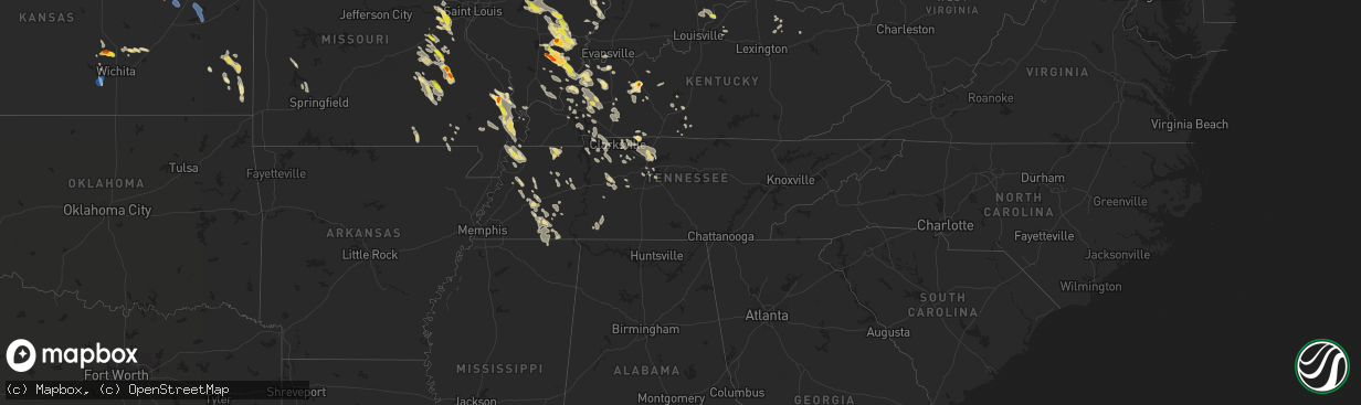
Hail Map in Tennessee on August 6, 2019
The weather event in Tennessee on August 6, 2019 includes Wind and Hail maps. 28 states and 779 cities were impacted and suffered possible damage. The total estimated number of properties impacted is 80.
Want more than just the map?
Turn this storm into a full workflow.
- Owner + property data so you know who to knock
- OnDemand branded weather history reports to win the "did we even have hail?" argument
- RoofTrace estimate so reps stop guessing numbers at the door
Bought this map? Upgrade within 7 days and we'll credit the $230. (10-15 min setup call)
Wind
Hail
80
Estimated number of impacted properties by a 1.00" hail or larger0
Estimated number of impacted properties by a 1.75" hail or larger0
Estimated number of impacted properties by a 2.50" hail or largerStorm reports in Tennessee
Tennessee
| Date | Description |
|---|---|
| 08/06/20194:43 AM CDT | At 943 PM CDT, severe thunderstorms were located along a line extending from 11 miles north of Manchester to 6 miles north of Petersburg, moving southeast at 35 mph. HAZARD...60 mph wind gusts. SOURCE...Radar indicated. IMPACT...Expect damage to roofs, siding, and trees. Locations impacted include... Shelbyville, Lewisburg, Manchester, Tullahoma, Chapel Hill, Wartrace, Bell Buckle, Normandy, Christiana, Beechgrove, Raus, Fosterville, Rover, Belfast, Deason, Hillsboro, Farmington and Unionville.This includes Interstate 24 between mile markers 85 and 127. |
| 08/06/20194:07 AM CDT | At 907 PM CDT, severe thunderstorms were located along a line extending from 8 miles northwest of Woodbury to 6 miles east of Spring Hill, moving southeast at 40 mph. HAZARD...60 mph wind gusts. SOURCE...Radar indicated. IMPACT...Expect damage to roofs, siding, and trees. Locations impacted include... Murfreesboro, Shelbyville, McMinnville, Lewisburg, Manchester, Woodbury, Walterhill, Chapel Hill, Cornersville, Morrison, Wartrace, Eagleville, Bell Buckle, Auburntown, Centertown, Normandy, Viola, Beechgrove, Raus and Fosterville.This includes the following highways... Interstate 65 between mile markers 23 and 26. Interstate 24 between mile markers 72 and 113. Interstate 840 between mile markers 37 and 57. |
| 08/06/20193:34 AM CDT | At 834 PM CDT, severe thunderstorms were located along a line extending from near Lebanon to near Forest Hills, moving southeast at 40 mph. HAZARD...60 mph wind gusts and penny size hail. SOURCE...Radar indicated. IMPACT...Expect damage to roofs, siding, and trees. Locations impacted include... Murfreesboro, Lebanon, Nashville, Madison, Smyrna, Brentwood, La Vergne, Mount Juliet, Goodlettsville, Nolensville, Forest Hills, Oak Hill, Lakewood, Watertown, Hermitage, Walterhill, Rural Hill, Antioch, Belinda City and Old Hickory.This includes the following highways... Interstate 40 between mile markers 204 and 243. Interstate 65 between mile markers 71 and 97. Interstate 24 between mile markers 36 and 84. Interstate 840 between mile markers 36 and 76. |
| 08/06/20192:58 AM CDT | At 758 PM CDT, a severe thunderstorm was located over Millersville, or 11 miles southeast of Springfield, moving south at 50 mph. HAZARD...70 mph wind gusts and penny size hail. SOURCE...Radar indicated. IMPACT...Expect considerable tree damage. Damage is likely to mobile homes, roofs, and outbuildings. Locations impacted include... Gallatin, Lebanon, Nashville, Madison, Hendersonville, Mount Juliet, Goodlettsville, White House, Millersville, Greenbrier, Coopertown, Lakewood, Ridgetop, Hermitage, Rural Hill, Belinda City, Old Hickory, Joelton, Berry Hill and Bledsoe Creek State Park.This includes the following highways... Interstate 40 between mile markers 207 and 249. Interstate 65 between mile markers 79 and 109. Interstate 24 between mile markers 27 and 57. Interstate 840 between mile markers 70 and 76. |
| 08/06/20192:16 AM CDT | At 716 PM CDT, a severe thunderstorm was located near Russellville, moving southeast at 55 mph. HAZARD...60 mph wind gusts. SOURCE...Radar indicated. IMPACT...Expect damage to roofs, siding, and trees. Locations impacted include... Russellville, Auburn, Adairville, Justice, Gordonsville, Spa, Epleys, Black Jack, Dennis and Geddes. |
| 08/06/20191:23 AM CDT | At 623 PM CDT, a severe thunderstorm was located 9 miles north of Springfield, moving east at 10 mph. HAZARD...60 mph wind gusts and quarter size hail. SOURCE...Radar indicated. IMPACT...Hail damage to vehicles is expected. Expect wind damage to roofs, siding, and trees. Locations impacted include... Adairville, Keysburg, Neosheo, Schochoh, Middleton, Dot, Schweizer, Prices Mill and Schley. |
| 08/06/20191:19 AM CDT | At 619 PM CDT, a severe thunderstorm was located 10 miles northwest of Springfield, moving east at 15 mph. HAZARD...60 mph wind gusts and quarter size hail. SOURCE...Radar indicated. IMPACT...Hail damage to vehicles is expected. Expect wind damage to roofs, siding, and trees. Locations impacted include... Springfield, Cross Plains, Orlinda, Adams and Cedar Hill. |
| 08/05/20199:47 PM CDT | A local report indicates 60 MPH wind near 1 N NORMANDY |
| 08/05/20199:40 PM CDT | Numerous trees and power lines were blown down across eastern hickman county including on hwy 50 east...swan creek road...ugly creek road...falls branch road...blue buc |
| 08/05/20199:13 PM CDT | Tree snapped near barfield crescent park |
| 08/05/20199:10 PM CDT | Powerlines and several large tree limbs down on millsfield highway near cloverdale. Time estimated. |
| 08/05/20199:00 PM CDT | Large tree limb fell on vehicle. |
| 08/05/20198:50 PM CDT | Trees down at nolensville rd and pettus rd |
| 08/05/20198:37 PM CDT | Tree down in sylvan park |
| 08/05/20198:34 PM CDT | Tree and power lines down in roadway at 727 rome pike |
| 08/05/20198:32 PM CDT | Tree in roadway at 435 spring creek road |
| 08/05/20198:30 PM CDT | Tree on car |
| 08/05/20198:29 PM CDT | Tree in roadway at 430 s rutland rd |
| 08/05/20198:26 PM CDT | Tree down across graylynn drive |
| 08/05/20198:22 PM CDT | Tree in roadway at beckwith road and lebanon road |
| 08/05/20198:21 PM CDT | Trees down |
| 08/05/20198:05 PM CDT | A local report indicates 60 MPH wind near GREENBRIER |
| 08/05/20198:05 PM CDT | Trees and power lines down throughout town. |
| 08/05/20198:00 PM CDT | Nws employee reported numerous trees and tree limbs down across white house |
| 08/05/20197:55 PM CDT | A local report indicates 60 MPH wind near 3 E SPRINGFIELD |
| 08/05/20197:55 PM CDT | Numerous trees and power lines blown down across robertson county with several roadways blocked...including hwy 76 at new hall road...kinneys road...glen raven road at |
All States Impacted by Hail Map on August 6, 2019
Cities Impacted by Hail Map on August 6, 2019
- Burlington, CO
- Herreid, SD
- Grand Forks, ND
- Gilby, ND
- Inkster, ND
- Manvel, ND
- Fordville, ND
- Forest River, ND
- Minto, ND
- Mekinock, ND
- Campbellsburg, IN
- Orleans, IN
- Corydon, KY
- Henderson, KY
- Cannon Ball, ND
- Newark Valley, NY
- Berkshire, NY
- Scott City, MO
- Harrison, NE
- Macedonia, IL
- Springerton, IL
- McLeansboro, IL
- Enfield, IL
- Dahlgren, IL
- Zap, ND
- Golden Valley, ND
- Hazen, ND
- Dodge, ND
- Halliday, ND
- Beulah, ND
- Dyersburg, TN
- Friendship, TN
- Minneola, KS
- Perryton, TX
- Bismarck, ND
- Stanton, ND
- Harrold, SD
- Pierre, SD
- Johnstown, NE
- Ainsworth, NE
- Long Pine, NE
- Burrton, KS
- Moundridge, KS
- Benton, KY
- Gilbertsville, KY
- Rinard, IL
- Xenia, IL
- Johnsonville, IL
- Madison, TN
- Hendersonville, TN
- Goodlettsville, TN
- Old Hickory, TN
- Greenbrier, TN
- Raleigh, IL
- Eldorado, IL
- Galatia, IL
- Broughton, IL
- Blunt, SD
- Lesterville, MO
- Centerville, MO
- Redford, MO
- Burke, SD
- Gregory, SD
- Whitewater, MO
- Chaffee, MO
- Cape Girardeau, MO
- Stonefort, IL
- Golconda, IL
- Eddyville, IL
- Herod, IL
- Jackson, MO
- Stuart, NE
- Atkinson, NE
- Naper, NE
- Halstead, KS
- Sedgwick, KS
- Hornsby, TN
- Wood Lake, NE
- Selby, SD
- Java, SD
- Holabird, SD
- Gettysburg, SD
- Onida, SD
- Eagle Butte, SD
- Trail City, SD
- Lower Brule, SD
- Wakpala, SD
- Agar, SD
- Fort Thompson, SD
- Goodridge, MN
- Grygla, MN
- Silex, MO
- Ellington, MO
- Austin, KY
- Fountain Run, KY
- Lexington, IN
- Nabb, IN
- Princeton, KY
- Sikeston, MO
- Benton, MO
- Oran, MO
- Dresden, TN
- Bassett, NE
- Burwell, NE
- Hurdsfield, ND
- Harvey, ND
- Laporte, MN
- Bemidji, MN
- Mandan, ND
- Center, ND
- New Salem, ND
- Pen Argyl, PA
- Belvidere, NJ
- Nazareth, PA
- Phillipsburg, NJ
- Bangor, PA
- Newton, KS
- Ojo Caliente, NM
- Hartford, KY
- Solen, ND
- Dawson Springs, KY
- Marion, KY
- Fredonia, KY
- Pittsburg, KS
- Girard, KS
- Cherokee, KS
- Gate, OK
- Charlotte, TN
- White Bluff, TN
- Englewood, KS
- Deposit, NY
- Hancock, NY
- Bethlehem, IN
- New Washington, IN
- Bowdle, SD
- Oberon, ND
- Backus, MN
- Pine River, MN
- Hackensack, MN
- Hillsboro, MO
- De Soto, MO
- Southside, TN
- Labadie, MO
- Laverne, OK
- Rosston, OK
- Ironton, MO
- Grand Rivers, KY
- Smithland, KY
- Nunnelly, TN
- Fairfield, IL
- New Madrid, MO
- Matthews, MO
- Bertrand, MO
- East Prairie, MO
- Mercer, TN
- Denmark, TN
- Jackson, TN
- Martinsville, IL
- Saint Albans, MO
- Villa Ridge, MO
- Dittmer, MO
- Washington, MO
- Marthasville, MO
- Robertsville, MO
- Defiance, MO
- Foristell, MO
- Saint Clair, MO
- Augusta, MO
- Lonedell, MO
- Catawissa, MO
- Gray Summit, MO
- Pacific, MO
- House Springs, MO
- Eureka, MO
- Union, MO
- Cedar Hill, MO
- Bunker, MO
- Geddes, SD
- Platte, SD
- Salem, IL
- Iuka, IL
- Patoka, IL
- Odin, IL
- Sandoval, IL
- Annapolis, MO
- Caledonia, MO
- Arcadia, MO
- Belgrade, MO
- Belleview, MO
- Middle Brook, MO
- Yuma, CO
- Sturgis, KY
- Potwin, KS
- Whitewater, KS
- Bethune, CO
- Goodrich, ND
- Alexandria, KY
- Latonia, KY
- Newport, KY
- Ft Mitchell, KY
- Independence, KY
- Jonesboro, AR
- Beech Grove, AR
- Peach Orchard, AR
- Paragould, AR
- Walnut Ridge, AR
- Delaplaine, AR
- Bono, AR
- Pocahontas, AR
- Dixon, KY
- Nebo, KY
- Slaughters, KY
- Manitou, KY
- Cleveland, ND
- Medina, ND
- Port Saint Lucie, FL
- Strasburg, ND
- Saint Paul, KS
- Wayne City, IL
- Sims, IL
- Potosi, MO
- Junction City, AR
- Newport, NE
- Linton, ND
- Highmore, SD
- Leasburg, MO
- Steelville, MO
- Nashville, TN
- Bells, TN
- Niagara, ND
- Petersburg, ND
- Crookston, NE
- Valentine, NE
- Underwood, ND
- Vandalia, IL
- Ramsey, IL
- Mulberry Grove, IL
- Shobonier, IL
- Seneca, SD
- Walnut, KS
- Erie, KS
- Booker, TX
- Pollock, SD
- Hague, ND
- Dickson, TN
- Bon Aqua, TN
- McEwen, TN
- Morganfield, KY
- Adairville, KY
- Adams, TN
- Cedar Hill, TN
- Olmstead, KY
- Springfield, TN
- Humansville, MO
- Stockton, MO
- Uniontown, KS
- Redfield, KS
- Bronson, KS
- Medon, TN
- Brownsville, TN
- Queenstown, MD
- Saint Michaels, MD
- Claiborne, MD
- Millville, DE
- Frankford, DE
- Ocean View, DE
- Watauga, SD
- Toone, TN
- Howes, SD
- White Owl, SD
- Wall, SD
- Sterling, ND
- Great Falls, VA
- Beaver Dam, KY
- Centertown, KY
- Castle Creek, NY
- Chenango Forks, NY
- Greene, NY
- Trezevant, TN
- Greenfield, TN
- McKenzie, TN
- Conneaut, OH
- Follett, TX
- Higgins, TX
- Lipscomb, TX
- Henderson, TN
- Finger, TN
- Bridgeport, IL
- Sumner, IL
- Baltimore, MD
- Kit Carson, CO
- Cadiz, KY
- Eureka, SD
- Saint Francisville, IL
- Allendale, IL
- Idalia, CO
- Kirk, CO
- Carmi, IL
- Mound City, SD
- Hornbeak, TN
- Burna, KY
- Salem, KY
- Gadsden, TN
- Poplar Bluff, MO
- Grandin, MO
- Dahlen, ND
- Denhoff, ND
- Bethesda, MD
- Washington, DC
- Chevy Chase, MD
- Corinth, MS
- Barnhill, IL
- Flora, IL
- Geff, IL
- Mill Shoals, IL
- Norris City, IL
- Keenes, IL
- Cisne, IL
- Bluford, IL
- Fort Plain, NY
- Little Falls, NY
- Cresco, PA
- Canadensis, PA
- Alton, MO
- Couch, MO
- Brentwood, TN
- Thief River Falls, MN
- Newfolden, MN
- Herrick, SD
- Mills, NE
- Naylor, MO
- Doniphan, MO
- Oxly, MO
- Moffit, ND
- Braddock, ND
- Flasher, ND
- Hazelton, ND
- Menoken, ND
- Saint Anthony, ND
- Troy, KS
- Denton, KS
- Montgomery, IN
- El Dorado Springs, MO
- Collins, MO
- Bethel Springs, TN
- Hoven, SD
- Tolstoy, SD
- Yale, IL
- Newton, IL
- Willow Hill, IL
- Wheeler, IL
- Collinwood, TN
- Waynesboro, TN
- Cassoday, KS
- Burns, KS
- Dale, IL
- Thompsonville, IL
- Harrisburg, IL
- Cadet, MO
- Mineral Point, MO
- Davisville, MO
- McLaughlin, SD
- Saint Charles, SD
- Fairfax, SD
- Pukwana, SD
- Reliance, SD
- Bonesteel, SD
- Oacoma, SD
- Chamberlain, SD
- Cynthiana, KY
- Paris, KY
- Carlisle, KY
- Eddyville, KY
- Oxford, AR
- Brockwell, AR
- Wideman, AR
- Violet Hill, AR
- Boss, MO
- Brownsville, KY
- Smiths Grove, KY
- Bowling Green, KY
- Robards, KY
- Regent, ND
- Hepler, KS
- Fort Scott, KS
- Moran, KS
- Cass Lake, MN
- Junction, IL
- Equality, IL
- Rochester, KY
- Fort Yates, ND
- Hoyt, KS
- Meriden, KS
- Falkner, MS
- Tiplersville, MS
- Butte, NE
- Sullivan, MO
- Carson, NM
- Mcclusky, ND
- Spencer, NE
- Eads, CO
- Charlestown, IN
- Otisco, IN
- Hanover, IN
- Marysville, IN
- Henryville, IN
- Westport, KY
- Underwood, IN
- Bedford, KY
- Cottontown, TN
- Whites Creek, TN
- White House, TN
- Joelton, TN
- Roseau, MN
- Salem, MO
- Centerville, TN
- Lyles, TN
- Kanorado, KS
- Mount Carmel, IL
- Huron, TN
- Cerrillos, NM
- Faulkton, SD
- Michigan, ND
- Larimore, ND
- Mountain Dale, NY
- Fairview, TN
- Byron, NE
- Blackwell, MO
- Ash Grove, MO
- Aldrich, MO
- Walnut Grove, MO
- Eckley, CO
- Park City, KY
- Cave City, KY
- Texico, IL
- Beltsville, MD
- Livermore, KY
- Primm Springs, TN
- Franklin, TN
- Ridgely, TN
- Obion, TN
- Tiptonville, TN
- Troy, TN
- Glasgow, KY
- Cedarville, OH
- Leonardville, KS
- Randolph, KS
- Versailles, IN
- Lamar, CO
- Holly, CO
- Alta Vista, KS
- Alma, KS
- Bolivar, TN
- Marsland, NE
- Conway Springs, KS
- Viola, KS
- Glencross, SD
- Hamill, SD
- Bristow, NE
- Oneill, NE
- Lynch, NE
- Kennebec, SD
- Timber Lake, SD
- Fort Campbell, KY
- Woodlawn, TN
- Indian Mound, TN
- Cumberland City, TN
- La Fayette, KY
- Big Rock, TN
- Palmyra, TN
- Ashland City, TN
- Kunkletown, PA
- Wright City, MO
- Solway, MN
- Eminence, KY
- Shelbyville, KY
- Dillsboro, IN
- Ruskin, NE
- Richwoods, MO
- Andale, KS
- Vernon, CO
- Goddard, KS
- Corning, AR
- Glenham, SD
- Everton, MO
- Torrington, WY
- Knobel, AR
- Lafayette Hill, PA
- Narberth, PA
- Philadelphia, PA
- Clarksville, TN
- Philip, SD
- Enning, SD
- Bagley, MN
- El Dorado, AR
- White Oak, GA
- Sheridan Lake, CO
- Lakota, ND
- Central City, KY
- McHenry, KY
- La Vergne, TN
- Antioch, TN
- Nolensville, TN
- Michie, TN
- Ramer, TN
- Guys, TN
- Selmer, TN
- State University, AR
- Shawnee, WY
- Holton, IN
- Osgood, IN
- Bourbon, MO
- Pilot Knob, MO
- Russellville, KY
- Dover, TN
- Tennessee Ridge, TN
- Huntingdon, TN
- Stratton, CO
- Arapahoe, CO
- Rising City, NE
- Oblong, IL
- Alliance, NE
- Ewing, IL
- Whittington, IL
- Benton, IL
- Welch, OK
- Bluejacket, OK
- Miami, OK
- Goodland, KS
- Harviell, MO
- Chambers, NE
- Effingham, IL
- Teutopolis, IL
- Westport, IN
- Greensburg, IN
- O'Fallon, MO
- Lake Saint Louis, MO
- Wentzville, MO
- Success, AR
- Gatzke, MN
- Lawrenceville, IL
- Salem, IN
- Burnsville, MS
- Glen, MS
- Garden Plain, KS
- Easton, MD
- Scammon, KS
- Carlyle, IL
- Shawneetown, IL
- Burnt Prairie, IL
- Clay, KY
- Cave In Rock, IL
- Alma, IL
- Elizabethtown, IL
- Omaha, IL
- Kinmundy, IL
- Ridgway, IL
- Belle Rive, IL
- West Frankfort, IL
- Nortonville, KY
- White Plains, KY
- Cathay, ND
- New Rockford, ND
- Reynolds Station, KY
- Fordsville, KY
- Chapmansboro, TN
- Stark, KS
- Wildersville, TN
- Gettysburg, PA
- Altamont, IL
- Fessenden, ND
- Atwood, TN
- Cedar Grove, TN
- Madisonville, KY
- Providence, KY
- Hanson, KY
- Stewart, TN
- Kintyre, ND
- Driscoll, ND
- Merriman, NE
- Beechmont, KY
- Drakesboro, KY
- Beech Creek, KY
- Belton, KY
- Browder, KY
- Humboldt, TN
- Trenton, TN
- Middleton, TN
- Walnut, MS
- Pocahontas, TN
- Amarillo, TX
- Cottage Grove, TN
- Dukedom, TN
- Palmersville, TN
- Havre, MT
- Bala Cynwyd, PA
- Glenside, PA
- Flourtown, PA
- Conshohocken, PA
- Gladwyne, PA
- Lake George, MN
- Dodge City, KS
- Sheyenne, ND
- Erin, TN
- Holladay, TN
- Westport, TN
- Lawrenceburg, TN
- Marion, IL
- Puryear, TN
- Shumway, IL
- Decker, IN
- Vincennes, IN
- Paris, TN
- Berry, KY
- Enville, TN
- Cherryville, MO
- Viburnum, MO
- Pinson, TN
- Amelia, NE
- Evansville, IN
- Patoka, IN
- Owensville, IN
- Charleston, MO
- Smithfield, KY
- Lucas, KY
- Chanute, KS
- Mount Olivet, KY
- Montrose, IL
- Kuttawa, KY
- Mound City, IL
- Mounds, IL
- Cincinnati, OH
- Dexter, MO
- Dudley, MO
- Union City, TN
- Portageville, MO
- Elbing, KS
- Scottsville, KY
- Alamo, TN
- Halls, TN
- Columbus, KS
- Bone Gap, IL
- Hopkinsville, KY
- Crofton, KY
- Newbern, TN
- Potomac, MD
- Bridgeport, NE
- Wind Gap, PA
- Caneyville, KY
- McLean, VA
- Cabin John, MD
- Glen Echo, MD
- Hillsboro, KY
- Owingsville, KY
- Holland, KY
- Bumpus Mills, TN
- Burfordville, MO
- Mount Vernon, IN
- Uniontown, KY
- Savannah, NY
- McIntosh, SD
- McCune, KS
- Essex, MO
- Bloomfield, MO
- Watson, IL
- Dieterich, IL
- Warrenton, MO
- Saint Cloud, FL
- Robinson, KS
- Hiawatha, KS
- Morgantown, KY
- Buena Vista, TN
- Lisle, NY
- Metropolis, IL
- Grantsburg, IL
- Vienna, IL
- Simpson, IL
- Glen Ullin, ND
- Carrier Mills, IL
- Green, KS
- Greenleaf, KS
- Barnes, KS
- Dundas, IL
- Burlingame, KS
- Mchenry, ND
- Kilgore, NE
- Weir, KS
- Farlington, KS
- Calhoun, KY
- Cub Run, KY
- Mammoth Cave, KY
- Mohawk, NY
- Beech Bluff, TN
- Luray, TN
- Troy, MO
- Moscow Mills, MO
- Jay Em, WY
- Miller City, IL
- Marble Hill, MO
- Thebes, IL
- Hickman, KY
- Westmoreland, KS
- Cumberland Furnace, TN
- Vanleer, TN
- Etoile, KY
- Rosiclare, IL
- Selbyville, DE
- Dagsboro, DE
- Boelus, NE
- Saint Paul, NE
- Clay Center, NE
- Cairo, NE
- Superior, NE
- Chapman, NE
- Elba, NE
- Shelton, NE
- Alda, NE
- Oak, NE
- Glenvil, NE
- Ord, NE
- Ayr, NE
- Dannebrog, NE
- Harvard, NE
- North Loup, NE
- Saint Libory, NE
- Loup City, NE
- Nelson, NE
- Webber, KS
- Elyria, NE
- Aurora, NE
- Wood River, NE
- Republic, KS
- Grand Island, NE
- Palmer, NE
- Phillips, NE
- Ashton, NE
- Blue Hill, NE
- Farwell, NE
- Giltner, NE
- Inland, NE
- Edgar, NE
- Deweese, NE
- Doniphan, NE
- Trumbull, NE
- Marquette, NE
- Juniata, NE
- Hastings, NE
- Fairfield, NE
- Hardy, NE
- Onaka, SD
- Meade, KS
- Scotia, NE
- Tappen, ND
- Jamestown, ND
- Black, MO
- Milton, KS
- Cheney, KS
- Riley, KS
- Manhattan, KS
- Wamego, KS
- Saint George, KS
- Olsburg, KS
- Emmett, KS
- Paxico, KS
- Onaga, KS
- Eskridge, KS
- Belvue, KS
- Saint Marys, KS
- McFarland, KS
- Melvern, KS
- Quenemo, KS
- Vassar, KS
- Lyndon, KS
- Lebo, KS
- Osage City, KS
- Scranton, KS
- Allen, KS
- Dundalk, MD
- Rosedale, MD


