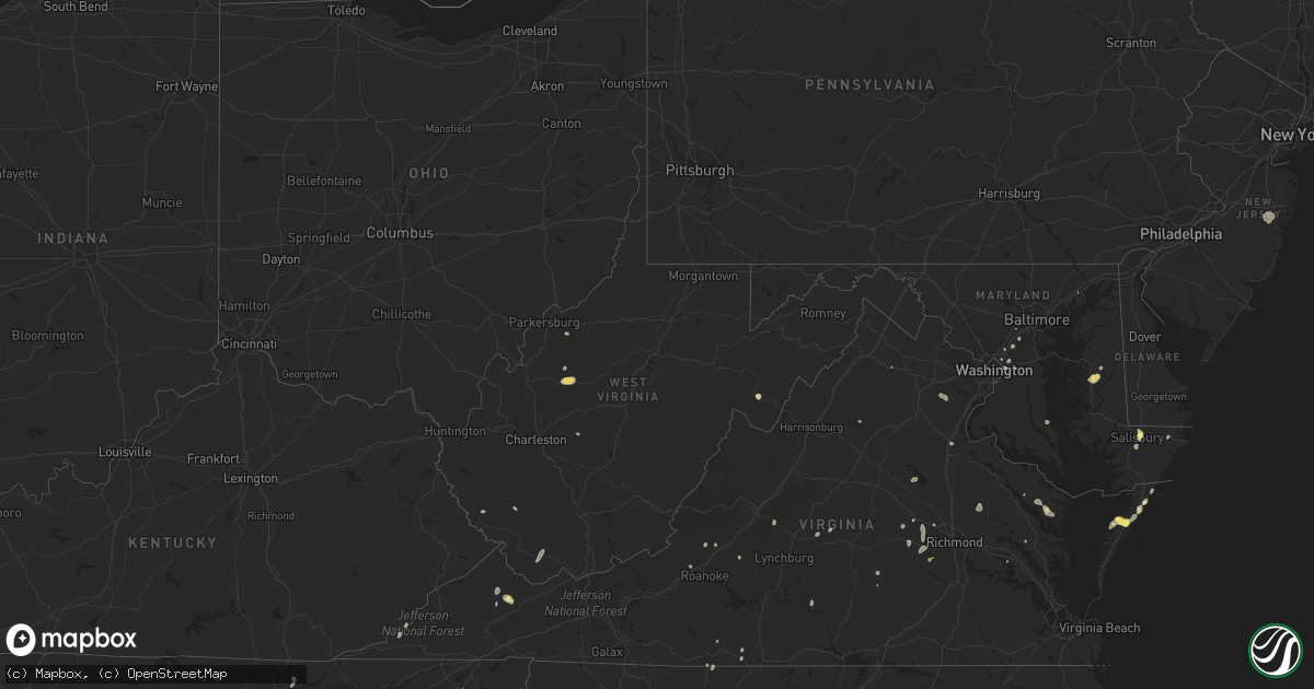
Hail Map in West Virginia on August 5, 2022
Get this storm
August 5 map
$229
one time, instant access
Download today. No call, no setup
Keep the $229
Bought the map and want the full workflow? Apply the entire $229 to a subscription within 7 days. None of it is wasted.
Every map, not just this one
This buys you this map. Subscription and you get every map we run, in the markets you choose from a few cities to whole states to nationwide. Plus real-time alerts the moment a storm fires.
Contact data
Name, contact info, occupancy, even credit band for addresses in the footprint. You go from where it hit to who to call.
Become the source they trust
Unlimited branding weather history reports on demand. You already have the documented answer ready for the property owner, and you are the one who showed up with it.
Property data and RoofTrace estimates
Pull up any address you have got, its value and the exact code rules for that jurisdiction, straight from One Click Code. Then RoofTrace estimates the squares, pitch, and roof value, priced the way you price.
Storm reports in West Virginia
West Virginia
| Date | Description |
|---|---|
| 08/05/20226:50 PM CDT | Mcdowell county 911 advised there are several trees down in the town of paynesville. Time estimated by radar. |
| 08/05/20226:47 PM CDT | Mcdowell county 911 reported a tree down on coal heritage road near town of kimball. Time estimated by radar. |
| 08/05/20226:24 PM CDT | Buchanan county 911 center advised there is a tree down at state line ridge road at the state line. Time was estimated by radar. |
| 08/05/20223:26 PM CDT | A local report indicates 64 MPH wind near 3 NE CHARLESTON |
| 08/05/202212:57 PM CDT | Tree down near ruddle park off of hwy 220. |
| 08/05/20222:31 AM CDT | At 730 PM EDT, a severe thunderstorm was located over Welch, moving northeast at 15 mph. HAZARD...60 mph wind gusts and penny size hail. SOURCE...Radar indicated. IMPACT...Expect damage to roofs, siding, and trees. Locations impacted include... Welch, Gary, Northfork, Keystone and Kimball. |
| 08/05/20222:17 AM CDT | At 717 PM EDT, a severe thunderstorm was located near Oceana, or 12 miles north of Pineville, moving southeast at 15 mph. HAZARD...60 mph wind gusts and quarter size hail. SOURCE...Radar indicated. IMPACT...Hail damage to vehicles is expected. Expect wind damage to roofs, siding, and trees. Locations impacted include... Oceana, Twin Falls State Park, Amherstdale-Robinette, Lester, Kopperston, Cyclone, Bolt and Maben. |
| 08/05/20222:10 AM CDT | At 710 PM EDT, a severe thunderstorm was located 8 miles northwest of Glen Burke, or 8 miles east of Grundy, moving northeast at 10 mph. HAZARD...60 mph wind gusts. SOURCE...Radar indicated. IMPACT...Expect damage to roofs, siding, and trees. Locations impacted include... Bradshaw and Jolo. |
| 08/05/20221:23 AM CDT | At 623 PM EDT, a severe thunderstorm was located over Raven, or near Richlands, moving north at 10 mph. HAZARD...60 mph wind gusts and penny size hail. SOURCE...Radar indicated. IMPACT...Expect damage to roofs, siding, and trees. Locations impacted include... Grundy, Davenport, Big Rock, Stacy, Vansant, Hurley, Oakwood and Roseann. |
| 08/04/20228:37 PM CDT | At 136 PM EDT, a severe thunderstorm was located near Upper Tract, or near Franklin, moving east at 10 mph. HAZARD...60 mph wind gusts and quarter size hail. SOURCE...Radar indicated. IMPACT...Damaging winds will cause some trees and large branches to fall. This could injure those outdoors, as well as damage homes and vehicles. Roadways may become blocked by downed trees. Localized power outages are possible. Unsecured light objects may become projectiles. Locations impacted include... Franklin, Upper Tract, Ruddle and Deer Run. |
All States Impacted by Hail Map on August 5, 2022
Cities Impacted by Hail Map on August 5, 2022
- Leonard, MN
- Milnor, ND
- Moorhead, MN
- Fargo, ND
- Dilworth, MN
- West Fargo, ND
- Hyattsville, MD
- Capitol Heights, MD
- Washington, DC
- New Church, VA
- Wallops Island, VA
- Horace, ND
- Sweetwater, TN
- Madisonville, TN
- Gladstone, VA
- Bellingham, MN
- Cordova, MD
- Easton, MD
- Bowie, MD
- Frankford, DE
- Dagsboro, DE
- Holabird, SD
- Farnham, VA
- Wanblee, SD
- Long Valley, SD
- Morris, MN
- Keokee, VA
- Holmes Mill, KY
- Dell Rapids, SD
- Trent, SD
- Claremont, SD
- Lanexa, VA
- Aberdeen, MD
- Maidens, VA
- Littlefork, MN
- Big Falls, MN
- Dracut, MA
- Tyngsboro, MA
- Syria, VA
- Bedford, VA
- Waubay, SD
- Mahnomen, MN
- Twin Valley, MN
- Waubun, MN
- Lancaster, VA
- Fincastle, VA
- Laurel, MD
- Glyndon, MN
- Jasper, GA
- Bloxom, VA
- Parksley, VA
- Saint Leonard, MD
- Port Republic, MD
- International Falls, MN
- Raton, NM
- Wapakoneta, OH
- Powhatan, VA
- Danville, VA
- Dry Fork, VA
- Fairmount, GA
- Felton, MN
- Amherst, MA
- Temperanceville, VA
- Assawoman, VA
- Alexandria, MN
- Farwell, MN
- Shevlin, MN
- Puposky, MN
- Redlake, MN
- Northome, MN
- Mizpah, MN
- Cando, ND
- Laurel, DE
- Georgetown, DE
- Millsboro, DE
- Ipswich, SD
- Roscoe, SD
- Lima, OH
- Conde, SD
- Kensington, MN
- Morristown, TN
- Beltsville, MD
- Patagonia, AZ
- Burkeville, VA
- Jetersville, VA
- Berlin, MD
- Aberdeen, SD
- Lake Benton, MN
- Swords Creek, VA
- Riverdale, MD
- Lanham, MD
- Twentynine Palms, CA
- Clearbrook, MN
- Ponemah, MN
- Redby, MN
- Dalton, GA
- Blakeslee, PA
- Faulkton, SD
- Washburn, TN
- Del Rio, TN
- Corona, SD
- Twin Brooks, SD
- Wilmot, SD
- Marvin, SD
- Milbank, SD
- Summit, SD
- Valentine, NE
- Englewood, FL
- Groton, SD
- Sabin, MN
- Columbia, MD
- Ellicott City, MD
- Ulen, MN
- Hawley, MN
- Clara City, MN
- Colman, SD
- Pelham, NC
- Providence, NC
- Sisseton, SD
- Duff, TN
- La Follette, TN
- Annapolis Junction, MD
- Jessup, MD
- Britton, SD
- Alpharetta, GA
- Big Piney, WY
- Langford, SD
- Madison, MN
- Johnson City, TN
- Harrold, SD
- Chesterfield, VA
- Midlothian, VA
- Waterford, OH
- Denton, MD
- Hillsboro, MD
- Queen Anne, MD
- Summerfield, NC
- Stokesdale, NC
- Madison, NC
- Hull, MA
- Tabiona, UT
- Hanna, UT
- Rowe, VA
- Oakwood, VA
- Martinsville, VA
- Clayton, GA
- Wood, SD
- Okreek, SD
- Mission, SD
- Parmelee, SD
- Presho, SD
- Vivian, SD
- Witten, SD
- Martin, SD
- White River, SD
- Norris, SD
- Murdo, SD
- Winner, SD
- Draper, SD
- Saint Francis, SD
- Rosebud, SD
- Ideal, SD
- Amherst, VA
- Vesuvius, VA
- Columbia, SD
- Delmar, MD
- Salisbury, MD
- Pocono Lake, PA
- Dryden, VA
- Pennington Gap, VA
- Tuthill, SD
- Watertown, SD
- Ortley, SD
- Big Stone City, SD
- Labolt, SD
- Bisbee, ND
- Franklin, WV
- Flandreau, SD
- Palestine, WV
- Dahlonega, GA
- Nokesville, VA
- Bristow, VA
- Clark, SD
- Ivanhoe, MN
- Ennice, NC
- Landrum, SC
- Elkton, SD
- Buckingham, VA
- Bristol, SD
- Webster, SD
- Sacred Heart, MN
- Bradley, SD
- Linden, VA
- Jonesborough, TN
- Henry, SD
- Hazel, SD
- Pierre, SD
- Blunt, SD
- Bath, SD
- Pierpont, SD
- Orient, SD
- Onaka, SD
- Mansfield, SD
- Northville, SD
- Ashton, SD
- Lebanon, SD
- Stratford, SD
- Mellette, SD
- Onida, SD
- Seneca, SD
- Roslyn, SD
- Andover, SD
- Highmore, SD
- Warner, SD
- Cresbard, SD
- Walcott, ND
- Wyndmere, ND
- Mcleod, ND
- Glenwood, MN
- Lowry, MN
- Villard, MN
- Murphy, NC
- Fredericksburg, VA
- Amherstdale, WV
- Lakewood, NJ
- Jackson, NJ
- Toms River, NJ
- Manchester Township, NJ
- Delbarton, WV
- Cattaraugus, NY
- Randolph, NY
- Egan, SD
- Manakin Sabot, VA
- Painter, VA
- Hacksneck, VA
- Onancock, VA
- Accomac, VA
- Onley, VA
- Melfa, VA
- Greenbush, VA
- Aylett, VA
- Windsor, OH
- Middlefield, OH
- Ball Ground, GA
- Raven, VA
- Honaker, VA
- Knoxville, TN
- Freeport, FL
- Punta Gorda, FL
- Florence, SD
- Eagle Bend, MN
- Kingston, GA
- Bokeelia, FL
- Las Vegas, NM
- Garita, NM
- Spencer, WV
- Stoneville, NC
- Eden, NC
- Ridgeway, VA
- Warsaw, VA
- Watson, MN
- Benson, MN
- Montevideo, MN
- Milan, MN
- Danvers, MN
- Port Charlotte, FL
- Dawsonville, GA
- Hallwood, VA
- Safety Harbor, FL
- Clearwater, FL
- Dunedin, FL
- Wallace, SD
- Marietta, GA
- Kennesaw, GA
- Kilgore, NE
- Bradenton, FL
- Parrish, FL
- Ellenton, FL
- Mineral, VA
- Old Town, FL
- Arcadia, FL
- Buchanan, VA
- Woodstock, GA
- Cedar Key, FL
- Temple, GA
- Crookston, NE
- Fort Pierre, SD
- Huntsville, TX
- Bedias, TX
- Saint Petersburg, FL
- Largo, FL
- Seminole, FL
- Indian Rocks Beach, FL
- Dallas, GA
- Rockmart, GA
- Roswell, GA
- Waskish, MN
- Salem, VA
- Fruitland, MD
- Eden, MD
- Shacklefords, VA
- Palmetto, FL
- Canton, GA
- Walker, WV
- Petroleum, WV
- Cleveland, TN
- Cohutta, GA
- Welch, WV
- Paynesville, WV
- Cartersville, GA
- Sonoita, AZ
- Calhoun, GA
- Brookneal, VA
- Kelliher, MN
- Moseley, VA
- Bybee, TN
- Russellville, TN
- Newport, TN
- Mohawk, TN
- Atlanta, GA
- Appleton, MN
- Hosford, FL
- Belview, MN
- Redwood Falls, MN
- Glen Allen, VA
- Tyner, KY
- Chatsworth, GA
- Maynardville, TN
- Luttrell, TN
- Powder Springs, TN
- Bomont, WV
- Frederick, SD
- Houghton, SD
- Barnard, SD
- Westport, SD
- Lake City, SD
- Veblen, SD
- Cogswell, ND
- Forman, ND
- Gwinner, ND
- Loman, MN
- Parsonsburg, MD


