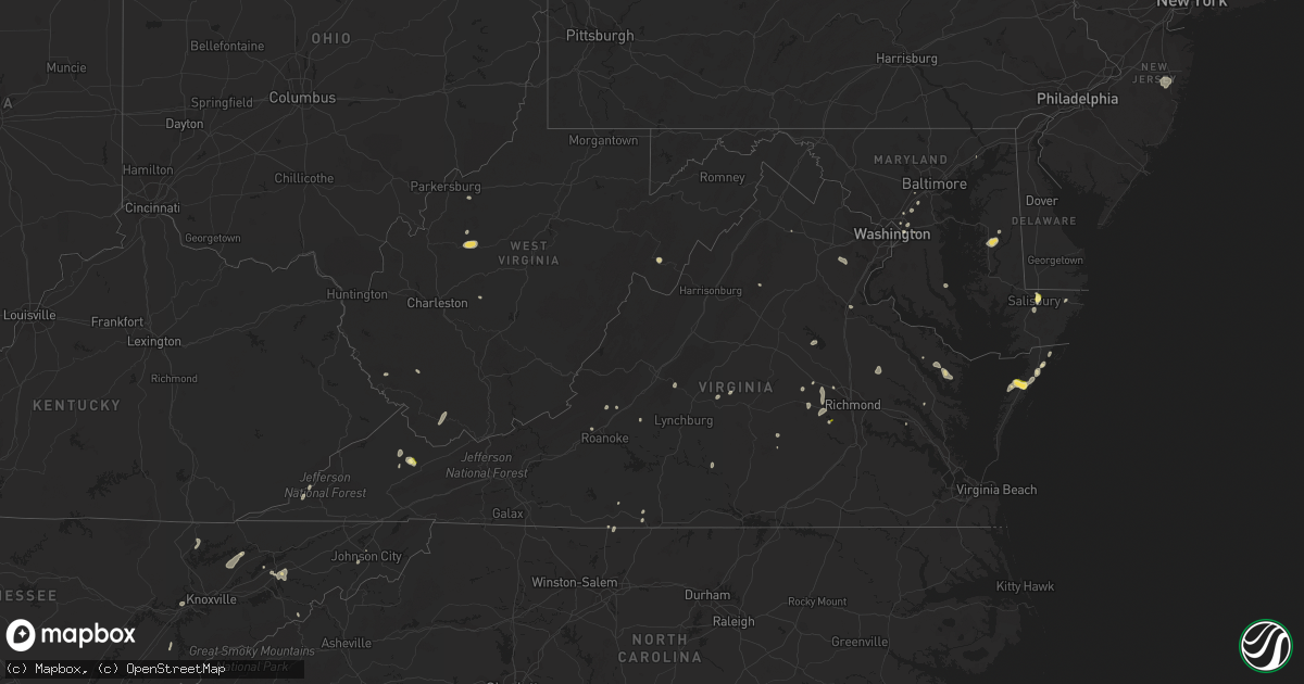
Hail Map in Virginia on August 5, 2022
Get this storm
August 5 map
$229
one time, instant access
Download today. No call, no setup
Keep the $229
Bought the map and want the full workflow? Apply the entire $229 to a subscription within 7 days. None of it is wasted.
Every map, not just this one
This buys you this map. Subscription and you get every map we run, in the markets you choose from a few cities to whole states to nationwide. Plus real-time alerts the moment a storm fires.
Contact data
Name, contact info, occupancy, even credit band for addresses in the footprint. You go from where it hit to who to call.
Become the source they trust
Unlimited branding weather history reports on demand. You already have the documented answer ready for the property owner, and you are the one who showed up with it.
Property data and RoofTrace estimates
Pull up any address you have got, its value and the exact code rules for that jurisdiction, straight from One Click Code. Then RoofTrace estimates the squares, pitch, and roof value, priced the way you price.
Storm reports in Virginia
Virginia
| Date | Description |
|---|---|
| 08/05/20226:12 PM CDT | Tree reported down on slate creek road blocking two lanes. Time estimated from radar. |
| 08/05/20226:00 PM CDT | Virginia state police dispatch advised one of their troopers reported a tree down 1000 block of cydney circle at keen mountain camp road. Time estimated by radar. |
| 08/05/20225:46 PM CDT | Thunderstorm winds blew down multiple trees in buchanan. |
| 08/05/20225:43 PM CDT | Thunderstorm winds blew down multiple trees in blue ridge. |
| 08/05/20225:36 PM CDT | Buchanan county 911 center advised there is a tree down on patterson road and route 638. Time was estimated by radar. |
| 08/05/20225:30 PM CDT | Thunderstorm winds blew down multiple trees in troutville. |
| 08/05/20225:25 PM CDT | Thunderstorm winds blew down multiple trees in daleville. |
| 08/05/20225:24 PM CDT | Dickenson county 911 center reported a tree down on dante mountain road in the community of nora. Time is estimated by radar. |
| 08/05/20225:19 PM CDT | Dickenson county 911 advised there is a tree down on poker flats road in nora. Time was estimated by radar. |
| 08/05/20225:00 PM CDT | Trees down in dungannon. Time estimated from radar. |
| 08/05/20224:50 PM CDT | Several trees down in fort blackmore. Time estimated from radar. |
| 08/05/20224:41 PM CDT | Tree down on leavells rd. Naer smith station rd. |
| 08/05/20224:40 PM CDT | Tree down blocking both lanes of the road. |
| 08/05/20224:30 PM CDT | Tree down at wagner road and campground road. Another tree down a short distance away on wagner road. |
| 08/05/20224:30 PM CDT | Trees down in jasper community. Time estimated from radar. |
| 08/05/20224:30 PM CDT | Trees down in duffield. Time estimated from radar. |
| 08/05/20224:20 PM CDT | Trees down in dryden. Time estimated from radar. |
| 08/05/20224:20 PM CDT | Trees and power lines down on holly st. |
| 08/05/20224:15 PM CDT | A local report indicates 1.00 inch wind near ONANCOCK |
| 08/05/20224:05 PM CDT | Trees down in jonesville. Time estimated by radar. |
| 08/05/20224:00 PM CDT | Thunderstorm winds blew down one tree on to the 1000 block of barker road. |
| 08/05/20223:55 PM CDT | Large oak tree down on semmes ave blocking the road. |
| 08/05/20223:49 PM CDT | Tree down at the intersection of rober e. Lee dr. And seays rd. |
| 08/05/20223:45 PM CDT | Report from mping: quarter |
| 08/05/20223:25 PM CDT | Thunderstorm winds blew down multiple trees between bassett and stanleytown. |
| 08/05/20223:10 PM CDT | Trees down east of highway 13. |
| 08/05/20223:10 PM CDT | Thunderstorm winds blew down multiple trees in ridgeway. |
| 08/05/20223:07 PM CDT | Tree down near the 100 block of old church rd. |
| 08/05/20223:05 PM CDT | Trees down near 288 east of manakin. |
| 08/05/20222:23 PM CDT | Thunderstorm winds blew down powerlines near the intersection of loyal street and lynn street. |
| 08/05/20222:23 PM CDT | Thunderstorm winds blew down a tree and powerlines near the intersection of colquohoun street and dame street. |
| 08/05/20222:20 PM CDT | Corrects previous tstm wnd dmg report from 2 ssw danville city. A tree was blown down by thunderstorm winds and fell across the road on milton avenue. |
| 08/05/20222:15 PM CDT | Trees down on nocks landing rd. |
| 08/05/20222:10 PM CDT | Thunderstorm winds blew down several trees along south main street between route 58 and the dan river. A few of them were close to the danville community college. |
| 08/05/20221:50 PM CDT | Thunderstorm winds blew down two trees on riverside drive. |
| 08/05/20227:37 AM CDT | At 1237 AM EDT, a severe thunderstorm was located over North Potomac, or over Gaithersburg, moving east at 25 mph. HAZARD...60 mph wind gusts. SOURCE...Radar indicated. IMPACT...Damaging winds will cause some trees and large branches to fall. This could injure those outdoors, as well as damage homes and vehicles. Roadways may become blocked by downed trees. Localized power outages are possible. Unsecured light objects may become projectiles. Locations impacted include... Columbia, Germantown, Rockville, Bethesda, Gaithersburg, Olney, Beltsville, Aspen Hill, Potomac, North Bethesda, Montgomery Village, North Potomac, Fairland, White Oak, Redland, Great Falls, Colesville, Kemp Mill, North Kensington and South Kensington. |
| 08/05/20221:24 AM CDT | At 624 PM EDT, severe thunderstorms were located along a line extending from near Springwood to near Cave Spring, moving east at 20 mph. HAZARD...60 mph wind gusts. SOURCE...Radar indicated. IMPACT...Expect damage to roofs, siding, and trees. Locations impacted include... Roanoke... Salem... Vinton... Buchanan... Troutville... Stewartsville... and Montvale. |
| 08/05/20221:07 AM CDT | At 607 PM EDT, a severe thunderstorm was located near Clintwood, moving northeast at 15 mph. HAZARD...60 mph wind gusts and penny size hail. SOURCE...Radar indicated. IMPACT...Expect damage to roofs, siding, and trees. Locations impacted include... Clintwood, Haysi, Breaks Interstate, John Flannagan Lake, Trammel, Clinchco, Nora and McClure. |
| 08/05/20221:00 AM CDT | At 559 PM EDT, severe thunderstorms were located along a line extending from near Hadensville to near Goochland to near Moseley, moving east to northeast at 20 mph. HAZARD...60 mph wind gusts and quarter size hail. SOURCE...Radar indicated. IMPACT...Minor damage to vehicles is possible. Expect wind damage to trees and powerlines. Severe thunderstorms will be near... Moseley around 605 PM EDT. Oilville around 610 PM EDT. Sabot around 615 PM EDT. Manakin around 620 PM EDT. Gum Spring around 625 PM EDT. Tuckahoe around 630 PM EDT. Wyndham and Chesterfield Court House around 635 PM EDT. Laurel and Glen Allen around 645 PM EDT.Other locations impacted by these severe thunderstorms includeOrchid, Crozier, Rock Castle, Pilkinton, Vontay, Maidens, ThreeSquare, Irwin, Johnsons Springs and Pocahontas State Park. |
| 08/05/202212:57 AM CDT | At 556 PM EDT, severe thunderstorms were located along a line extending from near Payne Gap to 8 miles northeast of Gate City to near Quarry, moving northeast at 35 mph. HAZARD...60 mph wind gusts and penny size hail. SOURCE...Radar indicated. IMPACT...Expect damage to roofs, siding, and trees. Locations impacted include... Norton, Lebanon, Wise, Cleveland Va, Coeburn, Glade Spring, Honaker, Pound, St. Paul and Nickelsville.This includes Interstate 81 in Virginia between mile markers 23 and32. |
| 08/05/202212:40 AM CDT | At 540 PM EDT, a severe thunderstorm was located over Lewis Creek, or 9 miles south of Whitesburg, moving northeast at 40 mph. HAZARD...60 mph wind gusts and penny size hail. SOURCE...Radar indicated. IMPACT...Expect damage to roofs, siding, and trees. This severe thunderstorm will be near... Eolia around 550 PM EDT. Whitesburg around 555 PM EDT. Mayking around 600 PM EDT.Other locations in the path of this severe thunderstorm includeWhitaker and Jenkins. |
| 08/04/202211:45 PM CDT | At 445 PM EDT, a severe thunderstorm was located over Onley, or 11 miles northeast of Exmore, moving southwest at 10 mph. HAZARD...60 mph wind gusts and quarter size hail. SOURCE...Radar indicated. IMPACT...Minor damage to vehicles is possible. Expect wind damage to trees and powerlines. This severe thunderstorm will be near... Willis Wharf around 530 PM EDT.Other locations impacted by this severe thunderstorm includeLocustville, Harborton, Melfa, Pungoteague, Painter, Tasley, Keller,Quinby, Wachapreague and Accomac. |
| 08/04/202211:43 PM CDT | At 442 PM EDT, a severe thunderstorm was located near Bon Air, moving north at 10 mph. HAZARD...60 mph wind gusts and nickel size hail. SOURCE...Radar indicated. IMPACT...Expect damage to trees and powerlines. This severe thunderstorm will be near... Bon Air, University Of Richmond and Downtown Richmond around 515 PM EDT.Other locations impacted by this severe thunderstorm includePocahontas State Park, Beach, Midlothian, Subletts and Chesterfield. |
| 08/04/202211:21 PM CDT | At 421 PM EDT, a severe thunderstorm was located near Sabot, or 8 miles east of Goochland, moving north at 15 mph. HAZARD...60 mph wind gusts and penny size hail. SOURCE...Radar indicated. IMPACT...Expect damage to trees and powerlines. This severe thunderstorm will be near... Oilville around 430 PM EDT. Montpelier around 500 PM EDT.Other locations impacted by this severe thunderstorm includeRockville, Dabneys, Crozier, Vontay, Johnsons Springs, Goodall andMabelton. |
| 08/04/202211:01 PM CDT | At 401 PM EDT, a severe thunderstorm was located over Manakin, or 7 miles west of Tuckahoe, moving north at 10 mph. HAZARD...60 mph wind gusts and penny size hail. SOURCE...Radar indicated. IMPACT...Expect damage to trees and powerlines. This severe thunderstorm will be near... Manakin around 410 PM EDT. Sabot around 415 PM EDT.Other locations impacted by this severe thunderstorm include Crozier,Fine Creek Mills, Maidens, Holly Hills, Johnsons Springs, Midlothianand Subletts. |
| 08/04/202210:54 PM CDT | At 354 PM EDT, a severe thunderstorm was located near Bull Run, or 8 miles northwest of Dale City, and is nearly stationary. HAZARD...60 mph wind gusts. SOURCE...Radar indicated. IMPACT...Damaging winds will cause some trees and large branches to fall. This could injure those outdoors, as well as damage homes and vehicles. Roadways may become blocked by downed trees. Localized power outages are possible. Unsecured light objects may become projectiles. Locations impacted include... Linton Hall, Bull Run, Manassas, Sudley, Manassas Park, Independent Hill, Nokesville and Aden. |
| 08/04/202210:46 PM CDT | At 346 PM EDT, a severe thunderstorm was located near Parksley, or 20 miles south of Pocomoke City, and is nearly stationary. HAZARD...60 mph wind gusts. SOURCE...Radar indicated. IMPACT...Expect damage to trees and powerlines. Locations impacted include... Parksley, Accomac, Bloxom, Nelsonia, Modest Town and Mappsville. |
| 08/04/20228:57 PM CDT | At 157 PM EDT, a severe thunderstorm was located near Big Meadows, or 9 miles northwest of Madison, moving east at 5 mph. HAZARD...60 mph wind gusts and quarter size hail. SOURCE...Radar indicated. IMPACT...Damaging winds will cause some trees and large branches to fall. This could injure those outdoors, as well as damage homes and vehicles. Roadways may become blocked by downed trees. Localized power outages are possible. Unsecured light objects may become projectiles. Locations impacted include... Big Meadows, Criglersville, Banco, Etlan, Nethers, Haywood, Aylor and Syria. |
All States Impacted by Hail Map on August 5, 2022
Cities Impacted by Hail Map on August 5, 2022
- Leonard, MN
- Milnor, ND
- Moorhead, MN
- Fargo, ND
- Dilworth, MN
- West Fargo, ND
- Hyattsville, MD
- Capitol Heights, MD
- Washington, DC
- New Church, VA
- Wallops Island, VA
- Horace, ND
- Sweetwater, TN
- Madisonville, TN
- Gladstone, VA
- Bellingham, MN
- Cordova, MD
- Easton, MD
- Bowie, MD
- Frankford, DE
- Dagsboro, DE
- Holabird, SD
- Farnham, VA
- Wanblee, SD
- Long Valley, SD
- Morris, MN
- Keokee, VA
- Holmes Mill, KY
- Dell Rapids, SD
- Trent, SD
- Claremont, SD
- Lanexa, VA
- Aberdeen, MD
- Maidens, VA
- Littlefork, MN
- Big Falls, MN
- Dracut, MA
- Tyngsboro, MA
- Syria, VA
- Bedford, VA
- Waubay, SD
- Mahnomen, MN
- Twin Valley, MN
- Waubun, MN
- Lancaster, VA
- Fincastle, VA
- Laurel, MD
- Glyndon, MN
- Jasper, GA
- Bloxom, VA
- Parksley, VA
- Saint Leonard, MD
- Port Republic, MD
- International Falls, MN
- Raton, NM
- Wapakoneta, OH
- Powhatan, VA
- Danville, VA
- Dry Fork, VA
- Fairmount, GA
- Felton, MN
- Amherst, MA
- Temperanceville, VA
- Assawoman, VA
- Alexandria, MN
- Farwell, MN
- Shevlin, MN
- Puposky, MN
- Redlake, MN
- Northome, MN
- Mizpah, MN
- Cando, ND
- Laurel, DE
- Georgetown, DE
- Millsboro, DE
- Ipswich, SD
- Roscoe, SD
- Lima, OH
- Conde, SD
- Kensington, MN
- Morristown, TN
- Beltsville, MD
- Patagonia, AZ
- Burkeville, VA
- Jetersville, VA
- Berlin, MD
- Aberdeen, SD
- Lake Benton, MN
- Swords Creek, VA
- Riverdale, MD
- Lanham, MD
- Twentynine Palms, CA
- Clearbrook, MN
- Ponemah, MN
- Redby, MN
- Dalton, GA
- Blakeslee, PA
- Faulkton, SD
- Washburn, TN
- Del Rio, TN
- Corona, SD
- Twin Brooks, SD
- Wilmot, SD
- Marvin, SD
- Milbank, SD
- Summit, SD
- Valentine, NE
- Englewood, FL
- Groton, SD
- Sabin, MN
- Columbia, MD
- Ellicott City, MD
- Ulen, MN
- Hawley, MN
- Clara City, MN
- Colman, SD
- Pelham, NC
- Providence, NC
- Sisseton, SD
- Duff, TN
- La Follette, TN
- Annapolis Junction, MD
- Jessup, MD
- Britton, SD
- Alpharetta, GA
- Big Piney, WY
- Langford, SD
- Madison, MN
- Johnson City, TN
- Harrold, SD
- Chesterfield, VA
- Midlothian, VA
- Waterford, OH
- Denton, MD
- Hillsboro, MD
- Queen Anne, MD
- Summerfield, NC
- Stokesdale, NC
- Madison, NC
- Hull, MA
- Tabiona, UT
- Hanna, UT
- Rowe, VA
- Oakwood, VA
- Martinsville, VA
- Clayton, GA
- Wood, SD
- Okreek, SD
- Mission, SD
- Parmelee, SD
- Presho, SD
- Vivian, SD
- Witten, SD
- Martin, SD
- White River, SD
- Norris, SD
- Murdo, SD
- Winner, SD
- Draper, SD
- Saint Francis, SD
- Rosebud, SD
- Ideal, SD
- Amherst, VA
- Vesuvius, VA
- Columbia, SD
- Delmar, MD
- Salisbury, MD
- Pocono Lake, PA
- Dryden, VA
- Pennington Gap, VA
- Tuthill, SD
- Watertown, SD
- Ortley, SD
- Big Stone City, SD
- Labolt, SD
- Bisbee, ND
- Franklin, WV
- Flandreau, SD
- Palestine, WV
- Dahlonega, GA
- Nokesville, VA
- Bristow, VA
- Clark, SD
- Ivanhoe, MN
- Ennice, NC
- Landrum, SC
- Elkton, SD
- Buckingham, VA
- Bristol, SD
- Webster, SD
- Sacred Heart, MN
- Bradley, SD
- Linden, VA
- Jonesborough, TN
- Henry, SD
- Hazel, SD
- Pierre, SD
- Blunt, SD
- Bath, SD
- Pierpont, SD
- Orient, SD
- Onaka, SD
- Mansfield, SD
- Northville, SD
- Ashton, SD
- Lebanon, SD
- Stratford, SD
- Mellette, SD
- Onida, SD
- Seneca, SD
- Roslyn, SD
- Andover, SD
- Highmore, SD
- Warner, SD
- Cresbard, SD
- Walcott, ND
- Wyndmere, ND
- Mcleod, ND
- Glenwood, MN
- Lowry, MN
- Villard, MN
- Murphy, NC
- Fredericksburg, VA
- Amherstdale, WV
- Lakewood, NJ
- Jackson, NJ
- Toms River, NJ
- Manchester Township, NJ
- Delbarton, WV
- Cattaraugus, NY
- Randolph, NY
- Egan, SD
- Manakin Sabot, VA
- Painter, VA
- Hacksneck, VA
- Onancock, VA
- Accomac, VA
- Onley, VA
- Melfa, VA
- Greenbush, VA
- Aylett, VA
- Windsor, OH
- Middlefield, OH
- Ball Ground, GA
- Raven, VA
- Honaker, VA
- Knoxville, TN
- Freeport, FL
- Punta Gorda, FL
- Florence, SD
- Eagle Bend, MN
- Kingston, GA
- Bokeelia, FL
- Las Vegas, NM
- Garita, NM
- Spencer, WV
- Stoneville, NC
- Eden, NC
- Ridgeway, VA
- Warsaw, VA
- Watson, MN
- Benson, MN
- Montevideo, MN
- Milan, MN
- Danvers, MN
- Port Charlotte, FL
- Dawsonville, GA
- Hallwood, VA
- Safety Harbor, FL
- Clearwater, FL
- Dunedin, FL
- Wallace, SD
- Marietta, GA
- Kennesaw, GA
- Kilgore, NE
- Bradenton, FL
- Parrish, FL
- Ellenton, FL
- Mineral, VA
- Old Town, FL
- Arcadia, FL
- Buchanan, VA
- Woodstock, GA
- Cedar Key, FL
- Temple, GA
- Crookston, NE
- Fort Pierre, SD
- Huntsville, TX
- Bedias, TX
- Saint Petersburg, FL
- Largo, FL
- Seminole, FL
- Indian Rocks Beach, FL
- Dallas, GA
- Rockmart, GA
- Roswell, GA
- Waskish, MN
- Salem, VA
- Fruitland, MD
- Eden, MD
- Shacklefords, VA
- Palmetto, FL
- Canton, GA
- Walker, WV
- Petroleum, WV
- Cleveland, TN
- Cohutta, GA
- Welch, WV
- Paynesville, WV
- Cartersville, GA
- Sonoita, AZ
- Calhoun, GA
- Brookneal, VA
- Kelliher, MN
- Moseley, VA
- Bybee, TN
- Russellville, TN
- Newport, TN
- Mohawk, TN
- Atlanta, GA
- Appleton, MN
- Hosford, FL
- Belview, MN
- Redwood Falls, MN
- Glen Allen, VA
- Tyner, KY
- Chatsworth, GA
- Maynardville, TN
- Luttrell, TN
- Powder Springs, TN
- Bomont, WV
- Frederick, SD
- Houghton, SD
- Barnard, SD
- Westport, SD
- Lake City, SD
- Veblen, SD
- Cogswell, ND
- Forman, ND
- Gwinner, ND
- Loman, MN
- Parsonsburg, MD


