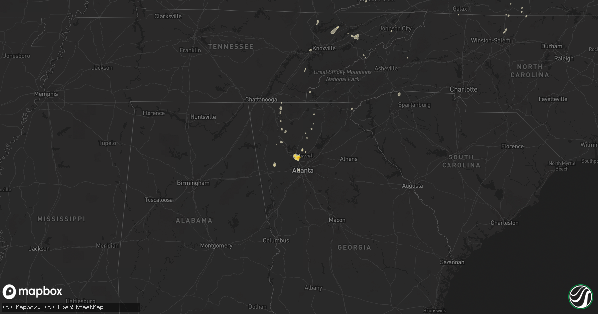
Hail Map on August 5, 2022
Get this storm
August 5 map
$229
one time, instant access
Download today. No call, no setup
Keep the $229
Bought the map and want the full workflow? Apply the entire $229 to a subscription within 7 days. None of it is wasted.
Every map, not just this one
This buys you this map. Subscription and you get every map we run, in the markets you choose from a few cities to whole states to nationwide. Plus real-time alerts the moment a storm fires.
Contact data
Name, contact info, occupancy, even credit band for addresses in the footprint. You go from where it hit to who to call.
Become the source they trust
Unlimited branding weather history reports on demand. You already have the documented answer ready for the property owner, and you are the one who showed up with it.
Property data and RoofTrace estimates
Pull up any address you have got, its value and the exact code rules for that jurisdiction, straight from One Click Code. Then RoofTrace estimates the squares, pitch, and roof value, priced the way you price.
States Impacted by Hail Map on August 5, 2022
Storm reports
Minnesota
| Date | Description |
|---|---|
| 08/05/20223:54 AM CDT | At 853 PM CDT, a severe thunderstorm was located near Debs, or 22 miles northwest of Bemidji, moving east at 55 mph. HAZARD...60 mph wind gusts and quarter size hail. SOURCE...Radar indicated. IMPACT...Hail damage to vehicles is expected. Expect wind damage to roofs, siding, and trees. This severe thunderstorm will be near... Little Rock around 855 PM CDT. Island Lake in Beltrami County and Red Lake around 900 PM CDT. Nebish and Redby around 905 PM CDT.Other locations in the path of this severe thunderstorm includeBlackduck, Shooks, Funkley and Kelliher. |
| 08/05/20223:41 AM CDT | At 841 PM CDT, a severe thunderstorm was located near Rollag, or 16 miles west of Detroit Lakes, moving east at 40 mph. HAZARD...60 mph wind gusts and quarter size hail. SOURCE...Radar indicated. IMPACT...Hail damage to vehicles is expected. Expect wind damage to roofs, siding, and trees. This severe thunderstorm will be near... Lake Park around 845 PM CDT. Cormorant around 850 PM CDT. Shoreham around 900 PM CDT.Other locations in the path of this severe thunderstorm includeDetroit Lakes, Frazee and Rochert. |
| 08/05/20223:37 AM CDT | At 837 PM CDT, a severe thunderstorm was located over eastern Lower Red Lake, or 34 miles north of Bemidji, moving northeast at 50 mph. HAZARD...60 mph wind gusts and half dollar size hail. SOURCE...Radar indicated. IMPACT...Hail damage to vehicles is expected. Expect wind damage to roofs, siding, and trees. This severe thunderstorm will be near... Saum around 840 PM CDT. Shotley around 845 PM CDT. Otto around 850 PM CDT. Waskish around 855 PM CDT. |
| 08/05/20223:19 AM CDT | At 818 PM CDT, a severe thunderstorm was located over western White Earth Nation, or 31 miles north of Detroit Lakes, moving northeast at 45 mph. HAZARD...60 mph wind gusts and half dollar size hail. SOURCE...Radar indicated. IMPACT...Hail damage to vehicles is expected. Expect wind damage to roofs, siding, and trees. This severe thunderstorm will be near... Beaulieu around 830 PM CDT. Naytahwaush around 835 PM CDT.Other locations in the path of this severe thunderstorm includeMahkonce, Island Lake in Mahnomen County, Roy Lake, Pine Bend, LowerRice Lake, Rice Lake and Ebro. |
| 08/05/20223:08 AM CDT | At 807 PM CDT, a severe thunderstorm was located over southern Red Lake Nation, or 28 miles northwest of Bemidji, moving east at 45 mph. HAZARD...60 mph wind gusts and quarter size hail. SOURCE...Radar indicated. IMPACT...Hail damage to vehicles is expected. Expect wind damage to roofs, siding, and trees. This severe thunderstorm will be near... Lower Red Lake around 810 PM CDT. Little Rock and Island Lake in Beltrami County around 815 PM CDT. Red Lake around 820 PM CDT. Redby around 825 PM CDT.Other locations in the path of this severe thunderstorm includePonemah. |
| 08/05/20223:01 AM CDT | At 801 PM CDT, a severe thunderstorm was located over Syre, or 29 miles northwest of Detroit Lakes, moving northeast at 30 mph. HAZARD...60 mph wind gusts and half dollar size hail. SOURCE...Radar indicated. IMPACT...Hail damage to vehicles is expected. Expect wind damage to roofs, siding, and trees. This severe thunderstorm will be near... Flom around 805 PM CDT. Faith around 820 PM CDT.Other locations in the path of this severe thunderstorm includeWaubun. |
| 08/05/20222:39 AM CDT | At 739 PM CDT, a severe thunderstorm was located near Averill, or 18 miles northeast of Fargo, moving northeast at 30 mph. HAZARD...60 mph wind gusts and quarter size hail. SOURCE...Radar indicated. IMPACT...Hail damage to vehicles is expected. Expect wind damage to roofs, siding, and trees. Locations impacted include... Ulen. |
| 08/04/20229:03 PM CDT | Hail across highway 89 just south of the casino. |
| 08/04/20228:34 PM CDT | At 133 PM CDT, a severe thunderstorm was located 10 miles southwest of Loman, or 27 miles southwest of International Falls, moving east at 45 mph. HAZARD...Ping pong ball size hail and 60 mph wind gusts. SOURCE...Radar indicated. IMPACT...People and animals outdoors will be injured. Expect hail damage to roofs, siding, windows, and vehicles. Expect wind damage to roofs, siding, and trees. This severe thunderstorm will be near... Loman around 145 PM CDT.Other locations in the path of this severe thunderstorm includeLittlefork and Pelland. |
| 08/04/20228:25 PM CDT | A number of 4 to 6 inch branches broken down. Wind gusted for about 5 minutes. |
| 08/04/20228:18 PM CDT | Quarter size hail covering the ground. Very heavy rain. |
| 08/04/20228:15 PM CDT | A few quarter sized hail and very strong winds. |
| 08/04/20227:55 PM CDT | Brief burst of hail. |
| 08/04/20227:40 PM CDT | Nickel to quarter size hail on and on for 2 to 3 minutes... Until 743 pm cdt. |
| 08/04/20227:35 PM CDT | Wind gusts to 60 mph along with half inch hail. Winds gusted until 738 pm cdt |
| 08/04/20227:15 PM CDT | A local report indicates 1.00 inch wind near 2 E MOORHEAD |
| 08/04/20227:15 PM CDT | Hail near hwy 10 at east edge of moorhead. |
Georgia
| Date | Description |
|---|---|
| 08/05/20225:20 PM CDT | A tree was downed onto an suv on i-575 at the exit to bells ferry road. No injuries reported. |
| 08/05/20225:10 PM CDT | Quarter to as large as ping-pong sized hail was reported on east piedmont rd near sandy plains rd. |
| 08/05/20221:12 AM CDT | At 612 PM EDT, a severe thunderstorm was located over Sweat Mountain, or over Mountain Park, moving north at 30 mph. HAZARD...Ping pong ball size hail. SOURCE...Radar indicated. IMPACT...People and animals outdoors will be injured. Expect damage to roofs, siding, windows, and vehicles. Locations impacted include... Marietta, Canton, Cumming, Mountain Park, Sandy Springs, Roswell, Alpharetta, Dunwoody, Milton, Kennesaw, Woodstock, Holly Springs, Free Home, Buffington, Fair Oaks, Mount Bethel, Hickory Flat, Drew, Sandy Plains and Lathemtown. |
Nebraska
| Date | Description |
|---|---|
| 08/05/20223:24 AM CDT | At 824 PM CDT, severe thunderstorms were located along a line extending from 10 miles south of Earling Hill to 2 miles north of Okreek to near Upper Cut Meat, moving southeast at 20 mph. HAZARD...70 mph wind gusts and penny size hail. SOURCE...Radar indicated. IMPACT...Expect considerable tree damage. Damage is likely to mobile homes, roofs, and outbuildings. Severe thunderstorms will be near... Okreek, Mosher and Haystack Butte around 830 PM CDT.Other locations in the path of these severe thunderstorms includeCarter, Hidden Timber, Rosebud, Fairgrounds Housing, Ideal andLakeview. |
| 08/04/202211:35 PM CDT | A local report indicates 1.00 inch wind near CROOKSTON |
Wyoming
| Date | Description |
|---|---|
| 08/05/202212:03 AM CDT | At 503 PM MDT, a severe thunderstorm was located near Big Piney, moving north at 30 mph. HAZARD...60 mph wind gusts and quarter size hail. SOURCE...Radar indicated. IMPACT...Hail damage to vehicles is expected. Expect wind damage to roofs, siding, and trees. Locations impacted include... Daniel. |
North Carolina
| Date | Description |
|---|---|
| 08/05/20225:10 PM CDT | Thunderstorm winds blew down one tree near the intersection of bethany road and honeysuckle road. |
| 08/05/20224:53 PM CDT | Thunderstorm winds blew down one tree near the intersection of bald hill loop and martin farm road. |
| 08/05/20224:02 PM CDT | Thunderstorm winds blew down one tree across the 600 block of riverside drive. |
| 08/04/202211:49 PM CDT | At 449 PM EDT, a severe thunderstorm was located over Eden, moving northeast at 15 mph. HAZARD...60 mph wind gusts and quarter size hail. SOURCE...Radar indicated. IMPACT...Hail damage to vehicles is expected. Expect wind damage to roofs, siding, and trees. Locations impacted include... Eden... Axton... Harrisons Crossroads... Draper... Aiken Summit... Sandy Level... and Cascade. |
| 08/04/20229:55 PM CDT | At 254 PM EDT, a severe thunderstorm was located over Westover Hills, or over Danville, moving east at 5 mph. HAZARD...60 mph wind gusts and quarter size hail. SOURCE...Radar indicated. IMPACT...Hail damage to vehicles is expected. Expect wind damage to roofs, siding, and trees. Locations impacted include... Danville... Providence... Blairs... Milton... Gatewood... Dry Fork... and Blanch. |
Texas
| Date | Description |
|---|---|
| 08/05/20224:30 PM CDT | Widespread wind damage reported across the city of mount pleasant. Trees and powerlines were reported down on happy street and near the intersection of hwy 67 and fm 14 |
| 08/05/20223:08 PM CDT | *** 1 inj *** nws storm survey confirmed a downburst with maximum winds estimated at 105 mph. 5 buildings at pinehurst apartments sustained roof damage with 15 hardwood |
| 08/05/20222:55 PM CDT | *** 1 inj *** reports of damage on east side of longview including tree falling on vehicle with one injury reported on audrey street; damage reported to southern auto p |
| 08/05/20222:55 PM CDT | *** 1 inj *** corrects previous downburst report from longview. Reports of damage on east side of longview including tree falling on vehicle with one injury reported on |
New Hampshire
| Date | Description |
|---|---|
| 08/05/20223:45 PM CDT | Large branches down across a stretch of dracut road in southern hudson. Numerous reports of downed branches and a few trees across town. Time estimated by radar. |
| 08/05/20221:45 PM CDT | Corrects previous tstm wnd dmg report from 4 sse hudson. Large branches down across a stretch of dracut road in southern hudson. Numerous reports of downed branches and |
| 08/05/20221:40 PM CDT | Tree fell on an accessory building near the golf course. Home weather station clocked wind gust at 58mph. Time estimated by radar. |
| 08/05/20221:14 PM CDT | Trees down in greeley park. Branches down on concord street north of downtown. Time estimated by radar. |
| 08/05/20221:06 PM CDT | Silver lake state park reported roof damage on two small buildings at the park. Time estimated by radar. |
| 08/05/20221:06 PM CDT | Reported by weather spotter: delayed report: two large trees |
| 08/05/20221:04 PM CDT | Trees and branches down on north end of nashua near the penichuck. Time estimated by radar. |
| 08/05/202212:59 PM CDT | Corrects previous tstm wnd dmg report from 1 nnw hollis. Multiple reports on social media and broadcast media on storm damage in hollis. Trees down across town. Time es |
| 08/05/20222:40 AM CDT | At 739 PM EDT, a severe thunderstorm was located near Hooksett, or 9 miles north of Auburn, moving southeast at 10 mph. HAZARD...60 mph wind gusts and quarter size hail. SOURCE...Radar indicated. IMPACT...Hail damage to vehicles is expected. Expect wind damage to roofs, siding, and trees. Locations impacted include... Manchester, Derry, Hooksett, Epping, Epsom, Raymond, Londonderry, Bow, Chester, Allenstown, Fremont, Deerfield, Candia, Nottingham and Pembroke.This includes Interstate 93 between mile markers 15 and 31. |
| 08/04/20229:43 PM CDT | At 242 PM EDT, a severe thunderstorm was located over Pelham, or 8 miles southwest of Salem, moving east at 25 mph. HAZARD...60 mph wind gusts and quarter size hail. SOURCE...Radar indicated. IMPACT...Hail damage to vehicles is expected. Expect wind damage to roofs, siding, and trees. Locations impacted include... Nashua, Pelham, Hudson and Windham. |
Florida
| Date | Description |
|---|---|
| 08/05/20224:20 PM CDT | Public pictures of nickel to quarter size hail in charlotte harbor reported by broadcast media. |
| 08/05/20222:45 PM CDT | Duke energy utility company reported power outages north of reddick near nw 160th street and nw 43 court due to trees and limbs blown down onto utility equipment. The t |
| 08/05/20222:22 PM CDT | Duke energy reported power outages off of ne 45th terrace due to trees and limbs blown down onto powerlines. The time of damage was based on radar. |
| 08/05/202212:19 AM CDT | At 519 PM EDT, a severe thunderstorm was located over Port Charlotte, moving west at 20 mph. HAZARD...60 mph wind gusts and quarter size hail. SOURCE...Radar indicated. IMPACT...Hail damage to vehicles is expected. Expect wind damage to roofs, siding, and trees. Locations impacted include... North Port, Punta Gorda, Murdock, Gulf Cove, El Jobean, Palm Island, Harbour Heights, Rotonda, Charlotte Park and Cleveland. |
| 08/04/202210:14 PM CDT | At 313 PM EDT, a severe thunderstorm was located near Anthony, or near Fort McCoy, moving west at 10 mph. HAZARD...60 mph wind gusts and penny size hail. SOURCE...Radar indicated. IMPACT...Expect damage to roofs, siding, and trees. Locations impacted include... Anthony and Burbank. |
Delaware
| Date | Description |
|---|---|
| 08/05/20223:30 PM CDT | 911 call center reports tree limbs down on east grove street in delmar. Time estimated via radar. |
| 08/04/202211:13 PM CDT | At 413 PM EDT, severe thunderstorms were located along a line extending from near Salisbury to near Salisbury University to near Parsonsburg, moving north at 20 mph. HAZARD...60 mph wind gusts and penny size hail. SOURCE...Radar indicated. IMPACT...Expect damage to trees and powerlines. Severe thunderstorms will be near... Delmar around 425 PM EDT. Parsonsburg around 430 PM EDT.Other locations impacted by these severe thunderstorms includeMelson, Salisbury-Wicomico, Chesapeake Heights, Pittsville andLakewood. |
South Carolina
| Date | Description |
|---|---|
| 08/05/202212:16 AM CDT | At 516 PM EDT, a severe thunderstorm was located 9 miles south of Columbus, or 5 miles southwest of Landrum, moving northeast at 5 mph. HAZARD...60 mph wind gusts and penny size hail. SOURCE...Radar indicated. IMPACT...Expect damage to trees and power lines. Locations impacted include... Columbus, Landrum, Tryon, Campobello, Gowensville, Glassy Mountain, Saluda, Tigerville, Green Creek and North Saluda Reservoir. |
Missouri
| Date | Description |
|---|---|
| 08/05/20224:55 PM CDT | Severe thunderstorm wind gusts downed a tree across the intersection of pythian and fremont streets. |
| 08/05/20224:55 PM CDT | Severe thunderstorm wind gusts downed a tree at 1160 south virginia st. In central springfield. |
| 08/04/202211:36 PM CDT | At 435 PM CDT, a severe thunderstorm was located over Springfield, moving southeast at 10 mph. HAZARD...60 mph wind gusts and penny size hail. SOURCE...Radar indicated. IMPACT...Expect damage to roofs, siding, and trees. Locations impacted include... Springfield... Nixa... Ozark... Battlefield... Fremont Hills... Brookline... Galloway... This includes Interstate 44 between mile markers 75 and 80. |
Kentucky
| Date | Description |
|---|---|
| 08/05/20223:52 PM CDT | A tree was downed onto ky-38 approximately 0.5 mile toward harlan from the harlan county detention center. The event time is radar estimated. |
| 08/04/202211:38 PM CDT | At 438 PM EDT, severe thunderstorms were located along a line extending from 8 miles south of Hensley Store to 7 miles southeast of Russellville, moving northeast at 30 mph. HAZARD...60 mph wind gusts and nickel size hail. SOURCE...Radar indicated. IMPACT...Expect damage to roofs, siding, and trees. Locations impacted include... Morristown, Rogersville, Sneedville, Jonesville, Bean Station, Surgoinsville, Pennington Gap, Russellville, Church Hill and Mosheim.This includes Interstate 81 in Tennessee between mile markers 14 and39. |
| 08/04/20229:32 PM CDT | At 232 PM EDT, a severe thunderstorm was located over Wabp, or near Mount Vernon, moving northeast at 25 mph. HAZARD...60 mph wind gusts and quarter size hail. SOURCE...Radar indicated. IMPACT...Hail damage to vehicles is expected. Expect wind damage to roofs, siding, and trees. This severe thunderstorm will be near... Burr around 240 PM EDT. Lake Linville around 245 PM EDT. Mount Vernon around 250 PM EDT.Other locations in the path of this severe thunderstorm includeRoundstone, Conway and Snider. |
Utah
| Date | Description |
|---|---|
| 08/04/20228:56 PM CDT | At 155 PM MDT, a severe thunderstorm was located 11 miles north of Tabiona, or 26 miles northwest of Duchesne, moving northeast at 25 mph. HAZARD...60 mph wind gusts and quarter size hail. SOURCE...Radar indicated. IMPACT...Hail damage to vehicles is expected. Expect wind damage to roofs, siding, and trees. Locations impacted include... Kings Peak and Moon Lake. |
North Dakota
| Date | Description |
|---|---|
| 08/05/20225:08 AM CDT | At 1008 PM CDT, a severe thunderstorm was located 8 miles east of McLeod, or 27 miles northwest of Wahpeton, moving northeast at 35 mph. HAZARD...60 mph wind gusts and half dollar size hail. SOURCE...Radar indicated. IMPACT...Hail damage to vehicles is expected. Expect wind damage to roofs, siding, and trees. Locations impacted include... Colfax, Walcott, Christine, Abercrombie, McCauleyville, Wolverton and Comstock.This includes Interstate 29 between mile markers 31 and 55. |
| 08/05/20224:20 AM CDT | At 920 PM CDT, a severe thunderstorm was located near Gwinner, or 46 miles west of Wahpeton, moving east at 55 mph. HAZARD...60 mph wind gusts and quarter size hail. SOURCE...Radar indicated. IMPACT...Hail damage to vehicles is expected. Expect wind damage to roofs, siding, and trees. This severe thunderstorm will be near... Milnor around 930 PM CDT. De Lamere and Hamlin around 935 PM CDT. McLeod around 940 PM CDT.Other locations in the path of this severe thunderstorm includeWyndmere and Barney.This includes Interstate 29 between mile markers 19 and 33. |
| 08/05/20223:02 AM CDT | At 802 PM CDT, a severe thunderstorm was located near Fort Sisseton State Park, or 8 miles east of Langford, moving northeast at 40 mph. HAZARD...Golf ball size hail and 60 mph wind gusts. SOURCE...Radar indicated. IMPACT...People and animals outdoors will be injured. Expect hail damage to roofs, siding, windows, and vehicles. Expect wind damage to roofs, siding, and trees. This severe thunderstorm will be near... Fort Sisseton State Park and Opitz Lake around 810 PM CDT. Eden and Cattail Lake around 815 PM CDT. Roy Lake Rec Area around 820 PM CDT.Other locations in the path of this severe thunderstorm include LakeCity, Red Iron Housing, Clear Lake Rec Area, Hillhead, Veblen andSica Hollow State Park. |
| 08/05/20221:58 AM CDT | At 657 PM CDT, a severe thunderstorm was located over southwestern Fargo, moving east at 30 mph. HAZARD...60 mph wind gusts and quarter size hail. SOURCE...Radar indicated. IMPACT...Hail damage to vehicles is expected. Expect wind damage to roofs, siding, and trees. This severe thunderstorm will be near... Briarwood around 700 PM CDT. Fargo and North River around 705 PM CDT. Dilworth, Moorhead and Oakport around 710 PM CDT.Other locations in the path of this severe thunderstorm includeGlyndon and Averill.This includes the following highways... Interstate 29 between mile markers 59 and 70. Interstate 94 in North Dakota between mile markers 344 and 352. Interstate 94 in Minnesota between mile markers 1 and 11. |
| 08/04/20229:55 PM CDT | Sheets of hail in periods of very heavy rain. |
| 08/04/20229:15 PM CDT | Peak wind measured at the gwinner airport /kgwr/. |
New York
| Date | Description |
|---|---|
| 08/05/20225:00 PM CDT | Tree down on park ave. Via county dispatch feed. Radar estimated time. |
Maryland
| Date | Description |
|---|---|
| 08/05/20226:09 PM CDT | Tree down in the 1600 block of stone dr. |
| 08/05/20226:07 PM CDT | Tree down in the 5400 block of school house rd. |
| 08/05/20225:05 PM CDT | Tree down at the intersection of and ridge rd. Md-295 |
| 08/05/20224:49 PM CDT | Multiple trees down near the intersection of md-295 and md-100. |
| 08/05/20224:45 PM CDT | Tree down at the intersection of md-295 and md-175. |
| 08/05/20224:42 PM CDT | Trees down along church lane and three bridge branch road. Also reports of hail nearby... Though no estimate of hail size was given. Time estimated via radar. |
| 08/05/20224:40 PM CDT | Multiple trees down along hailem school road near easton... Md. Time estimated via radar. |
| 08/05/20223:44 PM CDT | Tree down onto power lines near the intersection of bowie rd and port tobacco rd. |
| 08/05/20223:22 PM CDT | A local report indicates 1.00 inch wind near 3 S DELMAR |
| 08/05/20221:29 AM CDT | At 629 PM EDT, severe thunderstorms were located along a line extending from Greenwell State Park to 7 miles northwest of Leonardtown, moving northeast at 20 mph. HAZARD...60 mph wind gusts. SOURCE...Radar indicated. IMPACT...Damaging winds will cause some trees and large branches to fall. This could injure those outdoors, as well as damage homes and vehicles. Roadways may become blocked by downed trees. Localized power outages are possible. Unsecured light objects may become projectiles. Locations impacted include... Leonardtown, Cuckold Creek, Greenwell State Park, Saint Leonard Creek, Town Creek, California, Lusby, Saint Leonard, Hollywood, Long Beach, Calvert Beach, Bushwood, Clements, Chaptico, Sandgates, Sotterley, Loveville, Oakley, Compton and Morganza. |
| 08/05/202212:44 AM CDT | At 544 PM EDT, a severe thunderstorm was located over Elkridge, moving north at 20 mph. HAZARD...60 mph wind gusts. SOURCE...Radar indicated. IMPACT...Damaging winds will cause some trees and large branches to fall. This could injure those outdoors, as well as damage homes and vehicles. Roadways may become blocked by downed trees. Localized power outages are possible. Unsecured light objects may become projectiles. Locations impacted include... Baltimore, Columbia, Severn, Pikesville, Elkridge, Baltimore-Washington Airport, Historic Ellicott City, Ellicott City, Catonsville, Woodlawn, Odenton, Randallstown, Owings Mills, Milford Mill, Lochearn, Arbutus, Ferndale, Brooklyn Park, Fort Meade and Savage-guilford. |
| 08/05/202212:37 AM CDT | At 536 PM EDT, a severe thunderstorm was located over Cordova, or near Easton, and is nearly stationary. HAZARD...60 mph wind gusts and quarter size hail. SOURCE...Radar indicated. IMPACT...Minor damage to vehicles is possible. Wind damage to roofs, siding, trees, and power lines is possible. Locations impacted include... Easton, Queen Anne, Matthews, Tanyard, Wye Mills, Griffin, Skipton, Copperville, Cordova, Harmony and Hillsboro. |
| 08/04/202211:52 PM CDT | At 452 PM EDT, a severe thunderstorm was located 7 miles northwest of Port Tobacco River, moving north at 10 mph. HAZARD...60 mph wind gusts. SOURCE...Radar indicated. IMPACT...Damaging winds will cause some trees and large branches to fall. This could injure those outdoors, as well as damage homes and vehicles. Roadways may become blocked by downed trees. Localized power outages are possible. Unsecured light objects may become projectiles. Locations impacted include... Bryans Road, Potomac Heights, Pomfret, Marbury, Pisgah, Welcome, Ironsides, Ripley and Rison. |
| 08/04/202211:23 PM CDT | At 423 PM EDT, a severe thunderstorm was located over Delmar, or near Salisbury, moving north at 15 mph. HAZARD...60 mph wind gusts and nickel size hail. SOURCE...Radar indicated. IMPACT...Damage to roofs, siding, trees, and power lines is possible. Locations impacted include... Laurel, Delmar, Sycamore and Bethel. |
Pennsylvania
| Date | Description |
|---|---|
| 08/05/20224:35 PM CDT | A single tree was downed across old route 86 at lewis road in washington township. Time estimated via radar. |
| 08/05/20223:40 PM CDT | A single tree was downed across west greene rd outside of waterford. Time estimated via radar. |
| 08/05/20222:55 AM CDT | At 755 PM EDT, a severe thunderstorm was located over Yoe, moving north at 10 mph. HAZARD...60 mph wind gusts and penny size hail. SOURCE...Radar indicated. IMPACT...Expect damage to roofs, siding, and trees. Locations impacted include... York, Red Lion, Spry, Dallastown, East York, Stonybrook-Wilshire, Tyler Run-Queens Gate, Hallam, Wrightsville, Yorklyn, Windsor and Yoe.This includes Interstate 83 from mile markers 15 to 19. |
| 08/04/20229:32 PM CDT | At 232 PM EDT, a severe thunderstorm was located over Bedford, moving east at 10 mph. HAZARD...60 mph wind gusts and penny size hail. SOURCE...Radar indicated. IMPACT...Expect damage to roofs, siding, and trees. Locations impacted include... Bedford, Everett, Buffalo Mills, Cessna, Indian Lake, Schellsburg, Manns Choice, New Paris and New Baltimore.This includes the following Interstates... The Pennsylvania Turnpike from mile markers 126 to 155. Interstate 99 from mile markers 0 to 6. |
| 08/04/20229:09 PM CDT | At 208 PM EDT, a severe thunderstorm was located near Pocono Pines, or 8 miles west of Mount Pocono, and is nearly stationary. HAZARD...60 mph wind gusts and penny size hail. SOURCE...Radar indicated. IMPACT...Damage to roofs, siding, trees, and power lines is possible. Locations impacted include... Blakeslee, Long Pond, Albrightsville, Pocono Pines, Pocono Raceway, Lake Harmony, Arrowhead Lake and Meckesville.This includes the following highways... Interstate 80 in Pennsylvania between mile markers 283 and 299. Interstate 380 in Pennsylvania between mile markers 0 and 4. |
New Jersey
| Date | Description |
|---|---|
| 08/05/20226:09 PM CDT | Reports of trees down on wires on lakewood-farmingdale road. Time estimated via radar. |
| 08/05/20225:36 PM CDT | Trained spotter reports a large tree down. Picture provided via social media. Time estimated via radar. |
| 08/05/20222:06 AM CDT | At 705 PM EDT, a cluster of severe thunderstorms were located over Browns Mills and across portions of northern Ocean County, moving northeast at 15 mph. HAZARD...60 mph wind gusts and quarter size hail. SOURCE...Radar indicated. IMPACT...Minor damage to vehicles is possible. Wind damage to roofs, siding, trees, and power lines is possible. Locations impacted include... Toms River, Lakewood, Jackson, Lakehurst, Pemberton, Wrightstown, Cassville, Vista Center, Leisure Village, Woodruff, Six Flags Theme Park, Cedar Glen West, Browns Mills, Jacksons Mills, Leisure Village East, Leisure Village West-Pine Lake Park, Country Lake Estates, Leisure Knoll, New Egypt and Fort Dix.This includes the following highways... Interstate 195 in New Jersey between mile markers 17 and 26. Garden State Parkway between mile markers 88 and 91. |
| 08/05/20221:26 AM CDT | At 625 PM EDT, a severe thunderstorm was located over Lakewood, or 9 miles north of Toms River, moving northeast at 5 mph. Another storm was located over Joint Base, also moving northeast at 5 mph. HAZARD...60 mph wind gusts and quarter size hail. SOURCE...Radar indicated. IMPACT...Minor damage to vehicles is possible. Wind damage to roofs, siding, trees, and power lines is possible. Locations impacted include... Toms River, Lakewood, Jackson, Howell, Lakehurst, Cassville, Adelphia, Vista Center, Allenwood, Ramtown, Cedar Glen West, Freewood Acres, Jacksons Mills, West Freehold, Brielle and Leisure Knoll.This includes the following highways... Interstate 195 in New Jersey between mile markers 22 and 32. Garden State Parkway between mile markers 91 and 96. |
New Mexico
| Date | Description |
|---|---|
| 08/04/202210:11 PM CDT | At 311 PM MDT, a severe thunderstorm was located 14 miles east of Engle, moving northwest at 15 mph. HAZARD...Quarter size hail. SOURCE...Radar indicated. IMPACT...Damage to vehicles is expected. This severe thunderstorm will remain over mainly rural areas of northeastern Sierra County. |
District of Columbia
| Date | Description |
|---|---|
| 08/05/20223:49 PM CDT | Tree down in the 2100 block of lafayette ave ne. |
| 08/05/20223:49 PM CDT | Tree down near the instersection of buchanan st se and 10th st ne. |
| 08/05/20223:26 PM CDT | Tree down in the 3900 block of clay pl ne. |
| 08/04/202211:45 PM CDT | At 445 PM EDT, a severe thunderstorm was located over Bladensburg, moving north at 10 mph. HAZARD...60 mph wind gusts. SOURCE...Radar indicated. IMPACT...Damaging winds will cause some trees and large branches to fall. This could injure those outdoors, as well as damage homes and vehicles. Roadways may become blocked by downed trees. Localized power outages are possible. Unsecured light objects may become projectiles. Locations impacted include... College Park, Greenbelt, Langley Park, Beltsville, Largo, Bladensburg, University of Maryland, Fedex Field, Gallaudet University, Fort Totten, RFK Stadium, Fairland, Landover, Hyattsville, White Oak, Takoma Park, East Riverdale, Adelphi, Colesville and Kettering. |
Massachusetts
| Date | Description |
|---|---|
| 08/05/20223:45 PM CDT | Many large trees and limbs down between rt. 9 and rt. 30. Parkerville and deerfoot roads closed. Relayed by amateur radio. |
| 08/05/20223:37 PM CDT | Large branch blocking half the roadway. Relayed by amateur radio. |
| 08/05/20223:28 PM CDT | Multiple tree branches down at adams street at hillsdale. Relayed by amateur radio. |
| 08/05/20223:17 PM CDT | Tree limb and wires down in front yard of home on willow street. Relayed by amateur radio. |
| 08/05/20223:15 PM CDT | Tree down blocking right lane of the road. Relayed by amateur radio. |
| 08/05/20223:15 PM CDT | Tree on roadway. Relayed by amateur radio. |
| 08/05/20223:15 PM CDT | Tree down on car... No injuries. Relayed by amateur radio. |
| 08/05/20223:15 PM CDT | Multiple tree branches down in the roadway. Relayed by amateur radio. |
| 08/05/20223:15 PM CDT | Tree down on ivring street. Relayed by amateur radio. |
| 08/05/20223:15 PM CDT | Tree and wires down. Relayed by amateur radio. |
| 08/05/20223:09 PM CDT | Tree down blocking the southbound lane of canton ave by dollar lane. Relayed by amateur radio. |
| 08/05/20222:48 PM CDT | Large limb down at middle road and depot road. Relayed by amateur radio. |
| 08/05/20222:35 PM CDT | Tree down at 100 block of main street and 700 block of main street. Relayed by amateur radio. |
| 08/05/20222:33 PM CDT | Large branch down on massachusetts ave near kelly corner. Relayed by amateur radio. |
| 08/05/20221:55 PM CDT | Large tree down blocking portion of merrimack ave per p.d. Relayed my amateur radio. |
| 08/05/20221:55 PM CDT | Large branch... Estimated 1 foot in diameter down across hildreth street. Relayed my amateur radio. |
| 08/05/20221:53 PM CDT | Tree down on high tension wires on billings street... Lowell. Relayed by amateur radio. |
| 08/04/202211:10 PM CDT | At 410 PM EDT, a severe thunderstorm was located over Newton, moving east at 15 mph. HAZARD...60 mph wind gusts and penny size hail. SOURCE...Radar indicated. IMPACT...Expect damage to trees and power lines. Locations impacted include... Boston, Cambridge, Quincy, Newton, Somerville, Waltham, Brookline, Medford, Revere, Arlington, Everett, Braintree, Chelsea, Watertown, Needham, Wellesley, Milton, Belmont, Dedham and Winthrop. |
| 08/04/202210:24 PM CDT | At 324 PM EDT, a severe thunderstorm was located over Acton, or 9 miles southwest of Chelmsford, moving east at 15 mph. HAZARD...60 mph wind gusts and quarter size hail. SOURCE...Radar indicated. IMPACT...Expect wind damage to trees and power lines. Minor hail damage to vehicles is possible. Locations impacted include... Waltham, Arlington, Billerica, Woburn, Lexington, Belmont, Burlington, Acton, Concord, Sudbury, Bedford, Weston, Maynard, Littleton, Stow, Lincoln, Boxborough and Carlisle. |
| 08/04/20229:41 PM CDT | At 241 PM EDT, a severe thunderstorm was located over Pelham, or near Amherst, moving east at 15 mph. HAZARD...60 mph wind gusts and penny size hail. SOURCE...Radar indicated. IMPACT...Expect damage to trees and power lines. Locations impacted include... Ware, Barre, West Brookfield, Hardwick, Shutesbury, Pelham, Petersham, New Braintree and New Salem. |
West Virginia
| Date | Description |
|---|---|
| 08/05/20226:50 PM CDT | Mcdowell county 911 advised there are several trees down in the town of paynesville. Time estimated by radar. |
| 08/05/20226:47 PM CDT | Mcdowell county 911 reported a tree down on coal heritage road near town of kimball. Time estimated by radar. |
| 08/05/20226:24 PM CDT | Buchanan county 911 center advised there is a tree down at state line ridge road at the state line. Time was estimated by radar. |
| 08/05/20223:26 PM CDT | A local report indicates 64 MPH wind near 3 NE CHARLESTON |
| 08/05/202212:57 PM CDT | Tree down near ruddle park off of hwy 220. |
| 08/05/20222:31 AM CDT | At 730 PM EDT, a severe thunderstorm was located over Welch, moving northeast at 15 mph. HAZARD...60 mph wind gusts and penny size hail. SOURCE...Radar indicated. IMPACT...Expect damage to roofs, siding, and trees. Locations impacted include... Welch, Gary, Northfork, Keystone and Kimball. |
| 08/05/20222:17 AM CDT | At 717 PM EDT, a severe thunderstorm was located near Oceana, or 12 miles north of Pineville, moving southeast at 15 mph. HAZARD...60 mph wind gusts and quarter size hail. SOURCE...Radar indicated. IMPACT...Hail damage to vehicles is expected. Expect wind damage to roofs, siding, and trees. Locations impacted include... Oceana, Twin Falls State Park, Amherstdale-Robinette, Lester, Kopperston, Cyclone, Bolt and Maben. |
| 08/05/20222:10 AM CDT | At 710 PM EDT, a severe thunderstorm was located 8 miles northwest of Glen Burke, or 8 miles east of Grundy, moving northeast at 10 mph. HAZARD...60 mph wind gusts. SOURCE...Radar indicated. IMPACT...Expect damage to roofs, siding, and trees. Locations impacted include... Bradshaw and Jolo. |
| 08/05/20221:23 AM CDT | At 623 PM EDT, a severe thunderstorm was located over Raven, or near Richlands, moving north at 10 mph. HAZARD...60 mph wind gusts and penny size hail. SOURCE...Radar indicated. IMPACT...Expect damage to roofs, siding, and trees. Locations impacted include... Grundy, Davenport, Big Rock, Stacy, Vansant, Hurley, Oakwood and Roseann. |
| 08/04/20228:37 PM CDT | At 136 PM EDT, a severe thunderstorm was located near Upper Tract, or near Franklin, moving east at 10 mph. HAZARD...60 mph wind gusts and quarter size hail. SOURCE...Radar indicated. IMPACT...Damaging winds will cause some trees and large branches to fall. This could injure those outdoors, as well as damage homes and vehicles. Roadways may become blocked by downed trees. Localized power outages are possible. Unsecured light objects may become projectiles. Locations impacted include... Franklin, Upper Tract, Ruddle and Deer Run. |
Virginia
| Date | Description |
|---|---|
| 08/05/20226:12 PM CDT | Tree reported down on slate creek road blocking two lanes. Time estimated from radar. |
| 08/05/20226:00 PM CDT | Virginia state police dispatch advised one of their troopers reported a tree down 1000 block of cydney circle at keen mountain camp road. Time estimated by radar. |
| 08/05/20225:46 PM CDT | Thunderstorm winds blew down multiple trees in buchanan. |
| 08/05/20225:43 PM CDT | Thunderstorm winds blew down multiple trees in blue ridge. |
| 08/05/20225:36 PM CDT | Buchanan county 911 center advised there is a tree down on patterson road and route 638. Time was estimated by radar. |
| 08/05/20225:30 PM CDT | Thunderstorm winds blew down multiple trees in troutville. |
| 08/05/20225:25 PM CDT | Thunderstorm winds blew down multiple trees in daleville. |
| 08/05/20225:24 PM CDT | Dickenson county 911 center reported a tree down on dante mountain road in the community of nora. Time is estimated by radar. |
| 08/05/20225:19 PM CDT | Dickenson county 911 advised there is a tree down on poker flats road in nora. Time was estimated by radar. |
| 08/05/20225:00 PM CDT | Trees down in dungannon. Time estimated from radar. |
| 08/05/20224:50 PM CDT | Several trees down in fort blackmore. Time estimated from radar. |
| 08/05/20224:41 PM CDT | Tree down on leavells rd. Naer smith station rd. |
| 08/05/20224:40 PM CDT | Tree down blocking both lanes of the road. |
| 08/05/20224:30 PM CDT | Tree down at wagner road and campground road. Another tree down a short distance away on wagner road. |
| 08/05/20224:30 PM CDT | Trees down in jasper community. Time estimated from radar. |
| 08/05/20224:30 PM CDT | Trees down in duffield. Time estimated from radar. |
| 08/05/20224:20 PM CDT | Trees and power lines down on holly st. |
| 08/05/20224:20 PM CDT | Trees down in dryden. Time estimated from radar. |
| 08/05/20224:15 PM CDT | A local report indicates 1.00 inch wind near ONANCOCK |
| 08/05/20224:05 PM CDT | Trees down in jonesville. Time estimated by radar. |
| 08/05/20224:00 PM CDT | Thunderstorm winds blew down one tree on to the 1000 block of barker road. |
| 08/05/20223:55 PM CDT | Large oak tree down on semmes ave blocking the road. |
| 08/05/20223:49 PM CDT | Tree down at the intersection of rober e. Lee dr. And seays rd. |
| 08/05/20223:45 PM CDT | Report from mping: quarter |
| 08/05/20223:25 PM CDT | Thunderstorm winds blew down multiple trees between bassett and stanleytown. |
| 08/05/20223:10 PM CDT | Thunderstorm winds blew down multiple trees in ridgeway. |
| 08/05/20223:10 PM CDT | Trees down east of highway 13. |
| 08/05/20223:07 PM CDT | Tree down near the 100 block of old church rd. |
| 08/05/20223:05 PM CDT | Trees down near 288 east of manakin. |
| 08/05/20222:23 PM CDT | Thunderstorm winds blew down powerlines near the intersection of loyal street and lynn street. |
| 08/05/20222:23 PM CDT | Thunderstorm winds blew down a tree and powerlines near the intersection of colquohoun street and dame street. |
| 08/05/20222:20 PM CDT | Corrects previous tstm wnd dmg report from 2 ssw danville city. A tree was blown down by thunderstorm winds and fell across the road on milton avenue. |
| 08/05/20222:15 PM CDT | Trees down on nocks landing rd. |
| 08/05/20222:10 PM CDT | Thunderstorm winds blew down several trees along south main street between route 58 and the dan river. A few of them were close to the danville community college. |
| 08/05/20221:50 PM CDT | Thunderstorm winds blew down two trees on riverside drive. |
| 08/05/20227:37 AM CDT | At 1237 AM EDT, a severe thunderstorm was located over North Potomac, or over Gaithersburg, moving east at 25 mph. HAZARD...60 mph wind gusts. SOURCE...Radar indicated. IMPACT...Damaging winds will cause some trees and large branches to fall. This could injure those outdoors, as well as damage homes and vehicles. Roadways may become blocked by downed trees. Localized power outages are possible. Unsecured light objects may become projectiles. Locations impacted include... Columbia, Germantown, Rockville, Bethesda, Gaithersburg, Olney, Beltsville, Aspen Hill, Potomac, North Bethesda, Montgomery Village, North Potomac, Fairland, White Oak, Redland, Great Falls, Colesville, Kemp Mill, North Kensington and South Kensington. |
| 08/05/20221:24 AM CDT | At 624 PM EDT, severe thunderstorms were located along a line extending from near Springwood to near Cave Spring, moving east at 20 mph. HAZARD...60 mph wind gusts. SOURCE...Radar indicated. IMPACT...Expect damage to roofs, siding, and trees. Locations impacted include... Roanoke... Salem... Vinton... Buchanan... Troutville... Stewartsville... and Montvale. |
| 08/05/20221:07 AM CDT | At 607 PM EDT, a severe thunderstorm was located near Clintwood, moving northeast at 15 mph. HAZARD...60 mph wind gusts and penny size hail. SOURCE...Radar indicated. IMPACT...Expect damage to roofs, siding, and trees. Locations impacted include... Clintwood, Haysi, Breaks Interstate, John Flannagan Lake, Trammel, Clinchco, Nora and McClure. |
| 08/05/20221:00 AM CDT | At 559 PM EDT, severe thunderstorms were located along a line extending from near Hadensville to near Goochland to near Moseley, moving east to northeast at 20 mph. HAZARD...60 mph wind gusts and quarter size hail. SOURCE...Radar indicated. IMPACT...Minor damage to vehicles is possible. Expect wind damage to trees and powerlines. Severe thunderstorms will be near... Moseley around 605 PM EDT. Oilville around 610 PM EDT. Sabot around 615 PM EDT. Manakin around 620 PM EDT. Gum Spring around 625 PM EDT. Tuckahoe around 630 PM EDT. Wyndham and Chesterfield Court House around 635 PM EDT. Laurel and Glen Allen around 645 PM EDT.Other locations impacted by these severe thunderstorms includeOrchid, Crozier, Rock Castle, Pilkinton, Vontay, Maidens, ThreeSquare, Irwin, Johnsons Springs and Pocahontas State Park. |
| 08/05/202212:57 AM CDT | At 556 PM EDT, severe thunderstorms were located along a line extending from near Payne Gap to 8 miles northeast of Gate City to near Quarry, moving northeast at 35 mph. HAZARD...60 mph wind gusts and penny size hail. SOURCE...Radar indicated. IMPACT...Expect damage to roofs, siding, and trees. Locations impacted include... Norton, Lebanon, Wise, Cleveland Va, Coeburn, Glade Spring, Honaker, Pound, St. Paul and Nickelsville.This includes Interstate 81 in Virginia between mile markers 23 and32. |
| 08/05/202212:40 AM CDT | At 540 PM EDT, a severe thunderstorm was located over Lewis Creek, or 9 miles south of Whitesburg, moving northeast at 40 mph. HAZARD...60 mph wind gusts and penny size hail. SOURCE...Radar indicated. IMPACT...Expect damage to roofs, siding, and trees. This severe thunderstorm will be near... Eolia around 550 PM EDT. Whitesburg around 555 PM EDT. Mayking around 600 PM EDT.Other locations in the path of this severe thunderstorm includeWhitaker and Jenkins. |
| 08/04/202211:45 PM CDT | At 445 PM EDT, a severe thunderstorm was located over Onley, or 11 miles northeast of Exmore, moving southwest at 10 mph. HAZARD...60 mph wind gusts and quarter size hail. SOURCE...Radar indicated. IMPACT...Minor damage to vehicles is possible. Expect wind damage to trees and powerlines. This severe thunderstorm will be near... Willis Wharf around 530 PM EDT.Other locations impacted by this severe thunderstorm includeLocustville, Harborton, Melfa, Pungoteague, Painter, Tasley, Keller,Quinby, Wachapreague and Accomac. |
| 08/04/202211:43 PM CDT | At 442 PM EDT, a severe thunderstorm was located near Bon Air, moving north at 10 mph. HAZARD...60 mph wind gusts and nickel size hail. SOURCE...Radar indicated. IMPACT...Expect damage to trees and powerlines. This severe thunderstorm will be near... Bon Air, University Of Richmond and Downtown Richmond around 515 PM EDT.Other locations impacted by this severe thunderstorm includePocahontas State Park, Beach, Midlothian, Subletts and Chesterfield. |
| 08/04/202211:21 PM CDT | At 421 PM EDT, a severe thunderstorm was located near Sabot, or 8 miles east of Goochland, moving north at 15 mph. HAZARD...60 mph wind gusts and penny size hail. SOURCE...Radar indicated. IMPACT...Expect damage to trees and powerlines. This severe thunderstorm will be near... Oilville around 430 PM EDT. Montpelier around 500 PM EDT.Other locations impacted by this severe thunderstorm includeRockville, Dabneys, Crozier, Vontay, Johnsons Springs, Goodall andMabelton. |
| 08/04/202211:01 PM CDT | At 401 PM EDT, a severe thunderstorm was located over Manakin, or 7 miles west of Tuckahoe, moving north at 10 mph. HAZARD...60 mph wind gusts and penny size hail. SOURCE...Radar indicated. IMPACT...Expect damage to trees and powerlines. This severe thunderstorm will be near... Manakin around 410 PM EDT. Sabot around 415 PM EDT.Other locations impacted by this severe thunderstorm include Crozier,Fine Creek Mills, Maidens, Holly Hills, Johnsons Springs, Midlothianand Subletts. |
| 08/04/202210:54 PM CDT | At 354 PM EDT, a severe thunderstorm was located near Bull Run, or 8 miles northwest of Dale City, and is nearly stationary. HAZARD...60 mph wind gusts. SOURCE...Radar indicated. IMPACT...Damaging winds will cause some trees and large branches to fall. This could injure those outdoors, as well as damage homes and vehicles. Roadways may become blocked by downed trees. Localized power outages are possible. Unsecured light objects may become projectiles. Locations impacted include... Linton Hall, Bull Run, Manassas, Sudley, Manassas Park, Independent Hill, Nokesville and Aden. |
| 08/04/202210:46 PM CDT | At 346 PM EDT, a severe thunderstorm was located near Parksley, or 20 miles south of Pocomoke City, and is nearly stationary. HAZARD...60 mph wind gusts. SOURCE...Radar indicated. IMPACT...Expect damage to trees and powerlines. Locations impacted include... Parksley, Accomac, Bloxom, Nelsonia, Modest Town and Mappsville. |
| 08/04/20228:57 PM CDT | At 157 PM EDT, a severe thunderstorm was located near Big Meadows, or 9 miles northwest of Madison, moving east at 5 mph. HAZARD...60 mph wind gusts and quarter size hail. SOURCE...Radar indicated. IMPACT...Damaging winds will cause some trees and large branches to fall. This could injure those outdoors, as well as damage homes and vehicles. Roadways may become blocked by downed trees. Localized power outages are possible. Unsecured light objects may become projectiles. Locations impacted include... Big Meadows, Criglersville, Banco, Etlan, Nethers, Haywood, Aylor and Syria. |
South Dakota
| Date | Description |
|---|---|
| 08/05/20226:59 PM CDT | Mesonet station rfps2 vivian 13 n. |
| 08/05/20226:48 PM CDT | 2 to 4 inch diameter branches down and one elm tree snapped. Pea to quarter sized hail. Time estimated from radar. |
| 08/05/20226:47 PM CDT | Relayed via social media with photo. Approximate time and location. |
| 08/05/20226:40 PM CDT | 70-80 mph winds. |
| 08/05/20226:30 PM CDT | Many limbs downed... 3-4 inches of rain... Small hail. |
| 08/05/20226:20 PM CDT | A semi jack knifed on southbound us 83 from strong winds. Radar estimated time. |
| 08/05/20226:10 PM CDT | A local report indicates 1.50 inch wind near HARROLD |
| 08/05/20226:00 PM CDT | A local report indicates 61 MPH wind near 7 NNW VIVIAN |
| 08/05/20225:46 PM CDT | A local report indicates 60 MPH wind near 7 E WANBLEE |
| 08/05/20225:40 PM CDT | Radar estimated time. |
| 08/05/20225:52 AM CDT | At 1052 PM CDT, severe thunderstorms were located along a line extending from 6 miles north of Dakota Sioux Casino to near Pelican Lake, moving east at 25 mph. HAZARD...70 mph wind gusts and quarter size hail. SOURCE...Trained weather spotters. IMPACT...Hail damage to vehicles is expected. Expect considerable tree damage. Wind damage is also likely to mobile homes, roofs, and outbuildings. Severe thunderstorms will be near... Kranzburg around 1110 PM CDT.Other locations in the path of these severe thunderstorms includeGoodwin, Bemis, South Shore, Troy, Stockholm, Strandburg, Altamont,School Lake, Tunerville, Bullhead Lake and Lake Alice. |
| 08/05/20225:28 AM CDT | At 1028 PM CDT, severe thunderstorms were located along a line extending from 4 miles north of Soldier Creek to near Rosebud to 4 miles south of Spring Creek, moving east at 35 mph. HAZARD...70 mph wind gusts and nickel size hail. SOURCE...Radar indicated. IMPACT...Expect considerable tree damage. Damage is likely to mobile homes, roofs, and outbuildings. Severe thunderstorms will be near... Mission and Antelope around 1045 PM CDT.Other locations in the path of these severe thunderstorms includeLakeview, Haystack Butte, Okreek, Sicangu Village, Hidden Timber andLittleburg. |
| 08/05/20224:12 AM CDT | At 912 PM CDT, a severe thunderstorm was located over Devoe, or 14 miles northeast of Faulkton, moving east at 35 mph. HAZARD...Two inch hail and 60 mph wind gusts. SOURCE...Radar indicated. IMPACT...People and animals outdoors will be injured. Expect hail damage to roofs, siding, windows, and vehicles. Expect wind damage to roofs, siding, and trees. This severe thunderstorm will be near... South Scatterwood Lake around 920 PM CDT. Chelsea around 925 PM CDT.Other locations in the path of this severe thunderstorm includeNorthville, Mellette and Mansfield. |
| 08/05/20223:36 AM CDT | Mesonet station 306 3s conde |
| 08/05/20223:31 AM CDT | At 831 PM CDT, a severe thunderstorm was located over Evergreen Colony, or 8 miles northeast of Faulkton, moving east at 35 mph. HAZARD...Ping pong ball size hail and 60 mph wind gusts. SOURCE...Radar indicated. IMPACT...People and animals outdoors will be injured. Expect hail damage to roofs, siding, windows, and vehicles. Expect wind damage to roofs, siding, and trees. This severe thunderstorm will be near... Cresbard around 835 PM CDT. Devoe around 840 PM CDT. South Scatterwood Lake around 850 PM CDT.Other locations in the path of this severe thunderstorm includeChelsea, North Scatterwood Lake, Northville, Mansfield and Mellette. |
| 08/05/20223:06 AM CDT | At 804 PM CDT, a severe thunderstorm was located near Richmond Lake Rec Area, or near Aberdeen, moving northeast at 40 mph. HAZARD...60 mph wind gusts and quarter size hail. SOURCE...Trained weather spotters. At 751 PM strong winds of 60 mph were reported Richmond Lake. At 757 PM strong winds of 60 mph were reported near the Aberdeen airport. IMPACT...Hail damage to vehicles is expected. Expect wind damage to roofs, siding, and trees. This severe thunderstorm will be near... Westport around 815 PM CDT.Other locations in the path of this severe thunderstorm includeColumbia, Tacoma Park, Putney, Houghton and Claremont. |
| 08/05/20222:49 AM CDT | At 749 PM CDT, a severe thunderstorm was located near Aberdeen, moving northeast at 25 mph. HAZARD...70 mph wind gusts and nickel size hail. SOURCE...Radar indicated. IMPACT...Expect considerable tree damage. Damage is likely to mobile homes, roofs, and outbuildings. This severe thunderstorm will be near... Aberdeen around 755 PM CDT. Bath around 805 PM CDT.Other locations in the path of this severe thunderstorm includeTacoma Park, Columbia and Putney. |
| 08/05/20222:45 AM CDT | At 745 PM CDT, a severe thunderstorm was located near Mina, or 10 miles east of Ipswich, moving northeast at 35 mph. HAZARD...60 mph wind gusts and quarter size hail. SOURCE...Radar indicated. IMPACT...Hail damage to vehicles is expected. Expect wind damage to roofs, siding, and trees. This severe thunderstorm will be near... Mina Lake Rec Area around 755 PM CDT. Richmond Lake Rec Area around 805 PM CDT. |
| 08/05/20222:27 AM CDT | At 727 PM CDT, a severe thunderstorm was located over Groton, moving northeast at 30 mph. HAZARD...Ping pong ball size hail and 60 mph wind gusts. SOURCE...Radar indicated. IMPACT...People and animals outdoors will be injured. Expect hail damage to roofs, siding, windows, and vehicles. Expect wind damage to roofs, siding, and trees. This severe thunderstorm will be near... Andover around 745 PM CDT.Other locations in the path of this severe thunderstorm includePierpont and Langford. |
| 08/05/20222:09 AM CDT | At 708 PM CDT, a severe thunderstorm was located near Cresbard, or 13 miles south of Ipswich, moving northeast at 45 mph. HAZARD...Two inch hail and 70 mph wind gusts. SOURCE...Radar indicated. IMPACT...People and animals outdoors will be injured. Expect hail damage to roofs, siding, windows, and vehicles. Expect considerable tree damage. Wind damage is also likely to mobile homes, roofs, and outbuildings. This severe thunderstorm will be near... Pembrook Colony around 720 PM CDT. Ipswich around 725 PM CDT.Other locations in the path of this severe thunderstorm include Mina,Cravens Corner, Mina Lake Rec Area and Deerfield Colony. |
| 08/05/20221:57 AM CDT | At 657 PM CDT, a severe thunderstorm was located over Mansfield, or 7 miles southwest of Warner, moving northeast at 20 mph. HAZARD...70 mph wind gusts and ping pong ball size hail. SOURCE...Radar indicated. IMPACT...People and animals outdoors will be injured. Expect hail damage to roofs, siding, windows, and vehicles. Expect considerable tree damage. Wind damage is also likely to mobile homes, roofs, and outbuildings. This severe thunderstorm will be near... Warner around 715 PM CDT.Other locations in the path of this severe thunderstorm includeStratford and Hutterville Colony. |
| 08/05/20221:54 AM CDT | At 653 PM CDT, a severe thunderstorm was located over Vivian, or 10 miles west of Presho, moving northeast at 25 mph. HAZARD...Ping pong ball size hail and 60 mph wind gusts. SOURCE...Radar indicated. IMPACT...People and animals outdoors will be injured. Expect hail damage to roofs, siding, windows, and vehicles. Expect wind damage to roofs, siding, and trees. Locations impacted include... Cedar Creek Rec Area. |
| 08/05/20221:27 AM CDT | At 626 PM CDT, a severe thunderstorm was located near Stone Lake, or 14 miles southeast of Gettysburg, moving northeast at 20 mph. HAZARD...Two inch hail and 60 mph wind gusts. SOURCE...Radar indicated. IMPACT...People and animals outdoors will be injured. Expect hail damage to roofs, siding, windows, and vehicles. Expect wind damage to roofs, siding, and trees. This severe thunderstorm will be near... Stone Lake around 635 PM CDT.Other locations in the path of this severe thunderstorm includeSeneca. |
| 08/05/20221:24 AM CDT | At 624 PM CDT, a severe thunderstorm was located 13 miles east of Stone Lake, or 21 miles north of Highmore, moving northeast at 50 mph. HAZARD...Two inch hail and 60 mph wind gusts. SOURCE...Radar indicated. IMPACT...People and animals outdoors will be injured. Expect hail damage to roofs, siding, windows, and vehicles. Expect wind damage to roofs, siding, and trees. Locations impacted include... Burkmere, Faulkton, Brentwood Colony, Thunderbird Colony, Norbeck and Blumengard Colony. |
| 08/05/20221:13 AM CDT | At 613 PM CDT, a severe thunderstorm was located near Vivian, or 11 miles northwest of Presho, moving east at 45 mph. HAZARD...70 mph wind gusts and half dollar size hail. SOURCE...Radar indicated. IMPACT...Hail damage to vehicles is expected. Expect considerable tree damage. Wind damage is also likely to mobile homes, roofs, and outbuildings. Locations impacted include... Cedar Creek Rec Area, Joe Creek Rec Area, West Bend Rec Area and Lower Brule. |
| 08/05/202212:56 AM CDT | Mesonet station 292 7ne milbank |
| 08/05/202212:51 AM CDT | At 550 PM CDT, a severe thunderstorm was located near Harrold, or 8 miles east of Blunt, moving northeast at 35 mph. HAZARD...60 mph wind gusts and half dollar size hail. SOURCE...Trained weather spotters. IMPACT...Hail damage to vehicles is expected. Expect wind damage to roofs, siding, and trees. This severe thunderstorm will be near... Harrold around 555 PM CDT. Holabird around 605 PM CDT. |
| 08/05/202212:41 AM CDT | At 541 PM CDT, a severe thunderstorm was located 10 miles north of Vivian, or 18 miles northwest of Presho, moving northeast at 20 mph. HAZARD...60 mph wind gusts and half dollar size hail. SOURCE...Radar indicated. IMPACT...Hail damage to vehicles is expected. Expect wind damage to roofs, siding, and trees. This severe thunderstorm will remain over mainly rural areas of east central Jones and northwestern Lyman Counties, including the following locations... western Lower Brule Reservation. |
| 08/05/202212:28 AM CDT | At 528 PM CDT, a severe thunderstorm was located over Canning, or 8 miles southwest of Blunt, moving northeast at 20 mph. HAZARD...Ping pong ball size hail and 60 mph wind gusts. SOURCE...Radar indicated. IMPACT...People and animals outdoors will be injured. Expect hail damage to roofs, siding, windows, and vehicles. Expect wind damage to roofs, siding, and trees. Locations impacted include... Blunt and Harrold. |
| 08/05/202212:24 AM CDT | A local report indicates 58 MPH wind near 2 W CORONA |
| 08/05/202212:03 AM CDT | At 503 PM CDT, a severe thunderstorm was located 13 miles southeast of Wendte, or 17 miles south of Fort Pierre, moving northeast at 25 mph. HAZARD...Ping pong ball size hail and 60 mph wind gusts. SOURCE...Radar indicated. IMPACT...People and animals outdoors will be injured. Expect hail damage to roofs, siding, windows, and vehicles. Expect wind damage to roofs, siding, and trees. This severe thunderstorm will remain over mainly rural areas of northeastern Jones, southeastern Stanley and northwestern Lyman Counties. |
| 08/04/202211:12 PM CDT | A local report indicates 59 MPH wind near 15 SSE MISSION |
| 08/04/202210:57 PM CDT | A local report indicates 62 MPH wind near 15 SSE MISSION |
| 08/04/202210:53 PM CDT | 70 plus mph wind gusts were measured from 1044pm to 1053pm. |
| 08/04/202210:48 PM CDT | Asos station katy watertown muni ap. |
| 08/04/202210:40 PM CDT | Repair shop and storage shed sustained some damage. |
| 08/04/20229:54 PM CDT | Mesonet station 174 clark |
| 08/04/20229:53 PM CDT | Time estimated from radar |
| 08/04/20229:20 PM CDT | Building blown through trees and across road. Another building had its north doors blow out. Time approximate from radar. |
| 08/04/20229:20 PM CDT | Time estimated from radar. 2.75 inches total rainfall from storms. |
| 08/04/20228:40 PM CDT | A local report indicates 1.00 inch wind near 3 SSE EVERGEEN COLONY |
| 08/04/20228:28 PM CDT | A local report indicates 72 MPH wind near 6 W PARMELEE |
| 08/04/20228:13 PM CDT | Estimated speed up to 60mph enough to bend flag pole but no other damage of note. |
| 08/04/20228:11 PM CDT | Tree snapped in half and landed on a pickup topper. Relayed via social media. Radar estimated time. |
| 08/04/20228:10 PM CDT | Some trees blown down. Time estimated based on radar. Report relayed via social media. |
| 08/04/20227:57 PM CDT | Kabr asos. |
| 08/04/20227:54 PM CDT | Corrects previous non-tstm wnd dmg report from 2 se aberdeen. Large tree branch down. |
| 08/04/20227:51 PM CDT | A local report indicates 60 MPH wind near 1 W RICHMOND LAKE REC A |
| 08/04/20227:48 PM CDT | Relayed via social media with photo. Radar estimated time. |
| 08/04/20227:48 PM CDT | Relayed via social media with photo. Radar estimated time. |
| 08/04/20227:42 PM CDT | Report from facebook. |
| 08/04/20227:36 PM CDT | Minor tree damage. Time estimated from radar. |
| 08/04/20227:33 PM CDT | A local report indicates 1.25 inch wind near GROTON |
| 08/04/20227:18 PM CDT | Relayed via social media with photos. |
| 08/04/20227:15 PM CDT | Relayed via social media. |
| 08/04/20227:05 PM CDT | A local report indicates 1.00 inch wind near 1 N MANSFIELD |
| 08/04/20227:00 PM CDT | Very heavy rainfall also with these storms... With water filling up the ditches in town. Power is out in town. Radar estimated time. |
Tennessee
| Date | Description |
|---|---|
| 08/05/20225:02 PM CDT | Tree down on old walland highway and wesley woods road. Time estimated from radar. |
| 08/05/20224:45 PM CDT | Several trees down. |
| 08/05/20224:38 PM CDT | Tree down in the road us highway 411 and cedar lawn blvd. Time estimated from radar. |
| 08/05/20224:25 PM CDT | Several trees down in church hill area. Time estimated from radar. |
| 08/05/20224:20 PM CDT | Tree down and powerlines and covering the whole road. Time estimated from radar. |
| 08/05/20224:20 PM CDT | Tree down and powerlines down and covering the whole road. Time estimated from radar. |
| 08/05/20224:20 PM CDT | A few trees down in madisonville. Time estimated from radar. |
| 08/05/20224:00 PM CDT | Tree down on chestnut ridge road about 5 miles east of hwy 66. Time estimated from radar. |
| 08/05/20224:00 PM CDT | Tree down on chestnut ridge road about 5 miles east of hwy 66. Time estimated. |
| 08/05/20224:00 PM CDT | Corrects previous tstm wnd dmg report from 4 e sneedville. Tree down on chestnut ridge road about 5 miles east of hwy 66. Time estimated. |
| 08/05/20223:56 PM CDT | Trees down in loudon and other parts of loudon county. Time estimated from radar. |
| 08/05/20223:55 PM CDT | Tree down on shepherd drive. |
| 08/05/20223:55 PM CDT | Corrects previous tstm wnd dmg report from 1 n bulls gap. Tree down on shepherd drive. |
| 08/05/20223:50 PM CDT | Tree down at panther creek road and hwy 33. Time estimated from radar. |
| 08/05/20223:50 PM CDT | Tree down at panther creek road and hwy 33. Time estimated. |
| 08/05/20223:46 PM CDT | Tree down and hanging on power lines. |
| 08/05/20223:45 PM CDT | Tree down on lovell road. |
| 08/05/20223:20 PM CDT | Several trees and powerlines down in and near chuckey. Also some roof damage. Time estimated from radar. |
| 08/05/20223:20 PM CDT | Several trees and powerlines down in and near chuckey. Also some roof damage. Time estimated from radar. |
| 08/05/202212:52 AM CDT | At 552 PM EDT, severe thunderstorms were located along a line extending from near Lenoir City to near Maryville to 11 miles southeast of Eagleton Village, moving northeast at 20 mph. HAZARD...60 mph wind gusts and penny size hail. SOURCE...Radar indicated. IMPACT...Expect damage to roofs, siding, and trees. Locations impacted include... Knoxville, Maryville, Sevierville, Lenoir City, Alcoa, Loudon, Farragut, Pigeon Forge, Louisville and Rockford.This includes Interstate 40 in Tennessee between mile markers 377 and389, and between mile markers 405 and 407. |
| 08/05/202212:37 AM CDT | At 537 PM EDT, a severe thunderstorm was located near Wildwood Lake, or 11 miles south of Cleveland, moving north at 15 mph. HAZARD...60 mph wind gusts and nickel size hail. SOURCE...Radar indicated. IMPACT...Expect damage to roofs, siding, and trees. Locations impacted include... Cleveland, Benton, South Cleveland, East Cleveland, Wildwood Lake, Waterville, Flint Springs, Gap Springs, Tasso and Red Clay State Park.This includes Interstate 75 in Tennessee between mile markers 24 and26. |
| 08/05/202212:16 AM CDT | At 516 PM EDT, severe thunderstorms were located along a line extending from near Holmes Mill to near Surgoinsville, moving northeast at 25 mph. HAZARD...60 mph wind gusts and nickel size hail. SOURCE...Radar indicated. IMPACT...Expect damage to roofs, siding, and trees. Locations impacted include... Norton, Wise, Gate City, Big Stone Gap, Surgoinsville, Weber City, Church Hill, Mount Carmel, Coeburn and Appalachia. |
| 08/05/202212:12 AM CDT | At 512 PM EDT, severe thunderstorms were located along a line extending from near Louisville to near Madisonville, moving east at 10 mph. HAZARD...60 mph wind gusts and nickel size hail. SOURCE...Radar indicated. IMPACT...Expect damage to roofs, siding, and trees. Locations impacted include... Knoxville, Maryville, Lenoir City, Alcoa, Madisonville, Farragut, Louisville, Rockford, Eagleton Village and Vonore.This includes Interstate 40 in Tennessee between mile markers 373 and384. |
| 08/05/202212:09 AM CDT | At 508 PM EDT, severe thunderstorms were located along a line extending from 6 miles east of Bristol Va to near Bristol Tn to 7 miles southwest of Colonial Heights, moving north at 15 mph. HAZARD...60 mph wind gusts and nickel size hail. SOURCE...Radar indicated. IMPACT...Expect damage to roofs, siding, and trees. Locations impacted include... Johnson City, Kingsport, Bristol Tn, Bristol Va, Abingdon, Lebanon, Gate City, Weber City, Spurgeon and Colonial Heights.This includes the following highways... Interstate 26 in Tennessee between mile markers 1 and 12. Interstate 81 in Tennessee between mile markers 50 and 75. Interstate 81 in Virginia between mile markers 1 and 25. |
| 08/04/202211:34 PM CDT | At 434 PM EDT, severe thunderstorms were located along a line extending from 6 miles east of Oak Ridge to Loudon, moving east at 20 mph. HAZARD...60 mph wind gusts and nickel size hail. SOURCE...Radar indicated. IMPACT...Expect damage to roofs, siding, and trees. Locations impacted include... Knoxville, Oak Ridge, Maryville, Clinton, Lenoir City, Alcoa, Loudon, Farragut, Louisville and Plainview.This includes the following highways... Interstate 40 in Tennessee between mile markers 364 and 392. Interstate 75 in Tennessee between mile markers 68 and 118. |
Cities Impacted by Hail Map on August 5, 2022
- Leonard, MN
- Milnor, ND
- Moorhead, MN
- Fargo, ND
- Dilworth, MN
- West Fargo, ND
- Hyattsville, MD
- Capitol Heights, MD
- Washington, DC
- New Church, VA
- Wallops Island, VA
- Horace, ND
- Sweetwater, TN
- Madisonville, TN
- Gladstone, VA
- Bellingham, MN
- Cordova, MD
- Easton, MD
- Bowie, MD
- Frankford, DE
- Dagsboro, DE
- Holabird, SD
- Farnham, VA
- Wanblee, SD
- Long Valley, SD
- Morris, MN
- Keokee, VA
- Holmes Mill, KY
- Dell Rapids, SD
- Trent, SD
- Claremont, SD
- Lanexa, VA
- Aberdeen, MD
- Maidens, VA
- Littlefork, MN
- Big Falls, MN
- Dracut, MA
- Tyngsboro, MA
- Syria, VA
- Bedford, VA
- Waubay, SD
- Mahnomen, MN
- Twin Valley, MN
- Waubun, MN
- Lancaster, VA
- Fincastle, VA
- Laurel, MD
- Glyndon, MN
- Jasper, GA
- Bloxom, VA
- Parksley, VA
- Saint Leonard, MD
- Port Republic, MD
- International Falls, MN
- Raton, NM
- Wapakoneta, OH
- Powhatan, VA
- Danville, VA
- Dry Fork, VA
- Fairmount, GA
- Felton, MN
- Amherst, MA
- Temperanceville, VA
- Assawoman, VA
- Alexandria, MN
- Farwell, MN
- Shevlin, MN
- Puposky, MN
- Redlake, MN
- Northome, MN
- Mizpah, MN
- Cando, ND
- Laurel, DE
- Georgetown, DE
- Millsboro, DE
- Ipswich, SD
- Roscoe, SD
- Lima, OH
- Conde, SD
- Kensington, MN
- Morristown, TN
- Beltsville, MD
- Patagonia, AZ
- Burkeville, VA
- Jetersville, VA
- Berlin, MD
- Aberdeen, SD
- Lake Benton, MN
- Swords Creek, VA
- Riverdale, MD
- Lanham, MD
- Twentynine Palms, CA
- Clearbrook, MN
- Ponemah, MN
- Redby, MN
- Dalton, GA
- Blakeslee, PA
- Faulkton, SD
- Washburn, TN
- Del Rio, TN
- Corona, SD
- Twin Brooks, SD
- Wilmot, SD
- Marvin, SD
- Milbank, SD
- Summit, SD
- Valentine, NE
- Englewood, FL
- Groton, SD
- Sabin, MN
- Columbia, MD
- Ellicott City, MD
- Ulen, MN
- Hawley, MN
- Clara City, MN
- Colman, SD
- Pelham, NC
- Providence, NC
- Sisseton, SD
- Duff, TN
- La Follette, TN
- Annapolis Junction, MD
- Jessup, MD
- Britton, SD
- Alpharetta, GA
- Big Piney, WY
- Langford, SD
- Madison, MN
- Johnson City, TN
- Harrold, SD
- Chesterfield, VA
- Midlothian, VA
- Waterford, OH
- Denton, MD
- Hillsboro, MD
- Queen Anne, MD
- Summerfield, NC
- Stokesdale, NC
- Madison, NC
- Hull, MA
- Tabiona, UT
- Hanna, UT
- Rowe, VA
- Oakwood, VA
- Martinsville, VA
- Clayton, GA
- Wood, SD
- Okreek, SD
- Mission, SD
- Parmelee, SD
- Presho, SD
- Vivian, SD
- Witten, SD
- Martin, SD
- White River, SD
- Norris, SD
- Murdo, SD
- Winner, SD
- Draper, SD
- Saint Francis, SD
- Rosebud, SD
- Ideal, SD
- Amherst, VA
- Vesuvius, VA
- Columbia, SD
- Delmar, MD
- Salisbury, MD
- Pocono Lake, PA
- Dryden, VA
- Pennington Gap, VA
- Tuthill, SD
- Watertown, SD
- Ortley, SD
- Big Stone City, SD
- Labolt, SD
- Bisbee, ND
- Franklin, WV
- Flandreau, SD
- Palestine, WV
- Dahlonega, GA
- Nokesville, VA
- Bristow, VA
- Clark, SD
- Ivanhoe, MN
- Ennice, NC
- Landrum, SC
- Elkton, SD
- Buckingham, VA
- Bristol, SD
- Webster, SD
- Sacred Heart, MN
- Bradley, SD
- Linden, VA
- Jonesborough, TN
- Henry, SD
- Hazel, SD
- Pierre, SD
- Blunt, SD
- Bath, SD
- Pierpont, SD
- Orient, SD
- Onaka, SD
- Mansfield, SD
- Northville, SD
- Ashton, SD
- Lebanon, SD
- Stratford, SD
- Mellette, SD
- Onida, SD
- Seneca, SD
- Roslyn, SD
- Andover, SD
- Highmore, SD
- Warner, SD
- Cresbard, SD
- Walcott, ND
- Wyndmere, ND
- Mcleod, ND
- Glenwood, MN
- Lowry, MN
- Villard, MN
- Murphy, NC
- Fredericksburg, VA
- Amherstdale, WV
- Lakewood, NJ
- Jackson, NJ
- Toms River, NJ
- Manchester Township, NJ
- Delbarton, WV
- Cattaraugus, NY
- Randolph, NY
- Egan, SD
- Manakin Sabot, VA
- Painter, VA
- Hacksneck, VA
- Onancock, VA
- Accomac, VA
- Onley, VA
- Melfa, VA
- Greenbush, VA
- Aylett, VA
- Windsor, OH
- Middlefield, OH
- Ball Ground, GA
- Raven, VA
- Honaker, VA
- Knoxville, TN
- Freeport, FL
- Punta Gorda, FL
- Florence, SD
- Eagle Bend, MN
- Kingston, GA
- Bokeelia, FL
- Las Vegas, NM
- Garita, NM
- Spencer, WV
- Stoneville, NC
- Eden, NC
- Ridgeway, VA
- Warsaw, VA
- Watson, MN
- Benson, MN
- Montevideo, MN
- Milan, MN
- Danvers, MN
- Port Charlotte, FL
- Dawsonville, GA
- Hallwood, VA
- Safety Harbor, FL
- Clearwater, FL
- Dunedin, FL
- Wallace, SD
- Marietta, GA
- Kennesaw, GA
- Kilgore, NE
- Bradenton, FL
- Parrish, FL
- Ellenton, FL
- Mineral, VA
- Old Town, FL
- Arcadia, FL
- Buchanan, VA
- Woodstock, GA
- Cedar Key, FL
- Temple, GA
- Crookston, NE
- Fort Pierre, SD
- Huntsville, TX
- Bedias, TX
- Saint Petersburg, FL
- Largo, FL
- Seminole, FL
- Indian Rocks Beach, FL
- Dallas, GA
- Rockmart, GA
- Roswell, GA
- Waskish, MN
- Salem, VA
- Fruitland, MD
- Eden, MD
- Shacklefords, VA
- Palmetto, FL
- Canton, GA
- Walker, WV
- Petroleum, WV
- Cleveland, TN
- Cohutta, GA
- Welch, WV
- Paynesville, WV
- Cartersville, GA
- Sonoita, AZ
- Calhoun, GA
- Brookneal, VA
- Kelliher, MN
- Moseley, VA
- Bybee, TN
- Russellville, TN
- Newport, TN
- Mohawk, TN
- Atlanta, GA
- Appleton, MN
- Hosford, FL
- Belview, MN
- Redwood Falls, MN
- Glen Allen, VA
- Tyner, KY
- Chatsworth, GA
- Maynardville, TN
- Luttrell, TN
- Powder Springs, TN
- Bomont, WV
- Frederick, SD
- Houghton, SD
- Barnard, SD
- Westport, SD
- Lake City, SD
- Veblen, SD
- Cogswell, ND
- Forman, ND
- Gwinner, ND
- Loman, MN
- Parsonsburg, MD