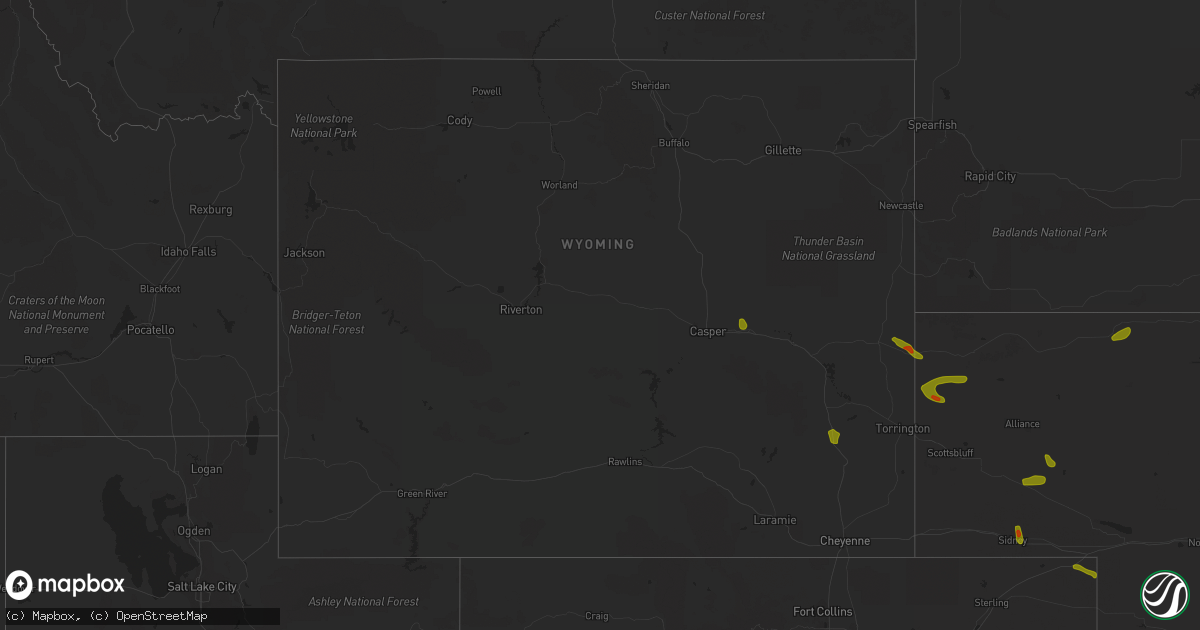
Hail Map in Wyoming on August 5, 2020
Get this storm
August 5 map
$229
one time, instant access
Download today. No call, no setup
Keep the $229
Bought the map and want the full workflow? Apply the entire $229 to a subscription within 7 days. None of it is wasted.
Every map, not just this one
This buys you this map. Subscription and you get every map we run, in the markets you choose from a few cities to whole states to nationwide. Plus real-time alerts the moment a storm fires.
Contact data
Name, contact info, occupancy, even credit band for addresses in the footprint. You go from where it hit to who to call.
Become the source they trust
Unlimited branding weather history reports on demand. You already have the documented answer ready for the property owner, and you are the one who showed up with it.
Property data and RoofTrace estimates
Pull up any address you have got, its value and the exact code rules for that jurisdiction, straight from One Click Code. Then RoofTrace estimates the squares, pitch, and roof value, priced the way you price.
Storm reports in Wyoming
Wyoming
| Date | Description |
|---|---|
| 08/05/20206:03 PM CDT | Corrects previous hail report from 3 s wheatland. Reported at 58 jackrabbit rd... Wheatland... Wy 82201 hunton creek outfitters. |
| 08/05/20206:02 PM CDT | Reported at 58 jackrabbit rd... Wheatland... Wy 82201 hunton creek outfitters. |
| 08/05/202012:01 AM CDT | At 501 PM MDT, severe thunderstorms were located along a line extending from Lakeview North to 6 miles west of Chugwater, moving northeast at 35 mph. HAZARD...60 mph wind gusts and quarter size hail. SOURCE...Radar indicated. IMPACT...Hail damage to vehicles is expected. Expect wind damage to roofs, siding, and trees. Severe thunderstorms will be near... Wheatland, Lakeview North, Chugcreek and Y-O Ranch around 505 PM MDT. Grayrocks Reservoir around 520 PM MDT. Fort Laramie National Historic Site around 535 PM MDT. Fort Laramie around 540 PM MDT.This includes Interstate 25 in Wyoming between mile markers 53 and82. |
| 08/04/202011:34 PM CDT | At 434 PM MDT, a severe thunderstorm was located near Rolling Hills Estates, or 20 miles east of Casper, moving south at 15 mph. HAZARD...60 mph wind gusts and quarter size hail. SOURCE...Radar indicated. IMPACT...Hail damage to vehicles is expected. Expect wind damage to roofs, siding, and trees. This severe thunderstorm will be near... Glenrock around 445 PM MDT. Deer Creek around 455 PM MDT.This includes Interstate 25 in Wyoming between mile markers 158 and174. |
All States Impacted by Hail Map on August 5, 2020
Cities Impacted by Hail Map on August 5, 2020
- Macdoel, CA
- Las Vegas, NM
- Montezuma, NM
- Raton, NM
- Dairy, OR
- Klamath Falls, OR
- Parker, CO
- Colorado Springs, CO
- Strasburg, CO
- Byers, CO
- Manitou Springs, CO
- Fountain, CO
- Boulder, CO
- Golden, CO
- Cascade, CO
- Wiggins, CO
- Fort Morgan, CO
- Weldona, CO
- Brush, CO
- Vernon, CO
- Yuma, CO
- Eckley, CO
- Otis, CO
- Wetmore, CO
- Pueblo, CO
- Beulah, CO
- Wray, CO
- Julesburg, CO
- Akron, CO
- Stratton, CO
- Burlington, CO
- Harrison, NE
- Broadwater, NE
- Lisco, NE
- Haigler, NE
- Saint Francis, KS
- Parks, NE
- Gurley, NE
- Sidney, NE
- Stratton, NE
- Atwood, KS
- McDonald, KS
- Oshkosh, NE
- Saronville, NE
- Sutton, NE
- Harvard, NE
- Hastings, NE
- Clay Center, NE
- Trumbull, NE
- Inland, NE
- Riverdale, NE
- Amherst, NE
- Pleasanton, NE
- Merriman, NE
- Eddyville, NE
- Cozad, NE
- Lexington, NE
- Sumner, NE
- Oconto, NE
- Friend, NE
- Dorchester, NE
- Gambrills, MD
- Odenton, MD
- Grovetown, GA
- Harlem, GA
- Appling, GA
- Glenrock, WY
- Wheatland, WY
- Lusk, WY
- Van Tassell, WY
- Chiloquin, OR
- Bosler, WY
- Angora, NE
- White Sulphur Springs, MT
- Ensign, KS
- Max, NE
- Whitney, NE
- Woodston, KS
- Massey, MD
- Galena, MD
- Millington, MD
- Stockett, MT
- Tuthill, SD
- Chemult, OR
- Hayes Center, NE
- Wellfleet, NE
- Alliance, NE
- Hemingford, NE
- Gordon, NE
- Rushville, NE
- Roggen, CO
- Crawford, NE
- Doniphan, NE
- Montague, CA
- Cheyenne, WY
- Valentine, NE
- Maxwell, NE
- North Platte, NE
- Wood River, NE
- Winona, KS
- Esbon, KS
- Downs, KS
- Gaylord, KS
- Portis, KS
- Gate, OK
- Marsland, NE
- Wolf Creek, MT
- Eustis, NE
- Shickley, NE
- Benkelman, NE
- Cody, NE
- Mason City, NE
- Woodland Park, CO
- Minneola, KS
- Pierce, NE
- Montezuma, KS
- Garden City, KS
- Midwest, WY
- Wadley, GA
- Bartow, GA
- Yreka, CA
- La Pine, OR
- Kilgore, NE
- Sisters, OR
- Etna, CA
- Gazelle, CA
- Arnold, NE
- Divide, CO
- Cawker City, KS
- Pierceville, KS
- Stokesdale, NC
- Summerfield, NC
- Claxton, GA
- Pilot Mountain, NC
- Carleton, NE
- Davenport, NE
- Colby, KS
- Levant, KS
- Deer Trail, CO
- Millersville, MD
- Fort George G Meade, MD
- Bowie, MD
- Hanahan, SC
- Goose Creek, SC
- Charleston, SC
- Sylvan Grove, KS
- Lucas, KS
- Lincoln, DE
- Greenwood, DE
- Harrington, DE
- Elberton, GA
- Brooklet, GA
- Norfolk, NE
- Dover, DE
- Clayton, DE
- Hay Springs, NE
- Chadron, NE
- Great Falls, MT
- Arvada, CO
- Ingalls, KS
- Holcomb, KS
- Venango, NE
- Dickens, NE
- Queen Anne, MD
- Ridgely, MD
- Germanton, NC
- Rural Hall, NC
- Alton, KS
- Osmond, NE
- Kirwin, KS
- Stockton, KS
- Mitchell, NE
- Giltner, NE
- Juniata, NE
- Edgar, NE
- Fowler, KS
- Pembroke, GA
- Plains, KS
- Chesapeake Beach, MD
- Prince Frederick, MD
- Huntingtown, MD
- Ainsworth, NE
- Wallace, KS
- Kennedyville, MD
- Crumpton, MD
- Chestertown, MD
- Stevensville, MD
- Cimarron, KS
- Bridgeville, DE
- Ellendale, DE
- Mcalister, NM
- Marydel, MD
- Henderson, MD
- Annapolis, MD
- Arnold, MD


