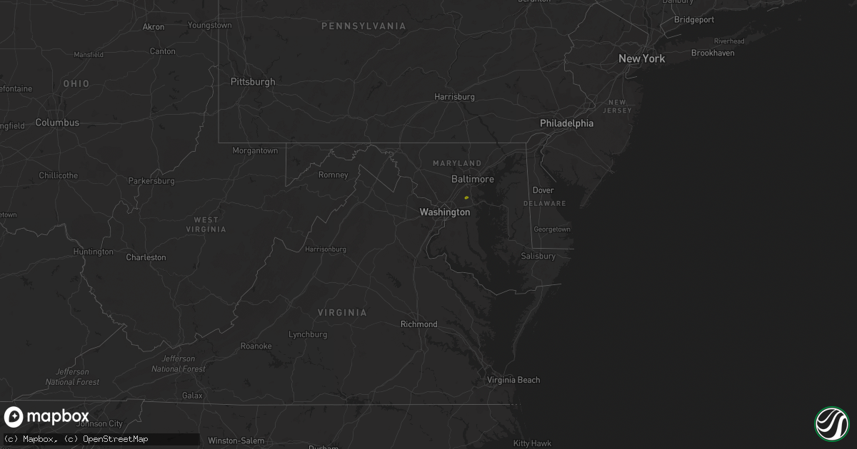
Hail Map in Maryland on August 5, 2020
Get this storm
August 5 map
$229
one time, instant access
Download today. No call, no setup
Keep the $229
Bought the map and want the full workflow? Apply the entire $229 to a subscription within 7 days. None of it is wasted.
Every map, not just this one
This buys you this map. Subscription and you get every map we run, in the markets you choose from a few cities to whole states to nationwide. Plus real-time alerts the moment a storm fires.
Contact data
Name, contact info, occupancy, even credit band for addresses in the footprint. You go from where it hit to who to call.
Become the source they trust
Unlimited branding weather history reports on demand. You already have the documented answer ready for the property owner, and you are the one who showed up with it.
Property data and RoofTrace estimates
Pull up any address you have got, its value and the exact code rules for that jurisdiction, straight from One Click Code. Then RoofTrace estimates the squares, pitch, and roof value, priced the way you price.
Storm reports in Maryland
Maryland
| Date | Description |
|---|---|
| 08/05/20205:36 AM CDT | Several reports of power lines down in the marydel and templeville areas. Time estimated from radar. |
| 08/05/20205:36 AM CDT | Downed wires near the goldsboro area. Time estimated from radar. |
| 08/05/20205:33 AM CDT | Downed power lines near tanyard. Time estimated from radar. |
| 08/05/20205:31 AM CDT | Several reports of downed wires in and near massey. Time estimated from radar. |
| 08/05/20205:30 AM CDT | Several reports of downed trees and wires near millington. Time estimated from radar. |
| 08/05/20205:28 AM CDT | Downed trees and wires near the intersection of u.s. Highway 301 and state highway 290. Time estimated from radar. |
| 08/05/20205:22 AM CDT | Downed wires on willis avenue near arbor place. Time estimated from radar. |
| 08/05/20205:20 AM CDT | Downed wires near u.s. Highway 50 near boh brooks road. Time estimated from radar. |
| 08/05/20205:18 AM CDT | Wires downed in church hill. Time estimated from radar. |
| 08/05/20205:15 AM CDT | Several reports of downed trees and wires in chestertown. Time estimated from radar. |
| 08/05/20205:09 AM CDT | Downed power lines reported in the worton... Lynch... And still pond areas. Time estimated from radar. |
| 08/05/20204:50 AM CDT | Several reports of downed power lines in the fairlee area. Time estimated from radar. |
| 08/05/20204:45 AM CDT | Several reports of downed trees and wires in rock hall. Time estimated from radar. |
| 08/05/20204:10 AM CDT | Downed tree on md-2 solomons island rd just north of us 50 john hanson hwy |
| 08/05/20203:41 AM CDT | Downed tree on md 175 annapolis rd between gambrills rd/dairy lane and claffy ave |
| 08/05/20203:34 AM CDT | Road closure due to downed tree between seneca dr and strawberry lake way |
All States Impacted by Hail Map on August 5, 2020
Cities Impacted by Hail Map on August 5, 2020
- Macdoel, CA
- Las Vegas, NM
- Montezuma, NM
- Raton, NM
- Dairy, OR
- Klamath Falls, OR
- Parker, CO
- Colorado Springs, CO
- Strasburg, CO
- Byers, CO
- Manitou Springs, CO
- Fountain, CO
- Boulder, CO
- Golden, CO
- Cascade, CO
- Wiggins, CO
- Fort Morgan, CO
- Weldona, CO
- Brush, CO
- Vernon, CO
- Yuma, CO
- Eckley, CO
- Otis, CO
- Wetmore, CO
- Pueblo, CO
- Beulah, CO
- Wray, CO
- Julesburg, CO
- Akron, CO
- Stratton, CO
- Burlington, CO
- Harrison, NE
- Broadwater, NE
- Lisco, NE
- Haigler, NE
- Saint Francis, KS
- Parks, NE
- Gurley, NE
- Sidney, NE
- Stratton, NE
- Atwood, KS
- McDonald, KS
- Oshkosh, NE
- Saronville, NE
- Sutton, NE
- Harvard, NE
- Hastings, NE
- Clay Center, NE
- Trumbull, NE
- Inland, NE
- Riverdale, NE
- Amherst, NE
- Pleasanton, NE
- Merriman, NE
- Eddyville, NE
- Cozad, NE
- Lexington, NE
- Sumner, NE
- Oconto, NE
- Friend, NE
- Dorchester, NE
- Gambrills, MD
- Odenton, MD
- Grovetown, GA
- Harlem, GA
- Appling, GA
- Glenrock, WY
- Wheatland, WY
- Lusk, WY
- Van Tassell, WY
- Chiloquin, OR
- Bosler, WY
- Angora, NE
- White Sulphur Springs, MT
- Ensign, KS
- Max, NE
- Whitney, NE
- Woodston, KS
- Massey, MD
- Galena, MD
- Millington, MD
- Stockett, MT
- Tuthill, SD
- Chemult, OR
- Hayes Center, NE
- Wellfleet, NE
- Alliance, NE
- Hemingford, NE
- Gordon, NE
- Rushville, NE
- Roggen, CO
- Crawford, NE
- Doniphan, NE
- Montague, CA
- Cheyenne, WY
- Valentine, NE
- Maxwell, NE
- North Platte, NE
- Wood River, NE
- Winona, KS
- Esbon, KS
- Downs, KS
- Gaylord, KS
- Portis, KS
- Gate, OK
- Marsland, NE
- Wolf Creek, MT
- Eustis, NE
- Shickley, NE
- Benkelman, NE
- Cody, NE
- Mason City, NE
- Woodland Park, CO
- Minneola, KS
- Pierce, NE
- Montezuma, KS
- Garden City, KS
- Midwest, WY
- Wadley, GA
- Bartow, GA
- Yreka, CA
- La Pine, OR
- Kilgore, NE
- Sisters, OR
- Etna, CA
- Gazelle, CA
- Arnold, NE
- Divide, CO
- Cawker City, KS
- Pierceville, KS
- Stokesdale, NC
- Summerfield, NC
- Claxton, GA
- Pilot Mountain, NC
- Carleton, NE
- Davenport, NE
- Colby, KS
- Levant, KS
- Deer Trail, CO
- Millersville, MD
- Fort George G Meade, MD
- Bowie, MD
- Hanahan, SC
- Goose Creek, SC
- Charleston, SC
- Sylvan Grove, KS
- Lucas, KS
- Lincoln, DE
- Greenwood, DE
- Harrington, DE
- Elberton, GA
- Brooklet, GA
- Norfolk, NE
- Dover, DE
- Clayton, DE
- Hay Springs, NE
- Chadron, NE
- Great Falls, MT
- Arvada, CO
- Ingalls, KS
- Holcomb, KS
- Venango, NE
- Dickens, NE
- Queen Anne, MD
- Ridgely, MD
- Germanton, NC
- Rural Hall, NC
- Alton, KS
- Osmond, NE
- Kirwin, KS
- Stockton, KS
- Mitchell, NE
- Giltner, NE
- Juniata, NE
- Edgar, NE
- Fowler, KS
- Pembroke, GA
- Plains, KS
- Chesapeake Beach, MD
- Prince Frederick, MD
- Huntingtown, MD
- Ainsworth, NE
- Wallace, KS
- Kennedyville, MD
- Crumpton, MD
- Chestertown, MD
- Stevensville, MD
- Cimarron, KS
- Bridgeville, DE
- Ellendale, DE
- Mcalister, NM
- Marydel, MD
- Henderson, MD
- Annapolis, MD
- Arnold, MD


