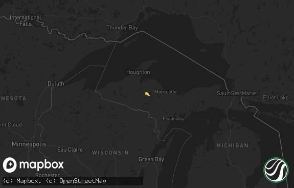
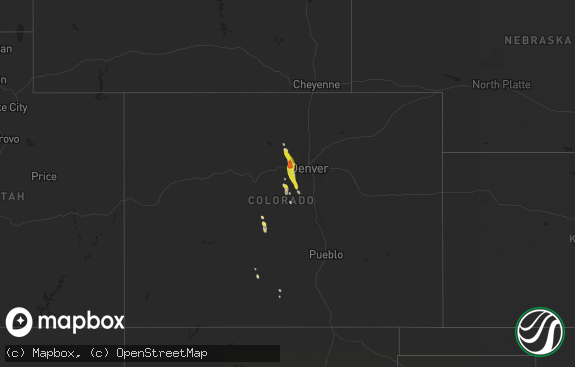
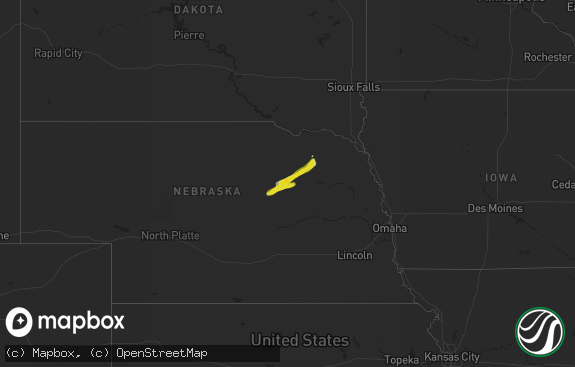
Hail Map in Michigan on August 5, 2019
The weather event in Michigan on August 5, 2019 includes Wind and Hail maps. 21 states and 511 cities were impacted and suffered possible damage. The total estimated number of properties impacted is 3,476.

Wind
Hail
3,476
Estimated number of impacted properties by a 1.00" hail or larger0
Estimated number of impacted properties by a 1.75" hail or larger0
Estimated number of impacted properties by a 2.50" hail or largerStorm reports in Michigan
Michigan
| Date | Description |
|---|---|
| 08/05/20193:22 PM CDT | Media partner reports trees down in michigan state police parking lot in gladstone. Time estimated by radar. |
| 08/05/20193:22 PM CDT | Media partner shared report of huge trees down in a park and trees laying across the road in gladstone. Time estimated by radar. |
| 08/05/20193:11 PM CDT | Multiple trees down along pine street. Report via social media. Time estimated by radar. |
| 08/05/20192:49 PM CDT | Tree down in neighbors yard. |
| 08/05/20192:20 PM CDT | Big bay lighthouse reports 78 mph wind at 100ft above water edge. |
| 08/05/20191:59 PM CDT | Law enforcement dispatch reports that a power line is down at the intersection of 9th street and calumet street in lake linden. |
| 08/05/20191:17 PM CDT | Large branches of tall maple trees down in front yard of home in calumet. Report via social media. Time estimated by radar. |
| 08/05/20191:11 PM CDT | Large tree down at calumet cemetery. Report from social media. Time estimated by radar. |
| 08/05/20193:11 AM CDT | At 811 PM EDT, severe thunderstorms were located along a line extending from near Lost Lake Woods to near Mikado, moving east at 30 mph. HAZARD...60 mph wind gusts and penny size hail. SOURCE...Radar indicated. IMPACT...Expect damage to roofs, siding, and trees. Locations impacted include... Harrisville, Mikado, Lincoln, Black River, Harrisville State Park, Lost Lake Woods and Negwegon State Park. |
| 08/05/20191:30 AM CDT | At 630 PM EDT, a severe thunderstorm was located near Millersburg, or 11 miles southeast of Onaway, moving northeast at 30 mph. HAZARD...60 mph wind gusts and penny size hail. SOURCE...Radar indicated. IMPACT...Expect damage to roofs, siding, and trees. Locations impacted include... Rogers City, Presque Isle Light, Presque Isle, Metz, Posen, Millersburg, Hawks, Thompsons Harbor State Park, Hagensville, P H Hoeft State Park, Bisma Township and Moltke Township. |
| 08/04/201911:38 PM CDT | At 438 PM EDT, a severe thunderstorm was located 8 miles south of Munising, moving northeast at 25 mph. HAZARD...60 mph wind gusts and quarter size hail. SOURCE...Radar indicated. IMPACT...Hail damage to vehicles is expected. Expect wind damage to roofs, siding, and trees. Locations impacted include... Munising, Chapel Lake, Miners Castle, Shingleton, Wetmore, Melstrand and Van Meer. |
| 08/04/201910:50 PM CDT | *** 1 inj *** tree down blocking road at 160th ave and mercury dr. Man drove into fallen tree becoming pinned. Taken to hospital in stable condition. |
| 08/04/20199:50 PM CDT | At 250 PM EDT, a severe thunderstorm was located near The Huron Islands, or 21 miles east of L'anse, moving east at 45 mph. HAZARD...60 mph wind gusts and quarter size hail. SOURCE...Radar indicated. IMPACT...Hail damage to vehicles is expected. Expect wind damage to roofs, siding, and trees. Locations impacted include... Big Bay, Mountain Lake and Huron River Point. |
| 08/04/20198:02 PM CDT | At 102 PM CDT, severe thunderstorms were located along a line extending from 9 miles north of Rainbow Flowage to near Crystal Lake Scout Reservation to near Tomahawk, moving east at 40 mph. HAZARD...60 mph wind gusts. SOURCE...Radar indicated. IMPACT...Expect damage to roofs, siding, and trees. Locations impacted include... Rhinelander, Crandon, Eagle River, Tomahawk, Harrison, Phelps, Woodboro, Popple River, North Otter Creek Natural Area and Crystal Lake Scout Reservation. |
All States Impacted by Hail Map on August 5, 2019
Cities Impacted by Hail Map on August 5, 2019
- Sheridan, WY
- Fenton, IA
- Lone Rock, IA
- Bancroft, IA
- Ringsted, IA
- Wheatland, WY
- Worland, WY
- Gilman, WI
- Spencer, WI
- Loyal, WI
- Granton, WI
- Chili, WI
- Hamel, MN
- Long Lake, MN
- Loretto, MN
- Maple Plain, MN
- Utica, MN
- Saint Charles, MN
- Lewiston, MN
- Oelrichs, SD
- Middle Amana, IA
- South Amana, IA
- Marengo, IA
- Amana, IA
- Exeland, WI
- Ladysmith, WI
- Winter, WI
- Fairchild, WI
- Augusta, WI
- New Raymer, CO
- Grover, CO
- Radisson, WI
- Houston, MN
- Rushford, MN
- Saint James, MN
- Kanawha, IA
- Couderay, WI
- Stone Lake, WI
- Hershey, NE
- Wabasha, MN
- Nelson, WI
- Alma, WI
- Reads Landing, MN
- Osseo, WI
- Mccammon, ID
- North Platte, NE
- Anoka, MN
- Dayton, MN
- Elk River, MN
- Minneapolis, MN
- Osseo, MN
- Columbia, MD
- Milaca, MN
- Ogilvie, MN
- Carpenter, WY
- Cheyenne, WY
- Nunn, CO
- Stanley, WI
- Spencer, ID
- Dubois, ID
- Watertown, MN
- Delano, MN
- Keystone, SD
- Hermosa, SD
- Lakin, KS
- Athens, GA
- Willard, WI
- Andover, MN
- Mound, MN
- Mayer, MN
- Scandia, MN
- Saint Bonifacius, MN
- Waconia, MN
- Saint Paul, MN
- Circle Pines, MN
- Excelsior, MN
- Saint Michael, MN
- Forest Lake, MN
- Stillwater, MN
- Hugo, MN
- Wayzata, MN
- New Germany, MN
- Marine On Saint Croix, MN
- Maple Grove, MN
- Spring Park, MN
- Champlin, MN
- Lester Prairie, MN
- Rogers, MN
- Chisago City, MN
- Rice Lake, WI
- Cameron, WI
- Lanse, MI
- Barron, WI
- Clayton, WI
- Elgin, MN
- Plainview, MN
- Eyota, MN
- Truman, MN
- Fairmont, MN
- Winnebago, MN
- Granada, MN
- Eleva, WI
- Harrisburg, IL
- Raleigh, IL
- Galatia, IL
- Withee, WI
- Owen, WI
- Ellsworth, WI
- Torrington, WY
- Dover, MN
- Rochester, MN
- Wisconsin Dells, WI
- Reedsburg, WI
- Oconto, NE
- Millboro, VA
- Warm Springs, VA
- Shawnee, WY
- Pavillion, WY
- Greenwood, WI
- Aitkin, MN
- Lanesboro, MN
- Mabel, MN
- Rockford, MN
- Montrose, MN
- Buffalo, MN
- Mcgregor, MN
- Braham, MN
- Rush City, MN
- Dalbo, MN
- Stanchfield, MN
- Spring Valley, MN
- Michigamme, MI
- Cochrane, WI
- Stockholm, WI
- Lake City, MN
- Pepin, WI
- Broughton, IL
- Macedonia, IL
- Ojibwa, WI
- Chatham, MI
- Spooner, WI
- Brainerd, MN
- Sarona, WI
- Arcadia, WI
- Altura, MN
- Bear Creek, WI
- Clintonville, WI
- Shiocton, WI
- Pittsville, WI
- Clarion, IA
- Elysian, MN
- Janesville, MN
- Custer, SD
- Cologne, MN
- Buffalo Gap, SD
- Oral, SD
- Fairburn, SD
- Thermopolis, WY
- Duchesne, UT
- Hot Springs, SD
- Smithwick, SD
- Algona, IA
- Bruce, WI
- Windom, MN
- Howard Lake, MN
- Glencoe, MN
- Big Lake, MN
- Silver Lake, MN
- Victoria, MN
- Eden Prairie, MN
- Prior Lake, MN
- Plato, MN
- Chanhassen, MN
- Albertville, MN
- Carver, MN
- Hopkins, MN
- Chaska, MN
- Young America, MN
- Minnetonka, MN
- Waverly, MN
- Becker, MN
- Winsted, MN
- Shakopee, MN
- Mancelona, MI
- New Smyrna Beach, FL
- Shell Lake, WI
- Dakota, MN
- Humboldt, IA
- Gilmore City, IA
- Fountain City, WI
- Eldorado, IL
- Ogema, WI
- Catawba, WI
- Prentice, WI
- Phillips, WI
- Brantwood, WI
- Deer Park, WI
- Almena, WI
- Prairie Farm, WI
- Dallas, WI
- Chetek, WI
- Clear Lake, WI
- Osceola, WI
- Amery, WI
- Star Prairie, WI
- Weyerhaeuser, WI
- Eagle Grove, IA
- Renwick, IA
- Lu Verne, IA
- Goldfield, IA
- Corwith, IA
- Belmond, IA
- Brandywine, MD
- Blooming Prairie, MN
- Owatonna, MN
- Onamia, MN
- Hillman, MN
- Maple, WI
- Eagle Bend, MN
- Miltona, MN
- Parkers Prairie, MN
- Preston, MN
- Canton, MN
- Harmony, MN
- Waterloo, IA
- Blue Earth, MN
- Claremont, MN
- Hayfield, MN
- Goodwell, OK
- Kellogg, MN
- Isle, MN
- New Richmond, WI
- Somerset, WI
- Duluth, MN
- Ottosen, IA
- Fall Creek, WI
- Cotton, MN
- Dexter, MN
- Grand Meadow, MN
- Strum, WI
- Plum City, WI
- Durand, WI
- Mondovi, WI
- Neillsville, WI
- Titusville, FL
- Wisconsin Rapids, WI
- Stevens Point, WI
- Rudolph, WI
- Bancroft, WI
- Plover, WI
- Trimont, MN
- Wetmore, MI
- Munising, MI
- Manville, WY
- Trego, WI
- Hager City, WI
- Red Wing, MN
- Taylor, WI
- Blair, WI
- Gillette, WY
- Pierz, MN
- Mora, MN
- Armstrong, IA
- Portage, WI
- Hawkins, WI
- Dodge Center, MN
- Rosholt, WI
- Waseca, MN
- Marshfield, WI
- Staples, MN
- Estherville, IA
- Jackson, MN
- Hugoton, KS
- New Lisbon, WI
- Mauston, WI
- Stewart, MN
- Brownton, MN
- Camp Douglas, WI
- Tamarack, MN
- Hardy, VA
- Moneta, VA
- Goodview, VA
- Burt, IA
- Douglas, WY
- Manson, IA
- Clare, IA
- Vinton, VA
- Le Roy, MN
- Taopi, MN
- Elkton, MN
- Hampton, IA
- Sheffield, IA
- Kendall, KS
- West Bend, IA
- Whittemore, IA
- Newberry, MI
- Jacobson, MN
- Floodwood, MN
- Cokato, MN
- Tomah, WI
- Kendall, WI
- Wilton, WI
- Hustler, WI
- Elroy, WI
- Dickens, NE
- Clifton, AZ
- Morenci, AZ
- Newhall, IA
- Wahkon, MN
- Kasson, MN
- Port Wing, WI
- Iron River, WI
- Bradgate, IA
- Glendo, WY
- Poplar, WI
- South Range, WI
- Boyd, WI
- Thorp, WI
- Humbird, WI
- Wellfleet, NE
- Mount Pleasant, IA
- Pine River, MN
- Motley, MN
- Pequot Lakes, MN
- Maple Lake, MN
- Annandale, MN
- Easton, MN
- Delavan, MN
- Goodell, IA
- Garner, IA
- Britt, IA
- Klemme, IA
- Westboro, WI
- Jim Falls, WI
- Chippewa Falls, WI
- Sioux Rapids, IA
- Greenville, IA
- Prescott, WI
- River Falls, WI
- Jewell, IA
- Lost Springs, WY
- Fairfax, IA
- Norway, IA
- West Concord, MN
- Sturgeon Lake, MN
- Eau Claire, WI
- Hector, MN
- Buffalo Lake, MN
- Alden, MN
- Wells, MN
- Amherst, WI
- Custer, WI
- Good Thunder, MN
- Mankato, MN
- Fountaintown, IN
- Fairland, IN
- Shelbyville, IN
- Warrens, WI
- Spring Grove, MN
- Alpha, MN
- Spirit Lake, IA
- Maiden Rock, WI
- Cadott, WI
- Joice, IA
- Lake Mills, IA
- Leland, IA
- Bluebell, UT
- Gilbert, IA
- Story City, IA
- Hastings, MN
- Lyndon Station, WI
- Thaxton, VA
- Lakeville, MN
- Rollingstone, MN
- Chugwater, WY
- Medford, MN
- Faribault, MN
- Hampton, MN
- Randolph, MN
- Alexander, IA
- Zumbrota, MN
- Grasston, MN
- Amherst Junction, WI
- Verona, WI
- Verndale, MN
- Bonduel, WI
- Black Creek, WI
- Nichols, WI
- Wesley, IA
- Hot Springs, VA
- Ames, IA
- Auburndale, WI
- Kenyon, MN
- Lodi, WI
- Mims, FL
- Meeteetse, WY
- Palisade, MN
- Rowan, IA
- Hollandale, MN
- Clarks Grove, MN
- Lansing, MN
- Albert Lea, MN
- Brownsdale, MN
- Waltham, MN
- Austin, MN
- Bricelyn, MN
- Kiester, MN
- Scarville, IA
- Thompson, IA
- Frost, MN
- Pemberton, MN
- Royal, IA
- Spencer, IA
- Everly, IA
- Primghar, IA
- Sutherland, IA
- Oxford, IA
- Frederic, WI
- Curlew, IA
- Laurens, IA
- Nekoosa, WI
- Cylinder, IA
- Graettinger, IA
- Sheldon, WI
- Medford, WI
- Lublin, WI
- Holcombe, WI
- Thompsonville, IL
- Willernie, MN
- Meservey, IA
- Thornton, IA
- Peterson, MN
- Caledonia, MN
- Hokah, MN
- Garrett, WY
- Deerwood, MN
- Danbury, WI
- Webster, WI
- Summerville, SC
- Farmington, MN
- Skanee, MI
- Zebulon, GA
- Bertha, MN
- Hewitt, MN
- Vining, MN
- Roanoke, VA
- Blue Ridge, VA
- Shafer, MN
- Turtle Lake, WI
- Dresser, WI
- Lake Elmo, MN
- Trempealeau, WI
- Dunnell, MN
- Superior, IA
- Springbrook, WI
- Hayward, WI
- Almond, WI
- Alma Center, WI
- Grand Marais, MI
- Kaukauna, WI
- Madison Lake, MN
- Webb, IA
- Wausau, WI
- Baxter, MN
- Wonewoc, WI
- Keystone, IA
- Bayfield, WI
- Seymour, WI
- Appleton, WI
- Lakefield, MN
- Cannon Falls, MN
- Goodhue, MN
- Mazeppa, MN
- Whitehall, WI
- Independence, WI
- Hixton, WI
- La Crescent, MN
- Minatare, NE
- Scottsbluff, NE
- Hudson, WI
- Ceylon, MN
- Rosemount, MN
- Gwinn, MI
- Milford, IA
- Hancock, MI
- Cumberland, WI
- West Liberty, IA
- Rapid River, MI
- Savage, MN
- Burnsville, MN
- Vinton, IA
- Lehigh, IA
- Swea City, IA
- Smiths Station, AL
- Hanover, MN
- Hackensack, MN
- Backus, MN
- Akeley, MN
- Walker, MN
- Longville, MN
- Remer, MN
- Marquette, MI
- Brookston, MN
- Canyon, MN
- Saginaw, MN
- Alborn, MN
- Cloquet, MN
- Brook Park, MN
- Hinckley, MN
- Sandstone, MN
- Sutherland, NE


