Hail Map on August 4, 2024
Get this storm
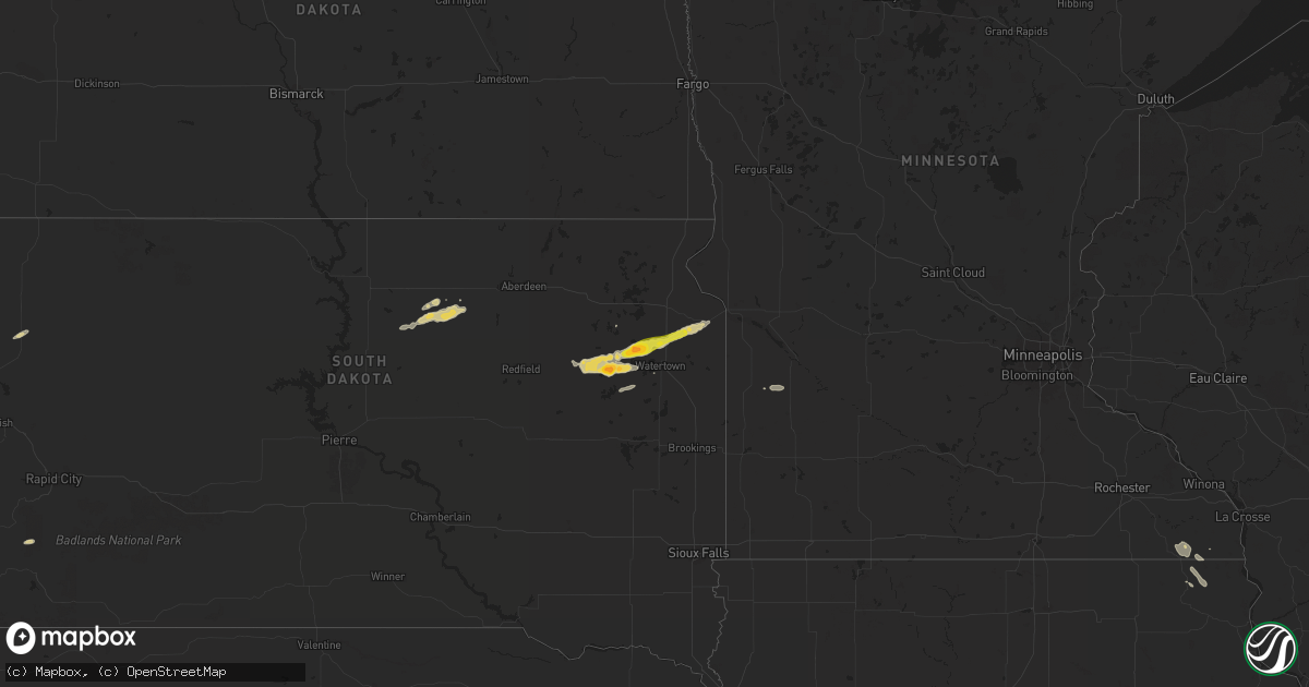
August 4 map
$229
one time, instant access
Download today. No call, no setup
Keep the $229
Bought the map and want the full workflow? Apply the entire $229 to a subscription within 7 days. None of it is wasted.
Every map, not just this one
This buys you this map. Subscription and you get every map we run, in the markets you choose from a few cities to whole states to nationwide. Plus real-time alerts the moment a storm fires.
Contact data
Name, contact info, occupancy, even credit band for addresses in the footprint. You go from where it hit to who to call.
Become the source they trust
Unlimited branding weather history reports on demand. You already have the documented answer ready for the property owner, and you are the one who showed up with it.
Property data and RoofTrace estimates
Pull up any address you have got, its value and the exact code rules for that jurisdiction, straight from One Click Code. Then RoofTrace estimates the squares, pitch, and roof value, priced the way you price.
States Impacted by Hail Map on August 4, 2024
Storm reports
Florida
| Date | Description |
|---|---|
| 08/04/20246:56 PM CDT | Columbia county em reported an observed tornado on the ground off hwy 441 near lake city airpark. Time estimated via radar and report. |
| 08/04/20246:55 PM CDT | Ussf wind sensor on tower 2 measured a wind gust of 62mph/54kt from the south at 7:55 pm. Sensor elevation is 54 feet. |
| 08/04/20246:40 PM CDT | Multiple public reports of a tornado on the ground northwest of worthington springs. Time estimated via reports and radar. |
| 08/04/20245:35 PM CDT | Damage to five rvs in the sonrise palm rv park and a few toppled trees in the area. |
| 08/04/20245:00 PM CDT | Damage to a fence and a trailer were reported by residents along with reports of a tornado touching down. |
| 08/04/20241:47 PM CDT | Reports of a tree down blocking the road. |
| 08/04/202412:58 PM CDT | Spotter video of tornado on ground for around 2 minutes. Location and time based on spotter position and radar warned tornado location. |
| 08/04/202412:05 PM CDT | Large tree down in yard with damage to powerlines. Additional damage to tree branches to the northwest towards cr-452. |
| 08/04/202411:25 AM CDT | Nws student volunteer spotter picture of tornado on ground. Location and time based on spotter position and radar warned tornado location. |
South Dakota
| Date | Description |
|---|---|
| 08/04/20245:00 PM CDT | A local report indicates 61 MPH wind near 11 ESE Oelrichs |
| 08/04/20243:57 AM CDT | Quarter to golfball size hail. 3/4 mile wide crop damage. |
| 08/04/20242:04 AM CDT | A local report indicates 1.75 inch wind near 6 W Henry |
South Carolina
| Date | Description |
|---|---|
| 08/04/20244:58 PM CDT | Schp reported a tree down along fairfield rd at i-20. |
| 08/04/20244:55 PM CDT | Trained spotter reports multiple large trees down near the intersection of e columbia ave and james st. Time estimated by radar. |
| 08/04/20244:44 PM CDT | Schp reported tree down along fairfield rd at crane church rd. |
Idaho
| Date | Description |
|---|---|
| 08/04/20248:55 AM CDT | Big southern butte rwis site. |
| 08/04/20248:15 AM CDT | Tom cat summit rwis site. |
Montana
| Date | Description |
|---|---|
| 08/04/202412:21 AM CDT | Mesonet station mccm8 cow creek. |
| 08/03/202411:01 PM CDT | Mesonet station bafm8 badger peak. |
| 08/03/20249:03 PM CDT | Public weather station observation. |
| 08/03/20248:44 PM CDT | A local report indicates 63 MPH wind near 4 W Billings |
| 08/03/20248:20 PM CDT | A local report indicates 64 MPH wind near 6 SSW Acton |
Wyoming
| Date | Description |
|---|---|
| 08/03/20248:35 PM CDT | Awos station ku68 cowley airport. |
New Hampshire
| Date | Description |
|---|---|
| 08/04/20246:58 PM CDT | A few large trees down on nh hwy 175 near sugarplum lane and the airfield. |
| 08/04/20246:50 PM CDT | Numerous large trees snapped in half on east side of nh 10 about 1/2 mile south of robie farm. |
| 08/04/20246:26 PM CDT | Large tree fell on a garage on pearl lake rd. Numerous reports of downed trees across south lisbon. |
| 08/04/20246:24 PM CDT | Tree snapped near nh116 and pinnacle rd. |
| 08/04/20241:35 PM CDT | Sm photos of trees down at connolly cabins campground... Temporarily blocked entrance. Est diameter of trees between 8-14 inches. |
| 08/04/20241:25 PM CDT | Hail reported in stratford measured from 1 inch to 1.25 inches. B225e234. |
| 08/04/20241:10 PM CDT | Trees and power lines down on titus hill road. |
| 08/04/20241:10 PM CDT | Trees and wires down on fish pond road. |
| 08/04/202412:50 PM CDT | Large tree down partially blocking manchester st. Time estimated via radar. |
| 08/04/202412:45 PM CDT | Large tree down blocking derry rd. Pd has closed the road. Time estimated via radar. |
| 08/04/202412:05 PM CDT | Tree down blocking hall rd in fremont. Time estimated by radar. |
| 08/04/202411:50 AM CDT | Tree down across old auburn rd in the area of pingree hill rd. |
| 08/04/202411:47 AM CDT | Chester fire reported a tree down blocking derry rd. Time estimated by radar. |
| 08/03/20248:30 PM CDT | Numerous trees down on wires near hwy 171 causing power outages. |
| 08/03/20247:48 PM CDT | Trees down on wires on plains rd near nichols beach. |
| 08/03/20247:48 PM CDT | Social media reports of several trees down in chocorua. |
Maine
| Date | Description |
|---|---|
| 08/04/202412:25 PM CDT | Trees down and baseball field dugout collapsed at blanchard park. Based on photos. |
Illinois
| Date | Description |
|---|---|
| 08/04/20246:25 AM CDT | A local report indicates 1.00 inch wind near Highland Park |
Virginia
| Date | Description |
|---|---|
| 08/04/20245:05 PM CDT | Trees knocked down along new market rd. Time estimated from radar. |
| 08/04/20245:04 PM CDT | Significant damage to the southampton county fair. Numerous trees knocked down and outbuilding damaged. Time estimated from radar. |
Texas
| Date | Description |
|---|---|
| 08/04/20246:45 PM CDT | Between 5:30 and 6:00pm mdt on august 4th... 2024... A severe microburst occurred a few miles ne of dell city... Tx. Nws assessed a thunderstorm moving south-southwest |
Vermont
| Date | Description |
|---|---|
| 08/04/20246:17 PM CDT | Social media image of several large trees down in castleton. Another report mentioned a tree down on power lines. |
| 08/04/20246:10 PM CDT | Multiple reports of trees and power lines down across rutland. |
| 08/04/20246:10 PM CDT | Multiple trees down on south end of lake bomoseen near route 4a and creek road. |
| 08/04/20245:50 PM CDT | Trees and power lines were blown down by the first round of storms that moves through rutland. |
| 08/04/20245:50 PM CDT | Trees and powerlines down near elm street. |
| 08/04/20245:32 PM CDT | Trees down in pittsford |
| 08/04/20245:04 PM CDT | Social media report of trees down in benson. Time estimated from radar. |
| 08/04/20244:28 PM CDT | Trees down in weybridge near route 23. |
| 08/04/20241:24 PM CDT | Trees and wires down in south hero. |
North Carolina
| Date | Description |
|---|---|
| 08/04/20241:45 PM CDT | Trees down in surl. |
New York
| Date | Description |
|---|---|
| 08/04/20245:30 PM CDT | Tree down on wire on west hague road. |
| 08/04/20244:30 PM CDT | Corrects previous tstm wnd dmg report from 1 nw hague. Tree down on wire on west hague road. |
| 08/04/20241:06 PM CDT | Trees and wires down at ausable point campground/wharf way. |
Cities Impacted by Hail Map on August 4, 2024
- Mabel, MN
- Spring Grove, MN
- Canton, MN
- Lanesboro, MN
- Harmony, MN
- Decorah, IA
- Waukon, IA
- Arcadia, FL
- Ona, FL
- Morrisonville, NY
- Arco, ID
- Moore, ID
- Kingfield, ME
- Stratton, ME
- Plattsburgh, NY
- Bronte, TX
- Norton, TX
- Knott, TX
- Peru, NY
- Eldorado, TX
- Leander, TX
- Austin, TX
- Lenorah, TX
- Stanton, TX
- Rocksprings, TX
- Robert Lee, TX
- Big Spring, TX
- Del Rio, TX
- Denver, IN
- Peru, IN
- Vancourt, TX
- Christoval, TX
- Convoy, OH
- Payne, OH
- Pontotoc, TX
- Sonora, TX
- Gonzales, TX
- Cost, TX
- Van Wert, OH
- Mason, TX
- Eden, TX
- Westport, NY
- Llano, TX
- Paint Rock, TX
- Dryden, TX
- Vergennes, VT
- Blythewood, SC
- Hallettsville, TX
- London, TX
- Custer, SD
- Elizabeth, CO
- Columbia, SC
- Comstock, TX
- Buffalo Gap, SD
- Middlebury, VT
- New Haven, VT
- Saint Petersburg, FL
- Seminole, FL
- Brackettville, TX
- Whitehall, NY
- Huletts Landing, NY
- Silver Bay, NY
- Hague, NY
- Yoakum, TX
- Fort Stockton, TX
- Putnam Station, NY
- Clemons, NY
- Cuero, TX
- Castleton, VT
- Bomoseen, VT
- West Rutland, VT
- Florence, VT
- Fair Haven, VT
- Pittsford, VT
- Kerrville, TX
- Chester, SC
- Junction, TX
- Chittenden, VT
- Proctor, VT
- Center Rutland, VT
- Brandon, VT
- Rutland, VT
- North Clarendon, VT
- Hunt, TX
- Fort Morgan, CO
- Wiggins, CO
- Poultney, VT
- Ingram, TX
- Bradenton, FL
- Longboat Key, FL
- Sarasota, FL
- Amado, AZ
- Tucson, AZ
- Lake Butler, FL
- Pleasanton, TX
- Ashwood, OR
- Harwood, TX
- Broadview, MT
- Antelope, OR
- Ozona, TX
- Eloy, AZ
- Molt, MT
- Powell Butte, OR
- Marana, AZ
- Culver, OR
- Terrebonne, OR
- Hondo, TX
- Bandera, TX
- Sells, AZ
- Rapelje, MT
- Laurel, MT
- Big Timber, MT
- Columbus, MT
- Melville, MT
- Park City, MT
- Ryegate, MT
- Reed Point, MT
- Billings, MT
- Acton, MT
- Shepherd, MT
- Huntley, MT
- Ballantine, MT
- Spray, OR
- D Hanis, TX
- Worden, MT
- Lake City, FL
- Monument, OR
- Pompeys Pillar, MT
- Hardin, MT
- Crow Agency, MT
- Yancey, TX
- Osprey, FL
- Nokomis, FL
- Parrish, FL
- Palmetto, FL
- Ellenton, FL
- Long Creek, OR
- Yerington, NV
- Mitchell, OR
- Custer, MT
- Prairie City, OR
- Roscoe, SD
- Hoven, SD
- Forsyth, MT
- Hysham, MT
- Bighorn, MT
- Tolstoy, SD
- Onaka, SD
- Algoma, WI
- Sturgeon Bay, WI
- Faulkton, SD
- Busby, MT
- Garryowen, MT
- Lame Deer, MT
- Bradenton Beach, FL
- Cortez, FL
- Anna Maria, FL
- Terra Ceia, FL
- Ruskin, FL
- Ipswich, SD
- Neenah, WI
- Appleton, WI
- Menasha, WI
- Winneconne, WI
- Larsen, WI
- Kaukauna, WI
- Brillion, WI
- Greenleaf, WI
- Manistee, MI
- Free Soil, MI
- Ludington, MI
- Pilot Rock, OR
- Hammond, MT
- Boyes, MT
- Raymond, SD
- Clark, SD
- Garden City, SD
- Henry, SD
- Doland, SD
- Raleigh, NC
- Belle Fourche, SD
- Florence, SD
- Wallace, SD
- Watertown, SD
- South Shore, SD
- Minneota, MN
- Taunton, MN
- Stockholm, SD
- Twin Brooks, SD
- Clarkfield, MN
- Lake Villa, IL
- Boyd, MN
- Milbank, SD
- Gurnee, IL
- Waukegan, IL
- Wadsworth, IL
- Iowa Falls, IA
- Ackley, IA
- Bradford, IA
- Hampton, IA
- Big Stone City, SD
- Steinhatchee, FL
- Perry, FL
- Old Town, FL
- Chiefland, FL
- Mayo, FL
- Cross City, FL
- Horseshoe Beach, FL
- Salem, FL
- Live Oak, FL
- Branford, FL
- Day, FL
- Bellingham, MN
- Lake Forest, IL
- Libertyville, IL
- Great Lakes, IL
- Lake Bluff, IL
- North Chicago, IL
- Zion, IL
- Glencoe, IL
- Northbrook, IL
- Evanston, IL
- Wilmette, IL
- Skokie, IL
- Lake Zurich, IL
- Mundelein, IL
- Winnetka, IL
- Chicago, IL
- Lincolnshire, IL
- Highland Park, IL
- Buffalo Grove, IL
- Vernon Hills, IL
- Highwood, IL
- Deerfield, IL
- Lamont, FL
- McAlpin, FL
- Lee, FL
- Madison, FL
- O'Brien, FL
- Trenton, FL
- Bell, FL
- Rolling Meadows, IL
- Des Plaines, IL
- Glenview, IL
- Arlington Heights, IL
- Mount Prospect, IL
- Golf, IL
- Morton Grove, IL
- Wheeling, IL
- Niles, IL
- Hazel, SD
- Vienna, SD
- Park Ridge, IL
- Lincolnwood, IL
- Elk Grove Village, IL
- Kenilworth, IL
- Bradley, SD
- Guildhall, VT
- North Stratford, NH