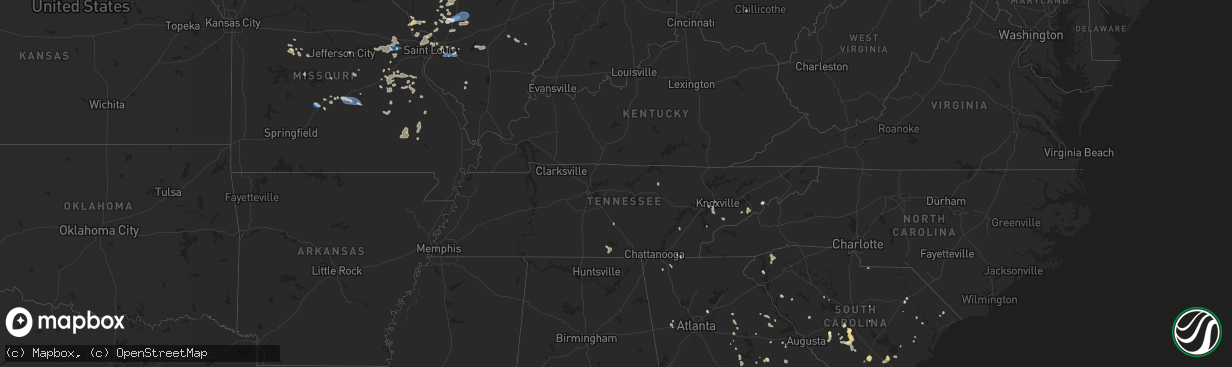
Hail Map in Wisconsin on August 3, 2022
The weather event in Wisconsin on August 3, 2022 includes Wind and Hail maps. 22 states and 722 cities were impacted and suffered possible damage. The total estimated number of properties impacted is 0.
Want more than just the map?
Turn this storm into a full workflow.
- Owner + property data so you know who to knock
- OnDemand branded weather history reports to win the "did we even have hail?" argument
- RoofTrace estimate so reps stop guessing numbers at the door
Bought this map? Upgrade within 7 days and we'll credit the $230. (10-15 min setup call)
Wind
Hail
0
Estimated number of impacted properties by a 1.00" hail or larger0
Estimated number of impacted properties by a 1.75" hail or larger0
Estimated number of impacted properties by a 2.50" hail or largerStorm reports in Wisconsin
Wisconsin
| Date | Description |
|---|---|
| 08/03/202210:17 AM CDT | Delayed public report via broadcast media. Multiple trees uprooted and blown over around the cheeseville area. Time estimated based on radar. |
| 08/03/20228:02 AM CDT | Report from mping: trees uprooted or snapped; roof blown off. |
| 08/03/20227:59 AM CDT | Numerous trees down. Power poles snapped. Time estimated via radar. |
| 08/03/20227:59 AM CDT | Numerous trees down. Power poles snapped. Time estimated via radar |
| 08/03/20227:55 AM CDT | Trees down and power pole snapped. |
| 08/03/20227:50 AM CDT | Multiple trees down. Time estimated via radar |
| 08/03/20227:50 AM CDT | Multiple trees down. Time estimated via radar. |
| 08/03/20227:46 AM CDT | Numerous trees down. Power lines damaged. Time estimated via radar |
| 08/03/20227:46 AM CDT | Numerous trees down. Power lines damaged. Time estimated via radar. |
| 08/03/20227:34 AM CDT | A local report indicates 79 MPH wind near 3 W FOREST JUNCTION |
| 08/03/20227:34 AM CDT | 10-12 inch diameter tree limb damage at mulberry farms. Time estimated via radar. |
| 08/03/20227:31 AM CDT | Near highway 10 and highway 55. 3 semi trucks tipped over. A roof was blown off a barn. Several trees and power lines damaged. |
| 08/03/20227:30 AM CDT | Large pine tree snapped in half. Damage to machine shed doors. Time estimated. Measured on home weather station. |
| 08/03/20227:29 AM CDT | At 1229 AM CDT, severe thunderstorms were located along a line extending from near Columbia Heights to St. Paul Park to 5 miles southeast of Rosemount, moving east at 60 mph. HAZARD...60 mph wind gusts. SOURCE...Radar indicated. IMPACT...Expect damage to roofs, siding, and trees. Severe thunderstorms will be near... Cottage Grove and Hastings around 1235 AM CDT. Oakdale and Prescott around 1240 AM CDT. Woodbury and Mahtomedi around 1245 AM CDT.Other locations in the path of these severe thunderstorms includeRiver Falls, Stillwater, Lake Elmo, Bayport, Afton, Hudson, NorthHudson, Ellsworth, Bay City, Somerset and Roberts. |
| 08/03/20227:21 AM CDT | At 1221 PM CDT, severe thunderstorms were located along a line extending from near Poynette to near Deforest to Madison, moving east at 35 mph. HAZARD...60 mph wind gusts. SOURCE...Radar indicated. IMPACT...Expect damage to roofs, siding, and trees. Locations impacted include... Eastern Madison, Sun Prairie, Windsor, Columbus, Marshall, Waterloo, Deforest, Poynette, Fall River, Milford, Arlington, Reeseville, Otsego, Richwood, Clyman, Lowell, Doylestown, Morrisonville, Hubbleton and South Beaver Dam. |
| 08/03/20227:00 AM CDT | At 1200 AM CDT, a severe thunderstorm was located 13 miles northeast of Weston, or 13 miles southwest of Antigo, moving southeast at 45 mph. HAZARD...60 mph wind gusts and penny size hail. SOURCE...Radar indicated. IMPACT...Expect damage to roofs, siding, and trees. Locations impacted include... Wausau, Antigo, Weston, Rib Mountain, Wittenberg, Neopit, Schofield, Ringle, Norrie and Birnamwood. |
| 08/03/20226:48 AM CDT | At 1148 AM CDT, a severe thunderstorm was located near Black Earth, or near Sauk City, moving east at 45 mph. HAZARD...60 mph wind gusts. SOURCE...Radar indicated. IMPACT...Expect damage to roofs, siding, and trees. Locations impacted include... Madison, Sun Prairie, Middleton, Waunakee, McFarland, Monona, Windsor, Prairie Du Sac, Sauk City, Lake Wisconsin, Deforest, Cottage Grove, Cross Plains, Lodi, Mazomanie, Shorewood Hills, Black Earth, Maple Bluff, Dane and Arlington.People attending The Crossfit Games in Madison should seek safeshelter immediately!This includes the following Location Wisconsin State Capitol. |
| 08/03/20225:12 AM CDT | At 1012 AM CDT, a severe thunderstorm was located over Newburg, or near West Bend, moving east at 35 mph. HAZARD...60 mph wind gusts and quarter size hail. SOURCE...Radar indicated. IMPACT...Hail damage to vehicles is expected. Expect wind damage to roofs, siding, and trees. Locations impacted include... West Bend, Port Washington, Saukville, Kewaskum, Belgium, Fredonia, Newburg, Harrington Beach St Park, Boltonville, Waubeka and Fillmore. |
| 08/03/20222:23 AM CDT | At 723 AM CDT, a severe thunderstorm was located over High Cliff State Park, or 9 miles southeast of Appleton, moving east at 55 mph. HAZARD...60 mph wind gusts and quarter size hail. SOURCE...Radar indicated. IMPACT...Hail damage to vehicles is expected. Expect wind damage to roofs, siding, and trees. This severe thunderstorm will be near... Brillion around 735 AM CDT.Other locations in the path of this severe thunderstorm includeDenmark and Two Creeks. |
| 08/02/202210:46 PM CDT | At 346 AM CDT, a severe thunderstorm was located 7 miles south of Turtle Flambeau Flowage, moving east at 60 mph. HAZARD...60 mph wind gusts. SOURCE...Radar indicated. IMPACT...Expect damage to roofs, siding, and trees. Locations impacted include... Park Falls, Turtle Flambeau Flowage, Fifield, Butternut, Glidden, Butternut Lake, Pike Lake, and Musser Lake. |
| 08/02/202210:25 PM CDT | At 325 AM CDT, a severe thunderstorm was located 10 miles west of Butternut, or 12 miles west of Park Falls, moving east at 55 mph. HAZARD...60 mph wind gusts. SOURCE...Radar indicated. IMPACT...Expect damage to roofs, siding, and trees. Locations impacted include... Park Falls, Turtle Flambeau Flowage, Phillips, Fifield, Butternut, Winter, Glidden, Connors Lake, Pike Lake, Wilson Lake Near Phillips, Loretta, Butternut Lake, Cranberry Lake, Blaisdell Lake, Musser Lake, and Brantwood. |
| 08/02/20229:50 PM CDT | At 249 AM CDT, a severe thunderstorm was located over Round Lake, or 7 miles east of Hayward, moving east at 50 mph. HAZARD...60 mph wind gusts. SOURCE...Radar indicated. IMPACT...Expect damage to roofs, siding, and trees. Locations impacted include... Park Falls, Hayward, Chippewa Flowage West, Chippewa Flowage East, Round Lake, Cable, Mellen, Butternut, New Post, Chief Lake on Chippewa Flowage, Little Round Lake, Seeley, Glidden, Clam Lake, Namekagon Lake, Namekagon, Morse, Spider Lake, Northwoods Beach, and Ghost Lake. |
| 08/02/20229:15 PM CDT | At 214 AM CDT, severe thunderstorms were located along a line extending from 8 miles west of Sheldon, to near Cadott, to 7 miles northeast of Augusta, moving east at 55 mph. HAZARD...60 mph wind gusts. SOURCE...Radar indicated. IMPACT...Expect damage to roofs, siding, and trees. Severe thunderstorms will be near... Ogema around 300 AM CDT. Prentice around 305 AM CDT. Spirit around 310 AM CDT.Other locations impacted by these severe thunderstorms includeBrantwood, Clifford and Kennan. |
| 08/02/20229:03 PM CDT | At 201 AM CDT, severe thunderstorms were located along a line extending from near Cornell to near Fall Creek, moving east at 60 mph. HAZARD...60 mph wind gusts. SOURCE...Radar indicated. IMPACT...Expect damage to roofs, siding, and trees. Severe thunderstorms will be near... Thorp and Jump River around 220 AM CDT. Owen around 235 AM CDT. Abbotsford, Colby, Dorchester and Westboro around 245 AM CDT.Other locations impacted by these severe thunderstorms include Polley, Atwood, Tioga, Perkinstown, Esadore Lake and Eidsvold. |
| 08/02/20228:39 PM CDT | At 138 AM CDT, a severe thunderstorm was located over Elk Mound, or 9 miles west of Eau Claire, moving east at 50 mph. HAZARD...60 mph wind gusts. SOURCE...Radar indicated. IMPACT...Expect damage to roofs, siding, and trees. This severe thunderstorm will be near... Lake Hallie around 145 AM CDT. Chippewa Falls and Altoona around 150 AM CDT. Eau Claire and Lake Wissota around 155 AM CDT. Cadott around 210 AM CDT. Boyd around 215 AM CDT. Stanley around 220 AM CDT.Other locations impacted by this severe thunderstorm includeCaryville, Holcombe, Tilden, Otter Lake, Jim Falls, Allen, SandCreek, Chippewa Moraine State Rec Area, Brackett and Lake Eau ClaireCounty Park. |
| 08/02/20228:05 PM CDT | At 104 AM CDT, a severe thunderstorm was located near Elmwood, or 17 miles west of Menomonie, moving east at 60 mph. HAZARD...60 mph wind gusts. SOURCE...Radar indicated. IMPACT...Expect damage to roofs, siding, and trees. This severe thunderstorm will be near... Menomonie around 120 AM CDT.Other locations in the path of this severe thunderstorm include ElkMound. |
All States Impacted by Hail Map on August 3, 2022
Cities Impacted by Hail Map on August 3, 2022
- Mayville, MI
- Allenton, WI
- West Bend, WI
- Hartford, WI
- Birch Run, MI
- Clio, MI
- Falmouth, MI
- Roscommon, MI
- Lansing, IA
- Brooklyn, MI
- Sherwood, MI
- Coldwater, MI
- Bronson, MI
- Columbiaville, MI
- North Branch, MI
- Lapeer, MI
- Avoca, MI
- Croswell, MI
- Cadillac, MI
- Lake City, MI
- Brown City, MI
- Kingston, MI
- Marlette, MI
- Sandusky, MI
- Melvin, MI
- Peck, MI
- Wisconsin Rapids, WI
- Houghton Lake, MI
- Hastings, MI
- Battle Creek, MI
- Dowling, MI
- Nashville, MI
- Bellevue, MI
- Delton, MI
- Winneconne, WI
- Brillion, WI
- Maribel, WI
- Greenleaf, WI
- Butte Des Morts, WI
- Potter, WI
- Sherwood, WI
- Larsen, WI
- Whitelaw, WI
- Menasha, WI
- Reedsville, WI
- Forest Junction, WI
- Oshkosh, WI
- Denmark, WI
- Hilbert, WI
- Kaukauna, WI
- Neenah, WI
- Yale, MI
- Memphis, MI
- Goodells, MI
- Hobart, IN
- Portage, IN
- Merrillville, IN
- Saint Anne, IL
- Milford, IL
- Loda, IL
- West Lebanon, IN
- Shipman, IL
- Brighton, IL
- Viola, AR
- Dalton, GA
- Hurricane, UT
- Elfrida, AZ
- Bartow, GA
- Silverwood, MI
- Clifford, MI
- Montrose, MI
- Eastman, WI
- Harpers Ferry, IA
- Manitowoc, WI
- Two Rivers, WI
- Remus, MI
- Jackson, MI
- Mahomet, IL
- Mansfield, IL
- Germfask, MI
- Seney, MI
- Manistique, MI
- Grand Marais, MI
- Munising, MI
- Benton Harbor, MI
- Watervliet, MI
- Lake Bluff, IL
- Libertyville, IL
- Lake Forest, IL
- Sullivan, MO
- Bourbon, MO
- Lanark, IL
- Mount Carroll, IL
- Pearl City, IL
- Tebbetts, MO
- Bonnots Mill, MO
- La Porte City, IA
- Marion, MI
- Tustin, MI
- McBain, MI
- Lincoln, IL
- Arrowsmith, IL
- Davison, MI
- Burton, MI
- Pinckneyville, IL
- Ivesdale, IL
- Seymour, IL
- White Heath, IL
- Champaign, IL
- Potosi, MO
- Steelville, MO
- Augusta, MO
- Marthasville, MO
- Foristell, MO
- Rives Junction, MI
- Plainwell, MI
- Sedalia, MO
- Hettick, IL
- Chesterfield, IL
- Carlinville, IL
- Saranac, MI
- Lake Odessa, MI
- Clarksville, MI
- Lowell, MI
- Ionia, MI
- Barrington, IL
- Duluth, GA
- Smoaks, SC
- Walterboro, SC
- Bismarck, IL
- Schererville, IN
- Crown Point, IN
- Corona, NM
- Newport, TN
- Cosby, TN
- Cotopaxi, CO
- Pittsfield, IL
- Tignall, GA
- Cissna Park, IL
- Prosperity, SC
- Lancaster, SC
- Sylvania, GA
- Dallas, GA
- Seneca, SC
- Washington, MO
- Hermann, MO
- Berger, MO
- Warrenton, MO
- New Haven, MO
- Mount Pulaski, IL
- Bruning, NE
- Carleton, NE
- Clinton, IL
- Williamsport, IN
- Coaldale, CO
- Howard, CO
- Evart, MI
- Waterville, IA
- Applegate, MI
- Lexington, MI
- Canton, MI
- Brandon, IA
- Jesup, IA
- Palatine, IL
- Charlotte, MI
- Sunfield, MI
- Mulliken, MI
- Eagle, MI
- Grand Ledge, MI
- Vermontville, MI
- Aviston, IL
- Kankakee, IL
- Aroma Park, IL
- Chebanse, IL
- Athens, IL
- Middletown, IL
- Elkhart, IL
- Silva, MO
- Fredericktown, MO
- Annapolis, MO
- Des Arc, MO
- Lodi, MO
- Patterson, MO
- Lebanon, MO
- Stoutland, MO
- Summerville, SC
- Moncks Corner, SC
- Ridgeville, SC
- Dewitt, MI
- Lansing, MI
- Saint Johns, MI
- Chicago, IL
- Saint Joseph, MI
- Berrien Springs, MI
- Sodus, MI
- Eau Claire, MI
- Stevensville, MI
- Watseka, IL
- Sheldon, IL
- Conklin, MI
- Coopersville, MI
- Vernon Hills, IL
- Lake Zurich, IL
- Grayslake, IL
- Hillsboro, MO
- De Soto, MO
- Garnavillo, IA
- Bagley, WI
- Napoleon, OH
- Defiance, OH
- Walled Lake, MI
- Wixom, MI
- Commerce Township, MI
- Milford, MI
- West Bloomfield, MI
- Westphalia, MI
- Fowler, MI
- Flushing, MI
- Flint, MI
- Swartz Creek, MI
- Gaines, MI
- Brussels, IL
- Bismarck, MO
- Union, MO
- Beaufort, MO
- Saluda, SC
- Johnston, SC
- Edgefield, SC
- Knoxville, TN
- Sevierville, TN
- Highland Park, IL
- Argenta, IL
- Macon, IL
- Hammond, IL
- Decatur, IL
- Mt Zion, IL
- Milmine, IL
- Cisco, IL
- Cerro Gordo, IL
- Oreana, IL
- Richland, MO
- Portland, MI
- Cutler, IL
- Robbinsville, NC
- Alton, IL
- Bridgeton, MO
- Saint Charles, MO
- Maryland Heights, MO
- Saint Louis, MO
- Saint Ann, MO
- West Alton, MO
- Hazelwood, MO
- Florissant, MO
- Godfrey, IL
- Ocala, FL
- Wauzeka, WI
- Prairie Du Chien, WI
- Bernice, LA
- Lehigh Acres, FL
- Noble, IL
- Ingraham, IL
- Sparta, MI
- Northville, MI
- Plymouth, MI
- Shelbyville, MI
- Martin, MI
- Wayland, MI
- Middleville, MI
- Hopkins, MI
- Bannister, MI
- Oakley, MI
- Ashley, MI
- Perrinton, MI
- Elsie, MI
- Chesaning, MI
- Henderson, MI
- Maple Rapids, MI
- South Lyon, MI
- Ann Arbor, MI
- Ovid, MI
- Laingsburg, MI
- Bath, MI
- Richland Center, WI
- Lone Rock, WI
- Hillpoint, WI
- Mascoutah, IL
- Coloma, MI
- Covert, MI
- Edinburg, IL
- Caseyville, IL
- Collinsville, IL
- Cass City, MI
- Deford, MI
- Decker, MI
- Grass Lake, MI
- Chelsea, MI
- Munith, MI
- Weiser, ID
- Attica, MI
- Rankin, IL
- Abbeville, SC
- Girard, IL
- Thomson, GA
- Dearing, GA
- Haddock, GA
- Milledgeville, GA
- Eatonton, GA
- Orangeburg, SC
- Crown King, AZ
- Mayer, AZ
- Rocky Face, GA
- Ringgold, GA
- Chesterton, IN
- Saint George, SC
- Buffalo, IL
- Tombstone, AZ
- Bisbee, AZ
- Tinnie, NM
- Ellenboro, NC
- Elgin, AZ
- Stapleton, GA
- Louisville, GA
- Washington, GA
- Jesup, GA
- Salley, SC
- Wagener, SC
- Naples, FL
- Bonita Springs, FL
- North, SC
- Sandoval, IL
- Carlyle, IL
- Gobles, MI
- Estancia, NM
- Green Ridge, MO
- Warthen, GA
- Owosso, MI
- Bostic, NC
- Statesboro, GA
- Fort Myers, FL
- Johnsonville, SC
- Pamplico, SC
- Lake Lure, NC
- Norwood, GA
- Labelle, FL
- Conway, SC
- Millen, GA
- Kouts, IN
- Ellabell, GA
- Mount Olive, IL
- Gillespie, IL
- Litchfield, IL
- Harrietta, MI
- Hardeeville, SC
- Brook, IN
- Morocco, IN
- Animas, NM
- Willard, NM
- Ridgeland, SC
- Greeneville, TN
- Del Rio, TN
- Allegan, MI
- Wrightsville, GA
- Lordsburg, NM
- Bloomingdale, GA
- Douglas, AZ
- Barton City, MI
- Bogart, GA
- Bishop, GA
- Good Hope, GA
- Fieldon, IL
- Louisville, TN
- Ashkum, IL
- Savoy, IL
- Heyworth, IL
- Wapella, IL
- Le Roy, IL
- Downs, IL
- Smithton, MO
- Mora, MO
- Iberia, MO
- Ulman, MO
- Greenville, MO
- Bonne Terre, MO
- Cadet, MO
- Statham, GA
- Rocky Ford, GA
- Eastman, GA
- Port Wentworth, GA
- Pooler, GA
- Savannah, GA
- Reidsville, GA
- Glennville, GA
- Batchtown, IL
- Hardin, IL
- Jerseyville, IL
- Trenton, IL
- New Baden, IL
- Climax Springs, MO
- Edwards, MO
- Stover, MO
- Maxton, NC
- Laurinburg, NC
- Cedar Lake, IN
- Rochester, IL
- Divernon, IL
- Pawnee, IL
- Gary, IN
- Union Mills, IN
- Marietta, SC
- Pickens, SC
- Pima, AZ
- Branchville, SC
- Cope, SC
- Florence, SC
- Harrison, GA
- Davisboro, GA
- Benson, AZ
- Murrayville, IL
- Jacksonville, IL
- Imlay City, MI
- Winchester, TN
- Huntland, TN
- Mulberry, TN
- Belvidere, TN
- Kempton, IL
- Bainbridge, OH
- South Salem, OH
- Farmersville, IL
- Virden, IL
- O'Fallon, IL
- Benld, IL
- Neeses, SC
- Norway, SC
- Saint Clair, MO
- Lonedell, MO
- Bethalto, IL
- Bangor, MI
- Paw Paw, MI
- Bloomingdale, MI
- Hillsboro, IL
- Coffeen, IL
- Walshville, IL
- Warrensburg, IL
- Maroa, IL
- Weldon, IL
- Modesto, IL
- Villa Rica, GA
- Gadsden, AL
- Newberry, SC
- Latham, IL
- Lena, LA
- Illiopolis, IL
- Fort Myers Beach, FL
- Rembert, SC
- Dewey, AZ
- Cottonwood, AZ
- Union Point, GA
- Townsend, TN
- Bixby, MO
- Hendersonville, NC
- Immokalee, FL
- Wetmore, CO
- Salem, IL
- Odin, IL
- Boon, MI
- Dewitt, IL
- Farmer City, IL
- Blackwell, MO
- Saint Jacob, IL
- Troy, IL
- Superior, NE
- Franklin, IL
- Iva, SC
- Due West, SC
- Ellington, MO
- Vulcan, MO
- Piedmont, MO
- Trementina, NM
- Williston, SC
- Windsor, SC
- Loris, SC
- Springport, MI
- Gilman, IL
- Onarga, IL
- Caro, MI
- Palmyra, IL
- Kentland, IN
- Donovan, IL
- Granite City, IL
- Valparaiso, IN
- Monroe, GA
- Belle, MO
- Alcoa, TN
- Maryville, TN
- Vonore, TN
- Dutton, AL
- Livingston, IL
- Staunton, IL
- New Douglas, IL
- Rutledge, GA
- Madison, GA
- Estill, SC
- Luray, SC
- Springfield, SC
- Rincon, GA
- Bunker, MO
- Black, MO
- Sanderson, FL
- Bryceville, FL
- Wellston, MI
- Comstock Park, MI
- Grand Junction, MI
- Lawrence, MI
- Otsego, MI
- Hartford, MI
- Portage Des Sioux, MO
- Golden Eagle, IL
- Fort Scott, KS
- Penfield, IL
- Galien, MI
- Homer, IL
- Saint Stephen, SC
- Old Fort, TN
- Bexar, AR
- Salem, AR
- Cleveland, TN
- Punta Gorda, FL
- Brooklet, GA
- Concord, MI
- Spring Arbor, MI
- Parma, MI
- New Buffalo, MI
- Michigan City, IN
- Onondaga, MI
- Leslie, MI
- Eaton Rapids, MI
- Mason, MI
- Highland, IL
- Richwoods, MO
- Dittmer, MO
- Grubville, MO
- Lowell, IN
- Westcliffe, CO
- Andrews, SC
- Stevenson, AL
- Crawford, TN
- Allred, TN
- Rickman, TN
- Wedgefield, SC
- Saint Robert, MO
- Fort Leonard Wood, MO
- Devils Elbow, MO
- Duke, MO
- Edgar Springs, MO
- Newburg, MO
- Kalamazoo, MI
- Olney, IL
- Philo, IL
- Urbana, IL
- Hebron, IN
- Highwood, IL
- Wheeling, IL
- Buffalo Grove, IL
- Arlington Heights, IL
- Northbrook, IL
- Deerfield, IL
- Prospect Heights, IL
- De Land, IL
- Wheatfield, IN
- La Crosse, IN
- Vienna, MO
- Wentzville, MO
- Wright City, MO
- Farmington, MO
- Davenport, NE
- Emmett, MI
- Rolla, MO
- Louisville, IL
- Mason, IL
- Odum, GA
- Swansea, SC
- Gaston, SC
- Hemingway, SC
- Guyton, GA
- Waynesville, MO
- Versailles, MO
- Fortuna, MO
- Sparta, GA
- Cordova, SC
- Bamberg, SC
- Lillie, LA
- Red Springs, NC
- Union Mills, NC
- Rutherfordton, NC
- Laquey, MO
- Timmonsville, SC
- Manchester, TN
- Swainsboro, GA
- Farmersburg, IA
- Otterville, MO
- Riverton, IL
- Niantic, IL
- Williamsville, IL
- Dawson, IL
- Mechanicsburg, IL
- Athens, TN
- Decatur, TN
- Whitmore Lake, MI
- Pinckney, MI
- Dexter, MI
- Mount Morris, MI
- Genesee, MI
- Shady Dale, GA
- Colfax, LA
- Blue Mound, IL
- Cullom, IL
- Paxton, IL
- Leasburg, MO
- Congress, AZ
- Newborn, GA
- Carlton, GA
- Newberry, FL
- Townsend, GA
- Merritt, MI
- Manton, MI
- Glennie, MI
- Mikado, MI
- Greenbush, MI
- National City, MI
- Oscoda, MI
- Long Lake, MI
- South Branch, MI
- Hale, MI
- Lupton, MI
- East Tawas, MI
- Tawas City, MI
- Vernon, MI
- Byron, MI
- Grand Blanc, MI
- Corunna, MI
- Lennon, MI
- Durand, MI
- Bancroft, MI
- Lyons, MI
- Linden, MI
- Morrice, MI
- Fenton, MI
- Holly, MI
- New Lothrop, MI
- East Lansing, MI
- Haslett, MI
- Perry, MI
- Pullman, MI
- Fennville, MI
- South Haven, MI
- Stockbridge, MI
- Webberville, MI
- Gregory, MI
- Albion, MI
- Pleasant Lake, MI
- Dansville, MI
- Howell, MI
- Cecil, OH
- Holland, OH
- Liberty Center, OH
- Holgate, OH
- Berkey, OH
- Swanton, OH
- Wauseon, OH
- Delta, OH
- Paulding, OH
- Oakwood, OH
- Monclova, OH
- Sylvania, OH
- Toledo, OH
- Harbert, MI
- Three Oaks, MI
- New Carlisle, IN
- Union Pier, MI
- New Troy, MI
- La Porte, IN
- Buchanan, MI
- Bridgman, MI
- Westville, IN
- Beverly Shores, IN
- Baroda, MI
- Rolling Prairie, IN
- Sawyer, MI
- Lakeside, MI
- Orland Park, IL
- Mokena, IL
- Dalton City, IL
- Lovington, IL
- Arthur, IL
- La Place, IL
- Witt, IL
- Irving, IL
- Butler, IL
- Nokomis, IL
- Raymond, IL
- Lebanon, IL
- Scott Air Force Base, IL
- Belleville, IL
- Germantown, IL
- Albers, IL
- Defiance, MO
- Manchester, IA
- Kewaunee, WI
- Mishicot, WI
- Columbus, WI
- Waunakee, WI
- Deforest, WI
- Sauk City, WI
- Marshall, WI
- Sun Prairie, WI
- Dane, WI
- Rio, WI
- Morrisonville, WI
- Lodi, WI
- Mazomanie, WI
- Arlington, WI
- New Lenox, IL


