Hail Map in Missouri on August 3, 2022
Get this storm
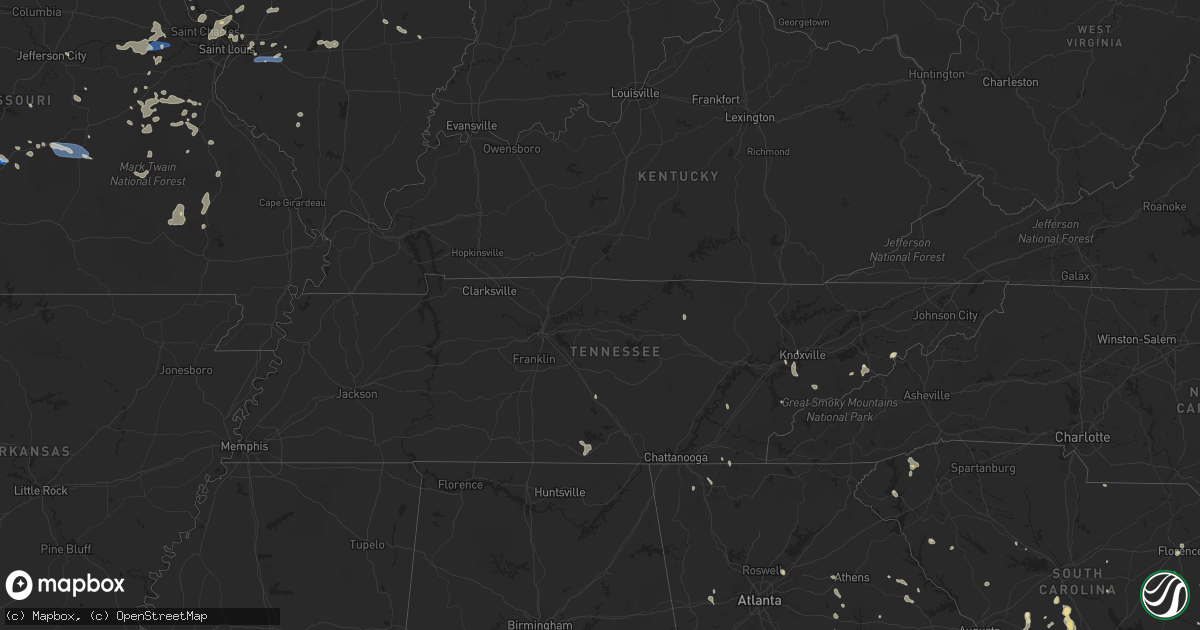
August 3 map
$229
one time, instant access
Download today. No call, no setup
Keep the $229
Bought the map and want the full workflow? Apply the entire $229 to a subscription within 7 days. None of it is wasted.
Every map, not just this one
This buys you this map. Subscription and you get every map we run, in the markets you choose from a few cities to whole states to nationwide. Plus real-time alerts the moment a storm fires.
Contact data
Name, contact info, occupancy, even credit band for addresses in the footprint. You go from where it hit to who to call.
Become the source they trust
Unlimited branding weather history reports on demand. You already have the documented answer ready for the property owner, and you are the one who showed up with it.
Property data and RoofTrace estimates
Pull up any address you have got, its value and the exact code rules for that jurisdiction, straight from One Click Code. Then RoofTrace estimates the squares, pitch, and roof value, priced the way you price.
Storm reports in Missouri
Missouri
| Date | Description |
|---|---|
| 08/03/20226:45 PM CDT | Severe thunderstorm wind gusts downed a tree across the road. |
| 08/03/20225:35 PM CDT | Tree blown over onto hwy v just northwest of town. Via twitter with picture. |
| 08/03/20225:20 PM CDT | Corrects previous tstm wnd dmg report from de soto. Large tree branches blown down around town. Via facebook post with picture. |
| 08/03/20225:15 PM CDT | Large tree branches blown down around town. Via facebook post with picture. |
| 08/03/20223:43 PM CDT | Report from mping: quarter |
| 08/03/20223:42 PM CDT | Report from mping: tree limbs broken. |
| 08/03/20223:36 PM CDT | Report from mping: tree limbs broken; shingles blown off. |
| 08/03/20223:30 PM CDT | Corrects previous tstm wnd dmg report from saint ann. Large tree uprooted in town. |
| 08/03/20223:13 PM CDT | Several trees blown down onto hwy 94. |
| 08/03/20223:13 PM CDT | Falling timber reported. |
| 08/03/20223:11 PM CDT | Large tree uprooted in town. |
| 08/03/20223:05 PM CDT | Delayed report. Several pictures of large limbs down in the rolla area. Pictures via social media. |
| 08/03/20222:40 PM CDT | Thunderstorm wind gusts snapped a couple of large limbs. |
| 08/03/20228:30 AM CDT | Wind gust displaced and severely damaged a car port. Very little to no rain occurred at time of gust which may have been a microburst. Delayed report and time estimated |
| 08/03/20225:20 AM CDT | At 1020 PM CDT, a severe thunderstorm was located over Kirkwood, moving east at 20 mph. HAZARD...60 mph wind gusts. SOURCE...Radar indicated. IMPACT...Expect damage to roofs, siding, and trees. This severe thunderstorm will be near... Crestwood, Ladue, Olivette, Glendale and Oakland around 1025 PM CDT. University City, Webster Groves, Clayton, Richmond Heights, Brentwood, Rock Hill, Grantwood Village, Concord and Sappington around 1030 PM CDT. Maplewood, Shrewsbury, Lakeshire, Affton, Pagedale, Green Park, Marlborough and Mackenzie around 1035 PM CDT. Lemay, Mehlville, Oakville, St. George, Bella Villa and Wilbur Park around 1040 PM CDT.Other locations in the path of this severe thunderstorm include EastCarondelet, Columbia, Dupo, Brooklyn, East St. Louis, Cahokia,Centreville, Washington Park, Cahokia Parks Airport, Fairmont Cityand Alorton.This includes Interstate 44 in Missouri between exits 272 and 277. This also includes Scott Joplin Historic Site. |
| 08/03/20223:19 AM CDT | At 819 PM CDT, a severe thunderstorm was located over Conway, or 12 miles southwest of Lebanon, moving southeast at 30 mph. HAZARD...60 mph wind gusts and quarter size hail. SOURCE...Radar indicated. IMPACT...Hail damage to vehicles is expected. Expect wind damage to roofs, siding, and trees. Locations impacted include... Morgan... Conway... Duncan... Phillipsburg... Twin Bridges... Rader... Grovespring... Odin... This includes Interstate 44 between mile markers 108 and 109, andbetween mile markers 112 and 123. |
| 08/03/20221:56 AM CDT | At 656 PM CDT, a severe thunderstorm was located 7 miles northwest of Lebanon, moving southeast at 30 mph. HAZARD...60 mph wind gusts and quarter size hail. SOURCE...Radar indicated. IMPACT...Hail damage to vehicles is expected. Expect wind damage to roofs, siding, and trees. Locations impacted include... Lebanon... Bennett Spring State Park... Twin Bridges... Competition... Lynchburg... Dry Knob... Falcon... This includes Interstate 44 between mile markers 121 and 134. |
| 08/03/20221:55 AM CDT | Delayed report. Overnight storm produced extensive wind damage with five homes damaged... Barn destroyed... 20-30 power lines down. Numerous trees/tree limbs. Time esti |
| 08/03/20221:49 AM CDT | At 649 PM CDT, a severe thunderstorm was located over St. Robert, or over Waynesville, moving east at 35 mph. HAZARD...60 mph wind gusts and quarter size hail. SOURCE...Radar indicated. IMPACT...Hail damage to vehicles is expected. Expect wind damage to roofs, siding, and trees. Locations impacted include... Fort Leonard Wood... Waynesville... St. Robert... Edgar Springs... Laquey... Beulah... Devil's Elbow... This includes Interstate 44 between mile markers 150 and 165. |
| 08/03/20221:41 AM CDT | At 641 PM CDT, a severe thunderstorm was located near Fordland, or 8 miles south of Marshfield, moving east at 15 mph. HAZARD...60 mph wind gusts and quarter size hail. SOURCE...Radar indicated. IMPACT...Hail damage to vehicles is expected. Expect wind damage to roofs, siding, and trees. Locations impacted include... Seymour... Fordland... Diggins... Northview... This includes Interstate 44 near mile marker 96. |
| 08/02/202211:49 PM CDT | At 449 PM CDT, a severe thunderstorm was located 7 miles southeast of Miramiguoa Park, moving east at 20 mph. HAZARD...60 mph wind gusts and nickel size hail. SOURCE...Radar indicated. IMPACT...Expect damage to roofs, siding, and trees. Locations impacted include... Richwoods.This also includes Washington State Park. |
| 08/02/202210:49 PM CDT | At 349 PM CDT, a severe thunderstorm was located 9 miles northwest of Linn, moving east at 25 mph. HAZARD...60 mph wind gusts and quarter size hail. SOURCE...Radar indicated. IMPACT...Hail damage to vehicles is expected. Expect wind damage to roofs, siding, and trees. This severe thunderstorm will be near... Linn around 405 PM CDT.Other locations in the path of this severe thunderstorm includeChamois. |
| 08/02/202210:45 PM CDT | At 344 PM CDT, a severe thunderstorm was located near Hardin, moving east at 20 mph. HAZARD...60 mph wind gusts and quarter size hail. SOURCE...Radar indicated. IMPACT...Hail damage to vehicles is expected. Expect wind damage to roofs, siding, and trees. Locations impacted include... Carrollton, Jerseyville and Old Kane. |
| 08/02/202210:36 PM CDT | At 336 PM CDT, a severe thunderstorm was located near Union, moving east at 30 mph. HAZARD...60 mph wind gusts and quarter size hail. SOURCE...Radar indicated. IMPACT...Hail damage to vehicles is expected. Expect wind damage to roofs, siding, and trees. This severe thunderstorm will be near... Union, St. Clair and Parkway around 345 PM CDT.Other locations in the path of this severe thunderstorm include VillaRidge, Gray Summit and Pacific.This includes Interstate 44 in Missouri between exits 230 and 257. This also includes Robertsville State Park. |
| 08/02/202210:30 PM CDT | Tree... Tree limbs down. Unknown diameter. |
| 08/02/202210:21 PM CDT | At 320 PM CDT, a severe thunderstorm was located over Lambert-St. Louis International Airport, moving east at 10 mph. HAZARD...60 mph wind gusts and penny size hail. SOURCE...Radar indicated. IMPACT...Expect damage to roofs, siding, and trees. This severe thunderstorm will be near... University City, Clayton, St. John, Vinita Park, Charlack, Sycamore Hills and Vinita Terrace around 325 PM CDT. Florissant, Pagedale and Hanley Hills around 330 PM CDT. Berkeley, Bel-Ridge, Kinloch, Wellston, Bel-Nor, Greendale and Bellerive around 335 PM CDT. Normandy, Hillsdale, Cool Valley, Velda City, Calverton Park, Velda Village Hills, Norwood Court, Pasadena Hills, Beverly Hills and Pasadena Park around 340 PM CDT.Other locations in the path of this severe thunderstorm includeFerguson, Northwoods, Pine Lawn, Country Club Hills, Jennings,Dellwood, Flordell Hills, Moline Acres, Castle Point, St. Louis,Granite City, Bellefontaine Neighbors, Black Jack, Madison,Riverview, Venice, Spanish Lake and Glasgow Village.This includes Interstate 70 in Missouri between exits 229 and 231. This also includes Confluence State Park, First Missouri StateCapitol Historic Site, and Horseshoe Lake State Park. |
| 08/02/202210:12 PM CDT | At 312 PM CDT, a severe thunderstorm was located near Treloar, moving east at 30 mph. HAZARD...60 mph wind gusts and nickel size hail. SOURCE...Radar indicated. IMPACT...Expect damage to roofs, siding, and trees. Locations impacted include... Wentzville, Washington, Warrenton, Wright City, New Haven, Marthasville, Truesdale, Innsbrook, New Melle, Treloar, Dutzow, Foristell, Lyon and Holstein.This includes Interstate 70 in Missouri between exits 199 and 203. |
| 08/02/20229:27 PM CDT | At 226 PM CDT, a severe thunderstorm was located near Truesdale, moving east at 20 mph. HAZARD...60 mph wind gusts and penny size hail. SOURCE...Radar indicated. IMPACT...Expect damage to roofs, siding, and trees. Locations impacted include... Wentzville, Warrenton, Wright City, Truesdale, Innsbrook, New Melle, Treloar, Foristell and Holstein.This includes Interstate 70 in Missouri between exits 193 and 203. |
| 08/02/20227:31 PM CDT | Reported by trained spotter. |
| 08/02/20227:07 PM CDT | Severe thunderstorm wind gusts caused significant damage to a barn and the roof of a home suffered moderate damage. |
| 08/02/20227:07 PM CDT | Corrects previous tstm wnd dmg report from 3 wnw lebanon. Severe thunderstorm wind gusts caused significant damage to a barn and the roof of a home suffered moderate da |
All States Impacted by Hail Map on August 3, 2022
Cities Impacted by Hail Map on August 3, 2022
- Mayville, MI
- Allenton, WI
- West Bend, WI
- Hartford, WI
- Birch Run, MI
- Clio, MI
- Falmouth, MI
- Roscommon, MI
- Lansing, IA
- Brooklyn, MI
- Sherwood, MI
- Coldwater, MI
- Bronson, MI
- Columbiaville, MI
- North Branch, MI
- Lapeer, MI
- Avoca, MI
- Croswell, MI
- Cadillac, MI
- Lake City, MI
- Brown City, MI
- Kingston, MI
- Marlette, MI
- Sandusky, MI
- Melvin, MI
- Peck, MI
- Wisconsin Rapids, WI
- Houghton Lake, MI
- Hastings, MI
- Battle Creek, MI
- Dowling, MI
- Nashville, MI
- Bellevue, MI
- Delton, MI
- Winneconne, WI
- Brillion, WI
- Maribel, WI
- Greenleaf, WI
- Butte Des Morts, WI
- Potter, WI
- Sherwood, WI
- Larsen, WI
- Whitelaw, WI
- Menasha, WI
- Reedsville, WI
- Forest Junction, WI
- Oshkosh, WI
- Denmark, WI
- Hilbert, WI
- Kaukauna, WI
- Neenah, WI
- Yale, MI
- Memphis, MI
- Goodells, MI
- Hobart, IN
- Portage, IN
- Merrillville, IN
- Saint Anne, IL
- Milford, IL
- Loda, IL
- West Lebanon, IN
- Shipman, IL
- Brighton, IL
- Viola, AR
- Dalton, GA
- Hurricane, UT
- Elfrida, AZ
- Bartow, GA
- Silverwood, MI
- Clifford, MI
- Montrose, MI
- Eastman, WI
- Harpers Ferry, IA
- Manitowoc, WI
- Two Rivers, WI
- Remus, MI
- Jackson, MI
- Mahomet, IL
- Mansfield, IL
- Germfask, MI
- Seney, MI
- Manistique, MI
- Grand Marais, MI
- Munising, MI
- Benton Harbor, MI
- Watervliet, MI
- Lake Bluff, IL
- Libertyville, IL
- Lake Forest, IL
- Sullivan, MO
- Bourbon, MO
- Lanark, IL
- Mount Carroll, IL
- Pearl City, IL
- Tebbetts, MO
- Bonnots Mill, MO
- La Porte City, IA
- Marion, MI
- Tustin, MI
- McBain, MI
- Lincoln, IL
- Arrowsmith, IL
- Davison, MI
- Burton, MI
- Pinckneyville, IL
- Ivesdale, IL
- Seymour, IL
- White Heath, IL
- Champaign, IL
- Potosi, MO
- Steelville, MO
- Augusta, MO
- Marthasville, MO
- Foristell, MO
- Rives Junction, MI
- Plainwell, MI
- Sedalia, MO
- Hettick, IL
- Chesterfield, IL
- Carlinville, IL
- Saranac, MI
- Lake Odessa, MI
- Clarksville, MI
- Lowell, MI
- Ionia, MI
- Barrington, IL
- Duluth, GA
- Smoaks, SC
- Walterboro, SC
- Bismarck, IL
- Schererville, IN
- Crown Point, IN
- Corona, NM
- Newport, TN
- Cosby, TN
- Cotopaxi, CO
- Pittsfield, IL
- Tignall, GA
- Cissna Park, IL
- Prosperity, SC
- Lancaster, SC
- Sylvania, GA
- Dallas, GA
- Seneca, SC
- Washington, MO
- Hermann, MO
- Berger, MO
- Warrenton, MO
- New Haven, MO
- Mount Pulaski, IL
- Bruning, NE
- Carleton, NE
- Clinton, IL
- Williamsport, IN
- Coaldale, CO
- Howard, CO
- Evart, MI
- Waterville, IA
- Applegate, MI
- Lexington, MI
- Canton, MI
- Brandon, IA
- Jesup, IA
- Palatine, IL
- Charlotte, MI
- Sunfield, MI
- Mulliken, MI
- Eagle, MI
- Grand Ledge, MI
- Vermontville, MI
- Aviston, IL
- Kankakee, IL
- Aroma Park, IL
- Chebanse, IL
- Athens, IL
- Middletown, IL
- Elkhart, IL
- Silva, MO
- Fredericktown, MO
- Annapolis, MO
- Des Arc, MO
- Lodi, MO
- Patterson, MO
- Lebanon, MO
- Stoutland, MO
- Summerville, SC
- Moncks Corner, SC
- Ridgeville, SC
- Dewitt, MI
- Lansing, MI
- Saint Johns, MI
- Chicago, IL
- Saint Joseph, MI
- Berrien Springs, MI
- Sodus, MI
- Eau Claire, MI
- Stevensville, MI
- Watseka, IL
- Sheldon, IL
- Conklin, MI
- Coopersville, MI
- Vernon Hills, IL
- Lake Zurich, IL
- Grayslake, IL
- Hillsboro, MO
- De Soto, MO
- Garnavillo, IA
- Bagley, WI
- Napoleon, OH
- Defiance, OH
- Walled Lake, MI
- Wixom, MI
- Commerce Township, MI
- Milford, MI
- West Bloomfield, MI
- Westphalia, MI
- Fowler, MI
- Flushing, MI
- Flint, MI
- Swartz Creek, MI
- Gaines, MI
- Brussels, IL
- Bismarck, MO
- Union, MO
- Beaufort, MO
- Saluda, SC
- Johnston, SC
- Edgefield, SC
- Knoxville, TN
- Sevierville, TN
- Highland Park, IL
- Argenta, IL
- Macon, IL
- Hammond, IL
- Decatur, IL
- Mt Zion, IL
- Milmine, IL
- Cisco, IL
- Cerro Gordo, IL
- Oreana, IL
- Richland, MO
- Portland, MI
- Cutler, IL
- Robbinsville, NC
- Alton, IL
- Bridgeton, MO
- Saint Charles, MO
- Maryland Heights, MO
- Saint Louis, MO
- Saint Ann, MO
- West Alton, MO
- Hazelwood, MO
- Florissant, MO
- Godfrey, IL
- Ocala, FL
- Wauzeka, WI
- Prairie Du Chien, WI
- Bernice, LA
- Lehigh Acres, FL
- Noble, IL
- Ingraham, IL
- Sparta, MI
- Northville, MI
- Plymouth, MI
- Shelbyville, MI
- Martin, MI
- Wayland, MI
- Middleville, MI
- Hopkins, MI
- Bannister, MI
- Oakley, MI
- Ashley, MI
- Perrinton, MI
- Elsie, MI
- Chesaning, MI
- Henderson, MI
- Maple Rapids, MI
- South Lyon, MI
- Ann Arbor, MI
- Ovid, MI
- Laingsburg, MI
- Bath, MI
- Richland Center, WI
- Lone Rock, WI
- Hillpoint, WI
- Mascoutah, IL
- Coloma, MI
- Covert, MI
- Edinburg, IL
- Caseyville, IL
- Collinsville, IL
- Cass City, MI
- Deford, MI
- Decker, MI
- Grass Lake, MI
- Chelsea, MI
- Munith, MI
- Weiser, ID
- Attica, MI
- Rankin, IL
- Abbeville, SC
- Girard, IL
- Thomson, GA
- Dearing, GA
- Haddock, GA
- Milledgeville, GA
- Eatonton, GA
- Orangeburg, SC
- Crown King, AZ
- Mayer, AZ
- Rocky Face, GA
- Ringgold, GA
- Chesterton, IN
- Saint George, SC
- Buffalo, IL
- Tombstone, AZ
- Bisbee, AZ
- Tinnie, NM
- Ellenboro, NC
- Elgin, AZ
- Stapleton, GA
- Louisville, GA
- Washington, GA
- Jesup, GA
- Salley, SC
- Wagener, SC
- Naples, FL
- Bonita Springs, FL
- North, SC
- Sandoval, IL
- Carlyle, IL
- Gobles, MI
- Estancia, NM
- Green Ridge, MO
- Warthen, GA
- Owosso, MI
- Bostic, NC
- Statesboro, GA
- Fort Myers, FL
- Johnsonville, SC
- Pamplico, SC
- Lake Lure, NC
- Norwood, GA
- Labelle, FL
- Conway, SC
- Millen, GA
- Kouts, IN
- Ellabell, GA
- Mount Olive, IL
- Gillespie, IL
- Litchfield, IL
- Harrietta, MI
- Hardeeville, SC
- Brook, IN
- Morocco, IN
- Animas, NM
- Willard, NM
- Ridgeland, SC
- Greeneville, TN
- Del Rio, TN
- Allegan, MI
- Wrightsville, GA
- Lordsburg, NM
- Bloomingdale, GA
- Douglas, AZ
- Barton City, MI
- Bogart, GA
- Bishop, GA
- Good Hope, GA
- Fieldon, IL
- Louisville, TN
- Ashkum, IL
- Savoy, IL
- Heyworth, IL
- Wapella, IL
- Le Roy, IL
- Downs, IL
- Smithton, MO
- Mora, MO
- Iberia, MO
- Ulman, MO
- Greenville, MO
- Bonne Terre, MO
- Cadet, MO
- Statham, GA
- Rocky Ford, GA
- Eastman, GA
- Port Wentworth, GA
- Pooler, GA
- Savannah, GA
- Reidsville, GA
- Glennville, GA
- Batchtown, IL
- Hardin, IL
- Jerseyville, IL
- Trenton, IL
- New Baden, IL
- Climax Springs, MO
- Edwards, MO
- Stover, MO
- Maxton, NC
- Laurinburg, NC
- Cedar Lake, IN
- Rochester, IL
- Divernon, IL
- Pawnee, IL
- Gary, IN
- Union Mills, IN
- Marietta, SC
- Pickens, SC
- Pima, AZ
- Branchville, SC
- Cope, SC
- Florence, SC
- Harrison, GA
- Davisboro, GA
- Benson, AZ
- Murrayville, IL
- Jacksonville, IL
- Imlay City, MI
- Winchester, TN
- Huntland, TN
- Mulberry, TN
- Belvidere, TN
- Kempton, IL
- Bainbridge, OH
- South Salem, OH
- Farmersville, IL
- Virden, IL
- O'Fallon, IL
- Benld, IL
- Neeses, SC
- Norway, SC
- Saint Clair, MO
- Lonedell, MO
- Bethalto, IL
- Bangor, MI
- Paw Paw, MI
- Bloomingdale, MI
- Hillsboro, IL
- Coffeen, IL
- Walshville, IL
- Warrensburg, IL
- Maroa, IL
- Weldon, IL
- Modesto, IL
- Villa Rica, GA
- Gadsden, AL
- Newberry, SC
- Latham, IL
- Lena, LA
- Illiopolis, IL
- Fort Myers Beach, FL
- Rembert, SC
- Dewey, AZ
- Cottonwood, AZ
- Union Point, GA
- Townsend, TN
- Bixby, MO
- Hendersonville, NC
- Immokalee, FL
- Wetmore, CO
- Salem, IL
- Odin, IL
- Boon, MI
- Dewitt, IL
- Farmer City, IL
- Blackwell, MO
- Saint Jacob, IL
- Troy, IL
- Superior, NE
- Franklin, IL
- Iva, SC
- Due West, SC
- Ellington, MO
- Vulcan, MO
- Piedmont, MO
- Trementina, NM
- Williston, SC
- Windsor, SC
- Loris, SC
- Springport, MI
- Gilman, IL
- Onarga, IL
- Caro, MI
- Palmyra, IL
- Kentland, IN
- Donovan, IL
- Granite City, IL
- Valparaiso, IN
- Monroe, GA
- Belle, MO
- Alcoa, TN
- Maryville, TN
- Vonore, TN
- Dutton, AL
- Livingston, IL
- Staunton, IL
- New Douglas, IL
- Rutledge, GA
- Madison, GA
- Estill, SC
- Luray, SC
- Springfield, SC
- Rincon, GA
- Bunker, MO
- Black, MO
- Sanderson, FL
- Bryceville, FL
- Wellston, MI
- Comstock Park, MI
- Grand Junction, MI
- Lawrence, MI
- Otsego, MI
- Hartford, MI
- Portage Des Sioux, MO
- Golden Eagle, IL
- Fort Scott, KS
- Penfield, IL
- Galien, MI
- Homer, IL
- Saint Stephen, SC
- Old Fort, TN
- Bexar, AR
- Salem, AR
- Cleveland, TN
- Punta Gorda, FL
- Brooklet, GA
- Concord, MI
- Spring Arbor, MI
- Parma, MI
- New Buffalo, MI
- Michigan City, IN
- Onondaga, MI
- Leslie, MI
- Eaton Rapids, MI
- Mason, MI
- Highland, IL
- Richwoods, MO
- Dittmer, MO
- Grubville, MO
- Lowell, IN
- Westcliffe, CO
- Andrews, SC
- Stevenson, AL
- Crawford, TN
- Allred, TN
- Rickman, TN
- Wedgefield, SC
- Saint Robert, MO
- Fort Leonard Wood, MO
- Devils Elbow, MO
- Duke, MO
- Edgar Springs, MO
- Newburg, MO
- Kalamazoo, MI
- Olney, IL
- Philo, IL
- Urbana, IL
- Hebron, IN
- Highwood, IL
- Wheeling, IL
- Buffalo Grove, IL
- Arlington Heights, IL
- Northbrook, IL
- Deerfield, IL
- Prospect Heights, IL
- De Land, IL
- Wheatfield, IN
- La Crosse, IN
- Vienna, MO
- Wentzville, MO
- Wright City, MO
- Farmington, MO
- Davenport, NE
- Emmett, MI
- Rolla, MO
- Louisville, IL
- Mason, IL
- Odum, GA
- Swansea, SC
- Gaston, SC
- Hemingway, SC
- Guyton, GA
- Waynesville, MO
- Versailles, MO
- Fortuna, MO
- Sparta, GA
- Cordova, SC
- Bamberg, SC
- Lillie, LA
- Red Springs, NC
- Union Mills, NC
- Rutherfordton, NC
- Laquey, MO
- Timmonsville, SC
- Manchester, TN
- Swainsboro, GA
- Farmersburg, IA
- Otterville, MO
- Riverton, IL
- Niantic, IL
- Williamsville, IL
- Dawson, IL
- Mechanicsburg, IL
- Athens, TN
- Decatur, TN
- Whitmore Lake, MI
- Pinckney, MI
- Dexter, MI
- Mount Morris, MI
- Genesee, MI
- Shady Dale, GA
- Colfax, LA
- Blue Mound, IL
- Cullom, IL
- Paxton, IL
- Leasburg, MO
- Congress, AZ
- Newborn, GA
- Carlton, GA
- Newberry, FL
- Townsend, GA
- Merritt, MI
- Manton, MI
- Glennie, MI
- Mikado, MI
- Greenbush, MI
- National City, MI
- Oscoda, MI
- Long Lake, MI
- South Branch, MI
- Hale, MI
- Lupton, MI
- East Tawas, MI
- Tawas City, MI
- Vernon, MI
- Byron, MI
- Grand Blanc, MI
- Corunna, MI
- Lennon, MI
- Durand, MI
- Bancroft, MI
- Lyons, MI
- Linden, MI
- Morrice, MI
- Fenton, MI
- Holly, MI
- New Lothrop, MI
- East Lansing, MI
- Haslett, MI
- Perry, MI
- Pullman, MI
- Fennville, MI
- South Haven, MI
- Stockbridge, MI
- Webberville, MI
- Gregory, MI
- Albion, MI
- Pleasant Lake, MI
- Dansville, MI
- Howell, MI
- Cecil, OH
- Holland, OH
- Liberty Center, OH
- Holgate, OH
- Berkey, OH
- Swanton, OH
- Wauseon, OH
- Delta, OH
- Paulding, OH
- Oakwood, OH
- Monclova, OH
- Sylvania, OH
- Toledo, OH
- Harbert, MI
- Three Oaks, MI
- New Carlisle, IN
- Union Pier, MI
- New Troy, MI
- La Porte, IN
- Buchanan, MI
- Bridgman, MI
- Westville, IN
- Beverly Shores, IN
- Baroda, MI
- Rolling Prairie, IN
- Sawyer, MI
- Lakeside, MI
- Orland Park, IL
- Mokena, IL
- Dalton City, IL
- Lovington, IL
- Arthur, IL
- La Place, IL
- Witt, IL
- Irving, IL
- Butler, IL
- Nokomis, IL
- Raymond, IL
- Lebanon, IL
- Scott Air Force Base, IL
- Belleville, IL
- Germantown, IL
- Albers, IL
- Defiance, MO
- Manchester, IA
- Kewaunee, WI
- Mishicot, WI
- Columbus, WI
- Waunakee, WI
- Deforest, WI
- Sauk City, WI
- Marshall, WI
- Sun Prairie, WI
- Dane, WI
- Rio, WI
- Morrisonville, WI
- Lodi, WI
- Mazomanie, WI
- Arlington, WI
- New Lenox, IL


