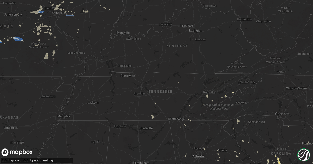
Hail Map in Tennessee on August 3, 2022
Get this storm
August 3 map
$229
one time, instant access
Download today. No call, no setup
Keep the $229
Bought the map and want the full workflow? Apply the entire $229 to a subscription within 7 days. None of it is wasted.
Every map, not just this one
This buys you this map. Subscription and you get every map we run, in the markets you choose from a few cities to whole states to nationwide. Plus real-time alerts the moment a storm fires.
Contact data
Name, contact info, occupancy, even credit band for addresses in the footprint. You go from where it hit to who to call.
Become the source they trust
Unlimited branding weather history reports on demand. You already have the documented answer ready for the property owner, and you are the one who showed up with it.
Property data and RoofTrace estimates
Pull up any address you have got, its value and the exact code rules for that jurisdiction, straight from One Click Code. Then RoofTrace estimates the squares, pitch, and roof value, priced the way you price.
Storm reports in Tennessee
Tennessee
| Date | Description |
|---|---|
| 08/03/20226:30 PM CDT | Dispatch reports multiple trees down across mainly northern parts of meigs county. |
| 08/03/20225:20 PM CDT | 1 tree down on hartford road. |
| 08/03/20223:25 PM CDT | A tree was knocked down between harry hill road and campbell lane. Time estimated by radar. |
| 08/03/20223:24 PM CDT | A tree was knocked down on griffin road on the sharp curve coming from chestnut ridge. Time estimated by radar. |
| 08/03/20223:24 PM CDT | A tree was knocked down into the roadway along pleasant hill road. Time estimated by radar. |
| 08/03/20223:23 PM CDT | Tree limbs were knocked down into the roadway on short creek road. Time estimated by radar. |
| 08/03/20223:23 PM CDT | A tree was knocked down onto the road at 1672 bull run road. Time estimated by radar. |
| 08/03/20223:23 PM CDT | A tree was knocked down into the roadway on preston ridge. Time estimated by radar. |
| 08/03/20223:22 PM CDT | Phone lines were knocked down across the roadway at highway 50 and lee gray road. Time estimated by radar. |
| 08/03/20223:22 PM CDT | A tree was knocked down partially blocking the road at 700 bull run road. Time estimated by radar. |
| 08/03/20223:22 PM CDT | A tree was knocked down blocking one lane of the roadway at 5646 tanyard hill road. Time estimated by radar. |
| 08/03/20223:21 PM CDT | A tree was knocked down at the intersection of winchester highway and bull run road. Time estimated by radar. |
| 08/03/20223:20 PM CDT | Two trees were knocked down on wet prong road. A tree was also hanging over the road. Time estimated by radar. |
| 08/03/20223:18 PM CDT | A tree was overhanging the road along maple hill road. Time estimated by radar. |
| 08/03/20224:05 AM CDT | At 904 PM EDT, a severe thunderstorm was located over Knoxville, moving north at 10 mph. HAZARD...60 mph wind gusts and quarter size hail. SOURCE...Radar indicated. IMPACT...Hail damage to vehicles is expected. Expect wind damage to roofs, siding, and trees. Locations impacted include... Knoxville, Oak Ridge, Clinton, Maynardville, Farragut, Plainview, Caryville, Halls, Rocky Top and Norris.This includes the following highways... Interstate 40 in Tennessee between mile markers 371 and 397. Interstate 75 in Tennessee between mile markers 108 and 134. |
| 08/03/20223:42 AM CDT | At 842 PM EDT, a severe thunderstorm was located over Louisville, or near Alcoa, moving northwest at 20 mph. HAZARD...60 mph wind gusts and quarter size hail. SOURCE...Radar indicated. IMPACT...Hail damage to vehicles is expected. Expect wind damage to roofs, siding, and trees. Locations impacted include... Knoxville, Oak Ridge, Maryville, Clinton, Lenoir City, Alcoa, Farragut, Oliver Springs, Louisville and Rockford.This includes the following highways... Interstate 40 in Tennessee between mile markers 362 and 384. Interstate 75 in Tennessee between mile markers 83 and 84. |
| 08/03/20223:23 AM CDT | At 823 PM EDT, a severe thunderstorm was located near Eagleton Village, or 8 miles east of Alcoa, moving northwest at 10 mph. HAZARD...60 mph wind gusts and quarter size hail. SOURCE...Radar indicated. IMPACT...Hail damage to vehicles is expected. Expect wind damage to roofs, siding, and trees. Locations impacted include... Knoxville, Maryville, Alcoa, Louisville, Rockford, Eagleton Village, Walland, Lake Forest, Bearden and Seymour.This includes Interstate 40 in Tennessee between mile markers 381 and384, between mile markers 386 and 388, and between mile markers 395and 402. |
| 08/03/20223:12 AM CDT | At 811 PM EDT, severe thunderstorms were located along a line extending from near Loudon to 10 miles east of Madisonville, moving north at 15 mph. HAZARD...60 mph wind gusts and nickel size hail. SOURCE...Radar indicated. IMPACT...Expect damage to roofs, siding, and trees. Locations impacted include... Oak Ridge, Maryville, Lenoir City, Alcoa, Kingston, Loudon, Farragut, Louisville, Midtown and Harriman.This includes the following highways... Interstate 40 in Tennessee between mile markers 350 and 373. Interstate 75 in Tennessee between mile markers 66 and 84. |
| 08/03/20222:59 AM CDT | At 759 PM EDT, a severe thunderstorm was located 11 miles southeast of Eagleton Village, or 11 miles east of Maryville, moving northwest at 15 mph. HAZARD...60 mph wind gusts and nickel size hail. SOURCE...Radar indicated. IMPACT...Expect damage to roofs, siding, and trees. Locations impacted include... Maryville, Alcoa, Louisville, Rockford, Eagleton Village, Townsend, Walland, Wildwood, McMahan and Wears Valley. |
| 08/03/20222:54 AM CDT | At 754 PM EDT/654 PM CDT/, a severe thunderstorm was located over Spring City, or 12 miles north of Decatur, moving northwest at 25 mph. HAZARD...60 mph wind gusts and nickel size hail. SOURCE...Radar indicated. IMPACT...Expect damage to roofs, siding, and trees. Locations impacted include... Spring City, Piney Falls State Park, Grandview, Melvine and Stinging Fork Falls State Park. |
| 08/03/20222:20 AM CDT | At 719 PM EDT, a severe thunderstorm was located near Decatur, moving north at 15 mph. HAZARD...60 mph wind gusts and quarter size hail. SOURCE...Radar indicated. IMPACT...Hail damage to vehicles is expected. Expect wind damage to roofs, siding, and trees. Locations impacted include... Athens, Sweetwater, Decatur, Spring City, Niota, Paint Rock, Peakland, Clear Water, Stinging Fork Falls State Park and Eagle Furnace.This includes Interstate 75 in Tennessee between mile markers 46 and60. |
| 08/03/202212:51 AM CDT | At 550 PM EDT, a severe thunderstorm was located 7 miles south of Newport, moving north at 5 mph. HAZARD...60 mph wind gusts and quarter size hail. SOURCE...Radar indicated. IMPACT...Hail damage to vehicles is expected. Expect wind damage to roofs, siding, and trees. Locations impacted include... Newport, Smoky Mountains-Big Creek, Cosby, Bird Crossing, Hartford and Waterville.This includes Interstate 40 in Tennessee between mile markers 436 and451. |
| 08/03/202212:22 AM CDT | At 521 PM EDT, a severe thunderstorm was located near Hot Springs, or 14 miles south of Greeneville, moving northeast at 5 mph. HAZARD...60 mph wind gusts and quarter size hail. SOURCE...Radar indicated. IMPACT...Hail damage to vehicles is expected. Expect wind damage to roofs, siding, and trees. Locations impacted include... Cedar Creek. |
| 08/02/202210:18 PM CDT | At 318 PM CDT, a severe thunderstorm was located near Lynchburg, moving northwest at 20 mph. HAZARD...60 mph wind gusts. SOURCE...Radar indicated. IMPACT...Expect damage to roofs, siding, and trees. Locations impacted include... Lynchburg, Huntland, Tims Ford Lake, Lexie Crossroads, Mulberry, Harmony, Belleville, Hurdlow, Lois and Maxwell. |
| 08/02/20228:52 PM CDT | Multiple trees down across mainly eastern and northern parts of the county. |
| 08/02/20228:52 PM CDT | Multiple trees down across mainly eastern and northern parts of the county. (mr |
| 08/02/20228:25 PM CDT | Several trees down across roadways throughout the county. Most centered west or northwest of knoxville. |
| 08/02/20227:42 PM CDT | Power lines down in roadway. Time estimated. |
| 08/02/20227:07 PM CDT | County dispatch reports a couple of trees down on hatchers cut road. |
| 08/02/20227:03 PM CDT | Tree down covering the entire roadway. |
| 08/02/20227:02 PM CDT | County dispatch reports multiple trees down across northern parts of rhea county. |
All States Impacted by Hail Map on August 3, 2022
Cities Impacted by Hail Map on August 3, 2022
- Mayville, MI
- Allenton, WI
- West Bend, WI
- Hartford, WI
- Birch Run, MI
- Clio, MI
- Falmouth, MI
- Roscommon, MI
- Lansing, IA
- Brooklyn, MI
- Sherwood, MI
- Coldwater, MI
- Bronson, MI
- Columbiaville, MI
- North Branch, MI
- Lapeer, MI
- Avoca, MI
- Croswell, MI
- Cadillac, MI
- Lake City, MI
- Brown City, MI
- Kingston, MI
- Marlette, MI
- Sandusky, MI
- Melvin, MI
- Peck, MI
- Wisconsin Rapids, WI
- Houghton Lake, MI
- Hastings, MI
- Battle Creek, MI
- Dowling, MI
- Nashville, MI
- Bellevue, MI
- Delton, MI
- Winneconne, WI
- Brillion, WI
- Maribel, WI
- Greenleaf, WI
- Butte Des Morts, WI
- Potter, WI
- Sherwood, WI
- Larsen, WI
- Whitelaw, WI
- Menasha, WI
- Reedsville, WI
- Forest Junction, WI
- Oshkosh, WI
- Denmark, WI
- Hilbert, WI
- Kaukauna, WI
- Neenah, WI
- Yale, MI
- Memphis, MI
- Goodells, MI
- Hobart, IN
- Portage, IN
- Merrillville, IN
- Saint Anne, IL
- Milford, IL
- Loda, IL
- West Lebanon, IN
- Shipman, IL
- Brighton, IL
- Viola, AR
- Dalton, GA
- Hurricane, UT
- Elfrida, AZ
- Bartow, GA
- Silverwood, MI
- Clifford, MI
- Montrose, MI
- Eastman, WI
- Harpers Ferry, IA
- Manitowoc, WI
- Two Rivers, WI
- Remus, MI
- Jackson, MI
- Mahomet, IL
- Mansfield, IL
- Germfask, MI
- Seney, MI
- Manistique, MI
- Grand Marais, MI
- Munising, MI
- Benton Harbor, MI
- Watervliet, MI
- Lake Bluff, IL
- Libertyville, IL
- Lake Forest, IL
- Sullivan, MO
- Bourbon, MO
- Lanark, IL
- Mount Carroll, IL
- Pearl City, IL
- Tebbetts, MO
- Bonnots Mill, MO
- La Porte City, IA
- Marion, MI
- Tustin, MI
- McBain, MI
- Lincoln, IL
- Arrowsmith, IL
- Davison, MI
- Burton, MI
- Pinckneyville, IL
- Ivesdale, IL
- Seymour, IL
- White Heath, IL
- Champaign, IL
- Potosi, MO
- Steelville, MO
- Augusta, MO
- Marthasville, MO
- Foristell, MO
- Rives Junction, MI
- Plainwell, MI
- Sedalia, MO
- Hettick, IL
- Chesterfield, IL
- Carlinville, IL
- Saranac, MI
- Lake Odessa, MI
- Clarksville, MI
- Lowell, MI
- Ionia, MI
- Barrington, IL
- Duluth, GA
- Smoaks, SC
- Walterboro, SC
- Bismarck, IL
- Schererville, IN
- Crown Point, IN
- Corona, NM
- Newport, TN
- Cosby, TN
- Cotopaxi, CO
- Pittsfield, IL
- Tignall, GA
- Cissna Park, IL
- Prosperity, SC
- Lancaster, SC
- Sylvania, GA
- Dallas, GA
- Seneca, SC
- Washington, MO
- Hermann, MO
- Berger, MO
- Warrenton, MO
- New Haven, MO
- Mount Pulaski, IL
- Bruning, NE
- Carleton, NE
- Clinton, IL
- Williamsport, IN
- Coaldale, CO
- Howard, CO
- Evart, MI
- Waterville, IA
- Applegate, MI
- Lexington, MI
- Canton, MI
- Brandon, IA
- Jesup, IA
- Palatine, IL
- Charlotte, MI
- Sunfield, MI
- Mulliken, MI
- Eagle, MI
- Grand Ledge, MI
- Vermontville, MI
- Aviston, IL
- Kankakee, IL
- Aroma Park, IL
- Chebanse, IL
- Athens, IL
- Middletown, IL
- Elkhart, IL
- Silva, MO
- Fredericktown, MO
- Annapolis, MO
- Des Arc, MO
- Lodi, MO
- Patterson, MO
- Lebanon, MO
- Stoutland, MO
- Summerville, SC
- Moncks Corner, SC
- Ridgeville, SC
- Dewitt, MI
- Lansing, MI
- Saint Johns, MI
- Chicago, IL
- Saint Joseph, MI
- Berrien Springs, MI
- Sodus, MI
- Eau Claire, MI
- Stevensville, MI
- Watseka, IL
- Sheldon, IL
- Conklin, MI
- Coopersville, MI
- Vernon Hills, IL
- Lake Zurich, IL
- Grayslake, IL
- Hillsboro, MO
- De Soto, MO
- Garnavillo, IA
- Bagley, WI
- Napoleon, OH
- Defiance, OH
- Walled Lake, MI
- Wixom, MI
- Commerce Township, MI
- Milford, MI
- West Bloomfield, MI
- Westphalia, MI
- Fowler, MI
- Flushing, MI
- Flint, MI
- Swartz Creek, MI
- Gaines, MI
- Brussels, IL
- Bismarck, MO
- Union, MO
- Beaufort, MO
- Saluda, SC
- Johnston, SC
- Edgefield, SC
- Knoxville, TN
- Sevierville, TN
- Highland Park, IL
- Argenta, IL
- Macon, IL
- Hammond, IL
- Decatur, IL
- Mt Zion, IL
- Milmine, IL
- Cisco, IL
- Cerro Gordo, IL
- Oreana, IL
- Richland, MO
- Portland, MI
- Cutler, IL
- Robbinsville, NC
- Alton, IL
- Bridgeton, MO
- Saint Charles, MO
- Maryland Heights, MO
- Saint Louis, MO
- Saint Ann, MO
- West Alton, MO
- Hazelwood, MO
- Florissant, MO
- Godfrey, IL
- Ocala, FL
- Wauzeka, WI
- Prairie Du Chien, WI
- Bernice, LA
- Lehigh Acres, FL
- Noble, IL
- Ingraham, IL
- Sparta, MI
- Northville, MI
- Plymouth, MI
- Shelbyville, MI
- Martin, MI
- Wayland, MI
- Middleville, MI
- Hopkins, MI
- Bannister, MI
- Oakley, MI
- Ashley, MI
- Perrinton, MI
- Elsie, MI
- Chesaning, MI
- Henderson, MI
- Maple Rapids, MI
- South Lyon, MI
- Ann Arbor, MI
- Ovid, MI
- Laingsburg, MI
- Bath, MI
- Richland Center, WI
- Lone Rock, WI
- Hillpoint, WI
- Mascoutah, IL
- Coloma, MI
- Covert, MI
- Edinburg, IL
- Caseyville, IL
- Collinsville, IL
- Cass City, MI
- Deford, MI
- Decker, MI
- Grass Lake, MI
- Chelsea, MI
- Munith, MI
- Weiser, ID
- Attica, MI
- Rankin, IL
- Abbeville, SC
- Girard, IL
- Thomson, GA
- Dearing, GA
- Haddock, GA
- Milledgeville, GA
- Eatonton, GA
- Orangeburg, SC
- Crown King, AZ
- Mayer, AZ
- Rocky Face, GA
- Ringgold, GA
- Chesterton, IN
- Saint George, SC
- Buffalo, IL
- Tombstone, AZ
- Bisbee, AZ
- Tinnie, NM
- Ellenboro, NC
- Elgin, AZ
- Stapleton, GA
- Louisville, GA
- Washington, GA
- Jesup, GA
- Salley, SC
- Wagener, SC
- Naples, FL
- Bonita Springs, FL
- North, SC
- Sandoval, IL
- Carlyle, IL
- Gobles, MI
- Estancia, NM
- Green Ridge, MO
- Warthen, GA
- Owosso, MI
- Bostic, NC
- Statesboro, GA
- Fort Myers, FL
- Johnsonville, SC
- Pamplico, SC
- Lake Lure, NC
- Norwood, GA
- Labelle, FL
- Conway, SC
- Millen, GA
- Kouts, IN
- Ellabell, GA
- Mount Olive, IL
- Gillespie, IL
- Litchfield, IL
- Harrietta, MI
- Hardeeville, SC
- Brook, IN
- Morocco, IN
- Animas, NM
- Willard, NM
- Ridgeland, SC
- Greeneville, TN
- Del Rio, TN
- Allegan, MI
- Wrightsville, GA
- Lordsburg, NM
- Bloomingdale, GA
- Douglas, AZ
- Barton City, MI
- Bogart, GA
- Bishop, GA
- Good Hope, GA
- Fieldon, IL
- Louisville, TN
- Ashkum, IL
- Savoy, IL
- Heyworth, IL
- Wapella, IL
- Le Roy, IL
- Downs, IL
- Smithton, MO
- Mora, MO
- Iberia, MO
- Ulman, MO
- Greenville, MO
- Bonne Terre, MO
- Cadet, MO
- Statham, GA
- Rocky Ford, GA
- Eastman, GA
- Port Wentworth, GA
- Pooler, GA
- Savannah, GA
- Reidsville, GA
- Glennville, GA
- Batchtown, IL
- Hardin, IL
- Jerseyville, IL
- Trenton, IL
- New Baden, IL
- Climax Springs, MO
- Edwards, MO
- Stover, MO
- Maxton, NC
- Laurinburg, NC
- Cedar Lake, IN
- Rochester, IL
- Divernon, IL
- Pawnee, IL
- Gary, IN
- Union Mills, IN
- Marietta, SC
- Pickens, SC
- Pima, AZ
- Branchville, SC
- Cope, SC
- Florence, SC
- Harrison, GA
- Davisboro, GA
- Benson, AZ
- Murrayville, IL
- Jacksonville, IL
- Imlay City, MI
- Winchester, TN
- Huntland, TN
- Mulberry, TN
- Belvidere, TN
- Kempton, IL
- Bainbridge, OH
- South Salem, OH
- Farmersville, IL
- Virden, IL
- O'Fallon, IL
- Benld, IL
- Neeses, SC
- Norway, SC
- Saint Clair, MO
- Lonedell, MO
- Bethalto, IL
- Bangor, MI
- Paw Paw, MI
- Bloomingdale, MI
- Hillsboro, IL
- Coffeen, IL
- Walshville, IL
- Warrensburg, IL
- Maroa, IL
- Weldon, IL
- Modesto, IL
- Villa Rica, GA
- Gadsden, AL
- Newberry, SC
- Latham, IL
- Lena, LA
- Illiopolis, IL
- Fort Myers Beach, FL
- Rembert, SC
- Dewey, AZ
- Cottonwood, AZ
- Union Point, GA
- Townsend, TN
- Bixby, MO
- Hendersonville, NC
- Immokalee, FL
- Wetmore, CO
- Salem, IL
- Odin, IL
- Boon, MI
- Dewitt, IL
- Farmer City, IL
- Blackwell, MO
- Saint Jacob, IL
- Troy, IL
- Superior, NE
- Franklin, IL
- Iva, SC
- Due West, SC
- Ellington, MO
- Vulcan, MO
- Piedmont, MO
- Trementina, NM
- Williston, SC
- Windsor, SC
- Loris, SC
- Springport, MI
- Gilman, IL
- Onarga, IL
- Caro, MI
- Palmyra, IL
- Kentland, IN
- Donovan, IL
- Granite City, IL
- Valparaiso, IN
- Monroe, GA
- Belle, MO
- Alcoa, TN
- Maryville, TN
- Vonore, TN
- Dutton, AL
- Livingston, IL
- Staunton, IL
- New Douglas, IL
- Rutledge, GA
- Madison, GA
- Estill, SC
- Luray, SC
- Springfield, SC
- Rincon, GA
- Bunker, MO
- Black, MO
- Sanderson, FL
- Bryceville, FL
- Wellston, MI
- Comstock Park, MI
- Grand Junction, MI
- Lawrence, MI
- Otsego, MI
- Hartford, MI
- Portage Des Sioux, MO
- Golden Eagle, IL
- Fort Scott, KS
- Penfield, IL
- Galien, MI
- Homer, IL
- Saint Stephen, SC
- Old Fort, TN
- Bexar, AR
- Salem, AR
- Cleveland, TN
- Punta Gorda, FL
- Brooklet, GA
- Concord, MI
- Spring Arbor, MI
- Parma, MI
- New Buffalo, MI
- Michigan City, IN
- Onondaga, MI
- Leslie, MI
- Eaton Rapids, MI
- Mason, MI
- Highland, IL
- Richwoods, MO
- Dittmer, MO
- Grubville, MO
- Lowell, IN
- Westcliffe, CO
- Andrews, SC
- Stevenson, AL
- Crawford, TN
- Allred, TN
- Rickman, TN
- Wedgefield, SC
- Saint Robert, MO
- Fort Leonard Wood, MO
- Devils Elbow, MO
- Duke, MO
- Edgar Springs, MO
- Newburg, MO
- Kalamazoo, MI
- Olney, IL
- Philo, IL
- Urbana, IL
- Hebron, IN
- Highwood, IL
- Wheeling, IL
- Buffalo Grove, IL
- Arlington Heights, IL
- Northbrook, IL
- Deerfield, IL
- Prospect Heights, IL
- De Land, IL
- Wheatfield, IN
- La Crosse, IN
- Vienna, MO
- Wentzville, MO
- Wright City, MO
- Farmington, MO
- Davenport, NE
- Emmett, MI
- Rolla, MO
- Louisville, IL
- Mason, IL
- Odum, GA
- Swansea, SC
- Gaston, SC
- Hemingway, SC
- Guyton, GA
- Waynesville, MO
- Versailles, MO
- Fortuna, MO
- Sparta, GA
- Cordova, SC
- Bamberg, SC
- Lillie, LA
- Red Springs, NC
- Union Mills, NC
- Rutherfordton, NC
- Laquey, MO
- Timmonsville, SC
- Manchester, TN
- Swainsboro, GA
- Farmersburg, IA
- Otterville, MO
- Riverton, IL
- Niantic, IL
- Williamsville, IL
- Dawson, IL
- Mechanicsburg, IL
- Athens, TN
- Decatur, TN
- Whitmore Lake, MI
- Pinckney, MI
- Dexter, MI
- Mount Morris, MI
- Genesee, MI
- Shady Dale, GA
- Colfax, LA
- Blue Mound, IL
- Cullom, IL
- Paxton, IL
- Leasburg, MO
- Congress, AZ
- Newborn, GA
- Carlton, GA
- Newberry, FL
- Townsend, GA
- Merritt, MI
- Manton, MI
- Glennie, MI
- Mikado, MI
- Greenbush, MI
- National City, MI
- Oscoda, MI
- Long Lake, MI
- South Branch, MI
- Hale, MI
- Lupton, MI
- East Tawas, MI
- Tawas City, MI
- Vernon, MI
- Byron, MI
- Grand Blanc, MI
- Corunna, MI
- Lennon, MI
- Durand, MI
- Bancroft, MI
- Lyons, MI
- Linden, MI
- Morrice, MI
- Fenton, MI
- Holly, MI
- New Lothrop, MI
- East Lansing, MI
- Haslett, MI
- Perry, MI
- Pullman, MI
- Fennville, MI
- South Haven, MI
- Stockbridge, MI
- Webberville, MI
- Gregory, MI
- Albion, MI
- Pleasant Lake, MI
- Dansville, MI
- Howell, MI
- Cecil, OH
- Holland, OH
- Liberty Center, OH
- Holgate, OH
- Berkey, OH
- Swanton, OH
- Wauseon, OH
- Delta, OH
- Paulding, OH
- Oakwood, OH
- Monclova, OH
- Sylvania, OH
- Toledo, OH
- Harbert, MI
- Three Oaks, MI
- New Carlisle, IN
- Union Pier, MI
- New Troy, MI
- La Porte, IN
- Buchanan, MI
- Bridgman, MI
- Westville, IN
- Beverly Shores, IN
- Baroda, MI
- Rolling Prairie, IN
- Sawyer, MI
- Lakeside, MI
- Orland Park, IL
- Mokena, IL
- Dalton City, IL
- Lovington, IL
- Arthur, IL
- La Place, IL
- Witt, IL
- Irving, IL
- Butler, IL
- Nokomis, IL
- Raymond, IL
- Lebanon, IL
- Scott Air Force Base, IL
- Belleville, IL
- Germantown, IL
- Albers, IL
- Defiance, MO
- Manchester, IA
- Kewaunee, WI
- Mishicot, WI
- Columbus, WI
- Waunakee, WI
- Deforest, WI
- Sauk City, WI
- Marshall, WI
- Sun Prairie, WI
- Dane, WI
- Rio, WI
- Morrisonville, WI
- Lodi, WI
- Mazomanie, WI
- Arlington, WI
- New Lenox, IL


