Hail Map in Indiana on August 3, 2022
Get this storm
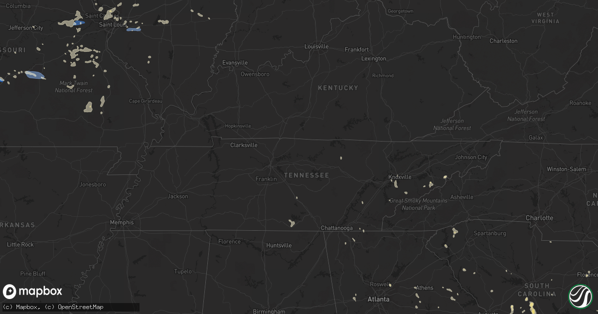
August 3 map
$229
one time, instant access
Download today. No call, no setup
Keep the $229
Bought the map and want the full workflow? Apply the entire $229 to a subscription within 7 days. None of it is wasted.
Every map, not just this one
This buys you this map. Subscription and you get every map we run, in the markets you choose from a few cities to whole states to nationwide. Plus real-time alerts the moment a storm fires.
Contact data
Name, contact info, occupancy, even credit band for addresses in the footprint. You go from where it hit to who to call.
Become the source they trust
Unlimited branding weather history reports on demand. You already have the documented answer ready for the property owner, and you are the one who showed up with it.
Property data and RoofTrace estimates
Pull up any address you have got, its value and the exact code rules for that jurisdiction, straight from One Click Code. Then RoofTrace estimates the squares, pitch, and roof value, priced the way you price.
Storm reports in Indiana
Indiana
| Date | Description |
|---|---|
| 08/03/20224:16 PM CDT | Tree reported on power lines county road 400w and 700s. |
| 08/03/20224:00 PM CDT | Trees down blocking the road. |
| 08/03/20224:00 PM CDT | Trees down blocking the road. |
| 08/03/20223:00 PM CDT | Multiple trees and power lines down within the city. |
| 08/03/20222:56 PM CDT | Report of tree limb downed and partially blocking us-41. |
| 08/03/20222:47 PM CDT | Dispatch reports downed tree limbs on power lines. |
| 08/03/20222:40 PM CDT | Photo of tree branch about six inches in diameter snapped relayed via social media. Time estimated by radar. |
| 08/03/20222:27 PM CDT | Portions of wooden fence blown over. |
| 08/03/20222:26 PM CDT | [delayed report] several trees down on tecumseh street in portage. Time estimated based on radar. |
| 08/03/20222:23 PM CDT | Large tree down in lake station off of 80/94 eastbound exit 15a. |
| 08/03/20222:14 PM CDT | Multiple trees reported down. |
| 08/03/20222:00 PM CDT | Report from mping: 1-inch tree limbs broken; shingles blown off. |
| 08/03/202212:57 AM CDT | At 556 PM EDT, severe thunderstorms were located along a line extending from 7 miles northwest of Covington to Sidell, moving east at 25 mph. HAZARD...60 mph wind gusts. SOURCE...Radar indicated. IMPACT...Expect damage to roofs, siding, and trees. Severe thunderstorms will be near... Foster around 600 PM EDT. Covington around 605 PM EDT. West Lebanon around 610 PM EDT.Other locations in the path of these severe thunderstorms includeWilliamsport and Attica.This includes Interstate 74 between mile markers 1 and 9. |
| 08/03/202212:30 AM CDT | At 530 PM EDT, severe thunderstorms were located along a line extending from 6 miles north of Otterbein to 8 miles west of Williamsport, moving northeast at 35 mph. HAZARD...60 mph wind gusts. SOURCE...Radar indicated. IMPACT...Expect damage to roofs, siding, and trees. Severe thunderstorms will be near... Rainsville around 550 PM EDT.Other locations in the path of these severe thunderstorms includePine Village.This includes Interstate 65 near mile marker 184. |
| 08/03/202212:14 AM CDT | At 513 PM EDT, severe thunderstorms were located along a line extending from 7 miles southwest of Winamac to near Monticello to near Atkinson, moving southeast at 35 mph. HAZARD...60 mph wind gusts. SOURCE...Radar indicated. IMPACT...Expect damage to roofs, siding, and trees. Locations impacted include... Logansport, Monticello, Monon, Brookston, Wolcott, Royal Center, Pulaski, Reynolds, Chalmers, Burnettsville, Clymers, Smithson, Leases Corner, Indiana Beach, Idaville, Sitka, Thornhope, Lucerne, Buffalo and Badger Grove.This includes Interstate 65 between mile markers 185 and 198. |
| 08/02/202211:43 PM CDT | At 442 PM EDT/342 PM CDT/, severe thunderstorms were located along a line extending from Hamlet to near Knox to near Medaryville to near Collegeville, moving southeast at 30 mph. HAZARD...60 mph wind gusts. SOURCE...Radar indicated. IMPACT...Expect damage to roofs, siding, and trees. Locations impacted include... Plymouth, Winamac, Argos, Culver, Pulaski, Walnut, Oak Grove, Ripley, Kewanna, Monterey, Leiters Ford, Beardstown, Ober, Hibbard, Winona, Delong, Lake Bruce, Donaldson, Star City and Tiosa. |
| 08/02/202211:19 PM CDT | At 419 PM EDT, severe thunderstorms were located along a line extending from near Hartford to 7 miles northwest of Dowagiac to near New Carlisle, moving east at 45 mph. HAZARD...60 mph wind gusts. SOURCE...Radar indicated. IMPACT...Expect damage to roofs, siding, and trees. Locations impacted include... Niles, Three Rivers, Dowagiac, Constantine, Cassopolis, White Pigeon, Edwardsburg, Marcellus, Union, Pokagon, Penn, Flowerfield, Mottville, Vandalia, Magician Lake, Dewey Lake, La Grange, Adamsville, Juno Lake and Indian Lake. |
| 08/02/202211:12 PM CDT | At 411 PM EDT/311 PM CDT/, severe thunderstorms were located along a line extending from near La Crosse to near Surrey, moving east at 30 mph. HAZARD...60 mph wind gusts and penny size hail. SOURCE...Radar indicated. IMPACT...Expect damage to roofs, siding, and trees. Locations impacted include... Knox, North Judson, Francesville, Hamlet, Medaryville, La Crosse, Lomax, English Lake, Denham, Brems, Toto, Clarks, San Pierre, Grovertown and Bass Lake. |
| 08/02/202210:41 PM CDT | At 340 PM EDT, severe thunderstorms were located along a line extending from 16 miles northwest of Lake Michigan Beach to 8 miles west of Shorewood-Tower Hill to Beverly Shores, moving east at 35 mph. HAZARD...60 mph wind gusts and penny size hail. SOURCE...Radar indicated. IMPACT...Expect damage to roofs, siding, and trees. Locations impacted include... Niles, Benton Harbor, St. Joseph, Buchanan, Fair Plain, Benton Heights, Bridgman, New Buffalo, Berrien Springs, Watervliet, Three Oaks, Coloma, Stevensville, Shorewood-Tower Hill, Paw Paw Lake, Shorewood-Tower Hills-Harbert, Lake Michigan Beach, Bertrand, Dayton and Sodus.This includes the following highways... Interstate 196 between mile markers 0 and 7. Interstate 94 in Michigan between mile markers 0 and 42. |
| 08/02/202210:26 PM CDT | At 326 PM CDT/426 PM EDT/, severe thunderstorms were located along a line extending from near Rensselaer to near Rankin, moving east at 20 mph. HAZARD...60 mph wind gusts. SOURCE...Radar indicated. IMPACT...Expect damage to roofs, siding, and trees. Locations impacted include... Watseka, Fowler, Kentland, Milford, Morocco, Sheldon, Goodland, Brook, Cissna Park, Buckley, Earl Park, Stockland, Loda, Woodland, Donovan, Wellington, Ambia, Iroquois, Mount Ayr and Dunnington.Including the following interstate... I-57 between mile markers 264 and 276. |
| 08/02/20229:56 PM CDT | At 256 PM CDT, severe thunderstorms were located along a line extending from near Kouts to 6 miles north of Sheldon, moving northeast at 20 mph. HAZARD...60 mph wind gusts. SOURCE...Radar indicated. IMPACT...Expect damage to roofs, siding, and trees. Locations impacted include... Rensselaer, DeMotte, Hebron, Remington, Wheatfield, Roselawn, Kouts, Hanging Grove, Collegeville, Baileys Corner, Stoutsburg, Fair Oaks, Parr and Dunns Bridge.Including the following interstate... Indiana I-65 between mile markers 200 and 234. |
| 08/02/20229:36 PM CDT | At 235 PM CDT, a line of severe thunderstorms was located near Lowell to St. Anne to 9 miles east of Clifton, moving east at 30 mph. HAZARD...60 mph wind gusts. SOURCE...Radar indicated. IMPACT...Expect damage to roofs, siding, and trees. Locations impacted include... Watseka, Kentland, Milford, Morocco, Lake Village, Roselawn, Sheldon, Goodland, Brook, Cissna Park, Hopkins Park, Buckley, Shelby, Martinton, Stockland, Crescent City, Loda, Beaverville, Woodland and Donovan.Including the following interstates... I-57 between mile markers 264 and 273. Indiana I-65 between mile markers 233 and 241.This includes... US 41 Dragway. |
| 08/02/20229:29 PM CDT | At 228 PM CDT, severe thunderstorms were located along a line extending from 9 miles north of Ogden Dunes to Wheeler to near Hebron, moving east at 35 mph. HAZARD...60 mph wind gusts and nickel size hail. SOURCE...Radar indicated. IMPACT...Expect damage to roofs, siding, and trees. Locations impacted include... Michigan City, La Porte, Westville, Trail Creek, Kingsford Heights, Long Beach, Wanatah, Pottawattamie Park, Hanna, Michiana Shores, Kingsbury, Michiana, Waterford, Pinhook, Salem Heights, Otis, Stillwell, Hesston, Haskell and Byron.This includes the following highways... Interstate 80 in Indiana between mile markers 38 and 58. Interstate 94 in Indiana between mile markers 33 and 45. Interstate 94 in Michigan near mile marker 0. |
| 08/02/20229:17 PM CDT | At 217 PM CDT, severe thunderstorms were located along a line extending from 6 miles north of Gary to near Hobart to near Lake Dalecarlia, moving east at 50 mph. HAZARD...60 mph wind gusts. SOURCE...Radar indicated. IMPACT...Expect damage to roofs, siding, and trees. Locations impacted include... Portage, Valparaiso, Chesterton, Hebron, Lakes of the Four Seasons, South Haven, Porter, Burns Harbor, Ogden Dunes, Town of Pines, Beverly Shores, Wheeler, Dune Acres, Boone Grove and Malden.Including the following interstates... Indiana I-80 near mile marker 16. Indiana I-90 between mile markers 22 and 37. Indiana I-94 between mile markers 17 and 32.This includes... Valparaiso University, Indiana Dunes State Park,and Porter County Fairgrounds. |
| 08/02/20229:15 PM CDT | At 215 PM CDT, a severe thunderstorm was located over Homer Glen, moving east at 35 mph. HAZARD...60 mph wind gusts. SOURCE...Radar indicated. IMPACT...Expect damage to roofs, siding, and trees. Locations impacted include... Chicago, Hammond, Orland Park, Tinley Park, Oak Lawn, Calumet City, Chicago Heights, Chicago Lawn, Englewood, South Shore, Roseland, Burbank, Lansing, Oak Forest, Harvey, Homer Glen, Blue Island, Munster, Dolton and Park Forest.Including the following interstates... I-57 between mile markers 330 and 358. I-80 between mile markers 144 and 155. I-90 between mile markers 101 and 107. I-94 between mile markers 57 and 74. I-294 between mile markers 57 and 74. I-355 near mile marker 8. Indiana I-90 between mile markers 1 and 2.This includes... University of Chicago, Windy City ThunderboltsBaseball, Hollywood Casino Amphitheatre, Governors State University,Moraine Valley Community College, Prairie State College, SouthSuburban College, Will County Fairgrounds, and Museum of Science andIndustry. |
| 08/02/20228:56 PM CDT | At 155 PM CDT, severe thunderstorms were located along a line extending from near Manteno to 8 miles west of Ashkum to near Saybrook, moving east at 20 mph. HAZARD...60 mph wind gusts and quarter size hail. SOURCE...Radar indicated. IMPACT...Hail damage to vehicles is expected. Expect wind damage to roofs, siding, and trees. Locations impacted include... Kankakee, Bourbonnais, Bradley, Lowell, Manteno, Gibson City, Momence, Gilman, Clifton, Chatsworth, Onarga, Grant Park, St. Anne, Chebanse, Piper City, Ashkum, Aroma Park, Hopkins Park, Martinton and Crescent City.Including the following interstate... I-57 between mile markers 271 and 319. This includes... Kankakee Community College, Kankakee CountyFairgrounds and Speedway, and Olivet Nazarine University. |
All States Impacted by Hail Map on August 3, 2022
Cities Impacted by Hail Map on August 3, 2022
- Mayville, MI
- Allenton, WI
- West Bend, WI
- Hartford, WI
- Birch Run, MI
- Clio, MI
- Falmouth, MI
- Roscommon, MI
- Lansing, IA
- Brooklyn, MI
- Sherwood, MI
- Coldwater, MI
- Bronson, MI
- Columbiaville, MI
- North Branch, MI
- Lapeer, MI
- Avoca, MI
- Croswell, MI
- Cadillac, MI
- Lake City, MI
- Brown City, MI
- Kingston, MI
- Marlette, MI
- Sandusky, MI
- Melvin, MI
- Peck, MI
- Wisconsin Rapids, WI
- Houghton Lake, MI
- Hastings, MI
- Battle Creek, MI
- Dowling, MI
- Nashville, MI
- Bellevue, MI
- Delton, MI
- Winneconne, WI
- Brillion, WI
- Maribel, WI
- Greenleaf, WI
- Butte Des Morts, WI
- Potter, WI
- Sherwood, WI
- Larsen, WI
- Whitelaw, WI
- Menasha, WI
- Reedsville, WI
- Forest Junction, WI
- Oshkosh, WI
- Denmark, WI
- Hilbert, WI
- Kaukauna, WI
- Neenah, WI
- Yale, MI
- Memphis, MI
- Goodells, MI
- Hobart, IN
- Portage, IN
- Merrillville, IN
- Saint Anne, IL
- Milford, IL
- Loda, IL
- West Lebanon, IN
- Shipman, IL
- Brighton, IL
- Viola, AR
- Dalton, GA
- Hurricane, UT
- Elfrida, AZ
- Bartow, GA
- Silverwood, MI
- Clifford, MI
- Montrose, MI
- Eastman, WI
- Harpers Ferry, IA
- Manitowoc, WI
- Two Rivers, WI
- Remus, MI
- Jackson, MI
- Mahomet, IL
- Mansfield, IL
- Germfask, MI
- Seney, MI
- Manistique, MI
- Grand Marais, MI
- Munising, MI
- Benton Harbor, MI
- Watervliet, MI
- Lake Bluff, IL
- Libertyville, IL
- Lake Forest, IL
- Sullivan, MO
- Bourbon, MO
- Lanark, IL
- Mount Carroll, IL
- Pearl City, IL
- Tebbetts, MO
- Bonnots Mill, MO
- La Porte City, IA
- Marion, MI
- Tustin, MI
- McBain, MI
- Lincoln, IL
- Arrowsmith, IL
- Davison, MI
- Burton, MI
- Pinckneyville, IL
- Ivesdale, IL
- Seymour, IL
- White Heath, IL
- Champaign, IL
- Potosi, MO
- Steelville, MO
- Augusta, MO
- Marthasville, MO
- Foristell, MO
- Rives Junction, MI
- Plainwell, MI
- Sedalia, MO
- Hettick, IL
- Chesterfield, IL
- Carlinville, IL
- Saranac, MI
- Lake Odessa, MI
- Clarksville, MI
- Lowell, MI
- Ionia, MI
- Barrington, IL
- Duluth, GA
- Smoaks, SC
- Walterboro, SC
- Bismarck, IL
- Schererville, IN
- Crown Point, IN
- Corona, NM
- Newport, TN
- Cosby, TN
- Cotopaxi, CO
- Pittsfield, IL
- Tignall, GA
- Cissna Park, IL
- Prosperity, SC
- Lancaster, SC
- Sylvania, GA
- Dallas, GA
- Seneca, SC
- Washington, MO
- Hermann, MO
- Berger, MO
- Warrenton, MO
- New Haven, MO
- Mount Pulaski, IL
- Bruning, NE
- Carleton, NE
- Clinton, IL
- Williamsport, IN
- Coaldale, CO
- Howard, CO
- Evart, MI
- Waterville, IA
- Applegate, MI
- Lexington, MI
- Canton, MI
- Brandon, IA
- Jesup, IA
- Palatine, IL
- Charlotte, MI
- Sunfield, MI
- Mulliken, MI
- Eagle, MI
- Grand Ledge, MI
- Vermontville, MI
- Aviston, IL
- Kankakee, IL
- Aroma Park, IL
- Chebanse, IL
- Athens, IL
- Middletown, IL
- Elkhart, IL
- Silva, MO
- Fredericktown, MO
- Annapolis, MO
- Des Arc, MO
- Lodi, MO
- Patterson, MO
- Lebanon, MO
- Stoutland, MO
- Summerville, SC
- Moncks Corner, SC
- Ridgeville, SC
- Dewitt, MI
- Lansing, MI
- Saint Johns, MI
- Chicago, IL
- Saint Joseph, MI
- Berrien Springs, MI
- Sodus, MI
- Eau Claire, MI
- Stevensville, MI
- Watseka, IL
- Sheldon, IL
- Conklin, MI
- Coopersville, MI
- Vernon Hills, IL
- Lake Zurich, IL
- Grayslake, IL
- Hillsboro, MO
- De Soto, MO
- Garnavillo, IA
- Bagley, WI
- Napoleon, OH
- Defiance, OH
- Walled Lake, MI
- Wixom, MI
- Commerce Township, MI
- Milford, MI
- West Bloomfield, MI
- Westphalia, MI
- Fowler, MI
- Flushing, MI
- Flint, MI
- Swartz Creek, MI
- Gaines, MI
- Brussels, IL
- Bismarck, MO
- Union, MO
- Beaufort, MO
- Saluda, SC
- Johnston, SC
- Edgefield, SC
- Knoxville, TN
- Sevierville, TN
- Highland Park, IL
- Argenta, IL
- Macon, IL
- Hammond, IL
- Decatur, IL
- Mt Zion, IL
- Milmine, IL
- Cisco, IL
- Cerro Gordo, IL
- Oreana, IL
- Richland, MO
- Portland, MI
- Cutler, IL
- Robbinsville, NC
- Alton, IL
- Bridgeton, MO
- Saint Charles, MO
- Maryland Heights, MO
- Saint Louis, MO
- Saint Ann, MO
- West Alton, MO
- Hazelwood, MO
- Florissant, MO
- Godfrey, IL
- Ocala, FL
- Wauzeka, WI
- Prairie Du Chien, WI
- Bernice, LA
- Lehigh Acres, FL
- Noble, IL
- Ingraham, IL
- Sparta, MI
- Northville, MI
- Plymouth, MI
- Shelbyville, MI
- Martin, MI
- Wayland, MI
- Middleville, MI
- Hopkins, MI
- Bannister, MI
- Oakley, MI
- Ashley, MI
- Perrinton, MI
- Elsie, MI
- Chesaning, MI
- Henderson, MI
- Maple Rapids, MI
- South Lyon, MI
- Ann Arbor, MI
- Ovid, MI
- Laingsburg, MI
- Bath, MI
- Richland Center, WI
- Lone Rock, WI
- Hillpoint, WI
- Mascoutah, IL
- Coloma, MI
- Covert, MI
- Edinburg, IL
- Caseyville, IL
- Collinsville, IL
- Cass City, MI
- Deford, MI
- Decker, MI
- Grass Lake, MI
- Chelsea, MI
- Munith, MI
- Weiser, ID
- Attica, MI
- Rankin, IL
- Abbeville, SC
- Girard, IL
- Thomson, GA
- Dearing, GA
- Haddock, GA
- Milledgeville, GA
- Eatonton, GA
- Orangeburg, SC
- Crown King, AZ
- Mayer, AZ
- Rocky Face, GA
- Ringgold, GA
- Chesterton, IN
- Saint George, SC
- Buffalo, IL
- Tombstone, AZ
- Bisbee, AZ
- Tinnie, NM
- Ellenboro, NC
- Elgin, AZ
- Stapleton, GA
- Louisville, GA
- Washington, GA
- Jesup, GA
- Salley, SC
- Wagener, SC
- Naples, FL
- Bonita Springs, FL
- North, SC
- Sandoval, IL
- Carlyle, IL
- Gobles, MI
- Estancia, NM
- Green Ridge, MO
- Warthen, GA
- Owosso, MI
- Bostic, NC
- Statesboro, GA
- Fort Myers, FL
- Johnsonville, SC
- Pamplico, SC
- Lake Lure, NC
- Norwood, GA
- Labelle, FL
- Conway, SC
- Millen, GA
- Kouts, IN
- Ellabell, GA
- Mount Olive, IL
- Gillespie, IL
- Litchfield, IL
- Harrietta, MI
- Hardeeville, SC
- Brook, IN
- Morocco, IN
- Animas, NM
- Willard, NM
- Ridgeland, SC
- Greeneville, TN
- Del Rio, TN
- Allegan, MI
- Wrightsville, GA
- Lordsburg, NM
- Bloomingdale, GA
- Douglas, AZ
- Barton City, MI
- Bogart, GA
- Bishop, GA
- Good Hope, GA
- Fieldon, IL
- Louisville, TN
- Ashkum, IL
- Savoy, IL
- Heyworth, IL
- Wapella, IL
- Le Roy, IL
- Downs, IL
- Smithton, MO
- Mora, MO
- Iberia, MO
- Ulman, MO
- Greenville, MO
- Bonne Terre, MO
- Cadet, MO
- Statham, GA
- Rocky Ford, GA
- Eastman, GA
- Port Wentworth, GA
- Pooler, GA
- Savannah, GA
- Reidsville, GA
- Glennville, GA
- Batchtown, IL
- Hardin, IL
- Jerseyville, IL
- Trenton, IL
- New Baden, IL
- Climax Springs, MO
- Edwards, MO
- Stover, MO
- Maxton, NC
- Laurinburg, NC
- Cedar Lake, IN
- Rochester, IL
- Divernon, IL
- Pawnee, IL
- Gary, IN
- Union Mills, IN
- Marietta, SC
- Pickens, SC
- Pima, AZ
- Branchville, SC
- Cope, SC
- Florence, SC
- Harrison, GA
- Davisboro, GA
- Benson, AZ
- Murrayville, IL
- Jacksonville, IL
- Imlay City, MI
- Winchester, TN
- Huntland, TN
- Mulberry, TN
- Belvidere, TN
- Kempton, IL
- Bainbridge, OH
- South Salem, OH
- Farmersville, IL
- Virden, IL
- O'Fallon, IL
- Benld, IL
- Neeses, SC
- Norway, SC
- Saint Clair, MO
- Lonedell, MO
- Bethalto, IL
- Bangor, MI
- Paw Paw, MI
- Bloomingdale, MI
- Hillsboro, IL
- Coffeen, IL
- Walshville, IL
- Warrensburg, IL
- Maroa, IL
- Weldon, IL
- Modesto, IL
- Villa Rica, GA
- Gadsden, AL
- Newberry, SC
- Latham, IL
- Lena, LA
- Illiopolis, IL
- Fort Myers Beach, FL
- Rembert, SC
- Dewey, AZ
- Cottonwood, AZ
- Union Point, GA
- Townsend, TN
- Bixby, MO
- Hendersonville, NC
- Immokalee, FL
- Wetmore, CO
- Salem, IL
- Odin, IL
- Boon, MI
- Dewitt, IL
- Farmer City, IL
- Blackwell, MO
- Saint Jacob, IL
- Troy, IL
- Superior, NE
- Franklin, IL
- Iva, SC
- Due West, SC
- Ellington, MO
- Vulcan, MO
- Piedmont, MO
- Trementina, NM
- Williston, SC
- Windsor, SC
- Loris, SC
- Springport, MI
- Gilman, IL
- Onarga, IL
- Caro, MI
- Palmyra, IL
- Kentland, IN
- Donovan, IL
- Granite City, IL
- Valparaiso, IN
- Monroe, GA
- Belle, MO
- Alcoa, TN
- Maryville, TN
- Vonore, TN
- Dutton, AL
- Livingston, IL
- Staunton, IL
- New Douglas, IL
- Rutledge, GA
- Madison, GA
- Estill, SC
- Luray, SC
- Springfield, SC
- Rincon, GA
- Bunker, MO
- Black, MO
- Sanderson, FL
- Bryceville, FL
- Wellston, MI
- Comstock Park, MI
- Grand Junction, MI
- Lawrence, MI
- Otsego, MI
- Hartford, MI
- Portage Des Sioux, MO
- Golden Eagle, IL
- Fort Scott, KS
- Penfield, IL
- Galien, MI
- Homer, IL
- Saint Stephen, SC
- Old Fort, TN
- Bexar, AR
- Salem, AR
- Cleveland, TN
- Punta Gorda, FL
- Brooklet, GA
- Concord, MI
- Spring Arbor, MI
- Parma, MI
- New Buffalo, MI
- Michigan City, IN
- Onondaga, MI
- Leslie, MI
- Eaton Rapids, MI
- Mason, MI
- Highland, IL
- Richwoods, MO
- Dittmer, MO
- Grubville, MO
- Lowell, IN
- Westcliffe, CO
- Andrews, SC
- Stevenson, AL
- Crawford, TN
- Allred, TN
- Rickman, TN
- Wedgefield, SC
- Saint Robert, MO
- Fort Leonard Wood, MO
- Devils Elbow, MO
- Duke, MO
- Edgar Springs, MO
- Newburg, MO
- Kalamazoo, MI
- Olney, IL
- Philo, IL
- Urbana, IL
- Hebron, IN
- Highwood, IL
- Wheeling, IL
- Buffalo Grove, IL
- Arlington Heights, IL
- Northbrook, IL
- Deerfield, IL
- Prospect Heights, IL
- De Land, IL
- Wheatfield, IN
- La Crosse, IN
- Vienna, MO
- Wentzville, MO
- Wright City, MO
- Farmington, MO
- Davenport, NE
- Emmett, MI
- Rolla, MO
- Louisville, IL
- Mason, IL
- Odum, GA
- Swansea, SC
- Gaston, SC
- Hemingway, SC
- Guyton, GA
- Waynesville, MO
- Versailles, MO
- Fortuna, MO
- Sparta, GA
- Cordova, SC
- Bamberg, SC
- Lillie, LA
- Red Springs, NC
- Union Mills, NC
- Rutherfordton, NC
- Laquey, MO
- Timmonsville, SC
- Manchester, TN
- Swainsboro, GA
- Farmersburg, IA
- Otterville, MO
- Riverton, IL
- Niantic, IL
- Williamsville, IL
- Dawson, IL
- Mechanicsburg, IL
- Athens, TN
- Decatur, TN
- Whitmore Lake, MI
- Pinckney, MI
- Dexter, MI
- Mount Morris, MI
- Genesee, MI
- Shady Dale, GA
- Colfax, LA
- Blue Mound, IL
- Cullom, IL
- Paxton, IL
- Leasburg, MO
- Congress, AZ
- Newborn, GA
- Carlton, GA
- Newberry, FL
- Townsend, GA
- Merritt, MI
- Manton, MI
- Glennie, MI
- Mikado, MI
- Greenbush, MI
- National City, MI
- Oscoda, MI
- Long Lake, MI
- South Branch, MI
- Hale, MI
- Lupton, MI
- East Tawas, MI
- Tawas City, MI
- Vernon, MI
- Byron, MI
- Grand Blanc, MI
- Corunna, MI
- Lennon, MI
- Durand, MI
- Bancroft, MI
- Lyons, MI
- Linden, MI
- Morrice, MI
- Fenton, MI
- Holly, MI
- New Lothrop, MI
- East Lansing, MI
- Haslett, MI
- Perry, MI
- Pullman, MI
- Fennville, MI
- South Haven, MI
- Stockbridge, MI
- Webberville, MI
- Gregory, MI
- Albion, MI
- Pleasant Lake, MI
- Dansville, MI
- Howell, MI
- Cecil, OH
- Holland, OH
- Liberty Center, OH
- Holgate, OH
- Berkey, OH
- Swanton, OH
- Wauseon, OH
- Delta, OH
- Paulding, OH
- Oakwood, OH
- Monclova, OH
- Sylvania, OH
- Toledo, OH
- Harbert, MI
- Three Oaks, MI
- New Carlisle, IN
- Union Pier, MI
- New Troy, MI
- La Porte, IN
- Buchanan, MI
- Bridgman, MI
- Westville, IN
- Beverly Shores, IN
- Baroda, MI
- Rolling Prairie, IN
- Sawyer, MI
- Lakeside, MI
- Orland Park, IL
- Mokena, IL
- Dalton City, IL
- Lovington, IL
- Arthur, IL
- La Place, IL
- Witt, IL
- Irving, IL
- Butler, IL
- Nokomis, IL
- Raymond, IL
- Lebanon, IL
- Scott Air Force Base, IL
- Belleville, IL
- Germantown, IL
- Albers, IL
- Defiance, MO
- Manchester, IA
- Kewaunee, WI
- Mishicot, WI
- Columbus, WI
- Waunakee, WI
- Deforest, WI
- Sauk City, WI
- Marshall, WI
- Sun Prairie, WI
- Dane, WI
- Rio, WI
- Morrisonville, WI
- Lodi, WI
- Mazomanie, WI
- Arlington, WI
- New Lenox, IL


