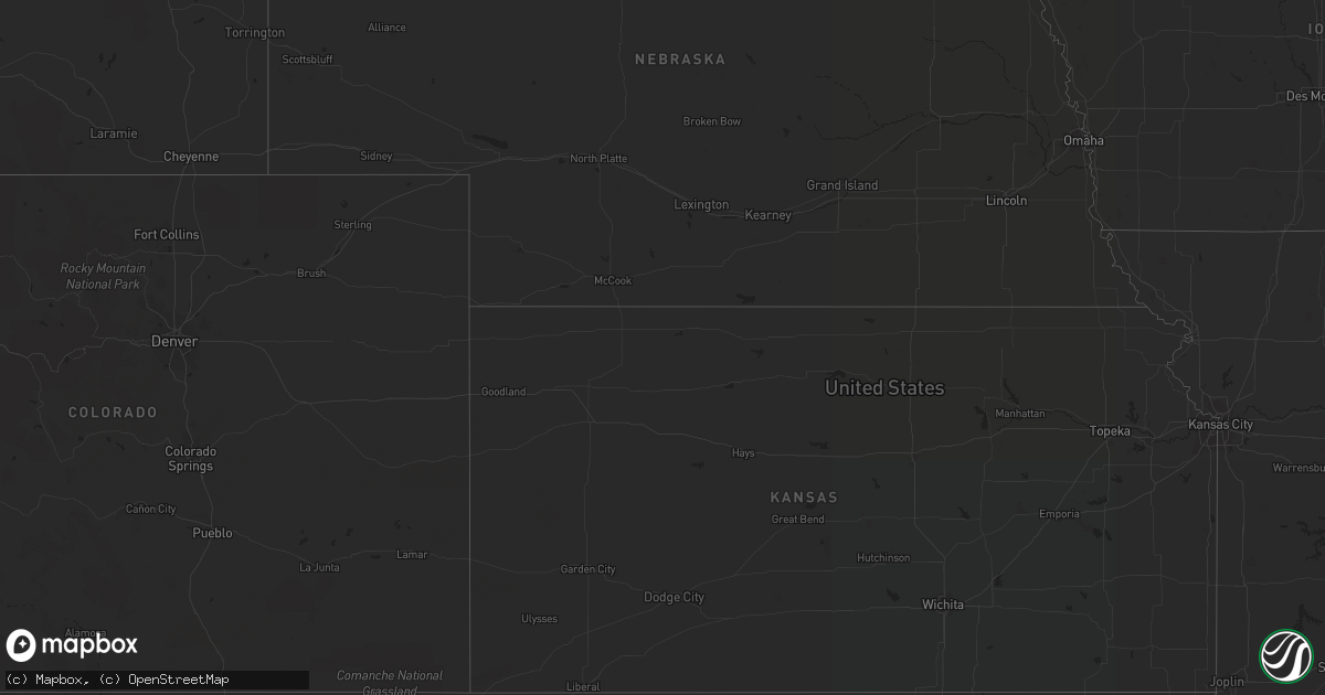
Hail Map in Arizona on July 30, 2022
Get this storm
July 30 map
$229
one time, instant access
Download today. No call, no setup
Keep the $229
Bought the map and want the full workflow? Apply the entire $229 to a subscription within 7 days. None of it is wasted.
Every map, not just this one
This buys you this map. Subscription and you get every map we run, in the markets you choose from a few cities to whole states to nationwide. Plus real-time alerts the moment a storm fires.
Contact data
Name, contact info, occupancy, even credit band for addresses in the footprint. You go from where it hit to who to call.
Become the source they trust
Unlimited branding weather history reports on demand. You already have the documented answer ready for the property owner, and you are the one who showed up with it.
Property data and RoofTrace estimates
Pull up any address you have got, its value and the exact code rules for that jurisdiction, straight from One Click Code. Then RoofTrace estimates the squares, pitch, and roof value, priced the way you price.
Storm reports in Arizona
Arizona
| Date | Description |
|---|---|
| 07/30/20224:45 PM CDT | Large tree fell down in neighborhood. |
| 07/30/20224:29 PM CDT | Down power lines near drexel road and s. Calle santa cruz road. |
| 07/30/20224:10 PM CDT | Trained spotter reports tree branches down and power out for the neighborhood. |
| 07/30/20225:03 AM CDT | At 1002 PM MST, a severe thunderstorm was located 10 miles east of Nogales International Airport, or 15 miles east of Nogales, moving northwest at 15 mph. HAZARD...60 mph wind gusts and quarter size hail. SOURCE...Radar indicated. IMPACT...Hail damage to vehicles is expected. Expect wind damage to roofs, siding, and trees. Locations impacted include... Nogales, Rio Rico, Patagonia, Elgin, Patagonia Lake State Park, Fort Huachuca, Nogales International Airport, Parker Canyon Lake, Tumacacori, Kino Springs, Canelo, Lochiel, Ramsey Canyon Preserve and Coronado National Memorial. |
| 07/30/20221:38 AM CDT | At 637 PM MST, a severe thunderstorm was located near Colorado City, moving south at 10 mph. HAZARD...60 mph wind gusts. SOURCE...Radar indicated. IMPACT...Expect damage to roofs, trees, and power lines. Locations impacted include... Colorado City, Pipe Spring and Kaibab. |
| 07/30/20221:30 AM CDT | At 629 PM MST, severe thunderstorms were located along a line extending from Arrowhead Mall to Deer Valley Airport to Scottsdale, moving north at 20 mph. HAZARD...60 mph wind gusts and penny size hail. SOURCE...Radar indicated. IMPACT...Expect damage to roofs, siding, and trees. Locations impacted include... Phoenix, Glendale, Scottsdale, Peoria, New River, Sun City, Sun City West, Cave Creek, Carefree, Deer Valley Airport, Lake Pleasant, Arrowhead Mall, Desert Mountain, Desert Ridge Marketplace and Camp Creek.This includes the following highways...AZ Interstate 17 between mile markers 212 and 241.AZ Route 51 between mile markers 13 and 15.AZ Route 101 between mile markers 12 and 37. |
| 07/30/202212:57 AM CDT | At 557 PM MST, severe thunderstorms were located along a line extending from Tolleson to Arizona State Fairgrounds to near Salt River Indian Community, moving north at 15 mph. HAZARD...60 mph wind gusts. SOURCE...Radar indicated. IMPACT...Expect damage to roofs, siding, and trees. Locations impacted include... Phoenix, Mesa, Glendale, Scottsdale, Tempe, Peoria, Surprise, Avondale, Goodyear, El Mirage, Fountain Hills, Paradise Valley, Tolleson, Youngtown and Sun City West.This includes the following highways...AZ Interstate 10 between mile markers 127 and 155.AZ Interstate 17 between mile markers 195 and 222.AZ Route 51 between mile markers 1 and 15. |
| 07/30/202212:41 AM CDT | At 540 PM MST, severe thunderstorms were located along a line extending from 6 miles northwest of Roosevelt Dam to near Four Peaks to near Fountain Hills, moving northwest at 15 mph. HAZARD...60 mph wind gusts. SOURCE...Radar indicated. IMPACT...Expect damage to roofs, siding, and trees. Locations impacted include... Mesa, Scottsdale, Fountain Hills, Round Valley, Sugarloaf Mountain, Ballantine Trailhead, Sunflower, Granite Reef Dam, Punkin Center, McDowell Mountain Park, Roosevelt Dam, Saguaro Lake, Tonto Basin, Goldfield Ranch and Four Peaks.This includes the following highways...AZ Route 87 between mile markers 184 and 224.AZ Route 202 near mile marker 21.AZ Route 188 between mile markers 245 and 267. |
| 07/30/202212:02 AM CDT | At 501 PM MST, severe thunderstorms were located along a line extending from Queen Creek to near Estrella Sailport, moving northwest at 15 mph. HAZARD...60 mph wind gusts. SOURCE...Radar indicated. IMPACT...Expect damage to roofs, siding, and trees. Locations impacted include... Phoenix, Mesa, Chandler, Gilbert, Tempe, Avondale, Goodyear, Apache Junction, East Mesa, Sun Lakes, Maricopa, Queen Creek, Tempe Marketplace, Salt River Indian Community and South Phoenix.This includes the following highways...AZ Interstate 10 between mile markers 149 and 177.AZ Interstate 17 between mile markers 195 and 196.US Highway 60 between mile markers 173 and 197. |
| 07/29/202211:57 PM CDT | At 457 PM MST, a severe thunderstorm was located 7 miles south of Tonto National Monument, or 9 miles southeast of Roosevelt, moving northwest at 15 mph. HAZARD...60 mph wind gusts. SOURCE...Radar indicated. IMPACT...Expect damage to roofs, siding, and trees. Locations impacted include... Roosevelt, Four Peaks, Roosevelt Dam, Apache Lake, Tonto National Monument and Roosevelt Estates.This includes AZ Route 188 between mile markers 227 and 250. |
| 07/29/202211:39 PM CDT | At 439 PM MST, a severe thunderstorm was located 7 miles northwest of Chui-Chu, or 9 miles southwest of Casa Grande, moving northwest at 5 mph. HAZARD...60 mph wind gusts. SOURCE...Radar indicated. IMPACT...Expect damage to roofs, siding, and trees. Locations impacted include... Casa Grande and Stanfield. This includes the following highways...AZ Interstate 8 between mile markers 152 and 175.AZ Route 347 between mile markers 161 and 166. |
| 07/29/202211:26 PM CDT | At 426 PM MST, a severe thunderstorm was located 10 miles southeast of Wenden, or 31 miles northwest of Tonopah, and is nearly stationary. HAZARD...60 mph wind gusts. SOURCE...Radar indicated. IMPACT...Expect damage to roofs, siding, and trees. Locations impacted include... Wenden, Salome and Harcuvar. This includes US Highway 60 between mile markers 54 and 75. |
| 07/29/202211:09 PM CDT | At 408 PM MST, a severe thunderstorm was located near Arizona City, or 17 miles south of Casa Grande, moving northwest at 15 mph. HAZARD...60 mph wind gusts and penny size hail. SOURCE...Radar indicated. IMPACT...Expect damage to roofs, siding, and trees. Locations impacted include... Eloy, Picacho, Chui-Chu, Shopishk and East Chui-Chu. |
| 07/29/202211:01 PM CDT | At 400 PM MST, a severe thunderstorm was located near Kearny, or 13 miles southeast of Superior, moving northwest at 15 mph. HAZARD...60 mph wind gusts and quarter size hail. SOURCE...Radar indicated. IMPACT...Hail damage to vehicles is expected. Expect wind damage to roofs, siding, and trees. Locations impacted include... Kearny and Kelvin. |
| 07/29/202210:27 PM CDT | At 327 PM MST, a severe thunderstorm was located 9 miles southeast of Vail, or 14 miles west of Benson, moving northwest at 5 mph. HAZARD...60 mph wind gusts and quarter size hail. SOURCE...Radar indicated. IMPACT...Hail damage to vehicles is expected. Expect wind damage to roofs, siding, and trees. Locations impacted include... Vail and Corona De Tucson. |
| 07/29/20229:34 PM CDT | At 233 PM MST, a severe thunderstorm was located near Marana, moving northwest at 20 mph. HAZARD...60 mph wind gusts and quarter size hail. SOURCE...Radar indicated. IMPACT...Hail damage to vehicles is expected. Expect wind damage to roofs, siding, and trees. Locations impacted include... Oro Valley, Marana, Casas Adobes, Avra Valley, Tortolita, Saguaro National Park West, Picture Rocks and Dove Mountain. |
| 07/29/20228:50 PM CDT | Uprooted 16 inch diameter tree fell into and blocked a residential road. |
| 07/29/20228:47 PM CDT | At 146 PM MST, a severe thunderstorm was located near Tucson International Airport, or near Davis-Monthan Air Force Base, moving north at 15 mph. HAZARD...60 mph wind gusts and quarter size hail. SOURCE...Radar indicated. IMPACT...Hail damage to vehicles is expected. Expect wind damage to roofs, siding, and trees. Locations impacted include... Tucson, Davis-Monthan Air Force Base, Casas Adobes, Drexel Heights, Flowing Wells, Tanque Verde, South Tucson, Sabino Canyon Recreation Area, Summit, Catalina Foothills, Tucson International Airport, Saguaro National Park East, Rita Ranch and San Xavier Mission. |
| 07/29/20228:45 PM CDT | Cwop... Cave buttes recreation area. |
| 07/29/20228:37 PM CDT | Asos station kdvt phoenix deer vly. |
| 07/29/20228:30 PM CDT | Gas station canopy knocked over by 60 mph winds. |
| 07/29/20228:20 PM CDT | Photo of a metal carport roof blown onto a couple parked cars. |
| 07/29/20228:18 PM CDT | Media live broadcast showed a snapped power pole. |
All States Impacted by Hail Map on July 30, 2022
Cities Impacted by Hail Map on July 30, 2022
- Iroquois, SD
- Tuttle, ND
- Cleveland, ND
- Pingree, ND
- Woodworth, ND
- Cove, AR
- Bowdon, ND
- Nashoba, OK
- Bowie, TX
- Sheridan, AR
- Prairie, MS
- Pearce, AZ
- Branchville, SC
- Tucson, AZ
- Green Valley, AZ
- Fouke, AR
- Carthage, SD
- Correll, MN
- Ortonville, MN
- Robinson, ND
- Danvers, MN
- Holloway, MN
- Benson, MN
- Clayton, NM
- Phoenix, AZ
- Wilmar, AR
- Clarksdale, MS
- Lyon, MS
- Garland City, AR
- Scottsdale, AZ
- Fort Mcdowell, AZ
- Mesa, AZ
- Ardmore, TN
- Dellrose, TN
- Cordesville, SC
- Mcdonough, GA
- Carthage, AR
- Dumont, MN
- Carrington, ND
- Breckenridge, TX
- Florence, SD
- Watertown, SD
- Sahuarita, AZ
- Atlanta, GA
- Kershaw, SC
- Bethune, SC
- Waterloo, AL
- Anderson, SC
- Jacksboro, TX
- Oldham, SD
- Rison, AR
- Winkelman, AZ
- Dalton, MN
- Gainesville, TX
- Delight, AR
- Murfreesboro, AR
- Ozan, AR
- Fayette, AL
- Sulligent, AL
- Glendale, AZ
- Grenville, NM
- Bryson, TX
- Goodrich, ND
- Hurdsfield, ND
- New Rockford, ND
- De Smet, SD
- Twain, CA
- Murdock, MN
- Clontarf, MN
- Hancock, MN
- Lithia Springs, GA
- Eatonton, GA
- Buckhead, GA
- Sumter, SC
- Harvey, ND
- Cathay, ND
- Cassatt, SC
- Prospect, TN
- Dalhart, TX
- Monetta, SC
- Batesburg, SC
- Clinton, MN
- Chokio, MN
- Chaseley, ND
- Jamestown, SC
- Paradise Valley, AZ
- De Queen, AR
- Cave Creek, AZ
- Hampton, AR
- Smyrna, GA
- Vernon, AL
- Sheyenne, ND
- Wahpeton, ND
- Eagletown, OK
- Kearny, AZ
- Amado, AZ
- Cubero, NM
- Leupp, AZ
- Lucerne Valley, CA
- Apple Valley, CA
- Big Bear City, CA
- Mableton, GA
- Austell, GA
- Lewisville, AR
- Winterville, GA
- Cotton Valley, LA
- Hugo, OK
- Grant, OK
- Scranton, SC
- Moncks Corner, SC
- Summerville, SC
- Piedmont, AL
- Felt, OK
- Texarkana, AR
- Texarkana, TX
- Smithville, OK
- Tintah, MN
- Wheaton, MN
- Fessenden, ND
- Bonneau, SC
- Denhoff, ND
- Mcclusky, ND
- Talihina, OK
- Honobia, OK
- Pope, MS
- Courtland, MS
- Lockesburg, AR
- Waskom, TX
- De Berry, TX
- Greensboro, GA
- Marietta, GA
- Rowland, NC
- Maxton, NC
- Fairmont, NC
- Hamer, SC
- Monticello, AR
- Hope, AR
- Enid, MS
- Athens, GA
- Cookville, TX
- Mount Pleasant, TX
- Timmonsville, SC
- Winslow, AZ
- Stephens, AR
- Rosston, AR
- Waldo, AR
- Tombstone, AZ
- Ridge Spring, SC
- Valliant, OK
- Ringold, OK
- Cades, SC
- McNeal, AZ
- Alexander, ND
- New Town, ND
- Stanley, ND
- Keene, ND
- Parshall, ND
- Killdeer, ND
- Ray, ND
- Roseglen, ND
- Epping, ND
- Williston, ND
- Mandaree, ND
- Ryder, ND
- Makoti, ND
- Watford City, ND
- Garrison, ND
- Tioga, ND
- Ross, ND
- Plaza, ND
- New River, AZ
- Carefree, AZ


