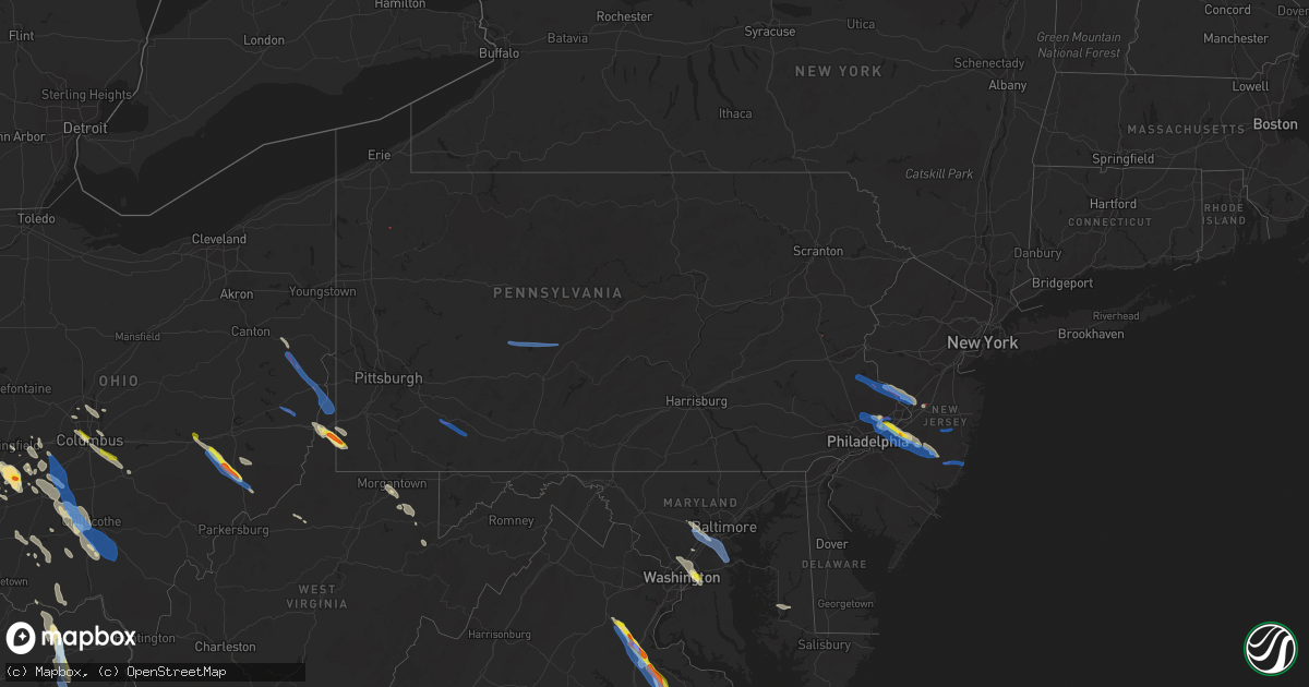
Hail Map in Pennsylvania on July 29, 2021
Get this storm
July 29 map
$229
one time, instant access
Download today. No call, no setup
Keep the $229
Bought the map and want the full workflow? Apply the entire $229 to a subscription within 7 days. None of it is wasted.
Every map, not just this one
This buys you this map. Subscription and you get every map we run, in the markets you choose from a few cities to whole states to nationwide. Plus real-time alerts the moment a storm fires.
Contact data
Name, contact info, occupancy, even credit band for addresses in the footprint. You go from where it hit to who to call.
Become the source they trust
Unlimited branding weather history reports on demand. You already have the documented answer ready for the property owner, and you are the one who showed up with it.
Property data and RoofTrace estimates
Pull up any address you have got, its value and the exact code rules for that jurisdiction, straight from One Click Code. Then RoofTrace estimates the squares, pitch, and roof value, priced the way you price.
Storm reports in Pennsylvania
Pennsylvania
| Date | Description |
|---|---|
| 07/29/20216:36 PM CDT | Numerous trees reported down along crabapple drive on the north end of waynesburg. Time updated based on radar imagery. |
| 07/29/20216:24 PM CDT | Twitter video of debris raining down near bensalem... Pa. Time estimated from radar. |
| 07/29/20216:10 PM CDT | Building damage and trees down in bensalem township near street road and the turnpike. |
| 07/29/20216:10 PM CDT | Debris in the air at the neshaminy mall in bensalem township. |
| 07/29/20216:07 PM CDT | A brief tornado occurred in the bustleton section of northeast philadelphia. Damage was first observed near grant ave at the grant gardens apartment complex... Where so |
| 07/29/20216:07 PM CDT | Faulkner auto building roof was blown off and collapsed. Multiple sections of the exterior walls also appear to be collapsed. Probable tornado. Time estimated radar. |
| 07/29/20216:07 PM CDT | Reports of damage to the lowes outdoor garden center just west of neshaminy mall. Multiple trees down as well as windows blown out of vehicles. Possible tornado. Time e |
| 07/29/20216:05 PM CDT | Wind damage reported in the vicinity of grant ave and roosevelt blvd. Branches down... Roof covering blown off a building. Time estimated from radar. |
| 07/29/20216:04 PM CDT | *** 5 inj *** the somerton-trevose-bensalem tornado began in somerton in philadelphia county near southampton road... Kelvin avenue... And trevose road where it uproote |
| 07/29/20215:27 PM CDT | A tornado touched down on the grounds of northern lehigh high school in slatington. Several trees were snapped or uprooted at the high school... With most of the snappi |
| 07/29/20215:23 PM CDT | Numerous trees reported down along crabapple drive on the north end of waynesburg. |
| 07/29/20215:12 PM CDT | Bleachers and a portable toilet where knocked over at blacklick valley high school. |
| 07/29/20215:10 PM CDT | Debris blocking pa route 32. |
| 07/29/20215:10 PM CDT | A tornado occurred on the evening of july 29th... 2021 near nanty-glo... Cambria county... Pennsylvania. The tornado developed on the western side of the blacklick vall |
| 07/29/20215:01 PM CDT | Confirmed ef1 tornado |
| 07/29/20215:00 PM CDT | Numerous trees reported down in richhill twp. Along day road. |
| 07/29/20214:59 PM CDT | Report of multiple trees down along crabapple road. Time estimated based on radar. |
| 07/29/20214:59 PM CDT | The supercell storm which produced a tornado in plumstead twp cycled and produced another tornado beginning in new hope in bucks county... Pennsylvania. Tree damage beg |
| 07/29/20214:50 PM CDT | Widespread tree damage along with some damage to structures in buckingham township. |
| 07/29/20214:40 PM CDT | Tree damage began in the area of bradshaw rd in plumstead twp in bucks county... Where a few sizable limbs were downed and a couple of larger but weakened trees were sn |
| 07/29/20214:34 PM CDT | A tornado touched down on the evening of july 29th... 2021 near houtztown rd where it destroyed a farm gate... Then moved southeast across a field where it knocked over |
| 07/29/20214:30 PM CDT | Utility lines down along dilltown heights road in buffington township |
| 07/29/20214:30 PM CDT | Debris blocking fretz valley road... Geigel hill road and creamery road. |
| 07/29/20214:20 PM CDT | Nws survey team observed ef0 tornado damage near geesey road... Where corn fields were disrupted and farm outbuildings were damaged. Time estimate based on radar. |
| 07/29/20214:17 PM CDT | Barn roof blown off structure; time estimate based on radar |
| 07/29/20214:11 PM CDT | Several trees down... Also have reports from buckingham and upper makefield. Time estimated from radar. |
| 07/29/20214:00 PM CDT | Three buildings damaged near the intersection of leithsville road and weavers lane. |
| 07/29/20213:58 PM CDT | 3 to 4 buildings damaged at the intersection of leithsville rd and weavers ln. Also some tree damage in the area. Possible tornado. Time estimated from radar. |
| 07/29/20213:57 PM CDT | Downed trees and power lines on hafler road off apples church road in lower saucon township. Time estimated from radar. Possible tornado. |
| 07/29/20213:31 PM CDT | Multiple trees down on lehigh dr. Possible tornado. Times estimated from radar. |
| 07/29/20213:31 PM CDT | Multiple downed >3 inch tree limbs. Possible tornado. Time estimated from radar. |
| 07/29/20213:28 PM CDT | Planes damaged at slatington airport. |
| 07/29/20213:28 PM CDT | Numerous trees and wires down at and around northern lehigh high school and on center street in slatington. Possible tornado. |
| 07/29/20213:27 PM CDT | Tree down and uprooted. Time estimated by radar. |
| 07/29/20213:27 PM CDT | A tornado touched down on the grounds of northern lehigh high school in slatington. Several trees were snapped or uprooted at the high school... With most of the snappi |
| 07/29/20213:15 PM CDT | Trees and wires down with partially torn off roof of a building. Possible tornado damage. Time estimated by radar. |
| 07/29/20213:14 PM CDT | Trees and wires down on 863. Route 863 is closed due to debris. |
| 07/29/20213:08 PM CDT | Trees and wires down. Time estimated by radar. |
| 07/29/20213:06 PM CDT | A tornado touched down between kunkels mill rd and red rd near the far southern tip of lynn twp in lehigh county... Pennsylvania... Just east of the county line with be |
| 07/29/20213:05 PM CDT | Downed trees and power lines in the new tripoli area. Some structural damage to an outside barn as well with pieces of roofing off. Time estimated from radar. |
| 07/29/20213:05 PM CDT | Utility poles down. |
| 07/29/20213:04 PM CDT | A tornado touched down near turkey rd in kempton... Albany twp... Berks county... Pa... Just west of the border with lehigh county. About 15 trees were uprooted in the |
| 07/29/20212:50 PM CDT | Several trees down in kempton. Time estimated from radar. |
| 07/29/20211:27 PM CDT | A tornado developed within laurel hill state park during the afternoon hours of thursday... July 29... 2021. The tornado began just north of laurel hill park drive and |
| 07/29/20211:22 PM CDT | Widespread trees down in laurel hill state park. |
| 07/29/20211:08 PM CDT | Damage extending down kessler school road near kessler extension... In salt lick township in fayette county. Pa. Single story shed overturned powerlines down... Barn ro |
| 07/29/20211:08 PM CDT | Report from mping: trees uprooted or snapped; roof blown off. |
| 07/29/20211:08 PM CDT | Multiple trees down |
| 07/29/20211:08 PM CDT | Report from mping: trees uprooted or snapped; roof blown off. |
| 07/29/20211:06 PM CDT | Report from mping: homes/buildings completely destroyed. |
| 07/29/20211:05 PM CDT | Mutliple trees down and structural damage in saltlick twp |
| 07/29/202112:53 PM CDT | Trees on wires. |
| 07/29/202112:06 PM CDT | Numerous trees uprooted closing barkeyville rd. Corrected for road name. |
| 07/29/202111:55 AM CDT | Nws storm survey team detected ef1 tornado damage near sr 417... Where hardwood trees were snapped and uprooted. Time estimate based on radar. |
| 07/29/202111:40 AM CDT | Ef0 tornado confirmed by preliminary storm survey. Tornado briefly touchdown around the intersection of fowler road and state highway 173. Damage reports were two barns |
| 07/29/20216:35 AM CDT | At 1134 AM EDT, severe thunderstorms were located along a line extending from Conneaut to near Geneva-On-The-Lake, moving southeast at 40 mph. HAZARD...60 mph wind gusts. SOURCE...Radar indicated. IMPACT...Expect damage to trees and power lines. Locations impacted include... Ashtabula, Meadville, Conneaut, Geneva-On-The-Lake, Geneva, Madison, North Kingsville, Albion, Andover, Linesville, Pymatuning Central, Harmonsburg, Pymatuning North, Austinburg, Kingsville, Roaming Shores, Pierpont, Saegertown, Cherry Valley and Conneautville. |
| 07/29/20212:28 AM CDT | At 727 PM EDT, a severe thunderstorm was located over Mercerville-Hamilton Square, or 7 miles east of Trenton, moving east at 30 mph. HAZARD...60 mph wind gusts. SOURCE...Radar indicated. IMPACT...Damage to roofs, siding, trees, and power lines is possible. Locations impacted include... Toms River, Trenton, Lakewood, Jackson, Howell, Manalapan, Hightstown, Bordentown, Cranbury, Allentown, Roosevelt, Windsor, East Freehold, Six Flags Theme Park, Cedar Glen West, Jacksons Mills, West Freehold, Clearbrook Park, Cassville and Adelphia.This includes the following highways... New Jersey Turnpike between exits 8 and 8A. Interstate 195 in New Jersey between mile markers 0 and 29. Interstate 295 in New Jersey between mile markers 58 and 68. |
| 07/29/20212:25 AM CDT | At 725 PM EDT, a severe thunderstorm was located over Willingboro, or 14 miles south of Trenton, moving southeast at 25 mph. HAZARD...Ping pong ball size hail and 60 mph wind gusts. SOURCE...Public. IMPACT...People and animals outdoors will be injured. Expect hail damage to roofs, siding, windows, and vehicles. Wind damage to roofs, siding, trees, and power lines is possible. Locations impacted include... Willingboro, Medford, Lumberton, Florence, Burlington, Bristol, Mount Holly, Riverside, Tabernacle, Bordentown, Presidential Lakes Estates, Beverly, Tullytown, Pemberton, Wrightstown, Florence-Roebling, Leisuretowne, Chatsworth, Jacksonville and Georgetown.This includes the following highways... New Jersey Turnpike between exits 5 and 7A. Pennsylvania Turnpike between mile markers 356 and 359. Interstate 95 in Pennsylvania between mile markers 37 and 40. Interstate 295 in New Jersey between mile markers 41 and 57. |
| 07/29/20211:45 AM CDT | At 645 PM EDT, a severe thunderstorm was located over Ivyland, or 14 miles north of Philadelphia, moving east at 25 mph. HAZARD...60 mph wind gusts and quarter size hail. SOURCE...Radar indicated. IMPACT...Minor damage to vehicles is possible. Wind damage to roofs, siding, trees, and power lines is possible. Locations impacted include... Philadelphia, Trenton, Bensalem, Ewing, Florence, Burlington, Bristol, Hatboro, Ambler, Beverly, Yardley, Newtown, Tullytown, Abington, Langhorne, Bryn Athyn, Ivyland, Feasterville-Trevose, Willow Grove and Florence-Roebling.This includes the following highways... New Jersey Turnpike between exits 5 and 6A. Pennsylvania Turnpike between mile markers 339 and 359. Interstate 95 in Pennsylvania between mile markers 34 and 40. Interstate 295 in New Jersey between mile markers 47 and 50, andbetween mile markers 75 and 76. |
| 07/29/20211:32 AM CDT | At 632 PM EDT, a severe thunderstorm was located 8 miles northwest of Cassville, or 10 miles south of Waynesburg, moving southeast at 40 mph. HAZARD...Wind gusts to 60 mph and half dollar-size hail. SOURCE...Radar. IMPACT...Minor hail damage to vehicles is possible. Expect wind damage to trees and power lines, resulting in some power outages. Locations impacted include... Morgantown... Westover... Star City... Point Marion... Granville... Cassville... Brookhaven... Bobtown... Blacksville... Mount Morris... Booth... Everettville...This includes the following highways... Interstate 68 in West Virginia between mile markers 1 and 10. Interstate 79 in Pennsylvania between mile markers 0 and 8. Interstate 79 in West Virginia between mile markers 144 and 160. |
| 07/29/20211:24 AM CDT | At 623 PM EDT, a severe thunderstorm was located over Ebensburg, moving southeast at 30 mph. HAZARD...60 mph wind gusts. SOURCE...Radar indicated. IMPACT...Expect damage to roofs, siding, and trees. Locations impacted include... Ebensburg, Portage, Roaring Spring, Cresson, Claysburg, Duncansville, Lilly, Queen, Ski Gap, East Freedom, Spring Hill, Summerhill, Newry, Wilmore, Cassandra, Blue Knob Ski Resort and Mt. Aloysius College.This includes Interstate 99 from mile markers 12 to 26. |
| 07/29/20211:14 AM CDT | At 614 PM EDT, a severe thunderstorm was located 9 miles east of Cameron, or 11 miles west of Waynesburg, moving southeast at 20 mph. HAZARD...Wind gusts to 60 mph and half dollar-size hail. SOURCE...Radar. IMPACT...Minor hail damage to vehicles is possible. Expect wind damage to trees and power lines, resulting in some power outages. Locations impacted include... Waynesburg... Rogersville... Spraggs... This includes Interstate 79 in Pennsylvania between mile markers 9and 13. |
| 07/29/202112:15 AM CDT | At 515 PM EDT, a severe thunderstorm was located near Indiana, moving southeast at 35 mph. HAZARD...Wind gusts to 60 mph. SOURCE...Radar. IMPACT...Expect damage to trees and power lines, resulting in some power outages. Locations impacted include... Homer City... Armagh... Lucerne Mines... Brush Vly... Yellow Creek State Park... |
| 07/29/202112:03 AM CDT | At 502 PM EDT, severe thunderstorms were located along a line extending from near Stormville to near Pleasant Valley, moving east at 30 mph. HAZARD...60 mph wind gusts. SOURCE...Radar indicated. IMPACT...Damage to roofs, siding, trees, and power lines is possible. Locations impacted include... Easton, Newton, Bethlehem, Hopatcong, Forks, Hackettstown, Quakertown, Wilson, Washington, Blairstown, Hellertown, Nazareth, Bangor, Flemington, Tinicum, High Bridge, Stanhope, Pen Argyl, Netcong and Wind Gap.This includes the following highways... Interstate 78 in Pennsylvania between mile markers 64 and 76. Interstate 78 in New Jersey between mile markers 0 and 29. Interstate 80 in New Jersey between mile markers 0 and 27. |
| 07/28/202110:48 PM CDT | At 348 PM EDT, a severe thunderstorm was located over Lenhartsville, or 14 miles east of Schuylkill Haven, moving east at 25 mph. HAZARD...60 mph wind gusts and quarter size hail. SOURCE...Radar indicated. IMPACT...Minor damage to vehicles is possible. Wind damage to roofs, siding, trees, and power lines is possible. Locations impacted include... Allentown, Bethlehem, Emmaus, Northampton, Kutztown, Hamburg, Topton, Shoemakersville, Lyons, Lenhartsville, Neffs, Coffeetown, New Tripoli, Zionsville, Ancient Oaks, Claussville, Wanamakers, Schnecksville, Catasauqua and Coplay.This includes the following highways... Northeast Extension between mile markers 46 and 66. Interstate 78 in Pennsylvania between mile markers 32 and 62. |
| 07/28/202110:31 PM CDT | At 330 PM EDT, a severe thunderstorm was located over Emmitsburg, moving east at 25 mph. HAZARD...60 mph wind gusts and quarter size hail. SOURCE...Radar indicated. IMPACT...Damaging winds will cause some trees and large branches to fall. This could injure those outdoors, as well as damage homes and vehicles. Roadways may become blocked by downed trees. Localized power outages are possible. Unsecured light objects may become projectiles. Locations impacted include... Westminster, Emmitsburg, Taneytown and Harney. |
| 07/28/20219:14 PM CDT | At 214 PM EDT, a severe thunderstorm was located near Tyrone, moving east at 35 mph. HAZARD...60 mph wind gusts. SOURCE...Radar indicated. IMPACT...Expect damage to roofs, siding, and trees. Locations impacted include... Tyrone, Bald Eagle, Warriors Mark, Pine Grove Mills, Ramblewood, Birmingham, Franklinville, Whipple Dam State Park, Mcalevys Fort and Rock Springs.This includes Interstate 99 from mile markers 47 to 56. |
| 07/28/20218:50 PM CDT | At 150 PM EDT, a severe thunderstorm was located over Prince Gallitzin State Park, moving east at 35 mph. HAZARD...60 mph wind gusts. SOURCE...Radar indicated. IMPACT...Expect damage to roofs, siding, and trees. Locations impacted include... Tyrone, Bald Eagle, Tipton, Blandburg, Prince Gallitzin State Park, Coalport and Delgrosso's Amusement Park.This includes Interstate 99 from mile markers 43 to 52. |
All States Impacted by Hail Map on July 29, 2021
Cities Impacted by Hail Map on July 29, 2021
- South Charleston, OH
- South Vienna, OH
- London, OH
- Meeker, CO
- Fieldon, IL
- Lebanon, IL
- Trenton, IL
- Highland, IL
- O'Fallon, IL
- Troy, IL
- Saint Jacob, IL
- Douglas, WY
- Cedarville, OH
- Xenia, OH
- Jamestown, OH
- Fenton, MO
- Imperial, MO
- Burtonsville, MD
- Laurel, MD
- South Solon, OH
- Jeffersonville, OH
- Payson, AZ
- Eureka, IL
- Wooton, KY
- Hazard, KY
- Casper, WY
- Evansville, WY
- West Finley, PA
- Wind Ridge, PA
- Cameron, WV
- Dallas, WV
- Wheeling, WV
- Clarkdale, AZ
- Prescott Valley, AZ
- Pinon, AZ
- Millstadt, IL
- Columbia, IL
- Ganado, AZ
- Winslow, AZ
- Teasdale, UT
- Hanksville, UT
- Somerset, CO
- Vanceburg, KY
- Emerson, KY
- Morehead, KY
- Olive Hill, KY
- Fredericksburg, VA
- Peebles, OH
- Hillsboro, OH
- Mancos, CO
- King William, VA
- West Point, VA
- Kaycee, WY
- Gillette, WY
- Lower Salem, OH
- Centennial, WY
- Walkerton, VA
- Kewanee, IL
- West Point, IA
- Washington, IL
- Sabina, OH
- Yellow Springs, OH
- Egnar, CO
- Mount Union, IA
- New London, IA
- Jackson, KY
- Clayhole, KY
- Vancleve, KY
- Lost Creek, KY
- Rousseau, KY
- Newcastle, WY
- Columbus, OH
- Flat Rock, IN
- Benton, IL
- Thompsonville, IL
- Dewey, AZ
- Minden, LA
- Hermann, MO
- Milford, VA
- Bowling Green, VA
- Port Royal, VA
- Woodford, VA
- Yates City, IL
- Williamsfield, IL
- Elmwood, IL
- Knoxville, IL
- Galesburg, IL
- Oneida, IL
- Gilson, IL
- Dahinda, IL
- Coalmont, CO
- Willcox, AZ
- Burlington, IA
- Mediapolis, IA
- Oquawka, IL
- Biggsville, IL
- Gladstone, IL
- Gypsum, CO
- Parachute, CO
- Canal Winchester, OH
- Groveport, OH
- Chinle, AZ
- Bladensburg, MD
- Brentwood, MD
- Riverdale, MD
- Hyattsville, MD
- District Heights, MD
- Capitol Heights, MD
- Washington, DC
- Mount Pleasant, IA
- Saint Stephens Church, VA
- Newtown, VA
- Mayer, AZ
- Humboldt, AZ
- Prescott, AZ
- Hilliard, OH
- Linn, MO
- Albion, IL
- Ellery, IL
- Mount Erie, IL
- West Salem, IL
- Parkersburg, IL
- Tappahannock, VA
- Cortez, CO
- Westerville, OH
- Lewis Center, OH
- Galena, OH
- Cairo, MO
- Rancocas, NJ
- Mount Holly, NJ
- Beverly, NJ
- Willingboro, NJ
- Caldwell, OH
- Glenwood, IN
- Rushville, IN
- Laurel, IN
- Maquon, IL
- Victoria, IL
- Claysville, PA
- West Alexander, PA
- Kaibeto, AZ
- Rowlesburg, WV
- Vincentown, NJ
- Pemberton, NJ
- East Saint Louis, IL
- Calhoun, IL
- Morgantown, WV
- Granite City, IL
- Muscatine, IA
- New Boston, IL
- Dolores, CO
- Glenrock, WY
- Dublin, OH
- Riverside, NJ
- Clifton Hill, MO
- Huntsville, MO
- Excello, MO
- Flagstaff, AZ
- Concho, AZ
- Sedona, AZ
- Aviston, IL
- Mascoutah, IL
- North Henderson, IL
- Batchtown, IL
- Hardin, IL
- Hamburg, IL
- Jerseyville, IL
- Jamesport, MO
- Dunlap, IL
- Chillicothe, IL
- Peoria, IL
- New Holland, OH
- Washington Court House, OH
- Beaver, UT
- Greenville, UT
- Columbia, MD
- Sykesville, MD
- Hanover, MD
- West Friendship, MD
- Ellicott City, MD
- Marriottsville, MD
- Elkridge, MD
- King City, MO
- McFall, MO
- Darlington, MO
- Springfield, OH
- Huntingdon Valley, PA
- Philadelphia, PA
- Feasterville Trevose, PA
- House Springs, MO
- Browns Mills, NJ
- Gueydan, LA
- Cahone, CO
- Goldvein, VA
- Midland, VA
- Grosse Tete, LA
- Toano, VA
- Williamsburg, VA
- Lanexa, VA
- Pleasant Hill, IL
- Corbin, KY
- Safford, AZ
- Chillicothe, OH
- Paris, MO
- Mount Laurel, NJ
- Abington, PA
- Bryn Athyn, PA
- Hainesport, NJ
- Croydon, PA
- Willow Grove, PA
- Jenkintown, PA
- Bensalem, PA
- Burlington, NJ
- Lumberton, NJ
- Blanding, UT
- Manito, IL
- Topeka, IL
- Forest City, IL
- Fairland, IN
- Shelbyville, IN
- Walden, CO
- Stafford, VA
- Aylett, VA
- Roanoke, IL
- Metamora, IL
- Lowpoint, IL
- Pattonsburg, MO
- Vincennes, IN
- Lawrenceville, IL
- Waverly, OH
- Keno, OR
- Chiloquin, OR
- Fort Klamath, OR
- Shelbina, MO
- Stoutsville, MO
- Jacksonville, MO
- Kennard, TX
- Port Saint Joe, FL
- Pennsboro, WV
- Alma, WV
- Kirksville, MO
- Brashear, MO
- Lithopolis, OH
- Lancaster, OH
- Carroll, OH
- Sarahsville, OH
- Summerfield, OH
- Kane, IL
- Annada, MO
- Kampsville, IL
- Nebo, IL
- Eldred, IL
- Elsberry, MO
- Mokane, MO
- Tebbetts, MO
- Annawan, IL
- Powell, OH
- Godfrey, IL
- Bethalto, IL
- Alton, IL
- Vandalia, IL
- Shobonier, IL
- Mulberry Grove, IL
- Letts, IA
- Nichols, IA
- West Union, WV
- Williamsburg, KY
- Frankfort, OH
- Sutherland, NE
- Yellow Jacket, CO
- Bonnots Mill, MO
- Fulton, MO
- New Bloomfield, MO
- Chamois, MO
- Triadelphia, WV
- Graysville, PA
- Piasa, IL
- Brighton, IL
- Eureka, UT
- Laramie, WY
- Speer, IL
- Wyoming, IL
- Atkinson, IL
- Cambridge, IL
- Hambleton, WV
- Parsons, WV
- Alhambra, IL
- Summerfield, IL
- Breese, IL
- Marine, IL
- Scott Air Force Base, IL
- Pocahontas, IL
- Collinsville, IL
- South Salem, OH
- Swan, IA
- Chambers, AZ
- Derby, IN
- Williams, AZ
- Chandlersville, OH
- Cumberland, OH
- Dexter City, OH
- Toulon, IL
- Galva, IL
- La Fayette, IL
- Wapello, IA
- Oakville, IA
- Montrose, CO
- Hurlock, MD
- Trappe, MD
- Smilax, KY
- Pittsfield, IL
- Milton, FL
- Hurricane, UT
- New Douglas, IL
- Sandy Hook, KY
- West Liberty, KY
- Barhamsville, VA
- Bealeton, VA
- Catlett, VA
- Bruington, VA
- Danville, IA
- Aledo, IL
- Milan, MO
- Somerset, KY
- Millsboro, DE
- Shelbyville, MO
- Bethel, MO
- Emden, MO
- Jameson, MO
- Gallatin, MO
- Harbeson, DE
- Georgetown, DE
- Busy, KY
- Hyden, KY
- Green River, UT
- Minerva, OH
- Mechanicstown, OH
- East Rochester, OH
- Kensington, OH
- Monroe City, MO
- Mount Sterling, MO
- Bland, MO
- Green Castle, MO
- Green City, MO
- Clarksville, MO
- Kykotsmovi Village, AZ
- Golconda, IL
- Waldron, IN
- Greenfield, OH
- Bainbridge, OH
- Bone Gap, IL
- Sumner, IL
- Mount Carmel, IL
- Claremont, IL
- Olney, IL
- Browns, IL
- Ramsey, IL
- Collbran, CO
- Fillmore, IL
- Pleasantville, IA
- Saint Paul, IN
- Hope, IN
- Linneus, MO
- Trivoli, IL
- Russell Springs, KY
- Crawfordsville, IA
- Winfield, IA
- Morning Sun, IA
- Argyle, IA
- Montrose, IA
- Bridgeport, IL
- Milton, DE
- New Baden, IL
- Kings Mountain, KY
- Waynesburg, KY
- Crab Orchard, KY
- Dow, IL
- Perry, MO
- Center, MO
- Novinger, MO
- Barnhart, MO
- Kingsbury, TX
- Durango, CO
- Donnellson, IA
- Lewes, DE
- Sheffield, IL
- Buda, IL
- Neponset, IL
- Mineral, IL
- Eubank, KY
- Bradford, IL
- Joy, IL
- Newburg, WV
- Kingwood, WV
- Tunnelton, WV
- Reedsville, WV
- Belleville, IL
- Manchester, OH
- East Carondelet, IL
- Saint Louis, MO
- Leopold, IN
- Eckerty, IN
- Saint Croix, IN
- Bristow, IN
- Cannelton, IN
- Branchville, IN
- English, IN
- Payneville, KY
- Union Star, KY
- Sulphur, IN
- Leavenworth, IN
- Holbrook, PA
- Martins Ferry, OH
- Bridgeport, OH
- Saint Martinville, LA
- Columbus, IN
- Gibbs, MO
- Novelty, MO
- Hurdland, MO
- Sulphur, LA
- Hustonville, KY
- Middleburg, KY
- Foley, MO
- Winfield, MO
- Princeville, IL
- Pagosa Springs, CO
- Moberly, MO
- Independence, WV
- Mount Sterling, OH
- Galt, MO
- Harris, MO
- Titusville, NJ
- Pennington, NJ
- Beaver, OH
- Clarksburg, OH
- Bloomingburg, OH
- Piketon, OH
- Zuni, NM
- Gerlaw, IL
- Monmouth, IL
- Cameron, IL
- Flat Rock, IL
- Morrison, MO
- Lynchburg, OH
- Kaplan, LA
- Madison, MO
- Holliday, MO
- Lentner, MO
- Clarence, MO
- Silver Spring, MD
- Kensington, MD
- Upper Marlboro, MD
- College Park, MD
- Greenbelt, MD
- Takoma Park, MD
- Mount Rainier, MD
- High Ridge, MO
- Eureka, MO
- Tuba City, AZ
- Spickard, MO
- Trenton, MO
- Reynolds, IL
- Viola, IL
- Taylor Ridge, IL
- Illinois City, IL
- Milan, IL
- Alexis, IL
- Matherville, IL
- Geneseo, IL
- Prophetstown, IL
- Otway, OH
- Stout, OH
- Blue Creek, OH
- Lewis, CO
- Gilman City, MO
- Macon, MO
- Eddyville, NE
- Seguin, TX
- Barnhill, IL
- Fairfield, IL
- Lambertville, NJ
- Trenton, NJ
- New Hope, PA
- Lawrence Township, NJ
- Robbinsville, NJ
- Middletown, IA
- Knightstown, IN
- Mays, IN
- Carrollton, IL
- Wilmington, OH
- Zanesville, OH
- Mcconnelsville, OH
- Macksburg, OH
- East Peoria, IL
- Kremmling, CO
- Clifton, AZ
- Brookfield, MO
- Shipman, IL
- Salem, KY
- Hampton, KY
- Smithland, KY
- Peoria Heights, IL
- Edwards, IL
- Mossville, IL
- Edelstein, IL
- East Alton, IL
- McNeal, AZ
- Wilberforce, OH
- Seaman, OH
- Waynesville, OH
- Carlyle, IL
- Greenville, IL
- Keyesport, IL
- Stevensville, VA
- Many Farms, AZ
- Teec Nos Pos, AZ
- Oldenburg, IN
- Milroy, IN
- Greensburg, IN
- Hastings, PA
- Flinton, PA
- Blandburg, PA
- Patton, PA
- Fallentimber, PA
- Cherry Tree, PA
- Tyrone, PA
- Acme, PA
- Mount Pleasant, PA
- Somerset, PA
- Champion, PA
- Jones Mills, PA
- Melcroft, PA
- Donegal, PA
- Carversville, PA
- Doylestown, PA
- Perkasie, PA
- Washington Crossing, PA
- Pipersville, PA
- Ottsville, PA
- Lumberville, PA
- Newtown, PA
- Quakertown, PA
- Waretown, NJ
- Barnegat, NJ
- Manchester Township, NJ
- Jackson, NJ
- Lakehurst, NJ
- Fort Washington, PA
- Oreland, PA
- Dresher, PA
- Moorestown, NJ
- Ambler, PA
- Medford, NJ
- Horsham, PA
- Glenside, PA
- Flourtown, PA
- Chatsworth, NJ
- Riverton, NJ
- Cheltenham, PA
- Slatington, PA
- Hightstown, NJ
- Cochranton, PA
- Guys Mills, PA
- Elkfork, KY
- Rowdy, KY
- Chavies, KY
- Sumerduck, VA
- Spotsylvania, VA
- Severn, MD
- Glen Burnie, MD
- Gambrills, MD
- Harmans, MD
- Jessup, MD
- Baltimore, MD
- Crownsville, MD
- Annapolis, MD
- Linthicum Heights, MD
- Severna Park, MD
- Millersville, MD
- New Kent, VA
- Palestine, IL
- Richmond Dale, OH
- Williamsport, OH
- Jackson, OH
- Ray, OH
- West Liberty, WV
- Wellsburg, WV
- Bergholz, OH
- Richmond, OH
- Amsterdam, OH
- Steubenville, OH
- Salineville, OH
- Bloomingdale, OH
- Valley Grove, WV
- Brilliant, OH
- Beech Bottom, WV
- Rayland, OH
- Mingo Junction, OH
- Bethany, WV
- Carrollton, OH
- Cadiz, OH
- Saint Clairsville, OH
- Blue Rock, OH


