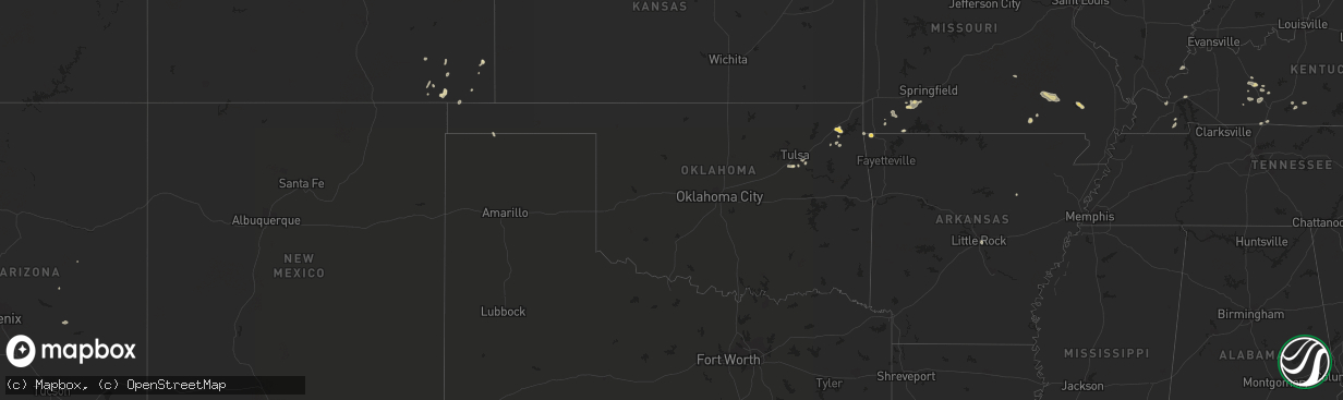
Hail Map in Oklahoma on July 27, 2022
The weather event in Oklahoma on July 27, 2022 includes Wind and Hail maps. 18 states and 293 cities were impacted and suffered possible damage. The total estimated number of properties impacted is 0.
Want more than just the map?
Turn this storm into a full workflow.
- Owner + property data so you know who to knock
- OnDemand branded weather history reports to win the "did we even have hail?" argument
- RoofTrace estimate so reps stop guessing numbers at the door
Bought this map? Upgrade within 7 days and we'll credit the $230. (10-15 min setup call)
Wind
Hail
0
Estimated number of impacted properties by a 1.00" hail or larger0
Estimated number of impacted properties by a 1.75" hail or larger0
Estimated number of impacted properties by a 2.50" hail or largerStorm reports in Oklahoma
Oklahoma
| Date | Description |
|---|---|
| 07/27/20226:10 PM CDT | Tree downed... Blocking the westbound lane of old highway 33. Relayed by broadcast media. Time estimated by radar. |
| 07/27/20226:05 PM CDT | Video of a metal shed damaged and relocated to the side of the road relayed via broadcast media twitter. Between 121st and 131st and elwood. Time estimated by radar. |
| 07/27/20226:05 PM CDT | Numerous tree limbs down in glenpool. Video relayed via twitter. Time estimated by radar. |
| 07/27/20226:05 PM CDT | Roof damage to a home. Photo relayed via broadcast media. Time estimated from radar. |
| 07/27/20226:00 PM CDT | Power lines downed. Time estimated by radar. |
| 07/27/20225:15 PM CDT | 3 high power transmission line structures have been destroyed near the intersection of highway 28 and n 444 rd. Highway 28 is currently shutdown due to lines across the |
| 07/27/20224:40 PM CDT | Camper blown over and a roof torn off a barn near the intersection of n 433 rd and w 470 rd. Time estimated by radar. |
| 07/27/20221:07 AM CDT | At 607 PM CDT, a severe thunderstorm was located over Salina, moving east at 20 mph. HAZARD...60 mph wind gusts. SOURCE...Radar indicated. IMPACT...Expect damage to roofs, siding, and trees. Locations in or near the path include... Jay... Pryor... Pryor Creek... Chouteau... Locust Grove... Salina... Langley... Kansas... Adair... Spavinaw... Oaks... Pensacola... Hoot Owl... Rose... Spavinaw State Park... Leach... Chloeta... Twin Oaks... Sportsmen Acres Community... Strang... |
| 07/27/202212:23 AM CDT | At 523 PM CDT, a severe thunderstorm was located 3 miles northwest of Verdigris, moving east at 20 mph. HAZARD...60 mph wind gusts. SOURCE...Radar indicated. IMPACT...Expect damage to roofs, siding, and trees. Locations in or near the path include... Claremore... Catoosa... Verdigris... Inola... Taiwah... Tiawah...This includes Interstate 44 between mile markers 236 and 259. |
| 07/27/202212:19 AM CDT | At 519 PM CDT, a severe thunderstorm was located over Oneta, moving northeast at 10 mph. HAZARD...60 mph wind gusts. SOURCE...Radar indicated. IMPACT...Expect damage to roofs, siding, and trees. Locations in or near the path include... Tulsa... Broken Arrow... Wagoner... Coweta... Inola... Stonebluff... Oneta... |
| 07/27/202212:16 AM CDT | At 515 PM CDT, a severe thunderstorm was located over South West City, or 11 miles southwest of Pineville, moving east at 20 mph. HAZARD...60 mph wind gusts and penny size hail. SOURCE...Radar indicated. IMPACT...Expect damage to roofs, siding, and trees. Locations impacted include... Noel... Dodge... South West City... Pineville... Lanagan... This includes Interstate 49 between mile markers 1 and 5. |
| 07/26/202211:58 PM CDT | At 458 PM CDT, a severe thunderstorm was located over Ketchum, moving east at 15 mph. HAZARD...60 mph wind gusts and nickel size hail. SOURCE...Radar indicated. IMPACT...Expect damage to roofs, siding, and trees. Locations in or near the path include... Vinita... Jay... Grove... Langley... Bernice... Ketchum... Disney... Pensacola... Cherokee State Park... Bernice State Park... Cleora... Chloeta... Strang... Disney Little Blue State Park... Zena... This includes Interstate 44 between mile markers 284 and 288. |
| 07/26/202211:55 PM CDT | At 454 PM CDT, a severe thunderstorm was located over Sand Springs, moving east at 10 mph. Another severe thunderstorm was near Owasso...moving east at 10 mph. HAZARD...60 mph wind gusts. SOURCE...Radar indicated. IMPACT...Expect damage to roofs, siding, and trees. Locations in or near the path include... Tulsa... Broken Arrow... Sand Springs... Owasso... Bixby... Jenks... Catoosa... Collinsville... Sperry... Jenks Riverside Airport... Turley... Tulsa International Airport... Gray... This includes Interstate 44 between mile markers 212 and 235. |
| 07/26/202211:19 PM CDT | At 419 PM CDT, a severe thunderstorm was located 4 miles south of Vinita, moving northeast at 15 mph. HAZARD...60 mph wind gusts. SOURCE...Radar indicated. IMPACT...Expect damage to roofs, siding, and trees. Locations in or near the path include... Vinita... Afton... Bernice... Bluejacket... Bernice State Park... Cleora...This includes Interstate 44 between mile markers 277 and 298. |
All States Impacted by Hail Map on July 27, 2022
Cities Impacted by Hail Map on July 27, 2022
- Wellington, CO
- Cheyenne, WY
- Portis, KS
- Peetz, CO
- Iliff, CO
- Morgantown, KY
- Jetson, KY
- Fairmont, MN
- Welcome, MN
- Eaton, CO
- Ault, CO
- Gill, CO
- Pierce, CO
- Nunn, CO
- Jackson, MN
- Alpha, MN
- Briggsdale, CO
- Sherburn, MN
- Grant, NE
- Parks, NE
- Champion, NE
- Haigler, NE
- Benkelman, NE
- North Platte, NE
- Oshkosh, NE
- Venango, NE
- Big Springs, NE
- Julesburg, CO
- Pine Bluffs, WY
- Albin, WY
- Harrisburg, NE
- Burns, WY
- Ellsworth, NE
- Hemingford, NE
- Alliance, NE
- Livermore, CO
- Laramie, WY
- Lexington, NE
- Carpenter, WY
- Joes, CO
- Anton, CO
- Vona, CO
- Cope, CO
- Bellvue, CO
- Callaway, NE
- Gothenburg, NE
- Roggen, CO
- Orchard, CO
- Jadwin, MO
- Salem, MO
- Austin, MN
- Hollandale, MN
- Littlefield, AZ
- Parker, CO
- Imperial, NE
- Yuma, CO
- Wray, CO
- Idalia, CO
- Holyoke, CO
- Vernon, CO
- Wheatland, WY
- Chugwater, WY
- Fort Collins, CO
- Kim, CO
- Oxford, NC
- Lewellen, NE
- Ogallala, NE
- Brule, NE
- Brady, NE
- Pritchett, CO
- Hillsdale, WY
- Akron, CO
- Merino, CO
- Rawlins, WY
- Whiting, IN
- East Chicago, IN
- Chicago, IL
- Hammond, IN
- Holdrege, NE
- Arriba, CO
- Dammeron Valley, UT
- Saint George, UT
- Gunlock, UT
- Wilcox, NE
- Cozad, NE
- Elwood, NE
- Eustis, NE
- Oxford, NE
- Bertrand, NE
- Edison, NE
- Murray, KY
- Almo, KY
- Dexter, KY
- Loveland, CO
- Bushnell, NE
- Texhoma, OK
- Stratford, TX
- Lander, WY
- Bixby, OK
- Kersey, CO
- Smithfield, NE
- Canadian, TX
- Overton, NE
- Stratton, CO
- Littleton, CO
- Gravette, AR
- Sulphur Springs, AR
- Wappapello, MO
- Puxico, MO
- Tipton, KS
- Glen Elder, KS
- Billings, MO
- Clever, MO
- Crane, MO
- Marionville, MO
- Aurora, MO
- Vinita, OK
- Strang, OK
- Burlington, CO
- Caliente, NV
- Minneapolis, KS
- Glenpool, OK
- Sapulpa, OK
- Cawker City, KS
- Mount Carmel, UT
- Orderville, UT
- Glasgow, KY
- Glasco, KS
- Delphos, KS
- Beloit, KS
- Barnard, KS
- Windsor, CO
- Greeley, CO
- Carr, CO
- Severance, CO
- Carrizozo, NM
- Granada, CO
- Bethune, CO
- Max, NE
- Morrison, CO
- Evergreen, CO
- Kanorado, KS
- Calvert City, KY
- Symsonia, KY
- Paducah, KY
- Madrid, NE
- Big Cabin, OK
- Young, AZ
- Stratton, NE
- McDonald, KS
- Kirk, CO
- Eddyville, KY
- Kuttawa, KY
- Sterling, CO
- Otis, CO
- Las Animas, CO
- Wiggins, CO
- Downs, KS
- Tescott, KS
- New Cambria, KS
- Solomon, KS
- Hunter, KS
- Lincoln, KS
- Salina, KS
- Bennington, KS
- Raton, NM
- Evans, CO
- Afton, OK
- Ketchum, OK
- Rochester, KY
- Broken Arrow, OK
- Bradford, AR
- Boulder, CO
- Cromwell, KY
- Beaver Dam, KY
- Eagle Rock, MO
- Hockley, TX
- Waller, TX
- Drake, CO
- Estes Park, CO
- Sinclair, WY
- Nederland, CO
- Phillipsburg, KS
- Lewisburg, KY
- Russellville, KY
- Enders, NE
- Wauneta, NE
- Berthoud, CO
- Gaylord, KS
- Agate, CO
- Jefferson, CO
- Lake George, CO
- Hillrose, CO
- Salina, OK
- Cave In Rock, IL
- Rocky Comfort, MO
- Pryor, OK
- Edmonton, KY
- Knob Lick, KY
- Ellsinore, MO
- Van Buren, MO
- Mill Spring, MO
- Piedmont, MO
- Ellington, MO
- South West City, MO
- Arvada, CO
- Tombstone, AZ
- Eckley, CO
- Franklin, KY
- Portland, TN
- Franklin, NE
- Bloomington, NE
- Tulsa, OK
- Conifer, CO
- Sedalia, CO
- Little Rock, AR
- Castle Rock, CO
- Lone Tree, CO
- Hendley, NE
- Golden, CO
- Denver, CO
- Show Low, AZ
- Two Buttes, CO
- Doniphan, MO
- Agra, KS
- Boise City, OK
- Atwood, KS
- Bowling Green, KY
- Rockfield, KY
- Alton, MO
- Kimball, NE
- Claunch, NM
- Snyder, CO
- Booneville, KY
- Globe, AZ
- Peridot, AZ
- Hurricane, UT
- Beaver City, NE
- Woodrow, CO
- Spavinaw, OK
- Roundhill, KY
- Broomfield, CO
- Louisville, CO
- Eldorado Springs, CO
- Semora, NC
- Fort Morgan, CO
- Alma, NE
- Naponee, NE
- Republican City, NE
- Jenks, OK
- Kiefer, OK
- Purdy, MO
- Monett, MO
- Butterfield, MO
- Pierce City, MO
- West Liberty, KY
- Mize, KY
- Ezel, KY
- Grenville, NM
- Campo, CO
- McKee, KY
- Tyner, KY
- Vincent, KY
- Warrenton, NC
- Amarillo, TX
- Saint Johns, AZ
- Timnath, CO
- Fort Washakie, WY
- Albert Lea, MN
- Freeborn, MN
- Alden, MN
- Blooming Prairie, MN
- Hartland, MN
- Clarks Grove, MN
- Bosler, WY
- Granite Canon, WY
- Fe Warren Afb, WY
- Englewood, CO
- Wellfleet, NE
- Farnam, NE
- Moorefield, NE
- Curtis, NE
- Stapleton, NE
- Maxwell, NE
- Junction City, KS
- Abilene, KS
- Enterprise, KS
- Chapman, KS
- Galeton, CO
- Irvine, KY
- Clay City, KY
- Stanton, KY
- Winchester, KY


