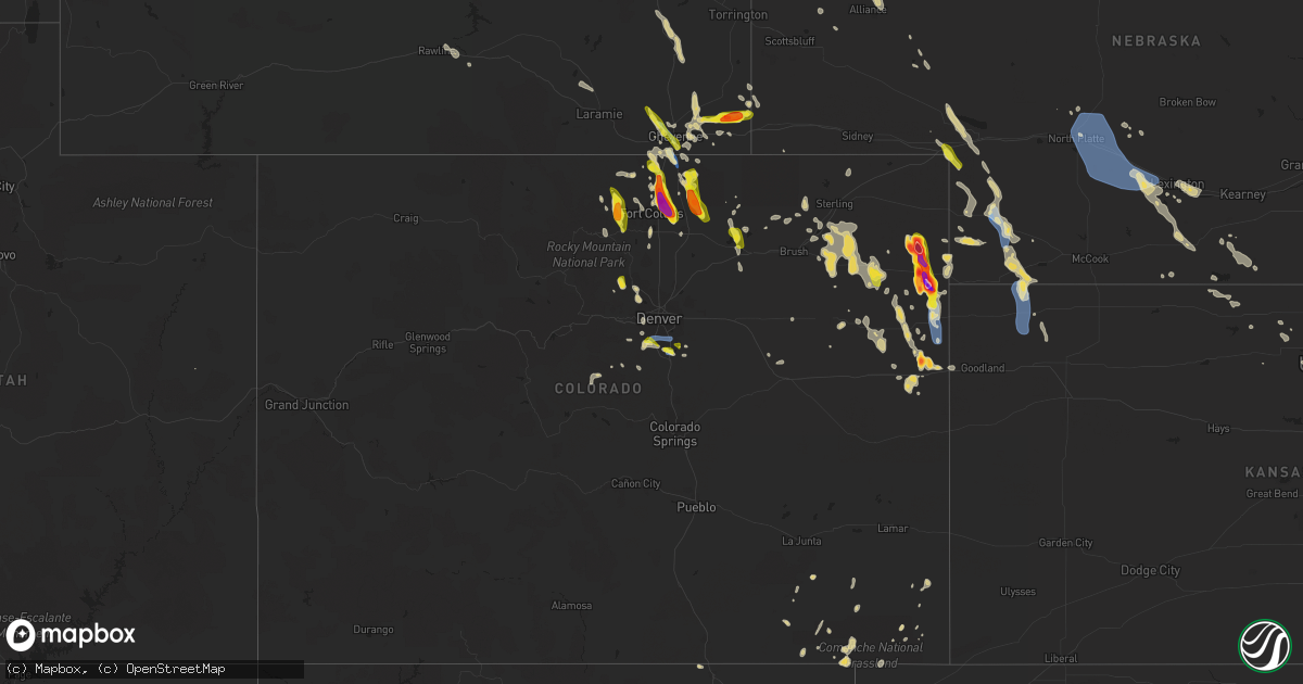
Hail Map on July 27, 2022
Get this storm
July 27 map
$229
one time, instant access
Download today. No call, no setup
Keep the $229
Bought the map and want the full workflow? Apply the entire $229 to a subscription within 7 days. None of it is wasted.
Every map, not just this one
This buys you this map. Subscription and you get every map we run, in the markets you choose from a few cities to whole states to nationwide. Plus real-time alerts the moment a storm fires.
Contact data
Name, contact info, occupancy, even credit band for addresses in the footprint. You go from where it hit to who to call.
Become the source they trust
Unlimited branding weather history reports on demand. You already have the documented answer ready for the property owner, and you are the one who showed up with it.
Property data and RoofTrace estimates
Pull up any address you have got, its value and the exact code rules for that jurisdiction, straight from One Click Code. Then RoofTrace estimates the squares, pitch, and roof value, priced the way you price.
States Impacted by Hail Map on July 27, 2022
Storm reports
Oklahoma
| Date | Description |
|---|---|
| 07/27/20226:10 PM CDT | Tree downed... Blocking the westbound lane of old highway 33. Relayed by broadcast media. Time estimated by radar. |
| 07/27/20226:05 PM CDT | Numerous tree limbs down in glenpool. Video relayed via twitter. Time estimated by radar. |
| 07/27/20226:05 PM CDT | Roof damage to a home. Photo relayed via broadcast media. Time estimated from radar. |
| 07/27/20226:05 PM CDT | Video of a metal shed damaged and relocated to the side of the road relayed via broadcast media twitter. Between 121st and 131st and elwood. Time estimated by radar. |
| 07/27/20226:00 PM CDT | Power lines downed. Time estimated by radar. |
| 07/27/20225:15 PM CDT | 3 high power transmission line structures have been destroyed near the intersection of highway 28 and n 444 rd. Highway 28 is currently shutdown due to lines across the |
| 07/27/20224:40 PM CDT | Camper blown over and a roof torn off a barn near the intersection of n 433 rd and w 470 rd. Time estimated by radar. |
| 07/27/20221:07 AM CDT | At 607 PM CDT, a severe thunderstorm was located over Salina, moving east at 20 mph. HAZARD...60 mph wind gusts. SOURCE...Radar indicated. IMPACT...Expect damage to roofs, siding, and trees. Locations in or near the path include... Jay... Pryor... Pryor Creek... Chouteau... Locust Grove... Salina... Langley... Kansas... Adair... Spavinaw... Oaks... Pensacola... Hoot Owl... Rose... Spavinaw State Park... Leach... Chloeta... Twin Oaks... Sportsmen Acres Community... Strang... |
| 07/27/202212:23 AM CDT | At 523 PM CDT, a severe thunderstorm was located 3 miles northwest of Verdigris, moving east at 20 mph. HAZARD...60 mph wind gusts. SOURCE...Radar indicated. IMPACT...Expect damage to roofs, siding, and trees. Locations in or near the path include... Claremore... Catoosa... Verdigris... Inola... Taiwah... Tiawah...This includes Interstate 44 between mile markers 236 and 259. |
| 07/27/202212:19 AM CDT | At 519 PM CDT, a severe thunderstorm was located over Oneta, moving northeast at 10 mph. HAZARD...60 mph wind gusts. SOURCE...Radar indicated. IMPACT...Expect damage to roofs, siding, and trees. Locations in or near the path include... Tulsa... Broken Arrow... Wagoner... Coweta... Inola... Stonebluff... Oneta... |
| 07/27/202212:16 AM CDT | At 515 PM CDT, a severe thunderstorm was located over South West City, or 11 miles southwest of Pineville, moving east at 20 mph. HAZARD...60 mph wind gusts and penny size hail. SOURCE...Radar indicated. IMPACT...Expect damage to roofs, siding, and trees. Locations impacted include... Noel... Dodge... South West City... Pineville... Lanagan... This includes Interstate 49 between mile markers 1 and 5. |
| 07/26/202211:58 PM CDT | At 458 PM CDT, a severe thunderstorm was located over Ketchum, moving east at 15 mph. HAZARD...60 mph wind gusts and nickel size hail. SOURCE...Radar indicated. IMPACT...Expect damage to roofs, siding, and trees. Locations in or near the path include... Vinita... Jay... Grove... Langley... Bernice... Ketchum... Disney... Pensacola... Cherokee State Park... Bernice State Park... Cleora... Chloeta... Strang... Disney Little Blue State Park... Zena... This includes Interstate 44 between mile markers 284 and 288. |
| 07/26/202211:55 PM CDT | At 454 PM CDT, a severe thunderstorm was located over Sand Springs, moving east at 10 mph. Another severe thunderstorm was near Owasso...moving east at 10 mph. HAZARD...60 mph wind gusts. SOURCE...Radar indicated. IMPACT...Expect damage to roofs, siding, and trees. Locations in or near the path include... Tulsa... Broken Arrow... Sand Springs... Owasso... Bixby... Jenks... Catoosa... Collinsville... Sperry... Jenks Riverside Airport... Turley... Tulsa International Airport... Gray... This includes Interstate 44 between mile markers 212 and 235. |
| 07/26/202211:19 PM CDT | At 419 PM CDT, a severe thunderstorm was located 4 miles south of Vinita, moving northeast at 15 mph. HAZARD...60 mph wind gusts. SOURCE...Radar indicated. IMPACT...Expect damage to roofs, siding, and trees. Locations in or near the path include... Vinita... Afton... Bernice... Bluejacket... Bernice State Park... Cleora...This includes Interstate 44 between mile markers 277 and 298. |
Arizona
| Date | Description |
|---|---|
| 07/27/20222:48 AM CDT | At 748 PM MST, a severe thunderstorm was located over Tombstone, or 17 miles northeast of Sierra Vista, moving southeast at 10 mph. HAZARD...60 mph wind gusts and quarter size hail. SOURCE...Radar indicated. IMPACT...Hail damage to vehicles is expected. Expect wind damage to roofs, siding, and trees. Locations impacted include... Tombstone. |
| 07/27/20222:41 AM CDT | At 740 PM PDT/740 PM MST/, a severe thunderstorm was located over Boulder Beach Campground, or near Boulder City, moving southwest at 25 mph. HAZARD...640 to 50 mph with 60 mph wind gusts possible. SOURCE...Radar indicated. IMPACT...Expect damage to roofs and trees and dangerous boating conditions. Locations impacted include... North Las Vegas, Las Vegas Bay, Nellis AFB, The Motor Speedway, Lake Las Vegas, East Las Vegas, Echo Bay, Boulder Beach, Boulder Beach Campground, Las Vegas Bay Campground, Echo Bay Campground, Callville Bay, Meadview, Hoover Dam, Valley Of Fire, Callville Bay Campground, Temple Bar Campground, South Cove, Lake Mead National Recreation Area and Sunrise Mtn.This includes Interstate 15 in Nevada between mile markers 60 and 81. |
| 07/27/20221:57 AM CDT | At 656 PM PDT/656 PM MST/, a severe thunderstorm was located 8 miles southwest of Echo Bay Campground, or 19 miles northeast of Las Vegas Bay, moving southwest at 25 mph. Gusty winds ahead of rain and thunderstorms are the primary threat and will occur well before any rainfall. HAZARD...60 mph wind gusts. SOURCE...Radar indicated. IMPACT...Expect damage to roofs and trees. Locations impacted include... North Las Vegas, Las Vegas Bay, Nellis AFB, The Motor Speedway, Lake Las Vegas, East Las Vegas, Echo Bay, Boulder Beach, Boulder Beach Campground, Las Vegas Bay Campground, Echo Bay Campground, Callville Bay, Meadview, Hoover Dam, Valley Of Fire, Callville Bay Campground, Temple Bar Campground, South Cove, Lake Mead National Recreation Area and Sunrise Mtn.This includes Interstate 15 in Nevada between mile markers 60 and 81. |
| 07/27/20221:12 AM CDT | At 612 PM PDT/612 PM MST/, a severe thunderstorm was located near Moapa Town, moving southwest at 40 mph. Wind gusts of 60 mph have been recorded in Moapa. HAZARD...60 mph wind gusts. SOURCE...Public. IMPACT...Expect damage to roofs and trees. Locations impacted include... Overton, Moapa Town, Moapa Valley, Echo Bay, Valley Of Fire, Sr 168 Mile Marker 21, Overton Beach, Echo Bay Campground, Coyote Springs and Logandale.This includes the following highways... Interstate 15 in Arizona near mile marker 3. Interstate 15 in Nevada between mile markers 63 and 95. |
| 07/26/202211:34 PM CDT | At 434 PM MST, a severe thunderstorm was located near Cutter, or 7 miles east of Globe, moving northwest at 15 mph. HAZARD...60 mph wind gusts and quarter size hail. SOURCE...Radar indicated. IMPACT...Hail damage to vehicles is expected. Expect wind damage to roofs, siding, and trees. Locations impacted include... Globe, Miami, Cutter, Central Heights-Midland City and Claypool. This includes the following highways...US Highway 60 between mile markers 243 and 264.AZ Route 70 between mile markers 253 and 264.AZ Route 77 between mile markers 167 and 170. |
Kentucky
| Date | Description |
|---|---|
| 07/27/20226:49 PM CDT | Image of tree down on east brown st. Blocking the road on a bridge. Via social media. |
| 07/27/20226:43 PM CDT | Via social media - image of fallen tree off home chapel rd. |
| 07/27/20226:43 PM CDT | Relayed a public report. Several trees down at davis crossroads in southern butler county. An older barn was also lost. |
| 07/27/20226:40 PM CDT | Report of a tree down in the windfield community. |
| 07/27/20224:29 AM CDT | At 929 PM EDT, a severe thunderstorm was located over Disputanta, or 7 miles northeast of Mount Vernon, moving east at 35 mph. HAZARD...60 mph wind gusts. SOURCE...Radar indicated. IMPACT...Expect damage to roofs, siding, and trees. This severe thunderstorm will be near... Climax around 935 PM EDT. Clover Bottom around 940 PM EDT. Kerby Knob around 945 PM EDT.Other locations in the path of this severe thunderstorm includeBrazil and Foxtown. |
| 07/27/20224:03 AM CDT | At 902 PM EDT, a severe thunderstorm was located near Gum Sulphur, moving east at 30 mph. HAZARD...60 mph wind gusts. SOURCE...Radar indicated. IMPACT...Expect damage to roofs, siding, and trees. This severe thunderstorm will remain over mainly rural areas of northeastern Lincoln and southeastern Garrard Counties, including the following locations... Crab Orchard, Jumbo, Manse, Ottenheim, Broughtentown, Cartersville, Preachersville, Rowland, Halls Gap and Walnut Flat. |
| 07/27/20223:31 AM CDT | At 831 PM EDT, a severe thunderstorm was located over Spout Springs, or 7 miles west of Stanton, moving east at 35 mph. HAZARD...60 mph wind gusts. SOURCE...Radar indicated. IMPACT...Expect damage to roofs, siding, and trees. This severe thunderstorm will be near... Clay City around 835 PM EDT. Vaughns Mill around 840 PM EDT. Stanton around 845 PM EDT. Cat Creek around 850 PM EDT.Other locations in the path of this severe thunderstorm includeLombard and Nada. |
| 07/27/20221:47 AM CDT | At 646 PM CDT, a severe thunderstorm was located 10 miles west of Memphis Junction, moving southeast at 25 mph. HAZARD...60 mph wind gusts and penny size hail. SOURCE...Radar indicated. IMPACT...Expect damage to roofs, siding, and trees. Locations impacted include... Memphis Junction and Crestmoor. |
| 07/27/20221:39 AM CDT | At 639 PM EDT, a severe thunderstorm was located over Scoville, or near Booneville, moving east at 20 mph. HAZARD...60 mph wind gusts and penny size hail. SOURCE...Radar indicated. IMPACT...Expect damage to roofs, siding, and trees. This severe thunderstorm will be near... Major around 645 PM EDT. Booneville around 650 PM EDT. Chestnut Gap around 655 PM EDT.Other locations in the path of this severe thunderstorm includeLerose, Arnett and Houston. |
| 07/27/20221:28 AM CDT | At 628 PM CDT, a severe thunderstorm was located 7 miles southwest of Brownsville, moving southeast at 25 mph. HAZARD...60 mph wind gusts and penny size hail. SOURCE...Radar indicated. IMPACT...Expect damage to roofs, siding, and trees. This severe thunderstorm will be near... Brownsville around 640 PM CDT. |
Colorado
| Date | Description |
|---|---|
| 07/27/20226:48 PM CDT | Delayed report... With hail collected over an hour after the storm ended. Time estimated by radar. |
| 07/27/20226:25 PM CDT | Cocorahs co-we-409. 15 minutes of hail up to quarter size. |
| 07/27/20226:43 AM CDT | At 1143 PM MDT, a severe thunderstorm was located 4 miles north of Akron, moving east at 15 mph. HAZARD...60 mph wind gusts and half dollar size hail. SOURCE...Radar indicated. IMPACT...Expect damage to roofs, siding, and trees. Hail damage to vehicles is expected. This severe thunderstorm will be near... Akron around 1155 PM MDT. |
| 07/27/20226:27 AM CDT | At 1127 PM MDT, a severe thunderstorm was located over Chatfield Reservoir, or 13 miles southwest of Denver, moving east at 15 mph. HAZARD...60 mph wind gusts and quarter size hail. SOURCE...Radar indicated. IMPACT...Expect damage to roofs, siding, and trees. Hail damage to vehicles is expected. This severe thunderstorm will be near... Littleton and Sheridan around 1145 PM MDT.Other locations in the path of this severe thunderstorm includeLouviers, Sedalia, Centennial, Highlands Ranch, Greenwood Village,Lone Tree and Castle Pines. |
| 07/27/20226:15 AM CDT | At 1115 PM MDT, a severe thunderstorm was located near Otis, or 11 miles east of Akron, moving east at 10 mph. HAZARD...60 mph wind gusts and half dollar size hail. SOURCE...Radar indicated. IMPACT...Expect damage to roofs, siding, and trees. Hail damage to vehicles is expected. This severe thunderstorm will be near... Otis around 1130 PM MDT. |
| 07/27/20225:59 AM CDT | At 1059 PM MDT, a severe thunderstorm was located near Platner, or 8 miles east of Akron, moving east at 10 mph. HAZARD...60 mph wind gusts and half dollar size hail. SOURCE...Radar indicated. IMPACT...Expect damage to roofs, siding, and trees. Hail damage to vehicles is expected. Locations impacted include... Otis. |
| 07/27/20225:33 AM CDT | At 1033 PM MDT, a severe thunderstorm was located 15 miles west of Bonny Reservoir, moving southeast at 25 mph. HAZARD...60 mph wind gusts and quarter size hail. SOURCE...Radar indicated. IMPACT...Hail damage to vehicles is expected. Expect wind damage to roofs, siding, and trees. Locations impacted include... Bethune.This includes Highway 385 between mile markers 190 and 214. |
| 07/27/20225:26 AM CDT | At 1026 PM MDT, a severe thunderstorm was located 6 miles southwest of Burdett, or 13 miles northeast of Akron, moving east at 15 mph. HAZARD...Quarter size hail. SOURCE...Radar indicated. IMPACT...Damage to vehicles is expected. This severe thunderstorm will be near... Burdett around 1045 PM MDT.Other locations in the path of this severe thunderstorm include LoneStar. |
| 07/27/20224:57 AM CDT | At 957 PM MDT, severe thunderstorms were located along a line extending from near Hillsdale to 9 miles east of North Cheyenne to Ranchettes, moving south at 30 mph. HAZARD...60 mph wind gusts. SOURCE...Radar indicated. IMPACT...Expect damage to roofs, siding, and trees. Locations impacted include... Cheyenne, North Cheyenne, Hillsdale, Ranchettes, South Greeley and Fox Farm-College.This includes Interstate 80 in Wyoming between mile markers 363 and383. |
| 07/27/20224:39 AM CDT | At 939 PM MDT, a severe thunderstorm was located over Crisman, or 29 miles northwest of Denver, moving southeast at 20 mph. HAZARD...Quarter size hail. SOURCE...Radar indicated. IMPACT...Damage to vehicles is expected. Locations impacted include... Boulder, Eldorado Springs, Louisville and Lafayette. |
| 07/27/20224:22 AM CDT | At 921 PM MDT, a severe thunderstorm was located 5 miles north of Burdett, or 17 miles southeast of Sterling, moving southeast at 10 mph. HAZARD...Quarter size hail. SOURCE...Radar indicated. IMPACT...Damage to vehicles is expected. This severe thunderstorm will be near... Burdett around 935 PM MDT.Other locations in the path of this severe thunderstorm include LoneStar. |
| 07/27/20224:11 AM CDT | At 911 PM MDT, a severe thunderstorm was located near Drake, or 15 miles southwest of Fort Collins, moving southeast at 20 mph. HAZARD...Quarter size hail. SOURCE...Radar indicated. IMPACT...Damage to vehicles is expected. This severe thunderstorm will be near... Drake around 915 PM MDT. Cedar Cove around 925 PM MDT.Other locations in the path of this severe thunderstorm includeCarter Lake and Pinewood Springs. |
| 07/27/20223:50 AM CDT | 1 maple and two pine trees knocked down. Time from radar. |
| 07/27/20223:42 AM CDT | At 842 PM MDT, a severe thunderstorm was located 5 miles west of Yuma, or near Hyde, and was near stationary. HAZARD...60 mph wind gusts and half dollar size hail. SOURCE...Radar indicated. IMPACT...Expect damage to roofs, siding, and trees. Hail damage to vehicles is expected. This severe thunderstorm will remain over mainly rural areas of east central Washington County, including the following locations... Hyde. |
| 07/27/20223:22 AM CDT | At 822 PM MDT, a severe thunderstorm was located near Stove Prairie, or 18 miles west of Fort Collins, moving south at 25 mph. HAZARD...60 mph wind gusts and quarter size hail. SOURCE...Radar indicated. IMPACT...Expect damage to roofs, siding, and trees. Hail damage to vehicles is expected. This severe thunderstorm will be near... Buckhorn Mountain around 830 PM MDT.Other locations in the path of this severe thunderstorm include GlenHaven and Masonville. |
| 07/27/20223:20 AM CDT | Tree branch broken off. Time from radar. |
| 07/27/20223:14 AM CDT | At 814 PM MDT, a severe thunderstorm was located 10 miles south of Yuma, moving southeast at 20 mph. HAZARD...60 mph wind gusts and quarter size hail. SOURCE...Radar indicated. IMPACT...Hail damage to vehicles is expected. Expect wind damage to roofs, siding, and trees. This severe thunderstorm will remain over mainly rural areas of southwestern Yuma County, including the following locations... Abarr and Heartstrong. |
| 07/27/20223:03 AM CDT | At 803 PM MDT, a severe thunderstorm was located over Big Springs, moving southeast at 35 mph. HAZARD...60 mph wind gusts and half dollar size hail. SOURCE...Radar indicated. IMPACT...Hail damage to vehicles is expected. Expect wind damage to roofs, siding, and trees. Locations impacted include... Big Springs, Venango and Brandon. This includes Interstate 80 in Nebraska between mile markers 106 and117. |
| 07/27/20223:02 AM CDT | At 801 PM MDT, a severe thunderstorm was located 4 miles northwest of Severance, or 8 miles east of Fort Collins, moving south at 25 mph. THIS IS A DESTRUCTIVE STORM FOR SEVERANCE, WINDSOR, TIMNATH. HAZARD...Three inch hail and 60 mph wind gusts. SOURCE...Radar indicated. IMPACT...People and animals outdoors will be severely injured. Expect shattered windows, extensive damage to roofs, siding, and vehicles. This severe thunderstorm will be near... Severance around 805 PM MDT. Windsor and Timnath around 810 PM MDT. Greeley and northeastern Loveland around 820 PM MDT.Other locations in the path of this severe thunderstorm includeMilliken and Johnstown. |
| 07/27/20222:43 AM CDT | At 743 PM MDT, a severe thunderstorm was located over Purcell, or 16 miles north of Greeley, moving south at 25 mph. HAZARD...60 mph wind gusts and half dollar size hail. SOURCE...Radar indicated. IMPACT...Expect damage to roofs, siding, and trees. Hail damage to vehicles is expected. This severe thunderstorm will be near... Ault around 750 PM MDT. Eaton around 800 PM MDT.Other locations in the path of this severe thunderstorm includeGaleton, eastern Greeley, Lucerne, Barnesville, Gill, Evans andKersey. |
| 07/27/20222:27 AM CDT | At 727 PM MDT, a severe thunderstorm was located 6 miles north of Wellington, or 17 miles north of Fort Collins, moving southeast at 25 mph. HAZARD...60 mph wind gusts and quarter size hail. SOURCE...Radar indicated. IMPACT...Expect damage to roofs, siding, and trees. Hail damage to vehicles is expected. This severe thunderstorm will be near... Wellington around 735 PM MDT.Other locations in the path of this severe thunderstorm include Nunnand Pierce. |
| 07/27/20222:21 AM CDT | At 720 PM MDT, a severe thunderstorm was located over Yuma, moving southeast at 20 mph. HAZARD...60 mph wind gusts and half dollar size hail. SOURCE...Radar indicated. IMPACT...Hail damage to vehicles is expected. Expect wind damage to roofs, siding, and trees. This severe thunderstorm will remain over mainly rural areas of northwestern Yuma County, including the following locations... Heartstrong and Vernon. |
| 07/27/20222:06 AM CDT | At 706 PM MDT, a severe thunderstorm was located 7 miles southeast of Rockport, or 22 miles south of Cheyenne, moving southeast at 25 mph. HAZARD...60 mph wind gusts and quarter size hail. SOURCE...Radar indicated. IMPACT...Expect damage to roofs, siding, and trees. Hail damage to vehicles is expected. Locations impacted include... Purcell. |
| 07/27/20221:51 AM CDT | At 651 PM MDT, a severe thunderstorm was located 5 miles southwest of Natural Fort, or 19 miles southwest of Cheyenne, moving south at 20 mph. HAZARD...60 mph wind gusts and quarter size hail. SOURCE...Radar indicated. IMPACT...Expect damage to roofs, siding, and trees. Hail damage to vehicles is expected. Locations impacted include... Wellington and Nunn. |
| 07/27/20221:15 AM CDT | A local report indicates 1.00 inch wind near 2 S AKRON |
| 07/27/202212:58 AM CDT | At 558 PM MDT, a severe thunderstorm was located near Purcell, or 15 miles northeast of Greeley, moving southeast at 25 mph. HAZARD...Golf ball size hail. SOURCE...Radar indicated. IMPACT...People and animals outdoors will be injured. Expect damage to roofs, siding, windows, and vehicles. This severe thunderstorm will be near... Galeton around 605 PM MDT.Other locations in the path of this severe thunderstorm includeBarnesville, Gill and Kersey. |
| 07/27/202212:44 AM CDT | Report from mping: quarter |
| 07/27/202212:33 AM CDT | Mesonet station co073 1.2 mi n of castle pines parkway. Also recorded a sustained wind of 47mph. |
| 07/27/202212:28 AM CDT | Report from mping: quarter |
| 07/27/202212:25 AM CDT | At 525 PM MDT, a severe thunderstorm was located 5 miles northeast of Nunn, or 23 miles northeast of Fort Collins, moving south at 20 mph. HAZARD...Half dollar size hail. SOURCE...Radar indicated. IMPACT...Damage to vehicles is expected. This severe thunderstorm will be near... Nunn around 530 PM MDT. Pierce around 545 PM MDT.Other locations in the path of this severe thunderstorm includePurcell, Ault and Eaton. |
| 07/27/202212:23 AM CDT | A local report indicates 1.00 inch wind near 2 WNW HIGHLANDS RANCH |
| 07/27/202212:23 AM CDT | At 522 PM MDT, a severe thunderstorm was located near Federal, or 12 miles northwest of Cheyenne, moving southeast at 25 mph. HAZARD...60 mph wind gusts and quarter size hail. SOURCE...Radar indicated. IMPACT...Hail damage to vehicles is expected. Expect wind damage to roofs, siding, and trees. Locations impacted include... Cheyenne, South Greeley, Federal, Warren AFB, Frontier Park, Warren Af Base, Ranchettes, Fox Farm-College and South Greeley High.This includes the following highways... Interstate 25 in Wyoming between mile markers 1 and 12. Interstate 80 in Wyoming between mile markers 349 and 362. |
| 07/27/202212:15 AM CDT | Delayed social media report. 2 miles south of hen egg hail report. Hail up to golf ball size... With lots of wind too. Branches down and considerable damage to crops. |
| 07/27/202212:10 AM CDT | Delayed social media report. 8 miles north and 5 miles west of burlington. Report of 1.75 inches of rain... Marble to hen egg size hail... Winds over 60 mph... And some |
| 07/27/202212:10 AM CDT | Delayed social media report. 8 miles north and 5 miles west of burlington. Report of 1.75 inches of rain... Marble to hen egg size hail... Winds over 60 mph... And some |
| 07/27/202212:09 AM CDT | Mesonet station co007 littleton c470/wadsworth. |
| 07/26/202211:26 PM CDT | At 426 PM MDT, a severe thunderstorm was located near Natural Fort, or 10 miles southwest of Cheyenne, moving southeast at 20 mph. HAZARD...60 mph wind gusts and penny size hail. SOURCE...Radar indicated. IMPACT...Expect damage to roofs, siding, and trees. Locations impacted include... South Greeley and Fox Farm-College. This includes Interstate 25 in Wyoming between mile markers 1 and 3. |
| 07/26/202211:00 PM CDT | A local report indicates 1.00 inch wind near 2 SW WALLSTREET |
| 07/26/202210:47 PM CDT | Mesonet station co047 385n220 idalia. |
| 07/26/202210:24 PM CDT | Social media report of pea size and quarter size hail at beecher island. |
| 07/26/20229:50 PM CDT | Nickel and quarter sized hail. |
| 07/26/20229:49 PM CDT | Hail up to quarter size. |
| 07/26/20229:48 PM CDT | Relayed report from the crystal mountain area. Also recorded over a half inch of rain in 15 minutes. Time estimated. |
| 07/26/20229:43 PM CDT | Delayed report... Reported that they were able to measure 1.75 inch hail but hail was likely larger before they got to it. Also reported storm total rainfall of 1.23 in |
| 07/26/20229:37 PM CDT | Photo of 1.6 inch diameter hail. |
| 07/26/20229:35 PM CDT | Report via social media with a |
| 07/26/20229:35 PM CDT | Report of hail up to quarter inch. |
| 07/26/20229:35 PM CDT | Report via social media with a photo of golf-ball sized hail 7 miles south of wray... Co on highway 385. Timing... Location... And magnitude are estimated. |
| 07/26/20229:30 PM CDT | Delayed social media report. Mixed hail of half to three quarters of an inch... With some stones as large as half dollar. |
| 07/26/20229:30 PM CDT | Public report via photo on social media of a 3 inch maximum diameter hail stone. Photo had the stone next to a tape measure. Location was at the intersection of county |
| 07/26/20229:27 PM CDT | A local report indicates 1.75 inch wind near SEVERANCE |
| 07/26/20229:17 PM CDT | Public report via social media with a photo of slightly smaller than tennis ball sized hail on the west side of wray... Co. Location and size are estimated. |
| 07/26/20229:17 PM CDT | Corrects previous hail report from 3 w wray. Public report via social media with a photo of slightly smaller than tennis ball sized hail on the west side of wray... Co. |
| 07/26/20229:15 PM CDT | Public report relayed via social media. Photo of hail stone next to a quarter. |
| 07/26/20229:15 PM CDT | Cocorahs co-we-564. |
| 07/26/20229:08 PM CDT | Photos of hail at the intersection of mulberry street and county road 15. Time estimated. |
| 07/26/20229:02 PM CDT | Off-duty nws employee provided photos of tennis ball size hail... Measured 45 minutes after the hail stopped falling. |
| 07/26/20229:00 PM CDT | Hail blown into house causing some damage. Tree limbs also down. |
| 07/26/20229:00 PM CDT | Large tree limbs down. |
| 07/26/20228:53 PM CDT | Larimer dispatch relayed report of significant damage... Including smashed windows... As a result of the hail. Time estimated. |
| 07/26/20228:47 PM CDT | Report via twitter. Time estimated. |
| 07/26/20228:47 PM CDT | Report relayed from spotter. |
| 07/26/20228:45 PM CDT | Up to ping pong ball sized hail. The hail damaged at least one window. Time estimated. |
| 07/26/20228:45 PM CDT | Cocorahs co-lr-1146. Reported car dents and damaged shingles. |
| 07/26/20228:44 PM CDT | Falling at time of report. |
| 07/26/20228:41 PM CDT | A local report indicates 1.00 inch wind near 1 NW WELLINGTON |
| 07/26/20228:39 PM CDT | A local report indicates 1.25 inch wind near 3 NE WELLINGTON |
| 07/26/20228:35 PM CDT | Cocorahs co-lr-142. |
| 07/26/20228:30 PM CDT | Public report via photo on social media of a hail stone next to a tape measure. At maximum diameter... The hail stone seems to be around 3.75 inches. Location was near |
| 07/26/20228:30 PM CDT | Corrects previous hail report from 6 wsw wauneta. Public report via photo on social media of a hail stone next to a tape measure. At maximum diameter... The hail stone |
| 07/26/20227:08 PM CDT | A local report indicates 1.00 inch wind near 2 N GALETON |
| 07/26/20227:03 PM CDT | Storm chaser reported hail at the intersection of state highway 14 and county road 49. Time estimated by radar. |
Wyoming
| Date | Description |
|---|---|
| 07/27/20226:50 PM CDT | Spotter estimated 60 mph winds with very heavy rainfall and pea-sized hail. |
| 07/27/20226:40 PM CDT | Report from law enforcement on f.e. Warren. From 540 to 550 pm quarter sized hail and wind gusts 70 to 75 mph. |
| 07/27/20226:25 PM CDT | No hail. Very strong winds. |
| 07/27/20225:41 PM CDT | A local report indicates 59 MPH wind near 5 SE WINCHESTER HILLS S |
| 07/27/20225:41 PM CDT | Mesonet station co128 us 85 wyoming border. |
| 07/27/20225:26 PM CDT | Mesonet station kwyh 6.5 n natural fort |
| 07/27/20225:16 PM CDT | Mesonet station kwyh 6.5 n natural fort |
| 07/27/20225:36 AM CDT | At 1035 PM MDT, severe thunderstorms were located along a line extending from 12 miles southeast of La Grange to near Albin, moving southeast at 20 mph. HAZARD...60 mph wind gusts and penny size hail. SOURCE...Radar indicated. IMPACT...Expect damage to roofs, siding, and trees. Locations impacted include... Oliver Reservoir, Oliver Campground and Bushnell. This includes Interstate 80 in Nebraska between mile markers 3 and17. |
| 07/27/20224:17 AM CDT | At 917 PM MDT, severe thunderstorms were located along a line extending from 11 miles west of Meriden Rest Area to 16 miles south of Chugwater to 9 miles north of Whitaker, moving south at 25 mph. HAZARD...70 mph wind gusts and penny size hail. SOURCE...Radar indicated. IMPACT...Expect considerable tree damage. Damage is likely to mobile homes, roofs, and outbuildings. Locations impacted include... Whitaker.This includes Interstate 25 in Wyoming between mile markers 22 and43. |
| 07/27/20223:40 AM CDT | At 838 PM MDT, a severe thunderstorm was located 7 miles east of Chugwater, or 23 miles southeast of Wheatland, moving southeast at 40 mph. HAZARD...70 mph wind gusts and quarter size hail. SOURCE...Radar indicated. At 822 pm MDT, Bordeaux WYDOT sensor reported 68 mph winds. IMPACT...Hail damage to vehicles is expected. Expect considerable tree damage. Wind damage is also likely to mobile homes, roofs, and outbuildings. Locations impacted include... Chugwater and Slater. This includes Interstate 25 in Wyoming between mile markers 55 and61. |
| 07/27/20223:03 AM CDT | At 803 PM MDT, a severe thunderstorm was located over Y-O Ranch, or over Wheatland, moving southeast at 30 mph. HAZARD...60 mph wind gusts and quarter size hail. SOURCE...Radar indicated. IMPACT...Hail damage to vehicles is expected. Expect wind damage to roofs, siding, and trees. Locations impacted include... Wheatland, Chugwater, Chugcreek, Lakeview North, Bordeaux, Westview Circle, Y-O Ranch and Slater.This includes Interstate 25 in Wyoming between mile markers 51 and83. |
| 07/27/20222:07 AM CDT | At 707 PM MDT, a severe thunderstorm was located 7 miles south of Albin, or 22 miles west of Kimball, moving east at 20 mph. HAZARD...60 mph wind gusts and half dollar size hail. SOURCE...Radar indicated. IMPACT...Hail damage to vehicles is expected. Expect wind damage to roofs, siding, and trees. Locations impacted include... Oliver Reservoir, Oliver Campground and Bushnell. |
| 07/27/20221:28 AM CDT | At 628 PM MDT, a severe thunderstorm was located near Burns, or 23 miles northeast of Cheyenne, moving east at 15 mph. HAZARD...60 mph wind gusts and quarter size hail. SOURCE...Radar indicated. IMPACT...Hail damage to vehicles is expected. Expect wind damage to roofs, siding, and trees. Locations impacted include... Pine Bluffs and Burns. This includes Interstate 80 in Wyoming between mile markers 398 and401. |
| 07/27/20221:05 AM CDT | At 604 PM MDT, a severe thunderstorm was located 9 miles southeast of Cheyenne, moving southeast at 25 mph. HAZARD...60 mph wind gusts and quarter size hail. SOURCE...Radar indicated. IMPACT...Expect damage to roofs, siding, and trees. Hail damage to vehicles is expected. This severe thunderstorm will remain over mainly rural areas of northwestern Weld County. |
| 07/27/202212:46 AM CDT | At 546 PM MDT, severe thunderstorms were located along a line extending from near Hillsdale to Cheyenne, moving southeast at 30 mph. HAZARD...60 mph wind gusts and quarter size hail. SOURCE...Radar indicated. IMPACT...Hail damage to vehicles is expected. Expect wind damage to roofs, siding, and trees. Locations impacted include... Cheyenne, Burns, Hillsdale, Carpenter, Ranchettes and Fox Farm-College.This includes the following highways... Interstate 25 in Wyoming near mile marker 13. Interstate 80 in Wyoming between mile markers 363 and 389. |
| 07/26/202211:24 PM CDT | At 423 PM MDT, a severe thunderstorm was located 5 miles northeast of Natural Fort, or 10 miles south of Cheyenne, moving southeast at 20 mph. HAZARD...60 mph wind gusts and nickel size hail. SOURCE...Radar indicated. IMPACT...Expect damage to roofs, siding, and trees. This severe thunderstorm will be near... Carr around 435 PM MDT.Other locations in the path of this severe thunderstorm includeRockport. |
| 07/26/20229:22 PM CDT | Bordeaux wydot site. Gusts 58 mph at 818pm. Gusts 65 mph at 820pm. |
| 07/26/20229:10 PM CDT | Heavy rain and no hail. |
| 07/26/20227:43 PM CDT | Hail currently falling. Some golfball sized hail. |
| 07/26/20227:15 PM CDT | Report received via facebook. Heavy wooden shed destroyed. |
Missouri
| Date | Description |
|---|---|
| 07/27/20226:30 PM CDT | Two trees down near county road 327 and highway h. |
| 07/27/20226:28 PM CDT | Trees reported down on power lines. Time estimated by radar. |
| 07/27/20225:33 PM CDT | Corrects previous tstm wnd dmg report from 1 nnw eagle rock. Trees down. |
| 07/27/20225:25 PM CDT | Trees over roadway. |
| 07/27/20225:17 PM CDT | Corrects previous tstm wnd dmg report from 2 ssw hurley. Trees over roadway. |
| 07/27/20225:10 PM CDT | Trees down. |
| 07/27/20225:05 PM CDT | There was also strong wind gusts that flipped over a swimming pool. |
| 07/27/20225:03 PM CDT | Severe thunderstorm wind gusts damaged two poultry houses roughly 1 mile north of butterfield. |
| 07/27/20224:35 PM CDT | Severe thunderstorm wind gusts downed 3 large trees into some power lines within the purdy city limits. |
| 07/27/20224:25 PM CDT | Mircroburst wind gusts damaged 2 farm outbuildings and roughly a dozen trees at the monett coop observers location 3 miles south southwest of monett. There was also qua |
| 07/27/20224:25 PM CDT | Delayed report: numerous trees down and all power out at montauk state park near salem. 1.01 inches of rain. Report via social media. |
| 07/27/20224:15 PM CDT | Severe thunderstorm wind gusts downed trees along highway m in northern stone county. |
| 07/27/20222:41 AM CDT | At 741 PM CDT, a severe thunderstorm was located near Puxico, or 7 miles east of Lake Wappapello State Park, moving southeast at 25 mph. HAZARD...60 mph wind gusts and nickel size hail. SOURCE...Radar indicated. IMPACT...Expect damage to roofs, siding, and trees. This severe thunderstorm will be near... Puxico around 750 PM CDT.Other locations in the path of this severe thunderstorm includeBloomfield. |
| 07/27/20222:17 AM CDT | At 717 PM CDT, a severe thunderstorm was located 9 miles southwest of Handy, or 21 miles west of Doniphan, moving southeast at 20 mph. HAZARD...60 mph wind gusts and penny size hail. SOURCE...Radar indicated. IMPACT...Expect damage to roofs, siding, and trees. Locations impacted include... Wilderness... |
| 07/27/20222:10 AM CDT | At 710 PM CDT, a severe thunderstorm was located over West Plains, moving southeast at 30 mph. HAZARD...60 mph wind gusts. SOURCE...Radar indicated. IMPACT...Expect damage to roofs, siding, and trees. Locations impacted include... West Plains... Grand Gulf State Park... Thayer... South Fork... Koshkonong... Brandsville... Lanton... |
| 07/27/20221:21 AM CDT | At 621 PM CDT, a severe thunderstorm was located 7 miles south of Piedmont, moving east at 25 mph. HAZARD...60 mph wind gusts and quarter size hail. SOURCE...Radar indicated. IMPACT...Hail damage to vehicles is expected. Expect wind damage to roofs, siding, and trees. This severe thunderstorm will be near... Piedmont around 625 PM CDT.Other locations in the path of this severe thunderstorm includeWilliamsville and Greenville. |
| 07/27/202212:28 AM CDT | At 527 PM CDT, a severe thunderstorm was located near Beaver, or 9 miles north of Eureka Springs, moving east at 20 mph. HAZARD...60 mph wind gusts and penny size hail. SOURCE...Radar indicated. IMPACT...Expect damage to roofs, siding, and trees. Locations impacted include... Table Rock Lake... Roaring River State Park... Shell Knob... Golden... Emerald Beach... Eagle Rock... Chain-O-Lakes... Arrow Point... |
| 07/27/202212:08 AM CDT | At 507 PM CDT, a severe thunderstorm was located near Crane, or near Aurora, moving east at 20 mph. HAZARD...60 mph wind gusts and penny size hail. SOURCE...Radar indicated. IMPACT...Expect damage to roofs, siding, and trees. Locations impacted include... Aurora... Marionville... Clever... Crane... Galena... Hurley... Boaz... Elsey... |
| 07/27/202212:05 AM CDT | At 505 PM CDT, a severe thunderstorm was located near Hiwasse, or near Bella Vista, moving east at 10 mph. HAZARD...60 mph wind gusts and penny size hail. SOURCE...Radar indicated. IMPACT...Expect damage to roofs, siding, and trees. This severe thunderstorm will remain over mainly rural areas of southeastern McDonald County. |
| 07/27/202212:00 AM CDT | At 500 PM CDT, a severe thunderstorm was located 9 miles southwest of Wheaton, or 13 miles east of Pineville, moving east at 15 mph. HAZARD...60 mph wind gusts and penny size hail. SOURCE...Radar indicated. IMPACT...Expect damage to roofs, siding, and trees. Locations impacted include... Exeter... Washburn... Wayne... Powell... Ridgley... |
| 07/26/202211:51 PM CDT | At 451 PM CDT, a severe thunderstorm was located over Purdy, or near Monett, moving east at 15 mph. HAZARD...60 mph wind gusts and penny size hail. SOURCE...Radar indicated. IMPACT...Expect damage to roofs, siding, and trees. Locations impacted include... Monett... Cassville... Purdy... Butterfield... Mcdowell... Pleasant Ridge... Madry... |
| 07/26/202211:08 PM CDT | At 407 PM CDT, a severe thunderstorm was located near Pierce City, or near Monett, moving northeast at 20 mph. HAZARD...60 mph wind gusts and penny size hail. SOURCE...Radar indicated. IMPACT...Expect damage to roofs, siding, and trees. Locations impacted include... Monett... Aurora... Pierce City... Purdy... Verona... Pioneer... Freistatt... Pleasant Ridge... This includes Interstate 44 between mile markers 40 and 41. |
| 07/26/20228:45 PM CDT | One tree reported down west kenton road. |
| 07/26/20227:50 PM CDT | Electrical line damage in puxico. Intersection of church and crumb streets. |
| 07/26/20227:35 PM CDT | Severe thunderstorm wind gusts downed a tree across county road 9370 near its intersection with highway 63. |
Illinois
| Date | Description |
|---|---|
| 07/27/20227:00 AM CDT | Trees down in the city of carmi. |
| 07/27/20221:58 AM CDT | At 658 AM CDT, a severe thunderstorm was located near Carmi, moving east at 45 mph. HAZARD...60 mph wind gusts. SOURCE...Radar indicated. IMPACT...Expect damage to roofs, siding, and trees. This severe thunderstorm will be near... Crossville around 705 AM CDT. New Harmony around 715 AM CDT.Other locations in the path of this severe thunderstorm includePoseyville, Blairsville and Cynthiana.This includes Interstate 64 in Indiana between Mile Markers 1 and 17. |
| 07/26/202210:38 PM CDT | At 338 PM CDT, a severe thunderstorm was located over Whiting, moving southeast at 20 mph. HAZARD...60 mph wind gusts and quarter size hail. SOURCE...Radar indicated. IMPACT...Hail damage to vehicles is expected. Expect wind damage to roofs, siding, and trees. Locations impacted include... Hammond, Gary, Portage, East Chicago, Hobart, Lake Station, Whiting, New Chicago, Hegewisch and Burnham.This includes...Indiana University Northwest and South Shore Rail Cats Baseball. |
Kansas
| Date | Description |
|---|---|
| 07/27/20226:53 AM CDT | At 1152 PM CDT, a severe thunderstorm was located 8 miles northeast of McDonald, or 12 miles west of Atwood, moving southeast at 25 mph. HAZARD...60 mph wind gusts and quarter size hail. SOURCE...Mesonet. A Mesonet site near McDonald reported a 57 mph wind gust. IMPACT...Hail damage to vehicles is expected. Expect wind damage to roofs, siding, and trees. This severe thunderstorm will be near... McDonald around 1200 AM CDT. |
| 07/27/20225:28 AM CDT | No damage reported but confident in severe level wind gusts. |
| 07/27/20225:26 AM CDT | At 1025 PM MDT/1125 PM CDT/, a severe thunderstorm was located 7 miles east of Benkelman, moving southeast at 30 mph. HAZARD...70 mph wind gusts and quarter size hail. SOURCE...Radar indicated. IMPACT...Hail damage to vehicles is expected. Expect considerable tree damage. Wind damage is also likely to mobile homes, roofs, and outbuildings. This severe thunderstorm will remain over mainly rural areas of northwestern Rawlins, southwestern Hitchcock and southeastern Dundy Counties. |
| 07/27/20224:40 AM CDT | Delayed report: scattered damage across minneapolis including snapped power poles... A roof torn off a church... Large trees uprooted and snapped... And window screens |
| 07/27/20224:40 AM CDT | Reported strong wind and power was out. |
| 07/27/20224:40 AM CDT | Observer reported that part of a large healthy tree was blown down and onto the power lines which caused a power outage. |
| 07/27/20223:59 AM CDT | At 859 PM MDT/959 PM CDT/, a severe thunderstorm was located 11 miles south of Wray, moving southeast at 15 mph. HAZARD...60 mph wind gusts and half dollar size hail. SOURCE...Radar indicated. IMPACT...Hail damage to vehicles is expected. Expect wind damage to roofs, siding, and trees. This severe thunderstorm will remain over mainly rural areas of southeastern Yuma County in northeastern Colorado and southwestern Cheyenne Counties in northwestern Kansas, including the following locations... Hale, Vernon and Beecher Island.This includes Highway 385 between mile markers 220 and 250. |
| 07/27/20222:53 AM CDT | At 753 PM MDT/853 PM CDT/, a severe thunderstorm was located near Wray, moving south at 15 mph. HAZARD...60 mph wind gusts and quarter size hail. SOURCE...Radar indicated. IMPACT...Hail damage to vehicles is expected. Expect wind damage to roofs, siding, and trees. This severe thunderstorm will be near... Wray around 800 PM MDT.This includes Highway 385 between mile markers 226 and 252. |
| 07/26/20229:35 PM CDT | Site cw8810 ... Northwest of elkhart. |
Virginia
| Date | Description |
|---|---|
| 07/26/202210:56 PM CDT | At 356 PM EDT, a severe thunderstorm was located near Norlina, or near Warrenton, moving east at 25 mph. HAZARD...60 mph wind gusts and penny size hail. SOURCE...Radar indicated. IMPACT...Expect damage to roofs, siding, and trees. Locations impacted include... Warrenton, Norlina, Littleton, Macon, Wise, Lake Gaston and Southpointe And Morningstar Marinas. |
Texas
| Date | Description |
|---|---|
| 07/26/202211:39 PM CDT | At 439 PM CDT, a severe thunderstorm was located 10 miles northeast of Amarillo, moving north at 10 mph. HAZARD...60 mph wind gusts. SOURCE...Radar indicated. IMPACT...Minor damage to roofs, siding, and trees is possible. Locations impacted include... Amarillo and Pantex. |
Arkansas
| Date | Description |
|---|---|
| 07/27/20225:49 AM CDT | At 1049 PM CDT, a severe thunderstorm was located near Marmaduke, moving east at 35 mph. HAZARD...60 mph wind gusts. SOURCE...Radar indicated. IMPACT...Expect damage to roofs, siding, and trees. Locations impacted include... Kennett, Senath, Marmaduke, Cardwell, Hornersville, Arbyrd, Heubner, Fritz, Bard, Mounds, Halliday, Leonard, Noland, Brighton, Bertig, Cotton Belt, Rives, Hornersville Junction, Octa and Paulding. |
| 07/26/202211:28 PM CDT | At 428 PM CDT, a severe thunderstorm was located 3 miles northeast of Gravette, moving east at 10 mph. HAZARD...60 mph wind gusts and nickel size hail. SOURCE...Radar indicated. IMPACT...Expect damage to roofs, siding, and trees. Locations in or near the path include... Rogers... Bentonville... Bella Vista... Pea Ridge... Gravette... Decatur... Hiwasse... Miller... Centerton... Vaughn...This includes Interstate 49 between mile markers 83 and 93. |
| 07/26/20229:36 PM CDT | At 235 PM CDT, a severe thunderstorm was located over Gravel Ridge, or over Sherwood, moving southeast at 10 mph. HAZARD...60 mph wind gusts and quarter size hail. SOURCE...Radar indicated. IMPACT...Hail damage to vehicles is expected. Expect wind damage to roofs, siding, and trees. Locations impacted include... Little Rock... North Little Rock... Sherwood... Jacksonville... Downtown Little Rock... Lonoke... North Little Rock Airport... Little Rock AFB... Wrightsville... Argenta... Gravel Ridge... Meto... Protho Junction... Gibson... Sweet Home... Lakewood... Camp Robinson... Sylvan Hills... Levy... McAlmont...This includes the following highways... Interstate 30 between mile markers 141 and 142. Interstate 40 between mile markers 153 and 171. Interstate 440 between mile markers 2 and 14. US Highway 67 between mile markers 1 and 15. |
North Carolina
| Date | Description |
|---|---|
| 07/27/20226:46 PM CDT | Trees were reported down in the enfield area. |
| 07/27/20226:16 PM CDT | Power outages at leonard rd and old benton way... Caused by fallen trees or limbs on power lines. |
| 07/27/20226:05 PM CDT | Trees and power lines down resulting in power outages on t k allen rd. |
| 07/27/20225:45 PM CDT | Trees were reported down on power lines near us highway 1 north youngsville. |
| 07/27/20225:43 PM CDT | Trees were reported down on power lines along pocomoke road near fred wilder road. |
| 07/27/20225:40 PM CDT | Trees were reported down on power lines near martin creek road and us highway 1. |
| 07/27/20224:40 PM CDT | A tree was reported down on a house near the intersection of wildflower lane and cavel chub lake road. |
| 07/27/20223:05 PM CDT | Reports of a few trees down across northern parts of warren county. Time estimated by radar. |
| 07/27/20222:52 PM CDT | Emergency management reported an area of wind damage stretching from the martin county airport east to the intersection of hopkins road and highway 125. Damage includes |
| 07/27/20222:24 AM CDT | At 723 PM EDT, a severe thunderstorm was located 13 miles southeast of Warrenton, moving east at 20 mph. HAZARD...60 mph wind gusts. SOURCE...Radar indicated. IMPACT...Expect damage to roofs, siding, and trees. Locations impacted include... Enfield, Centerville, Glenview, Arcola, Medoc Mountain State Park, Aventon and Airlie. |
| 07/27/20222:01 AM CDT | At 701 PM EDT, a severe thunderstorm was located near Kittrell, or 7 miles northwest of Louisburg, moving southeast at 25 mph. HAZARD...60 mph wind gusts. SOURCE...Radar indicated. IMPACT...Expect damage to roofs, siding, and trees. Locations impacted include... Louisburg, Franklinton, Bunn, Youngsville, Castalia, Centerville, Ingleside and Gillburg. |
| 07/27/20221:32 AM CDT | At 631 PM EDT, a severe thunderstorm was located near Oxford, moving southeast at 25 mph. HAZARD...60 mph wind gusts. SOURCE...Radar indicated. IMPACT...Expect damage to roofs, siding, and trees. Locations impacted include... Henderson, Oxford, Franklinton, Kittrell, Youngsville, Dabney, Ingleside, Gillburg and South Henderson. |
| 07/26/202211:09 PM CDT | At 409 PM EDT, a severe thunderstorm was located near Lenoir, or near Cajah's Mountain, moving east at 10 mph. HAZARD...60 mph wind gusts and penny size hail. SOURCE...Radar indicated. IMPACT...Expect damage to trees and power lines. Locations impacted include... Lenoir, Sawmills, Granite Falls, Gamewell, Hudson, Cajah's Mountain, Rhodhiss, Cedar Rock, Lake Rhodhiss and Hickory Regional Airport. |
| 07/26/20229:46 PM CDT | At 245 PM EDT, a severe thunderstorm was located over Cary, moving east at 25 mph. HAZARD...60 mph wind gusts. SOURCE...Radar indicated. IMPACT...Expect damage to roofs, siding, and trees. Locations impacted include... Raleigh, Durham, Cary, Garner, RDU International, Apex, Morrisville, Crosswinds Boating Center, Crosswinds Campground and Lake Wheeler. |
Nevada
| Date | Description |
|---|---|
| 07/27/20222:38 AM CDT | At 737 PM PDT, a severe thunderstorm was located over Downtown Las Vegas, moving southwest at 55 mph. HAZARD...60 mph wind gusts. SOURCE...Radar indicated. IMPACT...Expect damage to roofs and trees. Locations impacted include... Las Vegas, Henderson, North Las Vegas, Boulder City, Lone Mountain, Anthem, Summerlin, Mountains Edge, The Strip, Nellis AFB, Blue Diamond, Downtown Las Vegas, East Las Vegas, Sam Boyd Stadium, The Motor Speedway, Southern Highlands, Aliante, Lake Las Vegas, Spring Valley and Centennial Hills.This includes Interstate 15 in Nevada near mile marker 25. |
| 07/26/202210:00 PM CDT | Over 7000 people without power at time of report. Increased to over 10000 without power at 2115. Power lines down in north las vegas due to thunderstorm related wind gu |
| 07/26/202210:00 PM CDT | Desert shrub dri sensor measured a gust to 60 mph from nearby thunderstorms. |
| 07/26/20229:57 PM CDT | Gust to 60 mph on the east side of the las vegas valley from nearby thunderstorms. Data courtesy of earthnetworks. |
| 07/26/20229:52 PM CDT | Nellis air force base gusted to 60 mph due to nearby thunderstorms. |
| 07/26/20229:40 PM CDT | Harry reid international airport gusted to 60 mph from nearby thunderstorms. |
| 07/26/20229:32 PM CDT | North las vegas airport gusted to 59 mph from nearby thunderstorms. |
| 07/26/20229:30 PM CDT | Tree down due to thunderstorm related wind gusts. |
| 07/26/20228:06 PM CDT | Nvdot sensor measured a gust to 58 mph ahead of thunderstorms. |
Nebraska
| Date | Description |
|---|---|
| 07/27/20225:35 PM CDT | Pea sized hail with sustained winds 40 mph with higher gusts to 58 mph. |
| 07/27/20226:53 AM CDT | At 1152 PM CDT, severe thunderstorms were located along a line extending from near Callaway to near Maxwell to 8 miles southeast of Sutherland Reservoir State Recreation Area, moving southeast at 30 mph. HAZARD...60 mph wind gusts and penny size hail. SOURCE...Radar indicated. IMPACT...Expect damage to roofs, siding, and trees. These severe thunderstorms will remain over mainly rural areas of northwestern Dawson County, including the following locations... Gothenburg, Cozad, and Farnam.This includes Interstate 80 between mile markers 209 and 229. |
| 07/27/20226:29 AM CDT | At 1129 PM CDT, severe thunderstorms were located along a line extending from near Arnold to 6 miles northeast of Hershey, moving south at 40 mph. HAZARD...60 mph wind gusts and quarter size hail. SOURCE...Radar indicated. IMPACT...Hail damage to vehicles is expected. Expect wind damage to roofs, siding, and trees. Locations impacted include... North Platte, Hershey, Brady, Maxwell, Wellfleet, Lake Maloney State Recreation Area, North Platte Airport, Keith, Cottonwood Canyon State Wildlife Management Area, Etna, Milldale, Hansen Memorial Reserve State Wildlife Management Area, Jeffrey Canyon State Wildlife Management Area, Finchville, Birdwood, Vroman and Somerset.This includes the following highways... Highway 97 between mile markers 1 and 9. Interstate 80 in Nebraska between mile markers 163 and 208. Highway 83 between mile markers 52 and 101. |
| 07/27/20225:12 AM CDT | At 1011 PM CDT/911 PM MDT/, severe thunderstorms were located along a line extending from 6 miles northeast of Wauneta to near Imperial to 7 miles south of Lamar, moving southeast at 30 mph. HAZARD...60 mph wind gusts and quarter size hail. SOURCE...Radar indicated. IMPACT...Hail damage to vehicles is expected. Expect wind damage to roofs, siding, and trees. Locations impacted include... Imperial, Wauneta, Enders, Enders Reservoir State Recreation Area, Champion, Crete, Chase, Hamlet, Center Dam Campground, Wanamaker State Wildfire Management Area, Area A Campground and Church Grove Campground.This includes Highway 61 between mile markers 25 and 45. |
| 07/27/20224:47 AM CDT | At 946 PM MDT, a severe thunderstorm was located near Mitchell, or near Scottsbluff, moving southeast at 25 mph. HAZARD...60 mph wind gusts and quarter size hail. SOURCE...Radar indicated. IMPACT...Hail damage to vehicles is expected. Expect wind damage to roofs, siding, and trees. Locations impacted include... Scottsbluff, Gering, Terrytown, Minatare, Lake Minatare Campground, Scottsbluff Airport, Lake Minatare, Scotts Bluff National Monument and Melbeta. |
| 07/27/20224:27 AM CDT | At 926 PM CDT/826 PM MDT/, a severe thunderstorm was located near Madrid, or 8 miles southeast of Grant, moving southeast at 35 mph. HAZARD...60 mph wind gusts and quarter size hail. SOURCE...Radar indicated. IMPACT...Hail damage to vehicles is expected. Expect wind damage to roofs, siding, and trees. Locations impacted include... Imperial, Madrid, Enders and Center Dam Campground. This includes Highway 61 between mile markers 41 and 63. |
| 07/27/20224:25 AM CDT | At 924 PM MDT/1024 PM CDT/, severe thunderstorms were located along a line extending from 12 miles southwest of Lamar to 4 miles south of Champion to near Wauneta, moving south at 40 mph. THESE ARE DESTRUCTIVE STORMS FOR NORTHERN PORTIONS OF DUNDY AND NORTWHEST HITCHCOCK COUNTIES. HAZARD...80 mph wind gusts and quarter size hail. SOURCE...Radar indicated. IMPACT...Flying debris will be dangerous to those caught without shelter. Mobile homes will be heavily damaged. Expect considerable damage to roofs, windows, and vehicles. Extensive tree damage and power outages are likely. These severe thunderstorms will remain over mainly rural areas of northeastern Yuma, northwestern Hitchcock and Dundy Counties, including the following locations... Max and Alvin.This includes Highway 385 between mile markers 245 and 246. |
| 07/27/20223:57 AM CDT | At 857 PM MDT, severe thunderstorms were located along a line extending from near Imperial to 8 miles northwest of Champion to near Lamar, moving south at 40 mph. HAZARD...60 mph wind gusts and quarter size hail. SOURCE...Radar indicated. IMPACT...Hail damage to vehicles is expected. Expect wind damage to roofs, siding, and trees. Locations impacted include... Imperial, Lamar, Champion, Crete, Chase and Wanamaker State Wildfire Management Area.This includes Highway 61 between mile markers 41 and 44. |
| 07/27/20222:52 AM CDT | At 752 PM MDT, a severe thunderstorm was located near Ogallala, moving southeast at 35 mph. HAZARD...60 mph wind gusts and half dollar size hail. SOURCE...Radar indicated. IMPACT...Hail damage to vehicles is expected. Expect wind damage to roofs, siding, and trees. Locations impacted include... Grant, Madrid and Wild Horse Spring. This includes Highway 61 between mile markers 54 and 84. |
| 07/27/20222:29 AM CDT | At 729 PM MDT, a severe thunderstorm was located 14 miles northeast of Wray, moving east at 10 mph. HAZARD...60 mph wind gusts and half dollar size hail. SOURCE...Radar indicated. IMPACT...Hail damage to vehicles is expected. Expect wind damage to roofs, siding, and trees. This severe thunderstorm will remain over mainly rural areas of western Dundy County. |
| 07/27/20222:17 AM CDT | At 717 PM MDT, a severe thunderstorm was located near Lewellen, or 16 miles north of Big Springs, moving southeast at 30 mph. HAZARD...60 mph wind gusts and quarter size hail. SOURCE...Radar indicated. IMPACT...Hail damage to vehicles is expected. Expect wind damage to roofs, siding, and trees. Locations impacted include... Ogallala, Brule, Eagle Gulch Campground, Ruthon, Belmar, Clear Creek State Wildlife Management Area, Megeath, Otter Creek Campground and Lake View Campground.This includes the following highways... Highway 61 between mile markers 79 and 86. Highway 92 between mile markers 119 and 131. Interstate 80 in Nebraska between mile markers 109 and 127. |
| 07/27/20222:04 AM CDT | At 704 PM MDT, a severe thunderstorm was located 16 miles southeast of Highland Center, or 16 miles south of Holyoke, moving southeast at 15 mph. HAZARD...60 mph wind gusts and half dollar size hail. SOURCE...Radar indicated. IMPACT...Hail damage to vehicles is expected. Expect wind damage to roofs, siding, and trees. This severe thunderstorm will remain over mainly rural areas of northeastern Yuma County, including the following locations... Wauneta.This includes Highway 385 between mile markers 247 and 269. |
| 07/26/202211:40 PM CDT | 68 mph thunderstorm wind gust recorded by mesonet station 4 miles n of north platte |
| 07/26/202211:23 PM CDT | At 423 PM MDT, severe thunderstorms were located along a line extending from 10 miles northeast of Wild Horse Butte to near Hemingford, moving southeast at 30 mph. HAZARD...60 mph wind gusts and quarter size hail. SOURCE...Radar indicated. IMPACT...Hail damage to vehicles is expected. Expect wind damage to roofs, siding, and trees. Locations impacted include... Alliance, Hemingford, Wild Horse Butte, Berea and Alliance Airport. |
| 07/26/202211:15 PM CDT | Delayed social media report. 50 to 60 mph winds estimated. |
| 07/26/202211:01 PM CDT | At 400 AM MDT, a severe thunderstorm was located 9 miles west of Box Butte Campground, or 28 miles southwest of Chadron, moving east at 35 mph. HAZARD...Quarter size hail. SOURCE...Radar indicated. IMPACT...Damage to vehicles is expected. Locations impacted include... Box Butte Campground, Box Butte Dam and Marsland. |
| 07/26/202210:14 PM CDT | Imperial asos report of 81 mph wind gust |
| 07/26/20229:02 PM CDT | Storm chaser measured wind gust via anemometer while stationary |
| 07/26/20228:59 PM CDT | Quarter size hail reported northeast of big springs. |
Cities Impacted by Hail Map on July 27, 2022
- Wellington, CO
- Cheyenne, WY
- Portis, KS
- Peetz, CO
- Iliff, CO
- Morgantown, KY
- Jetson, KY
- Fairmont, MN
- Welcome, MN
- Eaton, CO
- Ault, CO
- Gill, CO
- Pierce, CO
- Nunn, CO
- Jackson, MN
- Alpha, MN
- Briggsdale, CO
- Sherburn, MN
- Grant, NE
- Parks, NE
- Champion, NE
- Haigler, NE
- Benkelman, NE
- North Platte, NE
- Oshkosh, NE
- Venango, NE
- Big Springs, NE
- Julesburg, CO
- Pine Bluffs, WY
- Albin, WY
- Harrisburg, NE
- Burns, WY
- Ellsworth, NE
- Hemingford, NE
- Alliance, NE
- Livermore, CO
- Laramie, WY
- Lexington, NE
- Carpenter, WY
- Joes, CO
- Anton, CO
- Vona, CO
- Cope, CO
- Bellvue, CO
- Callaway, NE
- Gothenburg, NE
- Roggen, CO
- Orchard, CO
- Jadwin, MO
- Salem, MO
- Austin, MN
- Hollandale, MN
- Littlefield, AZ
- Parker, CO
- Imperial, NE
- Yuma, CO
- Wray, CO
- Idalia, CO
- Holyoke, CO
- Vernon, CO
- Wheatland, WY
- Chugwater, WY
- Fort Collins, CO
- Kim, CO
- Oxford, NC
- Lewellen, NE
- Ogallala, NE
- Brule, NE
- Brady, NE
- Pritchett, CO
- Hillsdale, WY
- Akron, CO
- Merino, CO
- Rawlins, WY
- Whiting, IN
- East Chicago, IN
- Chicago, IL
- Hammond, IN
- Holdrege, NE
- Arriba, CO
- Dammeron Valley, UT
- Saint George, UT
- Gunlock, UT
- Wilcox, NE
- Cozad, NE
- Elwood, NE
- Eustis, NE
- Oxford, NE
- Bertrand, NE
- Edison, NE
- Murray, KY
- Almo, KY
- Dexter, KY
- Loveland, CO
- Bushnell, NE
- Texhoma, OK
- Stratford, TX
- Lander, WY
- Bixby, OK
- Kersey, CO
- Smithfield, NE
- Canadian, TX
- Overton, NE
- Stratton, CO
- Littleton, CO
- Gravette, AR
- Sulphur Springs, AR
- Wappapello, MO
- Puxico, MO
- Tipton, KS
- Glen Elder, KS
- Billings, MO
- Clever, MO
- Crane, MO
- Marionville, MO
- Aurora, MO
- Vinita, OK
- Strang, OK
- Burlington, CO
- Caliente, NV
- Minneapolis, KS
- Glenpool, OK
- Sapulpa, OK
- Cawker City, KS
- Mount Carmel, UT
- Orderville, UT
- Glasgow, KY
- Glasco, KS
- Delphos, KS
- Beloit, KS
- Barnard, KS
- Windsor, CO
- Greeley, CO
- Carr, CO
- Severance, CO
- Carrizozo, NM
- Granada, CO
- Bethune, CO
- Max, NE
- Morrison, CO
- Evergreen, CO
- Kanorado, KS
- Calvert City, KY
- Symsonia, KY
- Paducah, KY
- Madrid, NE
- Big Cabin, OK
- Young, AZ
- Stratton, NE
- McDonald, KS
- Kirk, CO
- Eddyville, KY
- Kuttawa, KY
- Sterling, CO
- Otis, CO
- Las Animas, CO
- Wiggins, CO
- Downs, KS
- Tescott, KS
- New Cambria, KS
- Solomon, KS
- Hunter, KS
- Lincoln, KS
- Salina, KS
- Bennington, KS
- Raton, NM
- Evans, CO
- Afton, OK
- Ketchum, OK
- Rochester, KY
- Broken Arrow, OK
- Bradford, AR
- Boulder, CO
- Cromwell, KY
- Beaver Dam, KY
- Eagle Rock, MO
- Hockley, TX
- Waller, TX
- Drake, CO
- Estes Park, CO
- Sinclair, WY
- Nederland, CO
- Phillipsburg, KS
- Lewisburg, KY
- Russellville, KY
- Enders, NE
- Wauneta, NE
- Berthoud, CO
- Gaylord, KS
- Agate, CO
- Jefferson, CO
- Lake George, CO
- Hillrose, CO
- Salina, OK
- Cave In Rock, IL
- Rocky Comfort, MO
- Pryor, OK
- Edmonton, KY
- Knob Lick, KY
- Ellsinore, MO
- Van Buren, MO
- Mill Spring, MO
- Piedmont, MO
- Ellington, MO
- South West City, MO
- Arvada, CO
- Tombstone, AZ
- Eckley, CO
- Franklin, KY
- Portland, TN
- Franklin, NE
- Bloomington, NE
- Tulsa, OK
- Conifer, CO
- Sedalia, CO
- Little Rock, AR
- Castle Rock, CO
- Lone Tree, CO
- Hendley, NE
- Golden, CO
- Denver, CO
- Show Low, AZ
- Two Buttes, CO
- Doniphan, MO
- Agra, KS
- Boise City, OK
- Atwood, KS
- Bowling Green, KY
- Rockfield, KY
- Alton, MO
- Kimball, NE
- Claunch, NM
- Snyder, CO
- Booneville, KY
- Globe, AZ
- Peridot, AZ
- Hurricane, UT
- Beaver City, NE
- Woodrow, CO
- Spavinaw, OK
- Roundhill, KY
- Broomfield, CO
- Louisville, CO
- Eldorado Springs, CO
- Semora, NC
- Fort Morgan, CO
- Alma, NE
- Naponee, NE
- Republican City, NE
- Jenks, OK
- Kiefer, OK
- Purdy, MO
- Monett, MO
- Butterfield, MO
- Pierce City, MO
- West Liberty, KY
- Mize, KY
- Ezel, KY
- Grenville, NM
- Campo, CO
- McKee, KY
- Tyner, KY
- Vincent, KY
- Warrenton, NC
- Amarillo, TX
- Saint Johns, AZ
- Timnath, CO
- Fort Washakie, WY
- Albert Lea, MN
- Freeborn, MN
- Alden, MN
- Blooming Prairie, MN
- Hartland, MN
- Clarks Grove, MN
- Bosler, WY
- Granite Canon, WY
- Fe Warren Afb, WY
- Englewood, CO
- Wellfleet, NE
- Farnam, NE
- Moorefield, NE
- Curtis, NE
- Stapleton, NE
- Maxwell, NE
- Junction City, KS
- Abilene, KS
- Enterprise, KS
- Chapman, KS
- Galeton, CO
- Irvine, KY
- Clay City, KY
- Stanton, KY
- Winchester, KY