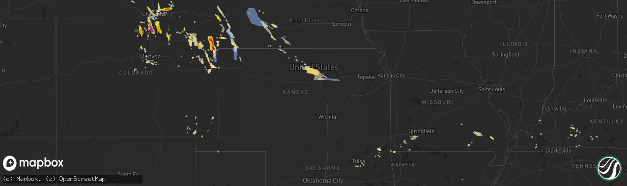
Hail Map in Kansas on July 27, 2022
The weather event in Kansas on July 27, 2022 includes Wind and Hail maps. 18 states and 293 cities were impacted and suffered possible damage. The total estimated number of properties impacted is 0.
Want more than just the map?
Turn this storm into a full workflow.
- Owner + property data so you know who to knock
- OnDemand branded weather history reports to win the "did we even have hail?" argument
- RoofTrace estimate so reps stop guessing numbers at the door
Bought this map? Upgrade within 7 days and we'll credit the $230. (10-15 min setup call)
Wind
Hail
0
Estimated number of impacted properties by a 1.00" hail or larger0
Estimated number of impacted properties by a 1.75" hail or larger0
Estimated number of impacted properties by a 2.50" hail or largerStorm reports in Kansas
Kansas
| Date | Description |
|---|---|
| 07/27/20226:53 AM CDT | At 1152 PM CDT, a severe thunderstorm was located 8 miles northeast of McDonald, or 12 miles west of Atwood, moving southeast at 25 mph. HAZARD...60 mph wind gusts and quarter size hail. SOURCE...Mesonet. A Mesonet site near McDonald reported a 57 mph wind gust. IMPACT...Hail damage to vehicles is expected. Expect wind damage to roofs, siding, and trees. This severe thunderstorm will be near... McDonald around 1200 AM CDT. |
| 07/27/20225:28 AM CDT | No damage reported but confident in severe level wind gusts. |
| 07/27/20225:26 AM CDT | At 1025 PM MDT/1125 PM CDT/, a severe thunderstorm was located 7 miles east of Benkelman, moving southeast at 30 mph. HAZARD...70 mph wind gusts and quarter size hail. SOURCE...Radar indicated. IMPACT...Hail damage to vehicles is expected. Expect considerable tree damage. Wind damage is also likely to mobile homes, roofs, and outbuildings. This severe thunderstorm will remain over mainly rural areas of northwestern Rawlins, southwestern Hitchcock and southeastern Dundy Counties. |
| 07/27/20224:40 AM CDT | Reported strong wind and power was out. |
| 07/27/20224:40 AM CDT | Observer reported that part of a large healthy tree was blown down and onto the power lines which caused a power outage. |
| 07/27/20224:40 AM CDT | Delayed report: scattered damage across minneapolis including snapped power poles... A roof torn off a church... Large trees uprooted and snapped... And window screens |
| 07/27/20223:59 AM CDT | At 859 PM MDT/959 PM CDT/, a severe thunderstorm was located 11 miles south of Wray, moving southeast at 15 mph. HAZARD...60 mph wind gusts and half dollar size hail. SOURCE...Radar indicated. IMPACT...Hail damage to vehicles is expected. Expect wind damage to roofs, siding, and trees. This severe thunderstorm will remain over mainly rural areas of southeastern Yuma County in northeastern Colorado and southwestern Cheyenne Counties in northwestern Kansas, including the following locations... Hale, Vernon and Beecher Island.This includes Highway 385 between mile markers 220 and 250. |
| 07/27/20222:53 AM CDT | At 753 PM MDT/853 PM CDT/, a severe thunderstorm was located near Wray, moving south at 15 mph. HAZARD...60 mph wind gusts and quarter size hail. SOURCE...Radar indicated. IMPACT...Hail damage to vehicles is expected. Expect wind damage to roofs, siding, and trees. This severe thunderstorm will be near... Wray around 800 PM MDT.This includes Highway 385 between mile markers 226 and 252. |
| 07/26/20229:35 PM CDT | Site cw8810 ... Northwest of elkhart. |
All States Impacted by Hail Map on July 27, 2022
Cities Impacted by Hail Map on July 27, 2022
- Wellington, CO
- Cheyenne, WY
- Portis, KS
- Peetz, CO
- Iliff, CO
- Morgantown, KY
- Jetson, KY
- Fairmont, MN
- Welcome, MN
- Eaton, CO
- Ault, CO
- Gill, CO
- Pierce, CO
- Nunn, CO
- Jackson, MN
- Alpha, MN
- Briggsdale, CO
- Sherburn, MN
- Grant, NE
- Parks, NE
- Champion, NE
- Haigler, NE
- Benkelman, NE
- North Platte, NE
- Oshkosh, NE
- Venango, NE
- Big Springs, NE
- Julesburg, CO
- Pine Bluffs, WY
- Albin, WY
- Harrisburg, NE
- Burns, WY
- Ellsworth, NE
- Hemingford, NE
- Alliance, NE
- Livermore, CO
- Laramie, WY
- Lexington, NE
- Carpenter, WY
- Joes, CO
- Anton, CO
- Vona, CO
- Cope, CO
- Bellvue, CO
- Callaway, NE
- Gothenburg, NE
- Roggen, CO
- Orchard, CO
- Jadwin, MO
- Salem, MO
- Austin, MN
- Hollandale, MN
- Littlefield, AZ
- Parker, CO
- Imperial, NE
- Yuma, CO
- Wray, CO
- Idalia, CO
- Holyoke, CO
- Vernon, CO
- Wheatland, WY
- Chugwater, WY
- Fort Collins, CO
- Kim, CO
- Oxford, NC
- Lewellen, NE
- Ogallala, NE
- Brule, NE
- Brady, NE
- Pritchett, CO
- Hillsdale, WY
- Akron, CO
- Merino, CO
- Rawlins, WY
- Whiting, IN
- East Chicago, IN
- Chicago, IL
- Hammond, IN
- Holdrege, NE
- Arriba, CO
- Dammeron Valley, UT
- Saint George, UT
- Gunlock, UT
- Wilcox, NE
- Cozad, NE
- Elwood, NE
- Eustis, NE
- Oxford, NE
- Bertrand, NE
- Edison, NE
- Murray, KY
- Almo, KY
- Dexter, KY
- Loveland, CO
- Bushnell, NE
- Texhoma, OK
- Stratford, TX
- Lander, WY
- Bixby, OK
- Kersey, CO
- Smithfield, NE
- Canadian, TX
- Overton, NE
- Stratton, CO
- Littleton, CO
- Gravette, AR
- Sulphur Springs, AR
- Wappapello, MO
- Puxico, MO
- Tipton, KS
- Glen Elder, KS
- Billings, MO
- Clever, MO
- Crane, MO
- Marionville, MO
- Aurora, MO
- Vinita, OK
- Strang, OK
- Burlington, CO
- Caliente, NV
- Minneapolis, KS
- Glenpool, OK
- Sapulpa, OK
- Cawker City, KS
- Mount Carmel, UT
- Orderville, UT
- Glasgow, KY
- Glasco, KS
- Delphos, KS
- Beloit, KS
- Barnard, KS
- Windsor, CO
- Greeley, CO
- Carr, CO
- Severance, CO
- Carrizozo, NM
- Granada, CO
- Bethune, CO
- Max, NE
- Morrison, CO
- Evergreen, CO
- Kanorado, KS
- Calvert City, KY
- Symsonia, KY
- Paducah, KY
- Madrid, NE
- Big Cabin, OK
- Young, AZ
- Stratton, NE
- McDonald, KS
- Kirk, CO
- Eddyville, KY
- Kuttawa, KY
- Sterling, CO
- Otis, CO
- Las Animas, CO
- Wiggins, CO
- Downs, KS
- Tescott, KS
- New Cambria, KS
- Solomon, KS
- Hunter, KS
- Lincoln, KS
- Salina, KS
- Bennington, KS
- Raton, NM
- Evans, CO
- Afton, OK
- Ketchum, OK
- Rochester, KY
- Broken Arrow, OK
- Bradford, AR
- Boulder, CO
- Cromwell, KY
- Beaver Dam, KY
- Eagle Rock, MO
- Hockley, TX
- Waller, TX
- Drake, CO
- Estes Park, CO
- Sinclair, WY
- Nederland, CO
- Phillipsburg, KS
- Lewisburg, KY
- Russellville, KY
- Enders, NE
- Wauneta, NE
- Berthoud, CO
- Gaylord, KS
- Agate, CO
- Jefferson, CO
- Lake George, CO
- Hillrose, CO
- Salina, OK
- Cave In Rock, IL
- Rocky Comfort, MO
- Pryor, OK
- Edmonton, KY
- Knob Lick, KY
- Ellsinore, MO
- Van Buren, MO
- Mill Spring, MO
- Piedmont, MO
- Ellington, MO
- South West City, MO
- Arvada, CO
- Tombstone, AZ
- Eckley, CO
- Franklin, KY
- Portland, TN
- Franklin, NE
- Bloomington, NE
- Tulsa, OK
- Conifer, CO
- Sedalia, CO
- Little Rock, AR
- Castle Rock, CO
- Lone Tree, CO
- Hendley, NE
- Golden, CO
- Denver, CO
- Show Low, AZ
- Two Buttes, CO
- Doniphan, MO
- Agra, KS
- Boise City, OK
- Atwood, KS
- Bowling Green, KY
- Rockfield, KY
- Alton, MO
- Kimball, NE
- Claunch, NM
- Snyder, CO
- Booneville, KY
- Globe, AZ
- Peridot, AZ
- Hurricane, UT
- Beaver City, NE
- Woodrow, CO
- Spavinaw, OK
- Roundhill, KY
- Broomfield, CO
- Louisville, CO
- Eldorado Springs, CO
- Semora, NC
- Fort Morgan, CO
- Alma, NE
- Naponee, NE
- Republican City, NE
- Jenks, OK
- Kiefer, OK
- Purdy, MO
- Monett, MO
- Butterfield, MO
- Pierce City, MO
- West Liberty, KY
- Mize, KY
- Ezel, KY
- Grenville, NM
- Campo, CO
- McKee, KY
- Tyner, KY
- Vincent, KY
- Warrenton, NC
- Amarillo, TX
- Saint Johns, AZ
- Timnath, CO
- Fort Washakie, WY
- Albert Lea, MN
- Freeborn, MN
- Alden, MN
- Blooming Prairie, MN
- Hartland, MN
- Clarks Grove, MN
- Bosler, WY
- Granite Canon, WY
- Fe Warren Afb, WY
- Englewood, CO
- Wellfleet, NE
- Farnam, NE
- Moorefield, NE
- Curtis, NE
- Stapleton, NE
- Maxwell, NE
- Junction City, KS
- Abilene, KS
- Enterprise, KS
- Chapman, KS
- Galeton, CO
- Irvine, KY
- Clay City, KY
- Stanton, KY
- Winchester, KY


