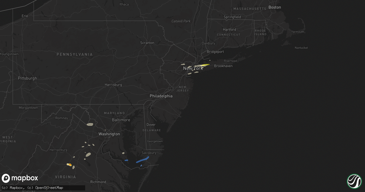
Hail Map in New Jersey on July 25, 2022
Get this storm
July 25 map
$229
one time, instant access
Download today. No call, no setup
Keep the $229
Bought the map and want the full workflow? Apply the entire $229 to a subscription within 7 days. None of it is wasted.
Every map, not just this one
This buys you this map. Subscription and you get every map we run, in the markets you choose from a few cities to whole states to nationwide. Plus real-time alerts the moment a storm fires.
Contact data
Name, contact info, occupancy, even credit band for addresses in the footprint. You go from where it hit to who to call.
Become the source they trust
Unlimited branding weather history reports on demand. You already have the documented answer ready for the property owner, and you are the one who showed up with it.
Property data and RoofTrace estimates
Pull up any address you have got, its value and the exact code rules for that jurisdiction, straight from One Click Code. Then RoofTrace estimates the squares, pitch, and roof value, priced the way you price.
Storm reports in New Jersey
New Jersey
| Date | Description |
|---|---|
| 07/25/20223:30 PM CDT | Tree down on southbound interstate 295 in logan township... Blocking the right lane. |
| 07/25/20223:22 AM CDT | At 821 PM EDT, a severe thunderstorm was located over North Wildwood, or 7 miles northeast of Cape May, moving northeast at 45 mph. HAZARD...60 mph wind gusts. SOURCE...Radar indicated. IMPACT...Damage to roofs, siding, trees, and power lines is possible. Locations impacted include... Ocean City, Cape May, Somers Point, North Wildwood, Wildwood Crest, Sea Isle City, Avalon, Longport, Stone Harbor, Scotch Bonnet, Diamond Beach, Strathmere, Rio Grande, Cape May Court House, Linwood, West Wildwood, Erma and Whitesboro-Burleigh.This includes Garden State Parkway between mile markers 1 and 9, andbetween mile markers 13 and 14. |
| 07/24/202210:14 PM CDT | At 314 PM EDT, a severe thunderstorm was located over Mays Landing, or 13 miles east of Vineland, moving east at 25 mph. HAZARD...60 mph wind gusts and quarter size hail. SOURCE...Radar indicated. IMPACT...Minor damage to vehicles is possible. Wind damage to roofs, siding, trees, and power lines is possible. Locations impacted include... Atlantic City, Pleasantville, Brigantine, Northfield, Absecon, Egg Harbor City, Weymouth, Estell Manor, Port Republic, Pomona, Mays Landing, English Creek, Wading River, Mizpah, New Gretna, Dorothy, Elwood-Magnolia, Mystic Island and Linwood.This includes the following highways... Garden State Parkway between mile markers 33 and 53. Atlantic City Expressway between mile markers 2 and 20. |
All States Impacted by Hail Map on July 25, 2022
Cities Impacted by Hail Map on July 25, 2022
- Kimball, NE
- Bushnell, NE
- Bethesda, MD
- Catlett, VA
- Inglis, FL
- Willow City, ND
- Rugby, ND
- Guthrie, KY
- Allensville, KY
- Locust Grove, VA
- Spotsylvania, VA
- Unionville, VA
- Rhoadesville, VA
- New Athens, IL
- Freeburg, IL
- Mascoutah, IL
- Crookston, NE
- Portland, TN
- Tremont, MS
- Land O'Lakes, FL
- Charlottesville, VA
- Valentine, NE
- East Saint Louis, IL
- Elmont, NY
- Floral Park, NY
- Franklin Square, NY
- West Hempstead, NY
- Garden City, NY
- New Hyde Park, NY
- Savage, MT
- Kilgore, NE
- Kim, CO
- Far Rockaway, NY
- Brooklyn, NY
- Hayes, SD
- Fort Pierre, SD
- East Hanover, NJ
- Livingston, NJ
- Whippany, NJ
- Roseland, NJ
- Colorado Springs, CO
- Ravenden Springs, AR
- Ravenden, AR
- Hardy, AR
- Salt Flat, TX
- Dunnellon, FL
- Crystal River, FL
- Appomattox, VA
- Red House, VA
- Midland, VA
- Bealeton, VA
- McEwen, TN
- Tompkinsville, KY
- Charlotte Court House, VA
- Cullen, VA
- Roslyn Heights, NY
- Roslyn, NY
- Manhasset, NY
- Old Westbury, NY
- Albertson, NY
- Barboursville, VA
- Oldsmar, FL
- Tampa, FL
- Murdo, SD
- Draper, SD
- Las Animas, CO
- Franklin, KY
- Lynchburg, VA
- Evington, VA
- Forest, VA
- Selma, AL
- Dickson, TN
- Orange, VA
- Mineral, VA
- Adairville, KY
- Springfield, TN
- Harrison, NJ
- Kearny, NJ
- Secaucus, NJ
- Jersey City, NJ
- Newark, NJ
- Dickinson, ND
- Belfield, ND
- Palmyra, VA
- Troy, VA
- Keswick, VA
- Great Neck, NY
- Chiefland, FL
- Trenton, FL
- Rienzi, MS
- California, MD
- Hollywood, MD
- Whitman, NE
- Culpeper, VA
- Jeffersonton, VA
- Warrenton, VA
- Olmstead, KY
- Rye, NH
- Kittery Point, ME
- Portsmouth, NH
- New Castle, NH
- Lobelville, TN
- Waverly, TN
- Hurricane Mills, TN
- Parrish, FL
- Cedar Hill, TN
- Dupo, IL
- Saint Louis, MO
- Millstadt, IL
- East Carondelet, IL
- Wood Lake, NE
- Merriman, NE
- Cody, NE
- Bluemont, VA
- Paeonian Springs, VA
- Hamilton, VA
- Purcellville, VA
- Harpers Ferry, WV
- Waterford, VA
- Round Hill, VA
- Roseglen, ND
- Glen Head, NY
- Little Neck, NY
- Jericho, NY
- Primm Springs, TN
- Franklin, TN
- Clarksville, TN
- Centerville, TN
- Santa Fe, TN
- Columbia, TN
- Hudson, FL
- Nantucket, MA
- Syosset, NY
- Bethpage, TN
- Willow Beach, AZ
- Cedar Key, FL
- Cottontown, TN
- Hicksville, NY
- Long Island City, NY
- Westbury, NY
- Woodbury, NY
- Plainview, NY
- Whitestone, NY
- East Elmhurst, NY
- Oakland Gardens, NY
- New York, NY
- Sunnyside, NY
- Greenvale, NY
- Flushing, NY
- College Point, NY
- Williston Park, NY
- Woodside, NY
- Corona, NY
- Bayside, NY
- Astoria, NY
- Jackson Heights, NY
- Bedford, NH
- Auburn, NH
- Manchester, NH
- Staten Island, NY
- Martin, SD
- Tuthill, SD
- Northport, NY
- Carrizozo, NM
- Madison, NH
- Saint Inigoes, MD
- Ridge, MD
- Dameron, MD
- Eden, MD
- Princess Anne, MD
- Deal Island, MD
- Westover, MD
- Crisfield, MD
- Huntington Station, NY
- Huntington, NY
- Melville, NY
- Branson, CO
- Richardton, ND
- Gladstone, ND
- Taylor, ND


