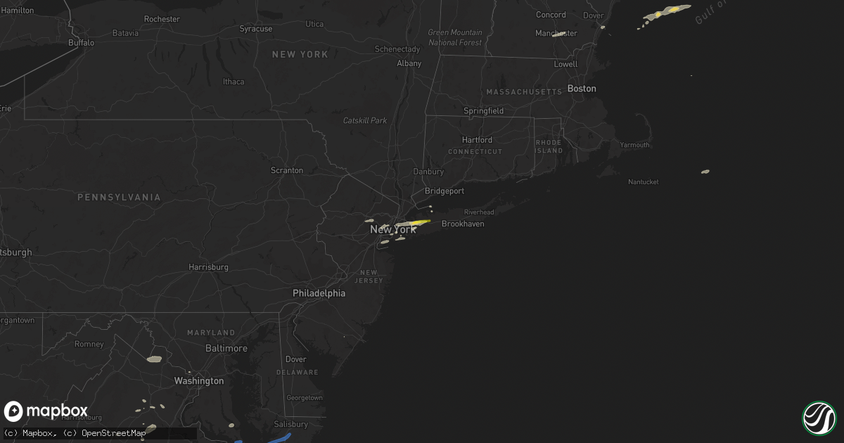
Hail Map on July 25, 2022
Get this storm
July 25 map
$229
one time, instant access
Download today. No call, no setup
Keep the $229
Bought the map and want the full workflow? Apply the entire $229 to a subscription within 7 days. None of it is wasted.
Every map, not just this one
This buys you this map. Subscription and you get every map we run, in the markets you choose from a few cities to whole states to nationwide. Plus real-time alerts the moment a storm fires.
Contact data
Name, contact info, occupancy, even credit band for addresses in the footprint. You go from where it hit to who to call.
Become the source they trust
Unlimited branding weather history reports on demand. You already have the documented answer ready for the property owner, and you are the one who showed up with it.
Property data and RoofTrace estimates
Pull up any address you have got, its value and the exact code rules for that jurisdiction, straight from One Click Code. Then RoofTrace estimates the squares, pitch, and roof value, priced the way you price.
States Impacted by Hail Map on July 25, 2022
Storm reports
North Carolina
| Date | Description |
|---|---|
| 07/25/20226:58 PM CDT | Trees were reported down along highway 52 near mcfarlan road. |
| 07/25/20226:43 PM CDT | Trees were reported down along st. Andrews church road. |
| 07/25/20226:37 PM CDT | Trees were reported down along robinson bridge road. |
| 07/25/20226:37 PM CDT | Trees were reported down along fred royster road. |
| 07/25/20225:35 PM CDT | Trees were reported down on power lines. |
| 07/25/20223:02 PM CDT | One tree down off fingerhut rd north of mountain view. |
| 07/25/20222:55 PM CDT | Tree down along beechnut creek road. |
| 07/25/20222:55 PM CDT | At least several large limbs down across south mountains state park. Considering the strength of the wind there may be a few trees down in the park as well. |
| 07/25/20222:43 PM CDT | One tree reported down off roebuck rd in valdese. |
| 07/25/20222:37 PM CDT | 2 pine trees blown down about a quarter of a mile north of the center of bethlehem. |
| 07/25/20221:25 PM CDT | Numerous trees down. One fell on the carport of house off rockford road. Time based on radar. |
| 07/25/20221:20 PM CDT | One tree reported down north of ellendale. |
| 07/25/20221:13 PM CDT | One tree and many large limbs blown down. |
| 07/25/20225:03 AM CDT | At 1002 PM EDT, a severe thunderstorm was located near Clayton, or 10 miles southeast of Raleigh, moving northeast at 30 mph. HAZARD...60 mph wind gusts. SOURCE...Radar indicated. IMPACT...Expect damage to roofs, siding, and trees. Locations impacted include... Raleigh, Nashville, Wilson, Clayton, Zebulon, Elm City, Bailey, Bunn, Knightdale and Wendell. |
| 07/25/20224:16 AM CDT | At 915 PM EDT, a severe thunderstorm was located 9 miles northwest of Lillington, moving east at 30 mph. HAZARD...60 mph wind gusts. SOURCE...Radar indicated. IMPACT...Expect damage to roofs, siding, and trees. Locations impacted include... Raleigh, Cary, Smithfield, Lillington, Garner, Fuquay-Varina, Clayton, Angier, Apex and Holly Springs. |
| 07/25/20222:34 AM CDT | At 733 PM EDT, a severe thunderstorm was located near Henderson, moving east at 55 mph. HAZARD...60 mph wind gusts. SOURCE...Radar indicated. IMPACT...Expect damage to roofs, siding, and trees. Locations impacted include... Henderson, Oxford, Warrenton, Norlina, Littleton, Kittrell, Middleburg, Macon, Gillburg and Afton. |
| 07/25/20222:27 AM CDT | At 727 PM EDT, a severe thunderstorm was located 10 miles east of Monroe, or near Marshville, moving northeast at 15 mph. HAZARD...60 mph wind gusts and quarter size hail. SOURCE...Radar indicated. IMPACT...Minor hail damage to vehicles is expected. Expect wind damage to trees and power lines. Locations impacted include... Wingate, Marshville and Sturdivants. |
| 07/25/202212:48 AM CDT | At 548 PM EDT, a severe thunderstorm was located near McLeansville, or 8 miles southeast of Greensboro, moving east at 45 mph. HAZARD...60 mph wind gusts. SOURCE...Radar indicated. IMPACT...Expect damage to roofs, siding, and trees. Locations impacted include... Chapel Hill, Burlington, Graham, Hillsborough, Carrboro, Mebane, Elon, McLeansville, Gibsonville and Pleasant Garden. |
| 07/24/202210:50 PM CDT | At 350 PM EDT, a severe thunderstorm was located 13 miles south of Morganton, or 4 miles southwest of South Mountains State Park, moving southeast at 25 mph. HAZARD...60 mph wind gusts. SOURCE...Radar indicated. IMPACT...Expect damage to trees and power lines. Locations impacted include... Cherryville, Belwood, Lawndale, Fallston, Polkville, Waco, Casar, Kingstown, South Mountains State Park and Crouse. |
| 07/24/202210:35 PM CDT | At 335 PM EDT, a severe thunderstorm was located 6 miles north of Hickory, or near Bethlehem, moving east at 15 mph. HAZARD...60 mph wind gusts and quarter size hail. SOURCE...Radar indicated. IMPACT...Minor hail damage to vehicles is expected. Expect wind damage to trees and power lines. Locations impacted include... Hickory, St. Stephens, Conover, Bethlehem, Stony Point, Claremont, Catawba, Lake Hickory, Lookout Shoals Lake and Northlakes. |
| 07/24/202210:29 PM CDT | At 329 PM EDT, a severe thunderstorm was located near Morganton, moving east at 25 mph. HAZARD...60 mph wind gusts and penny size hail. SOURCE...Radar indicated. IMPACT...Expect damage to trees and power lines. Locations impacted include... Hickory, Morganton, St. Stephens, Longview, Valdese, Icard, Drexel, Hildebran, Connelly Springs and Rutherford College. |
| 07/24/20229:56 PM CDT | At 255 PM EDT, a severe thunderstorm was located 7 miles east of Hendersonville, or 6 miles north of Saluda, moving east at 15 mph. HAZARD...60 mph wind gusts and quarter size hail. SOURCE...Radar indicated. IMPACT...Minor hail damage to vehicles is expected. Expect wind damage to trees and power lines. Locations impacted include... Columbus, Tryon, Saluda, Green Hill, Mill Spring, Edneyville, Lake Adger, Dana, Green Creek and East Flat Rock. |
| 07/24/20229:12 PM CDT | At 212 PM EDT, a severe thunderstorm was located near Boomer, moving southeast at 15 mph. HAZARD...60 mph wind gusts and quarter size hail. SOURCE...Radar indicated. IMPACT...Minor hail damage to vehicles is expected. Expect wind damage to trees and power lines. Locations impacted include... Taylorsville, Stony Point, Love Valley, Hiddenite, Vashti, Ellendale, Scotts and Millersville. |
| 07/24/20228:42 PM CDT | Power outages from fallen trees and limbs on old stage rd near stone home ln. |
| 07/24/20228:23 PM CDT | Trees were reported down on power lines along keelboat lane near royal street. |
Ohio
| Date | Description |
|---|---|
| 07/25/20227:44 AM CDT | At 1244 AM EDT, a severe thunderstorm was located over Kinsman, or 14 miles northwest of Sharpsville, moving east at 25 mph. HAZARD...60 mph wind gusts. SOURCE...Radar indicated. IMPACT...Expect damage to trees and power lines, resulting in some power outages. Locations impacted include... Franklin, Greenville, Sugarcreek, Stoneboro, Polk, Sandy Lake, Clark, Jamestown, Fredonia, Cooperstown, Utica, and New Lebanon. |
| 07/25/20227:36 AM CDT | At 1235 AM EDT, severe thunderstorms were located along a line extending from near Linesville to 6 miles northwest of Kinsman, moving east at 50 mph. HAZARD...60 mph wind gusts. SOURCE...Radar indicated. IMPACT...Expect damage to trees and power lines. Locations impacted include... Meadville, Titusville, Linesville, Harmonsburg, Adamsville, Guys Mills, Pymatuning North, Pymatuning Central, Atlantic, Cochranton, Saegertown, Conneaut Lake, Jamestown, Hydetown, Blooming Valley, Townville, Conneaut Lakeshore, Geneva and Hartstown. |
| 07/25/20227:28 AM CDT | At 1228 AM EDT, severe thunderstorms were located along a line extending from near Middlefield to near Burton, moving east at 30 mph. HAZARD...70 mph wind gusts. SOURCE...Radar indicated. IMPACT...Expect considerable tree damage. Damage is likely to mobile homes, roofs, and outbuildings. Locations impacted include... Middlefield, Burton, Parkman, Huntsburg and Claridon. |
| 07/25/20227:11 AM CDT | At 1210 AM EDT, severe thunderstorms were located along a line extending from 6 miles northeast of Middlefield to Burton, moving east at 45 mph. HAZARD...70 mph wind gusts. SOURCE...Radar indicated. IMPACT...Expect considerable tree damage. Damage is likely to mobile homes, roofs, and outbuildings. Locations impacted include... Kinsman, North Bloomfield, Orwell, Andover, Mecca, Johnston, Hartsgrove, Roaming Shores and Cherry Valley. |
| 07/24/20229:23 PM CDT | At 223 AM EDT, a severe thunderstorm was located over Boardman, or near Youngstown, moving east at 45 mph. HAZARD...60 mph wind gusts. SOURCE...Radar indicated. IMPACT...Expect damage to trees and power lines, resulting in some power outages. Locations impacted include... New Castle, Grove City, Columbiana, Shanor-Northvue, Slippery Rock, New Wilmington, Oakwood, Leetonia, New Castle Northwest, New Beaver, Pulaski, and Prospect. |
| 07/24/20228:56 PM CDT | At 156 AM EDT, severe thunderstorms were located along a line extending from near Sharpsville to near Alliance, moving east at 30 mph. HAZARD...60 mph wind gusts. SOURCE...Radar indicated. IMPACT...Expect damage to trees and power lines. Locations impacted include... Youngstown, Warren, Columbiana, Boardman, Niles, Campbell, Hubbard, Canfield, Lordstown, Vienna Center, Hilltop, Maplewood Park, Austintown, Struthers, Girard, Vienna, McDonald, Poland, Ellsworth and New Middletown. |
| 07/24/20228:52 PM CDT | At 152 AM EDT, a severe thunderstorm was located near Hartville, or 10 miles northeast of Canton, moving east at 45 mph. HAZARD...60 mph wind gusts. SOURCE...Radar indicated. IMPACT...Expect damage to trees and power lines. Locations impacted include... Canton, Salem, Alliance, Louisville, Sebring, Beloit, Limaville, Maple Ridge, Maximo and Greenford. |
| 07/24/20228:46 PM CDT | At 146 AM EDT, a severe thunderstorm was located near Greenville, or 14 miles northeast of Sharpsville, moving east at 30 mph. HAZARD...60 mph wind gusts. SOURCE...Radar indicated. IMPACT...Expect damage to trees and power lines, resulting in some power outages. Locations impacted include... Hermitage, Sharon, Franklin, Sharpsville, Greenville, Sugarcreek, Farrell, Mercer, Stoneboro, West Middlesex, Polk, and Sandy Lake. |
North Dakota
| Date | Description |
|---|---|
| 07/25/20224:24 AM CDT | At 923 PM CDT/823 PM MDT/, severe thunderstorms were located along a line extending from 4 miles west of Halliday to 4 miles northeast of Richardton to near New England, moving east at 50 mph. HAZARD...60 mph wind gusts. SOURCE...Radar indicated. IMPACT...Expect damage to roofs, siding, and trees. Severe thunderstorms will be near... Hebron around 935 PM CDT. Dodge around 835 PM MDT.Other locations in the path of these severe thunderstorms includeGolden Valley, Glen Ullin, Zap, Beulah, Hazen, New Salem, Stanton,Elgin and New Leipzig. |
| 07/24/20229:25 PM CDT | Nddot site at gladstone. 20 minute duration based on observations and radar. |
| 07/24/20228:50 PM CDT | Ndawn station. This is the 10 meter peak wind gust. 3 meter peak wind gust of 52 mph. |
| 07/24/20228:50 PM CDT | Nddot site at manning. |
South Carolina
| Date | Description |
|---|---|
| 07/25/20222:35 AM CDT | At 735 PM EDT, severe thunderstorms were located along a line extending from near Marshville to near Wadesboro, moving east at 25 mph. HAZARD...60 mph wind gusts. SOURCE...Radar indicated. IMPACT...Expect damage to roofs, siding, and trees. Locations impacted include... Rockingham, Wadesboro, Hamlet, Ansonville, Polkton, Norwood, Mount Gilead, Ellerbe, Dobbins Heights and Lilesville. |
| 07/24/202211:13 PM CDT | At 413 PM EDT, severe thunderstorms were located along a line extending from 4 miles east of Hickory to 6 miles north of Lincolnton to near Shelby, moving southeast at 30 mph. HAZARD...60 mph wind gusts and penny size hail. SOURCE...Radar indicated. IMPACT...Expect damage to trees and power lines. Locations impacted include... Gastonia, Shelby, Newton, Lincolnton, Kings Mountain, Mt Holly, St. Stephens, Belmont, Conover and Cherryville. |
| 07/24/202211:05 PM CDT | At 405 PM EDT, a severe thunderstorm was located 13 miles north of Abbeville, or near Due West, moving east at 20 mph. HAZARD...60 mph wind gusts and quarter size hail. SOURCE...Radar indicated. IMPACT...Minor hail damage to vehicles is expected. Expect wind damage to trees and power lines. Locations impacted include... Honea Path, Ware Shoals, Due West, Donalds, Cokesbury, Hodges, Shoals Junction, Greenwood and Princeton. |
Maine
| Date | Description |
|---|---|
| 07/25/20224:20 PM CDT | Delayed report. Several large tree limbs down within the park. Time estimated from radar. |
| 07/25/20224:02 PM CDT | Nws staff member reported trees and wires down on mountain road. Time estimated by radar. |
| 07/25/20223:27 AM CDT | At 826 AM EDT, a severe thunderstorm was located over Hiram, or 12 miles southeast of Fryeburg, moving east at 65 mph. HAZARD...60 mph wind gusts. SOURCE...Radar indicated. IMPACT...Expect damage to roofs, siding, and trees. Locations impacted include... Bridgton, Mechanic Falls, Naples, Gray, Hiram, Cornish, Raymond, Standish, Casco, Limington, Harrison, Brownfield, Denmark, Frye Island, Sebago, Baldwin, Poland, Porter, Oxford and Parsonsfield.This includes Interstate 95 between mile markers 62 and 70. |
| 07/25/20222:26 AM CDT | At 726 PM EDT, a severe thunderstorm was located near Thomaston, or near Rockland, moving east at 40 mph. HAZARD...60 mph wind gusts and quarter size hail. SOURCE...Radar indicated. IMPACT...Hail damage to vehicles is expected. Expect wind damage to roofs, siding, and trees. Locations impacted include... Rockland, Thomaston, Rockport, Cushing, Isle Au Haut, North Haven, South Thomaston, Owls Head, Saint George and Vinalhaven. |
| 07/25/20221:52 AM CDT | At 649 PM EDT, a severe thunderstorm was located near Bristol, or near Wiscasset, moving east at 30 mph. HAZARD...60 mph wind gusts and quarter size hail. SOURCE...Radar indicated. IMPACT...Hail damage to vehicles is expected. Expect wind damage to roofs, siding, and trees. Locations impacted include... Damariscotta, Wiscasset, Bristol, Bremen, Thomaston, Boothbay, Cushing, Edgecomb, Friendship, Saint George, Westport, Newcastle, South Bristol, South Thomaston and Waldoboro. |
| 07/25/202212:19 AM CDT | At 518 PM EDT, a severe thunderstorm was located over Naples, moving east at 40 mph. HAZARD...60 mph wind gusts and quarter size hail. SOURCE...Radar indicated. IMPACT...Hail damage to vehicles is expected. Expect wind damage to roofs, siding, and trees. Locations impacted include... Lewiston, Brunswick, Bridgton, Mechanic Falls, Naples, Topsham, Freeport, Gray, Raymond, Lisbon, Durham, Casco, Bowdoin, Harrison, New Gloucester, Sabattus, Poland, Minot, Sebago and Pownal.This includes the following highways... Interstate 295 between mile markers 26 and 29. Interstate 95 between mile markers 65 and 90. |
| 07/24/202211:37 PM CDT | At 436 PM EDT, severe thunderstorms were located along a line extending from near Oxbow to 9 miles east of Moosehorn Crossing, moving east at 40 mph. HAZARD...Two inch hail and 70 mph wind gusts. SOURCE...Radar indicated. IMPACT...People and animals outdoors will be injured. Expect hail damage to roofs, siding, windows, and vehicles. Expect considerable tree damage. Wind damage is also likely to mobile homes, roofs, and outbuildings. Severe thunderstorms will be near... Masardis around 445 PM EDT. Scopan around 510 PM EDT.Other locations impacted by these severe thunderstorms include SaintCroix, Scopan Lake, Blaine, Squa Pan, Westfield, Number NineMountain, Chapman and Monticello. |
| 07/24/202211:12 PM CDT | At 412 PM EDT, a severe thunderstorm was located near Moosehorn Crossing, or 29 miles north of Mount Katahdin, moving east at 35 mph. HAZARD...Ping pong ball size hail and 60 mph wind gusts. SOURCE...Radar indicated. IMPACT...People and animals outdoors will be injured. Expect hail damage to roofs, siding, windows, and vehicles. Expect wind damage to trees and power lines. Locations impacted include... Masardis, Oxbow, Moosehorn Crossing and Grand Lake Seboeis. |
| 07/24/20228:40 PM CDT | At 139 PM EDT, a severe thunderstorm was located over Manchester, moving northeast at 45 mph. HAZARD...60 mph wind gusts and quarter size hail. SOURCE...Radar indicated. IMPACT...Hail damage to vehicles is expected. Expect wind damage to roofs, siding, and trees. Locations impacted include... Manchester, Derry, Rochester, Durham, Northwood, Merrimack, Dover, Bedford, Hooksett, Barrington, Litchfield, Epping, Brentwood, Greenland, Raymond, Newington, Newmarket, Goffstown, Londonderry and Eliot.This includes the following highways... Interstate 293 between mile markers 1 and 11. Interstate 93 between mile markers 16 and 26. |
Virginia
| Date | Description |
|---|---|
| 07/25/20225:50 PM CDT | Power outages south of lilian. Time estimated. |
| 07/25/20225:20 PM CDT | Vdot reports lane closure due to tree in roadway. |
| 07/25/20225:10 PM CDT | Vdot reports lane closure due to tree in roadway. |
| 07/25/20225:05 PM CDT | Vdot reports road closure due to downed trees blocking road. |
| 07/25/20225:05 PM CDT | Vdot reports road closed due to several trees in road. |
| 07/25/20225:04 PM CDT | Trees an |
| 07/25/20225:04 PM CDT | Trees and wires blew down in the area of rosedale drive. |
| 07/25/20224:30 PM CDT | 911 call center reports wires down in multiple locations including the 1900 block of wood st in richmond. |
| 07/25/20224:30 PM CDT | 911 call center reports multiple trees and wires down across hanover county. Time estimated. |
| 07/25/20224:05 PM CDT | Trees and wires blew down near the intersection of bethany way and va-651 kellog mill road. |
| 07/25/20223:55 PM CDT | Trees blew down near the intersection of va-655 holly corner road and holly berry road. |
| 07/25/20223:38 PM CDT | Tree damage was reported near cookstown and spotsylvania courthouse... Including along wilderness park drive. |
| 07/25/20223:28 PM CDT | Tree downed and blocking portion of ontario road. Time is radar estimated. |
| 07/25/20223:23 PM CDT | Several trees blew down along joplin rd. |
| 07/25/20223:19 PM CDT | A tree blew down near fraley blvd and possum pt rd... Blocking the roadway. |
| 07/25/20223:18 PM CDT | Trees blew down near the intersection of us-1 richmond highway/jefferson davis highway and va-619 joplin road/fuller road. |
| 07/25/20223:17 PM CDT | Trees downed onto south boston road just north of va-53. |
| 07/25/20223:10 PM CDT | Tree down. Time estimated. |
| 07/25/20223:05 PM CDT | Tree fell and brought down powerlines... Blocking eureka school road entirely. Time estimated from radar. |
| 07/25/20223:00 PM CDT | Trees downed along prince edward highway with numerous power outages reported between pamplin and elam. |
| 07/25/20223:00 PM CDT | Several large tree limbs blew down around scottsville. |
| 07/25/20222:59 PM CDT | Over half a dozen trees blown down around charlotte county... With most falling in the charlotte court house area. |
| 07/25/20222:58 PM CDT | Trees blew down near green acre drive. |
| 07/25/20222:50 PM CDT | Time radar estimated. Numerous trees downed in lake monticello with several power outages reported in the area. |
| 07/25/20222:41 PM CDT | Dozens of trees... Wires... And large branches blew down just east of charlottesville in the pantops area. |
| 07/25/20222:41 PM CDT | Hail up to golf ball size was reported in pantops. |
| 07/25/20222:40 PM CDT | Wires down. Time estimated. |
| 07/25/20222:40 PM CDT | Trees down in the rockfish/faber area... Including along va-6 irish road. |
| 07/25/20222:40 PM CDT | A wind gust of 58 knots |
| 07/25/20222:37 PM CDT | Trees and wires blew down near catlett... Including along va-604 burwell road in the 8300 block. |
| 07/25/20222:34 PM CDT | Thunderstorm winds blew down one tree near the 1900 block of chalk level road. |
| 07/25/20222:34 PM CDT | A local report indicates 1.00 inch wind near 3 E CHARLOTTESVILLE |
| 07/25/20222:32 PM CDT | Quarter size hail was reported in pantops. |
| 07/25/20222:32 PM CDT | Trees and large limbs blew down near reva... Including in the 2700 block of ridgeview road... Blocking the roadway. |
| 07/25/20222:31 PM CDT | A tree blew down near the 200 block of river rd. |
| 07/25/20222:29 PM CDT | Several trees... Wires and tree limbs blew down in and near the city of charlottesville. |
| 07/25/20222:28 PM CDT | Trees and large tree limbs blew down near va-719 mountain lake road and bella pointe drive. |
| 07/25/20222:28 PM CDT | Three trees blew down near the 16900 block of north merrimac rd. |
| 07/25/20222:15 PM CDT | Thunderstorm winds blew down multiple large tree branches near the intersection of oxford road and lark drive. |
| 07/25/20221:49 PM CDT | Tree blown down near the intersection of feldspar road and bold branch road. Time estimated from radar. |
| 07/25/20221:49 PM CDT | Several trees blown down throughout lynchburg. Time estimated from radar. (rnk |
| 07/25/20221:49 PM CDT | Several trees blown down throughout lynchburg. Time estimated from radar. |
| 07/25/20221:49 PM CDT | Thunderstorm winds blew down numerous trees along winebarger circle. |
| 07/25/20221:47 PM CDT | A tree blew down near rt. 740e and james monroe hwy |
| 07/25/20221:45 PM CDT | Several trees blew down around leesburg... Including near the intersection of us-15 james monroe highway and va-740 tutt lane. Trees blew down near the intersection of |
| 07/25/20221:45 PM CDT | Tree down along south old moneta road near downtown moneta drive. Time estimated from radar. |
| 07/25/20221:20 PM CDT | Large tree blocking all lanes on harveys creek road near intersection with stewartsville road. Time estimated from radar. |
| 07/25/20221:18 PM CDT | Couple of trees down along highway 460 in the vicinity of patterson mill road. Time estimated from radar. |
| 07/25/20221:09 PM CDT | Multiple trees and power lines down along hardy road from post office to intersection with wysong mill road at 2:13pm. |
| 07/25/20221:02 PM CDT | Tree down along highway 460 near the thaxton community center. Time estimated from radar. |
| 07/25/202212:43 PM CDT | Thunderstorm winds blew down multiple tree branches and a shed door. |
| 07/25/202212:28 PM CDT | Thunderstorm winds blew down a power line along den hill road. |
| 07/25/202212:24 PM CDT | Thunderstorm winds blew down one large tree branch that took the mirror off a car on gobblers spur. |
| 07/25/202212:23 PM CDT | Thunderstorm winds blew down one large tree branch near the intersection of industrial park road and south main street. |
| 07/25/202212:14 PM CDT | Thunderstorm winds blew down one tree near the intersection of smith avenue and todd street. |
| 07/25/20227:55 AM CDT | At 1254 PM EDT, a severe thunderstorm was located over Poplar Hill, moving east at 25 mph. HAZARD...60 mph wind gusts. SOURCE...Radar indicated. IMPACT...Expect damage to roofs, siding, and trees. Locations impacted include... Blacksburg... Christiansburg... Radford... Pulaski... Dublin... Pembroke... and Newport. |
| 07/25/20222:30 AM CDT | At 729 PM EDT, a severe thunderstorm was located over Fruitland, moving east at 35 mph. HAZARD...60 mph wind gusts. SOURCE...Radar indicated. IMPACT...Expect damage to trees and powerlines. This severe thunderstorm will be near... Parsonsburg around 740 PM EDT. Snow Hill around 750 PM EDT. Newark around 755 PM EDT. Berlin around 805 PM EDT. Ocean Pines around 810 PM EDT. Ocean City and Cape Isle Of Wight around 815 PM EDT.Other locations impacted by this severe thunderstorm include Bishop,Boxiron, Ocean City Municipality, Salisbury-Wicomico, Bishopville,Goodwill, Public Landing, Ironshire, Willards and West Ocean City. |
| 07/25/20221:56 AM CDT | At 655 PM EDT, a severe thunderstorm was located near Deal Island, or 13 miles west of Princess Anne, moving east at 40 mph. HAZARD...60 mph wind gusts. SOURCE...Radar indicated. IMPACT...Expect damage to trees and powerlines. This severe thunderstorm will be near... Princess Anne and University Of Maryland Eastern Shore around 715 PM EDT. Fruitland around 720 PM EDT. Salisbury and Salisbury University around 725 PM EDT. Parsonsburg around 735 PM EDT.Other locations impacted by this severe thunderstorm includeWetipquin, Trinity, Cokesbury, Goodwill, Eden, Kingston, Saxis,Shelltown, Longridge and Mount Vernon. |
| 07/25/202212:55 AM CDT | At 554 PM EDT, a severe thunderstorm was located over Manquin, or near King William, moving northeast at 40 mph. HAZARD...60 mph wind gusts and penny size hail. SOURCE...Radar indicated. IMPACT...Expect damage to trees and powerlines. This severe thunderstorm will be near... King William around 605 PM EDT. Saint Stephens Church and Stevensville around 610 PM EDT. Millers Tavern around 615 PM EDT. Tappahannock, Dunnsville and Center Cross around 625 PM EDT. Sharps around 635 PM EDT. Warsaw, Haynesville and Farnham around 640 PM EDT.Other locations impacted by this severe thunderstorm includeThreeway, Upright, Ino, Dragonville, Rose Garden, Tidewater, Lyells,Crouch, Palls and Kennard. |
| 07/25/202212:23 AM CDT | At 523 PM EDT, severe thunderstorms were located along a line extending from near Hanover to Downtown Richmond, moving northeast at 35 mph. HAZARD...60 mph wind gusts and quarter size hail. SOURCE...Radar indicated. IMPACT...Minor damage to vehicles is possible. Expect wind damage to trees and powerlines. Severe thunderstorms will be near... Studley around 545 PM EDT. Manquin and Tunstall around 555 PM EDT.Other locations impacted by these severe thunderstorms includeEnfield, Richmond Heights, Elko, Elmont, Montrose, Sandston,Westwood, Richmond International, Fair Oaks and Solomons Store. |
| 07/25/202212:20 AM CDT | At 519 PM EDT, severe thunderstorms were located along a line extending from Ladysmith to near Kings Dominion to Hanover, moving east at 25 mph. HAZARD...60 mph wind gusts. SOURCE...Radar indicated. IMPACT...Expect damage to trees and powerlines. Locations impacted include... Ashland, Bowling Green, Randolph Macon College, Milford, Hanover, Beulahville, Ladysmith, Dawn, Aylett, Kings Dominion, Mangohick, Fort A.p. Hill, Chilesburg, Golansville, Guinea, Corbin, Gum Tree, Etna Mills, Penola and Epworth. |
| 07/24/202211:37 PM CDT | At 437 PM EDT, a severe thunderstorm was located 11 miles northwest of Spotsylvania, or 12 miles west of Fredericksburg, moving east at 35 mph. HAZARD...70 mph wind gusts and ping pong ball size hail. SOURCE...Radar indicated. IMPACT...Damaging winds will cause some trees and large branches to fall. This could injure those outdoors, as well as damage homes and vehicles. Roadways may become blocked by downed trees. Localized power outages are possible. Unsecured light objects may become projectiles. Locations impacted include... Fredericksburg, Falmouth, Stones Corner, Leeland, Flat Run, Spring Valley, Brooke, Chancellorsville, Ramoth, Storck, Holly Corner, Dunavant, Lake Of The Woods, Glendie, Hartwood, Brookfield and Cookstown. |
| 07/24/202211:21 PM CDT | At 420 PM EDT, a severe thunderstorm was located 10 miles east of Orange, moving east at 35 mph. HAZARD...60 mph wind gusts and quarter size hail. SOURCE...Radar indicated. IMPACT...Damaging winds will cause some trees and large branches to fall. This could injure those outdoors, as well as damage homes and vehicles. Roadways may become blocked by downed trees. Localized power outages are possible. Unsecured light objects may become projectiles. Locations impacted include... Orange, Spotsylvania, Mine Run, Everona, Verdiersville, Locust Grove, Snell, Thornhill, Nasons, Glenora, Lake Of The Woods, Unionville, Cookstown, Rhoadesville, Brokenburg, Parker, Rapidan, Burr Hill, Madison Run and Alsop. |
| 07/24/202211:15 PM CDT | At 414 PM EDT, a severe thunderstorm was located near Troy, or near Palmyra, moving east at 25 mph. HAZARD...60 mph wind gusts and nickel size hail. SOURCE...Radar indicated. IMPACT...Expect damage to trees and powerlines. This severe thunderstorm will be near... Ferncliff and Kents Store around 425 PM EDT.Other locations impacted by this severe thunderstorm include Nahor,Louisa Airport, Stage Junction, Zion Crossroads, Union Mills,Caledonia, Wildwood, Bybee, Yanceyville and Waldrop. |
| 07/24/202210:58 PM CDT | At 358 PM EDT, a severe thunderstorm was located over Hampden Sydney College, moving east at 40 mph. HAZARD...60 mph wind gusts and quarter size hail. SOURCE...Radar indicated. IMPACT...Minor damage to vehicles is possible. Expect wind damage to trees and powerlines. This severe thunderstorm will be near... Farmville, Longwood University and Green Bay around 405 PM EDT. Burkeville and Rice around 415 PM EDT. Crewe around 420 PM EDT. Jetersville around 430 PM EDT. Morven around 435 PM EDT. Amelia Courthouse around 440 PM EDT. Chula around 445 PM EDT.Other locations impacted by this severe thunderstorm include RainesTavern, North Wellville, Tuggle, Irby, Prince Edward Station, Angola,Briery, Arvins Store, Murdocks and Twin Lakes State Park. |
| 07/24/202210:37 PM CDT | At 337 PM EDT, a severe thunderstorm was located near Charlottesville, moving east at 25 mph. HAZARD...70 mph wind gusts and quarter size hail. SOURCE...Radar indicated. IMPACT...Minor damage to vehicles is possible. Expect considerable tree damage. Wind damage is also likely to mobile homes, roofs, and outbuildings. This severe thunderstorm will be near... Lake Monticello around 345 PM EDT. Troy around 355 PM EDT. Boswells Tavern around 400 PM EDT. Ferncliff around 410 PM EDT. Louisa around 415 PM EDT.Other locations impacted by this severe thunderstorm include Nahor,Green Springs, Zion Crossroads, Union Mills, Wildwood, Bybee,Waldrop, Byrd Mill, Trevilians and Wilmington. |
| 07/24/202210:34 PM CDT | At 333 PM EDT, a severe thunderstorm was located near Culpeper, moving east at 30 mph. HAZARD...60 mph wind gusts and quarter size hail. SOURCE...Radar indicated. IMPACT...Damaging winds will cause some trees and large branches to fall. This could injure those outdoors, as well as damage homes and vehicles. Roadways may become blocked by downed trees. Localized power outages are possible. Unsecured light objects may become projectiles. Locations impacted include... Culpeper, Catalpa, Elkwood, Cardova, Brandy Station, Rixeyville and Alanthus. |
| 07/24/202210:31 PM CDT | At 331 PM EDT, a severe thunderstorm was located over Bealeton, or 9 miles south of Warrenton, moving southeast at 30 mph. HAZARD...60 mph wind gusts and quarter size hail. SOURCE...Radar indicated. IMPACT...Damaging winds will cause some trees and large branches to fall. This could injure those outdoors, as well as damage homes and vehicles. Roadways may become blocked by downed trees. Localized power outages are possible. Unsecured light objects may become projectiles. Locations impacted include... Bealeton, Opal, Remington, Midland, Lois, Heflin, Storck, Morrisville, Ruby, Somerville, Goldvein, Sumerduck and Bristersburg. |
| 07/24/202210:31 PM CDT | At 331 PM EDT, a severe thunderstorm was located near Red House, moving east at 25 mph. HAZARD...60 mph wind gusts and quarter size hail. SOURCE...Radar indicated. IMPACT...Hail damage to vehicles is expected. Expect wind damage to roofs, siding, and trees. Locations impacted include... Brookneal... Charlotte Court House... Phenix... Red House... Drakes Branch... Pamplin City... and Madisonville. |
| 07/24/202210:27 PM CDT | At 327 PM EDT, a severe thunderstorm was located over Charlottesville, moving east at 20 mph. HAZARD...60 mph wind gusts and quarter size hail. SOURCE...Radar indicated. IMPACT...Damaging winds will cause some trees and large branches to fall. This could injure those outdoors, as well as damage homes and vehicles. Roadways may become blocked by downed trees. Localized power outages are possible. Unsecured light objects may become projectiles. Locations impacted include... Charlottesville, Campbell, Westmoreland, Cobham, Cismont, Newcomb Hall, Boyd Tavern, Monticello, Keswick, Carrsbrook, Shadwell, Barracks and Scott Stadium. |
| 07/24/202210:26 PM CDT | At 326 PM EDT, a severe thunderstorm was located 7 miles northeast of Madison, moving east at 25 mph. HAZARD...60 mph wind gusts and quarter size hail. SOURCE...Radar indicated. IMPACT...Damaging winds will cause some trees and large branches to fall. This could injure those outdoors, as well as damage homes and vehicles. Roadways may become blocked by downed trees. Localized power outages are possible. Unsecured light objects may become projectiles. Locations impacted include... Culpeper, Brightwood, Raccoon Ford, Winston, Stevensburg, Mitchells, Fordsville and Leon. |
| 07/24/202210:22 PM CDT | At 322 PM EDT, a severe thunderstorm was located near Madisonville, or near Red House, moving northeast at 20 mph. HAZARD...60 mph wind gusts and quarter size hail. SOURCE...Radar indicated. IMPACT...Minor damage to vehicles is possible. Expect wind damage to trees and powerlines. This severe thunderstorm will be near... Darlington Heights around 340 PM EDT. Prospect around 355 PM EDT. Farmville, Hampden Sydney, Hampden Sydney College and Longwood University around 400 PM EDT.Other locations impacted by this severe thunderstorm include RainesTavern, Briery Creek Lake, Tuggle, Prince Edward Station, Briery,Twin Lakes State Park, Allens Mill, Kingsville, Elam and Reeds. |
| 07/24/202210:09 PM CDT | At 308 PM EDT, severe thunderstorms were located along a line extending from near Leesville to near Gretna to near Pittsville, moving east at 30 mph. HAZARD...60 mph wind gusts and quarter size hail. SOURCE...Radar indicated. IMPACT...Hail damage to vehicles is expected. Expect wind damage to roofs, siding, and trees. Locations impacted include... Halifax... Hurt... Gretna... Brookneal... Ingram... Mt Airy... and Nathalie. |
| 07/24/202210:09 PM CDT | At 309 PM EDT, a severe thunderstorm was located near Lowesville, or 7 miles north of Clifford, moving east at 20 mph. HAZARD...60 mph wind gusts. SOURCE...Radar indicated. IMPACT...Damaging winds will cause some trees and large branches to fall. This could injure those outdoors, as well as damage homes and vehicles. Roadways may become blocked by downed trees. Localized power outages are possible. Unsecured light objects may become projectiles. Locations impacted include... Shipman, Arrington, Lovingston, Bryant, Jonesboro, Roseland, Elma, Tyro and Massies Mill. |
| 07/24/202210:02 PM CDT | At 302 PM EDT, a severe thunderstorm was located near Warrenton, moving east at 30 mph. HAZARD...60 mph wind gusts and quarter size hail. SOURCE...Radar indicated. IMPACT...Damaging winds will cause some trees and large branches to fall. This could injure those outdoors, as well as damage homes and vehicles. Roadways may become blocked by downed trees. Localized power outages are possible. Unsecured light objects may become projectiles. Locations impacted include... Warrenton, Linton Hall, Bull Run, Manassas, Sudley, Gainesville, New Baltimore, Nokesville, Opal, Catlett, Calverton, Midland, Broken Hill, Auburn, Casanova, Jeffersonton, Greenwich, Turnbull, Aden and Airlie. |
| 07/24/20229:46 PM CDT | At 246 PM EDT, a severe thunderstorm was located near Charlottesville, moving east at 20 mph. HAZARD...60 mph wind gusts and quarter size hail. SOURCE...Radar indicated. IMPACT...Damaging winds will cause some trees and large branches to fall. This could injure those outdoors, as well as damage homes and vehicles. Roadways may become blocked by downed trees. Localized power outages are possible. Unsecured light objects may become projectiles. Locations impacted include... Charlottesville, Campbell, Westmoreland, Hollymead, Ivy, Cobham, Cismont, Newcomb Hall, Monticello, Keswick, Stony Point, Flordon, Carrsbrook, Shadwell, Barracks, Scott Stadium and Boyd Tavern. |
| 07/24/20229:43 PM CDT | At 242 PM EDT, severe thunderstorms were located along a line extending from near Madison Heights to Bocock to near Evington, moving northeast at 40 mph. HAZARD...60 mph wind gusts and quarter size hail. SOURCE...Radar indicated. IMPACT...Hail damage to vehicles is expected. Expect wind damage to roofs, siding, and trees. Locations impacted include... Lynchburg... Amherst... Appomattox... Bent Creek... Concord... Rustburg... and Forest. |
| 07/24/20229:26 PM CDT | At 226 PM EDT, severe thunderstorms were located along a line extending from Northwest Smith Mountain Lake to near Western Smith Mountain Lake to near Rocky Mount, moving east at 20 mph. HAZARD...60 mph wind gusts and quarter size hail. SOURCE...Radar indicated. IMPACT...Hail damage to vehicles is expected. Expect wind damage to roofs, siding, and trees. Locations impacted include... Rocky Mount... Huddleston... Moneta... Penhook... Burnt Chimney... Northwest Smith Mountain Lake... and Goodview. |
| 07/24/20229:13 PM CDT | At 213 PM EDT, a severe thunderstorm was located near Thaxton, or near Moneta, moving east at 15 mph. HAZARD...60 mph wind gusts. SOURCE...Radar indicated. IMPACT...Expect damage to roofs, siding, and trees. Locations impacted include... Bedford... Altavista... Hurt... Huddleston... Forest... Evington... and Goode. |
| 07/24/20228:41 PM CDT | At 139 PM EDT, a severe thunderstorm was located over Crockett Springs, or near Shawsville, moving east at 35 mph. This storm has a history of creating wind gusts in excess of 45 mph. HAZARD...60 mph wind gusts. SOURCE...Radar indicated. IMPACT...Expect damage to roofs, siding, and trees. Locations impacted include... Roanoke... Salem... Christiansburg... Vinton... Rocky Mount... Boones Mill... and Pilot. |
Massachusetts
| Date | Description |
|---|---|
| 07/25/20224:55 PM CDT | In leominster... A shower downed a large branch. Street unspecified. Report per social media. |
| 07/25/20223:30 PM CDT | In greenfield... Police reported a tree down on cheapside st.... Between hope st. And deerfield st. Relayed by amateur radio. |
| 07/25/202210:15 AM CDT | Tree down near 32 hall road in winchendon... Dpw was advised. Relayed my amateur radio. |
| 07/25/202210:15 AM CDT | Tree down in winchendon on hall road. Relayed by amateur radio. |
Arkansas
| Date | Description |
|---|---|
| 07/25/20222:09 AM CDT | At 709 PM CDT, a severe thunderstorm was located near Ravenden Springs, or 12 miles east of Cherokee Village, moving east at 15 mph. HAZARD...60 mph wind gusts and quarter size hail. SOURCE...Radar indicated. IMPACT...Hail damage to vehicles is expected. Expect wind damage to roofs, siding, and trees. Locations impacted include... Ravenden Springs... Dalton... Williford... Armstrong... Ozark Acres... Elm Store... Eleven Point... |
Pennsylvania
| Date | Description |
|---|---|
| 07/25/20223:00 AM CDT | At 759 AM EDT, a severe thunderstorm was located over Pine Grove Mills, moving northeast at 55 mph. HAZARD...60 mph wind gusts and penny size hail. SOURCE...Radar indicated. IMPACT...Expect damage to roofs, siding, and trees. Locations impacted include... State College, Lewistown, Woodward, Boalsburg, Pleasant Gap, Lemont, Burnham, Belleville, Houserville, Pine Grove Mills, Milroy and Highland Park.For those driving on Interstate 80, this includes areas between theJersey Shore and Mile Run exits, specifically near mile marker 195. |
| 07/25/20221:09 AM CDT | At 609 AM EDT, a severe thunderstorm was located near Harrison Township, or 10 miles northwest of Vandergrift, moving east at 55 mph. HAZARD...60 mph wind gusts. SOURCE...Radar indicated. IMPACT...Expect damage to trees and power lines, resulting in some power outages. Locations impacted include... Vandergrift, Kittanning, Apollo, New Kensington, Lower Burrell, Harrison Township, Arnold, Tarentum, Natrona Heights, Brackenridge, Ford City, and Leechburg. |
| 07/25/202212:55 AM CDT | At 555 AM EDT, a severe thunderstorm was located over Mars, or near Cranberry, moving east at 45 mph. HAZARD...60 mph wind gusts. SOURCE...Radar indicated. IMPACT...Expect damage to trees and power lines, resulting in some power outages. Locations impacted include... Cranberry, Harrison Township, Seven Fields, Gibsonia, Sarver, Mars, Saxonburg, Curtisville, Valencia, Pine Township, and Warrendale. |
| 07/24/202211:24 PM CDT | At 424 PM EDT, a severe thunderstorm was located over Mullica Hill, or 10 miles southwest of Gloucester City, moving east at 35 mph. HAZARD...60 mph wind gusts and quarter size hail. SOURCE...Radar indicated. IMPACT...Minor damage to vehicles is possible. Wind damage to roofs, siding, trees, and power lines is possible. Locations impacted include... Evesham, Deptford, Voorhees, West Deptford, Glassboro, Lindenwold, Hammonton, Bellmawr, Woodbury, Pitman, Clayton, Berlin, Paulsboro, Magnolia, Westville, Woodbury Heights, National Park, Swedesboro, Brooklawn and Chesilhurst.This includes the following highways... New Jersey Turnpike between exits 2 and 3. Interstate 76 in New Jersey near mile marker 0. Interstate 295 in New Jersey between mile markers 12 and 32. Atlantic City Expressway between mile markers 31 and 44. |
| 07/24/202211:00 PM CDT | At 400 PM EDT, a severe thunderstorm was located over Wissinoming, or over Philadelphia, moving east at 35 mph. HAZARD...60 mph wind gusts and quarter size hail. SOURCE...Radar indicated. IMPACT...Minor damage to vehicles is possible. Wind damage to roofs, siding, trees, and power lines is possible. Locations impacted include... Philadelphia, Camden, Bensalem, Mount Laurel, Willingboro, Medford, Lumberton, Florence, Burlington, Bristol, Mount Holly, Riverside, Palmyra, Jenkintown, Bordentown, Beverly, Rockledge, Tullytown, Pemberton and Wrightstown.This includes the following highways... New Jersey Turnpike between exits 4 and 7A. Pennsylvania Turnpike between mile markers 351 and 359. Interstate 95 in Pennsylvania between mile markers 21 and 40. Interstate 76 in Pennsylvania between mile markers 343 and 344. Interstate 295 in New Jersey between mile markers 36 and 57. Interstate 676 in Pennsylvania between mile markers 0 and 1. Interstate 676 in New Jersey between mile markers 3 and 4. |
| 07/24/20228:32 PM CDT | At 132 AM EDT, a severe thunderstorm was located over Grand Valley, moving east at 55 mph. HAZARD...60 mph wind gusts. SOURCE...Radar indicated. IMPACT...Expect damage to roofs, siding, and trees. Locations impacted include... Sheffield, Chapman State Park, Tidioute and Clarendon. |
| 07/24/20228:24 PM CDT | At 124 AM EDT, a severe thunderstorm was located near Oil City, moving east at 25 mph. HAZARD...60 mph wind gusts. SOURCE...Radar indicated. IMPACT...Expect damage to trees and power lines, resulting in some power outages. Locations impacted include... Oil City, Marienville, Sugarcreek, Tionesta, Hasson Heights, Seneca, Rouseville, Woodland Heights, Sigel, Pleasantville, Fryburg, and Kellettville. |
New Mexico
| Date | Description |
|---|---|
| 07/24/20229:14 PM CDT | At 214 PM MDT, a severe thunderstorm was located near Lake Roberts, moving northwest at 20 mph. HAZARD...60 mph wind gusts and half dollar size hail. SOURCE...Radar indicated. IMPACT...Hail damage to vehicles is expected. Expect wind damage to roofs, siding, and trees. Locations impacted include... Lake Roberts, Gila Hot Springs, Camp Thunderbird, Copperas Vista, Sapillo Creek Valley, Upper Mimbres Valley, Sapillo Campground, McMillan Campground and Portions of the Gila Wilderness. |
| 07/24/20229:02 PM CDT | At 201 PM MDT, a severe thunderstorm was located over Lake Mescalero, moving northwest at 20 mph. HAZARD...60 mph wind gusts and quarter size hail. SOURCE...Radar indicated. IMPACT...Hail damage to vehicles is expected. Expect wind damage to roofs, siding, and trees. Locations impacted include... Lake Mescalero and Apache Summit. |
New Jersey
| Date | Description |
|---|---|
| 07/25/20223:30 PM CDT | Tree down on southbound interstate 295 in logan township... Blocking the right lane. |
| 07/25/20223:22 AM CDT | At 821 PM EDT, a severe thunderstorm was located over North Wildwood, or 7 miles northeast of Cape May, moving northeast at 45 mph. HAZARD...60 mph wind gusts. SOURCE...Radar indicated. IMPACT...Damage to roofs, siding, trees, and power lines is possible. Locations impacted include... Ocean City, Cape May, Somers Point, North Wildwood, Wildwood Crest, Sea Isle City, Avalon, Longport, Stone Harbor, Scotch Bonnet, Diamond Beach, Strathmere, Rio Grande, Cape May Court House, Linwood, West Wildwood, Erma and Whitesboro-Burleigh.This includes Garden State Parkway between mile markers 1 and 9, andbetween mile markers 13 and 14. |
| 07/24/202210:14 PM CDT | At 314 PM EDT, a severe thunderstorm was located over Mays Landing, or 13 miles east of Vineland, moving east at 25 mph. HAZARD...60 mph wind gusts and quarter size hail. SOURCE...Radar indicated. IMPACT...Minor damage to vehicles is possible. Wind damage to roofs, siding, trees, and power lines is possible. Locations impacted include... Atlantic City, Pleasantville, Brigantine, Northfield, Absecon, Egg Harbor City, Weymouth, Estell Manor, Port Republic, Pomona, Mays Landing, English Creek, Wading River, Mizpah, New Gretna, Dorothy, Elwood-Magnolia, Mystic Island and Linwood.This includes the following highways... Garden State Parkway between mile markers 33 and 53. Atlantic City Expressway between mile markers 2 and 20. |
West Virginia
| Date | Description |
|---|---|
| 07/24/202211:06 PM CDT | At 406 AM EDT, a severe thunderstorm was located 8 miles east of Minerva, or 11 miles southwest of Salem, moving east at 30 mph. HAZARD...60 mph wind gusts. SOURCE...Radar indicated. IMPACT...Expect damage to trees and power lines, resulting in some power outages. Locations impacted include... East Liverpool, Beaver Falls, Monaca, East Palestine, Wellsville, Ellwood City, New Brighton, Beaver, Calcutta, Rochester, Ohioville, and Lisbon. |
| 07/24/20228:58 PM CDT | At 157 AM EDT, a severe thunderstorm was located over Alliance, or 12 miles west of Salem, moving east at 50 mph. HAZARD...60 mph wind gusts. SOURCE...Radar indicated. IMPACT...Expect damage to trees and power lines, resulting in some power outages. Locations impacted include... New Castle, Salem, East Liverpool, Columbiana, East Palestine, Wellsville, Calcutta, Minerva, Ohioville, Lisbon, Midland, and Chester. |
Vermont
| Date | Description |
|---|---|
| 07/25/202211:34 AM CDT | A dozen large trees were down along and near 58 west. |
| 07/25/20227:21 AM CDT | At 1221 PM EDT, a severe thunderstorm was located over Belvidere, moving east at 40 mph. HAZARD...60 mph wind gusts. SOURCE...Radar indicated. IMPACT...Expect damage to trees and powerlines. Locations impacted include... Newport City, Orleans, Derby Center, Newport Town, Eden, Bakersfield, Orleans Village, Brownington, Albany, Montgomery, Coventry, Barton, Troy, Belvidere Center, Brownington Village, Belvidere, Waterville, Irasburg, Westfield and Newport Center. |
| 07/25/20227:08 AM CDT | At 1208 AM EDT, severe thunderstorms were located along a line extending from near Fort Covington to Madawaska, moving east at 45 mph. HAZARD...60 mph wind gusts. SOURCE...Radar indicated. IMPACT...Expect damage to trees and powerlines. Locations impacted include... Plattsburgh International Airport, Plattsburgh, Beekmantown, Schuyler Falls, Chazy, Saranac, Mooers, Altona, Bangor, Fort Covington, Ellenburg Depot, Champlain, Bryants Mill, Burke, Churubusco, Isle La Motte, Lyon Mountain, Merrill, Clayburg and Malone. |
| 07/24/20229:26 PM CDT | At 225 PM EDT, a severe thunderstorm was located near Bethlehem, moving east at 40 mph. HAZARD...60 mph wind gusts and quarter size hail. SOURCE...Radar indicated. IMPACT...Hail damage to vehicles is expected. Expect wind damage to roofs, siding, and trees. Locations impacted include... Berlin, Littleton, Lancaster, Bethlehem, Franconia, Pinkham Notch, Mount Washington, Carroll, Gorham, Lisbon, Jefferson, Bath, Dalton, Jackson, Chatham, Whitefield, Northumberland, Randolph, Monroe and Lyman.This includes Interstate 93 between mile markers 113 and 131. |
New York
| Date | Description |
|---|---|
| 07/25/202212:45 PM CDT | A local report indicates 1.00 inch wind near 1 SE SYOSSET |
| 07/25/202212:40 PM CDT | Spotter reports 1 inch hail in roslyn heights. |
| 07/25/20227:43 AM CDT | At 1243 AM EDT, a severe thunderstorm was located over Corry, moving east at 45 mph. HAZARD...60 mph wind gusts. SOURCE...Radar indicated. IMPACT...Expect damage to roofs, siding, and trees. Locations impacted include... Warren, Columbus, Youngsville, Russell, Spring Creek, Scandia, Lottsville, Grand Valley, Enterprise, Warren South, Garland and Kinzua Dam. |
| 07/25/20227:31 AM CDT | At 1231 AM EDT, severe thunderstorms were located along a line extending from 6 miles west of Ashford Hollow to Columbus, moving east at 55 mph. HAZARD...60 mph wind gusts. SOURCE...Radar indicated. IMPACT...Expect damage to trees and power lines. Locations impacted include... Jamestown, Olean, Salamanca, Wellsville, Allegany State Park, Alfred, Lakewood, Falconer, Ashford and Allegany.This includes Interstate 86 between exits 11 and 33. |
| 07/25/20227:25 AM CDT | At 1225 PM EDT, a severe thunderstorm was located over East Hanover, or near Caldwell, moving east at 35 mph. HAZARD...60 mph wind gusts and penny size hail. SOURCE...Radar indicated. IMPACT...Expect damage to trees and power lines. This severe thunderstorm will be near... Orange and Caldwell around 1230 PM EDT. Newark around 1235 PM EDT. Paterson and Bloomfield around 1240 PM EDT. Passaic and Lyndhurst around 1245 PM EDT. Hoboken and Hackensack around 1250 PM EDT. Bergenfield and Ridgefield around 1255 PM EDT. Mott Haven and RFK Bridge around 100 PM EDT. East Tremont and Laguardia Airport around 105 PM EDT. |
| 07/25/20227:17 AM CDT | At 1217 AM EDT, a severe thunderstorm was located over West Seneca, moving northeast at 55 mph. HAZARD...60 mph wind gusts. SOURCE...Radar indicated. IMPACT...Expect damage to trees and power lines. Locations impacted include... Buffalo, Cheektowaga, West Seneca, Clarence, Lackawanna, Batavia, Kenmore, Depew, Tonawanda and Amherst.This includes Interstate 90 between exits 57A and 48. |
| 07/25/20227:12 AM CDT | At 1212 AM EDT, a severe thunderstorm was located near Cambridge Springs, or 10 miles north of Meadville, moving east at 40 mph. HAZARD...60 mph wind gusts. SOURCE...Radar indicated. IMPACT...Expect damage to trees and power lines. Locations impacted include... Corry, Edinboro, Union City, Cambridge Springs, Riceville, Lincolnville, Canadohta Lake, Saegertown, Hydetown, Mill Village, Blooming Valley, Townville, Spartansburg, Venango, Elgin and Woodcock. |
| 07/25/202212:15 AM CDT | Large tree limbs down and blocking old field road. |
| 07/25/202212:14 AM CDT | Weather station recorded a 64 mph gust. |
| 07/24/202211:25 PM CDT | At 425 PM EDT, a severe thunderstorm was located over Parksville, or near Liberty, moving east at 30 mph. HAZARD...60 mph wind gusts. SOURCE...Radar indicated. IMPACT...Expect damage to roofs, siding, and trees. Locations impacted include... Fallsburg, Liberty, Neversink, South Fallsburg, Woodridge, White Sulphur Springs, Parksville, Loch Sheldrake, Woodbourne and Livingston Manor. |
| 07/24/20229:01 PM CDT | At 200 AM EDT, severe thunderstorms were located along a line extending from near Rutland Center to near Pulaski, moving east at 55 mph. HAZARD...60 mph wind gusts. SOURCE...Radar indicated. IMPACT...Expect damage to trees and power lines. Locations impacted include... Watertown, Fort Drum, Carthage, Lowville, Pulaski, West Carthage, Adams, Herrings, Adams Center and Barnes Corners.This includes Interstate 81 between exits 35 and 47. |
| 07/24/20228:53 PM CDT | At 153 AM EDT, a severe thunderstorm was located over Greenwood, or 14 miles south of Hornell, moving east at 45 mph. HAZARD...60 mph wind gusts and nickel size hail. SOURCE...Radar indicated. IMPACT...Expect damage to roofs, siding, and trees. Locations impacted include... Elmira, Corning, Southport, Big Flats, Horseheads, Elmira Heights, Campbell, Caton, Lindley and Painted Post. |
| 07/24/20228:29 PM CDT | At 128 PM EDT, a severe thunderstorm was located over Manhasset, or over Great Neck, moving east at 30 mph. HAZARD...60 mph wind gusts and quarter size hail. SOURCE...Radar indicated. IMPACT...Minor hail damage to vehicles is possible. Expect wind damage to trees and power lines. This severe thunderstorm will be near... Glen Cove and Hempstead around 135 PM EDT. Westbury around 140 PM EDT. Levittown and Hicksville around 145 PM EDT. Syosset and Oyster Bay around 150 PM EDT. Plainview and Farmingdale around 155 PM EDT. Huntington Station and Huntington around 200 PM EDT. Centerport around 205 PM EDT. |
| 07/24/20228:26 PM CDT | At 125 AM EDT, a severe thunderstorm was located over Allegany State Park, moving east at 30 mph. HAZARD...60 mph wind gusts. SOURCE...Radar indicated. IMPACT...Expect damage to trees and power lines. Locations impacted include... Olean, Salamanca, Wellsville, Allegany State Park, Alfred, Allegany, Cuba, St. Bonaventure, Whitesville and Weston Mills.This includes Interstate 86 between exits 15 and 30. |
| 07/24/20228:17 PM CDT | At 116 AM EDT, a severe thunderstorm was located 7 miles southwest of Redfield, or 12 miles northwest of Camden, moving east at 55 mph. HAZARD...60 mph wind gusts. SOURCE...Radar indicated. IMPACT...Expect damage to trees and power lines. Locations impacted include... Lowville, Redfield, Highmarket, Whetstone Gulf State Park, New Bremen, Watson, Martinsburg, Williamstown, Lyonsdale and Greig. |
Maryland
| Date | Description |
|---|---|
| 07/25/20226:10 PM CDT | Multiple trees down in salisbury. |
| 07/25/20226:10 PM CDT | Wind gusts of up to 50 knots |
| 07/25/20225:25 PM CDT | A wind gust of 52 knots |
| 07/25/20225:20 PM CDT | Tree down on heritage hill lane. |
| 07/25/20225:15 PM CDT | Numerous trees blew down in the great mills and callaway area. |
| 07/25/20225:12 PM CDT | Numerous trees blew down around lexington park. |
| 07/25/20225:10 PM CDT | Tree damage was reported in california... Including three trees that blew down along town creek drive. |
| 07/25/20224:29 PM CDT | A wind gust of 52 knots |
| 07/25/20224:22 PM CDT | Wind gusts of up to 52 knots |
| 07/25/20224:16 PM CDT | A few trees blew down along us-301 between rt 234 and rt 257. |
| 07/25/20222:43 PM CDT | Trees blew down in bethesda... Including along md-185 connecticut avenue between primrose street and md-191 bradley lane. |
| 07/25/20222:40 PM CDT | Trees blew down in bethesda... Including along md-185 connecticut avenue between primrose street and md-191 bradley lane. |
| 07/25/20221:15 AM CDT | At 615 PM EDT, severe thunderstorms were located along a line extending from near Popes Creek to near Warsaw to Little Plymouth, moving east at 45 mph. HAZARD...60 mph wind gusts. SOURCE...Radar indicated. IMPACT...Expect damage to trees and powerlines. Locations impacted include... Kilmarnock, Fair Port, Robley, Callao, Lancaster, White Stone, Kinsale, Morattico, Heathsville, Wicomico Church, Farnham, Coles Point, Hague, Westmoreland, Byrdton, Lottsburg, Avalon, Brook Vale, Bertrand and Reedville. |
| 07/25/202212:56 AM CDT | At 556 PM EDT, severe thunderstorms were located along a line extending from near Colonial Beach to near Warsaw, moving east at 35 mph. HAZARD...60 mph wind gusts and quarter size hail. SOURCE...Radar indicated. IMPACT...Damaging winds will cause some trees and large branches to fall. This could injure those outdoors, as well as damage homes and vehicles. Roadways may become blocked by downed trees. Localized power outages are possible. Unsecured light objects may become projectiles. Locations impacted include... Lexington Park, Piney Point, Tall Timbers, Saint Inigoes Creek, Saint Marys City, Saint George Island, Saint Clements Bay, Wicomico River, Saint Marys River, White Point Beach, California, Cobb Island, Rock Point, Bushwood, Issue, Abell, Valley Lee, Scotland, Swan Point and Great Mills. |
| 07/25/202212:44 AM CDT | At 544 PM EDT, a severe thunderstorm was located near Port Royal, or near King George, moving east at 40 mph. HAZARD...60 mph wind gusts. SOURCE...Radar indicated. IMPACT...Damaging winds will cause some trees and large branches to fall. This could injure those outdoors, as well as damage homes and vehicles. Roadways may become blocked by downed trees. Localized power outages are possible. Unsecured light objects may become projectiles. Locations impacted include... King George, Dahlgren, Port Royal, Weedonville, Ninde, Lambs Creek, Jersey, Shiloh and Dogue. |
| 07/25/202212:41 AM CDT | At 541 PM EDT, severe thunderstorms were located along a line extending from near King George to Leedstown to near Champlain, moving northeast at 35 mph. HAZARD...60 mph wind gusts. SOURCE...Radar indicated. IMPACT...Expect damage to trees and powerlines. Locations impacted include... Tappahannock, Warsaw, Montross, Champlain, Saint Stephens Church, Port Royal, Newtown, Newland, Coles Point, Hague, Loretto, Leedstown, Beazley, Currioman Landing, Hustle, Elevon, Supply, Mount Holly, Biscoe and Stratford Hall. |
| 07/25/202212:15 AM CDT | At 515 PM EDT, a severe thunderstorm was located near Popes Creek, moving east at 25 mph. HAZARD...60 mph wind gusts and quarter size hail. SOURCE...Radar indicated. IMPACT...Damaging winds will cause some trees and large branches to fall. This could injure those outdoors, as well as damage homes and vehicles. Roadways may become blocked by downed trees. Localized power outages are possible. Unsecured light objects may become projectiles. Locations impacted include... Lexington Park, Chesapeake Ranch Estates, La Plata, Leonardtown, Prince Frederick, Nanjemoy Creek, Popes Creek, Greenwell State Park, Hallowing Point, Saint Leonard Creek, Town Creek, Cuckold Creek, Sheridan Point, Calvert Cliffs, Port Tobacco River, Flag Harbor, California, Golden Beach, Lusby and Patuxent River Naval Air Station. |
| 07/24/202211:11 PM CDT | At 411 PM EDT, a severe thunderstorm was located near Stafford, moving southeast at 30 mph. HAZARD...60 mph wind gusts and quarter size hail. SOURCE...Radar indicated. IMPACT...Damaging winds will cause some trees and large branches to fall. This could injure those outdoors, as well as damage homes and vehicles. Roadways may become blocked by downed trees. Localized power outages are possible. Unsecured light objects may become projectiles. Locations impacted include... Stafford, Potomac Creek, Aquia Creek, Port Tobacco River, Falmouth, Stones Corner, Leeland, Roseville, Garrisonville, Ironsides, Arkendale, Brooke, Ramoth, Nanjemoy, Welcome, Glendie and Hartwood. |
| 07/24/202210:50 PM CDT | At 350 PM EDT, severe thunderstorms were located along a line extending from near Bull Run to 9 miles east of Bealeton, moving southeast at 25 mph. HAZARD...60 mph wind gusts and quarter size hail. SOURCE...Radar indicated. IMPACT...Damaging winds will cause some trees and large branches to fall. This could injure those outdoors, as well as damage homes and vehicles. Roadways may become blocked by downed trees. Localized power outages are possible. Unsecured light objects may become projectiles. Locations impacted include... Dale City, Woodbridge, Quantico, Lake Ridge, Linton Hall, Montclair, Lorton, Bull Run, Triangle, Dumfries, Manassas, Sudley, Cherry Hill, Manassas Park, Independent Hill, Mason Neck, Nokesville, Occoquan, Catlett and Widewater. |
| 07/24/20229:26 PM CDT | At 226 PM EDT, a severe thunderstorm was located over Round Hill, or 10 miles southeast of Charles Town, moving east at 40 mph. HAZARD...60 mph wind gusts and quarter size hail. SOURCE...Radar indicated. IMPACT...Damaging winds will cause some trees and large branches to fall. This could injure those outdoors, as well as damage homes and vehicles. Roadways may become blocked by downed trees. Localized power outages are possible. Unsecured light objects may become projectiles. Locations impacted include... Germantown, Gaithersburg, Leesburg, Lansdowne, Lowes Island, Poolesville, Ashburn, Montgomery Village, North Potomac, Countryside, Purcellville, Round Hill, Boyds, Darnestown, Belmont, Hamilton, Hillsboro, Paeonian Springs, Waterford and Lucketts. |
| 07/24/20227:10 PM CDT | Large tree limbs downed along md-12. Report via social media. |
Tennessee
| Date | Description |
|---|---|
| 07/24/20229:18 PM CDT | Tree down on post oak valley road. |
New Hampshire
| Date | Description |
|---|---|
| 07/25/20223:49 PM CDT | Trained spotter observing 1 inch hail currently falling in madison on highway 113/conway rd near rock farm lane. |
| 07/25/20221:13 PM CDT | Tree down on wires on crowley rd. |
| 07/25/202212:52 PM CDT | Tree down on cottage ave. |
| 07/25/202212:48 PM CDT | Multiple utility poles reported down along the londonderry turnpike... Closing part of the road. Time estimated from radar. |
| 07/25/202212:42 PM CDT | Corrects previous tstm wnd dmg report from 2 n manchester. Three trees down on wires on bruce rd... Including one on a vehicle. |
| 07/25/202210:22 AM CDT | Thunderstorms brought down trees and large branches. Time estimated by radar. |
| 07/25/20226:06 AM CDT | At 1105 AM EDT, a severe thunderstorm was located over Rindge, or 8 miles south of Jaffrey, moving northeast at 55 mph. HAZARD...60 mph wind gusts and quarter size hail. SOURCE...Radar indicated. IMPACT...Hail damage to vehicles is expected. Expect wind damage to roofs, siding, and trees. Locations impacted include... Manchester, Nashua, Derry, Jaffrey, Merrimack, Salem, Bedford, Milford, Hooksett, Amherst, Litchfield, Hollis, Peterborough, New Boston, Mont Vernon, Fitzwilliam, Greenfield, Lyndeborough, Rindge and New Ipswich.This includes the following highways... Interstate 293 between mile markers 1 and 11. Interstate 93 between mile markers 7 and 29. |
| 07/25/20226:04 AM CDT | At 1103 AM EDT, a severe thunderstorm was located over Winchendon, or 10 miles south of Jaffrey, moving northeast at 50 mph. HAZARD...60 mph wind gusts and quarter size hail. SOURCE...Radar indicated. IMPACT...Expect wind damage to trees and power lines. Minor hail damage to vehicles is possible. Locations impacted include... Gardner, Winchendon, Townsend, Templeton, Ashburnham, Ashby and Royalston. |
Montana
| Date | Description |
|---|---|
| 07/24/20228:30 PM CDT | Mesonet station dcrm8 deep creek raws. |
South Dakota
| Date | Description |
|---|---|
| 07/24/20229:18 PM CDT | At 218 PM MDT, a severe thunderstorm was located over Sansarc, or 34 miles west of Fort Pierre, moving east at 20 mph. HAZARD...Quarter size hail. SOURCE...Radar indicated. IMPACT...Damage to vehicles is expected. This severe thunderstorm will remain over mainly rural areas of west central Stanley County. |
District of Columbia
| Date | Description |
|---|---|
| 07/25/20222:46 PM CDT | Five trees blew down in northeast dc. |
| 07/24/202210:42 PM CDT | At 341 PM EDT, a severe thunderstorm was located over Bethesda, moving east at 30 mph. HAZARD...60 mph wind gusts and quarter size hail. SOURCE...Radar indicated. IMPACT...Damaging winds will cause some trees and large branches to fall. This could injure those outdoors, as well as damage homes and vehicles. Roadways may become blocked by downed trees. Localized power outages are possible. Unsecured light objects may become projectiles. Locations impacted include... Arlington, Rockville, Bethesda, Bowie, College Park, Greenbelt, Langley Park, Beltsville, Forestville, Largo, Coral Hills, Bladensburg, Mclean, University of Maryland, Fedex Field, Howard University, Gallaudet University, American Legion Bridge, Fort Totten and RFK Stadium. |
Colorado
| Date | Description |
|---|---|
| 07/24/202210:52 PM CDT | At 351 PM MDT, a severe thunderstorm was located over southwestern Colorado Springs, moving northeast at 10 mph. HAZARD...60 mph wind gusts and quarter size hail. SOURCE...Radar indicated. IMPACT...Hail damage to vehicles is expected. Expect wind damage to roofs, siding, and trees. Locations impacted include... Southern Colorado Springs, Fountain, Stratmoor, Fort Carson, Security, Peterson AFB, Security-Widefield and Cimarron Hills. |
Cities Impacted by Hail Map on July 25, 2022
- Kimball, NE
- Bushnell, NE
- Bethesda, MD
- Catlett, VA
- Inglis, FL
- Willow City, ND
- Rugby, ND
- Guthrie, KY
- Allensville, KY
- Locust Grove, VA
- Spotsylvania, VA
- Unionville, VA
- Rhoadesville, VA
- New Athens, IL
- Freeburg, IL
- Mascoutah, IL
- Crookston, NE
- Portland, TN
- Tremont, MS
- Land O'Lakes, FL
- Charlottesville, VA
- Valentine, NE
- East Saint Louis, IL
- Elmont, NY
- Floral Park, NY
- Franklin Square, NY
- West Hempstead, NY
- Garden City, NY
- New Hyde Park, NY
- Savage, MT
- Kilgore, NE
- Kim, CO
- Far Rockaway, NY
- Brooklyn, NY
- Hayes, SD
- Fort Pierre, SD
- East Hanover, NJ
- Livingston, NJ
- Whippany, NJ
- Roseland, NJ
- Colorado Springs, CO
- Ravenden Springs, AR
- Ravenden, AR
- Hardy, AR
- Salt Flat, TX
- Dunnellon, FL
- Crystal River, FL
- Appomattox, VA
- Red House, VA
- Midland, VA
- Bealeton, VA
- McEwen, TN
- Tompkinsville, KY
- Charlotte Court House, VA
- Cullen, VA
- Roslyn Heights, NY
- Roslyn, NY
- Manhasset, NY
- Old Westbury, NY
- Albertson, NY
- Barboursville, VA
- Oldsmar, FL
- Tampa, FL
- Murdo, SD
- Draper, SD
- Las Animas, CO
- Franklin, KY
- Lynchburg, VA
- Evington, VA
- Forest, VA
- Selma, AL
- Dickson, TN
- Orange, VA
- Mineral, VA
- Adairville, KY
- Springfield, TN
- Harrison, NJ
- Kearny, NJ
- Secaucus, NJ
- Jersey City, NJ
- Newark, NJ
- Dickinson, ND
- Belfield, ND
- Palmyra, VA
- Troy, VA
- Keswick, VA
- Great Neck, NY
- Chiefland, FL
- Trenton, FL
- Rienzi, MS
- California, MD
- Hollywood, MD
- Whitman, NE
- Culpeper, VA
- Jeffersonton, VA
- Warrenton, VA
- Olmstead, KY
- Rye, NH
- Kittery Point, ME
- Portsmouth, NH
- New Castle, NH
- Lobelville, TN
- Waverly, TN
- Hurricane Mills, TN
- Parrish, FL
- Cedar Hill, TN
- Dupo, IL
- Saint Louis, MO
- Millstadt, IL
- East Carondelet, IL
- Wood Lake, NE
- Merriman, NE
- Cody, NE
- Bluemont, VA
- Paeonian Springs, VA
- Hamilton, VA
- Purcellville, VA
- Harpers Ferry, WV
- Waterford, VA
- Round Hill, VA
- Roseglen, ND
- Glen Head, NY
- Little Neck, NY
- Jericho, NY
- Primm Springs, TN
- Franklin, TN
- Clarksville, TN
- Centerville, TN
- Santa Fe, TN
- Columbia, TN
- Hudson, FL
- Nantucket, MA
- Syosset, NY
- Bethpage, TN
- Willow Beach, AZ
- Cedar Key, FL
- Cottontown, TN
- Hicksville, NY
- Long Island City, NY
- Westbury, NY
- Woodbury, NY
- Plainview, NY
- Whitestone, NY
- East Elmhurst, NY
- Oakland Gardens, NY
- New York, NY
- Sunnyside, NY
- Greenvale, NY
- Flushing, NY
- College Point, NY
- Williston Park, NY
- Woodside, NY
- Corona, NY
- Bayside, NY
- Astoria, NY
- Jackson Heights, NY
- Bedford, NH
- Auburn, NH
- Manchester, NH
- Staten Island, NY
- Martin, SD
- Tuthill, SD
- Northport, NY
- Carrizozo, NM
- Madison, NH
- Saint Inigoes, MD
- Ridge, MD
- Dameron, MD
- Eden, MD
- Princess Anne, MD
- Deal Island, MD
- Westover, MD
- Crisfield, MD
- Huntington Station, NY
- Huntington, NY
- Melville, NY
- Branson, CO
- Richardton, ND
- Gladstone, ND
- Taylor, ND