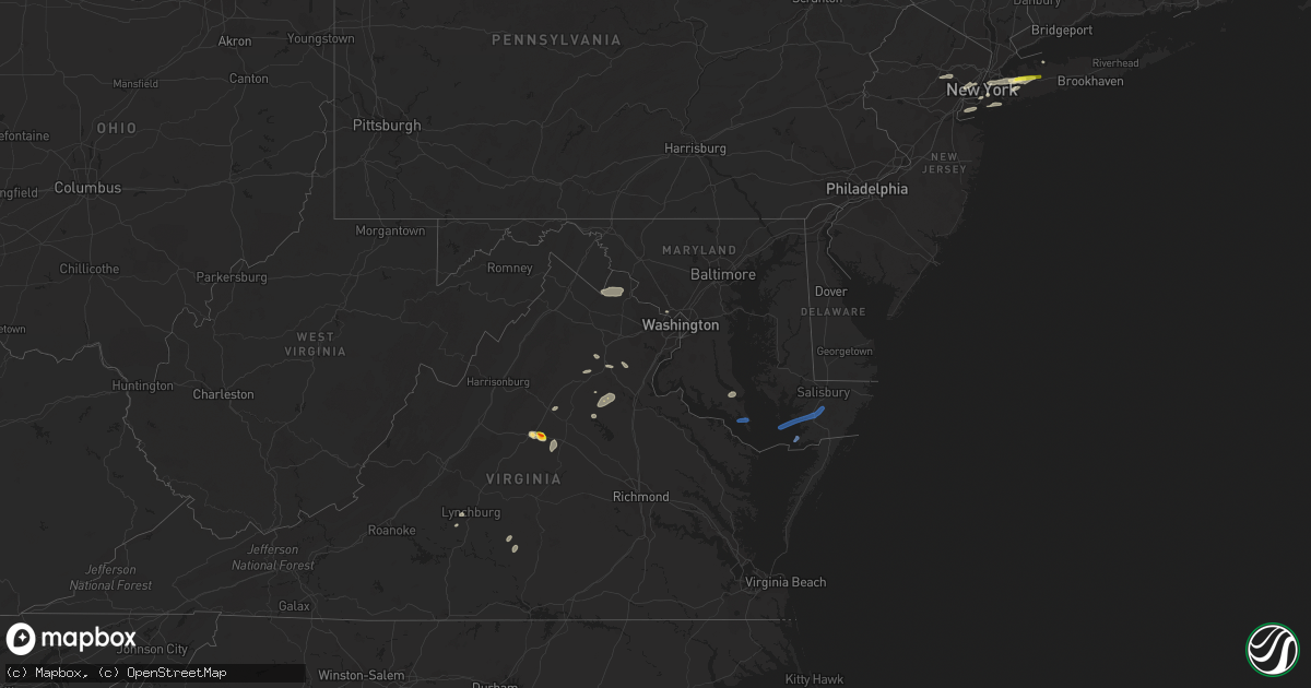
Hail Map in Maryland on July 25, 2022
Get this storm
July 25 map
$229
one time, instant access
Download today. No call, no setup
Keep the $229
Bought the map and want the full workflow? Apply the entire $229 to a subscription within 7 days. None of it is wasted.
Every map, not just this one
This buys you this map. Subscription and you get every map we run, in the markets you choose from a few cities to whole states to nationwide. Plus real-time alerts the moment a storm fires.
Contact data
Name, contact info, occupancy, even credit band for addresses in the footprint. You go from where it hit to who to call.
Become the source they trust
Unlimited branding weather history reports on demand. You already have the documented answer ready for the property owner, and you are the one who showed up with it.
Property data and RoofTrace estimates
Pull up any address you have got, its value and the exact code rules for that jurisdiction, straight from One Click Code. Then RoofTrace estimates the squares, pitch, and roof value, priced the way you price.
Storm reports in Maryland
Maryland
| Date | Description |
|---|---|
| 07/25/20226:10 PM CDT | Multiple trees down in salisbury. |
| 07/25/20226:10 PM CDT | Wind gusts of up to 50 knots |
| 07/25/20225:25 PM CDT | A wind gust of 52 knots |
| 07/25/20225:20 PM CDT | Tree down on heritage hill lane. |
| 07/25/20225:15 PM CDT | Numerous trees blew down in the great mills and callaway area. |
| 07/25/20225:12 PM CDT | Numerous trees blew down around lexington park. |
| 07/25/20225:10 PM CDT | Tree damage was reported in california... Including three trees that blew down along town creek drive. |
| 07/25/20224:29 PM CDT | A wind gust of 52 knots |
| 07/25/20224:22 PM CDT | Wind gusts of up to 52 knots |
| 07/25/20224:16 PM CDT | A few trees blew down along us-301 between rt 234 and rt 257. |
| 07/25/20222:43 PM CDT | Trees blew down in bethesda... Including along md-185 connecticut avenue between primrose street and md-191 bradley lane. |
| 07/25/20222:40 PM CDT | Trees blew down in bethesda... Including along md-185 connecticut avenue between primrose street and md-191 bradley lane. |
| 07/25/20221:15 AM CDT | At 615 PM EDT, severe thunderstorms were located along a line extending from near Popes Creek to near Warsaw to Little Plymouth, moving east at 45 mph. HAZARD...60 mph wind gusts. SOURCE...Radar indicated. IMPACT...Expect damage to trees and powerlines. Locations impacted include... Kilmarnock, Fair Port, Robley, Callao, Lancaster, White Stone, Kinsale, Morattico, Heathsville, Wicomico Church, Farnham, Coles Point, Hague, Westmoreland, Byrdton, Lottsburg, Avalon, Brook Vale, Bertrand and Reedville. |
| 07/25/202212:56 AM CDT | At 556 PM EDT, severe thunderstorms were located along a line extending from near Colonial Beach to near Warsaw, moving east at 35 mph. HAZARD...60 mph wind gusts and quarter size hail. SOURCE...Radar indicated. IMPACT...Damaging winds will cause some trees and large branches to fall. This could injure those outdoors, as well as damage homes and vehicles. Roadways may become blocked by downed trees. Localized power outages are possible. Unsecured light objects may become projectiles. Locations impacted include... Lexington Park, Piney Point, Tall Timbers, Saint Inigoes Creek, Saint Marys City, Saint George Island, Saint Clements Bay, Wicomico River, Saint Marys River, White Point Beach, California, Cobb Island, Rock Point, Bushwood, Issue, Abell, Valley Lee, Scotland, Swan Point and Great Mills. |
| 07/25/202212:44 AM CDT | At 544 PM EDT, a severe thunderstorm was located near Port Royal, or near King George, moving east at 40 mph. HAZARD...60 mph wind gusts. SOURCE...Radar indicated. IMPACT...Damaging winds will cause some trees and large branches to fall. This could injure those outdoors, as well as damage homes and vehicles. Roadways may become blocked by downed trees. Localized power outages are possible. Unsecured light objects may become projectiles. Locations impacted include... King George, Dahlgren, Port Royal, Weedonville, Ninde, Lambs Creek, Jersey, Shiloh and Dogue. |
| 07/25/202212:41 AM CDT | At 541 PM EDT, severe thunderstorms were located along a line extending from near King George to Leedstown to near Champlain, moving northeast at 35 mph. HAZARD...60 mph wind gusts. SOURCE...Radar indicated. IMPACT...Expect damage to trees and powerlines. Locations impacted include... Tappahannock, Warsaw, Montross, Champlain, Saint Stephens Church, Port Royal, Newtown, Newland, Coles Point, Hague, Loretto, Leedstown, Beazley, Currioman Landing, Hustle, Elevon, Supply, Mount Holly, Biscoe and Stratford Hall. |
| 07/25/202212:15 AM CDT | At 515 PM EDT, a severe thunderstorm was located near Popes Creek, moving east at 25 mph. HAZARD...60 mph wind gusts and quarter size hail. SOURCE...Radar indicated. IMPACT...Damaging winds will cause some trees and large branches to fall. This could injure those outdoors, as well as damage homes and vehicles. Roadways may become blocked by downed trees. Localized power outages are possible. Unsecured light objects may become projectiles. Locations impacted include... Lexington Park, Chesapeake Ranch Estates, La Plata, Leonardtown, Prince Frederick, Nanjemoy Creek, Popes Creek, Greenwell State Park, Hallowing Point, Saint Leonard Creek, Town Creek, Cuckold Creek, Sheridan Point, Calvert Cliffs, Port Tobacco River, Flag Harbor, California, Golden Beach, Lusby and Patuxent River Naval Air Station. |
| 07/24/202211:11 PM CDT | At 411 PM EDT, a severe thunderstorm was located near Stafford, moving southeast at 30 mph. HAZARD...60 mph wind gusts and quarter size hail. SOURCE...Radar indicated. IMPACT...Damaging winds will cause some trees and large branches to fall. This could injure those outdoors, as well as damage homes and vehicles. Roadways may become blocked by downed trees. Localized power outages are possible. Unsecured light objects may become projectiles. Locations impacted include... Stafford, Potomac Creek, Aquia Creek, Port Tobacco River, Falmouth, Stones Corner, Leeland, Roseville, Garrisonville, Ironsides, Arkendale, Brooke, Ramoth, Nanjemoy, Welcome, Glendie and Hartwood. |
| 07/24/202210:50 PM CDT | At 350 PM EDT, severe thunderstorms were located along a line extending from near Bull Run to 9 miles east of Bealeton, moving southeast at 25 mph. HAZARD...60 mph wind gusts and quarter size hail. SOURCE...Radar indicated. IMPACT...Damaging winds will cause some trees and large branches to fall. This could injure those outdoors, as well as damage homes and vehicles. Roadways may become blocked by downed trees. Localized power outages are possible. Unsecured light objects may become projectiles. Locations impacted include... Dale City, Woodbridge, Quantico, Lake Ridge, Linton Hall, Montclair, Lorton, Bull Run, Triangle, Dumfries, Manassas, Sudley, Cherry Hill, Manassas Park, Independent Hill, Mason Neck, Nokesville, Occoquan, Catlett and Widewater. |
| 07/24/20229:26 PM CDT | At 226 PM EDT, a severe thunderstorm was located over Round Hill, or 10 miles southeast of Charles Town, moving east at 40 mph. HAZARD...60 mph wind gusts and quarter size hail. SOURCE...Radar indicated. IMPACT...Damaging winds will cause some trees and large branches to fall. This could injure those outdoors, as well as damage homes and vehicles. Roadways may become blocked by downed trees. Localized power outages are possible. Unsecured light objects may become projectiles. Locations impacted include... Germantown, Gaithersburg, Leesburg, Lansdowne, Lowes Island, Poolesville, Ashburn, Montgomery Village, North Potomac, Countryside, Purcellville, Round Hill, Boyds, Darnestown, Belmont, Hamilton, Hillsboro, Paeonian Springs, Waterford and Lucketts. |
| 07/24/20227:10 PM CDT | Large tree limbs downed along md-12. Report via social media. |
All States Impacted by Hail Map on July 25, 2022
Cities Impacted by Hail Map on July 25, 2022
- Kimball, NE
- Bushnell, NE
- Bethesda, MD
- Catlett, VA
- Inglis, FL
- Willow City, ND
- Rugby, ND
- Guthrie, KY
- Allensville, KY
- Locust Grove, VA
- Spotsylvania, VA
- Unionville, VA
- Rhoadesville, VA
- New Athens, IL
- Freeburg, IL
- Mascoutah, IL
- Crookston, NE
- Portland, TN
- Tremont, MS
- Land O'Lakes, FL
- Charlottesville, VA
- Valentine, NE
- East Saint Louis, IL
- Elmont, NY
- Floral Park, NY
- Franklin Square, NY
- West Hempstead, NY
- Garden City, NY
- New Hyde Park, NY
- Savage, MT
- Kilgore, NE
- Kim, CO
- Far Rockaway, NY
- Brooklyn, NY
- Hayes, SD
- Fort Pierre, SD
- East Hanover, NJ
- Livingston, NJ
- Whippany, NJ
- Roseland, NJ
- Colorado Springs, CO
- Ravenden Springs, AR
- Ravenden, AR
- Hardy, AR
- Salt Flat, TX
- Dunnellon, FL
- Crystal River, FL
- Appomattox, VA
- Red House, VA
- Midland, VA
- Bealeton, VA
- McEwen, TN
- Tompkinsville, KY
- Charlotte Court House, VA
- Cullen, VA
- Roslyn Heights, NY
- Roslyn, NY
- Manhasset, NY
- Old Westbury, NY
- Albertson, NY
- Barboursville, VA
- Oldsmar, FL
- Tampa, FL
- Murdo, SD
- Draper, SD
- Las Animas, CO
- Franklin, KY
- Lynchburg, VA
- Evington, VA
- Forest, VA
- Selma, AL
- Dickson, TN
- Orange, VA
- Mineral, VA
- Adairville, KY
- Springfield, TN
- Harrison, NJ
- Kearny, NJ
- Secaucus, NJ
- Jersey City, NJ
- Newark, NJ
- Dickinson, ND
- Belfield, ND
- Palmyra, VA
- Troy, VA
- Keswick, VA
- Great Neck, NY
- Chiefland, FL
- Trenton, FL
- Rienzi, MS
- California, MD
- Hollywood, MD
- Whitman, NE
- Culpeper, VA
- Jeffersonton, VA
- Warrenton, VA
- Olmstead, KY
- Rye, NH
- Kittery Point, ME
- Portsmouth, NH
- New Castle, NH
- Lobelville, TN
- Waverly, TN
- Hurricane Mills, TN
- Parrish, FL
- Cedar Hill, TN
- Dupo, IL
- Saint Louis, MO
- Millstadt, IL
- East Carondelet, IL
- Wood Lake, NE
- Merriman, NE
- Cody, NE
- Bluemont, VA
- Paeonian Springs, VA
- Hamilton, VA
- Purcellville, VA
- Harpers Ferry, WV
- Waterford, VA
- Round Hill, VA
- Roseglen, ND
- Glen Head, NY
- Little Neck, NY
- Jericho, NY
- Primm Springs, TN
- Franklin, TN
- Clarksville, TN
- Centerville, TN
- Santa Fe, TN
- Columbia, TN
- Hudson, FL
- Nantucket, MA
- Syosset, NY
- Bethpage, TN
- Willow Beach, AZ
- Cedar Key, FL
- Cottontown, TN
- Hicksville, NY
- Long Island City, NY
- Westbury, NY
- Woodbury, NY
- Plainview, NY
- Whitestone, NY
- East Elmhurst, NY
- Oakland Gardens, NY
- New York, NY
- Sunnyside, NY
- Greenvale, NY
- Flushing, NY
- College Point, NY
- Williston Park, NY
- Woodside, NY
- Corona, NY
- Bayside, NY
- Astoria, NY
- Jackson Heights, NY
- Bedford, NH
- Auburn, NH
- Manchester, NH
- Staten Island, NY
- Martin, SD
- Tuthill, SD
- Northport, NY
- Carrizozo, NM
- Madison, NH
- Saint Inigoes, MD
- Ridge, MD
- Dameron, MD
- Eden, MD
- Princess Anne, MD
- Deal Island, MD
- Westover, MD
- Crisfield, MD
- Huntington Station, NY
- Huntington, NY
- Melville, NY
- Branson, CO
- Richardton, ND
- Gladstone, ND
- Taylor, ND


