Hail Map in South Carolina on July 24, 2022
Get this storm
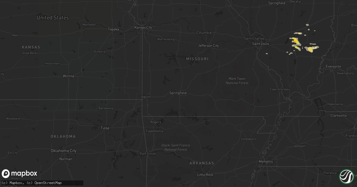
July 24 map
$229
one time, instant access
Download today. No call, no setup
Keep the $229
Bought the map and want the full workflow? Apply the entire $229 to a subscription within 7 days. None of it is wasted.
Every map, not just this one
This buys you this map. Subscription and you get every map we run, in the markets you choose from a few cities to whole states to nationwide. Plus real-time alerts the moment a storm fires.
Contact data
Name, contact info, occupancy, even credit band for addresses in the footprint. You go from where it hit to who to call.
Become the source they trust
Unlimited branding weather history reports on demand. You already have the documented answer ready for the property owner, and you are the one who showed up with it.
Property data and RoofTrace estimates
Pull up any address you have got, its value and the exact code rules for that jurisdiction, straight from One Click Code. Then RoofTrace estimates the squares, pitch, and roof value, priced the way you price.
Storm reports in South Carolina
South Carolina
| Date | Description |
|---|---|
| 07/24/20225:24 PM CDT | Highway patrol reported trees down blocking the i-20 wb on-ramp at monticello rd. |
| 07/24/20224:59 PM CDT | Highway patrol reports tree down along fish hatchery rd and arbor gate dr. |
| 07/24/20224:28 PM CDT | Power company reported numerous trees fell on power lines between gilbert and leesville resulting in approximately 3000 outages. |
| 07/24/20224:25 PM CDT | Highway patrol reports tree down along beulah church rd at wyatt way. |
| 07/24/20224:04 PM CDT | Highway patrol reports trees down along hwy 21 at valley ridge rd... Blocking the roadway. |
| 07/24/20223:53 PM CDT | Highway patrol reports trees down along caw caw hwy near i-26. |
| 07/24/20223:30 PM CDT | County received reports of trees down and damage to a mobile home roof. |
| 07/24/20223:25 PM CDT | On mud bridge road...numerous trees blown down. A house had its roof blown off and a large tree fell on the house. Also the roof of a barn was blown off. Sunday afterno |
| 07/24/20223:04 PM CDT | Tree down near the intersection of deerfield road and thomas egg farm road. Time estimated by radar. |
| 07/24/20223:04 PM CDT | South carolina highway patrol and 911 call center reported a tree down near the intersection of deerfield road and old charleston road. Time estimated by radar. |
| 07/24/202212:15 AM CDT | At 515 PM EDT, a severe thunderstorm was located 7 miles south of Dreher Island State Park, or 8 miles northeast of Batesburg-Leesville, and is nearly stationary. HAZARD...60 mph wind gusts and nickel size hail. SOURCE...Radar indicated. IMPACT...Expect damage to trees and powerlines. Locations impacted include... Batesburg-Leesville, Red Bank, Dreher Island State Park, Gilbert, Summit, Cedar Grove Fire Station, South Shore Marina, Oswald Park, Fredonia, Shull Island, Bundrick Island, Putnam's Landing, Siesta Cove Marina, Murray, Camp Kinard, Lake Murray Shores, Circle Fire Station, Delmar, Hollow Creek Public Park and Hibernia.This includes Interstate 20 in South Carolina between mile markers 43and 52. |
| 07/23/202211:49 PM CDT | At 448 PM EDT, a severe thunderstorm was located near St. Matthews, or 12 miles north of Brookdale, and is nearly stationary. HAZARD...60 mph wind gusts and penny size hail. SOURCE...Radar indicated. IMPACT...Expect damage to trees and powerlines. Locations impacted include... St. Matthews, Congaree National Park, Gadsden, Sandy Run and Fort Motte.This includes Interstate 26 between mile markers 123 and 146. |
| 07/23/202211:32 PM CDT | At 431 PM EDT, a severe thunderstorm was located near Monteith, moving south at 5 mph. HAZARD...60 mph wind gusts and quarter size hail. SOURCE...Radar indicated. IMPACT...Minor hail damage to vehicles is possible. Expect wind damage to trees and powerlines. Locations impacted include: Pooler, I-16/I-95 Interchange, Hunter Army Airfield, Midtown Savannah, Downtown Savannah, Godley Station, Savannah International Airport, Windsor Forest, Rincon, Garden City, Port Wentworth, Hardeeville, Bloomingdale, Thunderbolt and Sandfly.This warning includes the following interstates: I-16 between mile markers 150 and 168. I-516 between mile markers 3 and 9. I-95 in South Carolina between mile markers 2 and 4. I-95 in Georgia between mile markers 98 and 112. |
All States Impacted by Hail Map on July 24, 2022
Cities Impacted by Hail Map on July 24, 2022
- Pittsboro, NC
- Ajo, AZ
- Effingham, IL
- Dieterich, IL
- Akron, CO
- Brush, CO
- Fort Smith, MT
- Lodge Grass, MT
- Claxton, GA
- Broadview, MT
- Burgaw, NC
- Swansea, SC
- Saint Matthews, SC
- White Sulphur Springs, MT
- Mebane, NC
- Prospect Hill, NC
- Boulder, MT
- Whitehall, MT
- Holly, CO
- Greencastle, PA
- Mercersburg, PA
- Salley, SC
- Van Buren, ME
- Moncure, NC
- Molt, MT
- Venice, FL
- Nokomis, FL
- Manderson, WY
- Grover Hill, OH
- Cloverdale, OH
- Oakwood, OH
- Texico, IL
- Iuka, IL
- Kell, IL
- Billings, MT
- Cassadaga, NY
- Martinsdale, MT
- Rapelje, MT
- Big Timber, MT
- Benson, AZ
- Dragoon, AZ
- Leesville, SC
- Gilbert, SC
- Rochelle, GA
- Teutopolis, IL
- Willcox, AZ
- Hugo, CO
- Arriba, CO
- Karval, CO
- New Athens, IL
- Waterloo, IL
- Garryowen, MT
- Elloree, SC
- Johnsonville, IL
- Sinclairville, NY
- Cherry Creek, NY
- Stockton, NY
- Dewittville, NY
- Two Dot, MT
- Kane, PA
- Bunker, MO
- Acton, MT
- Apex, NC
- Cobbtown, GA
- Collins, GA
- Lumpkin, GA
- Pritchett, CO
- Richview, IL
- Show Low, AZ
- Cope, CO
- Seibert, CO
- Vona, CO
- Arivaca, AZ
- Tucson, AZ
- Crow Agency, MT
- Huntley, MT
- Hardin, MT
- Mount Lemmon, AZ
- Shawmut, MT
- Otter, MT
- Flagstaff, AZ
- Metter, GA
- Hampton, FL
- Swainsboro, GA
- Alma, IL
- Patoka, IL
- Odin, IL
- Centralia, IL
- Salem, IL
- Bluford, IL
- Vernon, IL
- Vandalia, IL
- Mount Vernon, IL
- Dix, IL
- Kinmundy, IL
- Saint David, AZ
- Busby, MT
- Decker, MT
- Bloomingdale, GA
- Guyton, GA
- Reeves, LA
- Ragley, LA
- McConnellsburg, PA
- Big Cove Tannery, PA
- Wake Forest, NC
- Clifton, AZ
- Morenci, AZ
- Snowflake, AZ
- Conway, NC
- Scottsburg, VA
- Tombstone, AZ
- Lavina, MT
- Edgewood, IL
- Brownstown, IL
- Mason, IL
- Farina, IL
- Saint Peter, IL
- Saint Elmo, IL
- Gaston, SC
- Rocky Point, NC
- Eads, CO
- Wild Horse, CO
- Kit Carson, CO
- Williston, SC
- Tidioute, PA
- Grand Valley, PA
- Pleasantville, PA
- Newberry, FL
- Sanford, NC
- New Hill, NC
- Eagle Lake, ME
- Sinclair, ME
- Stockholm, ME
- Canastota, NY
- Clarendon, PA
- Warren, PA
- Windsor, SC
- Saint Xavier, MT
- Snyder, CO
- Fort Morgan, CO
- Mill Hall, PA
- Lock Haven, PA
- Lamar, CO
- Wiley, CO
- McClave, CO
- Chapel Hill, NC
- Santee, SC
- Waterville, PA
- English, IN
- Birdseye, IN
- Eckerty, IN
- Wiggins, CO
- Weldona, CO
- Polk, PA
- Utica, PA
- Stoneboro, PA
- Jackson Center, PA
- Sandy Lake, PA
- Franklin, PA
- Mercer, PA
- Creedmoor, NC
- Patagonia, AZ
- Batesburg, SC
- Ashley, IL
- Woodlawn, IL
- Ryegate, MT
- Flagler, CO
- Register, GA
- Hardeeville, SC
- Great Falls, MT
- Piedmont, SD
- Nemo, SD
- Black Hawk, SD
- Rapid City, SD
- Stratton, CO
- Geff, IL
- Cisne, IL
- Mount Erie, IL
- Norman Park, GA
- Moultrie, GA
- Omega, GA
- Tifton, GA
- Oxford, NY
- Sims, IL
- Fairfield, IL
- Las Animas, CO
- Portageville, NY
- Gainesville, NY
- Bliss, NY
- Fillmore, NY
- Weston, WY
- Monarch, MT
- Noble, IL
- Clay City, IL
- Rincon, GA
- Port Wentworth, GA
- Elfrida, AZ
- Pembroke, GA
- Hulett, WY
- Hermosa, SD
- Haviland, OH
- Continental, OH
- Seabrook, SC
- Osprey, FL
- West Salem, IL
- Perry, FL
- Caputa, SD
- Newton, IL
- Opp, AL
- Elba, AL
- Arlington, IN
- Morristown, IN
- Carmichaels, PA
- Fort Kent, ME
- Louisville, IL
- Lamont, FL
- Chauncey, GA
- Milan, GA
- Drake, CO
- Cheyenne Wells, CO
- Arapahoe, CO
- Big Flats, NY
- Pine Valley, NY
- Horseheads, NY
- Addison, NY
- Painted Post, NY
- Corning, NY
- Millport, NY
- Van Etten, NY
- Spencer, NY
- Erin, NY
- South New Berlin, NY
- Sherburne, NY
- McDonough, NY
- Smithville Flats, NY
- Edmeston, NY
- South Plymouth, NY
- Cincinnatus, NY
- Norwich, NY
- Willet, NY
- Marathon, NY
- New Berlin, NY
- Davenport, NY
- Oneonta, NY
- East Meredith, NY
- Jefferson, NY
- Franklin, NY
- Otego, NY
- Davenport Center, NY
- West Davenport, NY
- Schenevus, NY
- Harpersfield, NY
- Feura Bush, NY
- Bloomville, NY
- Altamont, NY
- North Blenheim, NY
- Watervliet, NY
- Clarksville, NY
- Berne, NY
- Stamford, NY
- Delhi, NY
- Rensselaer, NY
- Fultonham, NY
- Slingerlands, NY
- West Fulton, NY
- Albany, NY
- Gilboa, NY
- Troy, NY
- Voorheesville, NY
- South Kortright, NY
- Middleburgh, NY
- Hobart, NY
- Delmar, NY
- Summit, NY
- Rensselaerville, NY
- East Berne, NY
- Preston Hollow, NY
- Westerlo, NY
- Conewango Valley, NY
- Little Valley, NY
- Randolph, NY
- Falconer, NY
- Cattaraugus, NY
- Jamestown, NY
- Gerry, NY
- Kennedy, NY
- Fredonia, NY
- Portland, NY
- Brocton, NY
- Westfield, NY
- Silver Creek, NY
- Angola, NY
- Irving, NY
- Dunkirk, NY
- Williamsfield, OH
- Newbury, OH
- Jamestown, PA
- Novelty, OH
- Centerville, PA
- Andover, OH
- Gates Mills, OH
- Chardon, OH
- Chagrin Falls, OH
- Burton, OH
- Middlefield, OH
- Chesterland, OH
- Huntsburg, OH
- Conneaut Lake, PA
- Hartstown, PA
- Guys Mills, PA
- Windsor, OH
- Townville, PA
- Meadville, PA
- Atlantic, PA
- Linesville, PA
- Orwell, OH


