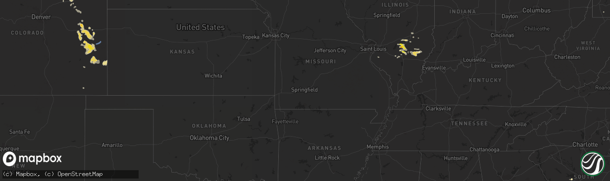
Hail Map in Colorado on July 24, 2022
The weather event in Colorado on July 24, 2022 includes Hail and Wind maps. 19 states and 316 cities were impacted and suffered possible damage. The total estimated number of properties impacted is 382.
Want more than just the map?
Turn this storm into a full workflow.
- Owner + property data so you know who to knock
- OnDemand branded weather history reports to win the "did we even have hail?" argument
- RoofTrace estimate so reps stop guessing numbers at the door
Bought this map? Upgrade within 7 days and we'll credit the $230. (10-15 min setup call)
Hail
Wind
382
Estimated number of impacted properties by a 1.00" hail or larger0
Estimated number of impacted properties by a 1.75" hail or larger0
Estimated number of impacted properties by a 2.50" hail or largerStorm reports in Colorado
Colorado
| Date | Description |
|---|---|
| 07/24/20225:11 PM CDT | Report from mping: 1-inch tree limbs broken; shingles blown off. |
| 07/24/20223:30 AM CDT | At 830 PM MDT, severe thunderstorms were located along a line extending from 11 miles north of Chivington to near Neegronda Reservoir to 7 miles southeast of Lamar, moving east at 30 mph. HAZARD...70 mph wind gusts and quarter size hail. SOURCE...Radar indicated. IMPACT...Hail damage to vehicles is expected. Expect considerable tree damage. Wind damage is also likely to mobile homes, roofs, and outbuildings. Locations impacted include... Holly, Granada, Sheridan Lake, Hartman, Towner, Bristol, Chivington and Brandon. |
| 07/24/20223:30 AM CDT | At 830 PM MDT, a severe thunderstorm was located 9 miles southeast of Kit Carson, or 17 miles southwest of Cheyenne Wells, moving east at 45 mph. HAZARD...60 mph wind gusts and quarter size hail. SOURCE...Radar indicated. IMPACT...Hail damage to vehicles is expected. Expect wind damage to roofs, siding, and trees. This severe thunderstorm will remain over mainly rural areas of southeastern Cheyenne County in east central Colorado, including the following locations... Arapahoe and Firstview.This includes Highway 385 between mile markers 136 and 155. |
| 07/24/20222:54 AM CDT | At 754 PM MDT, severe thunderstorms were located along a line extending from 7 miles east of Haswell to 9 miles east of Blue Lake to 7 miles southeast of John Martin Reservoir, moving east at 25 mph. HAZARD...60 mph wind gusts and penny size hail. SOURCE...Radar indicated. IMPACT...Expect damage to roofs, siding, and trees. Severe thunderstorms will be near... Hasty around 800 PM MDT. McClave around 815 PM MDT. Eads around 825 PM MDT. Wiley around 830 PM MDT. Neegronda Reservoir and Sweetwater Reservoir around 835 PM MDT. Lamar around 845 PM MDT. Queens Reservoir and Neeoshe Reservoir around 850 PM MDT.Other locations impacted by these severe thunderstorms includeCaddoa. |
| 07/24/20222:35 AM CDT | At 735 PM MDT, a severe thunderstorm was located 14 miles south of Seibert, moving southeast at 25 mph. HAZARD...60 mph wind gusts and quarter size hail. SOURCE...Radar indicated. IMPACT...Hail damage to vehicles is expected. Expect wind damage to roofs, siding, and trees. This severe thunderstorm will remain over mainly rural areas of north central Cheyenne and south central Kit Carson Counties in east central Colorado, including the following locations... Firstview.This includes Highway 385 between mile markers 161 and 164. |
| 07/24/20221:53 AM CDT | At 653 PM MDT, severe thunderstorms were located along a line extending from near Sugar City to near Higbee, moving northeast at 35 mph. HAZARD...60 mph wind gusts and penny size hail. SOURCE...Radar indicated. IMPACT...Expect damage to roofs, siding, and trees. Locations impacted include... La Junta, North La Junta, Las Animas, Sugar City, Cheraw, Hasty, John Martin Reservoir, Blue Lake, Fort Lyon and Caddoa. |
| 07/24/20221:25 AM CDT | At 624 PM MDT, a severe thunderstorm was located 10 miles north of Flagler, moving east at 10 mph. HAZARD...60 mph wind gusts and quarter size hail. SOURCE...Radar indicated. IMPACT...Hail damage to vehicles is expected. Expect wind damage to roofs, siding, and trees. This severe thunderstorm will remain over mainly rural areas of northwestern Kit Carson County. |
| 07/24/202212:36 AM CDT | At 536 PM MDT, severe thunderstorms were located along a line extending from Akron to 7 miles southwest of Platner to 3 miles north of Anton, or along a line extending from 30 miles east of Fort Morgan to 22 miles west of Yuma to 35 miles north of Flagler, moving east at 40 mph. HAZARD...60 mph wind gusts and penny size hail. SOURCE...Radar indicated. IMPACT...Expect damage to roofs, siding, and trees. Severe thunderstorms will be near... Platner and Arickaree School around 550 PM MDT.Other locations in the path of these severe thunderstorms includeOtis. |
| 07/24/202212:12 AM CDT | At 512 PM MDT, a severe thunderstorm was located over Security-Widefield, or 9 miles southeast of Colorado Springs, moving northeast at 20 mph. HAZARD...60 mph wind gusts and penny size hail. SOURCE...Radar indicated. IMPACT...Expect damage to roofs, siding, and trees. Locations impacted include... Schriever AFB and Ellicott. |
| 07/24/202212:05 AM CDT | At 505 PM MDT, a severe thunderstorm was located over Pueblo Reservoir, or near Pueblo, moving northeast at 25 mph. HAZARD...70 mph wind gusts. SOURCE...Radar indicated. IMPACT...Expect considerable tree damage. Damage is likely to mobile homes, roofs, and outbuildings. Locations impacted include... Pueblo, Boone, Salt Creek, Blende, Avondale, Pueblo Depot, Pinon and Pueblo West. |
| 07/24/202212:00 AM CDT | At 500 PM MDT, a severe thunderstorm was located near Palmer Lake, or 19 miles northwest of Colorado Springs, moving northeast at 20 mph. HAZARD...60 mph wind gusts and quarter size hail. Moderate rotation was also observed with this storm. SOURCE...Radar indicated. IMPACT...Hail damage to vehicles is expected. Expect wind damage to roofs, siding, and trees. This severe thunderstorm will be near... Palmer Lake around 515 PM MDT. Monument and Gleneagle around 520 PM MDT. |
| 07/23/202211:47 PM CDT | At 447 PM MDT, a severe thunderstorm was located near Pueblo Reservoir, or 13 miles west of Pueblo, moving northeast at 15 mph. HAZARD...60 mph wind gusts. SOURCE...Radar indicated. IMPACT...Expect damage to roofs, siding, and trees. Locations impacted include... Western Pueblo, Pueblo West and Pueblo Reservoir. |
| 07/23/202210:00 PM CDT | Report of overturned camper trailers... Downed powerlines... And roofs blown off at intersection of county road ss and county road 8 with earlier severe thunderstorm -- |
| 07/23/20229:45 PM CDT | A local report indicates 67 MPH wind near 2 SW FIRSTVIEW |
| 07/23/20229:45 PM CDT | Corrects previous tstm wnd gst report from 2 sw firstview. |
| 07/23/20229:43 PM CDT | Report of numerous large tree branches down just north of wiley. Tree branch diameters were several inches wide... With one branch blocking road. |
All States Impacted by Hail Map on July 24, 2022
Cities Impacted by Hail Map on July 24, 2022
- Pittsboro, NC
- Ajo, AZ
- Effingham, IL
- Dieterich, IL
- Akron, CO
- Brush, CO
- Fort Smith, MT
- Lodge Grass, MT
- Claxton, GA
- Broadview, MT
- Burgaw, NC
- Swansea, SC
- Saint Matthews, SC
- White Sulphur Springs, MT
- Mebane, NC
- Prospect Hill, NC
- Boulder, MT
- Whitehall, MT
- Holly, CO
- Greencastle, PA
- Mercersburg, PA
- Salley, SC
- Van Buren, ME
- Moncure, NC
- Molt, MT
- Venice, FL
- Nokomis, FL
- Manderson, WY
- Grover Hill, OH
- Cloverdale, OH
- Oakwood, OH
- Texico, IL
- Iuka, IL
- Kell, IL
- Billings, MT
- Cassadaga, NY
- Martinsdale, MT
- Rapelje, MT
- Big Timber, MT
- Benson, AZ
- Dragoon, AZ
- Leesville, SC
- Gilbert, SC
- Rochelle, GA
- Teutopolis, IL
- Willcox, AZ
- Hugo, CO
- Arriba, CO
- Karval, CO
- New Athens, IL
- Waterloo, IL
- Garryowen, MT
- Elloree, SC
- Johnsonville, IL
- Sinclairville, NY
- Cherry Creek, NY
- Stockton, NY
- Dewittville, NY
- Two Dot, MT
- Kane, PA
- Bunker, MO
- Acton, MT
- Apex, NC
- Cobbtown, GA
- Collins, GA
- Lumpkin, GA
- Pritchett, CO
- Richview, IL
- Show Low, AZ
- Cope, CO
- Seibert, CO
- Vona, CO
- Arivaca, AZ
- Tucson, AZ
- Crow Agency, MT
- Huntley, MT
- Hardin, MT
- Mount Lemmon, AZ
- Shawmut, MT
- Otter, MT
- Flagstaff, AZ
- Metter, GA
- Hampton, FL
- Swainsboro, GA
- Alma, IL
- Patoka, IL
- Odin, IL
- Centralia, IL
- Salem, IL
- Bluford, IL
- Vernon, IL
- Vandalia, IL
- Mount Vernon, IL
- Dix, IL
- Kinmundy, IL
- Saint David, AZ
- Busby, MT
- Decker, MT
- Bloomingdale, GA
- Guyton, GA
- Reeves, LA
- Ragley, LA
- McConnellsburg, PA
- Big Cove Tannery, PA
- Wake Forest, NC
- Clifton, AZ
- Morenci, AZ
- Snowflake, AZ
- Conway, NC
- Scottsburg, VA
- Tombstone, AZ
- Lavina, MT
- Edgewood, IL
- Brownstown, IL
- Mason, IL
- Farina, IL
- Saint Peter, IL
- Saint Elmo, IL
- Gaston, SC
- Rocky Point, NC
- Eads, CO
- Wild Horse, CO
- Kit Carson, CO
- Williston, SC
- Tidioute, PA
- Grand Valley, PA
- Pleasantville, PA
- Newberry, FL
- Sanford, NC
- New Hill, NC
- Eagle Lake, ME
- Sinclair, ME
- Stockholm, ME
- Canastota, NY
- Clarendon, PA
- Warren, PA
- Windsor, SC
- Saint Xavier, MT
- Snyder, CO
- Fort Morgan, CO
- Mill Hall, PA
- Lock Haven, PA
- Lamar, CO
- Wiley, CO
- McClave, CO
- Chapel Hill, NC
- Santee, SC
- Waterville, PA
- English, IN
- Birdseye, IN
- Eckerty, IN
- Wiggins, CO
- Weldona, CO
- Polk, PA
- Utica, PA
- Stoneboro, PA
- Jackson Center, PA
- Sandy Lake, PA
- Franklin, PA
- Mercer, PA
- Creedmoor, NC
- Patagonia, AZ
- Batesburg, SC
- Ashley, IL
- Woodlawn, IL
- Ryegate, MT
- Flagler, CO
- Register, GA
- Hardeeville, SC
- Great Falls, MT
- Piedmont, SD
- Nemo, SD
- Black Hawk, SD
- Rapid City, SD
- Stratton, CO
- Geff, IL
- Cisne, IL
- Mount Erie, IL
- Norman Park, GA
- Moultrie, GA
- Omega, GA
- Tifton, GA
- Oxford, NY
- Sims, IL
- Fairfield, IL
- Las Animas, CO
- Portageville, NY
- Gainesville, NY
- Bliss, NY
- Fillmore, NY
- Weston, WY
- Monarch, MT
- Noble, IL
- Clay City, IL
- Rincon, GA
- Port Wentworth, GA
- Elfrida, AZ
- Pembroke, GA
- Hulett, WY
- Hermosa, SD
- Haviland, OH
- Continental, OH
- Seabrook, SC
- Osprey, FL
- West Salem, IL
- Perry, FL
- Caputa, SD
- Newton, IL
- Opp, AL
- Elba, AL
- Arlington, IN
- Morristown, IN
- Carmichaels, PA
- Fort Kent, ME
- Louisville, IL
- Lamont, FL
- Chauncey, GA
- Milan, GA
- Drake, CO
- Cheyenne Wells, CO
- Arapahoe, CO
- Big Flats, NY
- Pine Valley, NY
- Horseheads, NY
- Addison, NY
- Painted Post, NY
- Corning, NY
- Millport, NY
- Van Etten, NY
- Spencer, NY
- Erin, NY
- South New Berlin, NY
- Sherburne, NY
- McDonough, NY
- Smithville Flats, NY
- Edmeston, NY
- South Plymouth, NY
- Cincinnatus, NY
- Norwich, NY
- Willet, NY
- Marathon, NY
- New Berlin, NY
- Davenport, NY
- Oneonta, NY
- East Meredith, NY
- Jefferson, NY
- Franklin, NY
- Otego, NY
- Davenport Center, NY
- West Davenport, NY
- Schenevus, NY
- Harpersfield, NY
- Feura Bush, NY
- Bloomville, NY
- Altamont, NY
- North Blenheim, NY
- Watervliet, NY
- Clarksville, NY
- Berne, NY
- Stamford, NY
- Delhi, NY
- Rensselaer, NY
- Fultonham, NY
- Slingerlands, NY
- West Fulton, NY
- Albany, NY
- Gilboa, NY
- Troy, NY
- Voorheesville, NY
- South Kortright, NY
- Middleburgh, NY
- Hobart, NY
- Delmar, NY
- Summit, NY
- Rensselaerville, NY
- East Berne, NY
- Preston Hollow, NY
- Westerlo, NY
- Conewango Valley, NY
- Little Valley, NY
- Randolph, NY
- Falconer, NY
- Cattaraugus, NY
- Jamestown, NY
- Gerry, NY
- Kennedy, NY
- Fredonia, NY
- Portland, NY
- Brocton, NY
- Westfield, NY
- Silver Creek, NY
- Angola, NY
- Irving, NY
- Dunkirk, NY
- Williamsfield, OH
- Newbury, OH
- Jamestown, PA
- Novelty, OH
- Centerville, PA
- Andover, OH
- Gates Mills, OH
- Chardon, OH
- Chagrin Falls, OH
- Burton, OH
- Middlefield, OH
- Chesterland, OH
- Huntsburg, OH
- Conneaut Lake, PA
- Hartstown, PA
- Guys Mills, PA
- Windsor, OH
- Townville, PA
- Meadville, PA
- Atlantic, PA
- Linesville, PA
- Orwell, OH


