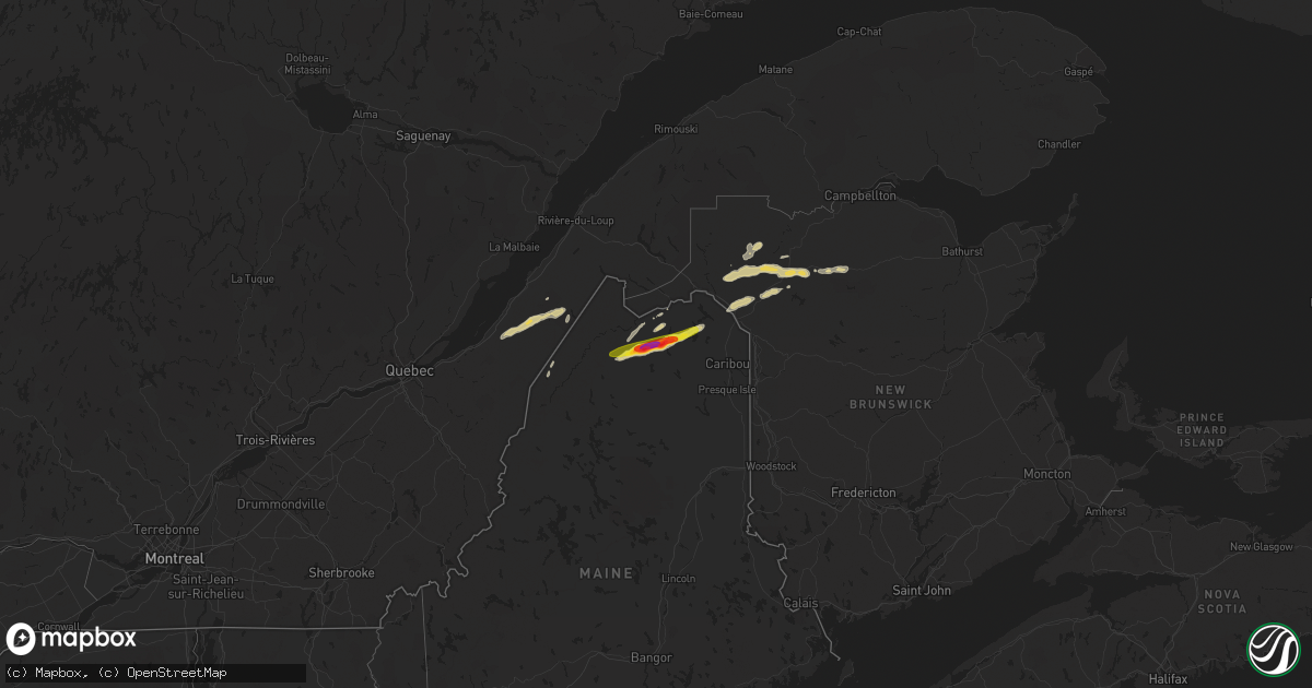
Hail Map on July 24, 2022
Get this storm
July 24 map
$229
one time, instant access
Download today. No call, no setup
Keep the $229
Bought the map and want the full workflow? Apply the entire $229 to a subscription within 7 days. None of it is wasted.
Every map, not just this one
This buys you this map. Subscription and you get every map we run, in the markets you choose from a few cities to whole states to nationwide. Plus real-time alerts the moment a storm fires.
Contact data
Name, contact info, occupancy, even credit band for addresses in the footprint. You go from where it hit to who to call.
Become the source they trust
Unlimited branding weather history reports on demand. You already have the documented answer ready for the property owner, and you are the one who showed up with it.
Property data and RoofTrace estimates
Pull up any address you have got, its value and the exact code rules for that jurisdiction, straight from One Click Code. Then RoofTrace estimates the squares, pitch, and roof value, priced the way you price.
States Impacted by Hail Map on July 24, 2022
Storm reports
Kentucky
| Date | Description |
|---|---|
| 07/24/20224:39 AM CDT | At 938 PM EDT, severe thunderstorms were located along a line extending from near English to 10 miles west of Carefree Town to 21 miles east of Santa Claus, moving east at 35 mph. HAZARD...60 mph wind gusts. SOURCE...Radar indicated. IMPACT...Expect damage to roofs, siding, and trees. Severe thunderstorms will be near... English around 950 PM EDT. Carefree Town around 955 PM EDT. |
Virginia
| Date | Description |
|---|---|
| 07/24/202212:45 AM CDT | At 544 PM EDT, a severe thunderstorm was located over Mobjack, or over Mathews, moving northeast at 15 mph. HAZARD...60 mph wind gusts and quarter size hail. SOURCE...Radar indicated. IMPACT...Minor damage to vehicles is possible. Expect wind damage to trees and powerlines. This severe thunderstorm will be near... Mathews around 555 PM EDT. Gwynn around 615 PM EDT.Other locations impacted by this severe thunderstorm include Diggs,Ruff, Moon, Peary, Laban, Hudgins, Redart, New Point and PortHaywood. |
West Virginia
| Date | Description |
|---|---|
| 07/24/20222:09 AM CDT | At 709 AM EDT, a severe thunderstorm was located near Valley Grove, moving east at 25 mph. HAZARD...60 mph wind gusts and penny size hail. SOURCE...Radar indicated. IMPACT...Expect damage to trees and power lines, resulting in some power outages. Locations impacted include... Wheeling, Bethlehem, Triadelphia, Valley Grove, West Finley, Claysville, West Alexander, Taylorstown, Amity, Nineveh, Green Hills, and Elm Grove. |
Vermont
| Date | Description |
|---|---|
| 07/24/20222:14 AM CDT | At 714 PM EDT, severe thunderstorms were located along a line extending from near Latham to near Castleton-On-Hudson to 6 miles west of Athens, moving east at 50 mph. HAZARD...60 mph wind gusts. SOURCE...Radar indicated. IMPACT...Expect damage to roofs, siding, and trees. Locations impacted include... Albany, Troy, Pittsfield, Bennington, East Greenbush, Cohoes, North Adams, Watervliet, Rensselaer, Colonie, Great Barrington, Hudson, Catskill, Hoosick Falls, Chatham, Nassau, Hunter, Latham, Delmar and Adams. |
| 07/24/20222:01 AM CDT | At 700 PM EDT, a severe thunderstorm was located near Hoosick Falls, moving east at 30 mph. HAZARD...60 mph wind gusts and penny size hail. SOURCE...Radar indicated. IMPACT...Expect damage to roofs, siding, and trees. Locations impacted include... Bennington, Hoosick Falls, Arlington, Stratton, Shaftsbury, Wilmington, Cambridge, West Wardsboro, Hoosick, Lee, White Creek, Easton, North Bennington, Dover, Marlboro, Jamaica, Wardsboro, Valley Falls, Woodford and Old Bennington. |
Maryland
| Date | Description |
|---|---|
| 07/24/202212:40 AM CDT | At 540 PM EDT, a severe thunderstorm was located over Greencastle, moving east at 20 mph. HAZARD...60 mph wind gusts and penny size hail. SOURCE...Radar indicated. IMPACT...Expect damage to roofs, siding, and trees. Locations impacted include... Chambersburg, Waynesboro, Greencastle, Guilford, St. Thomas, Fayetteville, Wayne Heights, Mont Alto, Scotland, Rouzerville, Marion and State Line.This includes Interstate 81 from mile markers 0 to 21. |
| 07/24/202212:03 AM CDT | At 503 PM EDT, a severe thunderstorm was located over Big Cove Tannery, moving east at 10 mph. HAZARD...60 mph wind gusts. SOURCE...Radar indicated. IMPACT...Expect damage to roofs, siding, and trees. Locations impacted include... Mercersburg, McConnellsburg, Fort Loudon, Big Cove Tannery, Claylick, Williamson, Upton and Whitetail Ski Area. |
New Jersey
| Date | Description |
|---|---|
| 07/23/20227:50 PM CDT | Tree and wires blown down on possum hill road. Time estimated from radar. |
| 07/23/20227:40 PM CDT | Trees and wires blown down along vail road. Time estimated from radar. |
Illinois
| Date | Description |
|---|---|
| 07/24/20226:38 PM CDT | A local report indicates 60 MPH wind near LAWRENCEVILLE AIRPORT |
| 07/24/20226:27 PM CDT | 1 inch hail reported via spotter network. |
| 07/24/20225:47 PM CDT | Via twitter: wind damage to trees... Tree damage to homes. Pictures included. |
| 07/24/20225:16 PM CDT | Report of 1 inch hail and 53 mph winds. |
| 07/24/20225:12 PM CDT | Corrects previous hail report from 3 wsw alma. Via twitter: 1 inch hail reported. |
| 07/24/20225:12 PM CDT | Via twitter: 1 inch hail reported with damage to trees and tree damage to homes. |
| 07/24/20223:40 AM CDT | At 839 PM CDT, severe thunderstorms were located along a line extending from 9 miles south of Schnell to near Cisne, moving east southeast at 25 mph. HAZARD...60 mph wind gusts and half dollar size hail. SOURCE...Radar indicated. IMPACT...Hail damage to vehicles is expected. Expect wind damage to roofs, siding, and trees. Locations impacted include... Albion. |
| 07/24/20222:43 AM CDT | At 743 PM EDT, a severe thunderstorm was located 8 miles east of Russellville, or 13 miles northeast of Vincennes, moving southeast at 25 mph. HAZARD...60 mph wind gusts and quarter size hail. SOURCE...Radar indicated. IMPACT...Hail damage to vehicles is expected. Expect wind damage to roofs, siding, and trees. This severe thunderstorm will be near... Bicknell around 755 PM EDT. Edwardsport around 800 PM EDT.Other locations in the path of this severe thunderstorm includePlainville, Washington, Montgomery, Cannelburg, Loogootee, West BoggsLake and Alfordsville. |
| 07/24/20221:29 AM CDT | At 628 PM CDT, a severe thunderstorm was located 7 miles south of Salem, moving southeast at 30 mph. HAZARD...60 mph wind gusts and quarter size hail. SOURCE...Radar indicated. IMPACT...Hail damage to vehicles is expected. Expect wind damage to roofs, siding, and trees. This severe thunderstorm will remain over mainly rural areas of northeastern Jefferson County, including the following locations... Dix.This includes Interstate 57 in Illinois between Mile Markers 103 and105. |
| 07/24/20221:28 AM CDT | At 628 PM EDT, a severe thunderstorm was located near Palestine, or 12 miles east of Robinson, moving east at 20 mph. HAZARD...60 mph wind gusts and quarter size hail. SOURCE...Radar indicated. IMPACT...Hail damage to vehicles is expected. Expect wind damage to roofs, siding, and trees. This severe thunderstorm will be near... Carlisle, Oaktown and Paxton around 645 PM EDT.Other locations in the path of this severe thunderstorm includePleasantville, Freelandville, Linton, Sandborn and Lyons. |
| 07/24/20221:23 AM CDT | At 623 PM CDT, a severe thunderstorm was located 7 miles south of Salem, moving east at 20 mph. HAZARD...60 mph wind gusts and quarter size hail. SOURCE...Radar indicated. IMPACT...Hail damage to vehicles is expected. Expect wind damage to roofs, siding, and trees. Locations impacted include... Helm.This includes Interstate 57 in Illinois near exit 109. |
| 07/24/202212:54 AM CDT | At 553 PM CDT, a severe thunderstorm was located near Helm, or 10 miles east of Salem, moving southeast at 20 mph. HAZARD...60 mph wind gusts and quarter size hail. SOURCE...Radar indicated. IMPACT...Hail damage to vehicles is expected. Expect wind damage to roofs, siding, and trees. Locations impacted include... Cisne. |
| 07/24/202212:47 AM CDT | At 546 PM CDT, a severe thunderstorm was located near Omega, moving east at 25 mph. HAZARD...Golf ball size hail and 60 mph wind gusts. SOURCE...Radar indicated. IMPACT...People and animals outdoors will be injured. Expect hail damage to roofs, siding, windows, and vehicles. Expect wind damage to roofs, siding, and trees. This severe thunderstorm will be near... Helm around 605 PM CDT. |
| 07/24/202212:13 AM CDT | At 513 PM CDT, a severe thunderstorm was located near Salem, moving east at 25 mph. HAZARD...60 mph wind gusts and quarter size hail. SOURCE...Radar indicated. IMPACT...Hail damage to vehicles is expected. Expect wind damage to roofs, siding, and trees. Locations impacted include... Omega and Stephen Forbes Station. |
| 07/24/202212:05 AM CDT | At 505 PM CDT, a severe thunderstorm was located near Edgewood, or 16 miles southwest of Effingham, moving east at 15 mph. HAZARD...60 mph wind gusts and quarter size hail. SOURCE...Radar indicated. IMPACT...Hail damage to vehicles is expected. Expect wind damage to roofs, siding, and trees. This severe thunderstorm will be near... Edgewood around 525 PM CDT.Other locations impacted by this severe thunderstorm include Masonand Altamont Reservoir.This includes Interstate 57 between mile markers 142 and 150. |
| 07/23/202211:47 PM CDT | At 446 PM CDT, a severe thunderstorm was located near Patoka, moving east at 25 mph. HAZARD...60 mph wind gusts and penny size hail. SOURCE...Radar indicated. IMPACT...Expect damage to roofs, siding, and trees. Locations impacted include... Kinmundy, Farina, Omega and Stephen Forbes Station.This includes Interstate 57 in Illinois between exits 127 and 135. |
| 07/23/20229:41 PM CDT | At 241 AM CDT, severe thunderstorms were located along a line extending from near Lac La Belle to near Elkhorn to near Clinton, moving east at 45 mph. HAZARD...60 mph wind gusts. SOURCE...Public. IMPACT...Expect damage to roofs, siding, and trees. Locations impacted include... Milwaukee, Kenosha, Racine, Waukesha, West Allis, Wauwatosa, New Berlin, Brookfield, Greenfield, Menomonee Falls, Oak Creek, Mount Pleasant, Muskego, South Milwaukee, Pleasant Prairie, Cudahy, Whitewater, Whitefish Bay, Greendale and Pewaukee.People attending The Waukesha County Fair , Country Thunder in TwinLakes , SA: Wisconsin State Fair Park , Konkel Park , and TheMilwaukee Air and Water Show should seek safe shelter immediately!This includes the following Locations Boerner Botanical Gardens,General Mitchell International Airport, Timmerman Airport, Froedert &the Medical College, Fiserv Forum, Pewaukee Lake, Ottawa LakeRecreation Area, and Pinewoods Campground. |
Maine
| Date | Description |
|---|---|
| 07/24/20225:48 PM CDT | Via social media. Time estimated from radar. |
| 07/24/20225:45 PM CDT | Report via social media of golf ball size. Time estimated via radar. |
| 07/24/20225:43 PM CDT | Several trees and powerlines down at s frosty hill rd. |
| 07/24/20225:43 PM CDT | Several trees down. Via social media. |
| 07/24/20225:43 PM CDT | Via social media. Time estimated from radar. |
| 07/24/20221:56 AM CDT | At 656 PM EDT, a severe thunderstorm was located near Eagle Lake, moving northeast at 35 mph. HAZARD...Ping pong ball size hail and 60 mph wind gusts. SOURCE...Radar indicated. IMPACT...People and animals outdoors will be injured. Expect hail damage to roofs, siding, windows, and vehicles. Expect wind damage to trees and power lines. Locations impacted include... Madawaska, Van Buren, Eagle Lake, New Canada, Lille, Madawaska Lake, Cross Lake, New Sweden, Wallagrass, Grand Isle, Connor, Stockholm, Winterville, Hamlin, Westmanland, Sinclair, Guerette, Saint Agatha and Cyr Plantation. |
| 07/24/202212:37 AM CDT | At 537 PM EDT, a severe thunderstorm was located 18 miles southwest of Allagash Township, or 18 miles southwest of Allagash, moving northeast at 30 mph. HAZARD...Ping pong ball size hail and 60 mph wind gusts. SOURCE...Radar indicated. IMPACT...People and animals outdoors will be injured. Expect hail damage to roofs, siding, windows, and vehicles. Expect wind damage to trees and power lines. Locations impacted include... Eagle Lake, Deboullie Mountain, Allagash Township, Wallagrass, Winterville, Saint Francis, Round Pond and Saint John. |
| 07/23/202211:51 PM CDT | At 451 PM EDT, a severe thunderstorm was located near Nine-mile Bridge, or 9 miles northwest of Clayton Lake, moving northeast at 20 mph. HAZARD...Ping pong ball size hail and 60 mph wind gusts. SOURCE...Radar indicated. IMPACT...People and animals outdoors will be injured. Expect hail damage to roofs, siding, windows, and vehicles. Expect wind damage to trees and power lines. Locations impacted include... Saint Pamphile, Nine-mile Bridge and Allagash Township. |
| 07/23/202211:01 PM CDT | At 400 PM EDT, a severe thunderstorm was located near Saint Juste, moving northeast at 25 mph. HAZARD...Two inch hail and 60 mph wind gusts. SOURCE...Radar indicated. IMPACT...People and animals outdoors will be injured. Expect hail damage to roofs, siding, windows, and vehicles. Expect wind damage to trees and power lines. Locations impacted include... Saint Juste, Saint Pamphile and Nine-mile Bridge. |
Alabama
| Date | Description |
|---|---|
| 07/24/20227:44 AM CDT | At 1244 PM CDT, a severe thunderstorm was located over Loxley, moving northeast at 35 mph. HAZARD...60 mph wind gusts. SOURCE...Radar indicated. IMPACT...Expect damage to roofs, siding, and trees. Locations impacted include... Robertsdale, Loxley, Stapleton and Silverhill. |
| 07/24/202212:46 AM CDT | At 546 PM CDT, a severe thunderstorm was located near Opp, moving east at 5 mph. HAZARD...60 mph wind gusts and quarter size hail. SOURCE...Radar indicated. IMPACT...Hail damage to vehicles is expected. Expect wind damage to roofs, siding, and trees. Locations impacted include... Opp. |
Kansas
| Date | Description |
|---|---|
| 07/24/20224:40 AM CDT | At 940 PM MDT/1040 PM CDT/, a severe thunderstorm was located 11 miles southwest of Horace, or 12 miles southwest of Tribune, moving east at 35 mph. HAZARD...60 mph wind gusts. SOURCE...Radar indicated. IMPACT...Expect damage to roofs, siding, and trees. This severe thunderstorm will be near... Tribune around 955 PM MDT. |
New York
| Date | Description |
|---|---|
| 07/24/20226:58 PM CDT | Tree down on wires in high falls. |
| 07/24/20226:54 PM CDT | Trees and wires down near rt 28a and stone church rd. Time estimated from radar. |
| 07/24/20226:48 PM CDT | Large tree split in half on ny-22 between provost and knapps rd. In stephentown... Ny. Time estimated by radar. |
| 07/24/20226:48 PM CDT | Tree leaning on wires... Ny-22 in the area of old post road. Time estimated from radar. |
| 07/24/20226:46 PM CDT | Tree and wires down near route 209 and route 44 in the hamlet of kerhonkson. |
| 07/24/20226:46 PM CDT | Tree and wires down on clay hill rd... Kerhonkson. Time estimated from radar. |
| 07/24/20226:44 PM CDT | Tree down on wires along cherrytown road. |
| 07/24/20226:42 PM CDT | Tree down on wires in the town of olive. |
| 07/24/20226:34 PM CDT | Tree and wires down along braden road near ellenville. |
| 07/24/20226:30 PM CDT | Tree down per albany county 911 dispatch. |
| 07/24/20226:26 PM CDT | Trees and wires down blocking the roadway. |
| 07/24/20226:26 PM CDT | Tree down blocking roadway in the village of fleischmanns. Time estimated by radar. |
| 07/24/20226:25 PM CDT | Trees and wires down along route 97 with a reported brush fire. Time estimated by radar. |
| 07/24/20226:24 PM CDT | Trees and wires down in multiple locations across renseselaer county. Dispatch too busy to provide exact locations. Time radar estimated. |
| 07/24/20226:22 PM CDT | Trees down blocking the roadway. Time estimated by radar. |
| 07/24/20226:21 PM CDT | Tree down blocking road on flood rd town of westerlo. |
| 07/24/20226:20 PM CDT | Report of multiple trees down in the town of jamestown. |
| 07/24/20226:13 PM CDT | Multiple trees down across albany county per 911 dispatch. |
| 07/24/20226:10 PM CDT | Tree down at corner of western ave and locust street. |
| 07/24/20225:57 PM CDT | Tree down. |
| 07/24/20225:57 PM CDT | Report of two trees and powerlines down in the town of south dayton. |
| 07/24/20225:57 PM CDT | Report of trees and powerlines down on eagle road near the town of bliss. |
| 07/24/20225:55 PM CDT | Several trees down over the roadway. Time estimated by radar. |
| 07/24/20225:49 PM CDT | Report of multiple trees and powerlines down in the town of randolph. |
| 07/24/20225:46 PM CDT | Report of a tree and powerlines down in the town of east otto. |
| 07/24/20225:43 PM CDT | Report of multiple trees down in the town of ellington. |
| 07/24/20225:43 PM CDT | Report of multiple trees down in the town of kennedy. |
| 07/24/20225:38 PM CDT | Numerous trees down. Time estimated from radar. |
| 07/24/20225:38 PM CDT | Numerous trees down. Time estimated from radar. |
| 07/24/20225:38 PM CDT | Numerous trees down. Time estimated from radar. |
| 07/24/20225:37 PM CDT | Report of multiple trees and powerlines down on java lake road near the town of arcade. |
| 07/24/20225:30 PM CDT | Trees down. |
| 07/24/20225:30 PM CDT | Multiple trees down in burnt hills. |
| 07/24/20225:28 PM CDT | Trees down across conesville. Time estimated by radar. |
| 07/24/20225:27 PM CDT | Trees and wires down. |
| 07/24/20225:27 PM CDT | Trees down across gilboa. Time estimated by radar. |
| 07/24/20225:18 PM CDT | Brush fire due to wires down. Time estimated by radar. |
| 07/24/20225:15 PM CDT | Trees and wires down blocking gulf summit rd... Underpass for route 17. |
| 07/24/20225:10 PM CDT | Trees and wires down. |
| 07/24/20225:06 PM CDT | Trees down. |
| 07/24/20225:05 PM CDT | Numerous trees and wires down. Time estimated by radar. |
| 07/24/20225:04 PM CDT | Report of multiple trees down in the town of arkwright. |
| 07/24/20224:59 PM CDT | Tree and wires down hwy 23. Time estimated from radar. |
| 07/24/20224:48 PM CDT | Tree down blocking road. Time estimated from radar. |
| 07/24/20224:45 PM CDT | Tree down blocking road. |
| 07/24/20224:44 PM CDT | Tree down blocking road county rd 8. |
| 07/24/20224:35 PM CDT | Multiple reports of trees down... Hwy 8 west oneonta. |
| 07/24/20223:50 PM CDT | Multiple reports of trees down. |
| 07/24/20223:45 PM CDT | T |
| 07/24/20223:45 PM CDT | Trees down landers corners road. |
| 07/24/20223:42 PM CDT | Tree down on a pickup truck. |
| 07/24/20223:36 PM CDT | Multiple reports of trees down. |
| 07/24/20223:26 PM CDT | Tree down blocking road. |
| 07/24/20223:25 PM CDT | Powerlines and tree limbs down on the road. |
| 07/24/20223:15 PM CDT | Trees down blocking the road in the town of troupsburg. |
| 07/24/20223:15 PM CDT | Tree with wires down. Time estimated from radar. |
| 07/24/20223:10 PM CDT | Multiple trees down elmira rd. |
| 07/24/20223:07 PM CDT | Tree down on garage. |
| 07/24/20223:05 PM CDT | Wires down with trees on fire. |
| 07/24/20223:05 PM CDT | Tree down with wires rt 392. Time estimated from radar. |
| 07/24/20223:03 PM CDT | Report of a downed tree and telephone pole split in half in the town of bliss. |
| 07/24/20223:00 PM CDT | Report of tree and multiple limbs down on telephone lines. |
| 07/24/20222:57 PM CDT | Multiple reports of trees down. Time estimated from radar. |
| 07/24/20222:51 PM CDT | Wires on road. |
| 07/24/20222:50 PM CDT | Trees and wires down across the road. |
| 07/24/20222:50 PM CDT | Trees down. |
| 07/24/20222:50 PM CDT | Multiple reports of trees down. Time estimated from radar. |
| 07/24/20222:50 PM CDT | Multiple reports of trees down. Time estimated from radar. |
| 07/24/20222:47 PM CDT | Corning elmira regional airport measured wind gust. |
| 07/24/20222:45 PM CDT | Multiple trees donw. |
| 07/24/20222:45 PM CDT | Multiple reports of trees down. Time estimated from radar. |
| 07/24/20222:43 PM CDT | Tree down blocking the road. |
| 07/24/20222:27 PM CDT | Wires down across the road. |
| 07/24/20222:25 PM CDT | Trees and wires down. |
| 07/24/20222:22 PM CDT | A local report indicates 59 MPH wind near 2 WSW WELLSVILLE |
| 07/24/20222:20 PM CDT | Tree down blocking the road. |
| 07/24/20226:57 AM CDT | At 1157 PM EDT, a severe thunderstorm was located near Wales Center, or 8 miles southeast of East Aurora, moving east at 45 mph. HAZARD...60 mph wind gusts. SOURCE...Radar indicated. IMPACT...Expect damage to trees and power lines. Locations impacted include... Batavia, Geneseo, East Aurora, Darien Lakes State Park, Letchworth State Park, Henrietta, Marilla, Le Roy, Springville and Pembroke.This includes the following highways... Interstate 390 between exits 6 and 12. Interstate 90 between exits 48A and 46. |
| 07/24/20226:24 AM CDT | At 1124 PM EDT, severe thunderstorms were located along a line extending from near Woodlawn Beach State Park to 7 miles north of Westfield, moving east at 35 mph. HAZARD...60 mph wind gusts. SOURCE...Radar indicated. IMPACT...Expect damage to trees and power lines. Locations impacted include... Buffalo, West Seneca, Lackawanna, Dunkirk, Fredonia, Hamburg, East Aurora, Evans, Elma and Boston.This includes Interstate 90 between exits 59 and 54. |
| 07/24/20226:18 AM CDT | At 1118 PM EDT, a severe thunderstorm was located near Raymondville, moving east at 50 mph. HAZARD...70 mph wind gusts. SOURCE...Radar indicated. IMPACT...Expect considerable tree damage. Damage is likely to mobile homes, roofs, and outbuildings. Locations impacted include... Potsdam, Massena, Canton, Norfolk, Louisville, Moira, Bangor, Parishville, Fort Covington, Bombay, Massena International Airport - Richards Field, Helena, Burke, Waddington, Madrid, Brushton, Lawrenceville, Malone, Chateaugay and Norwood. |
| 07/24/20226:02 AM CDT | At 1102 PM EDT, severe thunderstorms were located along a line extending from 6 miles northwest of North East to near North Kingsville, moving east at 45 mph. HAZARD...60 mph wind gusts. SOURCE...Radar indicated. IMPACT...Expect damage to trees and power lines. Locations impacted include... Erie, Corry, Edinboro, North East, Union City, Girard, Waterford, Albion, Wattsburg, Northwest Harborcreek, Harborcreek, Lawrence Park, Wesleyville, Lake City, Cranesville, Platea, Mill Village, McKean, Elgin and Northwest Harborcr. |
| 07/24/20225:27 AM CDT | At 1026 PM EDT, a severe thunderstorm was located 9 miles northwest of Jacques Cartier State Park, moving east at 40 mph. HAZARD...70 mph wind gusts. SOURCE...Radar indicated. IMPACT...Expect considerable tree damage. Damage is likely to mobile homes, roofs, and outbuildings. Locations impacted include... Ogdensburg, Canton, Potsdam, Lisbon, Rensselaer Falls, Heuvelton, Morley, Waddington, Madrid, Morristown, Chipman, De Peyster, Jacques Cartier State Park and West Potsdam. |
| 07/24/20225:22 AM CDT | At 1022 PM EDT, a severe thunderstorm was located over South Danby, or 9 miles southeast of Ithaca, moving east at 50 mph. HAZARD...60 mph wind gusts. SOURCE...Radar indicated. IMPACT...Expect damage to roofs, siding, and trees. Locations impacted include... Ithaca, Danby, Caroline, Nanticoke, Berkshire, Richford, Whitney Point, Harford, Marathon and Lapeer. |
| 07/24/20224:00 AM CDT | Trees and power lines down near conesus. Report from county sheriff. Time estimated based upon radar. |
| 07/24/20223:19 AM CDT | At 819 PM EDT, a severe thunderstorm was located over Alpine Mountain, or 8 miles east of Mount Pocono, moving northeast at 35 mph. HAZARD...60 mph wind gusts. SOURCE...Radar indicated. IMPACT...Expect damage to roofs, siding, and trees. Locations impacted include... Bushkill, Matamoras, Milford, Millrift, Dingmans Ferry and Tamiment. |
| 07/24/20222:51 AM CDT | At 749 PM EDT, severe thunderstorms were located along a line extending from near Windham to near Olivebridge to near Bloomingburg, moving east at 40 mph. HAZARD...60 mph wind gusts. SOURCE...Emergency management reported trees and wires down in the towns of Kerhonkson with this line of storms. IMPACT...Expect damage to roofs, siding, and trees. Locations impacted include... Poughkeepsie, Kingston, Beacon, New Paltz, Hudson, Ellenville, Catskill, Saugerties, Rhinebeck, Pawling, Chatham, Hunter, Wallkill, Hyde Park, Milton, Plattekill, Pleasant Valley, Hurley, Claverack and Woodstock. |
| 07/24/20222:17 AM CDT | At 717 PM EDT, a severe thunderstorm was located near Willowemoc, or 14 miles northeast of Liberty, moving east at 40 mph. HAZARD...60 mph wind gusts. SOURCE...Radar indicated. IMPACT...Expect damage to roofs, siding, and trees. Locations impacted include... Woodland Valley Campground, West Shokan, Mount Tremper, Phoenicia, Denning, Samsonville, Palentown, Sundown, Oliverea, Brodhead, Chichester, Woodland, Branch, Seager, Hardenburg, Boiceville, Frost Valley, Peekamoose, Beechford and Winchell. |
| 07/24/20222:08 AM CDT | At 707 PM EDT, a severe thunderstorm was located near Margaretville, or 14 miles southeast of Delhi, moving east at 45 mph. HAZARD...60 mph wind gusts. SOURCE...Radar indicated. IMPACT...Expect damage to roofs, siding, and trees. Locations impacted include... Roxbury, Andes, Margaretville, Fleischmanns, Arkville, Bovina Center, Dunraven, Big Pond Campsite, Wolf Hollow and Halcottsville. |
| 07/24/20221:58 AM CDT | At 657 PM EDT, severe thunderstorms were located along a line extending from near Downsville to near Hazel to near Narrowsburg, moving northeast at 50 mph. HAZARD...60 mph wind gusts. SOURCE...Radar indicated. IMPACT...Expect damage to roofs, siding, and trees. Locations impacted include... New Paltz, Ellenville, Hunter, Wallkill, Hurley, Woodstock, Windham, Prattsville, High Falls, Kerhonkson, Tillson, West Hurley, Napanoch, North-South Lake Campground, Woodland Valley Campground, West Shokan, Kenneth L Wilson Campground, Phoenicia, Mount Tremper and Lanesville. |
| 07/24/20221:44 AM CDT | At 644 PM EDT, a severe thunderstorm was located near Harvard, or 7 miles south of Walton, moving east at 45 mph. HAZARD...60 mph wind gusts. SOURCE...Radar indicated. IMPACT...Expect damage to roofs, siding, and trees. Locations impacted include... Walton, Colchester, Hamden, Andes, Harvard, Downsville, Corbett, Russell Brook Campsite, Wolf Hollow and Beerston. |
| 07/24/20221:42 AM CDT | At 641 PM EDT, a severe thunderstorm was located near Findley Lake, or 14 miles east of Erie, moving east at 45 mph. HAZARD...60 mph wind gusts and quarter size hail. SOURCE...Radar indicated. IMPACT...Minor damage to vehicles is possible. Expect wind damage to trees and power lines. Locations impacted include... Jamestown, Allegany State Park, Lakewood, Falconer, Mayville, Clymer, Long Point State Park, Jamestown West, Chautauqua Institution and Findley Lake.This includes Interstate 86 between exits 4 and 18. |
| 07/24/20221:38 AM CDT | At 638 PM EDT, severe thunderstorms were located along a line extending from Duanesburg to near Berne to near Preston Hollow, moving east at 40 mph. HAZARD...60 mph wind gusts. SOURCE...Radar indicated. IMPACT...Expect damage to roofs, siding, and trees. Locations impacted include... Albany, Schenectady, Troy, Rotterdam, East Greenbush, Cohoes, Watervliet, Rensselaer, Colonie, Nassau, Delmar, Latham, Guilderland, Duanesburg, Menands, New Baltimore, Westerlo, Ravena, Berne and Voorheesville. |
| 07/24/20221:35 AM CDT | Trees down across number four road. Time estimated based upon radar. |
| 07/24/20221:29 AM CDT | At 629 PM EDT, a severe thunderstorm was located 10 miles southwest of Gowanda, or 13 miles east of Fredonia, moving east at 40 mph. HAZARD...60 mph wind gusts and quarter size hail. SOURCE...Radar indicated. IMPACT...Minor damage to vehicles is possible. Expect wind damage to trees and power lines. Locations impacted include... Springville, Gowanda, Arcade, Rushford, Ashford Hollow, Chaffee, East Concord, Concord, Collins and Yorkshire. |
| 07/24/20221:17 AM CDT | At 616 PM EDT, severe thunderstorms were located along a line extending from near Starruca to near Tompkinsville to near Beach Haven, moving east at 35 mph. HAZARD...60 mph wind gusts. SOURCE...Radar indicated. IMPACT...Expect damage to roofs, siding, and trees. Severe thunderstorms will be near... West Hazleton, Hiawatha and Starlight around 630 PM EDT. Hazleton, Waymart and Hancock around 635 PM EDT. Freeland, Prompton and Bethany around 640 PM EDT. Honesdale, Fishs Eddy and East Branch around 645 PM EDT. White Haven, Peabrook and Stalker around 650 PM EDT. Hawley around 655 PM EDT. Narrowsburg and Stoddartsville around 700 PM EDT. Jeffersonville, Lava and Roscoe around 705 PM EDT. |
| 07/24/20221:03 AM CDT | At 603 PM EDT, a severe thunderstorm was located near Sanford, or 7 miles northwest of Deposit, moving east at 45 mph. HAZARD...60 mph wind gusts and penny size hail. SOURCE...Radar indicated. IMPACT...Expect damage to roofs, siding, and trees. Locations impacted include... Walton, Sanford, Colchester, Deposit, Masonville, Windsor, Sidney Center, Harvard, Harpursville and Downsville. |
| 07/24/20221:00 AM CDT | At 600 PM EDT, a severe thunderstorm was located near Jefferson, or 17 miles northeast of Delhi, moving east at 40 mph. HAZARD...60 mph wind gusts. SOURCE...Radar indicated. IMPACT...Expect damage to roofs, siding, and trees. Locations impacted include... Jefferson, Middleburgh, Gilboa, Summit, Schoharie, Livingstonville, North Blenheim, Breakabeen, Preston-Potter Hollow, Preston Hollow, Rensselaerville, Conesville, Shoefelt Corners, Baird Corners, West Berne, Huntersland, Broome Center, West Fulton, Arabia and Eminence. |
| 07/24/202212:58 AM CDT | At 557 PM EDT, severe thunderstorms were located along a line extending from near Davenport to near East Meredith to near Colchester, moving east at 55 mph. HAZARD...60 mph wind gusts. SOURCE...Radar indicated. IMPACT...Expect damage to roofs, siding, and trees. Locations impacted include... Delhi, Davenport, Kortright, Meredith, Stamford, Hobart, Bovina Center, Meridale, East Meredith and Butts Corner. |
| 07/24/202212:52 AM CDT | At 552 PM EDT, a severe thunderstorm was located near Fredonia, moving east at 40 mph. HAZARD...60 mph wind gusts and penny size hail. SOURCE...Radar indicated. IMPACT...Expect damage to trees and power lines. Locations impacted include... Fredonia, Boston, Springville, Gowanda, Ashford Hollow, Concord, Collins, Portland, Stockton and Dayton. |
| 07/24/202212:48 AM CDT | At 548 PM EDT, severe thunderstorms were located along a line extending from near Brackney to near Mehoopany to near Danville, moving east at 30 mph. HAZARD...60 mph wind gusts. SOURCE...Radar indicated. IMPACT...Expect damage to roofs, siding, and trees. Severe thunderstorms will be near... Tunkhannock, Montrose and Mehoopany around 555 PM EDT. Great Bend and Osterhout around 600 PM EDT. Falls, Hallstead and New Milford around 605 PM EDT. Factoryville, La Plume and Wallsville around 615 PM EDT. Waverly, Clarks Summit and Susquehanna around 620 PM EDT. Scranton, Nescopeck and East Benton around 625 PM EDT. Dunmore, Dickson City and Nuremburg around 630 PM EDT. Archbald, Olyphant and Mayfield around 635 PM EDT. |
| 07/24/202212:45 AM CDT | At 545 PM EDT, severe thunderstorms were located along a line extending from Colliersville to near Meridale to near Sidney Center, moving east at 55 mph. HAZARD...60 mph wind gusts. SOURCE...Radar indicated. IMPACT...Expect damage to roofs, siding, and trees. Locations impacted include... Walton, Delhi, Davenport, Roxbury, Kortright, Meredith, Hamden, Andes, Stamford and Hobart. |
| 07/24/202212:12 AM CDT | Trees and powerlines down on mountain view road. |
| 07/24/202212:09 AM CDT | Trees and powerlines down on number 37 road. |
| 07/24/202212:01 AM CDT | At 501 PM EDT, a severe thunderstorm was located over Norwich, moving east at 35 mph. HAZARD...Ping pong ball size hail and 60 mph wind gusts. SOURCE...Radar indicated. IMPACT...People and animals outdoors will be injured. Expect hail damage to roofs, siding, windows, and vehicles. Expect wind damage to roofs, siding, and trees. Locations impacted include... Oneonta, Norwich, Oxford, New Lisbon, Preston, Otego, Morris, Milford, Gilbertsville and Laurens. |
| 07/24/202212:00 AM CDT | Trees and powerlines down on county route 380 and state route 60 near gerry. |
| 07/23/202211:58 PM CDT | At 458 PM EDT, severe thunderstorms were located along a line extending from near Truxton to Mc Donough to Coventry, moving northeast at 50 mph. HAZARD...60 mph wind gusts and penny size hail. SOURCE...Law enforcement. IMPACT...Expect damage to roofs, siding, and trees. Locations impacted include... Oneida, Norwich, Eaton, Hamilton, Sherrill, Guilford, Brookfield, Morrisville, Hartwick and Stockbridge. |
| 07/23/202211:57 PM CDT | Several branches down across the area. Time estimated based upon radar. |
| 07/23/202211:46 PM CDT | Trees down in kiantone. Time estimated by radar. |
| 07/23/202211:46 PM CDT | Trees and powerlines down on plank road. |
| 07/23/202211:42 PM CDT | At 442 PM EDT, severe thunderstorms were located along a line extending from near Gillett to near Le Roy to near Shunk, moving east at 55 mph. HAZARD...60 mph wind gusts. SOURCE...Radar indicated. IMPACT...Expect damage to roofs, siding, and trees. Severe thunderstorms will be near... Ridgebury around 445 PM EDT. Chemung, Burlington and Franklindale around 450 PM EDT. Athens, Towanda and South Waverly around 455 PM EDT. Sayre, Wysox and Litchfield around 500 PM EDT. Rome, New Albany and South Branch around 505 PM EDT. Windham, Herrick and Camptown around 510 PM EDT. Wyalusing, Laceyville and Le Raysville around 515 PM EDT. |
| 07/23/202211:40 PM CDT | Several limbs down. Time estimated based upon radar. |
| 07/23/202211:40 PM CDT | At 439 PM EDT, a severe thunderstorm was located over Breesport, or 7 miles northeast of Elmira, moving northeast at 50 mph. HAZARD...60 mph wind gusts. SOURCE...Radar indicated. IMPACT...Expect damage to roofs, siding, and trees. This severe thunderstorm will be near... Lockwood around 445 PM EDT. Van Etten around 450 PM EDT. Spencer around 455 PM EDT. Danby, Candor and Willseyville around 500 PM EDT. Caroline and Newark Valley around 510 PM EDT. |
| 07/23/202211:37 PM CDT | At 437 PM EDT, a severe thunderstorm was located near Dansville, moving east at 40 mph. HAZARD...60 mph wind gusts and penny size hail. SOURCE...Radar indicated. IMPACT...Expect damage to roofs, siding, and trees. Locations impacted include... Wayland, Italy, Cohocton, Perkinsville, Stony Brook State Park and Atlanta. |
| 07/23/202211:32 PM CDT | At 431 PM EDT, a severe thunderstorm was located over Lisle, or near Marathon, moving east at 50 mph. HAZARD...60 mph wind gusts and penny size hail. SOURCE...Radar indicated. IMPACT...Expect damage to roofs, siding, and trees. Locations impacted include... Nanticoke, Coventry, Greene, Oxford, Berkshire, Richford, Cincinnatus, Willet, Whitney Point and Harford. |
| 07/23/202211:23 PM CDT | At 423 PM EDT, a severe thunderstorm was located over East Freetown, or 8 miles northeast of Marathon, moving east at 40 mph. HAZARD...60 mph wind gusts and nickel size hail. SOURCE...Radar indicated. IMPACT...Expect damage to roofs, siding, and trees. Locations impacted include... Oxford, Cincinnatus, Preston, Willet, Pitcher, Pharsalia, Taylor, German, Mc Donough and East Freetown. |
| 07/23/202211:15 PM CDT | Multiple reports of trees and powerlines down across malone. |
| 07/23/202211:15 PM CDT | At 415 PM EDT, severe thunderstorms were located along a line extending from Sonora to near Lawrenceville to near Arnot, moving northeast at 55 mph. HAZARD...60 mph wind gusts. SOURCE...Radar indicated. IMPACT...Expect damage to roofs, siding, and trees. Severe thunderstorms will be near... Sonora and Monterey around 420 PM EDT. Caton, Tyrone and Grover around 425 PM EDT. Canton, Southport and Pine City around 430 PM EDT. Elmira, West Elmira and Big Flats around 435 PM EDT. Troy, Horseheads and Breesport around 440 PM EDT. Erin, Springfield and Burlington around 445 PM EDT. |
| 07/23/202211:15 PM CDT | Tree down on powerlines. Time estimated based upon radar. |
| 07/23/202211:13 PM CDT | Trees and powerlines down on shadow lane. |
| 07/23/202211:10 PM CDT | Trees and powerlines down on fay road. |
| 07/23/202211:07 PM CDT | Trees down blocking route 60 between gerry and sinclairville. |
| 07/23/202210:58 PM CDT | At 358 PM EDT, severe thunderstorms were located along a line extending from near Tyrone to near Millport to near Breesport, moving northeast at 40 mph. HAZARD...60 mph wind gusts and penny size hail. SOURCE...Radar indicated. IMPACT...Expect damage to roofs, siding, and trees. Locations impacted include... Ithaca, Newfield, Hector, Cayuga Heights, Starkey, Lansing, Enfield, Danby, Caroline and Covert. |
| 07/23/202210:44 PM CDT | Trees down in charlotte township. |
| 07/23/202210:43 PM CDT | At 343 PM EDT, a severe thunderstorm was located over Arcade, or 17 miles southeast of East Aurora, moving east at 45 mph. HAZARD...60 mph wind gusts and quarter size hail. SOURCE...Radar indicated. IMPACT...Minor damage to vehicles is possible. Expect wind damage to trees and power lines. Locations impacted include... Dansville, Letchworth State Park, Perry, Mount Morris, Arcade, Chaffee, Portageville, Houghton, Yorkshire and Holland.This includes Interstate 390 between exits 4 and 7. |
| 07/23/202210:42 PM CDT | At 341 PM EDT, a severe thunderstorm was located near South Cortland, or near Cortland, moving east at 55 mph. HAZARD...60 mph wind gusts and penny size hail. SOURCE...Radar indicated. IMPACT...Expect damage to roofs, siding, and trees. Locations impacted include... Ithaca, Cortland, Cayuga Heights, Lansing, Homer, Virgil, Groton, Dryden, Preble and Truxton. |
| 07/23/202210:41 PM CDT | At 341 PM EDT, a severe thunderstorm was located over Greenwood, or 13 miles south of Hornell, moving northeast at 50 mph. HAZARD...60 mph wind gusts. SOURCE...Radar indicated. IMPACT...Expect damage to roofs, siding, and trees. This severe thunderstorm will be near... Jasper around 350 PM EDT. Cameron and West Cameron around 355 PM EDT. Bath, Thurston and Gang Mills around 405 PM EDT. Campbell, Savona and Coopers Plains around 410 PM EDT. |
| 07/23/202210:39 PM CDT | Multiple trees reported down in the city of dunkirk. |
| 07/23/202210:25 PM CDT | At 325 PM EDT, a severe thunderstorm was located over Gang Mills, or near Corning, moving northeast at 40 mph. HAZARD...60 mph wind gusts and penny size hail. SOURCE...Radar indicated. IMPACT...Expect damage to roofs, siding, and trees. Locations impacted include... Elmira, Corning, Southport, Big Flats, Horseheads, Elmira Heights, Campbell, Caton, Lindley and Watkins Glen. |
| 07/23/202210:18 PM CDT | Trees down on powerlines. |
| 07/23/202210:13 PM CDT | Trees and powerlines down at the intersection of 68 and 14. |
| 07/23/20227:37 PM CDT | Trees down. Time estimated by radar. |
| 07/23/20227:32 PM CDT | Downed tree and wires on ny 9g between ny 23 and middle rd. |
| 07/23/20227:27 PM CDT | Trees down. Time estimated by radar. |
| 07/23/20227:18 PM CDT | Trees and wires down near burt st and balclay st. Time estimated from radar. |
| 07/23/20227:15 PM CDT | Downed tree on rte 9g between lasher rd and west kerley corners rd. |
| 07/23/20227:13 PM CDT | Large tree branch hit house... Taking corner of roof down. |
| 07/23/20227:12 PM CDT | Powerlines down near plains rd and woodland dr. Time estimated from radar. |
| 07/23/20227:06 PM CDT | Multiple trees down near rt 9w and black creek rd. Time estimated from radar. |
| 07/23/20227:06 PM CDT | Multiple reports of trees and wires down in tillson. Time estimated from radar. |
| 07/23/20227:06 PM CDT | Tree on wires near hillside terrace and millers lane west of kingston. Time estimated from radar. |
| 07/23/20227:04 PM CDT | Downed tree and wires on rte 9g between south cross rd and deer hill rd. |
| 07/23/20227:04 PM CDT | Tree limbs down on ny 213/main st. Time estimated from radar. |
| 07/23/20227:04 PM CDT | Trees and wires down on old kings hwy. Time estimated from radar. |
| 07/23/20227:03 PM CDT | Tree and wires in road near old post rd and swartekill rd. Time estimated from radar. |
| 07/23/20227:00 PM CDT | Power lines down 300ft east of virginia drive. Time estimated from radar. |
| 07/23/20227:00 PM CDT | Trees down on wires near rt 28/rt 375 in west hurley. Time estimated from radar. |
| 07/23/20227:00 PM CDT | Fallen tree on powerlines. Time estimated from radar. |
New Mexico
| Date | Description |
|---|---|
| 07/24/20223:38 AM CDT | At 837 PM MDT, a severe thunderstorm was located near Hermanas, moving west at 20 mph. HAZARD...Ping pong ball size hail. SOURCE...Radar indicated. IMPACT...People and animals outdoors will be injured. Expect damage to roofs, siding, windows, and vehicles. Locations impacted include... Hermanas, Carzalia Valley and Camp Ramsey. |
| 07/23/20227:56 PM CDT | At the carlsbad asos. |
Montana
| Date | Description |
|---|---|
| 07/24/20226:45 PM CDT | Lots of half inch and pea sized hail. |
| 07/24/20223:08 PM CDT | Hail falling between dime and quarter size. |
| 07/24/20222:59 AM CDT | At 759 PM MDT, a severe thunderstorm was located 10 miles southwest of Hardin, moving east at 30 mph. HAZARD...60 mph wind gusts and quarter size hail. SOURCE...Radar indicated. IMPACT...Hail damage to vehicles is expected. Expect wind damage to roofs, siding, and trees. Locations impacted include... Hardin, Lodge Grass, Crow Agency, Fort Smith, St. Xavier and Crow Indian Reservation.This replaces the warning previously in effect for this area. |
| 07/24/20222:15 AM CDT | At 715 PM MDT, a severe thunderstorm was located 7 miles southeast of Lockwood, or 11 miles east of Billings, moving southeast at 35 mph. HAZARD...Golf ball size hail and 70 mph wind gusts. SOURCE...Trained weather spotters. IMPACT...People and animals outdoors will be injured. Expect hail damage to roofs, siding, windows, and vehicles. Expect considerable tree damage. Wind damage is also likely to mobile homes, roofs, and outbuildings. Locations impacted include... Billings, Lockwood, Huntley, Fort Smith, St. Xavier and Crow Indian Reservation.This replaces the warning previously in effect for this area. |
| 07/24/20221:23 AM CDT | At 623 PM MDT, a severe thunderstorm was located 12 miles northwest of Billings West End, or 16 miles northwest of Billings, moving east southeast at 25 mph. HAZARD...60 mph wind gusts and quarter size hail. SOURCE...Radar indicated. IMPACT...Hail damage to vehicles is expected. Expect wind damage to roofs, siding, and trees. Locations impacted include... Billings, Lockwood, Shepherd, Huntley, Billings Heights, Billings West End, Ballantine, Worden, Acton, Molt and Comanche.This replaces the warning previously in effect for this area. |
| 07/24/202212:51 AM CDT | At 551 PM MDT, a severe thunderstorm was located 21 miles northwest of Laurel, or 21 miles northeast of Columbus, and is moving east northeastward at 5 mph. HAZARD...60 mph wind gusts and quarter size hail. SOURCE...Radar indicated. IMPACT...Hail damage to vehicles is expected. Expect wind damage to roofs, siding, and trees. Locations impacted include... Ryegate, Broadview, Lavina, Halfbreed Lake Wildlife, Acton, Hailstone Wildlife Refuge and Comanche.This warning does not include the city of Billings. |
| 07/23/202211:53 PM CDT | At 452 PM MDT, a severe thunderstorm was located 19 miles southeast of White Sulphur Springs, moving northeast at 10 mph. HAZARD...60 mph wind gusts and quarter size hail. SOURCE...Radar indicated. IMPACT...Hail damage to vehicles is expected. Expect wind damage to roofs, siding, and trees. Locations impacted include... Martinsdale, Checkerboard and Lennep. |
| 07/23/20229:44 PM CDT | At 243 PM MDT, a severe thunderstorm was located 24 miles southwest of Geyser, or 30 miles west of Stanford, moving east at 15 mph. HAZARD...60 mph wind gusts and quarter size hail. SOURCE...Radar indicated. IMPACT...Hail damage to vehicles is expected. Expect wind damage to roofs, siding, and trees. Locations impacted include... Neihart and Monarch. |
| 07/23/20229:22 PM CDT | At 222 PM MDT, a severe thunderstorm was located 25 miles south of Belt, or 32 miles north of White Sulphur Springs, moving east at 10 mph. HAZARD...60 mph wind gusts and quarter size hail. SOURCE...Radar indicated. IMPACT...Hail damage to vehicles is expected. Expect wind damage to roofs, siding, and trees. Locations impacted include... Neihart and Monarch. |
| 07/23/20228:38 PM CDT | At 138 PM MDT, a severe thunderstorm was located near Boulder, moving east at 10 mph. HAZARD...60 mph wind gusts and nickel size hail. SOURCE...Radar indicated. IMPACT...Expect damage to roofs, siding, and trees. Locations impacted include... Boulder and Elkhorn State Park. |
| 07/23/20228:10 PM CDT | Quarter to half dollar size hail. |
| 07/23/20228:05 PM CDT | Pictures sent via social media. |
| 07/23/20228:00 PM CDT | A local report indicates 1.00 inch wind near 2 S BILLINGS |
| 07/23/20227:50 PM CDT | Quarter to ping pong hail. |
| 07/23/20227:50 PM CDT | Quarter to ping pong hail. |
| 07/23/20227:30 PM CDT | Several tree limbs down. |
Iowa
| Date | Description |
|---|---|
| 07/24/20227:06 AM CDT | At 1206 AM CDT, a severe thunderstorm was located over Ryan, or 11 miles south of Manchester, moving east at 50 mph. HAZARD...60 mph wind gusts. SOURCE...Radar indicated. IMPACT...Expect damage to roofs, siding, and trees. Locations impacted include... Monticello, Central City, Coggon, Hopkinton, Delhi, Ryan, Prairieburg, Waubeek, Langworthy, Paris, Robinson, Jones County Fairgrounds, Buffalo Creek Park, Howard H Cherry Scout Reservation, Linn County Fairgrounds, Pinicon Ridge Park, Buck Creek, Baileys Ford Park, Turtle Creek Park and Monticello Municipal Airport. |
Wyoming
| Date | Description |
|---|---|
| 07/24/20225:20 PM CDT | Asos station klnd lander airport. |
| 07/24/20223:48 AM CDT | At 846 PM MDT, severe thunderstorm outflow winds from Montana are pushing into the northern Bighorn Basin. This outflow was progressing south and southeast around 40 mph. HAZARD...70 mph wind gusts. SOURCE...Radar indicated. IMPACT...Expect considerable tree damage. Damage is likely to mobile homes, roofs, and outbuildings. Severe thunderstorms will be near... Horseshoe Bend, Bighorn Lake and Crooked Creek Natural Area around 850 PM MDT.Other locations in the path of these severe thunderstorms includeRalston, Powell and Shell. |
| 07/24/20221:53 AM CDT | At 653 PM MDT, a severe thunderstorm was located 18 miles southeast of Busby, or 35 miles north of Sheridan, moving east at 30 mph. HAZARD...60 mph wind gusts and nickel size hail. SOURCE...Trained weather spotters. IMPACT...Expect damage to roofs, siding, and trees. Locations impacted include... Birney, Birney Village and Northern Cheyenne Indian Reservation. |
| 07/23/202210:44 PM CDT | At 343 PM MDT, a severe thunderstorm was located near Hyattville, or 18 miles northwest of Ten Sleep, moving northeast at 20 mph. HAZARD...60 mph wind gusts and quarter size hail. SOURCE...Radar indicated. IMPACT...Hail damage to vehicles is expected. Expect wind damage to roofs, siding, and trees. This severe thunderstorm will be near... Hyattville around 350 PM MDT. Medicine Lodge Archaeological Site around 400 PM MDT.Other locations in the path of this severe thunderstorm includePaintrock Canyon and Upper Medicine Lodge Lake. |
| 07/23/202210:00 PM CDT | Over 400 customers are without power from downed powerlines and some downed trees. |
| 07/23/20229:55 PM CDT | Awos station kpoy powell airport. |
| 07/23/20229:35 PM CDT | Awos station kpoy powell airport. |
| 07/23/20227:45 PM CDT | Asos station klnd lander airport. |
North Carolina
| Date | Description |
|---|---|
| 07/24/20225:26 PM CDT | Multiple trees and powerlines reported down in the us-1 vicinity near cameron... Nc. |
| 07/24/20224:07 PM CDT | Multiple trees down northeast of pittsboro. |
| 07/24/20224:00 PM CDT | Multiple trees reported down in the king charles area east of raleigh. |
| 07/24/20223:40 PM CDT | Multiple trees reported down on powerlines in lexington... Nc. |
| 07/24/20223:30 PM CDT | Multiple trees reported down just west of lexington. |
| 07/24/20222:26 PM CDT | One tree reported down off old country rd. |
| 07/24/20221:22 PM CDT | The top of a black walnut tree snapped out and a large limb from another black walnut tree broken off. Sunday afternoon. |
| 07/24/20221:18 AM CDT | At 618 PM EDT, a severe thunderstorm was located near Lillington, moving east at 5 mph. HAZARD...60 mph wind gusts. SOURCE...Radar indicated. IMPACT...Expect damage to roofs, siding, and trees. Locations impacted include... Lillington, Angier, Coats, Broadway, Vass, Cameron, Lemon Springs, Raven Rock State Park, Olivia and Pineview. |
| 07/24/202212:55 AM CDT | At 554 PM EDT, a severe thunderstorm was located near Wake Forest, or 8 miles southeast of Creedmoor, moving northeast at 5 mph. HAZARD...60 mph wind gusts. SOURCE...Radar indicated. IMPACT...Expect damage to roofs, siding, and trees. Locations impacted include... Wake Forest, Youngsville, Falls Lake, Falls Lake State Rec Area, Falls Lake Boat Ramp and Purnell. |
| 07/23/202211:49 PM CDT | At 449 PM EDT, a severe thunderstorm was located near Raleigh, moving northeast at 10 mph. HAZARD...60 mph wind gusts. SOURCE...Radar indicated. IMPACT...Expect damage to siding, and trees. Locations impacted include... Raleigh and Knightdale. |
| 07/23/202211:44 PM CDT | At 444 PM EDT, a severe thunderstorm was located 7 miles east of Pittsboro, moving northeast at 10 mph. HAZARD...60 mph wind gusts. SOURCE...Radar indicated. IMPACT...Expect damage to roofs, siding, and trees. Locations impacted include... Cary, Apex, Holly Springs, Morrisville, Crosswinds Boating Center, Crosswinds Campground, New Hill, Jordan Lake, Jordan Lake State Rec Area and Seaforth Boat Dock. |
| 07/23/202211:24 PM CDT | At 424 PM EDT, a severe thunderstorm was located near Lexington, moving northeast at 10 mph. HAZARD...60 mph wind gusts and penny size hail. SOURCE...Radar indicated. IMPACT...Expect damage to roofs, siding, and trees. Locations impacted include... Lexington, Linwood, Welcome and Arcadia. |
| 07/23/202210:48 PM CDT | At 347 PM EDT, a severe thunderstorm was located 10 miles north of Kannapolis, or 6 miles northwest of Landis, and is nearly stationary. HAZARD...60 mph wind gusts and penny size hail. SOURCE...Radar indicated. IMPACT...Expect damage to trees and power lines. Locations impacted include... Mooresville, China Grove, Landis, Cleveland, Mount Ulla, Piedmont Research Station, Enochville, Kannapolis and Salisbury. |
| 07/23/202210:38 PM CDT | At 337 PM EDT, a severe thunderstorm was located near Salisbury, moving northeast at 5 mph. HAZARD...60 mph wind gusts and quarter size hail. SOURCE...Radar indicated. IMPACT...Minor hail damage to vehicles is expected. Expect wind damage to trees and power lines. Locations impacted include... Salisbury, Spencer, High Rock Lake, Woodleaf, Cooleemee, Granite Quarry and Fork Church. |
| 07/23/202210:03 PM CDT | At 302 PM EDT, a severe thunderstorm was located 7 miles north of Kannapolis, or near China Grove, and is nearly stationary. HAZARD...60 mph wind gusts and quarter size hail. SOURCE...Radar indicated. IMPACT...Minor hail damage to vehicles is expected. Expect wind damage to trees and power lines. Locations impacted include... Salisbury, China Grove, Landis, Granite Quarry, Cleveland, Faith, Piedmont Research Station, Spencer, Enochville and Kannapolis. |
Georgia
| Date | Description |
|---|---|
| 07/24/20226:02 PM CDT | Tree down on blue bird road. |
| 07/24/20223:26 PM CDT | Tree reported down along kennedy bridge road at ada bell road. Damage was most likely from an outflow boundary. Time estimated from radar. |
| 07/24/20223:06 AM CDT | At 805 PM EDT, a severe thunderstorm was located near Collins, and is nearly stationary. HAZARD...60 mph wind gusts and quarter size hail. SOURCE...Radar indicated. IMPACT...Minor hail damage to vehicles is possible. Expect wind damage to trees and powerlines. Locations impacted include: Metter, Collins, Cobbtown and Aline. This warning includes I-16 between mile markers 96 and 108. |
| 07/24/20222:38 AM CDT | At 738 PM EDT, a severe thunderstorm was located over Summertown, or 8 miles north of Swainsboro, moving south at 25 mph. HAZARD...60 mph wind gusts. SOURCE...Radar indicated. IMPACT...Expect damage to roofs, siding, and trees. Locations impacted include... Swainsboro, Twin City, Summertown, Nunez, Three Points, Dellwood, Modoc, Blundale and Lexsy. |
| 07/24/20221:54 AM CDT | At 653 PM EDT, severe thunderstorms were located along a line extending from near Enigma to 7 miles southeast of Moultrie, moving north at 15 mph. HAZARD...60 mph wind gusts and quarter size hail. SOURCE...Radar indicated. IMPACT...Hail damage to vehicles is expected. Expect wind damage to roofs, siding, and trees. Locations impacted include... Tifton, Moultrie, Enigma, Omega, Norman Park, Unionville, Phillipsburg, Riverside, Schley, Berlin, Ellenton, Eldorado, Scooterville, Harding, Waterloo, South Moultrie, Vanceville, Hillsdale, Cool Spring and Pineboro. |
| 07/23/202211:58 PM CDT | At 457 PM EDT, a severe thunderstorm was located near Godley Station, moving southwest at 5 mph. HAZARD...60 mph wind gusts and nickel size hail. SOURCE...Radar indicated. IMPACT...Expect damage to trees and powerlines. Locations impacted include: Pooler, Godley Station, Savannah International Airport, Port Wentworth, Bloomingdale, Blitchton, Meinhard, Pineora, Marlow, Eden, Meldrim and Ellabell.This warning includes the following interstates: I-16 between mile markers 139 and 155. I-95 in Georgia between mile markers 105 and 106, and near milemarker 111. |
| 07/23/202211:47 PM CDT | At 447 PM EDT, a severe thunderstorm was located near Rochelle, or 8 miles west of Abbeville, moving southwest at 10 mph. HAZARD...60 mph wind gusts. SOURCE...Radar indicated. IMPACT...Expect damage to roofs, siding, and trees. Locations impacted include... Rochelle, Pitts, Double Run, Owensboro, Pope City and Seville. |
| 07/23/202210:58 PM CDT | At 358 PM EDT, a severe thunderstorm was located near Jasper, and is nearly stationary. HAZARD...60 mph wind gusts and quarter size hail. SOURCE...Radar indicated. IMPACT...Minor hail damage to vehicles is possible. Expect wind damage to trees and powerlines. Locations impacted include: Bluffton, Ridgeland, Jasper, Rincon, Port Wentworth, Hardeeville, Purysburgh, Pritchardville, Tillman, Sun City and Switzerland.This warning includes the following interstates: I-95 in South Carolina between mile markers 2 and 19. I-95 in Georgia between mile markers 110 and 112. |
Ohio
| Date | Description |
|---|---|
| 07/24/202210:53 AM CDT | Tree down on car on north hambden st. Time estimated via radar. |
| 07/24/20226:48 AM CDT | At 1148 PM EDT, severe thunderstorms were located along a line extending from near Chesterland to near Solon to near Parma, moving east at 35 mph. HAZARD...60 mph wind gusts. SOURCE...Radar indicated. IMPACT...Expect damage to trees and power lines. Locations impacted include... Cleveland, Chardon, Parma, Cleveland Heights, Solon, Warrensville Heights, South Russell, Middlefield, Burton, Highland Hills, Chesterland, Garfield Heights, Shaker Heights, Maple Heights, South Euclid, Mayfield Heights, Lyndhurst, University Heights, Bedford and Beachwood. |
| 07/24/20225:56 AM CDT | At 1056 PM EDT, severe thunderstorms were located along a line extending from near Lorain to 6 miles north of Willard, moving east at 55 mph. HAZARD...60 mph wind gusts. SOURCE...Radar indicated. IMPACT...Expect damage to trees and power lines. Locations impacted include... Cleveland, Lorain, Elyria, Norwalk, Western Vermilion, Vermilion, Parma, Lakewood, Strongsville, Brunswick, Westlake, North Royalton, North Ridgeville, Avon Lake, Amherst, Grafton, Milan, Northern Milan, Wakeman and North Olmsted. |
| 07/24/20221:58 AM CDT | At 658 PM EDT, a severe thunderstorm was located near East Palestine, moving northeast at 30 mph. HAZARD...60 mph wind gusts and quarter size hail. SOURCE...Radar indicated. IMPACT...Minor hail damage to vehicles is possible. Expect wind damage to trees and power lines, resulting in some power outages. Locations impacted include... New Castle, Ellwood City, Slippery Rock, New Wilmington, Oakwood, New Castle Northwest, Mercer, Big Beaver, New Beaver, Bessemer, Plain Grove Township, and Wampum. |
| 07/24/20221:25 AM CDT | Tree down on wires. Time estimated via radar. |
| 07/24/202212:52 AM CDT | Large branch... Estimated diameter between 12 and 15 inches... Down. |
| 07/24/202212:45 AM CDT | Trees down in warren. |
| 07/24/202212:32 AM CDT | Corrects time of previous tstm wnd dmg report from 3 ene portage lakes. Large branch... Estimated diameter between 12 and 15 inches... Down. |
| 07/24/202212:31 AM CDT | Tree down across road. Time estimated via radar. |
| 07/24/202212:22 AM CDT | Trees and wires reported down on woodedge blvd. Time estimated via radar. |
| 07/23/202211:50 PM CDT | Trees down. |
| 07/23/202211:00 PM CDT | Trees down. |
| 07/23/202210:53 PM CDT | Corrects previous tstm wnd dmg report from chardon. Tree down on car on north hambden st. Time estimated via radar. Lsr corrected for time. |
| 07/23/202210:35 PM CDT | Tree down on road. |
| 07/23/202210:14 PM CDT | Tree down on road. |
South Carolina
| Date | Description |
|---|---|
| 07/24/20225:24 PM CDT | Highway patrol reported trees down blocking the i-20 wb on-ramp at monticello rd. |
| 07/24/20224:59 PM CDT | Highway patrol reports tree down along fish hatchery rd and arbor gate dr. |
| 07/24/20224:28 PM CDT | Power company reported numerous trees fell on power lines between gilbert and leesville resulting in approximately 3000 outages. |
| 07/24/20224:25 PM CDT | Highway patrol reports tree down along beulah church rd at wyatt way. |
| 07/24/20224:04 PM CDT | Highway patrol reports trees down along hwy 21 at valley ridge rd... Blocking the roadway. |
| 07/24/20223:53 PM CDT | Highway patrol reports trees down along caw caw hwy near i-26. |
| 07/24/20223:30 PM CDT | County received reports of trees down and damage to a mobile home roof. |
| 07/24/20223:25 PM CDT | On mud bridge road...numerous trees blown down. A house had its roof blown off and a large tree fell on the house. Also the roof of a barn was blown off. Sunday afterno |
| 07/24/20223:04 PM CDT | South carolina highway patrol and 911 call center reported a tree down near the intersection of deerfield road and old charleston road. Time estimated by radar. |
| 07/24/20223:04 PM CDT | Tree down near the intersection of deerfield road and thomas egg farm road. Time estimated by radar. |
| 07/24/202212:15 AM CDT | At 515 PM EDT, a severe thunderstorm was located 7 miles south of Dreher Island State Park, or 8 miles northeast of Batesburg-Leesville, and is nearly stationary. HAZARD...60 mph wind gusts and nickel size hail. SOURCE...Radar indicated. IMPACT...Expect damage to trees and powerlines. Locations impacted include... Batesburg-Leesville, Red Bank, Dreher Island State Park, Gilbert, Summit, Cedar Grove Fire Station, South Shore Marina, Oswald Park, Fredonia, Shull Island, Bundrick Island, Putnam's Landing, Siesta Cove Marina, Murray, Camp Kinard, Lake Murray Shores, Circle Fire Station, Delmar, Hollow Creek Public Park and Hibernia.This includes Interstate 20 in South Carolina between mile markers 43and 52. |
| 07/23/202211:49 PM CDT | At 448 PM EDT, a severe thunderstorm was located near St. Matthews, or 12 miles north of Brookdale, and is nearly stationary. HAZARD...60 mph wind gusts and penny size hail. SOURCE...Radar indicated. IMPACT...Expect damage to trees and powerlines. Locations impacted include... St. Matthews, Congaree National Park, Gadsden, Sandy Run and Fort Motte.This includes Interstate 26 between mile markers 123 and 146. |
| 07/23/202211:32 PM CDT | At 431 PM EDT, a severe thunderstorm was located near Monteith, moving south at 5 mph. HAZARD...60 mph wind gusts and quarter size hail. SOURCE...Radar indicated. IMPACT...Minor hail damage to vehicles is possible. Expect wind damage to trees and powerlines. Locations impacted include: Pooler, I-16/I-95 Interchange, Hunter Army Airfield, Midtown Savannah, Downtown Savannah, Godley Station, Savannah International Airport, Windsor Forest, Rincon, Garden City, Port Wentworth, Hardeeville, Bloomingdale, Thunderbolt and Sandfly.This warning includes the following interstates: I-16 between mile markers 150 and 168. I-516 between mile markers 3 and 9. I-95 in South Carolina between mile markers 2 and 4. I-95 in Georgia between mile markers 98 and 112. |
Pennsylvania
| Date | Description |
|---|---|
| 07/24/20226:56 PM CDT | Report of numerous trees snapped in area. Time estimated based on radar. |
| 07/24/20226:32 PM CDT | Multiple trees down resulting in power outages across southern pike co. Time estimated from radar. |
| 07/24/20226:20 PM CDT | Trees down. Time estimated on radar. |
| 07/24/20226:12 PM CDT | Tree fell on a car. Time estimated on radar. |
| 07/24/20226:10 PM CDT | Trees down. Time estimated on radar. |
| 07/24/20226:07 PM CDT | Tree fell on a house. Time estimated on radar. |
| 07/24/20226:05 PM CDT | Report from mping: 3-inch tree limbs broken; power poles broken. |
| 07/24/20226:00 PM CDT | Trees down. Time estimated on radar. |
| 07/24/20226:00 PM CDT | Trees down. |
| 07/24/20225:45 PM CDT | Large tree down on a house. |
| 07/24/20225:44 PM CDT | Trees and wires down. |
| 07/24/20225:44 PM CDT | Tree down on a house. Time estimated by radar. |
| 07/24/20225:28 PM CDT | Large tree down. |
| 07/24/20225:28 PM CDT | Report from mping: 1-inch tree limbs broken; shingles blown off. |
| 07/24/20225:25 PM CDT | Trees and wires down. |
| 07/24/20225:24 PM CDT | Report from mping: trees uprooted or snapped; roof blown off. |
| 07/24/20225:20 PM CDT | Large tree limbs down on a car and wires. Time estimated by radar. |
| 07/24/20225:10 PM CDT | Trees down by campground stranding campers. |
| 07/24/20225:05 PM CDT | Trees and wires down. |
| 07/24/20225:03 PM CDT | Trees and wires down. Wires started a grass fire. |
| 07/24/20225:02 PM CDT | Multiple trees down across a road. |
| 07/24/20224:50 PM CDT | Trees down on eagle rd in greenwood twp. |
| 07/24/20224:40 PM CDT | Trees down on the 1100 block of elkgrove rd. |
| 07/24/20224:38 PM CDT | Multiple trees down. |
| 07/24/20224:37 PM CDT | Trees down in forest lake. Time estimated from radar. |
| 07/24/20224:26 PM CDT | Report of trees down on power line. Time estimated based on radar. |
| 07/24/20224:26 PM CDT | Report of trees down on power line. Time estimated based on radar. |
| 07/24/20224:25 PM CDT | Trees down on wires in muncy valley. |
| 07/24/20224:21 PM CDT | Tree fell injuring pedestrian. |
| 07/24/20224:16 PM CDT | Tree down on wires. |
| 07/24/20224:14 PM CDT | Tree down blocking rte 220. |
| 07/24/20224:12 PM CDT | Multiple trees down near ulster rd. Time estimated from radar. |
| 07/24/20224:12 PM CDT | Corrects previous tstm wnd dmg report from towanda. Tree fell injuring pedestrian. Corrected time. |
| 07/24/20224:09 PM CDT | Tree on power lines at boyer crossing. |
| 07/24/20224:06 PM CDT | Trees down rte 414. |
| 07/24/20224:01 PM CDT | Trees down on road. Time estimated from radar. |
| 07/24/20223:58 PM CDT | Trees down on wires near bottle run rd in garden view. |
| 07/24/20223:57 PM CDT | Tree down blocking road. Columbia cross rd. |
| 07/24/20223:40 PM CDT | Several reports of trees on wires in the area. |
| 07/24/20223:35 PM CDT | Trees down. Time estimated on radar. |
| 07/24/20223:21 PM CDT | Multiple trees down. |
| 07/24/20223:20 PM CDT | Trees down. Time estimated on radar. |
| 07/24/20223:19 PM CDT | Several reports of trees and wires down in brown township. |
| 07/24/20223:19 PM CDT | Several reports of trees and wires down. |
| 07/24/20223:13 PM CDT | Several reports of trees and wires down. |
| 07/24/20223:10 PM CDT | Trees down. Time estimated on radar. |
| 07/24/20223:07 PM CDT | Corrects previous tstm wnd dmg report source from wellsboro. Multiple trees down. |
| 07/24/20222:57 PM CDT | Trees on wires. |
| 07/24/20222:46 PM CDT | Trees and wires down on 8 park rd. |
| 07/24/20222:22 PM CDT | Report of trees down on power lines. Time estimated based on radar. |
| 07/24/20222:01 PM CDT | Multiple trees down. |
| 07/24/20221:56 PM CDT | Multiple trees down. Time estimated on radar. |
| 07/24/20221:36 PM CDT | Tree down on long level rd. |
| 07/24/20221:16 PM CDT | Trees snapped near jacob ln and jackson run rd. |
| 07/24/20221:11 PM CDT | Tree on power lines. |
| 07/24/20221:10 PM CDT | Trees down across rt 607. |
| 07/24/20221:05 PM CDT | Trees down. |
| 07/24/20221:00 PM CDT | Trees down. |
| 07/24/202212:56 PM CDT | Tree on structure with minor damage. |
| 07/24/202212:56 PM CDT | Tree in power lines. |
| 07/24/202212:55 PM CDT | Tree on structure with utility lines. |
| 07/24/202212:55 PM CDT | Tree down on power lines. |
| 07/24/202212:55 PM CDT | Two trees on structure with minor damage. |
| 07/24/202212:55 PM CDT | Three reports of trees down in tidioute. |
| 07/24/202212:45 PM CDT | Over 30 reports of trees on wires... Trees into house... Trees in cars... And trees across roads. |
| 07/24/202212:21 PM CDT | Large tree fell onto two trailers in the idlewood trailer park on maplewood drive. There was one fataltiy. |
| 07/24/202212:17 PM CDT | Trees down in the town... Including one on a trailer |
| 07/24/202212:05 PM CDT | Report of several trees down at oak grove cemetery. Time estimated based on radar. |
| 07/24/20229:55 AM CDT | Tree down on griffey road between tracy road and the crawford county line. Time estimated via radar. |
| 07/24/20225:26 AM CDT | At 1026 PM EDT, a severe thunderstorm was located near Ashtabula, moving east at 45 mph. HAZARD...60 mph wind gusts. SOURCE...Radar indicated. IMPACT...Expect damage to trees and power lines. Locations impacted include... Ashtabula, Conneaut, Geneva-On-The-Lake, Geneva, Girard, North Kingsville, Albion, Lake City, Kingsville, Conneautville, Cranesville, Springboro, Platea, Edgewood, Plymouth Center and Kelloggsville. |
| 07/24/20223:46 AM CDT | Report of a tree down in the area. Time estimated based on radar. |
| 07/24/20223:37 AM CDT | At 837 PM EDT, severe thunderstorms were located along a line extending from near Bushkill to near Blairstown to Columbia, moving east at 30 mph. HAZARD...60 mph wind gusts. SOURCE...Radar indicated. IMPACT...Damage to roofs, siding, trees, and power lines is possible. Locations impacted include... Newton, Montague, Blairstown, Franklin, Hamburg, Ogdensburg, Sussex, Branchville, Andover, Flatbrookville, High Point, Lake Mohawk, Millbrook, Vernon Valley, Five Points, Pellettown, Crandon Lakes, Highland Lake and Hainesville. |
| 07/24/20223:22 AM CDT | Report of trees down blocking roadway in north sewickley township. Time estimated based on radar. |
| 07/24/20223:14 AM CDT | At 814 PM EDT, a severe thunderstorm was located over Henryville, or near Mount Pocono, moving northeast at 40 mph. HAZARD...60 mph wind gusts. SOURCE...Radar indicated. IMPACT...Damage to roofs, siding, trees, and power lines is possible. Locations impacted include... Mount Pocono, Reeders, Henryville, Werry Lake, Analomink, Tannersville, Mountainhome, Canadensis, Alpine Mountain, Scotrun, Echo Lake, Paradise Valley, Pocono Pines, Cresco, Marshalls Creek, Bartonsville and Arlington Heights.This includes the following highways... Interstate 80 in Pennsylvania between mile markers 296 and 306. Interstate 380 in Pennsylvania between mile markers 0 and 4. |
| 07/24/20223:08 AM CDT | At 808 AM EDT, a severe thunderstorm was located over Fairdale, or 11 miles east of Waynesburg, moving east at 25 mph. HAZARD...60 mph wind gusts and penny size hail. SOURCE...Radar indicated. IMPACT...Expect damage to trees and power lines, resulting in some power outages. Locations impacted include... Uniontown, Waynesburg, Masontown, Fredericktown-Millsboro, Fairdale, Jefferson Boro, Point Marion, Fairchance, Isabella, Smithfield, Deemston, and Bobtown. |
| 07/24/20222:58 AM CDT | At 758 PM EDT, a severe thunderstorm was located 9 miles north of Knox, moving east at 30 mph. HAZARD...60 mph wind gusts. SOURCE...Radar indicated. IMPACT...Expect damage to trees and power lines, resulting in some power outages. Locations impacted include... Marienville, Knox, Shippenville, Sigel, Fryburg, Fisher, Leeper, Clarington, Clear Creek State Park, and Cook Forest State Park. |
| 07/24/20222:41 AM CDT | At 740 AM EDT, a severe thunderstorm was located near Apollo, moving east at 45 mph. HAZARD...60 mph wind gusts and penny size hail. SOURCE...Radar indicated. IMPACT...Expect damage to trees and power lines, resulting in some power outages. Locations impacted include... Vandergrift, Homer City, Apollo, Murrysville, Blairsville, Black Lick, North Apollo, Avonmore, Orchard Hills, Saltsburg, Oklahoma, and West Lebanon. |
| 07/24/20222:41 AM CDT | At 741 PM EDT, a severe thunderstorm was located near Slippery Rock, or 12 miles south of Grove City, moving east at 30 mph. HAZARD...60 mph wind gusts. SOURCE...Radar indicated. IMPACT...Expect damage to trees and power lines, resulting in some power outages. Locations impacted include... Slippery Rock, Parker, Bruin, West Liberty, Eau Claire, Petrolia, Karns City, Fairview, West Sunbury, Cherry Valley, Hooker, and Boyers. |
| 07/24/20222:35 AM CDT | At 735 AM EDT, a severe thunderstorm was located near Waynesburg, moving east at 30 mph. HAZARD...60 mph wind gusts and penny size hail. SOURCE...Radar indicated. IMPACT...Expect damage to trees and power lines, resulting in some power outages. Locations impacted include... Waynesburg, California, Masontown, Bentleyville, Brownsville, Fredericktown-Millsboro, Fairdale, Jefferson Boro, Isabella, Ellsworth, Rogersville, and West Brownsville. |
| 07/24/20222:07 AM CDT | At 707 PM EDT, a severe thunderstorm was located 10 miles southwest of Franklin, moving east at 40 mph. HAZARD...60 mph wind gusts. SOURCE...Radar indicated. IMPACT...Expect damage to trees and power lines, resulting in some power outages. Locations impacted include... Oil City, Franklin, Sugarcreek, Tionesta, Hasson Heights, Seneca, Polk, Rouseville, Clintonville, Kennerdell, Barkeyville, and Woodland Heights. |
| 07/24/20222:03 AM CDT | At 703 PM EDT, severe thunderstorms were located along a line extending from 6 miles northwest of Willowemoc to near Lava to Paupack, moving east at 40 mph. HAZARD...60 mph wind gusts. SOURCE...Radar indicated. IMPACT...Expect damage to roofs, siding, and trees. Severe thunderstorms will be near... White Lake and Willowemoc around 710 PM EDT. Smallwood, Mongaup Valley and Swan Lake around 715 PM EDT. Maplewood and Harris around 720 PM EDT. Monticello, South Fallsburg and Shohola around 725 PM EDT. Fallsburg, Woodridge and Rock Hill around 730 PM EDT. Glen Spey and Haven around 735 PM EDT. Wurtsboro, Phillipsport and Highview around 740 PM EDT. Bloomingburg and Oakland around 745 PM EDT. |
| 07/24/20222:02 AM CDT | Report of a few trees down in wayne township. Time estimated based on radar. |
| 07/24/20221:53 AM CDT | Report of a few trees down in shenango township. Time estimated based on radar. |
| 07/24/20221:30 AM CDT | Report of trees down in pulaski township. Time estimated based on radar. |
| 07/24/20221:24 AM CDT | Report of trees down on powerlines near blue jay creek road and state route 66. Time estimated based on radar. |
| 07/24/20221:17 AM CDT | Report of a few trees and power lines down in findlay township... Mercer county. Time estimated based on radar. |
| 07/24/20221:15 AM CDT | Report of tree down on power lines. |
| 07/24/20221:01 AM CDT | At 600 PM EDT, a severe thunderstorm was located over Harveys Lake, or 10 miles northwest of Wilkes-Barre, moving east at 45 mph. HAZARD...70 mph wind gusts. SOURCE...Radar indicated. IMPACT...Expect considerable tree damage. Damage is likely to mobile homes, roofs, and outbuildings. This severe thunderstorm will be near... Edwardsville and Luzerne around 610 PM EDT. Wilkes-Barre and West Wyoming around 615 PM EDT. Pittston and Old Forge around 620 PM EDT. Moosic and Glendale around 625 PM EDT. Scranton, Dunmore and Dickson City around 630 PM EDT. |
| 07/24/20221:00 AM CDT | Tree down. |
| 07/24/202212:58 AM CDT | Tree down blocking road. |
| 07/24/202212:55 AM CDT | Multiple trees down. |
| 07/24/202212:55 AM CDT | Tree down on black bear ln. |
| 07/24/202212:30 AM CDT | At 530 PM EDT, severe thunderstorms were located along a line extending from Lovelton to Central to R.B. Winter State Park, moving east at 50 mph. HAZARD...60 mph wind gusts. SOURCE...Radar indicated. IMPACT...Expect damage to roofs, siding, and trees. Locations impacted include... Milton, Watsontown, New Columbia, Montandon, Jerseytown, Rohrsburg, Iola, Jamison City, Eyers Grove, Waller, Central and Exchange.For those driving on Interstate 80, this includes areas between theLewisburg-Williamsport and Buckhorn exits, specifically between milemarkers 211 and 222, and near mile marker 224.This includes Interstate 180 from mile markers 1 to 8. |
| 07/24/202212:28 AM CDT | Large limbs down. Time estimated from radar. |
| 07/24/202212:12 AM CDT | At 511 PM EDT, severe thunderstorms were located along a line extending from Sayre to near New Albany to near Hughesville, moving east at 40 mph. HAZARD...60 mph wind gusts. SOURCE...Radar indicated. IMPACT...Expect damage to roofs, siding, and trees. Severe thunderstorms will be near... Litchfield, New Albany and South Branch around 515 PM EDT. Wyalusing around 520 PM EDT. Windham and Sugar Run around 525 PM EDT. Laceyville and Lovelton around 530 PM EDT. Forkston, Little Meadows and Warren Center around 535 PM EDT. Mehoopany, Meshoppen and Auburn Center around 540 PM EDT. Tunkhannock, Springville and Friendsville around 545 PM EDT. Muhlenberg, Shickshinny and Sweet Valley around 550 PM EDT. |
| 07/24/202212:05 AM CDT | Corrects time of previous tstm wnd dmg report from 5 se blooming valley. Limbs snapped off trees onto car. |
| 07/24/202212:05 AM CDT | Report of multiple trees and power lines down in hempfield township... Mercer county. Time estimated based on radar. |
| 07/23/202211:49 PM CDT | At 449 PM EDT, a severe thunderstorm was located near Tionesta, or 9 miles northeast of Oil City, moving northeast at 35 mph. HAZARD...60 mph wind gusts and quarter size hail. SOURCE...Radar indicated. IMPACT...Minor hail damage to vehicles is possible. Expect wind damage to trees and power lines, resulting in some power outages. Locations impacted include... Tionesta, Pleasantville, Kellettville, West Hickory, East Hickory, and Starr. |
| 07/23/202211:45 PM CDT | At 445 PM EDT, severe thunderstorms were located along a line extending from Ralston to near Cogan Station to Castanea, moving east at 20 mph. HAZARD...60 mph wind gusts. SOURCE...Radar indicated. IMPACT...Expect damage to roofs, siding, and trees. Locations impacted include... Williamsport, Lock Haven, Montoursville, Jersey Shore, Mifflinburg, Carroll, Muncy, Watsontown, Hughesville, Mill Hall, Montgomery and Avis.For those driving on Interstate 80, this includes areas between theLock Haven and Milton-Williamsport exits, specifically from milemarkers 178 to 210.This includes Interstate 180 from mile markers 9 to 29. |
| 07/23/202211:41 PM CDT | Report of tree down near intersection of center road and cole road blocking the road. Time estimated via radar. |
| 07/23/202211:35 PM CDT | Report of a tree down blocking roadway at miles street and gillette street in union city. Time estimated via radar. |
| 07/23/202211:28 PM CDT | Report of tree down on us 6 and henry road blocking the road. Time estimated via radar. |
| 07/23/202211:26 PM CDT | At 426 PM EDT, a severe thunderstorm was located over Dunnstown, moving east at 30 mph. HAZARD...60 mph wind gusts and penny size hail. SOURCE...Radar indicated. IMPACT...Expect damage to roofs, siding, and trees. Locations impacted include... Williamsport, Lock Haven, Jersey Shore, Mill Hall, Avis, Dunnstown, Flemington, Duboistown, Castanea, McElhattan, Cogan Station and Collomsville. |
| 07/23/202211:18 PM CDT | Report of tree down at fry road and irish road. Time estimated via radar. |
| 07/23/202211:18 PM CDT | Several trees down just north of cambridge springs. |
| 07/23/202211:15 PM CDT | Report of trees down on mount pleasant road between arneman road and kreitz road. Time estimated via radar. |
| 07/23/202211:12 PM CDT | At 412 PM EDT, a severe thunderstorm was located over Waterville, moving east at 45 mph. HAZARD...60 mph wind gusts and penny size hail. SOURCE...Radar indicated. IMPACT...Expect damage to roofs, siding, and trees. Locations impacted include... Williamsport, Waterville, Cammal, Cogan Station, Trout Run, Little Pine State Park, Garden View and Salladasburg. |
| 07/23/202211:10 PM CDT | At 410 PM EDT, a severe thunderstorm was located near Franklin, moving northeast at 35 mph. HAZARD...60 mph wind gusts and quarter size hail. SOURCE...Radar indicated. IMPACT...Minor hail damage to vehicles is possible. Expect wind damage to trees and power lines, resulting in some power outages. Locations impacted include... Oil City, Franklin, Sugarcreek, Hasson Heights, Seneca, Polk, Rouseville, Cooperstown, Woodland Heights, Pleasantville, Utica, and Oil Creek State Park. |
| 07/23/202211:05 PM CDT | Limbs snapped off trees onto car. |
| 07/23/202210:59 PM CDT | At 358 PM EDT, severe thunderstorms were located along a line extending from Leonard Harrison State Park to Morris to Slate Run, moving east at 45 mph. HAZARD...60 mph wind gusts. SOURCE...Radar indicated. IMPACT...Expect damage to roofs, siding, and trees. Locations impacted include... Mansfield, Wellsboro, Morris, Blossburg, Covington, Arnot, Leetonia, Leonard Harrison State Park, Ralston, Ogdensburg, Cedar Run and Cammal. |
| 07/23/202210:49 PM CDT | At 349 PM EDT, a severe thunderstorm was located 10 miles east of Greenville, or 14 miles northwest of Grove City, moving northeast at 35 mph. HAZARD...60 mph wind gusts and quarter size hail. SOURCE...Radar indicated. IMPACT...Minor hail damage to vehicles is possible. Expect wind damage to trees and power lines, resulting in some power outages. Locations impacted include... Franklin, Sugarcreek, Stoneboro, Polk, Sandy Lake, Utica, New Lebanon, and Maurice K Goddard State Park. |
| 07/23/202210:46 PM CDT | At 346 PM EDT, a severe thunderstorm was located over Penfield, moving east at 35 mph. HAZARD...60 mph wind gusts and quarter size hail. SOURCE...Radar indicated. IMPACT...Hail damage to vehicles is expected. Expect wind damage to roofs, siding, and trees. Locations impacted include... Penfield, Force, Benezette, Parker Dam State Park, Medix Run, Hicks Run and Weedville. |
| 07/23/202210:32 PM CDT | Widespread tree damage across erie county... Pa. |
| 07/23/202210:09 PM CDT | At 308 PM EDT, a severe thunderstorm was located 7 miles south of Tionesta, or 11 miles northeast of Knox, moving east at 45 mph. HAZARD...60 mph wind gusts and quarter size hail. SOURCE...Radar indicated. IMPACT...Minor hail damage to vehicles is possible. Expect wind damage to trees and power lines, resulting in some power outages. Locations impacted include... Marienville, Tionesta, Fryburg, Leeper, Clarington, Clear Creek State Park, and Cook Forest State Park. |
| 07/23/202210:00 PM CDT | Several branches and a few trees down across the girard area. |
| 07/23/20229:59 PM CDT | At 258 PM EDT, severe thunderstorms were located along a line extending from Keating Summit to Sizerville to Truman, moving east at 35 mph. HAZARD...60 mph wind gusts and penny size hail. SOURCE...Radar indicated. IMPACT...Expect damage to roofs, siding, and trees. Locations impacted include... Wellsboro, Cameron, Wharton, Coudersport, Emporium, Galeton, Gaines, Cross Fork, Hicks Run, Leonard Harrison State Park, Denton Hill State Park and Tamarack.This includes the following highways... Route 6 between west of Coudersport and Coudersport, and from eastof Coudersport to Wellsboro. State Road 120 from near Truman to north of Driftwood. |
| 07/23/20229:55 PM CDT | Corrects previous tstm wnd dmg report from 6 wsw albion. Tree down on griffey road between tracy road and the crawford county line. Time estimated via radar. Corrected |
| 07/23/20229:53 PM CDT | At 252 PM EDT, a severe thunderstorm was located near Brookville, moving northeast at 40 mph. HAZARD...60 mph wind gusts and quarter size hail. SOURCE...Radar indicated. IMPACT...Minor hail damage to vehicles is possible. Expect wind damage to trees and power lines, resulting in some power outages. Locations impacted include... Brookville, Reynoldsville, Brockway, Falls Creek, and Knox-Dale. |
| 07/23/20229:53 PM CDT | At 253 PM EDT, a severe thunderstorm was located over Portland Mills, moving east at 30 mph. HAZARD...60 mph wind gusts and penny size hail. SOURCE...Radar indicated. IMPACT...Expect damage to roofs, siding, and trees. Locations impacted include... St. Marys, Ridgway, Force, Benezette, Medix Run, Brandy Camp, Portland Mills, Brockport, Hicks Run, Kersey and Weedville. |
| 07/23/20229:51 PM CDT | At 251 PM EDT, a severe thunderstorm was located near Troupsburg, or 18 miles east of Wellsville, moving northeast at 35 mph. HAZARD...60 mph wind gusts and nickel size hail. SOURCE...Radar indicated. IMPACT...Expect damage to roofs, siding, and trees. Locations impacted include... Hornell, Bath, Canisteo, Caton, Lindley, Addison, Woodhull, Howard, Jasper and Thurston. |
| 07/23/20229:09 PM CDT | At 208 PM EDT, a severe thunderstorm was located over Keating Summit, moving east at 40 mph. HAZARD...60 mph wind gusts and quarter size hail. SOURCE...Radar indicated. IMPACT...Hail damage to vehicles is expected. Expect wind damage to roofs, siding, and trees. Locations impacted include... Coudersport, Roulette, Galeton, Denton Hill State Park, Cherry Springs State Park, Lyman Run State Park, Ulysses, Austin, Sweden Valley and Ski Denton Ski Area. |
| 07/23/20228:59 PM CDT | At 158 PM EDT, a severe thunderstorm was located over Kane, moving east at 35 mph. HAZARD...60 mph wind gusts and quarter size hail. SOURCE...Radar indicated. IMPACT...Hail damage to vehicles is expected. Expect wind damage to roofs, siding, and trees. Locations impacted include... Kane, Betula, Wilcox, James City, East Branch Dam, Elk River and Mount Jewett. |
| 07/23/20228:51 PM CDT | At 150 PM EDT, a severe thunderstorm was located near Tidioute and Grand Valley, moving northeast at 45 mph. HAZARD...60 mph wind gusts and quarter size hail. SOURCE...Radar indicated. IMPACT...Hail damage to vehicles is expected. Expect wind damage to roofs, siding, and trees. This severe thunderstorm will be near... Warren, Chapman State Park and Warren South around 210 PM EDT. Kinzua Dam and Scandia around 220 PM EDT.Other locations impacted by this severe thunderstorm includeTidioute, Starbrick and Clarendon.This includes the following highways... Route 6 between Youngsville and north of Sheffield, and near nearLudlow. Route 62 from south of Tidioute to near the New York border. State Road 59 from Warren to east of Kinzua Dam. |
| 07/23/20228:00 PM CDT | At 100 PM EDT, a severe thunderstorm was located near Franklin, moving east at 25 mph. HAZARD...60 mph wind gusts and penny size hail. SOURCE...Radar indicated. IMPACT...Expect damage to trees and power lines, resulting in some power outages. Locations impacted include... Oil City, Franklin, Sugarcreek, Tionesta, Hasson Heights, Stoneboro, Seneca, Polk, Sandy Lake, Rouseville, Cooperstown, and Kennerdell. |
| 07/23/20227:32 PM CDT | Corrects time to previous tstm wnd dmg report from 1 n forest park. Multiple trees down resulting in power outages across southern pike co. Time estimated from radar. |
Colorado
| Date | Description |
|---|---|
| 07/24/20225:11 PM CDT | Report from mping: 1-inch tree limbs broken; shingles blown off. |
| 07/24/20223:30 AM CDT | At 830 PM MDT, a severe thunderstorm was located 9 miles southeast of Kit Carson, or 17 miles southwest of Cheyenne Wells, moving east at 45 mph. HAZARD...60 mph wind gusts and quarter size hail. SOURCE...Radar indicated. IMPACT...Hail damage to vehicles is expected. Expect wind damage to roofs, siding, and trees. This severe thunderstorm will remain over mainly rural areas of southeastern Cheyenne County in east central Colorado, including the following locations... Arapahoe and Firstview.This includes Highway 385 between mile markers 136 and 155. |
| 07/24/20223:30 AM CDT | At 830 PM MDT, severe thunderstorms were located along a line extending from 11 miles north of Chivington to near Neegronda Reservoir to 7 miles southeast of Lamar, moving east at 30 mph. HAZARD...70 mph wind gusts and quarter size hail. SOURCE...Radar indicated. IMPACT...Hail damage to vehicles is expected. Expect considerable tree damage. Wind damage is also likely to mobile homes, roofs, and outbuildings. Locations impacted include... Holly, Granada, Sheridan Lake, Hartman, Towner, Bristol, Chivington and Brandon. |
| 07/24/20222:54 AM CDT | At 754 PM MDT, severe thunderstorms were located along a line extending from 7 miles east of Haswell to 9 miles east of Blue Lake to 7 miles southeast of John Martin Reservoir, moving east at 25 mph. HAZARD...60 mph wind gusts and penny size hail. SOURCE...Radar indicated. IMPACT...Expect damage to roofs, siding, and trees. Severe thunderstorms will be near... Hasty around 800 PM MDT. McClave around 815 PM MDT. Eads around 825 PM MDT. Wiley around 830 PM MDT. Neegronda Reservoir and Sweetwater Reservoir around 835 PM MDT. Lamar around 845 PM MDT. Queens Reservoir and Neeoshe Reservoir around 850 PM MDT.Other locations impacted by these severe thunderstorms includeCaddoa. |
| 07/24/20222:35 AM CDT | At 735 PM MDT, a severe thunderstorm was located 14 miles south of Seibert, moving southeast at 25 mph. HAZARD...60 mph wind gusts and quarter size hail. SOURCE...Radar indicated. IMPACT...Hail damage to vehicles is expected. Expect wind damage to roofs, siding, and trees. This severe thunderstorm will remain over mainly rural areas of north central Cheyenne and south central Kit Carson Counties in east central Colorado, including the following locations... Firstview.This includes Highway 385 between mile markers 161 and 164. |
| 07/24/20221:53 AM CDT | At 653 PM MDT, severe thunderstorms were located along a line extending from near Sugar City to near Higbee, moving northeast at 35 mph. HAZARD...60 mph wind gusts and penny size hail. SOURCE...Radar indicated. IMPACT...Expect damage to roofs, siding, and trees. Locations impacted include... La Junta, North La Junta, Las Animas, Sugar City, Cheraw, Hasty, John Martin Reservoir, Blue Lake, Fort Lyon and Caddoa. |
| 07/24/20221:25 AM CDT | At 624 PM MDT, a severe thunderstorm was located 10 miles north of Flagler, moving east at 10 mph. HAZARD...60 mph wind gusts and quarter size hail. SOURCE...Radar indicated. IMPACT...Hail damage to vehicles is expected. Expect wind damage to roofs, siding, and trees. This severe thunderstorm will remain over mainly rural areas of northwestern Kit Carson County. |
| 07/24/202212:36 AM CDT | At 536 PM MDT, severe thunderstorms were located along a line extending from Akron to 7 miles southwest of Platner to 3 miles north of Anton, or along a line extending from 30 miles east of Fort Morgan to 22 miles west of Yuma to 35 miles north of Flagler, moving east at 40 mph. HAZARD...60 mph wind gusts and penny size hail. SOURCE...Radar indicated. IMPACT...Expect damage to roofs, siding, and trees. Severe thunderstorms will be near... Platner and Arickaree School around 550 PM MDT.Other locations in the path of these severe thunderstorms includeOtis. |
| 07/24/202212:12 AM CDT | At 512 PM MDT, a severe thunderstorm was located over Security-Widefield, or 9 miles southeast of Colorado Springs, moving northeast at 20 mph. HAZARD...60 mph wind gusts and penny size hail. SOURCE...Radar indicated. IMPACT...Expect damage to roofs, siding, and trees. Locations impacted include... Schriever AFB and Ellicott. |
| 07/24/202212:05 AM CDT | At 505 PM MDT, a severe thunderstorm was located over Pueblo Reservoir, or near Pueblo, moving northeast at 25 mph. HAZARD...70 mph wind gusts. SOURCE...Radar indicated. IMPACT...Expect considerable tree damage. Damage is likely to mobile homes, roofs, and outbuildings. Locations impacted include... Pueblo, Boone, Salt Creek, Blende, Avondale, Pueblo Depot, Pinon and Pueblo West. |
| 07/24/202212:00 AM CDT | At 500 PM MDT, a severe thunderstorm was located near Palmer Lake, or 19 miles northwest of Colorado Springs, moving northeast at 20 mph. HAZARD...60 mph wind gusts and quarter size hail. Moderate rotation was also observed with this storm. SOURCE...Radar indicated. IMPACT...Hail damage to vehicles is expected. Expect wind damage to roofs, siding, and trees. This severe thunderstorm will be near... Palmer Lake around 515 PM MDT. Monument and Gleneagle around 520 PM MDT. |
| 07/23/202211:47 PM CDT | At 447 PM MDT, a severe thunderstorm was located near Pueblo Reservoir, or 13 miles west of Pueblo, moving northeast at 15 mph. HAZARD...60 mph wind gusts. SOURCE...Radar indicated. IMPACT...Expect damage to roofs, siding, and trees. Locations impacted include... Western Pueblo, Pueblo West and Pueblo Reservoir. |
| 07/23/202210:00 PM CDT | Report of overturned camper trailers... Downed powerlines... And roofs blown off at intersection of county road ss and county road 8 with earlier severe thunderstorm -- |
| 07/23/20229:45 PM CDT | Corrects previous tstm wnd gst report from 2 sw firstview. |
| 07/23/20229:45 PM CDT | A local report indicates 67 MPH wind near 2 SW FIRSTVIEW |
| 07/23/20229:43 PM CDT | Report of numerous large tree branches down just north of wiley. Tree branch diameters were several inches wide... With one branch blocking road. |
Arizona
| Date | Description |
|---|---|
| 07/24/20224:45 PM CDT | Tree damage reported in subdivision. Time estimated based on radar and report. |
| 07/24/202212:14 AM CDT | At 514 PM MST, a severe thunderstorm was located near Kaka, or 33 miles southeast of Gila Bend, moving north at 5 mph. HAZARD...60 mph wind gusts and nickel size hail. SOURCE...Radar indicated. IMPACT...Expect damage to roofs, siding, and trees. Locations impacted include... Kaka. |
| 07/23/202211:59 PM CDT | At 458 PM MST, a severe thunderstorm was located near Morenci, or near Clifton, moving northwest at 25 mph. HAZARD...60 mph wind gusts and quarter size hail. SOURCE...Radar indicated. IMPACT...Hail damage to vehicles is expected. Expect wind damage to roofs, siding, and trees. Locations impacted include... Clifton and Morenci. |
| 07/23/202211:40 PM CDT | At 440 PM MST, a severe thunderstorm was located near Dudleyville, or 9 miles northwest of Mammoth, moving northwest at 15 mph. HAZARD...60 mph wind gusts and quarter size hail. SOURCE...Radar indicated. IMPACT...Hail damage to vehicles is expected. Expect wind damage to roofs, siding, and trees. Locations impacted include... Kearny and Dudleyville. |
| 07/23/202211:28 PM CDT | At 427 AM MST, severe thunderstorms were located along a line extending from near Kearny to 17 miles west of Hayden to 12 miles northwest of Oracle, moving northwest at 20 mph. HAZARD...60 mph wind gusts and penny size hail. SOURCE...Radar indicated. IMPACT...Expect damage to roofs, siding, and trees. Locations impacted include... Kearny, Cactus Forest and Kelvin. |
| 07/23/202210:58 PM CDT | At 358 PM MST, a severe thunderstorm was located over Organ Pipe Cactus National Monument, or 24 miles south of Ajo, and is nearly stationary. HAZARD...60 mph wind gusts, quarter size hail and heavy rain. SOURCE...Radar indicated. IMPACT...Hail damage to vehicles is expected. Expect wind damage to roofs, siding, and trees. Locations impacted include... Organ Pipe Cactus National Monument and Lukeville. |
| 07/23/202210:42 PM CDT | At 341 AM MST, a severe thunderstorm was located near and north of Dudleyville, or near Winkelman, moving northwest at 25 mph. HAZARD...60 mph wind gusts and quarter size hail. SOURCE...Radar indicated. IMPACT...Hail damage to vehicles is expected. Expect wind damage to roofs, siding, and trees. Locations impacted include... Oracle, Mammoth, San Manuel, Kearny, Dudleyville, Aravaipa Canyon Wilderness, Cactus Forest and Kelvin. |
| 07/23/202210:40 PM CDT | At 339 PM MST, severe thunderstorms were located along a line extending from 9 miles south of Santa Rosa to 7 miles northeast of Pisinemo, moving west at 5 mph. HAZARD...60 mph wind gusts, quarter size hail and brief heavy rain. SOURCE...Radar indicated. IMPACT...Hail damage to vehicles is expected. Expect wind damage to roofs, siding, and trees. Locations impacted include... Covered Wells and Mountain Village. |
| 07/23/202210:36 PM CDT | At 336 PM MST, a severe thunderstorm was located 10 miles west of Topawa, or 12 miles southwest of Sells, moving northwest at 15 mph. HAZARD...60 mph wind gusts and heavy rainfall. SOURCE...Radar indicated. IMPACT...Expect damage to roofs, siding, and trees. Locations impacted include... Gu Oidak, Vamori, Cowlic, Kots Kug, Kupk and Itak. |
| 07/23/202210:23 PM CDT | At 322 PM MST, a severe thunderstorm was located 18 miles southeast of San Manuel, or 24 miles southeast of Oracle, moving northwest at 5 mph. HAZARD...60 mph wind gusts and quarter size hail. SOURCE...Radar indicated. IMPACT...Hail damage to vehicles is expected. Expect wind damage to roofs, siding, and trees. Locations impacted include... Redington. |
| 07/23/202210:13 PM CDT | At 312 PM MST/412 PM MDT/, a severe thunderstorm was located near Two Guns, or 26 miles west of Winslow, moving northwest at 10 mph. HAZARD...60 mph wind gusts. SOURCE...Radar indicated. IMPACT...Expect damage to roofs, siding, and trees. Locations impacted include... Two Guns, Angell, Rimmy Jims and Twin Arrows. |
| 07/23/20229:37 PM CDT | At 237 PM MST, a severe thunderstorm was located over Oro Valley, and is nearly stationary. HAZARD...60 mph wind gusts and quarter size hail. SOURCE...Radar indicated. IMPACT...Hail damage to vehicles is expected. Expect wind damage to roofs, siding, and trees. Locations impacted include... Catalina, Oro Valley, Marana, Tortolita and Catalina State Park. |
| 07/23/20228:39 PM CDT | At 139 PM MST, a severe thunderstorm was located 9 miles north of Bisbee-Douglas Airport, or 17 miles northwest of Douglas, moving northwest at 5 mph. HAZARD...60 mph wind gusts and quarter size hail. SOURCE...Radar indicated. IMPACT...Hail damage to vehicles is expected. Expect wind damage to roofs, siding, and trees. Locations impacted include... Elfrida and McNeal. |
| 07/23/20227:30 PM CDT | Large broken tree branches down in the streets of clifton. Sourced from twitter. |
| 07/23/20227:03 PM CDT | Guthrie raws reported gust of 59 mph. |
Wisconsin
| Date | Description |
|---|---|
| 07/24/20227:57 AM CDT | At 1256 AM CDT, severe thunderstorms were located along a line extending from near Richland Center to 8 miles southeast of Muscoda to 10 miles northwest of Mineral Point, moving east at 45 mph. HAZARD...60 mph wind gusts. SOURCE...Radar indicated. IMPACT...Expect damage to roofs, siding, and trees. Locations impacted include... Dodgeville, Prairie Du Sac, Sauk City, Mineral Point, Spring Green, Barneveld, Highland, Arena, Plain, Bluffview, North Freedom, Ridgeway, Avoca, Linden, Waldwick, Cobb, Rock Springs, Clyde, Loganville and Rewey.This includes the following Locations Hyde's Mill, The House on theRock, and Iowa-Grant School. |
| 07/24/20227:25 AM CDT | At 1225 AM CDT, severe thunderstorms were located along a line extending from near Luxemburg to Langworthy, moving east at 45 mph. HAZARD...60 mph wind gusts. SOURCE...Radar indicated. IMPACT...Expect damage to roofs, siding, and trees. Locations impacted include... Dubuque, Anamosa, Galena, Asbury, Dyersville, Monticello, Bellevue, Cascade, Epworth, East Dubuque, Farley, Peosta, Hanover, Earlville, Elizabeth, Hopkinton, Andrew, New Vienna, Colesburg and Worthington. |
| 07/24/20227:00 AM CDT | At 1200 AM CDT, severe thunderstorms were located along a line extending from near Farmersburg to near Edgewood, moving east at 40 mph. HAZARD...60 mph wind gusts. SOURCE...Radar indicated. IMPACT...Expect damage to roofs, siding, and trees. Severe thunderstorms will be near... Guttenberg around 1230 AM CDT. Cassville and Bloomington around 1235 AM CDT.Other locations impacted by these severe thunderstorms include Big HCampground, Camp C.S. Klaus, Mederville, Turkey River, Beetown, BixbyState Park and Highway 13 And County C 24. |
| 07/23/202210:10 PM CDT | At 309 AM CDT, severe thunderstorms were located along a line extending from Hebron to near Genoa, moving east at 35 mph. HAZARD...60 mph wind gusts. SOURCE...Radar indicated. IMPACT...Expect damage to roofs, siding, and trees. Locations impacted include... Waukegan, Arlington Heights, Palatine, Buffalo Grove, Crystal Lake, Wheeling, Northbrook, North Chicago, Gurnee, Mundelein, Algonquin, Highland Park, Lake in the Hills, Round Lake Beach, McHenry, Vernon Hills, Woodstock, Zion, Huntley and Grayslake.This includes... Chain O Lakes State Park, College of Lake County,Great Lakes Naval Training Center, IL Beach State Park, Lake CountyIL Fairgrounds, Lake Forest College, Mchenry County College, MchenryCounty Fairgrounds, Moraine Hills State Park, Ravinia Music Festival,and Six Flags Great America. |
| 07/23/20229:44 PM CDT | At 244 AM CDT, severe thunderstorms were located along a line extending from near Clinton to near Capron to near Cherry Valley, moving northeast at 35 mph. HAZARD...60 mph wind gusts. SOURCE...Radar indicated. IMPACT...Expect damage to roofs, siding, and trees. Locations impacted include... Rockford, Beloit, Belvidere, Woodstock, Loves Park, Machesney Park, Roscoe, Harvard, South Beloit, Rockton, Marengo, Poplar Grove, Candlewick Lake, Wonder Lake, Cherry Valley, Richmond, Sharon, Capron, Hebron and Timberlane.Including the following interstates... I-39 between mile markers 121 and 123. I-90 between mile markers 0 and 39.This includes... Boone County Fairgrounds, Rock Cut State Park, RockValley College, Rockford Rivets Baseball, and Rockford Speedway. |
| 07/23/20229:35 PM CDT | At 234 AM CDT, severe thunderstorms were located along a line extending from near Campbellsport to Belgium, moving northeast at 30 mph. HAZARD...60 mph wind gusts. SOURCE...Radar indicated. IMPACT...Expect damage to roofs, siding, and trees. Locations impacted include... Sheboygan, West Bend, Grafton, Port Washington, Plymouth, Sheboygan Falls, Saukville, Kewaskum, Howards Grove, Oostburg, Belgium, Fredonia, Kohler, Cedar Grove, Random Lake, Newburg, Cascade, Adell, Waldo and Haven. |
| 07/23/20229:26 PM CDT | At 226 AM CDT, a severe thunderstorm was located near Campbellsport, or 9 miles southeast of Fond Du Lac, moving northeast at 40 mph. HAZARD...60 mph wind gusts. SOURCE...Radar indicated. IMPACT...Expect damage to roofs, siding, and trees. Locations impacted include... Fond Du Lac, Plymouth, North Fond Du Lac, Campbellsport, Elkhart Lake, Southern Lake Winnebago, Taycheedah, Byron, Greenbush, Eden, Mount Calvary, Cascade, Waldo, St. Cloud, Glenbeulah, Beechwood, Johnsonville, Waucousta, Calvary and Marytown.People attending The Fond du Lac County Fair should seek safeshelter immediately! |
| 07/23/20229:21 PM CDT | At 221 AM CDT, a severe thunderstorm was located near West Baraboo, or near Baraboo, moving east at 40 mph. HAZARD...60 mph wind gusts and penny size hail. SOURCE...Radar indicated. IMPACT...Expect damage to roofs, siding, and trees. Locations impacted include... Waunakee, Baraboo, Portage, Windsor, Prairie Du Sac, Sauk City, Wisconsin Dells, Lake Wisconsin, Deforest, Lodi, Lake Delton, Poynette, Mazomanie, West Baraboo, Dane, Arlington, Bluffview, North Freedom, Merrimac and Rock Springs.This includes the following Locations Mirror Lake State Park,Gibraltar Rock Natural Area County Park, Pine Island State WildlifeArea, Kilbourn Dam, Historic Indian Agency House, French CreekWildlife Area, and Alliant Energy Portage Power Plant. |
| 07/23/20229:03 PM CDT | At 202 AM CDT, a severe thunderstorm was located over Juneau, moving northeast at 50 mph. HAZARD...60 mph wind gusts. SOURCE...Radar indicated. IMPACT...Expect damage to roofs, siding, and trees. Locations impacted include... West Bend, Beaver Dam, Waupun, Mayville, Kewaskum, Horicon, Juneau, Lomira, Campbellsport, Theresa, Hustisford, Oakfield, Iron Ridge, Burnett, Addison, Ashford, Lamartine, Byron, Eden and Woodland.This includes the following Location Horicon Marsh. |
| 07/23/20228:45 PM CDT | At 145 AM CDT, a severe thunderstorm was located 9 miles southwest of Reedsburg, moving northeast at 40 mph. HAZARD...60 mph wind gusts. SOURCE...Radar indicated. IMPACT...Expect damage to roofs, siding, and trees. Locations impacted include... Reedsburg, Wisconsin Dells, Lake Delton, West Baraboo, North Freedom, La Valle, Rock Springs, Loganville, Ironton, Lime Ridge and Hill Point.This includes the following Locations Mirror Lake State Park andKilbourn Dam. |
| 07/23/20228:38 PM CDT | At 138 AM CDT, a severe thunderstorm was located over Kent, or 15 miles west of Freeport, moving east at 50 mph. HAZARD...60 mph wind gusts. SOURCE...Radar indicated. IMPACT...Expect damage to roofs, siding, and trees. Locations impacted include... Freeport, Lena, Stockton, Warren, Pearl City, Shannon, Cedarville, Davis, Dakota, German Valley, Winslow, Rock City, Ridott, Nora, Massbach, Buena Vista, Loran, Rock Grove, Oneco and Orangeville. |
| 07/23/20228:35 PM CDT | At 135 AM CDT, severe thunderstorms were located along a line extending from near New Glarus to near Winslow, moving east at 40 mph. HAZARD...60 mph wind gusts. SOURCE...Radar indicated. IMPACT...Expect damage to roofs, siding, and trees. Locations impacted include... Monroe, Evansville, Brodhead, Belleville, New Glarus, Orfordville, Brooklyn, Monticello, Albany, Argyle, Footville, Newark, Magnolia, Dayton, South Wayne, Browntown, Attica, Cooksville, Juda and Avon.This includes the following Location York Memorial Church. |
| 07/23/20228:31 PM CDT | At 130 AM CDT, severe thunderstorms were located along a line extending from 10 miles northwest of Prairie Du Sac to 7 miles south of Mount Horeb, moving northeast at 40 mph. HAZARD...60 mph wind gusts. SOURCE...Radar indicated. IMPACT...Expect damage to roofs, siding, and trees. Locations impacted include... Madison, Sun Prairie, Fitchburg, Middleton, Stoughton, Waunakee, Baraboo, Verona, Portage, Oregon, McFarland, Monona, Mount Horeb, Windsor, Prairie Du Sac, Sauk City, Lake Wisconsin, Deforest, Cross Plains and Lodi.People attending The Dane County Fair in Madison should seek safeshelter immediately!This includes the following Locations Wisconsin State Capitol,Gibraltar Rock Natural Area County Park, Pine Island State WildlifeArea, and Alliant Energy Portage Power Plant. |
| 07/23/20228:16 PM CDT | At 116 AM CDT, a severe thunderstorm was located over North Hanover, or 9 miles southeast of Galena, moving east at 50 mph. HAZARD...60 mph wind gusts. SOURCE...Radar indicated. IMPACT...Expect damage to roofs, siding, and trees. Locations impacted include... Galena, Lena, Bellevue, Stockton, Warren, Hanover, Pearl City, Elizabeth, Shannon, Woodbine, Scales Mound, Apple River, Winslow, Council Hill, Nora, Schapville, Massbach, Green Island, Loran and Guilford. |
Massachusetts
| Date | Description |
|---|---|
| 07/24/20223:37 AM CDT | At 836 PM EDT, severe thunderstorms were located along a line extending from near Valatie to near Livingston to near Sharon, moving east at 35 mph. HAZARD...60 mph wind gusts. SOURCE...Radar indicated. IMPACT...Expect damage to roofs, siding, and trees. Locations impacted include... Pittsfield, Great Barrington, Hudson, Chatham, Claverack, Lee, Lenox, Amenia, Livingston, Copake, Sheffield, Sharon, Pine Plains, New Lebanon, Valatie, Becket, Norfolk, Austerlitz, Otis and Ancram. |
| 07/23/20227:50 PM CDT | A branch of unspecified size was down on wires on burnett street in the turners falls section of montague. |
| 07/23/20227:46 PM CDT | Large limb down on littleville road near the high school. Report relayed by amateur radio. |
| 07/23/20227:12 PM CDT | Tree down on stormview road. Time estimated from the radar. |
| 07/23/20227:00 PM CDT | Tree down on miner rd. Tree and wires down on narragansett ave. Time estimated from radar. |
| 07/23/20227:00 PM CDT | Large tree down blocking laurel lake rd. Time estimated from radar. |
Indiana
| Date | Description |
|---|---|
| 07/24/20226:20 PM CDT | A tree was blown down onto a small vehicle at 4th and shipping street. |
| 07/24/20224:30 PM CDT | Multiple reports of trees and powerlines down. |
| 07/24/20225:05 AM CDT | [delayed report] large tree limb down on south park drive west of porter avenue. Time estimated based on radar. Photo from town facebook page. |
| 07/24/20224:15 AM CDT | At 914 PM EDT, a severe thunderstorm was located near Jasper, moving southeast at 25 mph. HAZARD...60 mph wind gusts. SOURCE...Radar indicated. IMPACT...Expect damage to roofs, siding, and trees. This severe thunderstorm will be near... Jasper around 920 PM EDT. |
| 07/24/20223:44 AM CDT | At 843 PM EDT, a severe thunderstorm was located 10 miles southwest of Shoals, or 18 miles northeast of Petersburg, moving southeast at 30 mph. HAZARD...70 mph wind gusts and penny size hail. SOURCE...Radar indicated. IMPACT...Expect considerable tree damage. Damage is likely to mobile homes, roofs, and outbuildings. This severe thunderstorm will be near... Lacy around 900 PM EDT. |
| 07/24/20222:41 AM CDT | At 741 PM CDT, a severe thunderstorm was located over Palestine, or near Robinson, moving southeast at 30 mph. HAZARD...60 mph wind gusts and quarter size hail. SOURCE...Radar indicated. IMPACT...Hail damage to vehicles is expected. Expect wind damage to roofs, siding, and trees. This severe thunderstorm will be near... Palestine around 745 PM CDT. |
| 07/24/20222:18 AM CDT | At 718 PM EDT, a severe thunderstorm was located near Bloomington, moving east at 25 mph. HAZARD...60 mph wind gusts and quarter size hail. SOURCE...Radar indicated. IMPACT...Hail damage to vehicles is expected. Expect wind damage to roofs, siding, and trees. This severe thunderstorm will be near... Unionville around 730 PM EDT. Lake Lemon around 735 PM EDT.Other locations in the path of this severe thunderstorm includeWoodville Hills, Yellowwood Lake, Helmsburg, Beanblossom, Nashville,Story, Gnaw Bone and Stone Head. |
| 07/24/202212:24 AM CDT | At 524 PM CDT, a severe thunderstorm was located over Palestine, or near Robinson, moving east at 15 mph. HAZARD...60 mph wind gusts and quarter size hail. SOURCE...Radar indicated. IMPACT...Hail damage to vehicles is expected. Expect wind damage to roofs, siding, and trees. This severe thunderstorm will remain over mainly rural areas of east central Crawford County, including the following locations... Crawford County Airport and Merom. |
| 07/24/202212:14 AM CDT | At 513 PM EDT, a severe thunderstorm was located over Greencastle, or 26 miles south of Crawfordsville, moving east at 20 mph. HAZARD...Ping pong ball size hail and 60 mph wind gusts. SOURCE...Radar indicated. IMPACT...People and animals outdoors will be injured. Expect hail damage to roofs, siding, windows, and vehicles. Expect wind damage to roofs, siding, and trees. This severe thunderstorm will be near... Cloverdale around 525 PM EDT. Fillmore around 530 PM EDT.Other locations in the path of this severe thunderstorm includeCoatesville, Belle Union, Amo, Stilesville, Little Point andEminence.This includes Interstate 70 between mile markers 39 and 52. |
| 07/23/20228:39 PM CDT | Tree down near intersection of west fork road and mifflin west fork road. |
| 07/23/20228:39 PM CDT | Tree down near inters |
| 07/23/20227:52 PM CDT | Multiple reports of tree and power line damage in and around the town of jasper. Traffic light also knocked down along 30th street and newton street. |
| 07/23/20227:44 PM CDT | Multiple trees down in and around the communities of haysville and portersville... Indiana... Including a tree blocking the road near 5220 portersville road. |
| 07/23/20227:16 PM CDT | Time is approximate based on report time and radar srm. Relayed by media. |
| 07/23/20227:10 PM CDT | A local report indicates 69 MPH wind near 4 NE WASHINGTON |
| 07/23/20227:00 PM CDT | Time is roughly estimated from radar. A tree was blown down onto n old us 41. |
| 07/23/20227:00 PM CDT | Time is roughly estimated from radar. A tree was blown down onto east stagecoach road. |
Florida
| Date | Description |
|---|---|
| 07/23/202211:24 PM CDT | At 424 PM EDT, a severe thunderstorm was located over Perry, moving west at 5 mph. HAZARD...60 mph wind gusts and penny size hail. SOURCE...Radar indicated. IMPACT...Expect damage to roofs, siding, and trees. Locations impacted include... Perry, Lake Bird, Secotan, Boyd, Foley, Perry-Foley Airport, Bucell Junction and Hampton Springs. |
Michigan
| Date | Description |
|---|---|
| 07/23/20228:39 PM CDT | At 138 AM EDT, a severe thunderstorm was located near Ravenna, or 17 miles northeast of Grand Haven, moving southeast at 40 mph. HAZARD...60 mph wind gusts. SOURCE...Radar indicated. IMPACT...Expect damage to roofs, siding, and trees. Locations impacted include... Grand Rapids... Lowell... Kentwood... Walker... East Grand Rapids... Rockford... Coopersville... Sparta... Ravenna... Ada... Grattan... Conklin... Wright... Kent City... Casnovia... Crockery Lake... Belmont... Alto... Cannonsburg... Cascade... |
New Hampshire
| Date | Description |
|---|---|
| 07/24/20222:55 AM CDT | At 754 PM EDT, severe thunderstorms were located along a line extending from near Bennington to near New Ashford to near Pittsfield to near Housatonic, moving east at 40 mph. HAZARD...60 mph wind gusts. SOURCE...Radar indicated. IMPACT...Expect damage to roofs, siding, and trees. Locations impacted include... Pittsfield, Bennington, North Adams, Brattleboro, Adams, Williamstown, Lee, Lenox, Pownal, Cheshire, Vernon, Wilmington, Becket, Otis, Stamford, Readsboro, Florida, Hancock, Savoy and New Ashford. |
| 07/23/20229:15 PM CDT | Delayed report. A storm late sunday evening knocked down several branches in surry along with one tree... Which fell on a home on village rd. Time of damage estimated f |
| 07/23/20228:23 PM CDT | Delayed report from sunday evening. Report from mping: 3-inch tree limbs broken; power poles broken. Time estimated from radar data. |
| 07/23/20228:18 PM CDT | Delayed report. Storms on sunday evening knocked down a tree and several branches off of state road 12 near sip pond. Time of damage is estimated from radar. |
Connecticut
| Date | Description |
|---|---|
| 07/24/20223:53 AM CDT | At 853 PM EDT, severe thunderstorms were located along a line extending from 6 miles northwest of Torrington to near New Preston to Brewster, moving east at 40 mph. HAZARD...60 mph wind gusts. SOURCE...Radar indicated. IMPACT...Expect damage to roofs, siding, and trees. Locations impacted include... Torrington, New Milford, Thomaston, New Hartford, Litchfield, Northwest Harwinton, Oakville, Terryville, New Hartford Center, Woodbury Center, Gaylordsville, New Preston, Cornwall Bridge, Winsted, Watertown, Plymouth, Woodbury, Harwinton, Barkhamsted and Bethlehem. |
| 07/23/20228:49 PM CDT | Tree down on lyons road in burlington. |
| 07/23/20228:26 PM CDT | Tree down. Time estimated by radar. |
| 07/23/20228:13 PM CDT | Tree down on wires along woodland drive. |
| 07/23/20228:12 PM CDT | Tree down. Time estimated by radar. |
| 07/23/20228:09 PM CDT | Tree down. Time estimated by radar. |
| 07/23/20227:48 PM CDT | Tree down. Time estimated by radar. |
Cities Impacted by Hail Map on July 24, 2022
- Pittsboro, NC
- Ajo, AZ
- Effingham, IL
- Dieterich, IL
- Akron, CO
- Brush, CO
- Fort Smith, MT
- Lodge Grass, MT
- Claxton, GA
- Broadview, MT
- Burgaw, NC
- Swansea, SC
- Saint Matthews, SC
- White Sulphur Springs, MT
- Mebane, NC
- Prospect Hill, NC
- Boulder, MT
- Whitehall, MT
- Holly, CO
- Greencastle, PA
- Mercersburg, PA
- Salley, SC
- Van Buren, ME
- Moncure, NC
- Molt, MT
- Venice, FL
- Nokomis, FL
- Manderson, WY
- Grover Hill, OH
- Cloverdale, OH
- Oakwood, OH
- Texico, IL
- Iuka, IL
- Kell, IL
- Billings, MT
- Cassadaga, NY
- Martinsdale, MT
- Rapelje, MT
- Big Timber, MT
- Benson, AZ
- Dragoon, AZ
- Leesville, SC
- Gilbert, SC
- Rochelle, GA
- Teutopolis, IL
- Willcox, AZ
- Hugo, CO
- Arriba, CO
- Karval, CO
- New Athens, IL
- Waterloo, IL
- Garryowen, MT
- Elloree, SC
- Johnsonville, IL
- Sinclairville, NY
- Cherry Creek, NY
- Stockton, NY
- Dewittville, NY
- Two Dot, MT
- Kane, PA
- Bunker, MO
- Acton, MT
- Apex, NC
- Cobbtown, GA
- Collins, GA
- Lumpkin, GA
- Pritchett, CO
- Richview, IL
- Show Low, AZ
- Cope, CO
- Seibert, CO
- Vona, CO
- Arivaca, AZ
- Tucson, AZ
- Crow Agency, MT
- Huntley, MT
- Hardin, MT
- Mount Lemmon, AZ
- Shawmut, MT
- Otter, MT
- Flagstaff, AZ
- Metter, GA
- Hampton, FL
- Swainsboro, GA
- Alma, IL
- Patoka, IL
- Odin, IL
- Centralia, IL
- Salem, IL
- Bluford, IL
- Vernon, IL
- Vandalia, IL
- Mount Vernon, IL
- Dix, IL
- Kinmundy, IL
- Saint David, AZ
- Busby, MT
- Decker, MT
- Bloomingdale, GA
- Guyton, GA
- Reeves, LA
- Ragley, LA
- McConnellsburg, PA
- Big Cove Tannery, PA
- Wake Forest, NC
- Clifton, AZ
- Morenci, AZ
- Snowflake, AZ
- Conway, NC
- Scottsburg, VA
- Tombstone, AZ
- Lavina, MT
- Edgewood, IL
- Brownstown, IL
- Mason, IL
- Farina, IL
- Saint Peter, IL
- Saint Elmo, IL
- Gaston, SC
- Rocky Point, NC
- Eads, CO
- Wild Horse, CO
- Kit Carson, CO
- Williston, SC
- Tidioute, PA
- Grand Valley, PA
- Pleasantville, PA
- Newberry, FL
- Sanford, NC
- New Hill, NC
- Eagle Lake, ME
- Sinclair, ME
- Stockholm, ME
- Canastota, NY
- Clarendon, PA
- Warren, PA
- Windsor, SC
- Saint Xavier, MT
- Snyder, CO
- Fort Morgan, CO
- Mill Hall, PA
- Lock Haven, PA
- Lamar, CO
- Wiley, CO
- McClave, CO
- Chapel Hill, NC
- Santee, SC
- Waterville, PA
- English, IN
- Birdseye, IN
- Eckerty, IN
- Wiggins, CO
- Weldona, CO
- Polk, PA
- Utica, PA
- Stoneboro, PA
- Jackson Center, PA
- Sandy Lake, PA
- Franklin, PA
- Mercer, PA
- Creedmoor, NC
- Patagonia, AZ
- Batesburg, SC
- Ashley, IL
- Woodlawn, IL
- Ryegate, MT
- Flagler, CO
- Register, GA
- Hardeeville, SC
- Great Falls, MT
- Piedmont, SD
- Nemo, SD
- Black Hawk, SD
- Rapid City, SD
- Stratton, CO
- Geff, IL
- Cisne, IL
- Mount Erie, IL
- Norman Park, GA
- Moultrie, GA
- Omega, GA
- Tifton, GA
- Oxford, NY
- Sims, IL
- Fairfield, IL
- Las Animas, CO
- Portageville, NY
- Gainesville, NY
- Bliss, NY
- Fillmore, NY
- Weston, WY
- Monarch, MT
- Noble, IL
- Clay City, IL
- Rincon, GA
- Port Wentworth, GA
- Elfrida, AZ
- Pembroke, GA
- Hulett, WY
- Hermosa, SD
- Haviland, OH
- Continental, OH
- Seabrook, SC
- Osprey, FL
- West Salem, IL
- Perry, FL
- Caputa, SD
- Newton, IL
- Opp, AL
- Elba, AL
- Arlington, IN
- Morristown, IN
- Carmichaels, PA
- Fort Kent, ME
- Louisville, IL
- Lamont, FL
- Chauncey, GA
- Milan, GA
- Drake, CO
- Cheyenne Wells, CO
- Arapahoe, CO
- Big Flats, NY
- Pine Valley, NY
- Horseheads, NY
- Addison, NY
- Painted Post, NY
- Corning, NY
- Millport, NY
- Van Etten, NY
- Spencer, NY
- Erin, NY
- South New Berlin, NY
- Sherburne, NY
- McDonough, NY
- Smithville Flats, NY
- Edmeston, NY
- South Plymouth, NY
- Cincinnatus, NY
- Norwich, NY
- Willet, NY
- Marathon, NY
- New Berlin, NY
- Davenport, NY
- Oneonta, NY
- East Meredith, NY
- Jefferson, NY
- Franklin, NY
- Otego, NY
- Davenport Center, NY
- West Davenport, NY
- Schenevus, NY
- Harpersfield, NY
- Feura Bush, NY
- Bloomville, NY
- Altamont, NY
- North Blenheim, NY
- Watervliet, NY
- Clarksville, NY
- Berne, NY
- Stamford, NY
- Delhi, NY
- Rensselaer, NY
- Fultonham, NY
- Slingerlands, NY
- West Fulton, NY
- Albany, NY
- Gilboa, NY
- Troy, NY
- Voorheesville, NY
- South Kortright, NY
- Middleburgh, NY
- Hobart, NY
- Delmar, NY
- Summit, NY
- Rensselaerville, NY
- East Berne, NY
- Preston Hollow, NY
- Westerlo, NY
- Conewango Valley, NY
- Little Valley, NY
- Randolph, NY
- Falconer, NY
- Cattaraugus, NY
- Jamestown, NY
- Gerry, NY
- Kennedy, NY
- Fredonia, NY
- Portland, NY
- Brocton, NY
- Westfield, NY
- Silver Creek, NY
- Angola, NY
- Irving, NY
- Dunkirk, NY
- Williamsfield, OH
- Newbury, OH
- Jamestown, PA
- Novelty, OH
- Centerville, PA
- Andover, OH
- Gates Mills, OH
- Chardon, OH
- Chagrin Falls, OH
- Burton, OH
- Middlefield, OH
- Chesterland, OH
- Huntsburg, OH
- Conneaut Lake, PA
- Hartstown, PA
- Guys Mills, PA
- Windsor, OH
- Townville, PA
- Meadville, PA
- Atlantic, PA
- Linesville, PA
- Orwell, OH