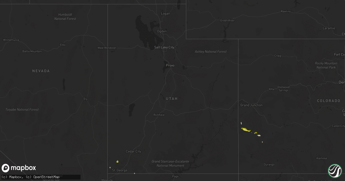
Hail Map in Utah on July 24, 2021
Get this storm
July 24 map
$229
one time, instant access
Download today. No call, no setup
Keep the $229
Bought the map and want the full workflow? Apply the entire $229 to a subscription within 7 days. None of it is wasted.
Every map, not just this one
This buys you this map. Subscription and you get every map we run, in the markets you choose from a few cities to whole states to nationwide. Plus real-time alerts the moment a storm fires.
Contact data
Name, contact info, occupancy, even credit band for addresses in the footprint. You go from where it hit to who to call.
Become the source they trust
Unlimited branding weather history reports on demand. You already have the documented answer ready for the property owner, and you are the one who showed up with it.
Property data and RoofTrace estimates
Pull up any address you have got, its value and the exact code rules for that jurisdiction, straight from One Click Code. Then RoofTrace estimates the squares, pitch, and roof value, priced the way you price.
Storm reports in Utah
Utah
| Date | Description |
|---|---|
| 07/24/20215:06 PM CDT | Hail fell at the veyo pool resort. Time estimated by radar. |
| 07/24/20213:24 PM CDT | Hildale dispatch reported 10 powerpoles down throughout the city along with multiple downed trees. Time estimated by radar. |
| 07/23/202111:04 PM CDT | At 403 PM MDT, a severe thunderstorm was located near Dameron Valley, or 22 miles southeast of Beaver Dam, moving northwest at 10 mph. HAZARD...Ping pong ball size hail and 60 mph wind gusts. SOURCE...Radar indicated. IMPACT...People and animals outdoors will be injured. Expect hail damage to roofs, siding, windows, and vehicles. Expect wind damage to roofs, siding, and trees. Locations impacted include... Dameron Valley, Veyo, Snow Canyon State Park and Gunlock. This includes Utah Route 18 between mile markers 15 and 22. |
| 07/23/202110:40 PM CDT | At 339 PM MDT, a severe thunderstorm was located 10 miles northeast of Dameron Valley, or 31 miles east of Beaver Dam, moving northwest at 10 mph. HAZARD...60 mph wind gusts and quarter size hail. SOURCE...Radar indicated. IMPACT...Hail damage to vehicles is expected. Expect wind damage to roofs, siding, and trees. Locations impacted include... Pine Valley, Pinto and Veyo. This includes Utah Route 18 between mile markers 23 and 32. |
| 07/23/202110:16 PM CDT | At 315 PM MDT, a severe thunderstorm was located 11 miles southwest of New Harmony, or 28 miles west of Zion National Park, and is nearly stationary. HAZARD...60 mph wind gusts and quarter size hail. SOURCE...Radar indicated. IMPACT...Hail damage to vehicles is expected. Expect wind damage to roofs, siding, and trees. Locations impacted include... Washington, Hurricane, New Harmony, Quail Creek State Park, Ivins, Toquerville, Leeds, Pine Valley and Snow Canyon State Park.This includes the following highways... Interstate 15 between mile markers 18 and 25. Utah Route 18 between mile markers 9 and 15. |
| 07/23/20218:26 PM CDT | At 125 PM MST, a severe thunderstorm was located over Colorado City, moving southwest at 5 mph. HAZARD...60 mph wind gusts and quarter size hail. SOURCE...Radar indicated. IMPACT...Hail damage to vehicles is expected. Expect wind damage to roofs and trees. Locations impacted include... Colorado City. |
All States Impacted by Hail Map on July 24, 2021
Cities Impacted by Hail Map on July 24, 2021
- Arapahoe, NE
- Cambridge, NE
- Eustis, NE
- Bertrand, NE
- Oxford, NE
- Edison, NE
- Holbrook, NE
- Elwood, NE
- Ganado, AZ
- Redvale, CO
- Hotevilla, AZ
- Albany, MO
- Bladen, NE
- Ayr, NE
- Blue Hill, NE
- Newark, MO
- Novelty, MO
- Guide Rock, NE
- Belleville, KS
- Peotone, IL
- Frankfort, IL
- Monee, IL
- Hollenberg, KS
- Saint George, UT
- Pinon, AZ
- Fairbury, NE
- Veyo, UT
- Lawrence, NE
- Roseland, NE
- Caliente, NV
- Bloomfield, NM
- Fence Lake, NM
- Gallup, NM
- Manhattan, IL
- New Lenox, IL
- Vermillion, KS
- Kaibeto, AZ
- Kayenta, AZ
- Polacca, AZ
- Saint Anne, IL
- Pembroke Township, IL
- Funk, NE
- Nucla, CO
- Redford, MI
- Dearborn Heights, MI
- Westland, MI
- Livonia, MI
- Placerville, CO
- Endicott, NE
- Washington, KS
- Bremen, KS
- Hanover, KS
- Peach Springs, AZ
- Orleans, NE
- Stamford, NE
- Lewistown, IL
- Ipava, IL
- Bethel, MO
- Williams, AZ
- Woodston, KS
- Long Island, KS
- Holdrege, NE
- New Lothrop, MI
- Chesaning, MI
- Owosso, MI
- Hardy, NE
- Fort Stockton, TX
- Norwood, CO
- Republic, KS
- Rockville, IN
- Hebron, NE
- Chester, NE
- Hildale, UT
- Colorado City, AZ
- Flushing, MI
- Corunna, MI
- Lennon, MI
- Ewing, MO
- La Belle, MO
- Keams Canyon, AZ
- Bedrock, CO
- Frankfort, KS
- Camden, IL
- Huntsville, IL
- Plymouth, IL
- Grants, NM
- Axtell, NE
- Durand, MI
- Gaines, MI
- Swartz Creek, MI
- Deshler, NE
- Naturita, CO
- Wilcox, NE
- Marshall, IN
- La Crosse, IN
- Wanatah, IN
- Superior, NE
- Beattie, KS
- Summerfield, KS
- Cuba, KS
- Farmington, NM
- Rutledge, MO
- Burr Oak, KS
- Campbell, NE
- Red Cloud, NE
- Holstein, NE
- Fort Davis, TX
- Centralia, KS
- Deerfield Beach, FL
- Boca Raton, FL
- Westville, IN
- Union Mills, IN
- Valparaiso, IN
- Chesterton, IN
- Michigan City, IN
- Esbon, KS
- Burbank, IL
- Chicago, IL
- Unionville, MO
- Au Gres, MI
- La Grange, IL
- Bridgeview, IL
- Summit Argo, IL
- Justice, IL
- Plymouth, MI
- Northville, MI
- Palatine, IL
- Hoffman Estates, IL
- Barrington, IL
- Stanton, TX
- Shonto, AZ
- Paradox, CO
- Flint, MI
- South Rockwood, MI
- River Rouge, MI
- Carleton, MI
- Riverview, MI
- Detroit, MI
- Novi, MI
- Southfield, MI
- Romulus, MI
- Wixom, MI
- Lincoln Park, MI
- Keego Harbor, MI
- Canton, MI
- Wyandotte, MI
- Waterford, MI
- White Lake, MI
- New Boston, MI
- Melvindale, MI
- Flat Rock, MI
- Trenton, MI
- Taylor, MI
- Southgate, MI
- Inkster, MI
- Grosse Ile, MI
- Allen Park, MI
- Rockwood, MI
- Walled Lake, MI
- Garden City, MI
- Ecorse, MI
- Farmington, MI
- Dearborn, MI
- West Bloomfield, MI
- Commerce Township, MI
- Wayne, MI
- Pontiac, MI
- Bloomfield Hills, MI
- Franklin, MI
- Armada, MI
- Munster, IN
- Whiting, IN
- Hobart, IN
- Hammond, IN
- Griffith, IN
- La Porte, IN
- Gary, IN
- Portage, IN
- Lake Station, IN
- East Chicago, IN
- Highland, IN


