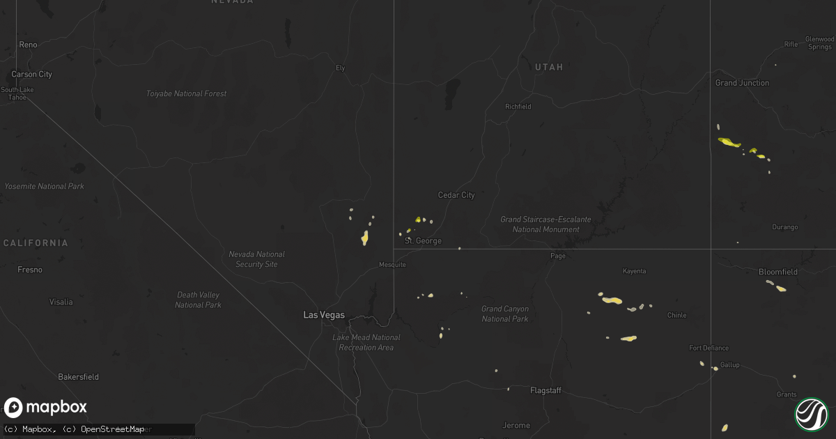
Hail Map on July 24, 2021
Get this storm
July 24 map
$229
one time, instant access
Download today. No call, no setup
Keep the $229
Bought the map and want the full workflow? Apply the entire $229 to a subscription within 7 days. None of it is wasted.
Every map, not just this one
This buys you this map. Subscription and you get every map we run, in the markets you choose from a few cities to whole states to nationwide. Plus real-time alerts the moment a storm fires.
Contact data
Name, contact info, occupancy, even credit band for addresses in the footprint. You go from where it hit to who to call.
Become the source they trust
Unlimited branding weather history reports on demand. You already have the documented answer ready for the property owner, and you are the one who showed up with it.
Property data and RoofTrace estimates
Pull up any address you have got, its value and the exact code rules for that jurisdiction, straight from One Click Code. Then RoofTrace estimates the squares, pitch, and roof value, priced the way you price.
States Impacted by Hail Map on July 24, 2021
Storm reports
Illinois
| Date | Description |
|---|---|
| 07/24/20215:14 PM CDT | Several branches up to around 3 inches in diameter downed in evergreen park. Time estimated from radar. |
| 07/24/20214:49 PM CDT | Large tree limbs downed onto a car in lincoln park. Time estimated from radar. |
| 07/24/20214:39 PM CDT | Photo shared on social media of a large tree branch downed near the i-90 and i-94 split on the northwest side of chicago. Time estimated from radar. |
| 07/24/20214:34 PM CDT | Video shared on social media of a large tree snapped in norridge. Time estimated from radar. |
| 07/24/20214:26 PM CDT | Large tree downed at intersection of oakton street and mannheim road. Time estimated using radar. |
| 07/24/20214:25 PM CDT | Large branch about foot and a half in diameter downed. Time estimated using radar. |
| 07/24/20214:12 PM CDT | Large limb and power line downed along arlington heights road north of rand road. Time estimated using radar. |
| 07/24/202112:36 AM CDT | At 535 PM CDT, a severe thunderstorm was located over Shorewood, or over south Plainfield, moving east at 30 mph. HAZARD...60 mph wind gusts. SOURCE...Radar indicated. IMPACT...Expect damage to roofs, siding, and trees. Locations impacted include... Joliet, South Plainfield, Lockport, New Lenox, Homer Glen, Channahon, Crest Hill, Shorewood, Ingalls Park, Preston Heights, Fairmont, Rockdale and Crystal Lawns.This includes... University of St. Francis, Chicagoland Speedway...Route 66 Raceway, Joliet Junior College, and Joliet SlammersBaseball. |
| 07/23/202111:26 PM CDT | At 425 PM CDT, a severe thunderstorm was located over near Ohare Airport, moving southeast at 30 mph. HAZARD...60 mph wind gusts. SOURCE...Radar indicated. IMPACT...Expect damage to roofs, siding, and trees. Locations impacted include... Chicago, Cicero, Evanston, Skokie, Oak Lawn, Berwyn, Oak Park, Park Ridge, Niles, West Town, Englewood, Chicago Lawn, Austin, West Ridge, Lincoln Park, Bridgeport, Chicago Loop, South Lawndale, Lake View and Irving Park.This includes...Brookfield Zoo, Lincoln Park Zoo, Loyola University, Triton College, University of Chicago, Hawthorne Park, Northeastern Illinois University, Soldier Field, University of Illinois Chicago, Guaranteed Rate Field...IL Institute of Technology, Wrigley Field, The Loop, Museum of Science and Industry, Museum Campus, and Northerly Island. |
| 07/23/202110:54 PM CDT | At 353 PM CDT, severe thunderstorms were located along a line extending from Arlington Heights to near Hoffman Estates, moving southeast at 30 mph. HAZARD...60 mph wind gusts. SOURCE...Radar indicated. IMPACT...Expect damage to roofs, siding, and trees. Locations impacted include... Far north side of Chicago, Arlington Heights, Evanston, Schaumburg, Palatine, Skokie, Des Plaines, Mount Prospect, Hoffman Estates, Glenview, Buffalo Grove, Bartlett, Ohare Airport, Streamwood, Carol Stream, Hanover Park, Wheeling, Park Ridge, Addison and Glendale Heights.This includes...Oakton Community College, Schaumburg Boomers Baseball, and Harper College. |
| 07/23/20218:26 PM CDT | Multiple power lines and branches downed. Time estimated using radar. |
| 07/23/20217:59 PM CDT | Multiple reports of large trees... Large tree limbs... And power lines downed in watseka. Time estimated from radar. |
| 07/23/20217:59 PM CDT | Large tree 1 to 2 feet in diameter down on power lines. Photo via social media from wcia champaign. Time estimated from radar. |
Colorado
| Date | Description |
|---|---|
| 07/24/20215:10 PM CDT | ***delayed report*** reports and photos of downed trees were taken in the town of avondale from a wet microburst that developed over the town. Timing was estimated from |
| 07/24/20214:43 PM CDT | Corrects previous tstm wnd dmg report from avondale. ***delayed report*** reports and photos of downed trees were taken in the town of avondale from a wet microburst th |
| 07/23/20218:46 PM CDT | Dime to quarter-sized hail accumulated in the yard on the east side of norwood. Report via facebook. |
Minnesota
| Date | Description |
|---|---|
| 07/24/20217:58 AM CDT | At 1258 AM CDT, a severe thunderstorm was located over Charlesville, or 24 miles south of Fergus Falls, moving east at 45 mph. HAZARD...60 mph wind gusts and quarter size hail. SOURCE...Radar indicated. IMPACT...Hail damage to vehicles is expected. Expect wind damage to roofs, siding, and trees. This severe thunderstorm will be near... Norcross around 100 AM CDT. Wendell around 105 AM CDT. Elbow Lake around 115 AM CDT.Other locations in the path of this severe thunderstorm includeBarrett, Erdahl and Hoffman.This includes Interstate 94 in Minnesota between mile markers 74 and80. |
| 07/24/202112:07 AM CDT | At 506 AM CDT, a severe thunderstorm was located over Duluth, moving east at 50 mph. HAZARD...70 mph wind gusts. SOURCE...Trained weather spotters. IMPACT...Expect considerable tree damage. Damage is likely to mobile homes, roofs, and outbuildings. Locations impacted include... Duluth, Superior, Hermantown, Proctor, Hawthorne, Iron River, Lake Nebagamon, Barnes, Maple, Brule, Poplar, Oulu, Oliver, Port Wing, Herbster, Wisconsin Point, Pike Lake Near Duluth, City of Rice Lake, French River, and South Range. |
| 07/23/20219:03 PM CDT | At 202 AM CDT, a severe thunderstorm was located near Hugo, or 20 miles northeast of St. Paul, moving east at 40 mph. HAZARD...60 mph wind gusts and quarter size hail. SOURCE...Radar indicated. IMPACT...Hail damage to vehicles is expected. Expect wind damage to roofs, siding, and trees. This severe thunderstorm will be near... Scandia around 210 AM CDT. Somerset and Osceola around 215 AM CDT. New Richmond around 220 AM CDT.Other locations in the path of this severe thunderstorm include StarPrairie, Amery and Clear Lake. |
| 07/23/20218:51 PM CDT | At 151 AM CDT, a severe thunderstorm was located over Perham, or 19 miles southeast of Detroit Lakes, moving east at 45 mph. HAZARD...60 mph wind gusts. SOURCE...Radar indicated. IMPACT...Expect damage to roofs, siding, and trees. This severe thunderstorm will be near... New York Mills around 205 AM CDT.Other locations in the path of this severe thunderstorm includeHillview, Bluffton, Sebeka, Blue Grass and Nimrod. |
| 07/23/20218:37 PM CDT | At 136 AM CDT, a severe thunderstorm was located near Melrose, or 27 miles southwest of Little Falls, moving east at 40 mph. HAZARD...60 mph wind gusts and penny size hail. SOURCE...Radar indicated. IMPACT...Expect damage to roofs, siding, and trees. This severe thunderstorm will be near... Grey Eagle around 140 AM CDT. Freeport around 145 AM CDT. St. Anthony and Albany around 150 AM CDT. Upsala around 155 AM CDT.Other locations in the path of this severe thunderstorm includeHoldingford, Bowlus and Royalton. |
| 07/23/20218:34 PM CDT | At 133 AM CDT, a severe thunderstorm was located near Underwood, or 11 miles east of Fergus Falls, moving east at 50 mph. HAZARD...60 mph wind gusts. SOURCE...Radar indicated. IMPACT...Expect damage to roofs, siding, and trees. This severe thunderstorm will be near... Battle Lake around 140 AM CDT. Clitherall around 145 AM CDT. Vining around 150 AM CDT.Other locations in the path of this severe thunderstorm includeUrbank, Henning and Almora.This includes Interstate 94 in Minnesota between mile markers 50 and74. |
| 07/23/20218:05 PM CDT | At 105 AM CDT, a severe thunderstorm was located over Frazee, or 9 miles southeast of Detroit Lakes, moving southeast at 20 mph. HAZARD...Ping pong ball size hail and 60 mph wind gusts. SOURCE...Radar indicated. IMPACT...People and animals outdoors will be injured. Expect hail damage to roofs, siding, windows, and vehicles. Expect wind damage to roofs, siding, and trees. Locations impacted include... Perham, Evergreen and Butler. |
Michigan
| Date | Description |
|---|---|
| 07/24/20216:54 PM CDT | *** 1 inj *** ef-1 tornado confirmed via nws storm survey. Winds estimated to 100 mph... With path width of 400 yards and path length of 1.8 miles. Tornado was on groun |
| 07/24/20216:52 PM CDT | Numerous trees reported down across indian springs metropark. |
| 07/24/20216:26 PM CDT | Tree on roadway. |
| 07/24/20216:25 PM CDT | Large tree branches down and house was shaking from the wind. |
| 07/24/20216:20 PM CDT | Tree limbs down. |
| 07/24/20216:19 PM CDT | Trees and power lines down in multiple locations across charlotte... Michigan. |
| 07/24/20216:18 PM CDT | Large section of tree snapped near i-96 and martin luther king blvd. Time estimated from radar. Additional reports and photos of very large limbs down have been receive |
| 07/24/20215:27 PM CDT | Reports of several large limbs down near m-21 and morrish road. |
| 07/24/20215:24 PM CDT | Report of multiple trees down and building damage |
| 07/24/20215:23 PM CDT | Siding and roof of residential home torn off. Photos sent via twitter |
| 07/24/20215:22 PM CDT | Report of a destroyed barn via photo on calkins and morrish rd |
| 07/24/20215:03 PM CDT | Tree blocking road of 8th and byron avenue. |
| 07/24/20214:56 PM CDT | 3 trees down across road. |
| 07/24/20214:54 PM CDT | Power line reported down in a field in drenthe... Mi. |
| 07/24/20214:53 PM CDT | Tree blocking road. |
| 07/24/20214:50 PM CDT | Trees and powers lines down. |
| 07/24/20214:50 PM CDT | Power lines down. |
| 07/24/20214:45 PM CDT | Dispatch reports downed wires at ormes and bray rd |
| 07/24/20214:40 PM CDT | Dispatch reports tree down on kelly and englehart rd |
| 07/24/20214:14 PM CDT | Dispatch reports several large tree limbs and power lines down in the city of saginaw. |
| 07/24/20213:45 PM CDT | 12 to 14 inch diameter tree down. Relayed via social media photo. |
| 07/24/20213:36 PM CDT | Large tree limb snapped reported via social media photo. |
| 07/24/20213:34 PM CDT | Several reports and social media photo of tornado on ground near port austin. |
| 07/24/20213:28 PM CDT | Several trees down in washington avenue park. Social media pictures included uprooted trees and a blown over portable toilet. |
| 07/24/20213:25 PM CDT | Reports of several trees and powerlines down |
| 07/24/20213:17 PM CDT | Report of a tree down on anderson rd and mackinaw rd |
| 07/24/20213:07 PM CDT | Reports of several trees and powerlines down in larkin twp |
| 07/24/20213:03 PM CDT | Multiple reports of down trees and power lines down |
| 07/24/20214:41 AM CDT | At 940 PM EDT, a line of severe thunderstorms were located from Hudson to Britton moving southeast at 40 mph. HAZARD...60 mph wind gusts. SOURCE...Radar indicated. IMPACT...Expect damage to roofs, siding, and trees. This severe thunderstorm will remain over mainly rural areas of Lenawee County, including the following locations... Seneca, Lime Creek, Munson, Ogden Center, Canandaigua, Ridgeway, Palmyra, Sand Creek, Rome Center and Jasper.People attending Lenawee County Fairgrounds should seek safe shelterimmediately! |
| 07/24/20214:30 AM CDT | At 930 PM EDT, a severe thunderstorm was located over Flat Rock, moving southeast at 35 mph. HAZARD...60 mph wind gusts. SOURCE...Radar indicated. IMPACT...Expect damage to roofs, siding, and trees. This severe thunderstorm will remain over mainly rural areas of south central Wayne County, including the following locations... Brownstown Township, Gibraltar, Allen Park, Woodhaven, Lincoln Park, Riverview, Rockwood, Southgate, South Rockwood and Melvindale. |
| 07/24/20213:50 AM CDT | At 849 PM EDT, a line of severe thunderstorms were located from Hanover to Saline moving southeast at 35 mph. HAZARD...60 mph wind gusts. SOURCE...Radar indicated. IMPACT...Expect damage to roofs, siding, and trees. Locations impacted include... Manchester, Onsted, Adrian, Tecumseh, Britton, Blissfield and Deerfield.People attending Lenawee County Fairgrounds should seek safe shelterimmediately! |
| 07/24/20213:41 AM CDT | At 841 PM EDT, severe thunderstorms were located along a line extending from near Vandercook Lake to 5 miles northeast of Litchfield, moving east at 50 mph. HAZARD...60 mph wind gusts. SOURCE...Radar indicated. IMPACT...Expect damage to roofs, siding, and trees. Locations impacted include... Jackson... Brooklyn... Vandercook Lake... Spring Arbor... Napoleon... Norvell... Pulaski... Concord... Horton... Hanover... Oak Point... Sunset Beach... Michigan Center... |
| 07/24/20213:14 AM CDT | At 814 PM EDT, severe thunderstorms were located along a line extending from near Mount Clemens to near Brighton, moving southeast at 35 mph. HAZARD...70 mph wind gusts. SOURCE...Radar indicated. IMPACT...Expect considerable tree damage. Damage is likely to mobile homes, roofs, and outbuildings. Locations impacted include... Northville, Canton, Romulus, Taylor, Greenfield Village, Flat Rock, Wyandotte, Trenton and Grosse Ile.People attending Comerica Park should seek safe shelter immediately! |
| 07/24/20213:07 AM CDT | At 806 PM EDT, a severe thunderstorm was located 7 miles north of Burlington, or 8 miles southwest of Marshall, moving east at 30 mph. HAZARD...60 mph wind gusts. SOURCE...Radar indicated. IMPACT...Expect damage to roofs, siding, and trees. Locations impacted include... Albion... Marshall... Battle Creek... Homer... Union City... Burlington... Brownlee Park... Marengo... Athens... Tekonsha... Pine Creek... Ceresco... |
| 07/24/20213:01 AM CDT | At 800 PM EDT, a severe thunderstorm was located over Rochester, or 7 miles north of Troy, moving southeast at 25 mph. HAZARD...60 mph wind gusts. SOURCE...Radar indicated. IMPACT...Expect damage to roofs, siding, and trees. This severe thunderstorm will be near... Warren and Sterling Heights around 820 PM EDT.Other locations in the path of this severe thunderstorm includeMacomb Township, Mount Clemens and St. Clair Shores.People attending Jimmy John Field should seek safe shelterimmediately! |
| 07/24/20212:49 AM CDT | At 748 PM EDT, severe thunderstorms were located along a line extending from near Elkhart to near Walkerton, moving southeast at 35 mph. HAZARD...60 mph wind gusts. SOURCE...Radar indicated. IMPACT...Expect damage to roofs, siding, and trees. Locations impacted include... South Bend, Elkhart, Mishawaka, Goshen, Warsaw, Nappanee, Bremen, Syracuse, Dunlap, Simonton Lake, Gulivoire Park, Granger, Middlebury, Osceola, Bourbon, Wakarusa, Bristol, Milford, North Webster and Millersburg.This includes Interstate 80 in Indiana between mile markers 88 and107. |
| 07/24/20212:48 AM CDT | At 748 PM EDT, severe thunderstorms were located along a line extending from near Elkhart to near Walkerton, moving southeast at 35 mph. HAZARD...60 mph wind gusts. SOURCE...Radar indicated. IMPACT...Expect damage to roofs, siding, and trees. Locations impacted include... South Bend, Elkhart, Mishawaka, Goshen, Warsaw, Nappanee, Bremen, Syracuse, Dunlap, Simonton Lake, Gulivoire Park, Granger, Middlebury, Osceola, Bourbon, Wakarusa, Bristol, Milford, North Webster and Millersburg.This includes Interstate 80 in Indiana between mile markers 88 and107. |
| 07/24/20212:40 AM CDT | At 739 PM EDT, a line of severe thunderstorms were located from Webberville to Lake Orion moving southeast at 25 mph. HAZARD...60 mph wind gusts. SOURCE...Radar indicated. IMPACT...Expect damage to roofs, siding, and trees. Locations impacted include... Milford, Novi, West Bloomfield and Northville.People attending Eddies Christmas in July Fireworks Show should seeksafe shelter immediately! |
| 07/24/20212:17 AM CDT | At 717 PM EDT, severe thunderstorms were located along a line extending from near Potterville to near Bellevue, moving east at 45 mph. HAZARD...60 mph wind gusts. SOURCE...Radar indicated. IMPACT...Expect damage to roofs, siding, and trees. Locations impacted include... Charlotte... Mason... Eaton Rapids... Potterville... Leslie... Bellevue... Stockbridge... Aurelius... Onondaga... Bunker Hill... Olivet... Brookfield... Dimondale... Dansville... Eden... Fitchburg... Holt... Gresham... |
| 07/24/20211:58 AM CDT | At 658 PM EDT, a severe thunderstorm was located near Grand Ledge, or 8 miles northwest of Lansing, moving east at 45 mph. HAZARD...60 mph wind gusts. SOURCE...Radar indicated. IMPACT...Expect damage to roofs, siding, and trees. Locations impacted include... Lansing... East Lansing... Grand Ledge... Williamston... Edgemont Park... DeWitt... Webberville... Waverly... Eagle... Wacousta... Okemos... Bath... Bell Oak... Haslett... Holt... |
| 07/24/20211:43 AM CDT | At 642 PM EDT, a severe thunderstorm was located over Lapeer, moving southeast at 35 mph. HAZARD...60 mph wind gusts. SOURCE...Radar indicated. IMPACT...Expect damage to roofs, siding, and trees. This severe thunderstorm will be near... Imlay City around 700 PM EDT.Other locations in the path of this severe thunderstorm includeDryden and Almont. |
| 07/24/20211:11 AM CDT | At 610 PM EDT, a line of severe thunderstorms were located New Lothrop to Otter Lake moving southeast at 25 mph. HAZARD...60 mph wind gusts. SOURCE...Radar indicated. IMPACT...Expect damage to roofs, siding, and trees. This severe thunderstorm will be near... Burton around 620 PM EDT. Davison around 625 PM EDT.Other locations in the path of this severe thunderstorm include GrandBlanc, Goodrich and Hadley. |
| 07/24/20211:06 AM CDT | At 605 PM EDT, a severe thunderstorm was located near New Lothrop, moving east at 40 mph. HAZARD...60 mph wind gusts. SOURCE...Radar indicated. IMPACT...Expect damage to roofs, siding, and trees. This severe thunderstorm will be near... New Lothrop around 610 PM EDT. Durand and Lennon around 615 PM EDT. |
| 07/24/202112:50 AM CDT | At 550 PM EDT, a severe thunderstorm was located near Hudsonville, or 11 miles southwest of Grand Rapids, moving east at 40 mph. HAZARD...60 mph wind gusts. SOURCE...Radar indicated. IMPACT...Expect damage to roofs, siding, and trees. Locations impacted include... Grand Rapids... Holland... Hastings... Lowell... Wyoming... Kentwood... Walker... Grandville... East Grand Rapids... Hudsonville... Zeeland... Wayland... Middleville... Caledonia... Saugatuck... Freeport... Beechwood... Jenison... Dorr... Irving... |
| 07/24/202112:49 AM CDT | At 549 PM EDT, a severe thunderstorm was located 7 miles southwest of Argyle, or 7 miles southeast of Cass City, moving east at 40 mph. HAZARD...60 mph wind gusts. SOURCE...Radar indicated. IMPACT...Expect damage to roofs, siding, and trees. This severe thunderstorm will be near... Argyle around 600 PM EDT.Other locations in the path of this severe thunderstorm includeSandusky, Deckerville and Carsonville. |
| 07/24/202112:23 AM CDT | At 522 PM EDT, a line of severe thunderstorms were located from Reese to Unionville, moving southeast at 35 mph. HAZARD...60 mph wind gusts. SOURCE...Radar indicated. IMPACT...Expect damage to roofs, siding, and trees. Locations impacted include... Kingston. |
| 07/24/202112:11 AM CDT | At 510 PM EDT, a line of severe thunderstorms were located from Marion Springs to Quanicassee moving southeast at 35 mph. HAZARD...60 mph wind gusts. SOURCE...Radar indicated. IMPACT...Expect damage to roofs, siding, and trees. Locations impacted include... Clio, Millington, Otisville, Otter Lake, Columbiaville, Lapeer and Lum. |
| 07/23/202111:57 PM CDT | At 457 PM EDT, severe thunderstorms were located along a line extending from near Quanicassee to 8 miles southeast of Ithaca, moving southeast at 40 mph. HAZARD...60 mph wind gusts. SOURCE...Radar indicated. IMPACT...Expect damage to roofs, siding, and trees. Severe thunderstorms will be near... Munger around 505 PM EDT.Other locations in the path of these severe thunderstorms includeOakley. |
| 07/23/202111:38 PM CDT | At 438 PM EDT, a severe thunderstorm was located 7 miles west of Ithaca, moving east at 35 mph. HAZARD...60 mph wind gusts. SOURCE...Radar indicated. IMPACT...Expect damage to roofs, siding, and trees. Locations impacted include... Ithaca... Sumner... North Star... Ashley... Perrinton... Pompeii... Bannister... |
| 07/23/202111:37 PM CDT | At 437 PM EDT, a severe thunderstorm was located 8 miles north of Quanicassee, or 11 miles northeast of Bay City, moving east at 45 mph. HAZARD...60 mph wind gusts and penny size hail. SOURCE...Radar indicated. IMPACT...Expect damage to roofs, siding, and trees. This severe thunderstorm will be near... Quanicassee around 440 PM EDT. Sebewaing, Akron and Unionville around 455 PM EDT.Other locations in the path of this severe thunderstorm includeOwendale, Gagetown and Cass City. |
| 07/23/202111:08 PM CDT | At 408 PM EDT, a severe thunderstorm was located near Port Austin, moving east at 35 mph. HAZARD...60 mph wind gusts. SOURCE...Radar indicated. IMPACT...Expect damage to roofs, siding, and trees. This severe thunderstorm will be near... Port Austin around 415 PM EDT. Kinde around 420 PM EDT.Other locations in the path of this severe thunderstorm include PortHope. |
| 07/23/202111:03 PM CDT | At 402 PM EDT, severe thunderstorms were located along a line extending from near Rhodes to 6 miles southwest of Mount Pleasant, moving east-southeast at 35 mph. HAZARD...60 mph wind gusts and penny size hail. SOURCE...Radar indicated. IMPACT...Expect damage to roofs, siding, and trees. Locations impacted include... Pleasant Valley and Merrill. |
| 07/23/202110:38 PM CDT | At 338 PM EDT, a severe thunderstorm was located near Beaverton, or near Gladwin, moving east at 35 mph. HAZARD...60 mph wind gusts and penny size hail. SOURCE...Radar indicated. IMPACT...Expect damage to roofs, siding, and trees. Locations impacted include... Bentley and Pinconning. |
| 07/23/202110:21 PM CDT | At 320 PM EDT, a severe thunderstorm was located 8 miles west of Beaverton, or 8 miles northeast of Clare, moving east at 30 mph. HAZARD...60 mph wind gusts and penny size hail. SOURCE...Radar indicated. IMPACT...Expect damage to roofs, siding, and trees. This severe thunderstorm will be near... Gladwin and Beaverton around 335 PM EDT.Other locations in the path of this severe thunderstorm includeWinegars, Wooden Shoe Village and Rhodes. |
| 07/23/202110:16 PM CDT | At 315 PM EDT, a severe thunderstorm was located near Au Gres, moving east at 30 mph. HAZARD...60 mph wind gusts and quarter size hail. SOURCE...Radar indicated. IMPACT...Hail damage to vehicles is expected. Expect wind damage to roofs, siding, and trees. This severe thunderstorm will remain over mainly rural areas of northeastern Arenac County. |
| 07/23/20219:58 PM CDT | At 257 PM EDT, a severe thunderstorm was located 6 miles southwest of Harrison, or 9 miles northwest of Clare, moving east at 40 mph. HAZARD...60 mph wind gusts. SOURCE...Radar indicated. IMPACT...Expect damage to roofs, siding, and trees. Locations impacted include... Clare... Farwell... Harrison... Lake... Lake George... |
| 07/23/20218:13 PM CDT | Numerous reports of tree damage at the willow metropark golf course. |
| 07/23/20217:55 PM CDT | Large tree limb down across road near moon rd and west willis rd. Reported via social media photo. |
| 07/23/20217:43 PM CDT | Damage to a gas station at the intersection of w lincoln ave and and john r.road. Time estimated based on radar. |
| 07/23/20217:33 PM CDT | Large tree limb down near 9 mile and telegraph rd. Photo relayed via social media. |
| 07/23/20217:19 PM CDT | Measured via west bloomfield mesonet. |
| 07/23/20217:19 PM CDT | Reports of multiple trees and power lines down near south commerce and wolverine lake. |
| 07/23/20217:12 PM CDT | Reports of large oak trees down on residential homes. |
| 07/23/20217:11 PM CDT | Measured by ptk asos. |
| 07/23/20217:09 PM CDT | Tree across road at l drive and 19 mile road. |
| 07/23/20217:09 PM CDT | Trees and power lines down. |
| 07/23/20217:02 PM CDT | Several trees down over maceday lake road. Large tree also fell onto a home less than a mile east of williams lake road market on williams lake road. Time estimated bas |
| 07/23/20217:01 PM CDT | Reported tornado near oxbow lake. Damage to cottage. |
| 07/23/20217:01 PM CDT | Multiple trees snapped or sheared off and powerlines down over road on intersection of armada center and spencer rd. Photos sent via twitter. |
New Mexico
| Date | Description |
|---|---|
| 07/23/202110:43 PM CDT | At 343 PM MDT, a severe thunderstorm was located near Twin Falls, or 26 miles west of Shiprock, moving west at 30 mph. HAZARD...60 mph wind gusts and quarter size hail. SOURCE...Radar indicated. IMPACT...Hail damage to vehicles is expected. Expect wind damage to roofs, siding, and trees. Locations impacted include... Twin Falls, Red Mesa, Totacon and Teec Nos Pos. |
| 07/23/202110:16 PM CDT | At 316 PM MDT, a severe thunderstorm was located near Twin Falls, or 17 miles west of Shiprock, moving west at 25 mph. HAZARD...60 mph wind gusts and quarter size hail. SOURCE...Radar indicated. IMPACT...Hail damage to vehicles is expected. Expect wind damage to roofs, siding, and trees. Locations impacted include... Twin Falls. |
| 07/23/20219:28 PM CDT | At 226 PM MDT, a severe thunderstorm was located near Manuelito, or 14 miles west of Gallup, moving west at 20 mph. HAZARD...60 mph wind gusts and quarter size hail. SOURCE...Radar indicated. IMPACT...Hail damage to vehicles is expected. Expect wind damage to roofs, siding, and trees. Locations impacted include... Oak Springs Valley, Indian Route 12. |
| 07/23/20218:31 PM CDT | At 130 PM MDT, a severe thunderstorm was located 7 miles southeast of NAPI Headquarters, or 9 miles southwest of Bloomfield, moving northwest at 20 mph. HAZARD...60 mph wind gusts and quarter size hail. SOURCE...Radar indicated. IMPACT...Hail damage to vehicles is expected. Expect wind damage to roofs, siding, and trees. Locations impacted include... Farmington, Kirtland, Ojo Amarillo, NAPI Headquarters, Fruitland, Upper Fruitland and Nenahnezad.This includes the following highways... Highway 550 between Mile Markers 143 and 148. Highway 64 between Mile Markers 36 and 60. |
| 07/23/20218:02 PM CDT | At 101 PM MDT, a severe thunderstorm was located 11 miles northwest of El Huerfano Trading Post, or 12 miles south of Bloomfield, moving northwest at 20 mph. HAZARD...60 mph wind gusts and quarter size hail. SOURCE...Radar indicated. IMPACT...Hail damage to vehicles is expected. Expect wind damage to roofs, siding, and trees. Locations impacted include... Bloomfield and NAPI Headquarters. This includes the following highways... Highway 550 between Mile Markers 133 and 150. Highway 64 between Mile Markers 55 and 62. |
Florida
| Date | Description |
|---|---|
| 07/23/20219:43 PM CDT | At 243 PM EDT, a severe thunderstorm was located over Boca Del Mar, or over Deerfield Beach, moving southeast at 10 mph. HAZARD...60 mph wind gusts and penny size hail. SOURCE...Radar indicated. IMPACT...Expect damage to roofs, siding, and trees. Locations impacted include... Fort Lauderdale, Coral Springs, Pompano Beach, Boca Raton and Deerfield Beach. |
Indiana
| Date | Description |
|---|---|
| 07/24/20216:57 PM CDT | Tree down across the road. |
| 07/24/20216:54 PM CDT | Report of a tree down on quince rd... South of 4b road. |
| 07/24/20216:50 PM CDT | Tree down at 4b and underwood road. |
| 07/24/20216:25 PM CDT | Report of power lines down at quince and sr 2. Cause unknown. |
| 07/24/20215:54 PM CDT | Photo shared on social media of large tree limb downed in highland. Time estimated from radar. |
| 07/24/20215:29 PM CDT | Couple of 2 to 3 inch diameter tree limbs downed by estimated 60 mph wind gusts. |
| 07/24/20215:00 AM CDT | At 959 PM EDT, a severe thunderstorm was located near Williamsport, or 17 miles southwest of Otterbein, moving southeast at 25 mph. HAZARD...60 mph wind gusts. SOURCE...Radar indicated. IMPACT...Expect damage to roofs, siding, and trees. This severe thunderstorm will be near... Williamsport and Attica around 1010 PM EDT.Other locations in the path of this severe thunderstorm includeNewtown.This includes Interstate 74 between mile markers 10 and 13. |
| 07/24/20214:36 AM CDT | At 935 PM EDT, a severe thunderstorm was located near Boswell, or 9 miles southwest of Fowler, moving southeast at 25 mph. HAZARD...60 mph wind gusts. SOURCE...Radar indicated. IMPACT...Expect damage to roofs, siding, and trees. This severe thunderstorm will be near... Tab around 950 PM EDT.Other locations in the path of this severe thunderstorm include PineVillage and Rainsville. |
| 07/24/20213:36 AM CDT | At 836 PM CDT, severe thunderstorms were located along a line extending from near Claytonville to near Templeton, moving south at 25 mph. HAZARD...60 mph wind gusts. SOURCE...Radar indicated. IMPACT...Expect damage to roofs, siding, and trees. Severe thunderstorms will be near... Hoopeston around 855 PM CDT.Other locations in the path of these severe thunderstorms includeRossville. |
| 07/24/20213:10 AM CDT | At 810 PM CDT/910 PM EDT/, severe thunderstorms were located along a line extending from near Remington to near Sheldon to 7 miles east of Onarga, moving southeast at 30 mph. HAZARD...60 mph wind gusts. SOURCE...Radar indicated. IMPACT...Expect damage to roofs, siding, and trees. Locations impacted include... Watseka, Fowler, Gilman, Milford, Otterbein, Oxford, Sheldon, Cissna Park, Boswell, Earl Park, Stockland, Crescent City, Danforth, Woodland, Wellington, Ambia, Dunnington, Wadena, Claytonville and Swanington.Including the following interstate... I-57 between mile markers 286 and 289. |
| 07/24/20212:24 AM CDT | At 723 PM EDT/623 PM CDT/, severe thunderstorms were located along a line extending from near New Carlisle to near Lakes Of The Four Seasons, moving southeast at 30 mph. HAZARD...60 mph wind gusts. SOURCE...Radar indicated. IMPACT...Expect damage to roofs, siding, and trees. Locations impacted include... La Porte, Plymouth, Westville, Knox, Walkerton, North Liberty, Bourbon, North Judson, Argos, Kingsford Heights, Culver, Wanatah, Hamlet, La Crosse, Koontz Lake, Tippecanoe, Oak Grove, Hanna, La Paz and Kingsbury. |
| 07/24/20212:22 AM CDT | At 721 PM CDT/821 PM EDT/, a severe thunderstorm was located near Morocco, moving southeast at 45 mph. HAZARD...60 mph wind gusts. SOURCE...Radar indicated. IMPACT...Expect damage to roofs, siding, and trees. Locations impacted include... Fowler, Kentland, Otterbein, Remington, Morocco, Oxford, Sheldon, Goodland, Brook, Boswell, Earl Park, Beaverville, Donovan, Ambia, Iroquois, Mount Ayr, Dunnington, Wadena, Swanington and Foresman.Including the following interstate... Indiana I-65 between mile markers 200 and 210. |
| 07/24/20212:17 AM CDT | At 717 PM EDT, a severe thunderstorm was located near Buchanan, moving southeast at 25 mph. HAZARD...60 mph wind gusts. SOURCE...Radar indicated. IMPACT...Expect damage to roofs, siding, and trees. Locations impacted include... South Bend, Elkhart, Mishawaka, Niles, Buchanan, Georgetown, Granger, Gulivoire Park, Simonton Lake, Osceola, Wakarusa, Edwardsburg, Lakeville, Roseland, Bertrand, Indian Village, Adamsville, Chain-o-lakes, Woodland and Jimtown.This includes Interstate 80 in Indiana between mile markers 65 and91. |
| 07/24/20211:49 AM CDT | At 649 PM EDT/549 PM CDT/, a severe thunderstorm was located near Michigan City, moving southeast at 35 mph. HAZARD...60 mph wind gusts. SOURCE...Radar indicated. IMPACT...Expect damage to roofs, siding, and trees. Locations impacted include... Michigan City, La Porte, Westville, Trail Creek, New Buffalo, Three Oaks, Long Beach, Pottawattamie Park, Shorewood-Tower Hill, Shorewood-Tower Hills-Harbert, Michiana Shores, Grand Beach, Kingsbury, Michiana, Union Pier, Waterford, New Troy, Harbert, Pinhook and Fish Lake.This includes the following highways... Interstate 80 in Indiana between mile markers 38 and 61. Interstate 94 in Indiana between mile markers 33 and 45. Interstate 94 in Michigan between mile markers 0 and 11. |
| 07/24/20211:36 AM CDT | At 634 PM CDT, a severe thunderstorm was located near Grant Park, moving southeast at 40 mph. HAZARD...70 mph wind gusts. SOURCE...Radar indicated. IMPACT...Expect considerable tree damage. Damage is likely to mobile homes, roofs, and outbuildings. Locations impacted include... Momence, Morocco, Lake Village, Roselawn, Hopkins Park, Mount Ayr, Fair Oaks, Parr, Sumava Resorts and Thayer.Including the following interstate... Indiana I-65 between mile markers 215 and 234. |
| 07/24/20211:07 AM CDT | At 607 PM CDT, severe thunderstorms were located along a line extending from near Griffith to near Crete to near Monee, moving southeast at 25 mph. HAZARD...60 mph wind gusts. SOURCE...Radar indicated. IMPACT...Expect damage to roofs, siding, and trees. Locations impacted include... Gary, Portage, Merrillville, Schererville, Hobart, Crown Point, Bourbonnais, Bradley, Cedar Lake, Steger, Lowell, Manteno, Peotone, Momence, Griffith, Dyer, St. John, Lake Station, Crete and University Park.This includes...Indiana University Northwest, Governors State University, Illiana Motor Speedway, Lake County Fairgrounds, and Will County Fairgrounds. |
| 07/24/20211:00 AM CDT | At 600 PM CDT, severe thunderstorms were located along a line extending from Burns Harbor to near Portage to Dyer, moving east at 40 mph. HAZARD...60 mph wind gusts. SOURCE...Radar indicated. IMPACT...Expect damage to roofs, siding, and trees. Locations impacted include... Portage, Valparaiso, Chesterton, Lakes of the Four Seasons, South Haven, Porter, Burns Harbor, Ogden Dunes, Town of Pines, Beverly Shores, Wheeler, Dune Acres and Malden.Including the following interstates... Indiana I-80 near mile marker 16. Indiana I-90 between mile markers 22 and 37. Indiana I-94 between mile markers 17 and 32.This includes... Valparaiso University, Indiana Dunes State Park,and Porter County Fairgrounds. |
| 07/24/202112:01 AM CDT | At 500 PM CDT, severe thunderstorms were located along a line extending from Northerly Island to Willow Springs, moving south- southeast at 25 mph. HAZARD...60 mph wind gusts. SOURCE...Radar indicated. IMPACT...Expect damage to roofs, siding, and trees. Locations impacted include... South side of Chicago, Hammond, Gary, Orland Park, Tinley Park, Oak Lawn, Calumet City, Portage, Merrillville, Chicago Heights, South Shore, Roseland, Englewood, Chicago Lawn, East Chicago, Schererville, Hobart, Burbank, Lansing and Oak Forest.This includes...Indiana University Northwest, Purdue University Northwest Hammond, SeatGeek Stadium, Windy City Thunderbolts Baseball, Hollywood Casino Amphitheatre, Moraine Valley Community College, Prairie State College, South Shore Rail Cats Baseball, and South Suburban College. |
| 07/23/20217:07 PM CDT | Tree blown down. |
Virginia
| Date | Description |
|---|---|
| 07/24/20214:25 PM CDT | Tree down on power line that resulted in several power outages. Time estimated from radar. |
| 07/24/20214:08 PM CDT | Trees down on w courthouse road near nottoway courthouse. |
| 07/24/20214:06 PM CDT | Trees down on eastbound us 460 near nottoway courthouse. |
| 07/24/20213:50 PM CDT | Siding damage on house. Also... Very heavy rain. |
| 07/24/20212:53 PM CDT | A line of trees down along us 360 causing lane closures. |
| 07/24/20212:05 AM CDT | At 705 PM EDT, a severe thunderstorm was located near Centenary, or 10 miles north of Buckingham, moving southeast at 10 mph. HAZARD...60 mph wind gusts. SOURCE...Radar indicated. IMPACT...Expect damage to roofs, siding, and trees. Locations impacted include... Buckingham... Dillwyn... Gold Hill... and Centenary. |
| 07/24/202112:13 AM CDT | At 512 PM EDT, a severe thunderstorm was located over Nottoway, or near Blackstone, moving south at 15 mph. HAZARD...60 mph wind gusts and quarter size hail. SOURCE...Radar indicated. IMPACT...Minor damage to vehicles is possible. Expect wind damage to trees and powerlines. This severe thunderstorm will be near, Victoria around 550 PM EDT. Kenbridge around 555 PM EDT.Other locations impacted by this severe thunderstorm include TheFalls, Irby and Murdocks. |
| 07/23/202111:30 PM CDT | At 430 PM EDT, a severe thunderstorm was located near Crewe, moving south at 10 mph. HAZARD...60 mph wind gusts and quarter size hail. SOURCE...Radar indicated. IMPACT...Minor damage to vehicles is possible. Expect wind damage to trees and powerlines. This severe thunderstorm will be near, Crewe around 445 PM EDT. Nottoway around 510 PM EDT. Blackstone around 515 PM EDT.Other locations impacted by this severe thunderstorm include Irby,Dominy Corner, Fergusonville, Jennings Ordinary, Murdocks, Forkland,Blackstone Airport, The Falls, Rubermount and Pattersons Store. |
| 07/23/202110:18 PM CDT | At 318 PM EDT, a severe thunderstorm was located near Amelia Courthouse, moving south at 10 mph. HAZARD...60 mph wind gusts and quarter size hail. SOURCE...Radar indicated. IMPACT...Minor damage to vehicles is possible. Expect wind damage to trees and powerlines. This severe thunderstorm will be near, Amelia Courthouse around 335 PM EDT. Scotts Fork around 350 PM EDT. Jetersville around 355 PM EDT.Other locations impacted by this severe thunderstorm includePaineville, Maplewood, Fergusonville, Jennings Ordinary, Earls,Lodore, Truxillo, Clay Store, Denaro and Winterham. |
North Dakota
| Date | Description |
|---|---|
| 07/24/20217:43 AM CDT | At 1243 AM CDT, a severe thunderstorm was located over Rosholt, or 9 miles west of Wheaton, moving east at 35 mph. HAZARD...60 mph wind gusts and penny size hail. SOURCE...Radar indicated. IMPACT...Expect damage to roofs, siding, and trees. This severe thunderstorm will be near... Silver Bridge around 1250 AM CDT. Mud Lake Landing around 1255 AM CDT. Wheaton around 100 AM CDT.Other locations in the path of this severe thunderstorm includeImmanuel Church. |
| 07/24/20217:41 AM CDT | At 1241 AM CDT, a severe thunderstorm was located near Foxhome, or 13 miles southwest of Fergus Falls, moving east at 40 mph. HAZARD...60 mph wind gusts and half dollar size hail. SOURCE...Radar indicated. IMPACT...Hail damage to vehicles is expected. Expect wind damage to roofs, siding, and trees. This severe thunderstorm will be near... Western around 1250 AM CDT. Fergus Falls around 100 AM CDT.Other locations in the path of this severe thunderstorm includeDalton, Ashby and Underwood.This includes Interstate 94 in Minnesota between mile markers 52 and73. |
Nevada
| Date | Description |
|---|---|
| 07/24/202112:42 AM CDT | At 541 PM PDT, a severe thunderstorm was located 14 miles west of Valley Of Fire, or 14 miles southwest of Moapa Town, moving southwest at 10 mph. HAZARD...60 mph wind gusts and quarter size hail. SOURCE...Radar indicated. IMPACT...Hail damage to vehicles is expected. Expect wind damage to roofs and trees. This severe thunderstorm will remain over mainly rural areas of north central Clark County.This includes Interstate 15 in Nevada between mile markers 60 and 80. |
| 07/23/202111:42 PM CDT | At 442 PM PDT, a severe thunderstorm was located 23 miles south of Cabin Pines Campground, or 30 miles south of Caliente, moving southwest at 30 mph. HAZARD...60 mph wind gusts and quarter size hail. SOURCE...Radar indicated. IMPACT...Hail damage to vehicles is expected. Expect wind damage to roofs and trees. Locations impacted include... Carp. |
| 07/23/202110:53 PM CDT | A local report indicates 62 MPH wind near 3 SW MERCURY |
| 07/23/202110:15 PM CDT | A local report indicates 58 MPH wind near 3 SSW MERCURY |
Ohio
| Date | Description |
|---|---|
| 07/24/20216:36 AM CDT | At 1135 PM EDT, a severe thunderstorm was located near Clyde, or 7 miles east of Fremont, moving east at 60 mph. HAZARD...60 mph wind gusts. SOURCE...Radar indicated. IMPACT...Expect damage to trees and power lines. This severe thunderstorm will be near... Bellevue around 1140 PM EDT. Castalia around 1145 PM EDT. Sandusky, Northern Milan and Milan around 1155 PM EDT. Norwalk around 1200 AM EDT. Wakeman around 1205 AM EDT.Other locations impacted by this severe thunderstorm include WhitesLanding, Ballville, Bloomingville, Monroeville, Sandusky South,Vickery, Berlin Heights, Birmingham and Fairview Lanes. |
| 07/24/20213:58 AM CDT | At 858 PM EDT, severe thunderstorms were located along a line extending from near Belleville to near Manchester, moving east at 40 mph. HAZARD...60 mph wind gusts. SOURCE...Radar indicated. IMPACT...Expect damage to roofs, siding, and trees. Severe thunderstorms will be near... Flat Rock around 915 PM EDT.Other locations in the path of these severe thunderstorms includeMilan, Dundee, Ida, Maybee, Monroe and Luna Pier. |
| 07/23/202111:10 PM CDT | Tree down at the intersection of fitchville river and cook roads. Time estimated by radar. |
Kansas
| Date | Description |
|---|---|
| 07/24/20216:01 PM CDT | A local report indicates 60 MPH wind near 1 W LOGAN |
| 07/24/202112:44 AM CDT | Asos station kddc dodge city regional airport. |
Utah
| Date | Description |
|---|---|
| 07/24/20215:06 PM CDT | Hail fell at the veyo pool resort. Time estimated by radar. |
| 07/24/20213:24 PM CDT | Hildale dispatch reported 10 powerpoles down throughout the city along with multiple downed trees. Time estimated by radar. |
| 07/23/202111:04 PM CDT | At 403 PM MDT, a severe thunderstorm was located near Dameron Valley, or 22 miles southeast of Beaver Dam, moving northwest at 10 mph. HAZARD...Ping pong ball size hail and 60 mph wind gusts. SOURCE...Radar indicated. IMPACT...People and animals outdoors will be injured. Expect hail damage to roofs, siding, windows, and vehicles. Expect wind damage to roofs, siding, and trees. Locations impacted include... Dameron Valley, Veyo, Snow Canyon State Park and Gunlock. This includes Utah Route 18 between mile markers 15 and 22. |
| 07/23/202110:40 PM CDT | At 339 PM MDT, a severe thunderstorm was located 10 miles northeast of Dameron Valley, or 31 miles east of Beaver Dam, moving northwest at 10 mph. HAZARD...60 mph wind gusts and quarter size hail. SOURCE...Radar indicated. IMPACT...Hail damage to vehicles is expected. Expect wind damage to roofs, siding, and trees. Locations impacted include... Pine Valley, Pinto and Veyo. This includes Utah Route 18 between mile markers 23 and 32. |
| 07/23/202110:16 PM CDT | At 315 PM MDT, a severe thunderstorm was located 11 miles southwest of New Harmony, or 28 miles west of Zion National Park, and is nearly stationary. HAZARD...60 mph wind gusts and quarter size hail. SOURCE...Radar indicated. IMPACT...Hail damage to vehicles is expected. Expect wind damage to roofs, siding, and trees. Locations impacted include... Washington, Hurricane, New Harmony, Quail Creek State Park, Ivins, Toquerville, Leeds, Pine Valley and Snow Canyon State Park.This includes the following highways... Interstate 15 between mile markers 18 and 25. Utah Route 18 between mile markers 9 and 15. |
| 07/23/20218:26 PM CDT | At 125 PM MST, a severe thunderstorm was located over Colorado City, moving southwest at 5 mph. HAZARD...60 mph wind gusts and quarter size hail. SOURCE...Radar indicated. IMPACT...Hail damage to vehicles is expected. Expect wind damage to roofs and trees. Locations impacted include... Colorado City. |
Nebraska
| Date | Description |
|---|---|
| 07/24/20215:21 AM CDT | A local report indicates 62 MPH wind near 7 NNW BOSTWICK |
Arizona
| Date | Description |
|---|---|
| 07/24/20213:30 PM CDT | Approximately 20 power poles snapped along oak street and mohave avenue. |
| 07/24/202112:30 AM CDT | At 529 PM MST/629 PM MDT/, a severe thunderstorm was located near Cow Springs and Navajo Trail, moving northwest at 15 mph. HAZARD...Half dollar size hail. SOURCE...Radar indicated. IMPACT...Damage to vehicles is expected. Locations impacted include... Cow Springs. |
| 07/23/202111:58 PM CDT | At 457 PM MST/557 PM MDT/, a severe thunderstorm was located 11 miles west of Forest Lake Chapter House, or 39 miles northwest of Keams Canyon, moving west at 15 mph. HAZARD...Quarter size hail. SOURCE...Radar indicated. IMPACT...Damage to vehicles is expected. This severe thunderstorm will remain over mainly rural areas of Navajo County. |
| 07/23/202111:51 PM CDT | At 450 PM MST, a severe thunderstorm was located over First Mesa, or 8 miles west of Keams Canyon, moving west at 10 mph. HAZARD...Half dollar size hail. Wind gusts to 50 mph. SOURCE...Radar indicated. IMPACT...Damage to vehicles is expected. Locations impacted include... First Mesa, Second Mesa, Shongopovi, Polacca and Hopi Reservation. |
| 07/23/202111:30 PM CDT | At 430 PM MDT, a severe thunderstorm was located 11 miles southwest of Gunlock State Park, or 17 miles northwest of Virgin River Gorge, moving southwest at 20 mph. HAZARD...Ping pong ball size hail and 60 mph wind gusts. SOURCE...Radar indicated. IMPACT...People and animals outdoors will be injured. Expect hail damage to roofs, siding, windows, and vehicles. Expect wind damage to roofs, siding, and trees. This severe thunderstorm will remain over mainly rural areas of west central Washington County. |
| 07/23/202111:20 PM CDT | At 419 PM MST, a severe thunderstorm was located near Keams Canyon, moving west at 10 mph. HAZARD...60 mph wind gusts and quarter size hail. SOURCE...Radar indicated. IMPACT...Hail damage to vehicles is expected. Expect wind damage to roofs, siding, and trees. Locations impacted include... Keams Canyon, First Mesa and Polacca. |
| 07/23/202110:55 PM CDT | At 355 PM MDT, a severe thunderstorm was located 9 miles northwest of Fence Lake, or 25 miles south of Zuni Pueblo, moving southwest at 30 mph. HAZARD...60 mph wind gusts and quarter size hail. SOURCE...Radar indicated. IMPACT...Hail damage to vehicles is expected. Expect wind damage to roofs, siding, and trees. This severe thunderstorm will remain over mainly rural areas of southwestern Cibola and northwestern Catron Counties. |
| 07/23/202110:18 PM CDT | At 318 PM MST, a severe thunderstorm was located 16 miles northwest of Bar Ten Ranch, or 40 miles southeast of Littlefield, moving west at 15 mph. HAZARD...60 mph wind gusts and quarter size hail. SOURCE...Radar indicated. IMPACT...Hail damage to vehicles is expected. Expect wind damage to roofs and trees. Locations impacted include... Mt. Trumbull, Toroweap Campground, Bar Ten Ranch and Tuweep. |
| 07/23/20219:56 PM CDT | At 254 PM MDT, a severe thunderstorm was located 7 miles northwest of Oak Springs Valley, or 26 miles west of Gallup, moving northwest at 30 mph. HAZARD...60 mph wind gusts and quarter size hail. SOURCE...Radar indicated. IMPACT...Hail damage to vehicles is expected. Expect wind damage to roofs, siding, and trees. This severe thunderstorm will remain over mainly rural areas of Apache County. |
| 07/23/20219:24 PM CDT | At 222 PM MDT, a severe thunderstorm was located over Colorado City, moving southwest at 15 mph. HAZARD...Quarter size hail. SOURCE...Radar indicated. IMPACT...Damage to vehicles is expected. Locations impacted include... Hildale. |
Cities Impacted by Hail Map on July 24, 2021
- Arapahoe, NE
- Cambridge, NE
- Eustis, NE
- Bertrand, NE
- Oxford, NE
- Edison, NE
- Holbrook, NE
- Elwood, NE
- Ganado, AZ
- Redvale, CO
- Hotevilla, AZ
- Albany, MO
- Bladen, NE
- Ayr, NE
- Blue Hill, NE
- Newark, MO
- Novelty, MO
- Guide Rock, NE
- Belleville, KS
- Peotone, IL
- Frankfort, IL
- Monee, IL
- Hollenberg, KS
- Saint George, UT
- Pinon, AZ
- Fairbury, NE
- Veyo, UT
- Lawrence, NE
- Roseland, NE
- Caliente, NV
- Bloomfield, NM
- Fence Lake, NM
- Gallup, NM
- Manhattan, IL
- New Lenox, IL
- Vermillion, KS
- Kaibeto, AZ
- Kayenta, AZ
- Polacca, AZ
- Saint Anne, IL
- Pembroke Township, IL
- Funk, NE
- Nucla, CO
- Redford, MI
- Dearborn Heights, MI
- Westland, MI
- Livonia, MI
- Placerville, CO
- Endicott, NE
- Washington, KS
- Bremen, KS
- Hanover, KS
- Peach Springs, AZ
- Orleans, NE
- Stamford, NE
- Lewistown, IL
- Ipava, IL
- Bethel, MO
- Williams, AZ
- Woodston, KS
- Long Island, KS
- Holdrege, NE
- New Lothrop, MI
- Chesaning, MI
- Owosso, MI
- Hardy, NE
- Fort Stockton, TX
- Norwood, CO
- Republic, KS
- Rockville, IN
- Hebron, NE
- Chester, NE
- Hildale, UT
- Colorado City, AZ
- Flushing, MI
- Corunna, MI
- Lennon, MI
- Ewing, MO
- La Belle, MO
- Keams Canyon, AZ
- Bedrock, CO
- Frankfort, KS
- Camden, IL
- Huntsville, IL
- Plymouth, IL
- Grants, NM
- Axtell, NE
- Durand, MI
- Gaines, MI
- Swartz Creek, MI
- Deshler, NE
- Naturita, CO
- Wilcox, NE
- Marshall, IN
- La Crosse, IN
- Wanatah, IN
- Superior, NE
- Beattie, KS
- Summerfield, KS
- Cuba, KS
- Farmington, NM
- Rutledge, MO
- Burr Oak, KS
- Campbell, NE
- Red Cloud, NE
- Holstein, NE
- Fort Davis, TX
- Centralia, KS
- Deerfield Beach, FL
- Boca Raton, FL
- Westville, IN
- Union Mills, IN
- Valparaiso, IN
- Chesterton, IN
- Michigan City, IN
- Esbon, KS
- Burbank, IL
- Chicago, IL
- Unionville, MO
- Au Gres, MI
- La Grange, IL
- Bridgeview, IL
- Summit Argo, IL
- Justice, IL
- Plymouth, MI
- Northville, MI
- Palatine, IL
- Hoffman Estates, IL
- Barrington, IL
- Stanton, TX
- Shonto, AZ
- Paradox, CO
- Flint, MI
- South Rockwood, MI
- River Rouge, MI
- Carleton, MI
- Riverview, MI
- Detroit, MI
- Novi, MI
- Southfield, MI
- Romulus, MI
- Wixom, MI
- Lincoln Park, MI
- Keego Harbor, MI
- Canton, MI
- Wyandotte, MI
- Waterford, MI
- White Lake, MI
- New Boston, MI
- Melvindale, MI
- Flat Rock, MI
- Trenton, MI
- Taylor, MI
- Southgate, MI
- Inkster, MI
- Grosse Ile, MI
- Allen Park, MI
- Rockwood, MI
- Walled Lake, MI
- Garden City, MI
- Ecorse, MI
- Farmington, MI
- Dearborn, MI
- West Bloomfield, MI
- Commerce Township, MI
- Wayne, MI
- Pontiac, MI
- Bloomfield Hills, MI
- Franklin, MI
- Armada, MI
- Munster, IN
- Whiting, IN
- Hobart, IN
- Hammond, IN
- Griffith, IN
- La Porte, IN
- Gary, IN
- Portage, IN
- Lake Station, IN
- East Chicago, IN
- Highland, IN