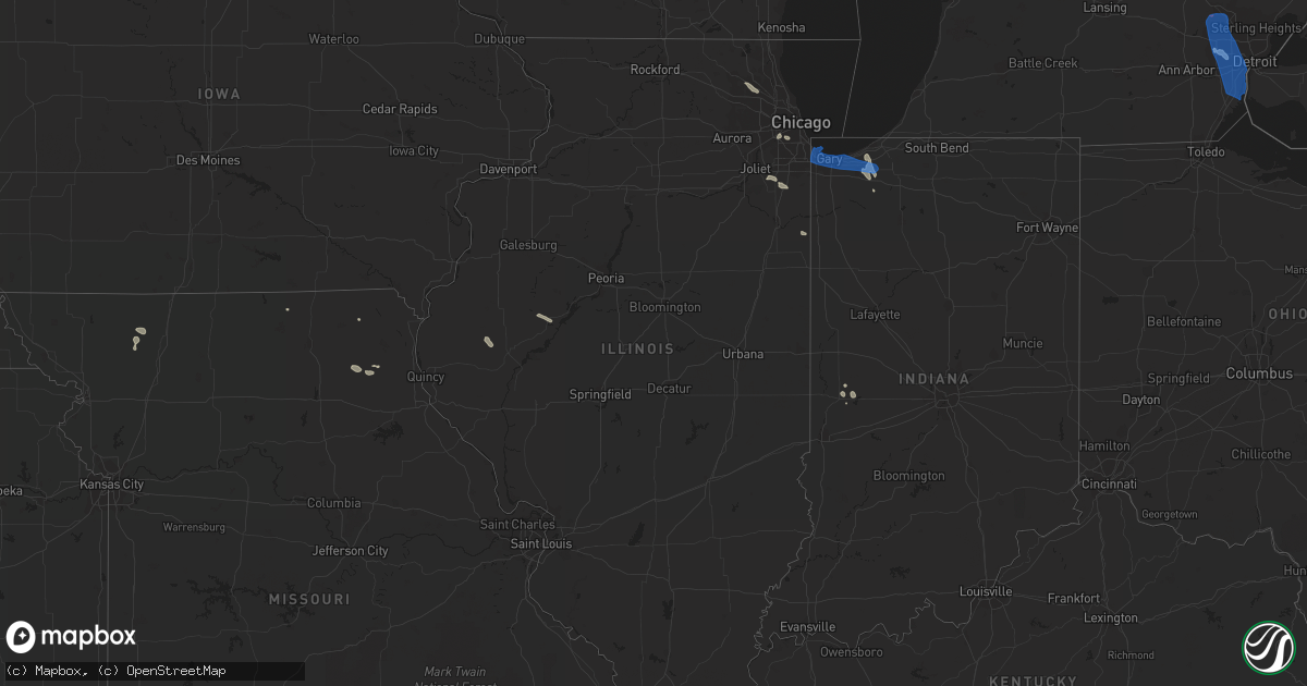
Hail Map in Illinois on July 24, 2021
Get this storm
July 24 map
$229
one time, instant access
Download today. No call, no setup
Keep the $229
Bought the map and want the full workflow? Apply the entire $229 to a subscription within 7 days. None of it is wasted.
Every map, not just this one
This buys you this map. Subscription and you get every map we run, in the markets you choose from a few cities to whole states to nationwide. Plus real-time alerts the moment a storm fires.
Contact data
Name, contact info, occupancy, even credit band for addresses in the footprint. You go from where it hit to who to call.
Become the source they trust
Unlimited branding weather history reports on demand. You already have the documented answer ready for the property owner, and you are the one who showed up with it.
Property data and RoofTrace estimates
Pull up any address you have got, its value and the exact code rules for that jurisdiction, straight from One Click Code. Then RoofTrace estimates the squares, pitch, and roof value, priced the way you price.
Storm reports in Illinois
Illinois
| Date | Description |
|---|---|
| 07/24/20215:14 PM CDT | Several branches up to around 3 inches in diameter downed in evergreen park. Time estimated from radar. |
| 07/24/20214:49 PM CDT | Large tree limbs downed onto a car in lincoln park. Time estimated from radar. |
| 07/24/20214:39 PM CDT | Photo shared on social media of a large tree branch downed near the i-90 and i-94 split on the northwest side of chicago. Time estimated from radar. |
| 07/24/20214:34 PM CDT | Video shared on social media of a large tree snapped in norridge. Time estimated from radar. |
| 07/24/20214:26 PM CDT | Large tree downed at intersection of oakton street and mannheim road. Time estimated using radar. |
| 07/24/20214:25 PM CDT | Large branch about foot and a half in diameter downed. Time estimated using radar. |
| 07/24/20214:12 PM CDT | Large limb and power line downed along arlington heights road north of rand road. Time estimated using radar. |
| 07/24/202112:36 AM CDT | At 535 PM CDT, a severe thunderstorm was located over Shorewood, or over south Plainfield, moving east at 30 mph. HAZARD...60 mph wind gusts. SOURCE...Radar indicated. IMPACT...Expect damage to roofs, siding, and trees. Locations impacted include... Joliet, South Plainfield, Lockport, New Lenox, Homer Glen, Channahon, Crest Hill, Shorewood, Ingalls Park, Preston Heights, Fairmont, Rockdale and Crystal Lawns.This includes... University of St. Francis, Chicagoland Speedway...Route 66 Raceway, Joliet Junior College, and Joliet SlammersBaseball. |
| 07/23/202111:26 PM CDT | At 425 PM CDT, a severe thunderstorm was located over near Ohare Airport, moving southeast at 30 mph. HAZARD...60 mph wind gusts. SOURCE...Radar indicated. IMPACT...Expect damage to roofs, siding, and trees. Locations impacted include... Chicago, Cicero, Evanston, Skokie, Oak Lawn, Berwyn, Oak Park, Park Ridge, Niles, West Town, Englewood, Chicago Lawn, Austin, West Ridge, Lincoln Park, Bridgeport, Chicago Loop, South Lawndale, Lake View and Irving Park.This includes...Brookfield Zoo, Lincoln Park Zoo, Loyola University, Triton College, University of Chicago, Hawthorne Park, Northeastern Illinois University, Soldier Field, University of Illinois Chicago, Guaranteed Rate Field...IL Institute of Technology, Wrigley Field, The Loop, Museum of Science and Industry, Museum Campus, and Northerly Island. |
| 07/23/202110:54 PM CDT | At 353 PM CDT, severe thunderstorms were located along a line extending from Arlington Heights to near Hoffman Estates, moving southeast at 30 mph. HAZARD...60 mph wind gusts. SOURCE...Radar indicated. IMPACT...Expect damage to roofs, siding, and trees. Locations impacted include... Far north side of Chicago, Arlington Heights, Evanston, Schaumburg, Palatine, Skokie, Des Plaines, Mount Prospect, Hoffman Estates, Glenview, Buffalo Grove, Bartlett, Ohare Airport, Streamwood, Carol Stream, Hanover Park, Wheeling, Park Ridge, Addison and Glendale Heights.This includes...Oakton Community College, Schaumburg Boomers Baseball, and Harper College. |
| 07/23/20218:26 PM CDT | Multiple power lines and branches downed. Time estimated using radar. |
| 07/23/20217:59 PM CDT | Multiple reports of large trees... Large tree limbs... And power lines downed in watseka. Time estimated from radar. |
| 07/23/20217:59 PM CDT | Large tree 1 to 2 feet in diameter down on power lines. Photo via social media from wcia champaign. Time estimated from radar. |
All States Impacted by Hail Map on July 24, 2021
Cities Impacted by Hail Map on July 24, 2021
- Arapahoe, NE
- Cambridge, NE
- Eustis, NE
- Bertrand, NE
- Oxford, NE
- Edison, NE
- Holbrook, NE
- Elwood, NE
- Ganado, AZ
- Redvale, CO
- Hotevilla, AZ
- Albany, MO
- Bladen, NE
- Ayr, NE
- Blue Hill, NE
- Newark, MO
- Novelty, MO
- Guide Rock, NE
- Belleville, KS
- Peotone, IL
- Frankfort, IL
- Monee, IL
- Hollenberg, KS
- Saint George, UT
- Pinon, AZ
- Fairbury, NE
- Veyo, UT
- Lawrence, NE
- Roseland, NE
- Caliente, NV
- Bloomfield, NM
- Fence Lake, NM
- Gallup, NM
- Manhattan, IL
- New Lenox, IL
- Vermillion, KS
- Kaibeto, AZ
- Kayenta, AZ
- Polacca, AZ
- Saint Anne, IL
- Pembroke Township, IL
- Funk, NE
- Nucla, CO
- Redford, MI
- Dearborn Heights, MI
- Westland, MI
- Livonia, MI
- Placerville, CO
- Endicott, NE
- Washington, KS
- Bremen, KS
- Hanover, KS
- Peach Springs, AZ
- Orleans, NE
- Stamford, NE
- Lewistown, IL
- Ipava, IL
- Bethel, MO
- Williams, AZ
- Woodston, KS
- Long Island, KS
- Holdrege, NE
- New Lothrop, MI
- Chesaning, MI
- Owosso, MI
- Hardy, NE
- Fort Stockton, TX
- Norwood, CO
- Republic, KS
- Rockville, IN
- Hebron, NE
- Chester, NE
- Hildale, UT
- Colorado City, AZ
- Flushing, MI
- Corunna, MI
- Lennon, MI
- Ewing, MO
- La Belle, MO
- Keams Canyon, AZ
- Bedrock, CO
- Frankfort, KS
- Camden, IL
- Huntsville, IL
- Plymouth, IL
- Grants, NM
- Axtell, NE
- Durand, MI
- Gaines, MI
- Swartz Creek, MI
- Deshler, NE
- Naturita, CO
- Wilcox, NE
- Marshall, IN
- La Crosse, IN
- Wanatah, IN
- Superior, NE
- Beattie, KS
- Summerfield, KS
- Cuba, KS
- Farmington, NM
- Rutledge, MO
- Burr Oak, KS
- Campbell, NE
- Red Cloud, NE
- Holstein, NE
- Fort Davis, TX
- Centralia, KS
- Deerfield Beach, FL
- Boca Raton, FL
- Westville, IN
- Union Mills, IN
- Valparaiso, IN
- Chesterton, IN
- Michigan City, IN
- Esbon, KS
- Burbank, IL
- Chicago, IL
- Unionville, MO
- Au Gres, MI
- La Grange, IL
- Bridgeview, IL
- Summit Argo, IL
- Justice, IL
- Plymouth, MI
- Northville, MI
- Palatine, IL
- Hoffman Estates, IL
- Barrington, IL
- Stanton, TX
- Shonto, AZ
- Paradox, CO
- Flint, MI
- South Rockwood, MI
- River Rouge, MI
- Carleton, MI
- Riverview, MI
- Detroit, MI
- Novi, MI
- Southfield, MI
- Romulus, MI
- Wixom, MI
- Lincoln Park, MI
- Keego Harbor, MI
- Canton, MI
- Wyandotte, MI
- Waterford, MI
- White Lake, MI
- New Boston, MI
- Melvindale, MI
- Flat Rock, MI
- Trenton, MI
- Taylor, MI
- Southgate, MI
- Inkster, MI
- Grosse Ile, MI
- Allen Park, MI
- Rockwood, MI
- Walled Lake, MI
- Garden City, MI
- Ecorse, MI
- Farmington, MI
- Dearborn, MI
- West Bloomfield, MI
- Commerce Township, MI
- Wayne, MI
- Pontiac, MI
- Bloomfield Hills, MI
- Franklin, MI
- Armada, MI
- Munster, IN
- Whiting, IN
- Hobart, IN
- Hammond, IN
- Griffith, IN
- La Porte, IN
- Gary, IN
- Portage, IN
- Lake Station, IN
- East Chicago, IN
- Highland, IN


