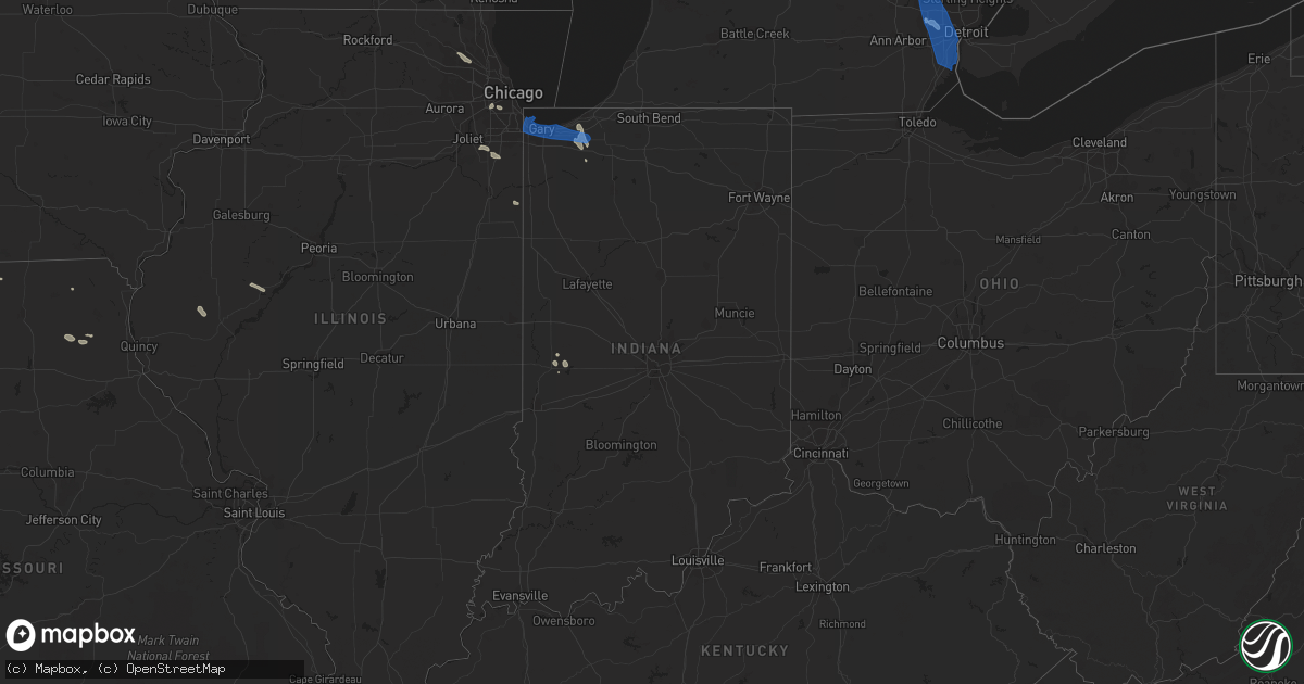
Hail Map in Indiana on July 24, 2021
Get this storm
July 24 map
$229
one time, instant access
Download today. No call, no setup
Keep the $229
Bought the map and want the full workflow? Apply the entire $229 to a subscription within 7 days. None of it is wasted.
Every map, not just this one
This buys you this map. Subscription and you get every map we run, in the markets you choose from a few cities to whole states to nationwide. Plus real-time alerts the moment a storm fires.
Contact data
Name, contact info, occupancy, even credit band for addresses in the footprint. You go from where it hit to who to call.
Become the source they trust
Unlimited branding weather history reports on demand. You already have the documented answer ready for the property owner, and you are the one who showed up with it.
Property data and RoofTrace estimates
Pull up any address you have got, its value and the exact code rules for that jurisdiction, straight from One Click Code. Then RoofTrace estimates the squares, pitch, and roof value, priced the way you price.
Storm reports in Indiana
Indiana
| Date | Description |
|---|---|
| 07/24/20216:57 PM CDT | Tree down across the road. |
| 07/24/20216:54 PM CDT | Report of a tree down on quince rd... South of 4b road. |
| 07/24/20216:50 PM CDT | Tree down at 4b and underwood road. |
| 07/24/20216:25 PM CDT | Report of power lines down at quince and sr 2. Cause unknown. |
| 07/24/20215:54 PM CDT | Photo shared on social media of large tree limb downed in highland. Time estimated from radar. |
| 07/24/20215:29 PM CDT | Couple of 2 to 3 inch diameter tree limbs downed by estimated 60 mph wind gusts. |
| 07/24/20215:00 AM CDT | At 959 PM EDT, a severe thunderstorm was located near Williamsport, or 17 miles southwest of Otterbein, moving southeast at 25 mph. HAZARD...60 mph wind gusts. SOURCE...Radar indicated. IMPACT...Expect damage to roofs, siding, and trees. This severe thunderstorm will be near... Williamsport and Attica around 1010 PM EDT.Other locations in the path of this severe thunderstorm includeNewtown.This includes Interstate 74 between mile markers 10 and 13. |
| 07/24/20214:36 AM CDT | At 935 PM EDT, a severe thunderstorm was located near Boswell, or 9 miles southwest of Fowler, moving southeast at 25 mph. HAZARD...60 mph wind gusts. SOURCE...Radar indicated. IMPACT...Expect damage to roofs, siding, and trees. This severe thunderstorm will be near... Tab around 950 PM EDT.Other locations in the path of this severe thunderstorm include PineVillage and Rainsville. |
| 07/24/20213:36 AM CDT | At 836 PM CDT, severe thunderstorms were located along a line extending from near Claytonville to near Templeton, moving south at 25 mph. HAZARD...60 mph wind gusts. SOURCE...Radar indicated. IMPACT...Expect damage to roofs, siding, and trees. Severe thunderstorms will be near... Hoopeston around 855 PM CDT.Other locations in the path of these severe thunderstorms includeRossville. |
| 07/24/20213:10 AM CDT | At 810 PM CDT/910 PM EDT/, severe thunderstorms were located along a line extending from near Remington to near Sheldon to 7 miles east of Onarga, moving southeast at 30 mph. HAZARD...60 mph wind gusts. SOURCE...Radar indicated. IMPACT...Expect damage to roofs, siding, and trees. Locations impacted include... Watseka, Fowler, Gilman, Milford, Otterbein, Oxford, Sheldon, Cissna Park, Boswell, Earl Park, Stockland, Crescent City, Danforth, Woodland, Wellington, Ambia, Dunnington, Wadena, Claytonville and Swanington.Including the following interstate... I-57 between mile markers 286 and 289. |
| 07/24/20212:24 AM CDT | At 723 PM EDT/623 PM CDT/, severe thunderstorms were located along a line extending from near New Carlisle to near Lakes Of The Four Seasons, moving southeast at 30 mph. HAZARD...60 mph wind gusts. SOURCE...Radar indicated. IMPACT...Expect damage to roofs, siding, and trees. Locations impacted include... La Porte, Plymouth, Westville, Knox, Walkerton, North Liberty, Bourbon, North Judson, Argos, Kingsford Heights, Culver, Wanatah, Hamlet, La Crosse, Koontz Lake, Tippecanoe, Oak Grove, Hanna, La Paz and Kingsbury. |
| 07/24/20212:22 AM CDT | At 721 PM CDT/821 PM EDT/, a severe thunderstorm was located near Morocco, moving southeast at 45 mph. HAZARD...60 mph wind gusts. SOURCE...Radar indicated. IMPACT...Expect damage to roofs, siding, and trees. Locations impacted include... Fowler, Kentland, Otterbein, Remington, Morocco, Oxford, Sheldon, Goodland, Brook, Boswell, Earl Park, Beaverville, Donovan, Ambia, Iroquois, Mount Ayr, Dunnington, Wadena, Swanington and Foresman.Including the following interstate... Indiana I-65 between mile markers 200 and 210. |
| 07/24/20212:17 AM CDT | At 717 PM EDT, a severe thunderstorm was located near Buchanan, moving southeast at 25 mph. HAZARD...60 mph wind gusts. SOURCE...Radar indicated. IMPACT...Expect damage to roofs, siding, and trees. Locations impacted include... South Bend, Elkhart, Mishawaka, Niles, Buchanan, Georgetown, Granger, Gulivoire Park, Simonton Lake, Osceola, Wakarusa, Edwardsburg, Lakeville, Roseland, Bertrand, Indian Village, Adamsville, Chain-o-lakes, Woodland and Jimtown.This includes Interstate 80 in Indiana between mile markers 65 and91. |
| 07/24/20211:49 AM CDT | At 649 PM EDT/549 PM CDT/, a severe thunderstorm was located near Michigan City, moving southeast at 35 mph. HAZARD...60 mph wind gusts. SOURCE...Radar indicated. IMPACT...Expect damage to roofs, siding, and trees. Locations impacted include... Michigan City, La Porte, Westville, Trail Creek, New Buffalo, Three Oaks, Long Beach, Pottawattamie Park, Shorewood-Tower Hill, Shorewood-Tower Hills-Harbert, Michiana Shores, Grand Beach, Kingsbury, Michiana, Union Pier, Waterford, New Troy, Harbert, Pinhook and Fish Lake.This includes the following highways... Interstate 80 in Indiana between mile markers 38 and 61. Interstate 94 in Indiana between mile markers 33 and 45. Interstate 94 in Michigan between mile markers 0 and 11. |
| 07/24/20211:36 AM CDT | At 634 PM CDT, a severe thunderstorm was located near Grant Park, moving southeast at 40 mph. HAZARD...70 mph wind gusts. SOURCE...Radar indicated. IMPACT...Expect considerable tree damage. Damage is likely to mobile homes, roofs, and outbuildings. Locations impacted include... Momence, Morocco, Lake Village, Roselawn, Hopkins Park, Mount Ayr, Fair Oaks, Parr, Sumava Resorts and Thayer.Including the following interstate... Indiana I-65 between mile markers 215 and 234. |
| 07/24/20211:07 AM CDT | At 607 PM CDT, severe thunderstorms were located along a line extending from near Griffith to near Crete to near Monee, moving southeast at 25 mph. HAZARD...60 mph wind gusts. SOURCE...Radar indicated. IMPACT...Expect damage to roofs, siding, and trees. Locations impacted include... Gary, Portage, Merrillville, Schererville, Hobart, Crown Point, Bourbonnais, Bradley, Cedar Lake, Steger, Lowell, Manteno, Peotone, Momence, Griffith, Dyer, St. John, Lake Station, Crete and University Park.This includes...Indiana University Northwest, Governors State University, Illiana Motor Speedway, Lake County Fairgrounds, and Will County Fairgrounds. |
| 07/24/20211:00 AM CDT | At 600 PM CDT, severe thunderstorms were located along a line extending from Burns Harbor to near Portage to Dyer, moving east at 40 mph. HAZARD...60 mph wind gusts. SOURCE...Radar indicated. IMPACT...Expect damage to roofs, siding, and trees. Locations impacted include... Portage, Valparaiso, Chesterton, Lakes of the Four Seasons, South Haven, Porter, Burns Harbor, Ogden Dunes, Town of Pines, Beverly Shores, Wheeler, Dune Acres and Malden.Including the following interstates... Indiana I-80 near mile marker 16. Indiana I-90 between mile markers 22 and 37. Indiana I-94 between mile markers 17 and 32.This includes... Valparaiso University, Indiana Dunes State Park,and Porter County Fairgrounds. |
| 07/24/202112:01 AM CDT | At 500 PM CDT, severe thunderstorms were located along a line extending from Northerly Island to Willow Springs, moving south- southeast at 25 mph. HAZARD...60 mph wind gusts. SOURCE...Radar indicated. IMPACT...Expect damage to roofs, siding, and trees. Locations impacted include... South side of Chicago, Hammond, Gary, Orland Park, Tinley Park, Oak Lawn, Calumet City, Portage, Merrillville, Chicago Heights, South Shore, Roseland, Englewood, Chicago Lawn, East Chicago, Schererville, Hobart, Burbank, Lansing and Oak Forest.This includes...Indiana University Northwest, Purdue University Northwest Hammond, SeatGeek Stadium, Windy City Thunderbolts Baseball, Hollywood Casino Amphitheatre, Moraine Valley Community College, Prairie State College, South Shore Rail Cats Baseball, and South Suburban College. |
| 07/23/20217:07 PM CDT | Tree blown down. |
All States Impacted by Hail Map on July 24, 2021
Cities Impacted by Hail Map on July 24, 2021
- Arapahoe, NE
- Cambridge, NE
- Eustis, NE
- Bertrand, NE
- Oxford, NE
- Edison, NE
- Holbrook, NE
- Elwood, NE
- Ganado, AZ
- Redvale, CO
- Hotevilla, AZ
- Albany, MO
- Bladen, NE
- Ayr, NE
- Blue Hill, NE
- Newark, MO
- Novelty, MO
- Guide Rock, NE
- Belleville, KS
- Peotone, IL
- Frankfort, IL
- Monee, IL
- Hollenberg, KS
- Saint George, UT
- Pinon, AZ
- Fairbury, NE
- Veyo, UT
- Lawrence, NE
- Roseland, NE
- Caliente, NV
- Bloomfield, NM
- Fence Lake, NM
- Gallup, NM
- Manhattan, IL
- New Lenox, IL
- Vermillion, KS
- Kaibeto, AZ
- Kayenta, AZ
- Polacca, AZ
- Saint Anne, IL
- Pembroke Township, IL
- Funk, NE
- Nucla, CO
- Redford, MI
- Dearborn Heights, MI
- Westland, MI
- Livonia, MI
- Placerville, CO
- Endicott, NE
- Washington, KS
- Bremen, KS
- Hanover, KS
- Peach Springs, AZ
- Orleans, NE
- Stamford, NE
- Lewistown, IL
- Ipava, IL
- Bethel, MO
- Williams, AZ
- Woodston, KS
- Long Island, KS
- Holdrege, NE
- New Lothrop, MI
- Chesaning, MI
- Owosso, MI
- Hardy, NE
- Fort Stockton, TX
- Norwood, CO
- Republic, KS
- Rockville, IN
- Hebron, NE
- Chester, NE
- Hildale, UT
- Colorado City, AZ
- Flushing, MI
- Corunna, MI
- Lennon, MI
- Ewing, MO
- La Belle, MO
- Keams Canyon, AZ
- Bedrock, CO
- Frankfort, KS
- Camden, IL
- Huntsville, IL
- Plymouth, IL
- Grants, NM
- Axtell, NE
- Durand, MI
- Gaines, MI
- Swartz Creek, MI
- Deshler, NE
- Naturita, CO
- Wilcox, NE
- Marshall, IN
- La Crosse, IN
- Wanatah, IN
- Superior, NE
- Beattie, KS
- Summerfield, KS
- Cuba, KS
- Farmington, NM
- Rutledge, MO
- Burr Oak, KS
- Campbell, NE
- Red Cloud, NE
- Holstein, NE
- Fort Davis, TX
- Centralia, KS
- Deerfield Beach, FL
- Boca Raton, FL
- Westville, IN
- Union Mills, IN
- Valparaiso, IN
- Chesterton, IN
- Michigan City, IN
- Esbon, KS
- Burbank, IL
- Chicago, IL
- Unionville, MO
- Au Gres, MI
- La Grange, IL
- Bridgeview, IL
- Summit Argo, IL
- Justice, IL
- Plymouth, MI
- Northville, MI
- Palatine, IL
- Hoffman Estates, IL
- Barrington, IL
- Stanton, TX
- Shonto, AZ
- Paradox, CO
- Flint, MI
- South Rockwood, MI
- River Rouge, MI
- Carleton, MI
- Riverview, MI
- Detroit, MI
- Novi, MI
- Southfield, MI
- Romulus, MI
- Wixom, MI
- Lincoln Park, MI
- Keego Harbor, MI
- Canton, MI
- Wyandotte, MI
- Waterford, MI
- White Lake, MI
- New Boston, MI
- Melvindale, MI
- Flat Rock, MI
- Trenton, MI
- Taylor, MI
- Southgate, MI
- Inkster, MI
- Grosse Ile, MI
- Allen Park, MI
- Rockwood, MI
- Walled Lake, MI
- Garden City, MI
- Ecorse, MI
- Farmington, MI
- Dearborn, MI
- West Bloomfield, MI
- Commerce Township, MI
- Wayne, MI
- Pontiac, MI
- Bloomfield Hills, MI
- Franklin, MI
- Armada, MI
- Munster, IN
- Whiting, IN
- Hobart, IN
- Hammond, IN
- Griffith, IN
- La Porte, IN
- Gary, IN
- Portage, IN
- Lake Station, IN
- East Chicago, IN
- Highland, IN


